Items Similar to Original 1859 Map of Asia from W.G. Blackie's Imperial Atlas of Modern Geography
Want more images or videos?
Request additional images or videos from the seller
1 of 6
Original 1859 Map of Asia from W.G. Blackie's Imperial Atlas of Modern Geography
About the Item
Antique map titled 'Asia'. Original antique map of Asia. This map originates from ‘The Imperial Atlas of Modern Geography’. Published by W. G. Blackie, 1859.
The "Classic Cartographic Masterpiece: 1859 Asia" is an original antique map from W. G. Blackie's esteemed collection, 'The Imperial Atlas of Modern Geography', published in 1859. This map offers a comprehensive and detailed representation of the continent of Asia, as understood in the mid-19th century.
**Description of the Map:**
1. **Geographical Coverage**: The map encompasses the entire continent of Asia, detailing its vast and diverse landscapes. It includes regions from the Middle East to the far reaches of East Asia, and from the Arctic shores of Siberia to the islands of Southeast Asia.
2. **Topographical Features**: It showcases a variety of geographical features, such as mountain ranges, rivers, deserts, and plains, highlighting the continent's complex physical geography.
3. **Political Boundaries**: Reflecting the knowledge of the era, the map illustrates the political boundaries of different Asian countries and regions as they were recognized in the 1850s. This provides a historical perspective on the political landscape of Asia during that time.
4. **Cities and Important Landmarks**: Major cities, trade routes, and possibly historical landmarks are marked, offering insights into the cultural and economic centers of 19th-century Asia.
5. **Artistic and Aesthetic Elements**: True to the style of the period, the map likely features decorative elements, such as ornate borders and an elegant title script, enhancing its visual appeal.
6. **Educational Value**: As a historical document, this map is invaluable for educational purposes, providing a glimpse into 19th-century perceptions and knowledge of Asian geography.
**Description of 'The Imperial Atlas of Modern Geography':**
1. **Scope and Content**: This atlas was a comprehensive collection of maps, covering various regions of the world. It was known for its detailed and accurate representations of different continents, countries, and regions as understood in the mid-19th century.
2. **Quality and Craftsmanship**: The maps in this atlas were crafted with a high level of detail and accuracy, reflecting the advanced cartographic techniques and geographical knowledge of the time.
3. **Historical Significance**: 'The Imperial Atlas of Modern Geography' is considered an important historical document, providing insights into the state of geographical knowledge and perceptions during the Victorian era.
4. **Audience and Usage**: The atlas was likely used for educational, reference, and navigational purposes, serving as an important tool for scholars, educators, and navigators of the time.
This antique map of Asia, along with the entire collection in 'The Imperial Atlas of Modern Geography', represents a significant piece of cartographic history, offering both historical and aesthetic value for collectors, historians, and map enthusiasts.
- Dimensions:Height: 14.57 in (37 cm)Width: 21.26 in (54 cm)Depth: 0.02 in (0.5 mm)
- Materials and Techniques:
- Period:
- Date of Manufacture:1859
- Condition:Wear consistent with age and use. General age-related toning. some foxing, Please study image carefully.
- Seller Location:Langweer, NL
- Reference Number:
About the Seller
5.0
Platinum Seller
These expertly vetted sellers are 1stDibs' most experienced sellers and are rated highest by our customers.
Established in 2009
1stDibs seller since 2017
1,928 sales on 1stDibs
Typical response time: <1 hour
- ShippingRetrieving quote...Ships From: Langweer, Netherlands
- Return PolicyA return for this item may be initiated within 14 days of delivery.
More From This SellerView All
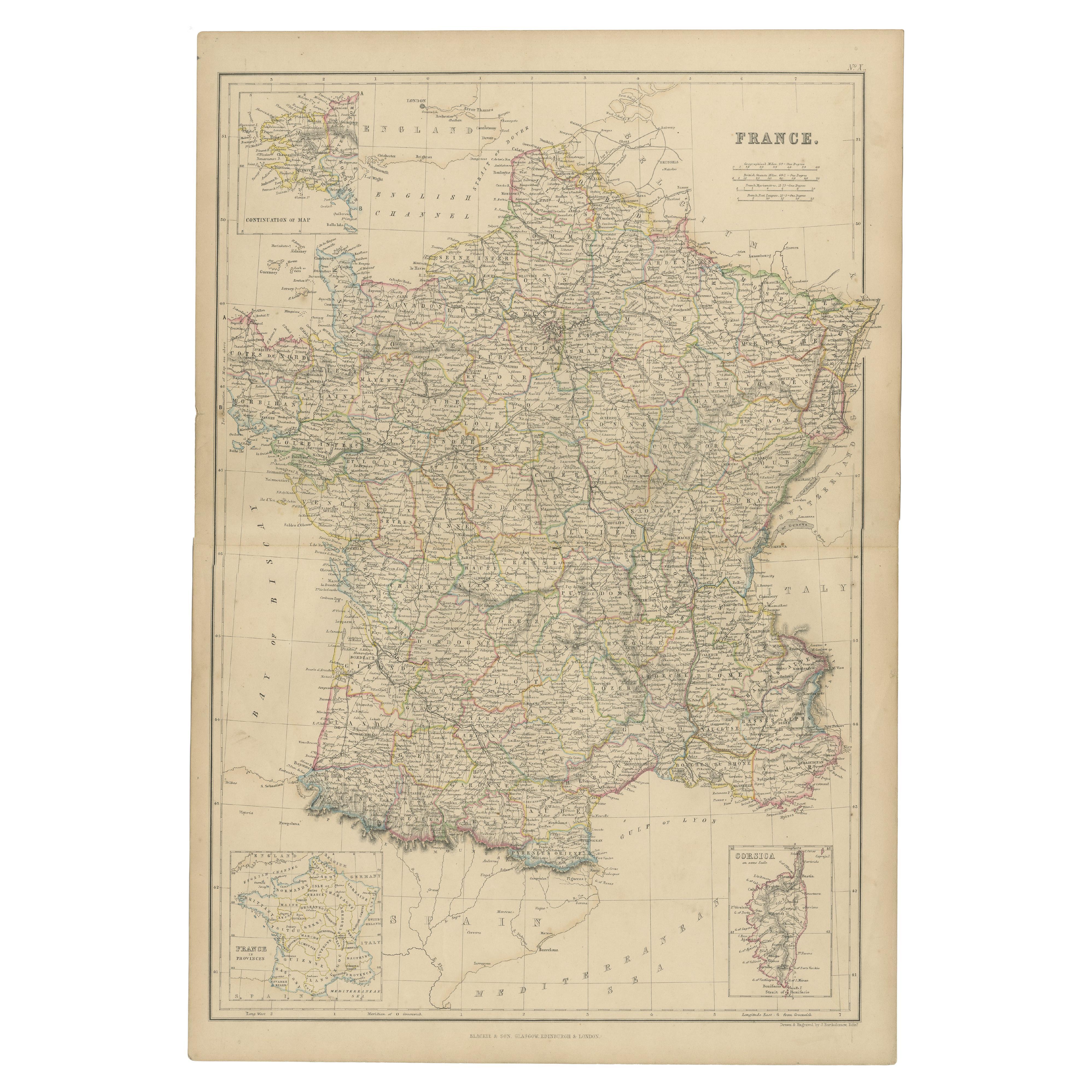
- 1859 Classic Map of France: Blackie's Imperial Geographic MasterpieceLocated in Langweer, NLThe "Antique Map of France" from 'The Imperial Atlas of Modern Geography', published in 1859 by W. G. Blackie, is a historically valuable cartographic work that offers a comprehensiv...Category
Antique Mid-19th Century Maps
MaterialsPaper
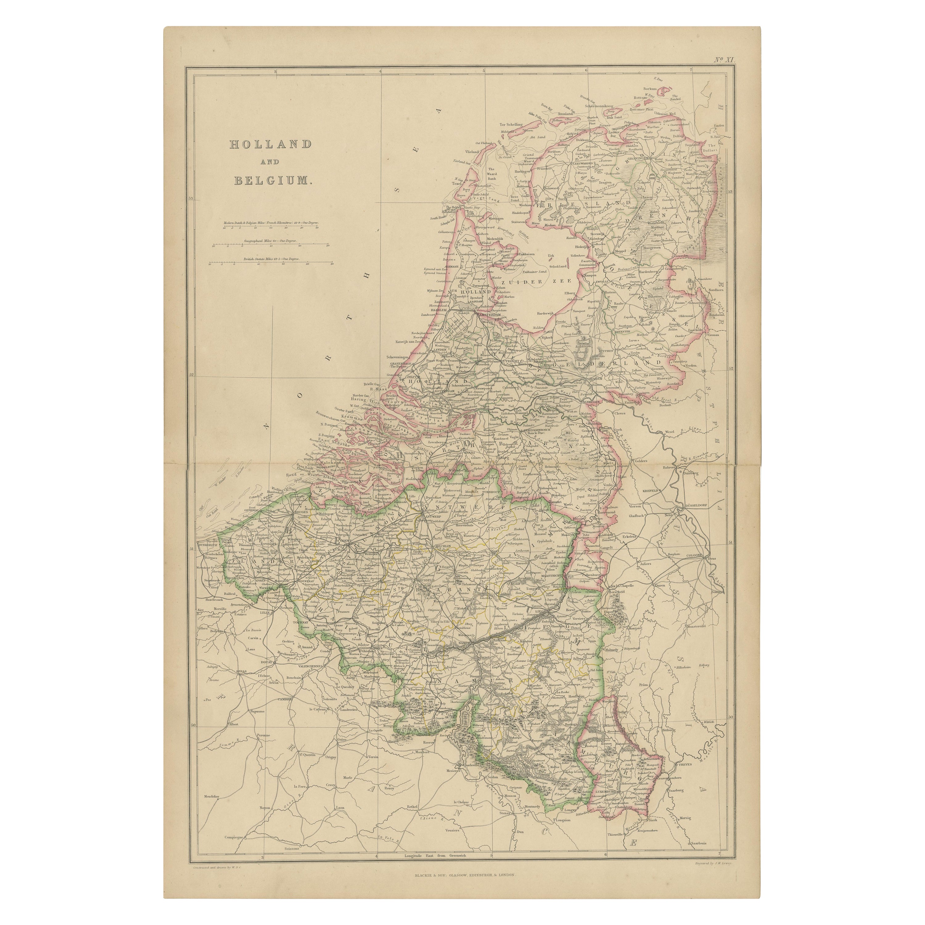
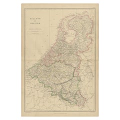
- 1859 Vintage Map of Holland and Belgium: Blackie's Imperial Geographic InsightLocated in Langweer, NLThe "Antique Map of Holland and Belgium" from 'The Imperial Atlas of Modern Geography', published by W. G. Blackie in 1859, is a significant hi...Category
Antique Mid-19th Century Maps
MaterialsPaper
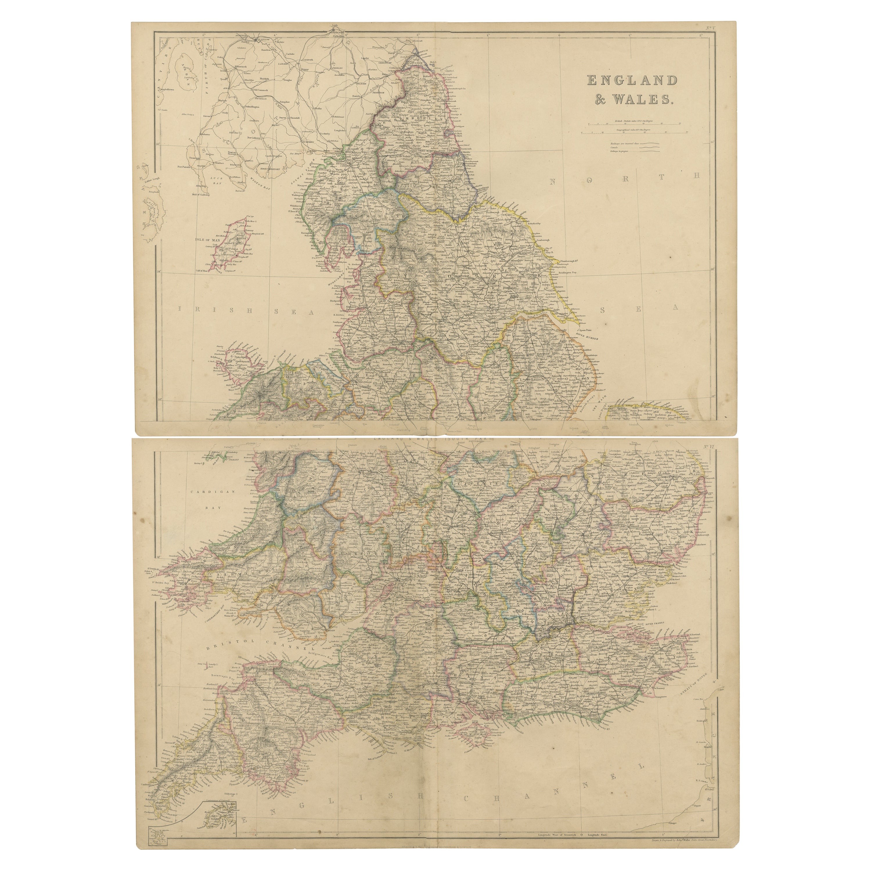
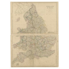
- 1859 Vintage Maps of England and Wales: Blackie's Imperial Geographic DetailLocated in Langweer, NLThe "Antique Map of England & Wales" from 'The Imperial Atlas of Modern Geography', published by W. G. Blackie in 1859, is an original antique map that provides a detailed depiction ...Category
Antique Mid-19th Century Maps
MaterialsPaper
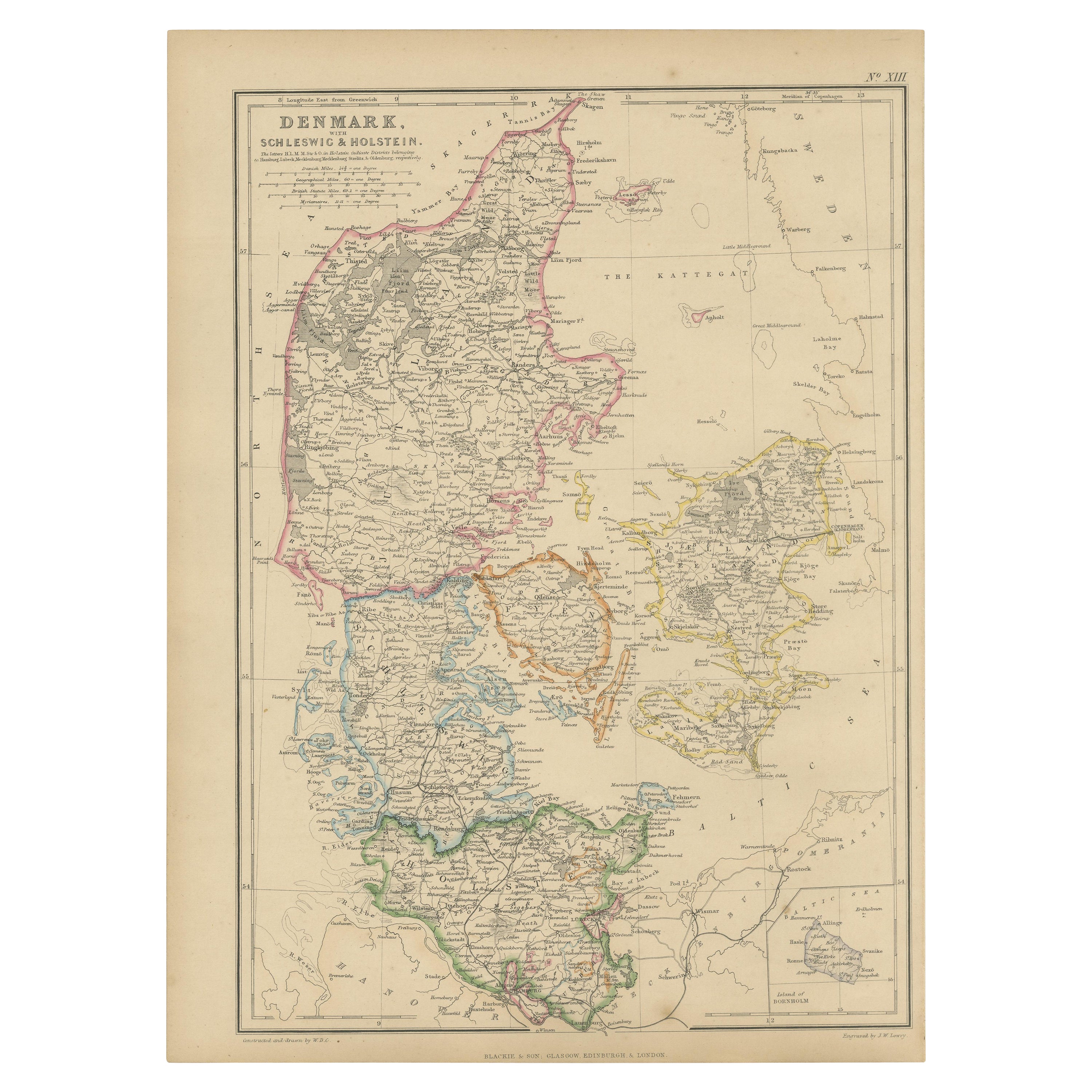
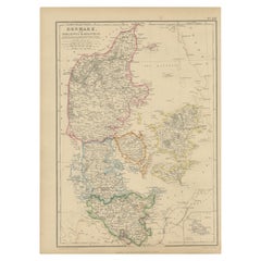
- 1859 Denmark and Schleswig-Holstein Map: A Historical View from Blackie's AtlasLocated in Langweer, NLThe "Antique Map of Denmark with Schleswig & Holstein" from 'The Imperial Atlas of Modern Geography', published by W. G. Blackie in 1859, is a valuable historical document that provi...Category
Antique Mid-19th Century Maps
MaterialsPaper
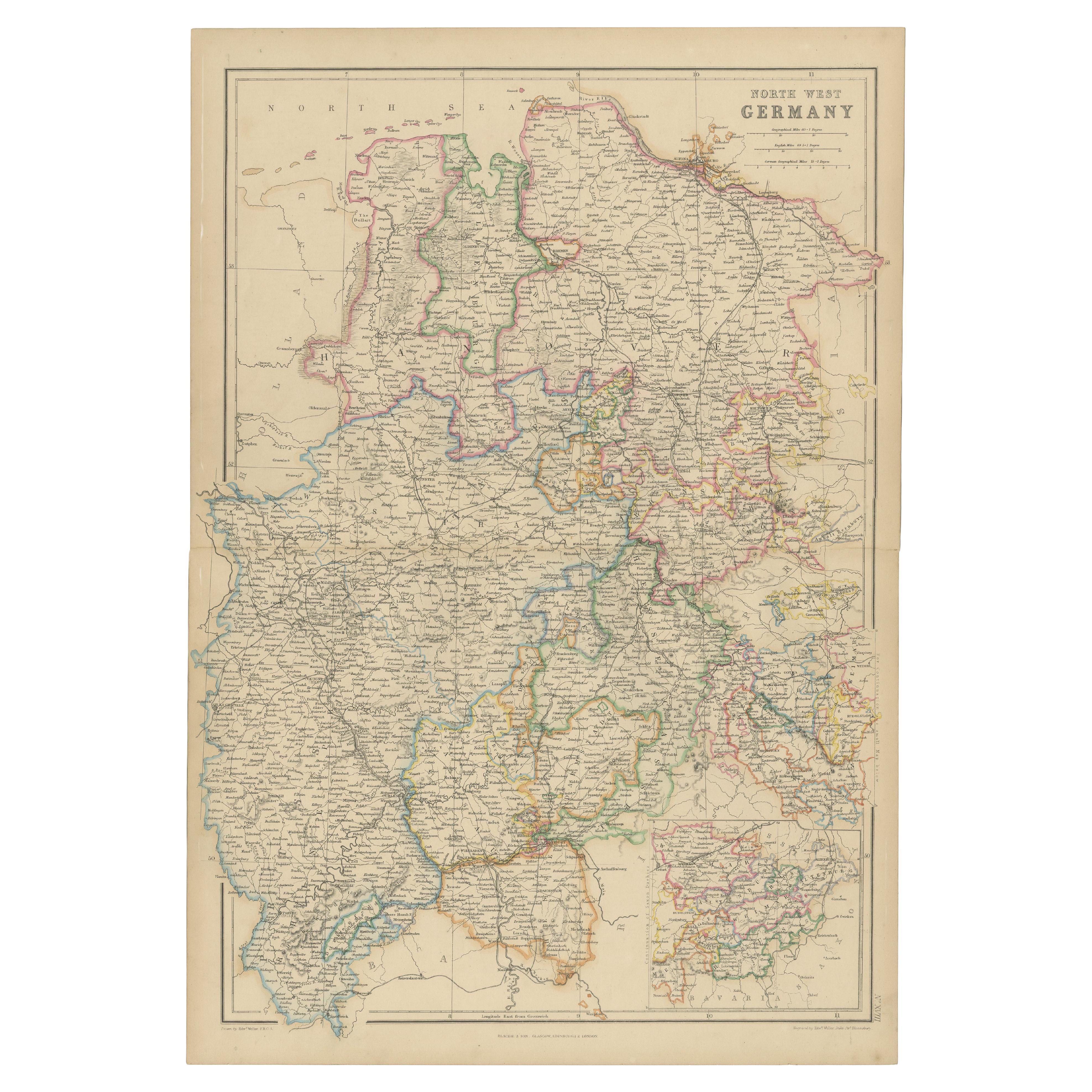
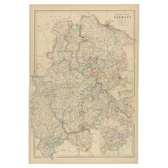
- 1859 Detailed Map of North West Germany with Bavaria Inset - Blackie's AtlasLocated in Langweer, NLThe "Antique Map of North West Germany" with an inset map of Bavaria is a distinguished piece from 'The Imperial Atlas of Modern Geography', published i...Category
Antique Mid-19th Century Maps
MaterialsPaper
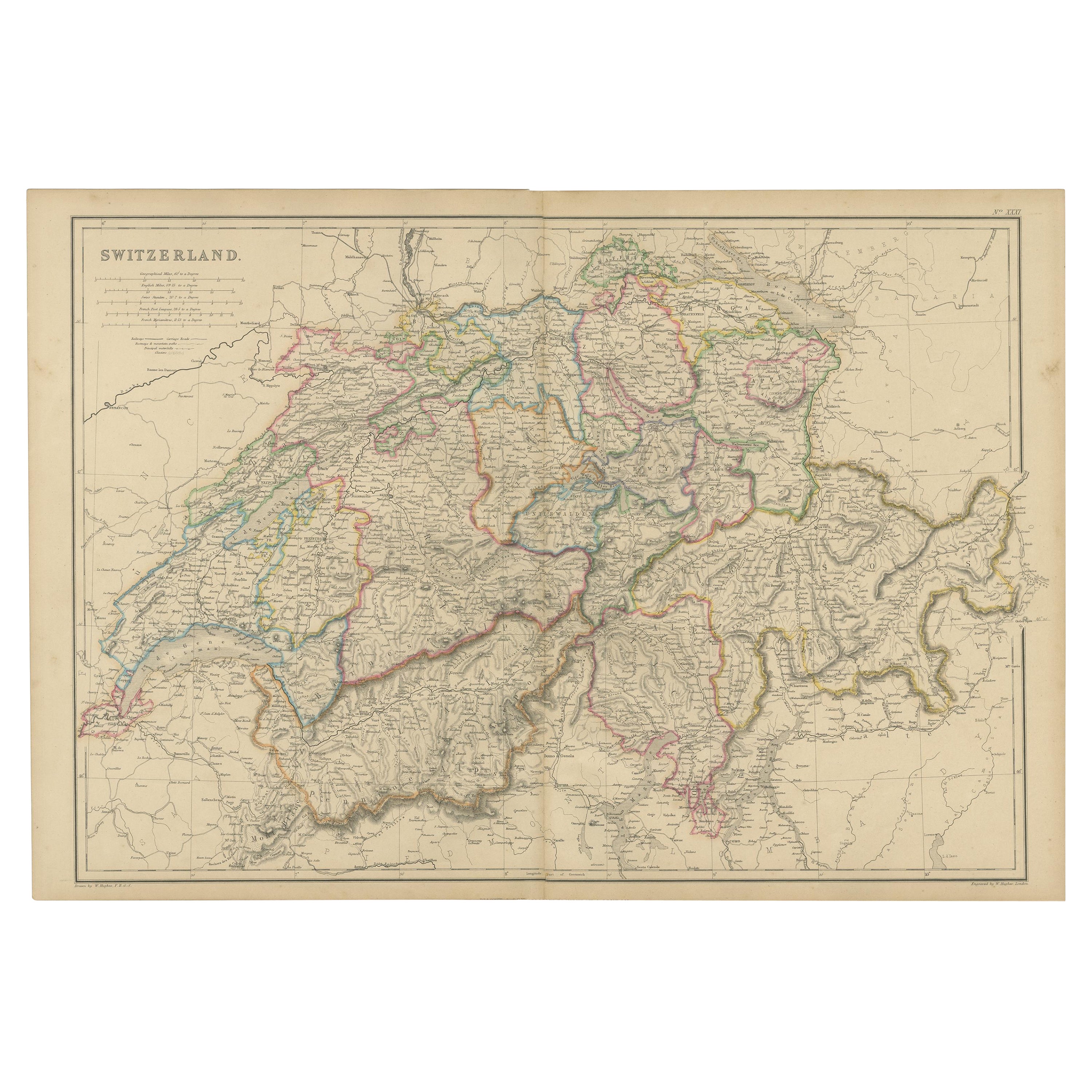
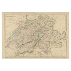
- 1859 Antique Swiss Panorama: Blackie's Detailed Map of SwitzerlandLocated in Langweer, NLThe "Antique Map of Switzerland" is a distinguished piece from 'The Imperial Atlas of Modern Geography', published in 1859 by the renowned cartographer W. G. Blackie. This map presen...Category
Antique Mid-19th Century Maps
MaterialsPaper

You May Also Like
- Large Antique 1859 Map of North AmericaLocated in Sag Harbor, NYThis Map was made by Augustus Mitchell in 1859 It is in amazing condition for being 163 years old. This price is for the rolled up easy to ship version of this piece. I will be Frami...Category
Antique Mid-19th Century American Maps
MaterialsCanvas, Paper

- Original Antique Map of South East Asia, Arrowsmith, 1820Located in St Annes, LancashireGreat map of South East Asia Drawn under the direction of Arrowsmith Copper-plate engraving Published by Longman, Hurst, Rees, Orme and Brown, 1820 Unframed.Category
Antique 1820s English Maps
MaterialsPaper
- Original Antique Map of South East Asia by Thomas Clerk, 1817Located in St Annes, LancashireGreat map of South East Asia Copper-plate engraving Drawn and engraved by Thomas Clerk, Edinburgh. Published by Mackenzie And Dent, 1817 Unframed.Category
Antique 1810s English Maps
MaterialsPaper
- Original Antique Map of South East Asia by Becker, circa 1840Located in St Annes, LancashireGreat map of South East Asia Steel engraving with original color outline Engraved by Becker Published by Virtue, circa 1840. Unframed.Category
Antique 1840s English Other Maps
MaterialsPaper
- Original Antique Map of Italy. Arrowsmith. 1820Located in St Annes, LancashireGreat map of Italy Drawn under the direction of Arrowsmith Copper-plate engraving Published by Longman, Hurst, Rees, Orme and Brown, 1820 Unframed.Category
Antique 1820s English Maps
MaterialsPaper
- Original Antique Map of China, Arrowsmith, 1820Located in St Annes, LancashireGreat map of China Drawn under the direction of Arrowsmith Copper-plate engraving Published by Longman, Hurst, Rees, Orme and Brown, 1820 Unfr...Category
Antique 1820s English Maps
MaterialsPaper


Recently Viewed
View AllMore Ways To Browse
Map Of Asia
Map Asia
Maps Asia
Antique Map Asia
Antique Maps Asia
Asia Antique Map
Antique Maps Of Asia
Antique Map Of Asia
Antique Asian Maps
Antique Maps Of Islands
18th Russian
Antique Maps Of Holland
Antique Maps Of America
Antique Map Of America
Antique Furniture In Edinburgh
Victorian Tear
Antique 17th Century Map
Antique Doctors