
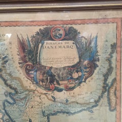
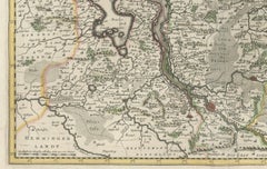
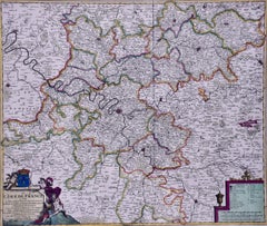
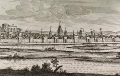
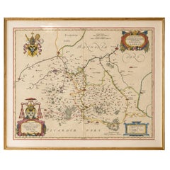
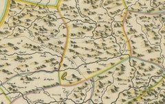
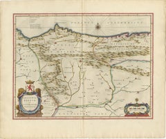
17th Century Map of Denmark by French Cartographer Sanson, Dated 1658
By Nicolas Sanson
Located in Copenhagen, K
17th century map of Denmark by French cartographer Sanson.
Category
17th Century French Antique 17th Century Map
Materials
Paper
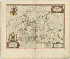
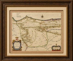
17th Century Map of Denmark by French Cartographer Sanson, Dated 1658
By Nicolas Sanson
Located in Copenhagen, K
17th century map of Denmark by French cartographer Sanson.
Paper
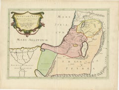
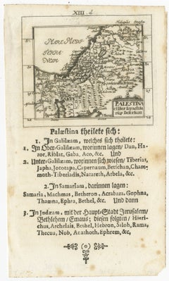
17th-Century Map of the Latin Patriarchate of Jerusalem by Melchior Tavernier
Located in Langweer, NL
Title: 17th-Century Map of the Latin Patriarchate of Jerusalem by Melchior Tavernier Description: This rare 17th-century map by Melchior Tavernier illustrates the geographical ext...
Paper
$1,574Sale Price|30% Off
Moses Pitt's 17th-Century Map of Frankfurt, Circa 1690
Located in Langweer, NL
Title: Territorium Francofurtens – Moses Pitt’s 17th-Century Map of Frankfurt Description: This rare 17th-century map, titled Territorium Francofurtens, was published by Moses ...
Paper
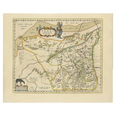
Original Antique 17th-Century Map of Shaangxi (Xensi) Province, China – by Blaeu
Located in Langweer, NL
Antique 17th-Century Map of Shaangxi Province, China – "Xensi" by Blaeu, Featuring Decorative Cartouches Description: This exquisite 17th-century map of Shaangxi Province, historica...
Paper

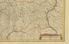
Rare 17th-Century Map of Dauphiné in Southeastern France by F. De Wit, ca.1688
Located in Langweer, NL
Title: Rare Hand-Colored 17th-Century Map of Dauphiné by Frederik De Wit c. 1688 Description: This captivating 17th-century map of Dauphiné, titled "Nova et Accurata Delphinatus Vul...
Paper
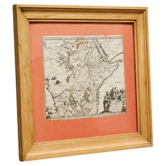
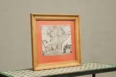
Willem Janszoon Blaeu Rare Original 17th Century Map of Ethiopia in a Pine Frame
By Willem Blaeu
Located in Meer, VAN
Willem Janszoon Blaeu Rare Original 17th Century Map of Ethiopia in a Pine Frame Rare early 17th century map of Ethiopia by Willem Janszoon Blaeu.
Pine, Paper

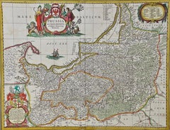
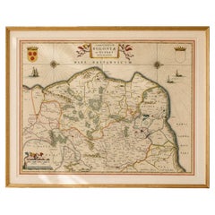
Prussia, Poland, N. Germany, Etc: A Hand-colored 17th Century Map by Janssonius
By Johannes Janssonius
Located in Alamo, CA
This is an attractive hand-colored copperplate engraved 17th century map of Prussia entitled "Prussia Accurate Descripta a Gasparo Henneberg Erlichensi", published in Amsterdam by Jo...
Paper
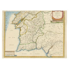
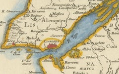
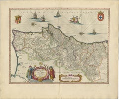
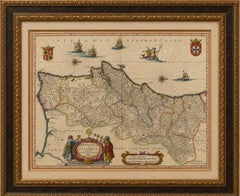
17th Century Map of Southern Portugal by Sanson – Hand-Colored, 1679
Located in Langweer, NL
17th Century Map of Southern Portugal by Sanson – Hand-Colored, 1679 This stunning 1679 map of Portugal offers a captivating glimpse into the past, showcasing the country's geograph...
Paper
OriginaAntique 17th-Century Map of Guizhou Province, China – (Qveichev) by Blaeu
Located in Langweer, NL
Title: Antique 17th-Century Map of Guizhou Province, China – "Qveichev" by Blaeu, Richly Illustrated and Colored Description: This remarkable map of Guizhou Province, historically k...
Paper
Original Antique 17th-Century Map of Shanxi (Xansi) Province, China – by Blaeu
Located in Langweer, NL
Antique 17th-Century Map of Shanxi Province, China – "Xansi" by Blaeu, with Artistic Cartouches Description: This beautifully engraved map of Shanxi Province, historically referred ...
Paper
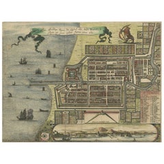
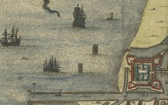
Rare 17th Century Map of Batavia and Castle on Java by Isaac de l'Obel
Located in Langweer, NL
Rare 17th Century Map of Batavia and Castle on Java by Isaac de l'Obel This finely detailed and vividly hand-colored copperplate engraving offers a rare and early view of Batavia (p...
Paper

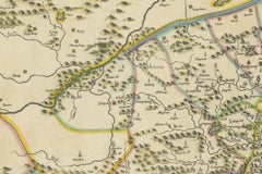
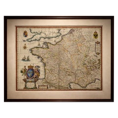
Beautiful 17th Century Map of Paris and Isle de France by Templeux, c.1650
Located in Langweer, NL
Keywords: Isle de France antique map, Paris region map 1650, French royal map, Île-de-France map Templeux, 17th century map France, decorative baroque map, antique map of Paris, map ...
Paper

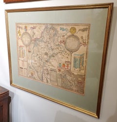
Framed 17th Century Map of Cumberland, England by John Speed, 1610
By John Speed
Located in Middleburg, VA
This early 17th-century engraving captures the historic landscape with remarkable clarity, depicting the ancient city of Carlisle, its surrounding topography, heraldic coats of arms,...
Copper, Gold Leaf
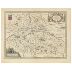
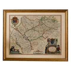
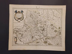
Cartographic Elegance of Touraine: A 17th-Century Map Showing French Heritage
Located in Langweer, NL
"Ducatus Turonensis - Touraine," is a original antique historical map of the Touraine region, which is located in the heart of France, centered around the city of Tours. Created by t...
Paper
$527Sale Price|19% Off
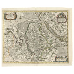
Johannes Janssonius' 17th-Century Map of the Duchy of Bremen in Germany
Located in Langweer, NL
This map is a fascinating artifact, offering insights into the political, geographical, and cultural landscape of 17th-century northern Germany.
Paper
$1,079Sale Price|20% Off
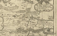
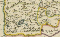
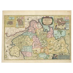
The 17th Century Map of Northern Dithmarschen and Its Towns in Germany
Located in Langweer, NL
Johannes Mejer, a noted cartographer and mathematician, lived around 1608-1674, and the engravers Matthias and Claus Petersen were renowned goldsmiths and copperplate engravers in Hu...
Paper
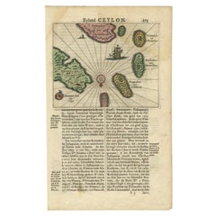

Antique 17th Century Map of the Islands Near Ceylon or Sri Lanka, 1672
Located in Langweer, NL
Our collection includes a wide range of authentic antique maps from the 16th to the 20th centuries. Buying and collecting antique maps is a tradition that goes back hundreds of years.
Paper

$1,475
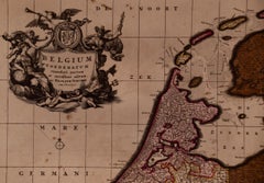
Belgium and the Netherlands: A Hand-colored 17th Century Map by Visscher
By Nicolaus Visscher
Located in Alamo, CA
This is an original hand-colored 17th century map of Belgium by Nicolaus (Nicolas) Visscher II entitled "Belgium Foederatum emendate auctum et novissime editum", published in Amsterd...
Engraving
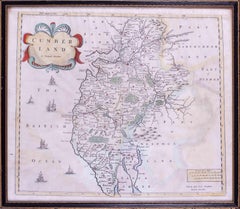
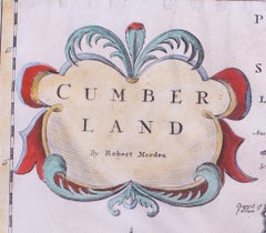
17th Century map of Cumberland, UK by Robert Morden
Located in Petworth, West Sussex
Robert Morden (British, circa 1650 – 1703) A map of Cumberland with hand colouring An engraving 14.1/4 x 16.5/8 in. (36.5 x 42.5 cm.)
Engraving

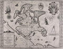
Rugen Island, Germany: An Early 17th Century Map by Mercator and Hondius
By Gerard Mercator
Located in Alamo, CA
This is an early 17th century map entitled "Nova Famigerabilis Insulae Ac Ducatus Rugiae Desciptio" (Map of Rugen Island, Germany) by Gerard Mercator and Henricus and Joducus Hondiu...
Engraving

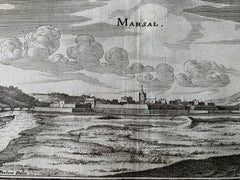
17th Century Topographical Map, Champagne-Ardenne, Marsal, Maubert Iohan Peeters
Located in New York, NY
Fine topographical 17th century map by Iohan Peeters of Marsal and Maubert Fontaine in the Champagne-Ardennes Region of North Eastern France.
Paper

$1,175
West Germany: Original Hand Colored 17th Century Map by Johannes Janssonius
By Johannes Janssonius
Located in Alamo, CA
It includes the 17th century region of the Archbishopric of Magdeburg, and the Duchy of Anhalt in West Germany.
Engraving

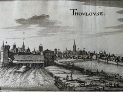
17th Century Toulouse, Savve, Sommieres Topographical Map by Iohan Peeters
Located in New York, NY
Fine topographical 17th century map of Toulouse, Savve and Sommieres by Iohan Peeters Beautiful engraving of the capital of France's Occitanie Region, Toulouse, called La Ville Ros...
Paper

Persia & Afghanistan: A Framed Hand-colored 17th Century Map by John Cary
By John Cary
Located in Alamo, CA
This colorful and detailed early 18th century copperplate map by John Cary entitled "A New Map of Persia from the Latest Authorities" was published in London in 1801. It depicts Pers...
Engraving

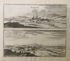
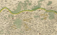
17th Century Topographical Map, French Champagne Region, Epernay, Iohan Peeters
Located in New York, NY
Fine topographical 17th century map by Iohan Peeters of the towns of Epernay and Lametz in the Champagne Region of North Eastern France.
Paper

L'Isle de France: A Hand-colored 17th Century Map by De Wit
By Frederick de Wit
Located in Alamo, CA
This colorful and detailed 17th century hand-colored copperplate map by Frederick De Wit was published in Amsterdam between 1666 and 1760.
Engraving

Hand Colored 17th Century Visscher Map "Hollandiae" Southern Holland
By Nicolaes Visscher II
Located in Alamo, CA
A hand colored 17th century map of the southern portions of Holland by Nicolaus (Nicolas) Visscher II entitled "Hollandiae pars Meridionalis, vulgo Zuyd-Holland", published in Amster...
Paper

$833Sale Price|20% Off
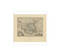
Antique Map of Greece by J. Jansson, circa 1653
Located in Langweer, NL
This striking 17th century map of Greece was based on “Totius Graeciae Descriptio,” a large 8 sheet work by Nikolaos Sophianos, published in 1540.
Paper

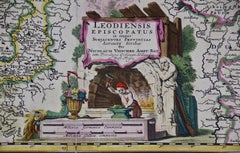
17th Century Hand Colored Map of the Liege Region in Belgium by Visscher
By Nicolaes Visscher II
Located in Alamo, CA
An original 17th century map entitled "Leodiensis Episcopatus in omnes Subjacentes Provincias distincté divisusVisscher, Leodiensis Episcopatus" by Nicolaes Visscher II, published in...
Paper

$5,113Sale Price|20% Off
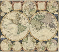
Antique World Map by P. Schenk '1706'
By Peter Schenk
Located in Langweer, NL
This map represented a noteworthy shift from the traditional decorative Dutch 17th century maps where the margins would be full of classical mythological figures and references.
Paper
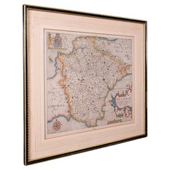
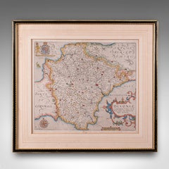
Antique Devon County Map, English, Framed 17th Century Atlas Cartography, C.1650
Located in Hele, Devon, GB
This is an antique Devon county map. An English, framed atlas engraving of Devonshire, dating to the 17th century and later, circa 1650.
Glass, Paper

17th Century Topographical Map of Cote D'azur, Avignon, Frejus by Iohan Peeters
Located in New York, NY
Fine topographical 17th century map by Iohan Peeters of the towns of Avignon and Frejus in the Cote d'Azur-Provence-Alpes Region of Southeastern France.
Paper


Large 17th Century Hand Colored Map of England and the British Isles by de Wit
By Frederick de Wit
Located in Alamo, CA
A large hand colored 17th century map of England and the British Isles by Frederick de Wit entitled "Accuratissima Angliæ Regni et Walliæ Principatus", published in Amsterdam in 1680.
Paper
$359Sale Price|20% Off
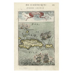
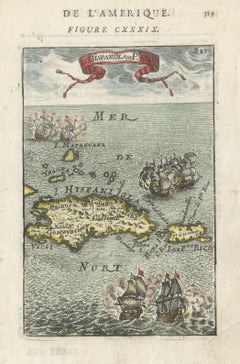
Antique 1683 Map of Hispaniola and Puerto Rico in the Caribbean by Mallet
Located in Langweer, NL
Title: 17th Century Map of Hispaniola and Puerto Rico by Mallet (1683) This exquisite 17th-century map by Mallet, titled "I. d'Hispaniola et P.to Rico," showcases the islands of His...
Paper
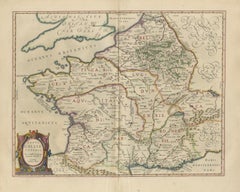
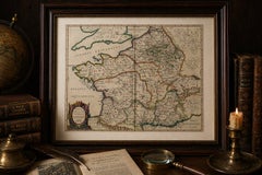
Caesar’s Gallia Veteris – Blaeu Map of Ancient Gaul, France c.1642
Located in Langweer, NL
Caesar’s Gallia Veteris – Blaeu Map of Ancient Gaul, France c.1642 Description: A finely engraved and highly decorative 17th-century map of ancient Gaul, titled Typus Galliae Veteri...
Paper

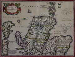
Northern Scotland: A 17th Century Hand-colored Map by Mercator
By Gerard Mercator
Located in Alamo, CA
This is a framed hand-colored 17th century map of Northern Scotland by Gerard Mercator entitled "Scotiae pars Septentrionalis", published in Amsterdam in 1636.
Paper
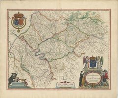
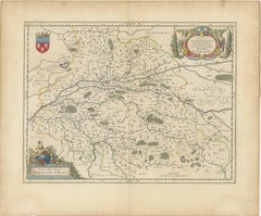
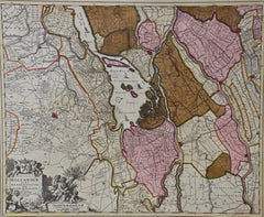
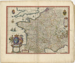
Blaeu Map of Île-de-France – Paris Region with Royal Arms, c.1642
Located in Langweer, NL
Blaeu Map of Île-de-France – Paris Region with Royal Arms, c.1642 Description: A richly detailed and highly decorative 17th-century map of the Île-de-France region, centered on Pari...
Paper
Blaeu Map of Cambrai, Artois & Hainaut – Heraldic France c.1642
Located in Langweer, NL
Keywords: Cambrai, Cambrésis, Archiepiscopatus Cameracensis, Artois, Hainaut, Picardy, Northern France, French map, Blaeu map, Willem Blaeu, Joan Blaeu, Dutch Golden Age, 17th centur...
Paper
Caesar’s Gallia Antiqua – Blaeu Map of Ancient France, c.1642
Located in Langweer, NL
Caesar’s Gallia Antiqua – Blaeu Map of Ancient France, c.1642 Description: A superb and highly decorative 17th-century map of ancient Gaul, titled Gallia Vetus, published by Willem ...
Paper

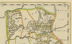
17th-Century Original Antique Map of Guangxi Province, China – Qvangsii by Blaeu
Located in Langweer, NL
Title: Antique 17th-Century Map of Guangxi Province, China – "Qvangsii" by Blaeu, Richly Illustrated and Colored Description: This fascinating 17th-century map of Guangxi Province...
Paper

Blaeu Map of Boulogne & Calais Coast – Maritime France, Ships c.1642
Located in Langweer, NL
Blaeu Map of Boulogne, Calais & Guînes – Coastal France, Ships c.1642 A striking and highly decorative 17th-century map of the northern French coast, centered on Boulogne-sur-Mer, C...
Paper
Blaeu Map of Portugal – Portugallia et Algarbia, Antique Iberia Map, 1642
Located in Langweer, NL
Keywords: Portugal, Portugallia, Lusitania, Algarve, Iberia, Atlantic coast, Willem Blaeu, Joan Blaeu, Dutch cartography, antique Portugal map, 17th century map, Toonneel des Aerdryc...
Paper
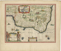
Blaeu Brazil Map, Novus Brasiliae Typus, Antique Hand-Colored Map 1642
Located in Langweer, NL
Keywords: Brazil, Brasilia, Novus Brasiliae Typus, South America, Dutch Brazil, Pernambuco, Bahia, Rio de Janeiro, Amazon, Atlantic coast, indigenous peoples, colonial Brazil, Dutch ...
Paper
Blaeu Map of Aragon – Arragonia Regnum, Decorative Spain Atlas Map, 1642
Located in Langweer, NL
Keywords: Aragon, Arragonia, Spain, Iberia, Pyrenees, Mediterranean, Zaragoza, Catalonia, Willem Blaeu, Joan Blaeu, Dutch cartography, antique Spain map, 17th century map, Toonneel d...
Paper
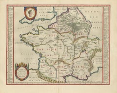
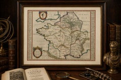
17th Century Blaeu Map of France, Gallia, Hand Colored, c.1642
Located in Langweer, NL
17th Century Blaeu Map of France, Gallia, Hand Colored, c.1642 Description: A beautifully engraved and highly decorative map of France, titled “Gallia,” published by Willem Jansz.
Paper

1635 Willem Blaeu Map of Northern France"Comitatvs Bellovacvm" Ric.a08
Located in Norton, MA
This very attractive early 17th-century map depicts the Beauvais Region in northern France.
Paper
$646Sale Price|30% Off
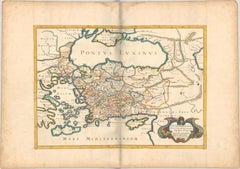
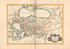
1667 Melchior Tavernier Map of the Patriarchate of Constantinople – Black Sea
Located in Langweer, NL
This 1667 map titled "Patriarchatus Constantinopolitani Geographica Descriptio" was crafted by renowned French cartographer Melchior Tavernier, who was a prominent map engraver durin...
Paper
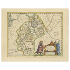
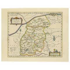
17th-Century Antique Map of Jiangxi (Kiangsi) Province, China – by Blaeu
Located in Langweer, NL
Title: 17th-Century Antique Map of Jiangxi Province, China – "Kiangsi" by Blaeu, Detailed and Vibrantly Colored Description: This detailed 17th-century map of Jiangxi Province, hi...
Paper
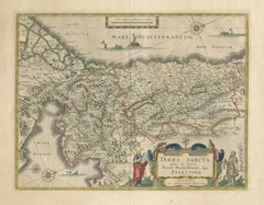

Antique Blaeu Holy Land Map – Terra Sancta Palestina, 1629
Located in Langweer, NL
Strong dark impression with wide margins. The map is an original 17th-century copper engraving, not a reproduction.
Paper
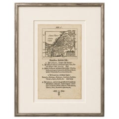
17th Century Holy Land Map “Palestina” with German Biblical Text, c.1650
Located in Langweer, NL
Title: 17th Century Holy Land Map “Palestina” with German Biblical Text, c.1650 Description: A rare and highly decorative 17th-century miniature woodcut or engraved map of the Holy ...
Paper
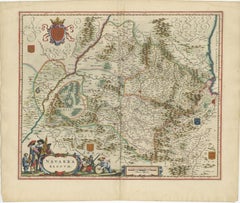
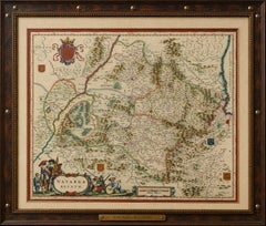
Blaeu Map of Navarra – Navarra Regnum, Decorative Pyrenees Chart, 1642
Located in Langweer, NL
Keywords: Navarra, Navarre, Pyrenees, Basque region, Spain, France, Iberia, Willem Blaeu, Joan Blaeu, Dutch cartography, antique Spain map, 17th century map, Toonneel des Aerdrycx, r...
Paper
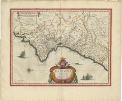
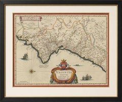
Blaeu Map of Valencia – Valentia Regnum, Decorative Mediterranean Chart, 1642
Located in Langweer, NL
Keywords: Valencia, Valentia Regnum, Spain, Mediterranean, Iberia, coastal map, Willem Blaeu, Joan Blaeu, Dutch cartography, antique Spain map, 17th century map, Toonneel des Aerdryc...
Paper
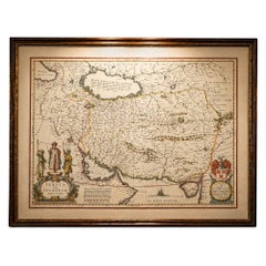
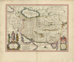
Blaeu Map of Persia, Caspian Sea & Arabia, Hand Colored, c.1642
Located in Langweer, NL
Special note: This is an original 17th-century map, not a reproduction. All items we offer are authentic period works of art over 100 years old.
Paper
Blaeu Map of León & Asturias – Legionis Regnum, Antique Spain Chart, 1642
Located in Langweer, NL
Keywords: León, Asturias, Spain, northern Spain, Iberia, Cantabrian coast, Willem Blaeu, Joan Blaeu, Dutch cartography, antique Spain map, 17th century map, Toonneel des Aerdrycx, Le...
Paper
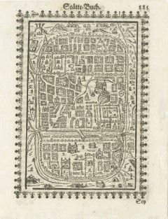
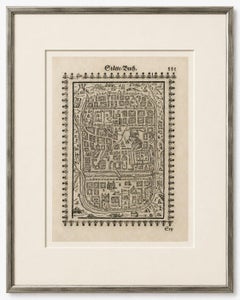
17th Century Woodcut Map of Jerusalem from Abraham Saur’s Städte-Buch, 1658
Located in Langweer, NL
Title: 17th Century Woodcut Map of Jerusalem from Abraham Saur’s Städte-Buch, 1658 Description: A rare and visually compelling 17th-century German woodcut map of Jerusalem published...
Paper
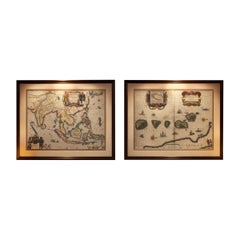
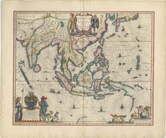
Antique Blaeu Maps, Indonesia & Moluccas – VOC Era, c.1642
Located in Langweer, NL
Antique Blaeu Maps, Indonesia & Moluccas – VOC Era, c.1642 A rare and highly decorative pair of original 17th-century maps by Willem Blaeu, depicting Indonesia and the Moluccas—...
Paper
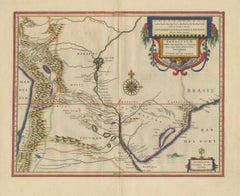
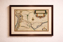
Blaeu Paraguay Map, Rio de la Plata, Antique Engraving, South America 1642
Located in Langweer, NL
Keywords: Paraguay, Rio de la Plata, Tucuman, Brazil, Argentina, Bolivia, Andes, Paraná River, Paraguay River, South America, Spanish Empire, colonial South America, Buenos Aires, As...
Paper
Antique and vintage collectibles and curiosities can bring whimsy and wonder to any interior.
Decorating with old scientific instruments, historical memorabilia and vintage musical instruments, as well as other authentic collectibles and curiosities that can be found on 1stDibs, presents an opportunity to create a unique, natural history museum-like atmosphere in your home that can provoke conversation as often as it pays tribute to how far we’ve come in understanding our world.
And bringing collectibles and curiosities into your space is actually on trend — Wunderkammern, or curiosity cabinets, were all the rage in Europe during the 1500s and continued to have adherents there and in the U.S. in the following centuries. Today, however, they’re experiencing a real surge in popularity and influencing how many interior designers are furnishing and decorating homes — combining contemporary with antique, scientific with tribal, earthly with extraterrestrial, Les Lalanne tables with Flemish tapestries.
The original Wunderkammern were entire rooms filled with objects demonstrating their owners’ worldly knowledge: A proper one included artificiala or preciosa (objets d’art); naturalia (such as skeletons, shells, minerals); exotica (taxidermy or dried plants); and scientifica (scientific instruments), frequently alongside religious relics and ancient artifacts.
Pay tribute to a history of rich and diverse musical traditions that have taken shape all over the world by decorating your home with a collection of antique and vintage musical instruments — with a little help from strong hanging wire or some wall hooks, vintage brass instruments such as a gong, French horn or trumpet can help elevate a home office or complement the efforts you’ve made to ensure a welcoming vibe in your home’s entryway. Bells or antique wind instruments can add provocative metallic contrasts to dark woods as tabletop decorative objects.
Create an intriguing focal point with Georgian scientific instruments, such as stick barometers with mahogany cases or lacquered brass telescopes. These items stem from an era named for the monarchies of the four King Georges, who ruled England in succession starting in 1714 (plus King William’s reign, which lasted until 1837). Just as there was beautiful jewelry produced during the period that today is coveted by collectors, there is much to be found in the collectibles and curiosities realm too.
Wanderlust, nostalgia and a shared love of good design are contributing factors to certain trends in decorating — just as vintage trunks and luggage have reappeared as furniture or home accents in a bedroom or foyer, decorating with globes, maps or nautical objects is similarly rooted in the allure of travel and a penchant for the stylish finishing touch that collectibles bring to our homes.
Find a wide range of antique and vintage collectibles and curiosities on 1stDibs.
It's hard to resist the allure of a beautiful pool. So, go ahead and daydream about whiling away your summer in paradise.
It’s never too early for good design. These interiors combine elevated furnishings and a youthful spirit, resulting in spaces that are at once elegant and whimsical.
Produced in 1843, the well-preserved volume is evidence of the author's exacting specifications.
New or old, the coverlets add old-time charm to any space.
Get into the games! These items celebrate the events, athletes, host countries and sporting spirit.
French trendsetter and serial collector Daniel Rozensztroch tells us about his obsession with objects related to seafaring men.
The sought-after designer worked with the team at Hoffman Creative to produce a monograph that beautifully showcases some of Studio Shamshiri's most inspiring projects.
Italian writer and collector Umberto Pasti opens the doors to his remarkable cave of wonders in North Africa.