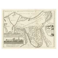
Maps Red Sea
3
to
24
114
67
74
57
49
43
29
27
25
18
17
15
14
10
10
9
9
8
7
7
7
5
4
4
3
3
2
2
2
2
2
2
2
2
1
1
1
1
1
1
1
1
1
1
1
1
12
10
6
4
4
Sort By
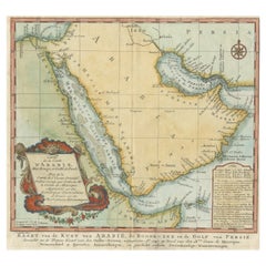
Original Antique Map of Arabia and the Red Sea
Located in Langweer, NL
Dutch version, engraved by J. van Schley, of Bellin's map of Arabia and the Red Sea. The emphasis is the
Category
Antique Mid-18th Century Maps
Materials
Paper
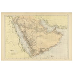
Original 1882 Map of Arabia, Red Sea & Persian Gulf
Located in Langweer, NL
This print is a historically significant map titled "Arabia, the Red Sea, and the Persian Gulf
Category
Antique 1880s Maps
Materials
Paper
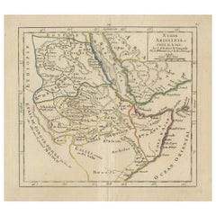
Original Antique Map of Abyssinia, Sudan and the Red Sea, 1749
Located in Langweer, NL
Antique map titled 'Nubie, Abissinie et Cote d'Ajan'.
Map of Abyssinia, Sudan and the Red Sea by
Category
Antique 1740s Maps
Materials
Paper
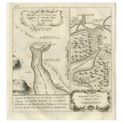
Rare Antique Map of Yam Suph, Egypt and Red Sea, 1773
Located in Langweer, NL
Israelites crossed following their exodus from Egypt. The right image shows a mountain range near the Red Sea
Category
Antique 18th Century Maps
Materials
Paper
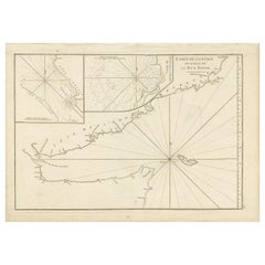
Original Antique Engraved Map of Part of the Red Sea, Arabia, 1775
Located in Langweer, NL
Antique map titled 'Carte de l'Entrée du Golfe de la Mer Rouge'. Uncommon sea chart of the entrance
Category
Antique Late 18th Century Maps
Materials
Paper
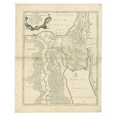
Antique Map of The Nile, Egypt and the Red Sea by Bachiene, 1765
Located in Langweer, NL
of Biblical Egypt and the Red Sea. With title cartouche, compass rose and scale. This map originates
Category
Antique 18th Century Maps
Materials
Paper
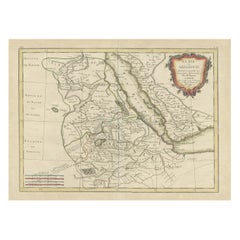
Antique Map of Arabia including Nubia and Abyssinia, also shows the Red Sea
Located in Langweer, NL
Antique map titled 'Nubie et Abissinie'. Original antique map of Nubia, a region along the Nile
Category
Antique Late 18th Century Maps
Materials
Paper
H 14.3 in W 20.36 in D 0.02 in
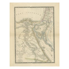
Antique Map of Ancient Egypt Also Depicting the Nile River and Red Sea, 1845
Located in Langweer, NL
depicting the Nile river and Red Sea. Source unknown, to be determined.
Artists and Engravers: Made after
Category
Antique 19th Century Maps
Materials
Paper
H 22.84 in W 17.92 in D 0 in
Old Map of the Sinai Peninsula Showing the Mediterranean and the Red Sea, 1773
Located in Langweer, NL
Antique map of the Sinai Peninsula showing the Mediterranean Sea to the north and the Red Sea to
Category
Antique 1770s Maps
Materials
Paper
H 17.05 in W 21.19 in D 0 in
16th Century Map of Saudi Arabia, the Persian Gulf and Red Sea, ca. 1574
Located in Langweer, NL
all of the peninsula, but does not include the head of the Red Sea. The coastlines are more accurate
Category
Antique 16th Century Maps
Materials
Paper
No Reserve
H 7.1 in W 9.8 in D 0.002 in
Original Antique Map of the Region Between the Gulf of Lybia and the Red Sea
Located in Langweer, NL
Gulf of Lybia and the Red Sea, with marvelous detail along the Mediterranean Coastline and the Nile
Category
Antique Early 18th Century Maps
Materials
Paper
H 7.56 in W 11.15 in D 0.02 in
Antique Map of the Sinai Peninsula, '1895'
Located in Langweer, NL
the north and the Red Sea to the south, and is a land bridge between Asia and Africa. Published by D
Category
Antique Late 19th Century Maps
Materials
Paper
Religious Old Print of Moses Making Water & The Crossing of the Red Sea, ca.1850
Located in Langweer, NL
Large antique print with two religious engravings. The upper image depicts the crossing of the Red
Category
Antique 1850s Maps
Materials
Paper
H 27.96 in W 19.89 in D 0 in
Antique Map of Persia with Dedication Cartouche
Located in Langweer, NL
Region, with the Red Sea and the Persian Gulf in the South and Caspian and Tartaria in the North. With
Category
Antique Mid-17th Century Maps
Materials
Paper
Antique Map Travel Children of Israel by Keur, 1748
Located in Langweer, NL
travel of the children of Israel from Egypt through the Red Sea and the desert to the Promised Lands
Category
Antique Mid-18th Century Dutch Maps
Materials
Paper
Beautiful Rare Antique Map of the Holy Land, 1648
Located in Langweer, NL
rare antique map of the Holy Land. Shows Exodus and wanderings of children of Israel across Red Sea
Category
Antique 1640s Maps
Materials
Paper
Antique Map of the Holy Land by Keur, 1748
Located in Langweer, NL
travel of the Children of Israel from Egypt through the Red Sea and the desert to the Promised Lands
Category
Antique 18th Century Maps
Materials
Paper
Antique Map of the Middle East with a Large Arabia, 1799
Located in Langweer, NL
Arabia, extending from the Black Sea to the Indian Ocean and from the Red Sea to Persia and Iraq. Small
Category
Antique Late 18th Century Maps
Materials
Paper
Free Shipping
H 11.03 in W 15.63 in D 0.02 in
Antique Map of Persia, Also Showing the Indus River, circa 1673
By Joan (Johannes) Blaeu
Located in Langweer, NL
Region, with the Red Sea and the Persian Gulf in the South and Caspian and Tartaria in the North
Category
Antique Late 17th Century Maps
Materials
Paper
No Reserve
H 21.07 in W 24.53 in D 0.02 in
Antique Map of the Region Near the Gulf of Zula, 1870
Located in Langweer, NL
Selat’e, is a body of water on the Eritrean coastline on the Red Sea. Lithographed by Wagner.
Category
Antique Mid-19th Century Maps
Materials
Paper
Antique Map of Western and Eastern Barbary in Africa, c.1744
Located in Langweer, NL
Nile Delta, Red Sea and Holy Land.
Artists and Engravers: The map was made by Emmanuel Bowen (ca
Category
Antique 18th Century Maps
Materials
Paper
17th Century Hand-Colored Map of West Africa by Mercator/Hondius
Located in Alamo, CA
A 17th century hand-colored map entitled "Guineae Nova Descriptio" by Gerard Mercator and Jodocus
Category
Antique Mid-17th Century Dutch Maps
Materials
Paper
Antique Map of the Middle East by Brion de la Tour '1772'
Located in Langweer, NL
, extending to the Red Sea, Egypt, the Eastern Mediterranean, Black Sea, Caspian Sea and the Indian Ocean
Category
Antique Late 18th Century Maps
Materials
Paper
Detailed Original Antique Map of the Turkish Empire with Arabia, 1778
Located in Langweer, NL
. . . 1753
Detailed map of the Turkish Empire, extending to the Black Sea, Georgia, the Caspian
Category
Antique 1770s Maps
Materials
Paper
1899 Poole Brothers Antique Railroad Map of the Illinois Central Railroad
Located in Colorado Springs, CO
This is an 1899 railroad map of the Illinois Central and Yazoo and Mississippi Valley Railroads
Category
Antique 1890s American Maps
Materials
Paper
Imperial Splendor: Antique Map of the Ottoman Empire by Blaeu, circa 1640
Located in Langweer, NL
the west to the Black and Caspian Seas in the north, and from the Gulf of Aden, Red Sea, and the
Category
Antique Mid-17th Century Maps
Materials
Paper
No Reserve
H 17.33 in W 21.54 in D 0.02 in
Large Antique Chart of The White Sea, Russa 1854
Located in Langweer, NL
Antique map titled 'The White Sea Index Chart'. Large uncommon map of the White Sea with a smaller
Category
Antique 19th Century Maps
Materials
Paper
Persia, Armenia & Adjacent Regions: A 17th Century Hand-colored Map by De Wit
By Frederick de Wit
Located in Alamo, CA
attractive map of Scandinavia, which includes the Baltic Sea, Norway, Sweden, Finland, Denmark and portions
Category
Antique Late 17th Century Dutch Maps
Materials
Paper
H 23.5 in W 27 in D 1.325 in
Antique Sea Chart of the Coast of Sumatra, Indonesia, circa 1775
Located in Langweer, NL
he devised a plan to correct and publish all the existing maps of the route to China: the Red Sea
Category
Antique 18th Century Maps
Materials
Paper
Wonderful Small Map of the Coasts of Arabia, Persia and Western India, ca. 1710
Located in Langweer, NL
geographical accuracy. The Red Sea is distorted and given an arched shape, and many towns are misplaced. The
Category
Antique Early 18th Century European Maps
Materials
Paper
H 5.9 in W 8.9 in D 0.002 in
Sea Chart of Part of the Southwestern Coast of Sumatra & Nias, Indonesia, C1775
Located in Langweer, NL
he devised a plan to correct and publish all the existing maps of the route to China: the Red Sea
Category
Antique 1770s Maps
Materials
Paper
H 30.71 in W 21.66 in D 0 in
Map of the Holy Land "Carte de la Syrie et de l'Egypte" by Pierre M. Lapie
By Pierre M. Lapie
Located in Alamo, CA
coastline of the Eastern Mediterranean in the north and the northern coast of the Red Sea in the south
Category
Antique Early 19th Century French Maps
Materials
Paper
H 27 in W 21.38 in D 0.75 in
Ancient Realms of Northeast Africa: Arabia, Ethiopia, and Egypt, Published 1880
Located in Langweer, NL
world, including the Nile River, the Red Sea, and possibly caravan routes across the desert.
3. **Inset
Category
Antique 1880s Maps
Materials
Paper
Free Shipping
H 15.56 in W 18.51 in D 0 in
Castellón de la Plana 1901: A Cartographic Perspective of the Valencian Coast
Located in Langweer, NL
The authentic map depicts the province of Castellón de la Plana, often referred to simply as
Category
Antique Early 1900s Maps
Materials
Paper
Free Shipping
H 14.77 in W 20.08 in D 0 in
1902 Murcia: A Cartographic Snapshot of Spain's Southeastern Province
Located in Langweer, NL
The map represents the province of Murcia, Spain, as it was in 1902. Here's an overview of its
Category
Antique Early 1900s Maps
Materials
Paper
Free Shipping
H 20.08 in W 14.77 in D 0 in
Cádiz 1901: Nautical Crossroads of the Atlantic and Mediterranean
Located in Langweer, NL
The map illustrates the province of Cádiz, located in the autonomous community of Andalusia, Spain
Category
Antique Early 1900s Maps
Materials
Paper
Free Shipping
H 14.77 in W 20.08 in D 0 in
A Catalonian Cartographic Depiction of Tarragona Province, 1901
Located in Langweer, NL
This image depicts a historical map of the province of Tarragona, which is in the northeastern part
Category
Antique Early 1900s Maps
Materials
Paper
Free Shipping
H 14.77 in W 20.08 in D 0 in
Barcelona 1901: A Cartographic Portrait of Catalonia's Capital Province
Located in Langweer, NL
and the Pyrenees to the north. The map includes the coastline along the Mediterranean Sea, indicating
Category
Antique Early 1900s Maps
Materials
Paper
Free Shipping
H 14.77 in W 20.08 in D 0 in
Gipuzkoa 1902: A Cartographic Snapshot of the Basque Coastline and Highlands
Located in Langweer, NL
The map showcases the province of Gipuzkoa (also known as Guipúzcoa in Spanish), which is part of
Category
Antique Early 1900s Maps
Materials
Paper
Free Shipping
H 14.77 in W 20.08 in D 0 in
Lugo 1901: A Cartographic Chronicle of Galicia's Ancient Roman Walled City
Located in Langweer, NL
The map presents the province of Lugo, located in the autonomous community of Galicia in
Category
Antique Early 1900s Maps
Materials
Paper
Free Shipping
H 20.08 in W 14.77 in D 0 in
Jaén 1902: A Cartographic Depiction of Andalusia's Olive Heartland
Located in Langweer, NL
This original antique map displays the province of Jaén, located in the autonomous community of
Category
Antique Early 1900s Maps
Materials
Paper
Free Shipping
H 20.08 in W 14.77 in D 0 in
Bonne, Map of Middle East, Persia, Red Sea, Egypt, Nubia Hand Coloured
Located in Norwich, GB
cartographic documents in Paris, Bonne was able to compile maps containing some of the most up-to-date
Category
Antique 1780s French Prints
Materials
Paper
Original Vintage Rail Travel Map Poster France Map SNCF National French Railway
Located in London, GB
Original vintage rail travel map poster - France Societe Nationale des Chemins de Fer Francais
Category
Vintage 1950s French Posters
Materials
Paper
H 39.38 in W 24.41 in D 0.04 in
Original Vintage Illustrated Map Poster Afrique Equatoriale Francaise Cameroon
Located in London, GB
Original vintage illustrated map poster for Cameroun AOF Afrique Occidentale Francaise / Cameroon
Category
Vintage 1950s French Posters
Materials
Paper
H 47.25 in W 30.71 in D 0.04 in
Persiae, Armeniae, Natoliae et Arabiae Descriptio per Frederick deWit 1666 map
Located in Paonia, CO
, the Red Sea, the Nile River, Cyprus, Asia Minor, the Gulf of Aden, Armenia, the Caspian Sea, and the
Category
1660s Realist Landscape Prints
Materials
Engraving
Original Vintage Advertising Poster Messageries Maritimes Far East Map H Baille
By Hervé Baille
Located in London, GB
/ Cambodia Laos Courriers d'Extreme Orient / Far East featuring a fantastic illustrated map design by Herve
Category
Vintage 1950s French Posters
Materials
Paper
H 22.84 in W 35.24 in D 0.04 in
West Africa: A 17th Century Hand-Colored Map by Mercator/Hondius
By Gerard Mercator
Located in Alamo, CA
A 17th century hand-colored map entitled "Guineae Nova Descriptio" by Gerard Mercator and Jodocus
Category
1630s Landscape Prints
Materials
Engraving
Original Antique Poster Northumberland Holidays Rail Travel Map Golf Roman Wall
By Frank Henry Mason
Located in London, GB
boats by the mouth of the River Tyne with a smaller map on the side and note that the red flags indicate
Category
Vintage 1920s British Posters
Materials
Paper
H 39.97 in W 49.81 in D 0.04 in
Original Vintage Pictorial Map Poster Ceylon Tea And Other Industries Sri Lanka
By "Leslie MacDonald ""Max"" Gill"
Located in London, GB
Original vintage pictorial map poster for Ceylon Her Tea & Other Industries featuring artwork by
Category
Vintage 1940s British Posters
Materials
Paper
H 29.93 in W 18.9 in D 0.04 in
Original Vintage Travel Poster Isle Of Wight Pictorial Map British Railways Art
By Reginald Lander
Located in London, GB
. Great pictorial map artwork by the notable commercial artist and poster designer Reginald Montague
Category
Vintage 1960s British Posters
Materials
Paper
H 40.16 in W 50.01 in D 0.04 in
Original Vintage Illustrated Map Poster Empire Industry Where Our Tea Comes From
Located in London, GB
version depicting colourful illustrated maps of India and Ceylon (now Sri Lanka) featuring the city names
Category
Vintage 1930s British Posters
Materials
Paper
H 24.02 in W 24.81 in D 0.04 in
Persia, Armenia & Adjacent Regions: A Hand-colored 17th Century Map by De Wit
By Frederick de Wit
Located in Alamo, CA
Amsterdam between 1666 and 1690. It depicts the Caspian Sea and portions of the Black, Red, Mediteranen, and
Category
Late 17th Century Old Masters More Prints
Materials
Engraving
Frederick de WitPersia, Armenia & Adjacent Regions: A Hand-colored 17th Century Map by De Wit , 1680
H 23.5 in W 27 in D 1.325 in
Asia Declineatio: A 17th Century Hand-colored Map of Asia by Justus Danckerts
Located in Alamo, CA
Indies, extending to northern Australia in the south, Japan in the west, the Mediterranean, the Red Sea
Category
Late 17th Century Old Masters Landscape Prints
Materials
Engraving
Original Vintage Poster Vignobles De France Vins Du Val De Loire Valley Wine Map
Located in London, GB
grapes in red and white, a sailing boat at sea and a chateau and lighthouse behind an image of wine
Category
Vintage 1950s French Posters
Materials
Paper
H 26.78 in W 33.27 in D 0.04 in
Red Autumn Moon - 21st Cent., Oil, abstract, night, red, gold leaf
By Chelsea Davine
Located in Barcelona, Catalonia
material itself, the coast, the sea, lines of desire that criss-cross the landscape, time and its corrosive
Category
21st Century and Contemporary Abstract Abstract Paintings
Materials
Gold Leaf
H 59.06 in W 59.06 in D 1.58 in
Original Vintage Poster Solnechnyy Bereg Bulgaria Beach Travel Sailing Black Sea
Located in London, GB
people sunbathing and enjoying their holiday on a sandy beach with sailing boats on the Black Sea in the
Category
Vintage 1960s Bulgarian Posters
Materials
Paper
H 26.58 in W 18.71 in D 0.04 in
Original Vintage Poster The Sunny Beach Bulgaria Travel Sailing Black Sea Resort
Located in London, GB
sandy beach with sailing boats on the Black Sea in the distance and the hotel building on the side, a
Category
Vintage 1960s Bulgarian Posters
Materials
Paper
H 26.58 in W 18.71 in D 0.04 in
Map of the Holy Land "Carte de la Syrie et de l'Egypte" by Pierre Lapie
By Pierre M. Lapie
Located in Alamo, CA
covers the coastline of the Eastern Mediterranean in the north and the northern coast of the Red Sea in
Category
1830s Landscape Prints
Materials
Engraving
H 27 in W 21.38 in D 0.75 in
Abstract India Edition 3/5 Linocut Print Nature Sea Jetty Yellow Green Australia
By Mukesh Sharma
Located in Norfolk, GB
me was the meeting of the sea and the mountain peak. Where the Jetty, a special curved wooden
Category
Early 2000s Abstract Abstract Prints
Materials
Archival Ink, Archival Paper, Linocut, Archival Pigment
Free Shipping
H 31.11 in W 21.66 in
Summer Woods - 21st Cent., Oil, abstract, night, red, gold leaf
By Chelsea Davine
Located in Barcelona, Catalonia
material itself, the coast, the sea, lines of desire that criss-cross the landscape, time and its corrosive
Category
21st Century and Contemporary Abstract Abstract Paintings
Materials
Gold Leaf
H 57.88 in W 38.19 in D 1.58 in
- 1
Get Updated with New Arrivals
Save "Maps Red Sea", and we’ll notify you when there are new listings in this category.
Maps Red Sea For Sale on 1stDibs
Choose from an assortment of styles, material and more with respect to the maps red sea you’re looking for at 1stDibs. Each maps red sea for sale was constructed with extraordinary care, often using paper. Your living room may not be complete without a maps red sea — find older editions for sale from the 18th Century and newer versions made as recently as the 19th Century.
How Much is a Maps Red Sea?
Prices for a maps red sea can differ depending upon size, time period and other attributes — at 1stDibs, they begin at $202 and can go as high as $1,464, while the average can fetch as much as $533.
More Ways To Browse
Map File
Antique Race Cars
Antique Thailand Map
Vintage German Record Player
Charles Ghost
Antique Map Of Thailand
Indian Regiment
Antique Map Of Israel
10 Q Mirror
Wood Huges Bowl
Fake Tree
China Wash Bowl
Alaska Antique Map
Gold British Sovereign
Antique Alaska Maps
Antique Maps Of Israel
Antique Map Poland
Bird Avery
