Items Similar to Cádiz 1901: Nautical Crossroads of the Atlantic and Mediterranean


Want more images or videos?
Request additional images or videos from the seller
1 of 6
Cádiz 1901: Nautical Crossroads of the Atlantic and Mediterranean
About the Item
The map illustrates the province of Cádiz, located in the autonomous community of Andalusia, Spain, from the year 1901. It displays various geographic and man-made features:
The map depicts the varied landscape of Cádiz, including the mountainous regions, such as the Sierra de Grazalema, and the lower elevation areas closer to the coast. The map details the extensive coastline that Cádiz has along both the Atlantic Ocean and the Mediterranean Sea, including the Strait of Gibraltar. Blue lines mark the rivers, such as the Guadalquivir River which borders the province to the north. Red lines represent the roads and railways, which show how the province is connected internally and with the surrounding regions. Various symbols indicate the locations of cities and towns, with the capital city of Cádiz possibly highlighted. Dotted lines may represent the borders of Cádiz province within Andalusia. The map includes a legend (Signos Convencionales) that explains the symbols used for provincial capitals, roads, railways, and boundaries. There is a scale in kilometers at the bottom for distance measurement.
The coat of arms of Cádiz is prominently displayed, featuring Hercules and two lions in silver plated print, which are symbols deeply associated with the mythological foundation of the city and the region. The crown is highlighted with gold.
About the province of Cádiz:
Cádiz is one of the oldest continuously inhabited cities in Western Europe, with a rich history that includes Phoenician, Roman, and Moorish influences. The province is known for its beautiful beaches, such as those of Tarifa, which are popular for windsurfing and kitesurfing due to the strong winds in the Strait of Gibraltar. The region is also famous for its Sherry wine production, particularly in the towns of Jerez de la Frontera, El Puerto de Santa María, and Sanlúcar de Barrameda. The province's cultural heritage is celebrated through its annual carnivals, especially the one in the city of Cádiz, which is among the most famous in Spain. The local cuisine features seafood prominently, with dishes like "pescaíto frito" (fried fish) being a local staple. Cádiz is also known for its contributions to flamenco music and dance.
- Dimensions:Height: 14.77 in (37.5 cm)Width: 20.08 in (51 cm)Depth: 0 in (0.02 mm)
- Materials and Techniques:
- Period:1900-1909
- Date of Manufacture:1901
- Condition:Good condition. Central vertical folding lines as issued. Aged paper with typically warm, yellowish-brown hue, especially around the edges. Check the images carefully.
- Seller Location:Langweer, NL
- Reference Number:
About the Seller
5.0
Platinum Seller
These expertly vetted sellers are 1stDibs' most experienced sellers and are rated highest by our customers.
Established in 2009
1stDibs seller since 2017
1,916 sales on 1stDibs
Typical response time: <1 hour
- ShippingRetrieving quote...Ships From: Langweer, Netherlands
- Return PolicyA return for this item may be initiated within 14 days of delivery.
More From This SellerView All
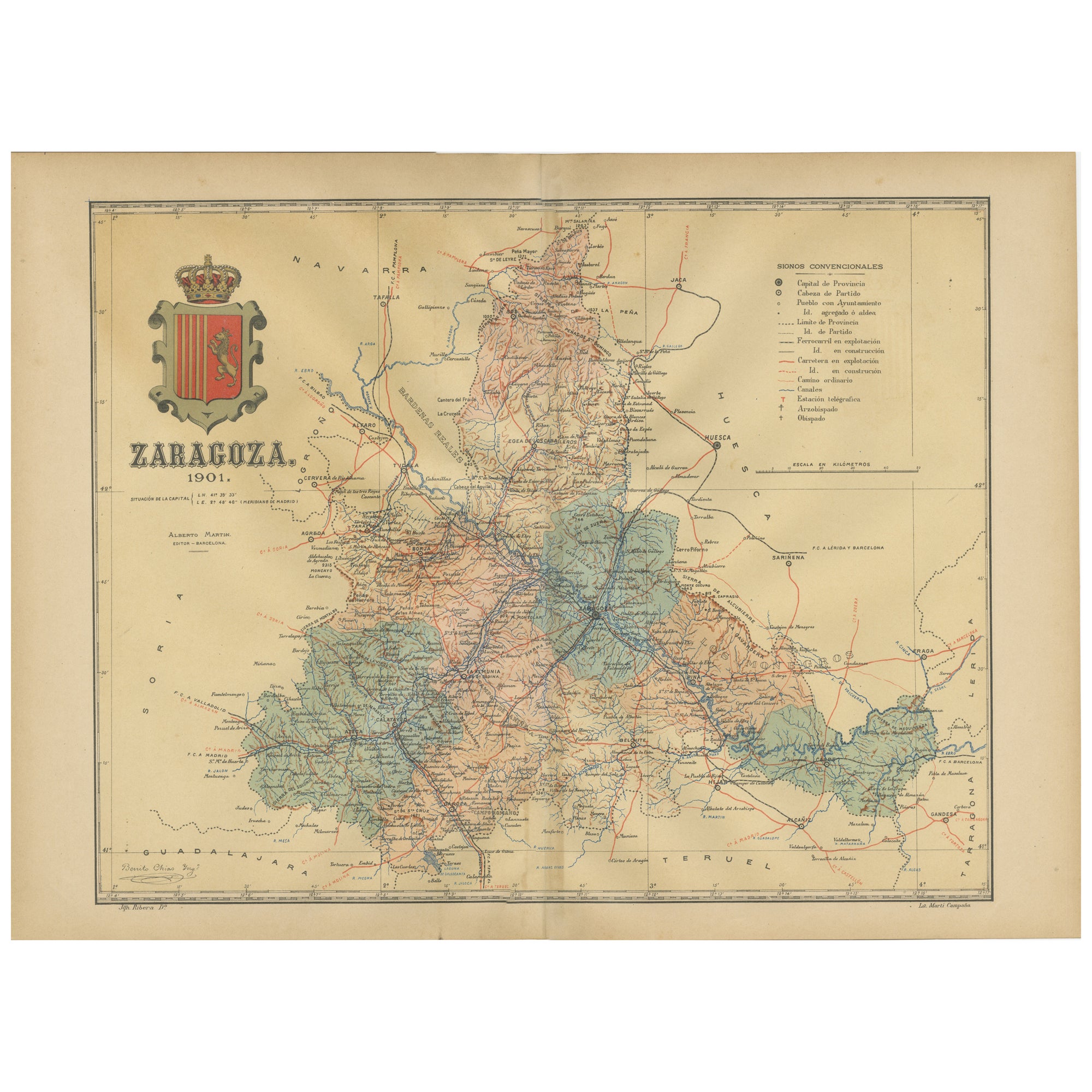
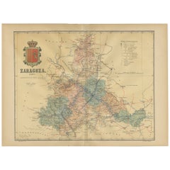
- Zaragoza: Crossroads of Heritage - The 1901 Cartographic ChronicleLocated in Langweer, NLThe print on sale is a historical map of the province of Zaragoza, Spain, dated 1901. The title on the map is "ZARAGOZA. 1901." This map details the geo...Category
Antique Early 1900s Maps
MaterialsPaper
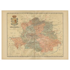
- Cáceres 1901: Mapping the Crossroads of Extremadura, Western SpainLocated in Langweer, NLThe map depicts the province of Cáceres in Spain, dated 1901. Key features of the map include: The map shows detailed contour lines indicating the diverse terrain, which includes the northern part of the province being part of the Sistema Central mountain range. Blue lines mark the rivers and larger bodies of water, likely including the Tagus River, which passes through the province. Red lines indicate roads and railways, highlighting the connections within the province and to neighboring areas. The coat of arms of Cáceres is featured prominently, displaying a castle and a lion, symbols associated with the historical heritage of the region. It is highlighted with a gold coating in the crown. About the province of Cáceres: Cáceres is one of the two provinces in the autonomous community of Extremadura, in western Spain, bordering Portugal. The province is known for its extensive natural environments, including part of the Monfragüe National Park, which is a UNESCO-designated Biosphere Reserve, and the Tagus River International Natural Park. The capital city, also named Cáceres, boasts a well-preserved old town with a wealth of Renaissance architecture...Category
Antique Early 1900s Maps
MaterialsPaper
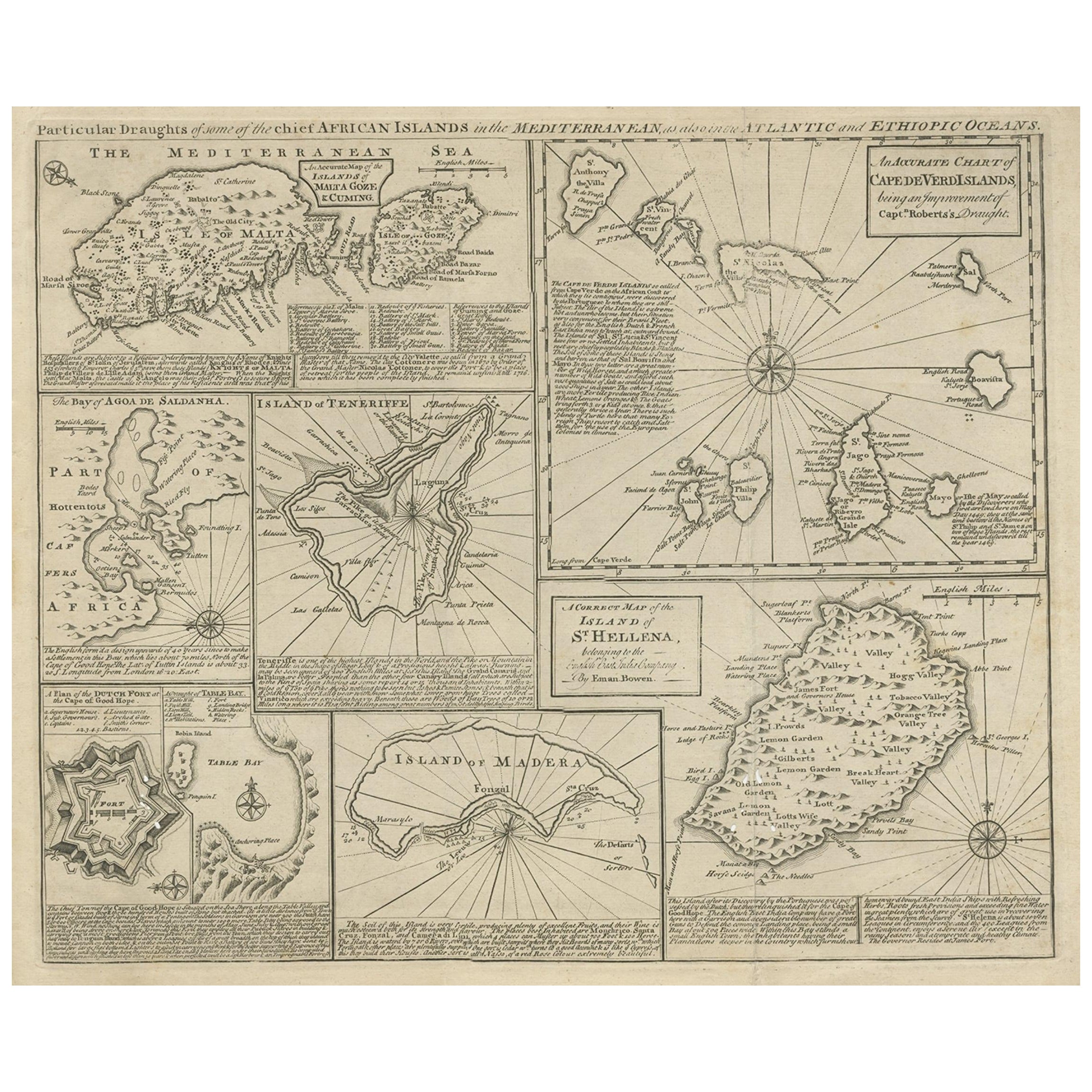
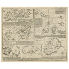
- Antique Map of 'African' Islands in the Mediterranean Sea and The Atlantic, 1747Located in Langweer, NLAntique map titled 'Particular draughts of some of the chief African Islands in the Mediterranean (..)'. Detailed set of eight maps, including a large and detailed Malta, the Bay of Agoa de Saldanha, Tenerife, the Dutch Fortress at the Cape of Good Hope, Table Bay...Category
Antique 18th Century Maps
MaterialsPaper
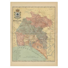
- Huelva 1901: A Cartographic Presentation of Andalusia's Atlantic FrontierLocated in Langweer, NLThe map displays the province of Huelva, located in the southwestern part of the autonomous community of Andalusia in Spain, as of the year 1901. It outlines various geographic and m...Category
Antique Early 1900s Maps
MaterialsPaper
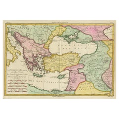
- Antique Map of the Eastern Mediterranean and the BalkansLocated in Langweer, NLAntique map titled 'La Turquie d'Europe et celle d'Asie'. Attractive double page map of the Eastern Mediterranean and the Balkans by R. Bonne. Originates from 'Atlas de Toutes les Pa...Category
Antique Late 18th Century Maps
MaterialsPaper
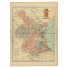
- Topographical and Infrastructure Map of the Province of Valencia, 1901Located in Langweer, NLA historical map of the province of Valencia, dated 1901. The map includes intricate details such as topographical features, with mountain ranges and river systems prominently marked...Category
Antique Early 1900s Maps
MaterialsPaper
You May Also Like
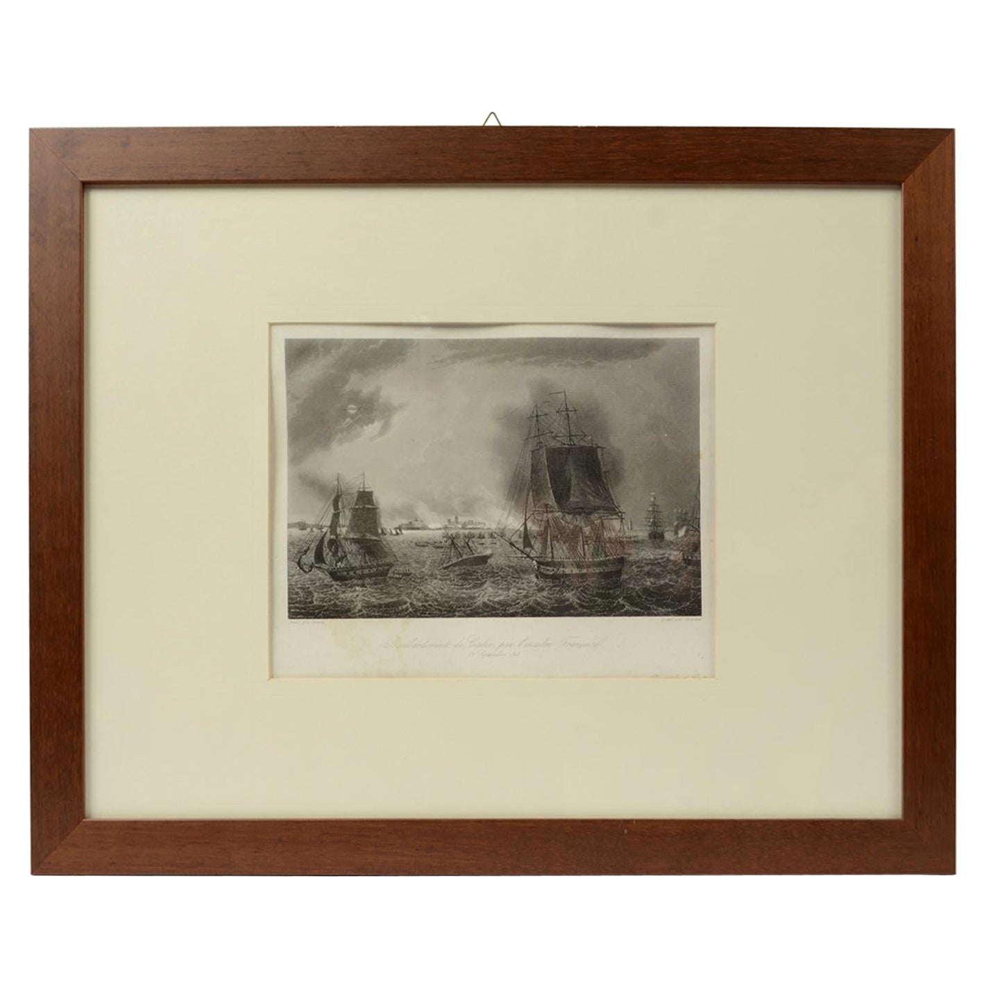
- Old Nautical Print Depicting the Bombardment of Cadiz by the French Navy 1823Located in Milan, ITPrint by engraving on copper plate of the first half of the 19th century, depicting the bombardment of Cadiz by the French Navy, 23 September 1823. The print is signed peint par Crep...Category
Antique 1830s French Nautical Objects
MaterialsPaper
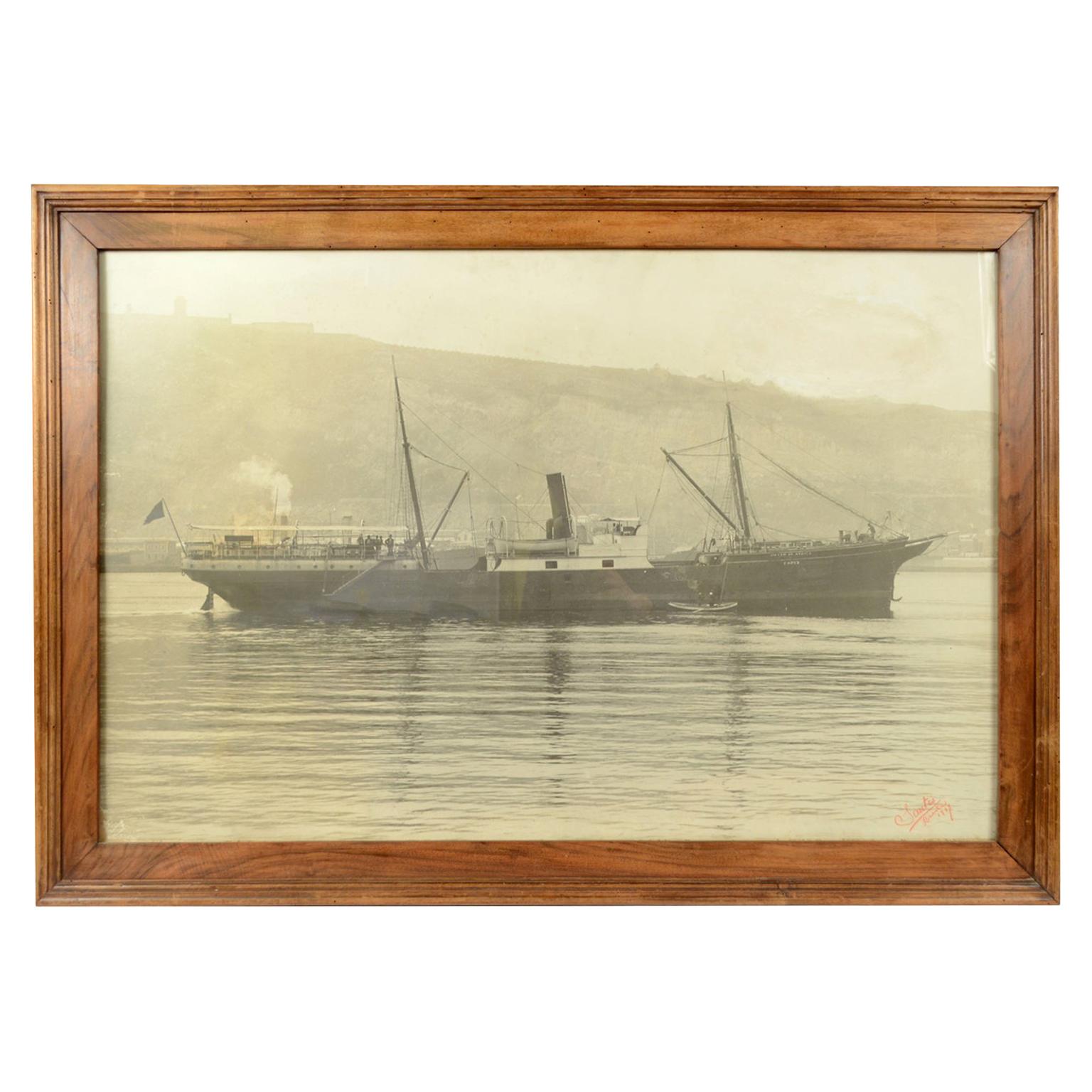
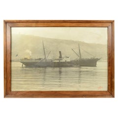
- Antique Nautical Historical Picture of the Ship Virgen De Africa Cadiz, 1917Located in Milan, ITLarge black and white historical picture depicting the ship Virgen de Africa Cadiz, dated 1917. Original frame, 112 x 79 - inches 44 x 31. Good condition.Category
Vintage 1910s Nautical Objects
MaterialsPaper
- 1901-03 The Novels of Jane AustenLocated in Bath, GBA smart set of the major novels of beloved author, Jane Austen, this set with the lively illustrations of Hugh Thomson. A smart set containing the major novels of Austen, complete w...Category
Antique Early 1900s British Books
MaterialsPaper
- Large Framed Map of the MediterraneanLocated in New York, NYLarge map/chart chart of The Mediterranean and the Grecian Archipelago showing Italy, Sardinia, Corsica, part of France, etc. in a black frame.Category
20th Century French Mid-Century Modern Maps
- Fine Half Model of the Racing Yacht AtlanticLocated in Norwell, MAThis s a highly detailed “half model”, not just a “half hull”. The deck detail is extensive with planked deck, skylights with brass bars, row of turned brass portholes, stubbed masts...Category
2010s North American Models and Miniatures
MaterialsWood
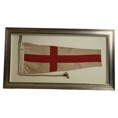
- Nautical Signal Flag Of The Numeral “8” EightLocated in Norwell, MAMaritime signal flag of the number eight. Pennant has a white field with red cross. Canvas hoist with stamped “8”, signal rope and wood toggle. Custom mount into a shadow box frame. ...Category
Vintage 1980s North American Nautical Objects
MaterialsLinen


Recently Viewed
View AllMore Ways To Browse
Map Of Old Armenia
Teak Wood Sphere
Nova Guinea Maps
Antique Map Of Illinois
Petite Point Hand Bag
Antique Map Of Southeastern Us
Antique Map Alabama
Antique Map Of Sydney
Malay Archipelago Map
Gambia Antique Map
Uruguay Antique Map
Guyana Antique Map
Ruscelli Map
Masque Theatre No
Nova Scotia Map
Antique Map Tuscany
Berkshire Antique Map
Cornwall Map