Antique Map Of Sydney
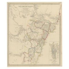
Antique Map of New South Wales with an Inset of Sydney, Australia, 1833
Located in Langweer, NL
Antique map of Australia titled 'New South Wales'. Old map of New South Wales, Australia. With an
Category
Antique 19th Century Maps
Materials
Paper
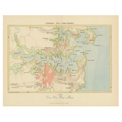
Antique Map Depicting Sydney and Surrounding Areas, Known as Port Jackson, c1889
Located in Langweer, NL
An antique map depicting Sydney and its surrounding areas, known as Port Jackson, dating from
Category
Antique 1880s Maps
Materials
Paper
Free Shipping
H 10.16 in W 13.39 in D 0 in
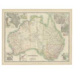
Antique Map of Australia by Johnston '1909'
Located in Langweer, NL
Antique map titled 'Australia'. Original antique map of Australia. With inset maps of Melbourne
Category
Early 20th Century Maps
Materials
Paper
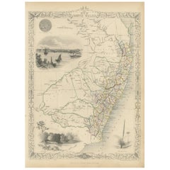
Antique Map of New South Wales by Tallis, circa 1851
Located in Langweer, NL
Antique map titled 'New South Wales'. Decorative and detailed map of New South Wales which was
Category
Antique Mid-19th Century Maps
Materials
Paper
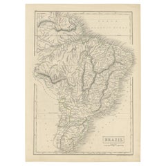
Antique Map of Brazil with Original Outline Hand-Colouring, c.1844
Located in Langweer, NL
Antique map titled 'Brazil'. Beautiful map with outline color of Brazil, engraved by S. Hall
Category
Antique 19th Century Maps
Materials
Paper
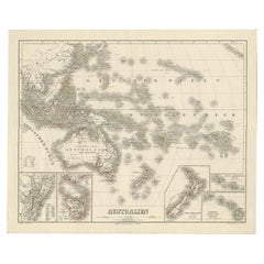
Map of Australia, New Zealand, Part of China, Japan and Southeast Asia, 1857
Located in Langweer, NL
German Antique map titled 'Australien'. Map of Australia, New Zealand, part of China, Japan and
Category
Antique 19th Century Maps
Materials
Paper
No Reserve
H 23.23 in W 27.96 in D 0 in
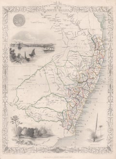
New South Wales, Australia, antique mid 19th century engraved John Tallis map
Located in Melbourne, Victoria
'New South Wales'
With decorative border surrounds and vignettes of 'Sydney Cove'. 'The Murray
Category
1840s Victorian Landscape Prints
Materials
Engraving
H 14.77 in W 10.63 in
People Also Browsed
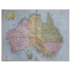
Large Original Vintage Map of Australia, circa 1920
Located in St Annes, Lancashire
Great map of Australia
Original color. Good condition
Published by Alexander Gross
Unframed.
Category
Vintage 1920s English Maps
Materials
Paper
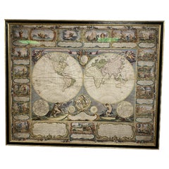
Colored wall map of the WORLD
By Chambon
Located in ZWIJNDRECHT, NL
“Mappe Monde, contenant les Parties Connues du Globe Terrestre”
CHAMBON, Gobert-Denis (France, 17.. - 1781)
Paris, Longchamps et Janvier, 1754
Size H. 115 x W. 145 cm.
Gobert-Denis...
Category
Antique Mid-18th Century French French Provincial Maps
Materials
Wood, Paper
Gold Rush Era Masterpiece: The Tallis & Rapkin Rare Map of Pre-Queensland, 1851
Located in Langweer, NL
The image is an original historical map of Australia from the year 1851, created by John Rapkin with illustrations by J. Marchant and engravings by J. B. Allen. The map was published...
Category
Antique 1850s Maps
Materials
Paper
No Reserve
H 104.34 in W 14.26 in D 0 in
Antique Detailed Map of New South Wales, Queensland & Victoria, Australia, 1865
Located in Langweer, NL
Antique map Australia titled 'South Australia, New South Wales, Victoria & Queensland'. Old map depicting South Australia including New South Wales, Victoria and Queensland. Orginate...
Category
Antique 19th Century Maps
Materials
Paper
H 24.41 in W 19.49 in D 0 in
Large Original Vintage Map of Western Australia, circa 1920
Located in St Annes, Lancashire
Great map of Western Australia with a vignette of Tasmania.
Original color.
Good condition
Published by Alexander Gross
Unframed.
Category
Vintage 1920s English Edwardian Maps
Materials
Paper
Antique Map of Suffren Island by Cook, 1803
Located in Langweer, NL
Antique map Australia titled 'Gezigt van het Eil. Suffren'. Antique map of Suffren Island. Originates from 'Reizen Rondom de Waereld door James Cook (..)'. Artists and Engravers: Tra...
Category
Antique 19th Century Maps
Materials
Paper
Old Antique Map of the Banda Islands (Southeast), Indonesia & Northern Australia
By F. Valentijn
Located in Langweer, NL
Original antique map titled 'Kaart van de Zuyd-Ooster Eylanden van Banda'. Important map of the seas and islands surrounding the Banda Islands, Indonesia, extending south to northern...
Category
Antique Early 18th Century Maps
Materials
Paper
No Reserve
H 20.28 in W 24.02 in D 0.02 in
Antique Map of Australia and New Zealand, c.1860
Located in Langweer, NL
Antique map titled 'Australia and New Zealand'. Unusual edition of this map of Australia and New Zealand, on very thin paper and multiple folding lines. Source unknown, to be determi...
Category
Antique 19th Century Maps
Materials
Paper
Detailed German Map of Australia Including Statistics of 1841, Published in 1854
Located in Langweer, NL
Title: "Detailed Map of Austral Land - 1854"
This historic map, titled "Australland," was published in Glogau in 1854 by cartographer Carl Flemming. It's an intricately detailed dep...
Category
Antique 1850s Maps
Materials
Paper
Free Shipping
H 14.06 in W 17.52 in D 0 in
Antique Map of Victoria ‘Australia’ by J. Tallis, circa 1855
Located in Langweer, NL
A highly decorative and finely engraved mid-19th century map of Victoria, Australia which appeared in John Tallis & co.'s The Illustrated Atlas (London & New York, circa 1855).
Th...
Category
Antique Mid-19th Century Maps
Materials
Paper
French Antique Map of Oceania with Details of the Australian Colonies, c.1840
Located in Langweer, NL
Antique map Oceania titled 'Océanie par C.V. Monin'. Old map of Oceania with an inset of New South Wales. Originates from 'Atlas Classique de la Géographie Ancienne (..)'.
Artists ...
Category
Antique 19th Century Maps
Materials
Paper
H 13 in W 17.52 in D 0 in
Antique Map of South East Australia by Stieler, c.1848
By Thomas Kitchin
Located in Langweer, NL
Antique map Australia titled 'Süd-Ost Australien'. Detailed map of South East Australia. Orginates from 'Stieler's Hand Atlas', published in Germany ca. 1848. Artists and Engravers: ...
Category
Antique 19th Century Maps
Materials
Paper
Antique Map of Oceania by Delamarche, 1836
Located in Langweer, NL
Antique map titled 'Carte de l'Oceanie contenant l'Australie la Poynesie et les iles Asiatiques.' Antique map of Oceania comprising Australia and Polynesia, New Zealand and Indonesia...
Category
Antique 19th Century Maps
Materials
Paper
Antique Map of Western Australia and Van Diemen's Land or Tasmania, 1833
Located in Langweer, NL
Antique map of Australia titled 'Western Australia - Van-Diemen Island'. Two maps on one sheet. Left, Western Australia containing the settlements of the Swan river. Right, Van Dieme...
Category
Antique 19th Century Maps
Materials
Paper
H 13.78 in W 16.15 in D 0 in
Antique Map of Oceania by Johnston, 1882
Located in Langweer, NL
Antique map titled 'Oceania'. Old map of Oceania with inset maps of Western Australia, Tasmania and New Zealand. This map originates from 'The Royal Atlas of Modern Geography, Exhibi...
Category
Antique 19th Century Maps
Materials
Paper
Antique Map of Oceania by Lapie, 1842
Located in Langweer, NL
Antique map titled 'Carte de l'Océanie contenant l'Australie, la Polynesie et les Iles Asiatiques'. Map of Oceania including Australia, Polynesia and several islands of Asia. This ma...
Category
Antique 19th Century Maps
Materials
Paper
Recent Sales
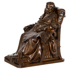
French Antique Bronze Sculpture “Last Days of Napoleon” by Vincenzo Vela
By Vincenzo Vela 1
Located in Shippensburg, PA
the chair his left nervously clutched rests on a map of Europe of 1814 spread on his lap, that Europe
Category
Antique 19th Century French Romantic Figurative Sculptures
Materials
Bronze
H 7.25 in W 6.75 in D 4.13 in
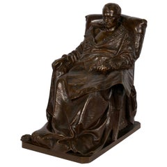
“Last Days of Napoleon” French Antique Bronze Sculpture by Vincenzo Vela
By F. Barbedienne Foundry, Vincenzo Vela 1
Located in Shippensburg, PA
. His right hand rests languidly on an arm of the chair his left nervously clutched rests on a map of
Category
20th Century French Figurative Sculptures
Materials
Bronze
H 16.63 in W 9 in D 15.13 in
Antique Map of Australia by C. Gräf, 1857
Located in Langweer, NL
Antique map titled 'Australien'. Map of Australia, New Zealand, part of China, Japan and Southeast
Category
Antique Mid-19th Century Maps
Materials
Paper
“Last Days of Napoleon” Antique French Bronze Sculpture by Vela & Barbedienne
By F. Barbedienne Foundry, Vincenzo Vela 1
Located in Shippensburg, PA
clutched rests on a map of Europe of 1814 spread on his lap, that Europe whose boundary lines he had so
Category
20th Century French Figurative Sculptures
Materials
Bronze
H 17 in W 11.5 in D 15.25 in
Get Updated with New Arrivals
Save "Antique Map Of Sydney", and we’ll notify you when there are new listings in this category.
More Ways To Browse
Vintage Gowns Sydney
Map Of French Alps
Map Chest
Antique Office Furniture Perth
Thin Model F
Map Document Chest
David By Ferdinand Barbedienne
Brower Chairs
Antique Map Chest
3 European Corner Chair
Bronze Heart Chair
Lap Blanket
Blanket Chests Images
Antique Map Sydney
Vela Chair
Small Map
Lane South America Furniture
Old Maps Of Italy
