Items Similar to Detailed German Map of Australia Including Statistics of 1841, Published in 1854
Want more images or videos?
Request additional images or videos from the seller
1 of 6
Detailed German Map of Australia Including Statistics of 1841, Published in 1854
About the Item
Title: "Detailed Map of Austral Land - 1854"
This historic map, titled "Australland," was published in Glogau in 1854 by cartographer Carl Flemming. It's an intricately detailed depiction of Australia, showcasing the division of colonies, which include New South Wales, West Australia, and Van Diemen's Land (now known as Tasmania). Towns, mountain ranges, rivers, and surrounding islands are meticulously marked, providing a comprehensive view of the mid-19th century Australian landscape.
A key feature of this map is the inclusion of a statistical table that gives a snapshot of the population distribution across the colonies as of 1841. This demographic information provides insight into the human geography of the time.
The map also honors the history of exploration and discovery in Australia, with notes referencing significant explorers such as De Witt, Tasman, and Flinders, among others. It acknowledges their contributions to charting the coastline and interior of the continent. The notes "Entdeckt Durch" followed by an explorer's name means "Discovered By," attributing the discovery of particular regions to these figures.
The cartographic style is indicative of the period, with fine engraving and a simple yet effective color scheme that differentiates land from sea, colonies, and borders. This map not only served as a practical reference for those living during the time but now serves as a historical document, offering valuable insights into the state of Australian exploration and colonization in the mid-1800s.
- Dimensions:Height: 14.06 in (35.7 cm)Width: 17.52 in (44.5 cm)Depth: 0 in (0.02 mm)
- Materials and Techniques:
- Period:
- Date of Manufacture:1854
- Condition:Good. Paper slightly browned or discoloured. General age-related toning and/or occasional minor defects from handling. Light creasing overal. Title 'Australland' is cut short by scan, not on the original. Please study scan carefully.
- Seller Location:Langweer, NL
- Reference Number:
About the Seller
5.0
Platinum Seller
These expertly vetted sellers are 1stDibs' most experienced sellers and are rated highest by our customers.
Established in 2009
1stDibs seller since 2017
1,922 sales on 1stDibs
Typical response time: <1 hour
- ShippingRetrieving quote...Ships From: Langweer, Netherlands
- Return PolicyA return for this item may be initiated within 14 days of delivery.
More From This SellerView All
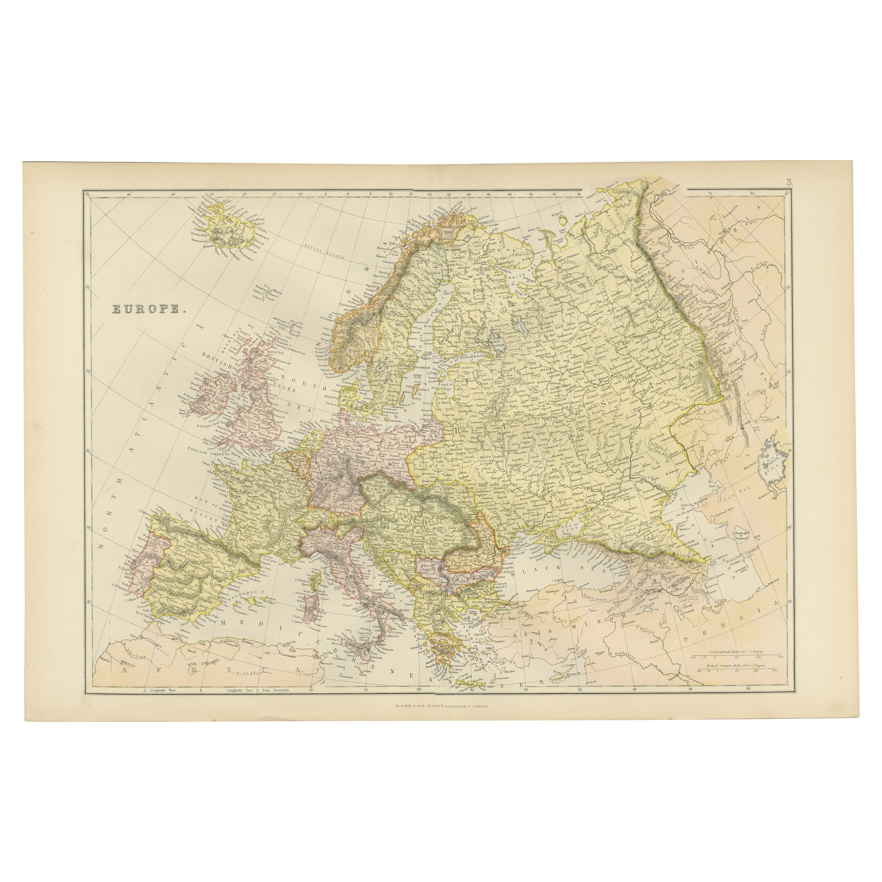
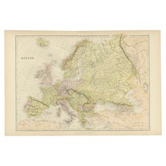
- Colorful Detailed Antique Map of Europe, Published in 1882Located in Langweer, NL"The Antique Map of Europe from 'The Comprehensive Atlas and Geography of the World,' published in 1882 by Blackie & Son, is a testament to meticulous cartography and scholarly preci...Category
Antique 1880s Maps
MaterialsPaper
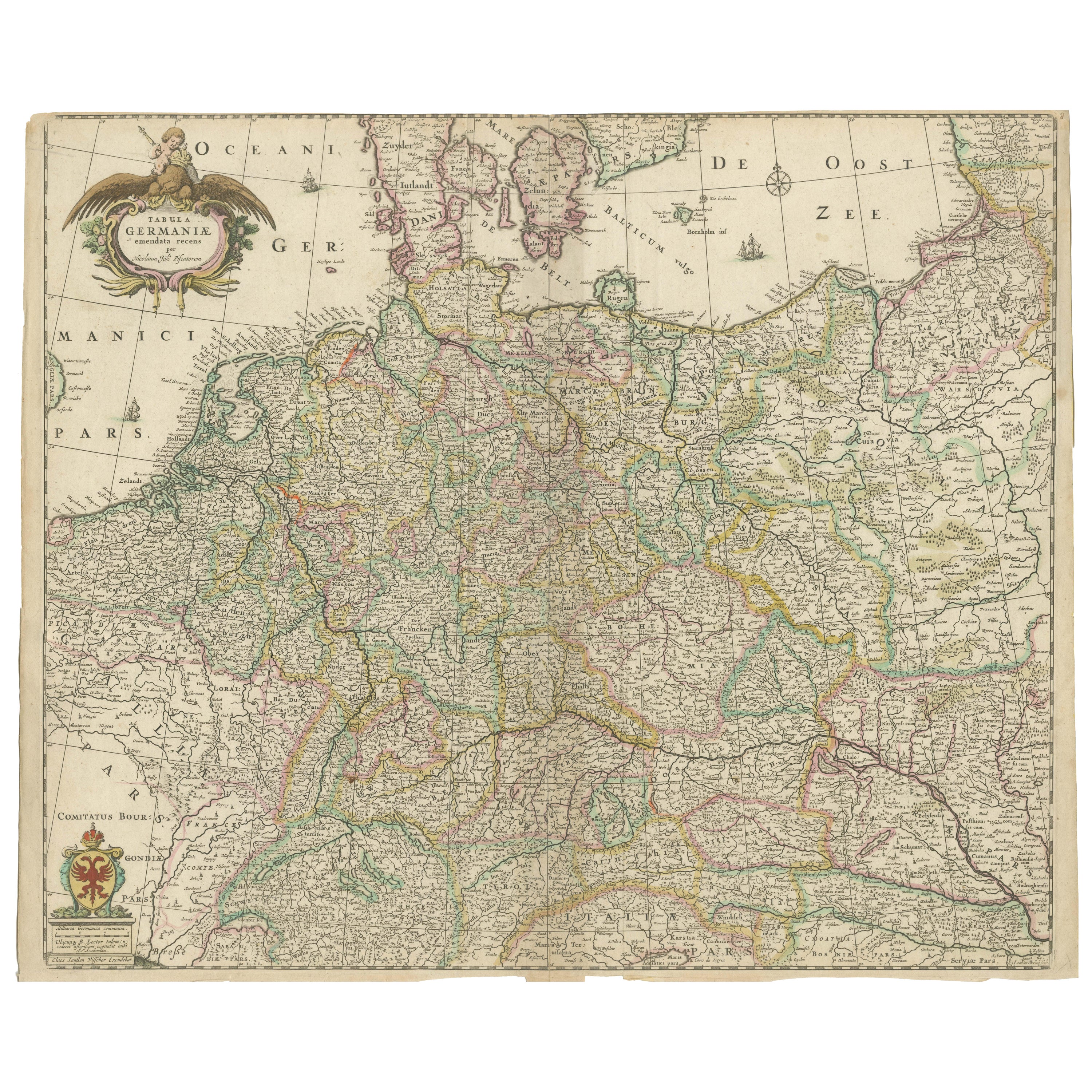
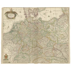
- Antique Map of Germany including surrounding countriesLocated in Langweer, NLAntique map titled 'Tabula Germaniae'. Orginal antique map of Germany by Claes Jansz. Visscher. Published circa 1650. including the Low Countries, Switze...Category
Antique Mid-17th Century Maps
MaterialsPaper
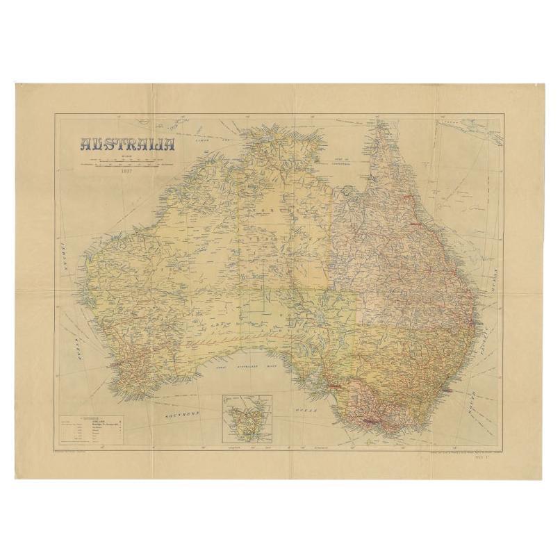
- Large Detailed Map of Australia Wint Inset of Tasmania, 1937Located in Langweer, NLAntique map titled 'Australia'. Large folding map of Australia. With inset map of Tasmania. Printed by L.F. Johnston, Canberra. Artists and Engravers: Compiled and drawn by Propert...Category
20th Century Maps
MaterialsPaper
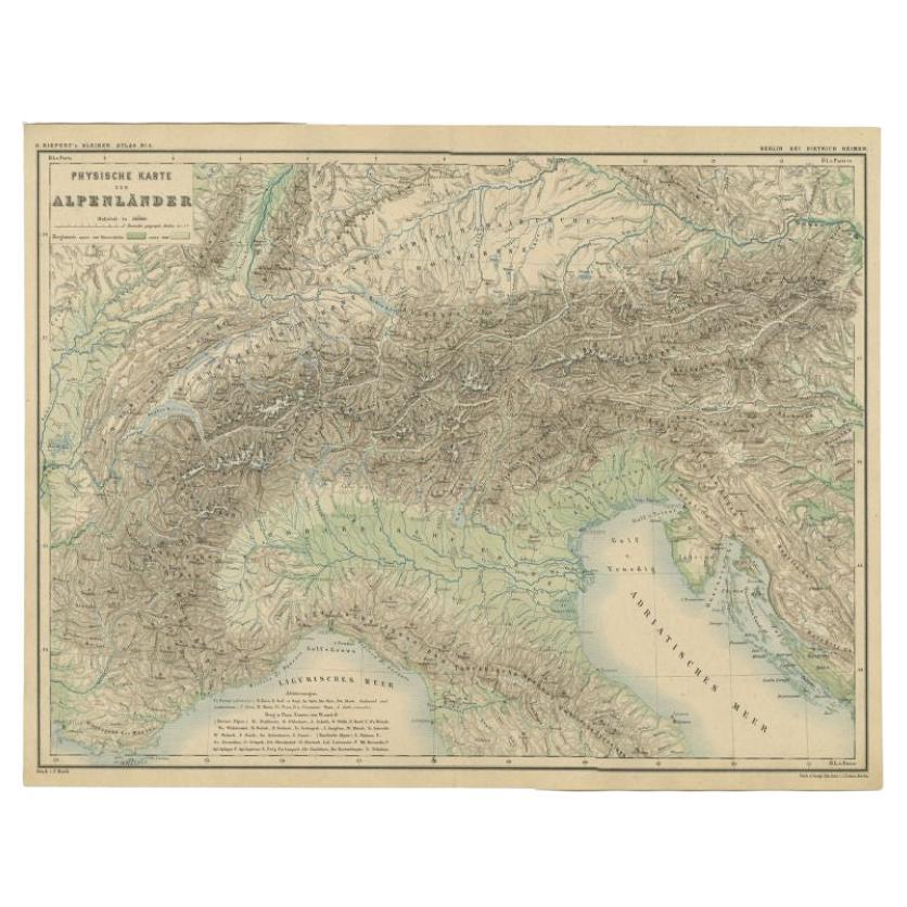
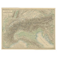
- Antique Map of the Alpine Countries, Published in Germany, c.1870Located in Langweer, NLAntique map titled 'Physische Karte der Alpenländer'. Old map of the Alpine countries. This map originates from 'H. Kiepert's Kleiner Atlas der Neueren Geographie für Schule und Haus...Category
Antique 19th Century Maps
MaterialsPaper
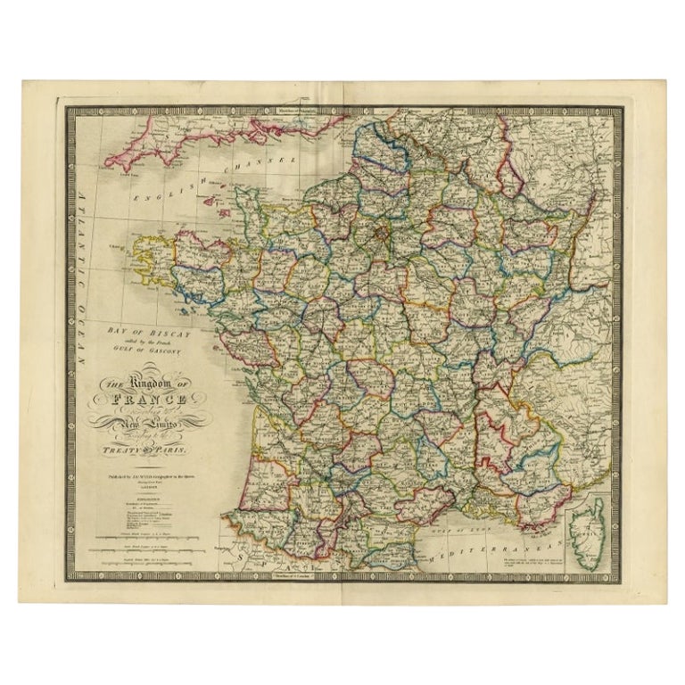
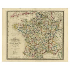
- Antique Map of France according to the Treaty of Paris '1815', Published in 1854Located in Langweer, NLAntique map titled 'The Kingdom of France, describing the new limits according to the treaty of Paris. (1815)'. Large map of France. From James Wyld's 'A New General Atlas of Modern ...Category
Antique 19th Century Maps
MaterialsPaper
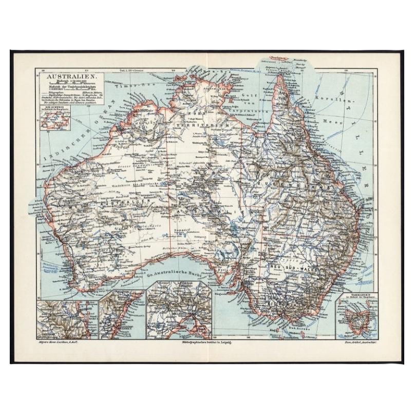
- German Antique Map of Australia, Meyers, 1885Located in Langweer, NLAustralien.' (Map of Australia. With inset maps of the large cities and Tasmania.) This attractive original old antique print / plate / map originate...Category
Antique 19th Century Maps
MaterialsPaper


You May Also Like
- 1853 Map of "Russia in Europe Including Poland" Ric.r016Located in Norton, MADescription Russia in Europe incl. Poland by J Wyld c.1853 Hand coloured steel engraving Dimension: Paper: 25 cm W x 33 cm H ; Sight: 22 cm W x 28 cm H Condition: Good ...Category
Antique 19th Century Unknown Maps
MaterialsPaper
- 18th Century Hand-Colored Homann Map of Germany, Including Frankfurt and BerlinBy Johann Baptist HomannLocated in Alamo, CAAn 18th century hand-colored map entitled "Tabula Marchionatus Brandenburgici et Ducatus Pomeraniae quae sunt Pars Septentrionalis Circuli Saxoniae Superioris" by Johann Baptist Homa...Category
Antique Early 18th Century German Maps
MaterialsPaper
- 1854 Map of Massachusetts, Connecticut and Rhode Island, Antique Wall MapLocated in Colorado Springs, COThis striking wall map was published in 1854 by Ensign, Bridgman & Fanning and has both full original hand-coloring and original hardware. This impression is both informative and highly decorative. The states are divided into counties, outlined in red, green, and black, and subdivided into towns. Roads, canals, and railroad lines are prominently depicted, although they are not all labeled. The mapmakers also marked lighthouses, banks, churches, and prominent buildings, with a key at right. The map is an informative and comprehensive overview of the infrastructural development of New England prior to the Civil War. Physical geographies depicted include elevation, conveyed with hachure marks, rivers and lakes. The impression features an inset map of Boston...Category
Antique 19th Century American Maps
MaterialsPaper
- Large Original Vintage Map of The Pacific Islands Including HawaiiLocated in St Annes, LancashireGreat map of The Pacific Islands Unframed Original color By John Bartholomew and Co. Edinburgh Geographical Institute Published, circa 1...Category
Vintage 1920s British Maps
MaterialsPaper
- Antique 1803 Italian Map of Asia Including China Indoneseia IndiaLocated in Amsterdam, Noord HollandAntique 1803 Italian Map of Asia Including China Indoneseia India Very nice map of Asia. 1803. Additional information: Type: Map Country of Manufacturing: Europe Period: 19th centu...Category
Antique 19th Century European Maps
MaterialsPaper
- Antique French Map of Asia Including China Indoneseia India, 1783Located in Amsterdam, Noord HollandVery nice map of Asia. 1783 Dedie au Roy. Additional information: Country of Manufacturing: Europe Period: 18th century Qing (1661 - 1912) Condition: Overall Condition B (Good Used)...Category
Antique 18th Century European Maps
MaterialsPaper


Recently Viewed
View AllMore Ways To Browse
Greek Map 1920
Marne Map
Antique Slovenia
Galicia Map
Antique Maps Sumatra
Santa Cruz Solomon Islands
Georg Barque
F V Hayden
Original Antique Map Of World
Map Zanzibar
Matthew Seutter On Sale
Minature Map
Vincenzo Coronelli On Sale
1681 Moses Pitt
Anguilla Map
Antique Cabbage Cutter
Antique Maps Denver
Antique Maps Washington Dc