Original Antique Map Of World
40
to
255
2,610
42
1,260
1,200
795
429
185
126
89
85
34
30
27
27
27
23
22
19
15
15
12
11
10
10
9
9
8
8
7
7
6
5
5
4
4
3
3
3
3
3
3
3
2
2
2
2
2
1
1
1
1
1
1
1
1
1
1
42
42
31
22
19
Sort By
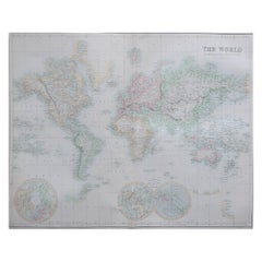
Large Original Antique Map of the World, Fullarton, circa 1870
Located in St Annes, Lancashire
Great map of the World.
From the celebrated Royal Illustrated Atlas
Lithograph. Original color
Category
Antique 1870s Scottish Maps
Materials
Paper
No Reserve
H 18.5 in W 22.5 in D 0.07 in
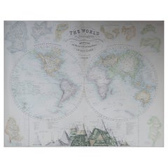
Large Original Antique Map of The World, Fullarton, C.1870
Located in St Annes, Lancashire
Great map of the World. Showing both hemispheres
From the celebrated Royal Illustrated Atlas
Category
Antique 1870s Scottish Maps
Materials
Paper
Original Antique Map of The World by Thomas Clerk, 1817
Located in St Annes, Lancashire
Great map of The Eastern and Western Hemispheres
On 2 sheets
Copper-plate engraving
Drawn
Category
Antique 1810s English Maps
Materials
Paper
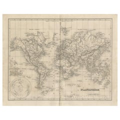
Antique Map of the World by Balbi '1847'
Located in Langweer, NL
Antique map titled 'Planisphère'. Original antique map of the world. This map originates from
Category
Antique Mid-19th Century Maps
Materials
Paper
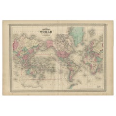
Antique Map of the World by Johnson, '1872'
Located in Langweer, NL
Antique map titled 'Johnson's World. Original world map. This map originates from 'Johnson's New
Category
Antique Late 19th Century Maps
Materials
Paper
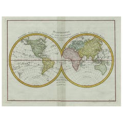
Original Engraved Antique Map of the World, Colorful and Decorative, C.1780
By Pierre François Tardieu
Located in Langweer, NL
: 51.6 x 39.6 cm.
Image size: 43 x 31.8 cm.
We sell original antique maps to collectors, historians
Category
Antique 18th Century Maps
Materials
Paper
H 15.6 in W 20.32 in D 0 in
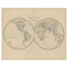
Antique World Map by Johnston, 1882
Located in Langweer, NL
Antique map titled 'The World in Hemispheres'. Old double-hemisphere world map. This map originates
Category
Antique 19th Century Maps
Materials
Paper
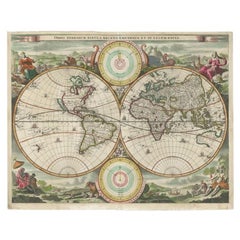
Antique Map of the World by Stoopendaal, c.1714
Located in Langweer, NL
Antique world map titled 'Orbis Terrarum Tabula Recens Emendata et in Lucem Edita'. Decorative
Category
Antique 18th Century Maps
Materials
Paper
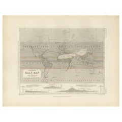
Antique Rain Map of the World by Johnston '1850'
Located in Langweer, NL
Antique map titled 'Hyetographic or Rain Map of the World'. Original antique rain map of the world
Category
Antique Mid-19th Century Maps
Materials
Paper
Antique Physical Map of the World by Reynolds, 1849
Located in Langweer, NL
Antique physical map of the world, showing the discoveries of the most eminent modern geographers
Category
Antique 19th Century Maps
Materials
Paper
Antique Ethnographic Map of the World by Johnston '1850'
Located in Langweer, NL
races of man'. Original antique ethnographic map of the world showing the present distribution of the
Category
Antique Mid-19th Century Maps
Materials
Paper
Antique Geological Map of the World by Johnston '1850'
Located in Langweer, NL
Antique map titled 'The Geological Structure of the Globe'. Original antique geological map of the
Category
Antique Mid-19th Century Maps
Materials
Paper
Antique Map of the World by D'Urville '1853'
Located in Langweer, NL
Antique map titled 'Voyage Autour du Monde'. Original map of the world. This map originates from
Category
Antique Mid-19th Century Maps
Materials
Paper
Original Antique Map of Switzerland, 1882
Located in Langweer, NL
Embark on a historical journey with an original Antique Map of Switzerland from the renowned
Category
Antique 1880s Maps
Materials
Paper
Very Decorative Original Antique Map of the World, Published in France in c.1780
By Rigobert Bonne
Located in Langweer, NL
Overall size: 44.7 x 26 cm.
Image size: 40.6 x 21 cm.
We sell original antique maps to collectors
Category
Antique 18th Century Maps
Materials
Paper
H 10.24 in W 17.6 in D 0 in
Antique World Map before the Voyages of Christopher Columbus, 1880
Located in Langweer, NL
Antique world map titled 'Monde Connu des Anciens'. Antique map of the World and continents before
Category
Antique 19th Century Maps
Materials
Paper
Antique Map of the World, Mercator Projection, by Wyld, '1845'
Located in Langweer, NL
Antique map titled 'The World'. Original antique world map, on Mercator's projection. This map
Category
Antique Mid-19th Century Maps
Materials
Paper
No Reserve
H 10.24 in W 14.18 in D 0.02 in
Antique Map of the World in Hemispheres by Johnson, '1872'
Located in Langweer, NL
Antique map titled 'Johnson's Globular World. Original world map depicting the Eastern Hemisphere
Category
Antique Late 19th Century Maps
Materials
Paper
Antique Map of the Distribution of Vegetation throughout the World '1851'
Located in Langweer, NL
Antique map titled 'Umrisse der Pflanzengeographie'. Original antique map showing the distribution
Category
Antique Mid-19th Century Maps
Materials
Paper
H 19.69 in W 21.86 in D 0.79 in
Original Decorative Antique Map of Prussia, 1628
Located in Langweer, NL
Antique map titled 'Prussia'. Original antique map of Prussia, a historically prominent German
Category
Antique 1620s Maps
Materials
Paper
Antique Map of the World on Mercator Projection by Anson, 1749
Located in Langweer, NL
'. Original antique map of the world on Mercator's Projection from a Dutch edition of Anson's voyages. The map
Category
Antique 18th Century Maps
Materials
Paper
Antique Map of the World with California as an Island, 1788
Located in Langweer, NL
Description: Antique map titled 'De wareld in een ronde gedaante van de Noord Pool te zien - De
Category
Antique 1780s Maps
Materials
Paper
Original Antique Map of Russia in Europe, 1882
Located in Langweer, NL
Embark on an enthralling journey with an original Antique Map of European Russia from the esteemed
Category
Antique 1880s Maps
Materials
Paper
Original Antique Map of The Austrian Empire, 1882
Located in Langweer, NL
Step into the past with an original Antique Map of The Austrian Empire from the esteemed
Category
Antique 1880s Maps
Materials
Paper
Original Antique Map of Spain and Portugal, 1882
Located in Langweer, NL
Embark on a historical voyage with an original Antique Map of Spain and Portugal from the esteemed
Category
Antique 1880s Maps
Materials
Paper
Antique Mercator Projection World Map by Petri, c.1873
Located in Langweer, NL
Antique world map titled 'Wereldkaart naar Mercator's Projectie'. Old map of the world. This map
Category
Antique 19th Century Maps
Materials
Paper
Original Antique Map of West Europe, circa 1870
Located in Langweer, NL
x 33.3 cm.
We sell original antique maps to collectors, historians, educators and interior
Category
Antique 19th Century Maps
Materials
Paper
Antique Detailed World Map Drawn on Mercator's Projection, 1700
Located in Langweer, NL
Antique world map titled 'Carte generale du monde, ou description du monde terrestre & Aquatique
Category
Antique 17th Century Maps
Materials
Paper
Original Antique Map of Friesland by Guicciardini, 1612
Located in Langweer, NL
Antique map titled 'Frisiae Occidentalis Typus'. Original antique map of the province of Friesland
Category
Antique 17th Century Maps
Materials
Paper
Antique Map of the World Showing the Distribution of Plants and Minerals, 1872
Located in Langweer, NL
Antique map titled 'Johnson's World showing the distribution of the Characteristic Forest Trees
Category
Antique Late 19th Century Maps
Materials
Paper
H 13.39 in W 16.93 in D 0.02 in
Old Original Antique Map of Western Canada, 1882
Located in Langweer, NL
Antique map titled 'Dominion of Canada'.
Old map of Western Canada. This map originates from
Category
Antique 1880s Maps
Materials
Paper
Original Old Composite of Several Maps of the Ancient World on One Sheet, 1880
Located in Langweer, NL
This original antique map is from Karl Spruner von Merz's "Atlas Antiquus", later edited by
Category
Antique 1880s Maps
Materials
Paper
Free Shipping
H 15.56 in W 18.51 in D 0 in
Antique Map of The World in Hemispheres by W. G. Blackie, 1859
Located in Langweer, NL
Antique map titled 'The World in Hemispheres with other projections'. Original antique map of The
Category
Antique Mid-19th Century Maps
Materials
Paper
Rare Original Double Hemisphere World Map with Allegorical Figures, 1785
Located in Langweer, NL
Antique map titled 'Nieuwe en Naukeurige Kaart der Gantsche bekende Werreld.'
A double
Category
Antique 1780s Maps
Materials
Paper
H 17.05 in W 23.23 in D 0 in
World Map Silver Leaf Print Based on Original Willem Blaeu Wall Map 1571-1638
Located in GB
We are delighted to offer for sale this lovely Antique style pictorial plan map of the globe based
Category
20th Century English Campaign Maps
Materials
Silver Leaf
H 22.05 in W 25.6 in D 0.99 in
Original Antique Map of Zuid-Holland by Brugsma, 1864
Located in Langweer, NL
.
Date: 1864
Overall size: 30.5 x 25.5 cm.
Image size: 23.5 x 19.5 cm.
We sell original antique maps
Category
Antique 19th Century Maps
Materials
Paper
Original Antique Map of Central Asia by Smith, 1808
Located in Langweer, NL
.
We sell original antique maps to collectors, historians, educators and interior decorators all over
Category
Antique 19th Century Maps
Materials
Paper
Antique Map of the Old World Projection, Entitled Orbis Terrarum Ad Mentem, 1825
Located in Langweer, NL
Antique map titled 'Orbis Terrarum ad Mentem (..)'. Old map of the world originating from 'Atlas
Category
Antique 19th Century Maps
Materials
Paper
H 8.51 in W 9.77 in D 0 in
Small Original Antique Map of Switzerland and Surroundings, 1807
Located in Langweer, NL
Antique map titled 'Switzerland with its subjects & allies from the best authorities'.
Small
Category
Antique Early 1800s Maps
Materials
Paper
Original Antique Map of Malabar, Coromandel 'India' and Ceylon
Located in Langweer, NL
Antique map titled 'Peninsula Indiae citra Gangem, hoc est Orae celeberrimae Malabar & Coromandel
Category
Antique Mid-18th Century Maps
Materials
Paper
Antique Map of Denmark, Original and Decorative, c.1846
Located in Langweer, NL
Antique map titled 'Denmark'. Old map of Denmark. This map originates from 'A New Universal Atlas
Category
Antique 19th Century Maps
Materials
Paper
Original Antique Map of Italy with an Inset of Sardinia, 1882
Located in Langweer, NL
Embark on a historical odyssey with an original Antique Map of Italy from the esteemed
Category
Antique 1880s Maps
Materials
Paper
Original Antique Map of the Township of Uithuizermeeden, the Netherlands, 1862
Located in Langweer, NL
light staining. Please study scan carefully.
Date: 1862
We sell original antique maps to collectors
Category
Antique 19th Century Maps
Materials
Paper
H 7.49 in W 9.85 in D 0 in
Original Antique Map of the Harbour of Tongatabu by Cook, 1784
Located in Langweer, NL
original antique maps to collectors, historians, educators and interior decorators all over the world. Our
Category
Antique 18th Century Maps
Materials
Paper
Original Antique Map of Part of the Bahar Region (India), 1834
Located in Langweer, NL
cm.
Image size: 35.5 x 26 cm.
We sell original antique maps to collectors, historians, educators
Category
Antique 19th Century Maps
Materials
Paper
Small Antique World Map in Decorative Old Hand-Colouring, circa 1840
Located in Langweer, NL
Antique map titled 'Wereld Kaart'. Small and very decorative double hemisphere world map. Source
Category
Antique 19th Century Maps
Materials
Paper
Antique Map showing Isotherm Lines throughout the World by Johnston '1850'
Located in Langweer, NL
Antique map titled 'Humboldt's System of Isothermal Lines'. Original antique map showing isotherm
Category
Antique Mid-19th Century Maps
Materials
Paper
H 11.03 in W 14.18 in D 0.02 in
Detailed Original Antique Map of Turkey in Europe, circa 1740
Located in Langweer, NL
x 16 cm.
We sell original antique maps to collectors, historians, educators and interior
Category
Antique 18th Century Maps
Materials
Paper
Original Antique Map of Friesland in Frame, The Netherlands, 1612
Located in Langweer, NL
Antique map titled 'Frisiae Occidentalis Typus'. Original antique map of the province of Friesland
Category
Antique 17th Century Maps
Materials
Paper
Original Antique Map of Friesland in Decorative Hand-Colouring, 1600
Located in Langweer, NL
descriptio'. Original antique map of the province of Friesland, the Netherlands. This map originates from
Category
Antique 17th Century Maps
Materials
Paper
Decorative Original Antique Map of Greece by Ortelius, c.1609
Located in Langweer, NL
: 53.5 x 42 cm.
Image size: 51 x 36 cm.
We sell original antique maps to collectors, historians
Category
Antique 17th Century Maps
Materials
Paper
Antique Double Hemisphere World Map with California as an Island, 1710
Located in Langweer, NL
Description: Antique map titled 'De Werelt Caart'. First state (out of three) antique double
Category
Antique 1710s Maps
Materials
Paper
Original Antique Map of the Maluku Islands or Moluccas, Indonesia
Located in Langweer, NL
Antique map titled 'Carte Particuliere des Isles Moluques'. This map depicts the islands of Herij
Category
Antique Mid-18th Century Maps
Materials
Paper
Antique Map of China, 1874
Located in Langweer, NL
.
Image size: 34 x 50 cm.
We sell original antique maps to collectors, historians, educators and
Category
Antique 19th Century Maps
Materials
Paper
Antique Map of Asia, 1846
Located in Langweer, NL
Antique map titled 'Asie'. Original antique map of Asia. Source unknown, to be determined
Category
Antique 19th Century Maps
Materials
Paper
Original Antique Map of the Township of Winschoten in The Netherlands, 1862
Located in Langweer, NL
scan carefully.
Date: 1862
We sell original antique maps to collectors, historians, educators and
Category
Antique 19th Century Maps
Materials
Paper
H 7.29 in W 9.85 in D 0 in
Original Antique Map of the township of Warffum in The Netherlands, 1862
Located in Langweer, NL
carefully.
Date: 1862
Overall size: 19 x 25 cm.
Image size: 15 x 19 cm.
We sell original antique maps to
Category
Antique 19th Century Maps
Materials
Paper
Original Antique Map of the Township of Borger in The Netherlands, 1865
Located in Langweer, NL
. Please study image carefully.
Date: 1865
We sell original antique maps to collectors, historians
Category
Antique 19th Century Maps
Materials
Paper
Original Antique Map of the Township of Beilen in the Netherlands, 1865
Located in Langweer, NL
cut, not affecting image. Please study image carefully.
Date: 1865
We sell original antique maps to
Category
Antique 19th Century Maps
Materials
Paper
Original Antique Map of the Southern Coast of France by Janssonius, 1657
By Johannes Janssonius
Located in Langweer, NL
.
Image size: 54 x 43 cm.
We sell original antique maps to collectors, historians, educators and
Category
Antique 17th Century Maps
Materials
Paper
H 19.69 in W 23.63 in D 0 in
- 1
- ...
Get Updated with New Arrivals
Save "Original Antique Map Of World", and we’ll notify you when there are new listings in this category.
Original Antique Map Of World For Sale on 1stDibs
Choose from an assortment of styles, material and more with respect to the original antique map of world you’re looking for at 1stDibs. Frequently made of paper, metal and wood, every original antique map of world was constructed with great care. Whether you’re looking for an older or newer original antique map of world, there are earlier versions available from the 18th Century and newer variations made as recently as the 21st Century. An original antique map of world made by Victorian designers — as well as those associated with Art Deco — is very popular. Johannes Janssonius, Jakob van der Schley and Jacques-Nicolas Bellin each produced at least one beautiful original antique map of world that is worth considering.
How Much is a Original Antique Map Of World?
Prices for an original antique map of world can differ depending upon size, time period and other attributes — at 1stDibs, they begin at $11 and can go as high as $135,000, while the average can fetch as much as $253.
More Ways To Browse
Antique Maps Sumatra
Vintage Map Of The Bahamas
Van Berkel
1681 Moses Pitt
Guatemala Antique Map
Map Of German
Small World Map
Taiwan Map
Antique Map Of Colombia
Colombia Map Antique
Formosa Vintage Map
Antique Old World Maps
18th Century European Maps
Antique Cabinet 1750
Antique Map Of Sri Lanka
L Tardieu
Antique Map Singapore
Antique Maps Singapore
