Items Similar to Original Antique Map of Malabar, Coromandel 'India' and Ceylon


Want more images or videos?
Request additional images or videos from the seller
1 of 7
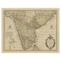
Original Antique Map of Malabar, Coromandel 'India' and Ceylon
About the Item
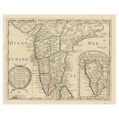
Antique map titled 'Peninsula Indiae citra Gangem, hoc est Orae celeberrimae Malabar & Coromandel (..)'. Large and attractive original hand colored map of Sri Lanka and the Southern part of the Indian Peninsula, with an elaborate cartouche showing an elephant and elaborately clothed indigenous people.
The map includes towns, roads, rivers, mountains, lakes, etc. An explanation of the map includes notations of various flags of England, Denmark, France, Holland and Portugal along the coast, delineating the various European trading posts along the Southern coastline of India, over 20 in all, plus fortified towns. A fascinating map published by Homann Heirs, circa 1750.
Johann Baptist Homann (20 March 1664 - 1 July 1724) was a German geographer and cartographer, who also made maps of the Americas. He soon turned to engraving and cartography; in 1702 he founded his own publishing house. Homann acquired renown as a leading German cartographer, and in 1715 was appointed Imperial Geographer by Emperor Charles VI. In 1716 Homann published his masterpiece Grosser Atlas ueber die ganze Welt (Grand Atlas of all the World). Numerous maps were drawn up in cooperation with the engraver Christoph Weigel the Elder, who also published Siebmachers Wappenbuch.
- Dimensions:Height: 22.25 in (56.5 cm)Width: 20.08 in (51 cm)Depth: 0.02 in (0.5 mm)
- Materials and Techniques:
- Period:
- Date of Manufacture:circa 1750
- Condition:Wear consistent with age and use. Original/contemporary hand coloring. Original folding line. Shows some wear and soiling. Blank verso, with handwritten title. Please study images carefully.
- Seller Location:Langweer, NL
- Reference Number:
About the Seller
5.0
Platinum Seller
These expertly vetted sellers are 1stDibs' most experienced sellers and are rated highest by our customers.
Established in 2009
1stDibs seller since 2017
1,928 sales on 1stDibs
Typical response time: <1 hour
- ShippingRetrieving quote...Ships From: Langweer, Netherlands
- Return PolicyA return for this item may be initiated within 14 days of delivery.
More From This SellerView All
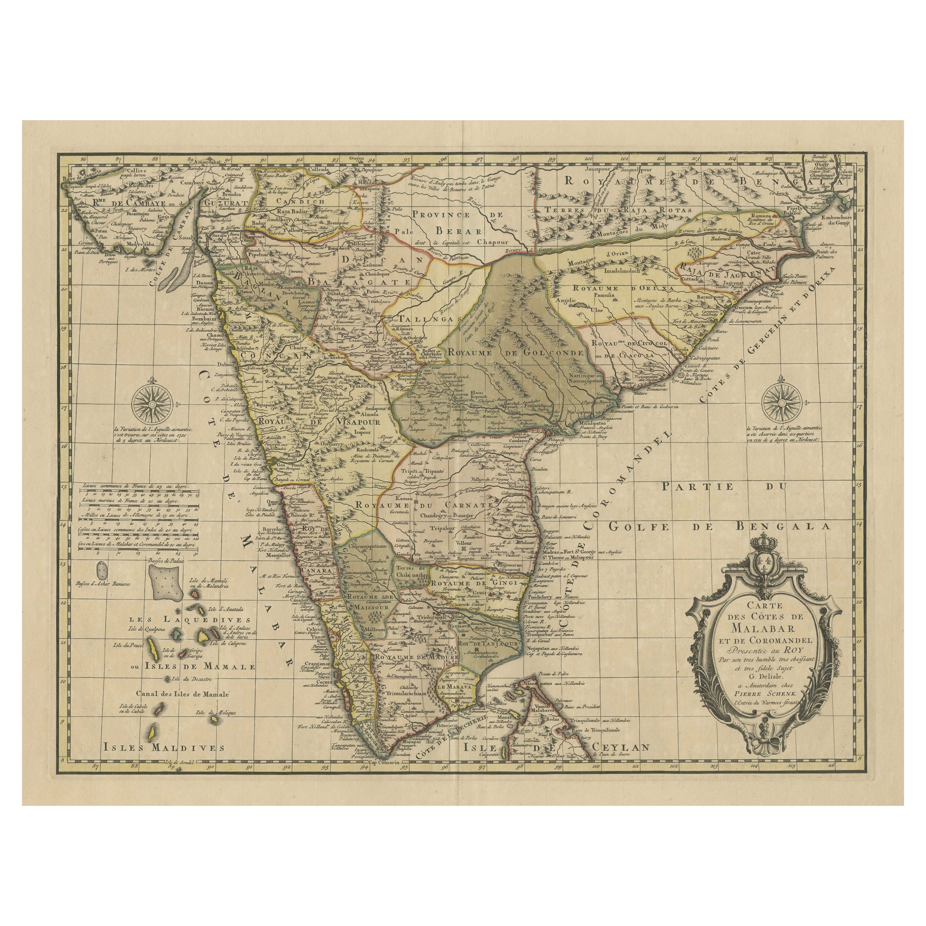
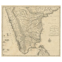
- Detailed Decorative Antique Map of the Coast of Malabar and Coromandel, IndiaLocated in Langweer, NLAntique map titled 'Carte des Côtes de Malabar et de Coromandel'. Finely engraved map of the southern part of India, first issued in 1723 by acclaimed French mapmaker Guillaume De L’...Category
Antique Mid-18th Century Maps
MaterialsPaper
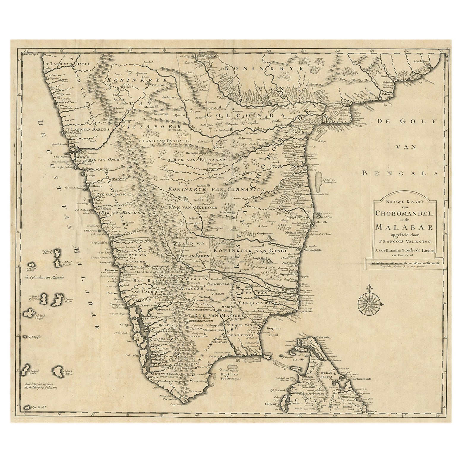
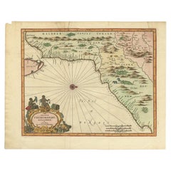
- Old Original Map of Chormandel & Malabar, India & Ceylon, Now Sri Lanka, 1726Located in Langweer, NLAntique map titled 'Nieuwe Kaart van Choromandel ende Malabar'. Antique map depicting the southern part of India and the northern tip of Ceylon, Sri Lanka. This map originates from...Category
Antique 1720s Maps
MaterialsPaper
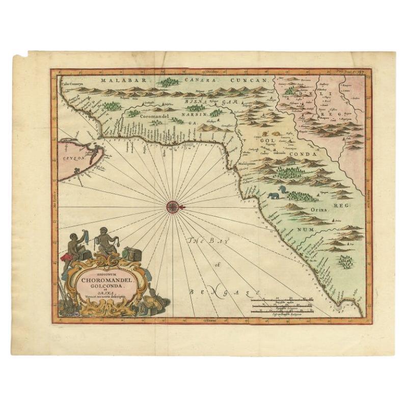
- Antique Map of Choromandel, Golconda and Orixa, Malabar, India, 1744By Philip BaldaeusLocated in Langweer, NLAntique map titled 'Regionum Choromandel, Golconda (..).' Handsome map of Choromandel, Golconda and Orixa, published in 'The True and Exact Description of the Most Celebrated East - ...Category
Antique 18th Century Maps
MaterialsPaper
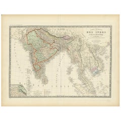
- Authentic Antique Map of India and Ceylon, '1875'Located in Langweer, NLAntique map titled 'Carte générale des Indes'. Large map of India and Ceylon. This map originates from 'Atlas de Géographie Moderne Physique et Politique' by A. Levasseur. Published ...Category
Antique Late 19th Century Maps
MaterialsPaper
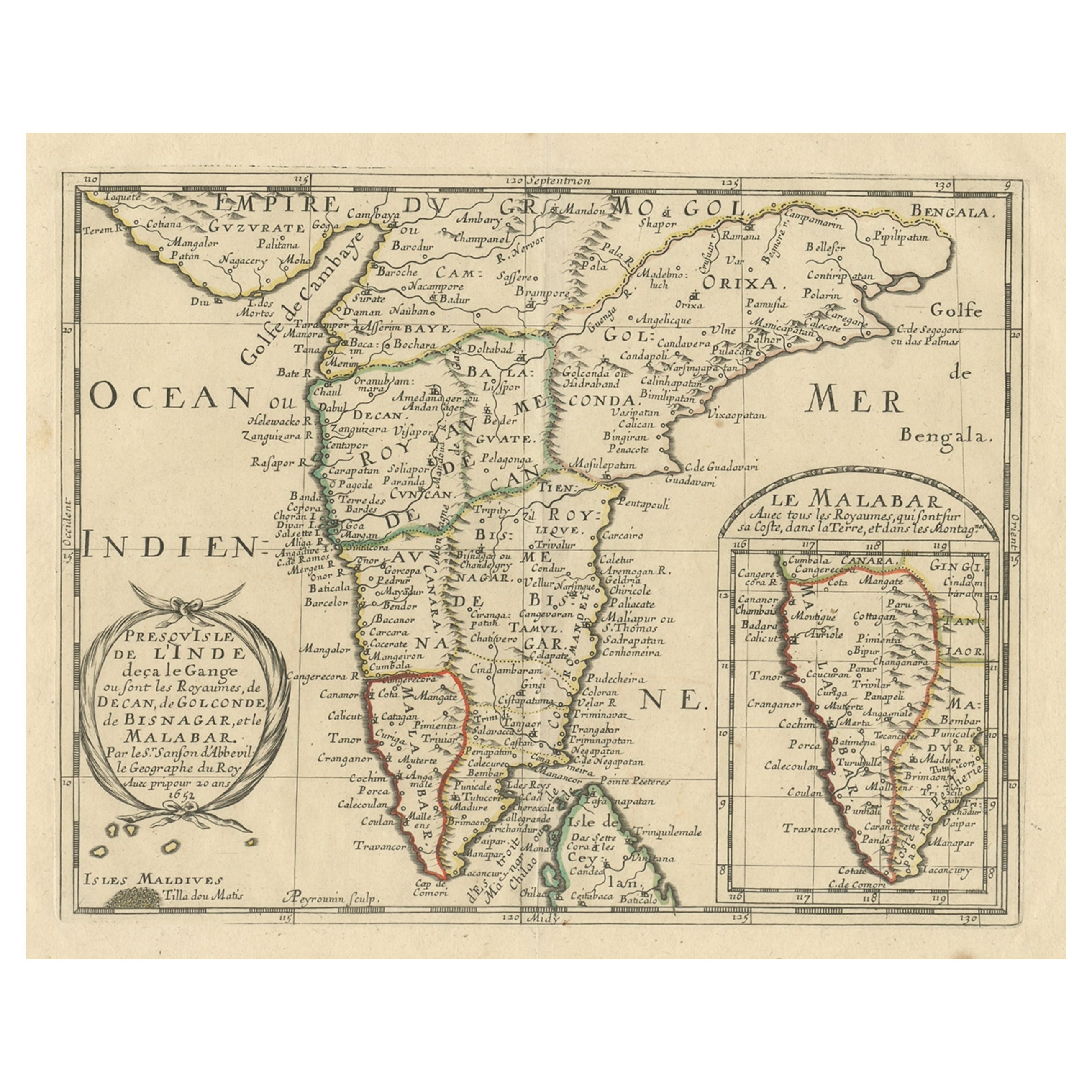
- Original Antique Map showing Southern India, Northern Sri Lanka & Malabar, 1652Located in Langweer, NLAntique map titled 'Presqu'Isle de l'Inde deca le Gange (..)'. Old map showing the southern part of India, including the northern part of Sri Lanka. With inset map of Southern India (Malabar). This map covers the subcontinent from the Bay of Bengal and the Gulf of Cambay to Ceylon. The Mogul Empire can be found in the north. Further south...Category
Antique 1650s Maps
MaterialsPaper
- Antique Map of India and Ceylon by Lapie, 1842Located in Langweer, NLAntique map titled 'Carte de l'Inde en deca et au dela du Gange'. Map of India and Ceylon (Sri Lanka). This map originates from 'Atlas universel de géographie ancienne et moderne (.....Category
Antique Mid-19th Century Maps
MaterialsPaper

You May Also Like
- Original Antique Map of India. C.1780Located in St Annes, LancashireGreat map of India Copper-plate engraving Published C.1780 Three small worm holes to right side of map and one bottom left corner Unframed.Category
Antique Early 1800s English Georgian Maps
MaterialsPaper

- Original Antique Map of Italy. C.1780Located in St Annes, LancashireGreat map of Italy Copper-plate engraving Published C.1780 Unframed.Category
Antique Early 1800s English Georgian Maps
MaterialsPaper

- Original Antique Map of Asia. C.1780Located in St Annes, LancashireGreat map of Asia Copper-plate engraving Published C.1780 Two small worm holes to right side of map Unframed.Category
Antique Early 1800s English Georgian Maps
MaterialsPaper

- Original Antique Map of Spain and Portugal, circa 1790Located in St Annes, LancashireSuper map of Spain and Portugal Copper plate engraving by A. Bell Published, circa 1790. Unframed.Category
Antique 1790s English Other Maps
MaterialsPaper
- Original Antique Map of Ireland- Tipperary and Waterford. C.1840Located in St Annes, LancashireGreat map of Tipperary and Waterford Steel engraving Drawn under the direction of A.Adlard Published by How and Parsons, C.1840 Unframed.Category
Antique 1840s English Maps
MaterialsPaper
- Original Antique Map of South America. C.1780Located in St Annes, LancashireGreat map of South America Copper-plate engraving Published C.1780 Two small worm holes to left side of map Unframed.Category
Antique Early 1800s English Georgian Maps
MaterialsPaper


Recently Viewed
View AllMore Ways To Browse
Dior India
Southern American Antiques
Antique Ceylon
Ceylon Furniture
Imperial German
Imperial Germany
Elephant Collectables
England Flag
India Antique 18th Century
Antique Large Flag
Antique Furniture In Sri Lanka
Flag 18th
Sri Lankan Antiques
Antique Sri Lanka
Ceylon Antique Furniture
Southern Flag
French Coromandel
Malabar Furniture