Items Similar to Original Engraved Antique Map of the World, Colorful and Decorative, C.1780


Want more images or videos?
Request additional images or videos from the seller
1 of 6
Original Engraved Antique Map of the World, Colorful and Decorative, C.1780
About the Item
Antique map titled 'Mappemonde en Deux Hemispheres ou l'on a Indique les Nouvelles Decouvertes' - This handsome double hemisphere map presents a view of the physical world with particularly nice detail of the islands throughout the world. Australia is still oddly shaped with a partially delineated southern coastline. Ter. De Diemen is still connected to Australia, although Bass Strait is shown just south, separating Pte. du Tristan from the mainland. Source unknown, to be determined.
Artists and Engravers: Made by 'Pierre Francois Tardieu' after 'Edme Mentelle'. Pierre François Tardieu (1711 - 1771) was a French engraver and cartographer, nephew of Nicolas-Henri Tardieu. Edme Mentelle (11 October 1730 - 28 April 1816) was a French geographer.
Condition: Good, given age. Slight discolouration near middle fold. Some minor small crinkles. Original folds as issued. General age-related toning and/or occasional minor defects from handling. Please study scan carefully.
Date: c.1780
Overall size: 51.6 x 39.6 cm.
Image size: 43 x 31.8 cm.
We sell original antique maps to collectors, historians, educators and interior decorators all over the world. Our collection includes a wide range of authentic antique maps from the 16th to the 20th centuries. Buying and collecting antique maps is a tradition that goes back hundreds of years. Antique maps have proved a richly rewarding investment over the past decade, thanks to a growing appreciation of their unique historical appeal. Today the decorative qualities of antique maps are widely recognized by interior designers who appreciate their beauty and design flexibility. Depending on the individual map, presentation, and context, a rare or antique map can be modern, traditional, abstract, figurative, serious or whimsical. We offer a wide range of authentic antique maps for any budget.
- Creator:Pierre François Tardieu (Maker)
- Dimensions:Height: 15.6 in (39.6 cm)Width: 20.32 in (51.6 cm)Depth: 0 in (0.01 mm)
- Materials and Techniques:
- Period:
- Date of Manufacture:circa 1780
- Condition:Condition: Good, given age. Slight discolouration near middle fold. Some minor small crinkles. Original folds as issued. General age-related toning and/or occasional minor defects from handling. Please study scan carefully.
- Seller Location:Langweer, NL
- Reference Number:

Pierre François Tardieu
Pierre François Tardieu was a very well-known map engraver, geographer and illustrator. Tardieu was born on December 24, 1711, in Paris. He was awarded a bronze medal by King Louis-Phillipe for the accuracy and beauty of his map-making. Tardieu produced many fine works, including maps of Louisiana, Mexico, Russia and Asia in addition to his illustrations of French provinces. Additionally, the mapmaker was the first to engrave steel rather than copper. Overall, he was widely celebrated for his skilled combination of research, detail and technical talent. Tardieu died on January 15, 1771, in Paris.
About the Seller
5.0
Platinum Seller
These expertly vetted sellers are 1stDibs' most experienced sellers and are rated highest by our customers.
Established in 2009
1stDibs seller since 2017
1,940 sales on 1stDibs
Typical response time: <1 hour
- ShippingRetrieving quote...Ships From: Langweer, Netherlands
- Return PolicyA return for this item may be initiated within 14 days of delivery.
More From This SellerView All
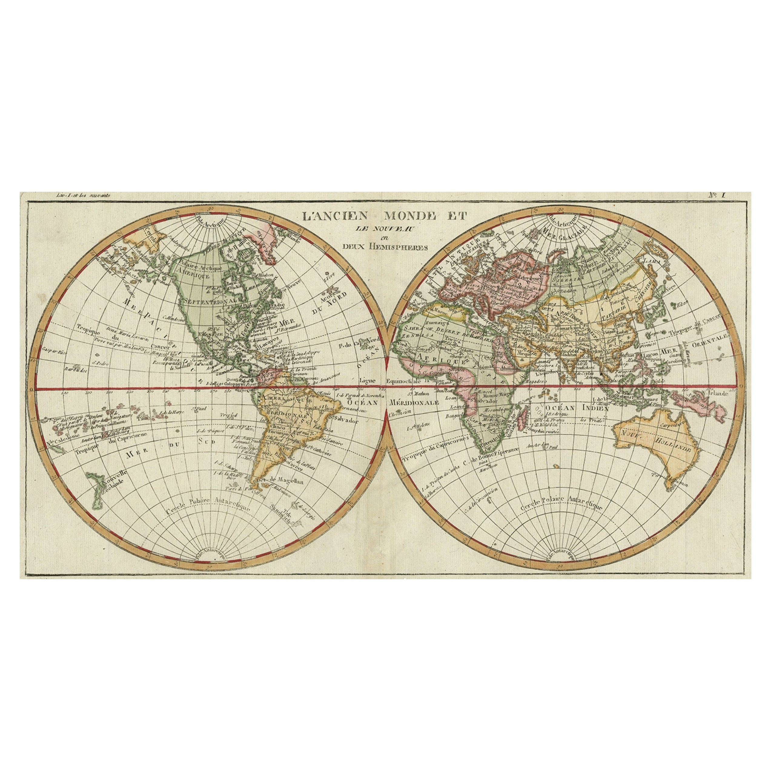
- Very Decorative Original Antique Map of the World, Published in France in c.1780By Rigobert BonneLocated in Langweer, NLAntique map titled 'L'Ancien Monde Et Le Nouveau en Deux Hemispheres' - Double hemisphere map of the World, showing the contemporary geographical...Category
Antique 18th Century Maps
MaterialsPaper
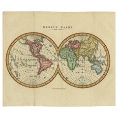
- Small Antique World Map in Decorative Old Hand-Colouring, circa 1840Located in Langweer, NLAntique map titled 'Wereld Kaart'. Small and very decorative double hemisphere world map. Source unknown, to be determined. Published c.1840. Artists and Engravers: Daniel Veelwaa...Category
Antique 19th Century Maps
MaterialsPaper
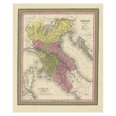
- Old Antique Colourful Decorative Map of Northern Italy, 1846Located in Langweer, NLDescription: Antique map titled 'Italy North Part'. Old map of Northern Italy. This map originates from 'A New Universal Atlas Containing Maps of the various Empires, Kingdoms, S...Category
Antique 1840s Maps
MaterialsPaper
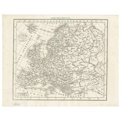
- Nice Decorative Black and White Small Antique Map of Europe, 'circa 1834'Located in Langweer, NLAntique French map titled 'Europe par A.H. Dufour'. Uncommon map of Europe. Published by or after A.H. Dufour, circa 1834. Source unknown, to be d...Category
Antique Mid-19th Century Maps
MaterialsPaper
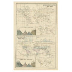
- Antique Zoological Chart of the World, 1854Located in Langweer, NLAntique map titled 'Zoological Chart of the World'. Total of six maps and insets. Insets of the distribution of Animals in a vertical direction, Chart o...Category
Antique 19th Century Maps
MaterialsPaper
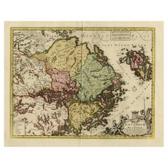
- Original and Decorative Antique Engraved Map of Finland and Sweden, ca.1720Located in Langweer, NLAntique map titled 'Ducatus Uplandiae cum Westmanniae Sudermanniae (..)' This map shows parts of Finland and Sweden. Originally published by Frederick de Wit in the late 1600's. ...Category
Antique 1720s Maps
MaterialsPaper

You May Also Like
- Large Original Antique Map of The World, Fullarton, C.1870Located in St Annes, LancashireGreat map of the World. Showing both hemispheres From the celebrated Royal Illustrated Atlas Lithograph. Original color. Published by Fullarton, Edinburgh, C.1870 Unframed. Rep...Category
Antique 1870s Scottish Maps
MaterialsPaper
- Large Original Antique Map of the World, Fullarton, circa 1870Located in St Annes, LancashireGreat map of the World. From the celebrated Royal Illustrated Atlas Lithograph. Original color. Published by Fullarton, Edinburgh, circa 1870. Unframed.Category
Antique 1870s Scottish Maps
MaterialsPaper
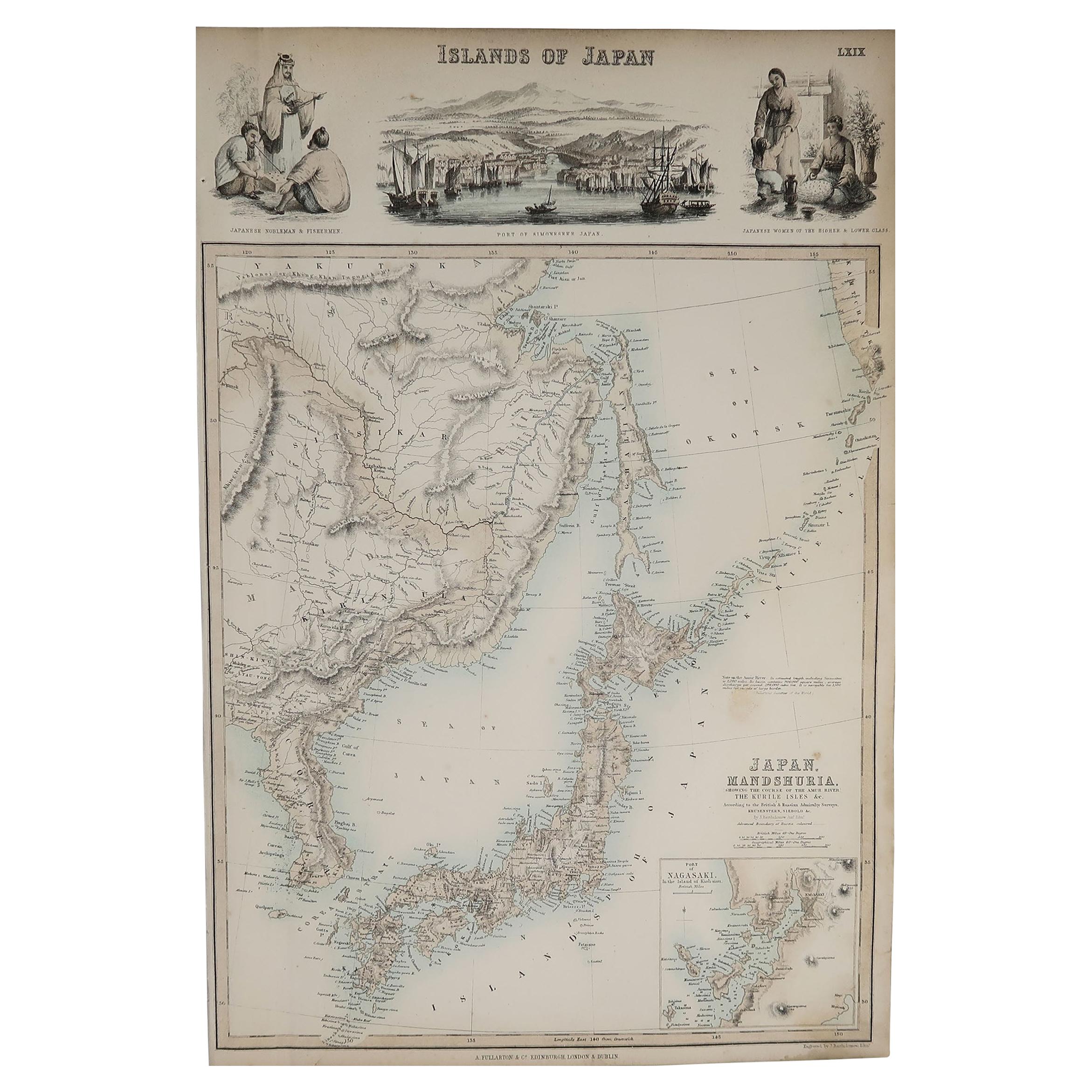
- Original Antique Decorative Map of Japan, Fullarton, C.1870Located in St Annes, LancashireGreat map of Japan Wonderful figural border From the celebrated Royal Illustrated Atlas Lithograph. Original color. Published by Fullarton, Edinburgh, C.1870 Unframed...Category
Antique 1870s Scottish Maps
MaterialsPaper
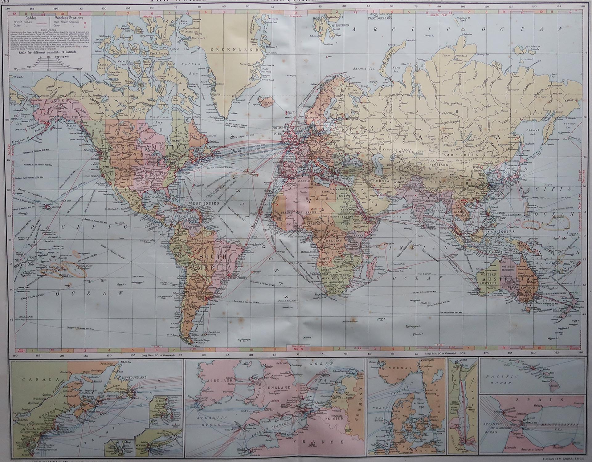
- Large Original Vintage Map of The World, circa 1920Located in St Annes, LancashireGreat map of The World Original color. Good condition / minor foxing Published by Alexander Gross Unframed.Category
Vintage 1920s English Maps
MaterialsPaper
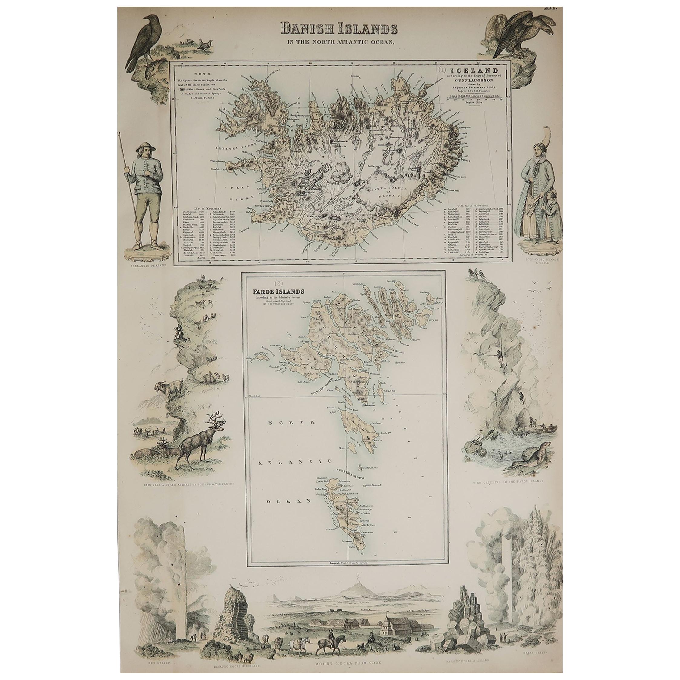
- Original Antique Decorative Map of Iceland & Faroe, Fullarton, C.1870Located in St Annes, LancashireGreat map of Iceland and The Faroe Islands Wonderful figural border From the celebrated Royal Illustrated Atlas Lithograph. Original color. Published by Fullarton, Edinb...Category
Antique 1870s Scottish Maps
MaterialsPaper
- Original Antique Decorative Map of South America-West Coast, Fullarton, C.1870Located in St Annes, LancashireGreat map of Chili, Peru and part of Bolivia Wonderful figural border From the celebrated Royal Illustrated Atlas Lithograph. Original color. Published by Fullarton, Edi...Category
Antique 1870s Scottish Maps
MaterialsPaper


Recently Viewed
View AllMore Ways To Browse
Engraved 28
Unknown Circa 1780
French Antique Australia
Antique Bass
Pierre Deux
French Antique Furniture Australia
Antique Hemisphere Maps
Antique Collectors Australia
Pierre Deux Furniture
Hemisphere World Map
Maps South Australia
Henri Deux
Mappemonde Antique
Hand Painted Antique Map
Antique Furniture Depot
Antique Road Maps
Antique Road Map
17th Century Scottish