Antique Hemisphere Maps
5
to
34
135
51
123
98
61
42
25
19
17
13
12
10
10
7
5
5
5
5
4
4
3
3
2
2
2
2
2
2
2
1
1
1
1
1
1
1
1
1
5
3
2
2
2
Sort By
Triple Extending Fire Screen of Northern Hemisphere Map
Located in Chillerton, Isle of Wight
A triple extending fire screen of Northern Hemisphere Map
A wonderful piece the screen has 3
Category
19th Century Adam Style Antique Hemisphere Maps
Materials
Silk
Interesting Original Antique Hemisphere Map Showing the Latest Discoveries
Located in Langweer, NL
Antique world map titled 'A Map of the World from the best Authorities'. Detailed map of the World
Category
Late 18th Century Antique Hemisphere Maps
Materials
Paper
No Reserve
H 13.39 in W 22.05 in D 0.02 in
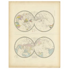
Antique Hemisphere Map of the World 'Two on One Sheet' by Levasseur, '1875'
Located in Langweer, NL
la projection polaire'. Large map with two hemisphere world maps on one sheet. This map originates
Category
Late 19th Century Antique Hemisphere Maps
Materials
Paper
H 24.02 in W 18.71 in D 0.02 in
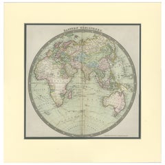
Antique Map of the Eastern Hemisphere by Teesdale, '1831'
Located in Langweer, NL
Antique map titled 'Eastern Hemisphere'. Hemispherical map of eastern hemisphere showing tracks of
Category
Mid-19th Century Antique Hemisphere Maps
Materials
Paper
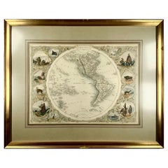
1850c J. & F. Tallis, Western Hemisphere Map, Fine Hand Color, Framed
By Philippe Tallis
Located in Norwich, GB
Western Hemisphere - America
Framed in relatively modern gilt frame and matting.
Tallis
Category
1850s British High Victorian Antique Hemisphere Maps
Materials
Paper
H 15.75 in W 19.49 in D 1.58 in
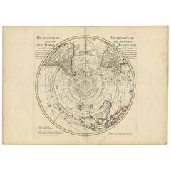
18th Century Antique Engraving of the Southern Hemisphere by G. de L'Isle
By Guillaume De L'Isle
Located in Langweer, NL
Antique map titled 'Hemisphere Meridional pour voir plus distinctement Les Terres Australes
Category
Late 18th Century Antique Hemisphere Maps
Materials
Paper
H 21.58 in W 29.93 in D 0.02 in
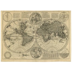
Antique Bible World Map by R. & J. Wetstein, 1743
Located in Langweer, NL
Antique world map titled 'De Werelt Caart'.
A scarce and richly detailed double hemisphere world
Category
Mid-18th Century Antique Hemisphere Maps
Materials
Paper
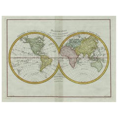
Original Engraved Antique Map of the World, Colorful and Decorative, C.1780
By Pierre François Tardieu
Located in Langweer, NL
Antique map titled 'Mappemonde en Deux Hemispheres ou l'on a Indique les Nouvelles Decouvertes
Category
18th Century Antique Hemisphere Maps
Materials
Paper
H 15.6 in W 20.32 in D 0 in
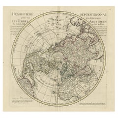
Antique Map of the Northern Hemisphere, 1782
Located in Langweer, NL
Antique map titled 'Hémisphère Septentrional pour voir plus distinctement les Terres Arctiques
Category
1780s Antique Hemisphere Maps
Materials
Paper
Antique Map of the Western Hemisphere by Wyld '1845'
Located in Langweer, NL
Antique map titled 'Western Hemisphere'. Original antique map of the western hemisphere. This map
Category
Mid-19th Century Antique Hemisphere Maps
Materials
Paper
Antique Map of the Eastern Hemisphere by Wyld '1845'
Located in Langweer, NL
Antique map titled 'Eastern Hemisphere'. Original antique map of the eastern hemisphere. This map
Category
Mid-19th Century Antique Hemisphere Maps
Materials
Paper
Antique Map of the Northern Hemisphere by Lowry, '1852'
Located in Langweer, NL
the northern hemisphere. This map originates from 'Lowry's Table Atlas constructed and engraved from
Category
Mid-19th Century Antique Hemisphere Maps
Materials
Paper
Antique Map of the Eastern Hemisphere by Wyld, 1842
Located in Langweer, NL
Antique map titled 'Eastern Hemisphere'. Large map depicting the continents Europe, Asia, Afrika
Category
19th Century Antique Hemisphere Maps
Materials
Paper
Antique Map Depiciting a Horizon or Hemisphere c.1703
Located in Langweer, NL
Antique map depiciting a horizon/hemisphere. Printed for Scherer's 'Atlas Novus' (1702-1710
Category
18th Century Antique Hemisphere Maps
Materials
Paper
Antique Map of a Hemisphere by Scherer, c.1703
Located in Langweer, NL
Antique map depiciting a horizon/hemisphere. Printed for Scherer's 'Atlas Novus' (1702-1710
Category
18th Century Antique Hemisphere Maps
Materials
Paper
Very Decorative Original Antique Map of the World, Published in France in c.1780
By Rigobert Bonne
Located in Langweer, NL
Antique map titled 'L'Ancien Monde Et Le Nouveau en Deux Hemispheres' - Double hemisphere map of
Category
18th Century Antique Hemisphere Maps
Materials
Paper
H 10.24 in W 17.6 in D 0 in
Antique Map of the World in Hemispheres by Johnson, '1872'
Located in Langweer, NL
Antique map titled 'Johnson's Globular World. Original world map depicting the Eastern Hemisphere
Category
Late 19th Century Antique Hemisphere Maps
Materials
Paper
Antique Map of the Eastern Hemisphere in Frame, 'circa 1683'
Located in Langweer, NL
Antique map titled 'Climats selon les Anciens'. Miniature map of the Eastern Hemisphere showing the
Category
Late 17th Century Antique Hemisphere Maps
Materials
Paper
Rare Original Double Hemisphere World Map with Allegorical Figures, 1785
Located in Langweer, NL
hemisphere world map. Four allegorical figures in the corners represent Europe, Asia, Africa and America
Category
1780s Antique Hemisphere Maps
Materials
Paper
H 17.05 in W 23.23 in D 0 in
Antique Map of the Eastern Hemisphere by Valk & Chenk '1708'
Located in Langweer, NL
'. Decorative example of Andreas Cellarius's map of the Eastern Hemisphere, illustrating with climatic zones
Category
Early 18th Century Antique Hemisphere Maps
Materials
Paper
No Reserve
H 20.67 in W 24.41 in D 0.02 in
Antique Map of The World in Hemispheres on Various Projections, 1882
Located in Langweer, NL
This stunning 1882 'Antique Map of The World in Hemispheres' showcases an exquisite blend of
Category
1880s Antique Hemisphere Maps
Materials
Paper
Antique Double Hemisphere World Map with California as an Island, 1710
Located in Langweer, NL
hemisphere world map from a Dutch bible by Cornelis Dankerts (Danckerts), engraved by Albert Schut, printed
Category
1710s Antique Hemisphere Maps
Materials
Paper
Antique Map of The World in Hemispheres by W. G. Blackie, 1859
Located in Langweer, NL
Antique map titled 'The World in Hemispheres with other projections'. Original antique map of The
Category
Mid-19th Century Antique Hemisphere Maps
Materials
Paper
Antique Map of the World in Hemispheres by Keizer & de Lat, 1788
Located in Langweer, NL
double hemisphere world map on polar projections. In North America, there is a large Island of California
Category
Late 18th Century Antique Hemisphere Maps
Materials
Paper
Antique Miniature Map of the Western Hemisphere, with California as an Island
Located in Langweer, NL
the Western Hemisphere, published by Alain Manesson Mallet. The map shows California as an Island, no
Category
Late 17th Century Antique Hemisphere Maps
Materials
Paper
H 8.27 in W 5.6 in D 0.02 in
Beautiful Antique Map of the Northern Hemisphere with California as an Island
By Isaak Tirion
Located in Langweer, NL
tot Amsterdam door Isaak Tirion'. Beautiful map of the Northern Hemisphere and North Pole, which shows
Category
Mid-18th Century Antique Hemisphere Maps
Materials
Paper
H 13.98 in W 18.9 in D 0.02 in
Map Silk Embroidered Western Eastern Hemisphere New Old World Asia America Afri
Located in BUNGAY, SUFFOLK
A rare, late-18th century, silk, embroidered, double hemisphere, world map, blackwork, sampler
Category
18th Century British Georgian Antique Hemisphere Maps
Materials
Silk
H 0.4 in W 0.4 in D 0.4 in
Antique Map of the World in two Hemispheres by Keizer & de Lat, 1788
Located in Langweer, NL
Antique map titled 'Kaart van de Twee platte Warelds Bollen (..)'. Interesting world map in two
Category
Late 18th Century Antique Hemisphere Maps
Materials
Paper
Antique Map of the Night Skies of the Northern and Southern Hemispheres, 1880
Located in Langweer, NL
northern and southern hemispheres. This map originates from 'Géographie Universelle Atlas-Migeon' by J
Category
1880s Antique Hemisphere Maps
Materials
Paper
H 13.59 in W 18.71 in D 0 in
Antique Map of the Northern Hemisphere and North Pole by Tirion, circa 1754
Located in Langweer, NL
'. Map of the Northern Hemisphere and North Pole, which shows the NE Passage, but no definite NW Passage
Category
Mid-18th Century Antique Hemisphere Maps
Materials
Paper
H 12.8 in W 14.77 in D 0.02 in
Original Antique Engraving of the Eastern Hemisphere, c.1700
Located in Langweer, NL
Antique map titled 'Proiectio Optica Aequinoctia lis Hemishaerii Orientalis' - Map of the Eastern
Category
17th Century Antique Hemisphere Maps
Materials
Paper
Interesting Antique Engraving of the World in Hemispheres with 6 Diagrams, 1788
Located in Langweer, NL
Antique map titled 'De Nieuwe en Ouden oppervlakke en doorzigtkundige Aardrykes Bollen (..)'. Twin
Category
Late 18th Century Antique Hemisphere Maps
Materials
Paper
H 8.08 in W 11.03 in D 0.02 in
Map Colonies Francaises Martinique, 1845
Located in BUNGAY, SUFFOLK
, Hemisphere Boreaal No 90
1845
In an ebonised frame length 49cm., 19" height 38cm., 15".
Category
19th Century French Antique Hemisphere Maps
Materials
Paper
Antique World Map by Lesage, 1823
Located in Langweer, NL
Antique world map titled 'Mappe Monde Historique'. The map depicts both the Eastern and Western
Category
Early 19th Century Antique Hemisphere Maps
Materials
Paper
Antique World Map by Johnston, 1882
Located in Langweer, NL
Antique map titled 'The World in Hemispheres'. Old double-hemisphere world map. This map originates
Category
19th Century Antique Hemisphere Maps
Materials
Paper
Colored wall map of the WORLD
By Chambon
Located in ZWIJNDRECHT, NL
huge wall map of the world in two hemispheres printed on two sheets, depicting the Eastern and Western
Category
Mid-18th Century French French Provincial Antique Hemisphere Maps
Materials
Wood, Paper
Antique Map of Bonthain Bay, Sulawesi, Celebes
Located in Langweer, NL
Antique map titled 'Vue de la Baye de Bonthain (..)'. Map of the island Sulawesi (Celebes
Category
Late 18th Century Antique Hemisphere Maps
Materials
Paper
Antique Map of Cordes Bay and Surroundings
Located in Langweer, NL
Antique map titled 'Baye et Havre de Cordes (..)'. Four maps on the one sheet of; Cordes Bay, Port
Category
Late 18th Century Antique Hemisphere Maps
Materials
Paper
Antique World Map by P. Schenk '1706'
By Peter Schenk
Located in Langweer, NL
Antique map titled 'Diversa Orbis Terrae. Visu Incedente per Coluros Tropicorum, Ambos Ejus Polos
Category
Early 18th Century Antique Hemisphere Maps
Materials
Paper
Antique Map of the Admiralty Islands, Bismarck Archipelago
Located in Langweer, NL
Antique map titled 'Trois Vues des Isles de l'Amirauté'. Several coastal views of the Admiralty
Category
Late 18th Century Antique Hemisphere Maps
Materials
Paper
Antique Map of the Southern Hemipshere by Lowry '1852'
Located in Langweer, NL
the southern hemisphere.
This map originates from 'Lowry's Table Atlas constructed and engraved from
Category
Mid-19th Century Antique Hemisphere Maps
Materials
Paper
Antique Map of the World by Stoopendaal, c.1714
Located in Langweer, NL
double hemisphere world map. Illustrated with numerous exotic animals and four female allegorical
Category
18th Century Antique Hemisphere Maps
Materials
Paper
Antique Map of the Cocos or Keeling Islands, 1778
Located in Langweer, NL
Antique map titled 'Die Cocos Insel vom Capt. Wallis Bosawren. Die Verrather Islel von Capt. Wallis
Category
18th Century Antique Hemisphere Maps
Materials
Paper
Antique Detailed World Map Drawn on Mercator's Projection, 1700
Located in Langweer, NL
Western and Eastern Hemispheres. The map was precisely engraved by Jan van Luchenburg (imprint at lower
Category
17th Century Antique Hemisphere Maps
Materials
Paper
Antique Map Illustrating Solar Eclipses by Scherer, C.1703
Located in Langweer, NL
Antique map of an hemisphere and several figures illustrating the position of the earth, moon and
Category
18th Century Antique Hemisphere Maps
Materials
Paper
Antique Map of New Ireland with 7 Coastal Profiles
Located in Langweer, NL
Antique print titled 'l'Isle St. Jean (..) - Cap St. George (..)'. Antique map of New Ireland, an
Category
Late 18th Century Antique Hemisphere Maps
Materials
Paper
1633 Map Entitled "Beauvaisis Comitatus Belova Cium, Ric.0002
Located in Norton, MA
/Ashley) * 1590 World Map in two hemispheres illustrating Drake\\\\\\\\\\\\\\\'s circumnavigation * c
Category
17th Century Dutch Antique Hemisphere Maps
Materials
Paper
Antique Geographical, Historical and Statistical Map of Massachusetts, 1822
Located in Langweer, NL
This attractive map of Massachusetts presents a finely detailed overview of the state in the first
Category
1820s Antique Hemisphere Maps
Materials
Paper
H 17.13 in W 21.46 in D 0 in
Antique Map of the Eastern Part of the World
Located in Langweer, NL
Antique map titled 'Nieuwe Kaart van het Oostelykste Deel der Weereld, diendende tot aanwyzing van
Category
Mid-18th Century Antique Hemisphere Maps
Materials
Paper
Large Original Antique Map of The World, Fullarton, C.1870
Located in St Annes, Lancashire
Great map of the World. Showing both hemispheres
From the celebrated Royal Illustrated Atlas
Category
1870s Scottish Antique Hemisphere Maps
Materials
Paper
Antique Map of Cap Providence, St. David's Cove and Surroundings
Located in Langweer, NL
Antique map titled 'Baye du Cap Upright (..)'. Eight charts on one sheet of Cap Providence, St
Category
Late 18th Century Antique Hemisphere Maps
Materials
Paper
Antique Map of CAP Providence, St. David's Cove and Surroundings
Located in Langweer, NL
Antique map titled 'Baye du Cap Upright (..)'. Eight charts on one sheet of Cap Providence, St
Category
Late 18th Century Antique Hemisphere Maps
Materials
Paper
Antique Map of the Islands Within the Queen Charlotte's Islands
Located in Langweer, NL
Antique map titled 'Cote Septentrional de la plus grande des Isles de la Reine Charlotte (..)'. Map
Category
Late 18th Century Antique Hemisphere Maps
Materials
Paper
Original Antique Map of The World by Thomas Clerk, 1817
Located in St Annes, Lancashire
Great map of The Eastern and Western Hemispheres
On 2 sheets
Copper-plate engraving
Drawn
Category
1810s English Antique Hemisphere Maps
Materials
Paper
Antique Map of the Stars and Constellations by Lapie, 1842
Located in Langweer, NL
Antique map titled 'Planisheres Célestes'. Two hemispheres depicting the stars and constellations
Category
Mid-19th Century Antique Hemisphere Maps
Materials
Paper
Antique Map of the British Isles by H. Chatelain, 1719
By Henri-Abraham Chatelain
Located in Langweer, NL
Beautiful hand colored large format map of the British Isles, with large insets of the Eastern and
Category
Early 18th Century Antique Hemisphere Maps
Materials
Paper
Antique Map of Cordes Bay, Port Famine, Woods Bay and Surroundings
Located in Langweer, NL
Antique map titled 'Baye et Havre de Cordes (..)'. Four maps on the one sheet of; Cordes Bay, Port
Category
Late 18th Century Antique Hemisphere Maps
Materials
Paper
A NEW MAP OF THE WORLD from the Latest Observations.
By John Senex
Located in New York, NY
.”
A fine British produced double hemisphere world map. On this map, California is shown as an island
Category
18th Century Other Art Style Antique Hemisphere Maps
Materials
Watercolor, Engraving
H 20.75 in W 23.75 in D 0.94 in
Original Antique Hand-colored World Map with or without Frame, '1696'
Located in Langweer, NL
Antique world map titled 'Mappe-Monde dressee sur les Observations de Mrs. de l'Academie Royale des
Category
Late 17th Century Antique Hemisphere Maps
Materials
Paper
H 28.75 in W 33.67 in D 1.58 in
Small Antique World Map in Decorative Old Hand-Colouring, circa 1840
Located in Langweer, NL
Antique map titled 'Wereld Kaart'. Small and very decorative double hemisphere world map. Source
Category
19th Century Antique Hemisphere Maps
Materials
Paper
- 1
Get Updated with New Arrivals
Save "Antique Hemisphere Maps", and we’ll notify you when there are new listings in this category.
Antique Hemisphere Maps For Sale on 1stDibs
There is a range of antique hemisphere maps for sale on 1stDibs. The range of distinct antique hemisphere maps — often made from paper, canvas and fabric — can elevate any home. Antique hemisphere maps have been made for many years, and versions that date back to the 18th Century alongside those produced as recently as the 20th Century. Many antique hemisphere maps are appealing in their simplicity, but Antonio Zatta, Gerard Mercator and Herman Moll produced popular antique hemisphere maps that are worth a look.
How Much are Antique Hemisphere Maps?
Prices for antique hemisphere maps start at $78 and top out at $28,000 with the average selling for $557.
More Ways To Browse
Bodega Bay
G Plan Ottoman
Isle Royale
Kansas Map
Antique South Carolina Maps
Antique Map Of New Orleans
Antique Maps Of New Orleans
Madagascar Antique Map
New Orleans Antique Maps
Antique Maps South Carolina
Antique New Orleans Maps
Antique South Carolina Map
Antique Map South Carolina
Map Of Dc
Missouri Sellers
Bohemia Map
Antique Maps Of South Carolina
F Gall


