Items Similar to Map Colonies Francaises Martinique, 1845


Want more images or videos?
Request additional images or videos from the seller
1 of 7
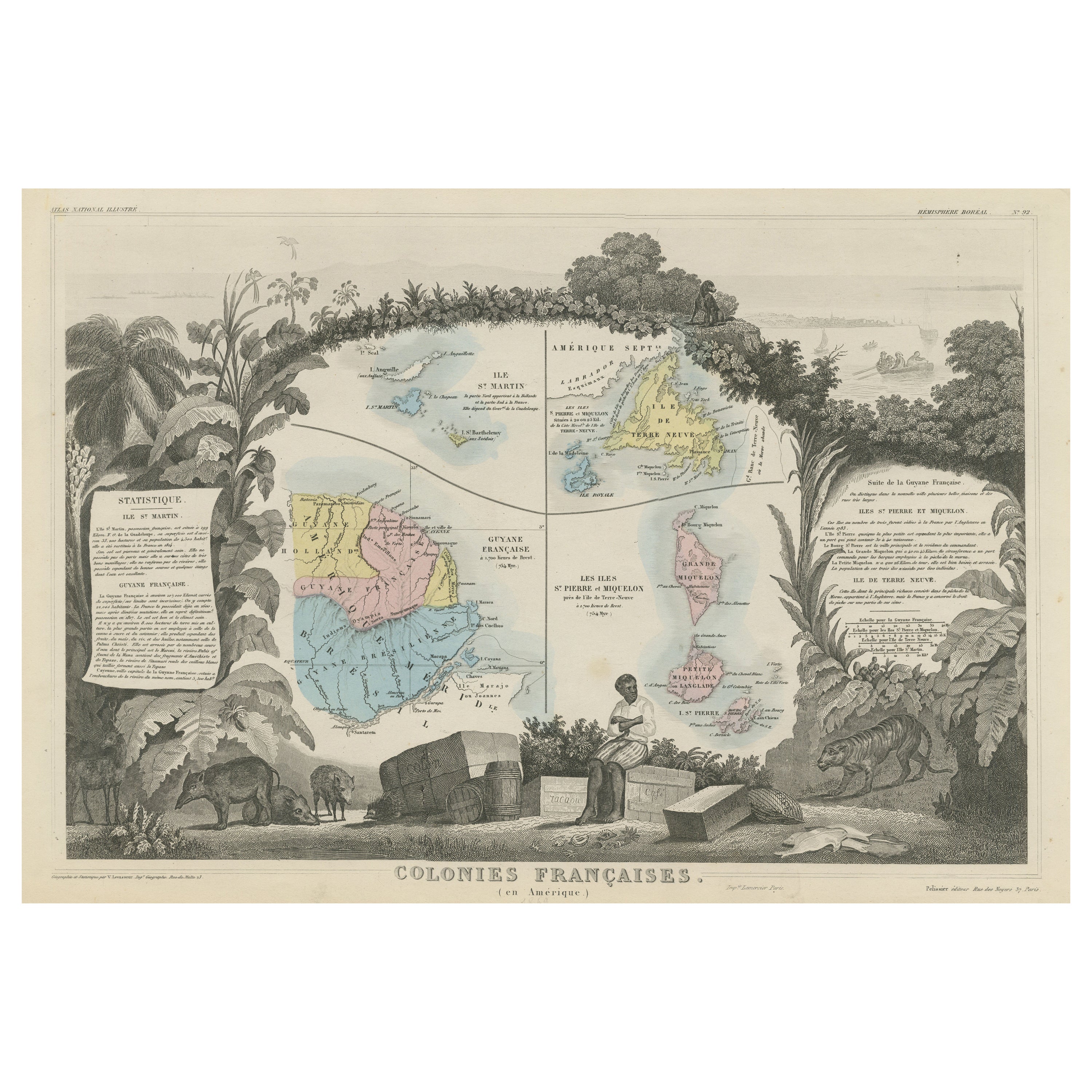
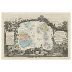
Map Colonies Francaises Martinique, 1845
About the Item
Colonies Francaises, Martinique, Amerique DU SUD
Geographie et Statistique par V.Levasseur. Ing'r Geographe.
Illustre par Raymond Bonheur, peintre.
Grave par Laguihermie, Rue St Jacques, No 82
A Paris chez L'Editeur, Rue de la Parcheminerie, 15
Imp'ie de Tremercier Paris
Atlas National Illustre, Hemisphere Boreaal No 90
1845
In an ebonised frame length 49cm., 19" height 38cm., 15".
- Dimensions:Height: 14.97 in (38 cm)Width: 19.3 in (49 cm)Depth: 0.4 in (1 cm)
- Materials and Techniques:
- Place of Origin:
- Period:
- Date of Manufacture:1845
- Condition:Wear consistent with age and use.
- Seller Location:BUNGAY, GB
- Reference Number:1stDibs: LU3867332076992
About the Seller
5.0
Vetted Seller
These experienced sellers undergo a comprehensive evaluation by our team of in-house experts.
Established in 1985
1stDibs seller since 2018
84 sales on 1stDibs
Typical response time: 9 hours
- ShippingRetrieving quote...Ships From: BUNGAY, United Kingdom
- Return PolicyA return for this item may be initiated within 7 days of delivery.
More From This SellerView All
- Map SussexLocated in BUNGAY, SUFFOLKMap of Sussex with explanation Maker unknown.Category
Antique 19th Century English Victorian Maps
MaterialsPaper
- Map Bedfordshire General FramedLocated in BUNGAY, SUFFOLKA general map of Bedfordshire with its hundreds A scale of 5 miles in the original green mount and traditional black and gold frame. Measures: 36cm 14" high.Category
Antique 18th Century English Georgian Maps
MaterialsPaper
- Map Bedfordshire No 3 General FramedLocated in BUNGAY, SUFFOLKA general map of Bedfordshire with its hundreds. Measure: 37cm 14 1/2" high A scale of 5 miles. in the original green mount and traditional black and gold frame. charming map with...Category
Antique 18th Century English Georgian Maps
MaterialsPaper
- Map North Wales Robert Marsden AngleseyLocated in BUNGAY, SUFFOLKMap of North Wales by Robert Marsden Including Anglesey Charming topography and detail and colouring just purchased more information to follow.Category
Antique 18th Century English Georgian Maps
MaterialsPaper
- Map Jersey Guernsey Scilly Islands AlderneyLocated in BUNGAY, SUFFOLKRare map of The Islands of Guernsey and Jersey, including Alderney & the Scilly Islands just purchased more information to follow In the original cream mount and gilded frame.Category
Antique 18th Century English Georgian Maps
MaterialsPaper
- Map Huntingdonshire R Scott Archibald Fullarton & Co GlasgowLocated in BUNGAY, SUFFOLKFolding Map of Huntingdonshire by R Scott with distances from London and reference to the hundreds. Published by Archibald Fullarton & Co Glasgow. Measure: 40...Category
Antique 19th Century English Victorian Maps
MaterialsPaper


You May Also Like
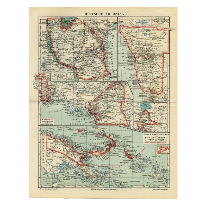
- Antique Map of German Colonies by Meyer, 1895Located in Langweer, NLAntique map titled 'Deutsche Kolonien.' Lithographed map of the German Colonies. German East-Africa, German Southeast-Africa, Cameroon, Marshall-Islands, German Colonies in the Pacif...Category
Antique 19th Century Maps
MaterialsPaper
- Antique Map of Algeria and the French Colonies, 1875Located in Langweer, NLAntique map titled 'Algérie et Colonies Francaises'. Large map of Algeria and the French Colonies. This map originates from 'Atlas de Géographie Moderne Physique et Politique' by A. ...Category
Antique Late 19th Century Maps
MaterialsPaper
- Original Steel Engraved Map of French Colonies in America, 1854Located in Langweer, NLAntique map titled 'Colonies Francaises (en Amerique)'. Detailed map bordered by vignettes showing local animals, produce and activities of the various French Colonies in America. Th...Category
Antique Mid-19th Century Maps
MaterialsPaper
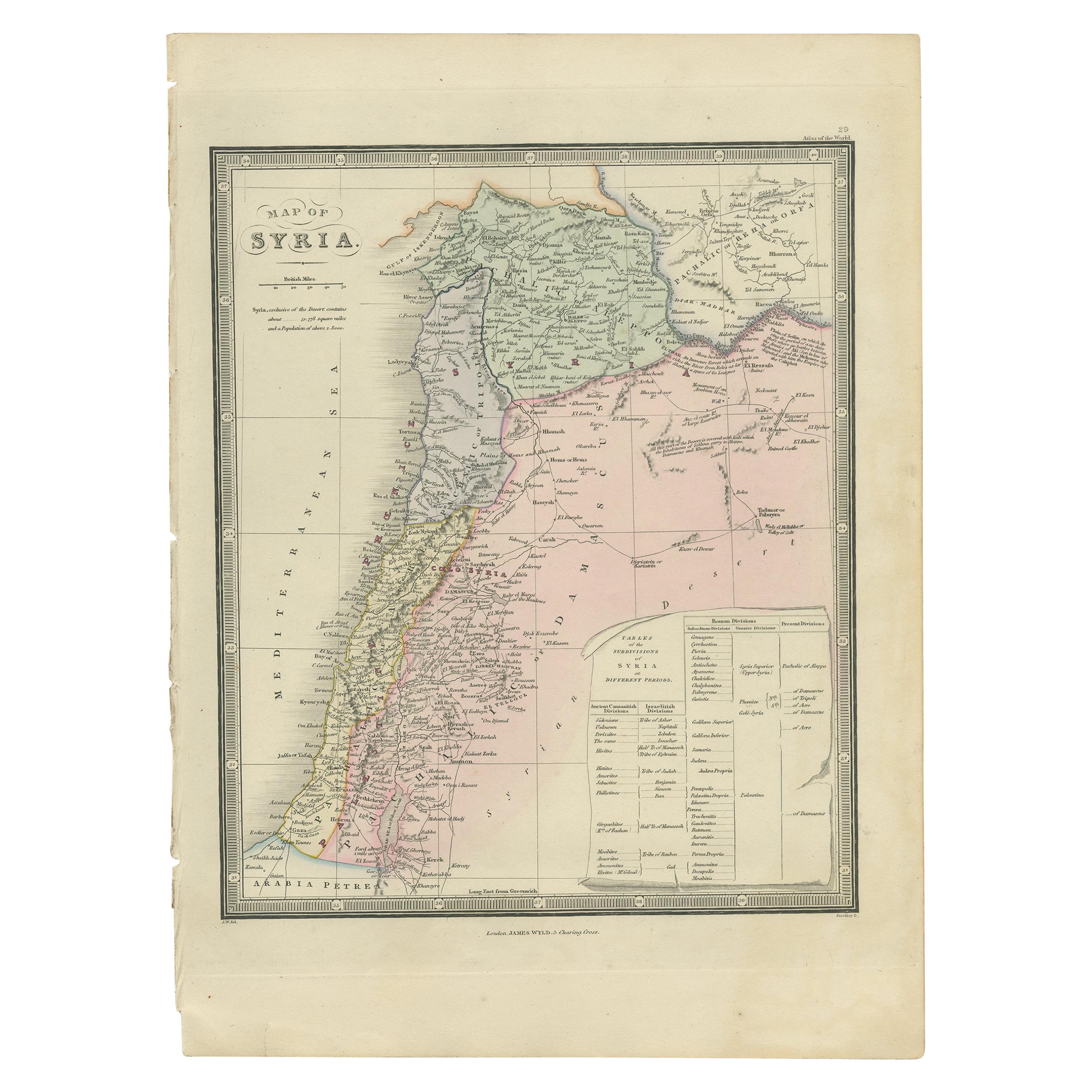
- Antique Map of Syria by Wyld '1845'Located in Langweer, NLAntique map titled 'Map of Syria'. Original antique map of Syria. This map originates from 'An Atlas of the World, Comprehending Separate Maps of its Var...Category
Antique Mid-19th Century Maps
MaterialsPaper
- Antique Map of Brazil by Wyld, '1845'Located in Langweer, NLAntique map titled 'Empire of Brazil'. Original antique map of Brazil. This map originates from 'An Atlas of the World, Comprehending Separate Ma...Category
Antique Mid-19th Century Maps
MaterialsPaper
- Antique Map of Europe by Wyld '1845'Located in Langweer, NLAntique map titled 'Europe'. Original antique map of Europe. This map originates from 'An Atlas of the World, Comprehending Separate Maps of its ...Category
Antique Mid-19th Century Maps
MaterialsPaper


Recently Viewed
View AllMore Ways To Browse
Antique Ing
Ebonised Frame
Antique Grave
Chez Antique
De La Sud
Antique Hemisphere Maps
Framed Atlas Map
De Sud
Colonies Map
Antique Blackwood Furniture
Antique Map Of New York City
Antique Maps Of New York City
Antique Linen Map
Boston Map
Map Of Boston
Malaysian Antique Furniture
Antique Hemisphere Maps
Antique Furniture Malaysia