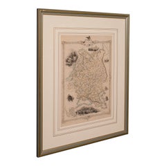
Framed Atlas Map

3
192
11
to
19
108
94
202
199
202
19
8
5
4
3
3
3
3
1
73
92
27
11
17
3
1
3
7
2
2
1
135
37
13
8
8
87
57
56
48
18
3
3
3
2
2
Sort By
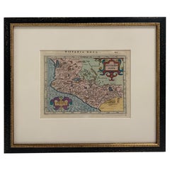
Framed Mercator Hondius Hispania Nova Atlas Minor Map
Located in Stamford, CT
Framed colored example of this decorative and important minature map. Newly framed in brown wood
Category

Antique 17th Century Dutch Spanish Colonial Maps

Materials

Glass, Wood, Paper

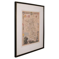
Antique Lithography Map, Buckinghamshire, English, Framed Cartography, Victorian
Located in Hele, Devon, GB
This is an antique lithography map of Buckinghamshire. An English, framed atlas engraving of
Category

Antique Mid-19th Century British Victorian Maps

Materials

Wood, Paper

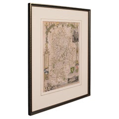
Antique Lithography Map, Bedfordshire, English, Framed Engraving, Cartography
Located in Hele, Devon, GB
This is an antique lithography map of Bedfordshire. An English, framed atlas engraving of
Category

Antique Mid-19th Century British Victorian Maps

Materials

Wood

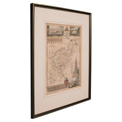
Antique Lithography Map, Hertfordshire, English, Framed Engraving, Cartography
Located in Hele, Devon, GB
This is an antique lithography map of Hertfordshire. An English, framed atlas engraving of
Category

Antique Mid-19th Century British Victorian Maps

Materials

Wood

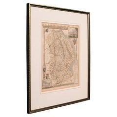
Antique Lithography Map, Lincolnshire, English, Framed, Engraving, Cartography
Located in Hele, Devon, GB
This is an antique lithography map of Lincolnshire. An English, framed atlas engraving of
Category

Antique Mid-19th Century British Victorian Maps

Materials

Wood

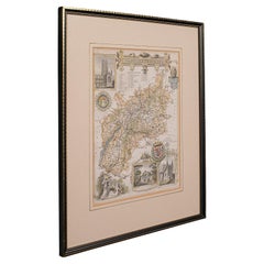
Antique Lithography Map, Gloucestershire, English, Framed Engraving, Cartography
Located in Hele, Devon, GB
This is an antique lithography map of Gloucestershire. An English, framed atlas engraving of
Category

Antique Mid-19th Century British Victorian Maps

Materials

Wood

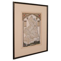
Antique Lithography Map, Northumberland, English, Framed, Engraving, Cartography
Located in Hele, Devon, GB
This is an antique lithography map of Northumberland. An English, framed atlas engraving of
Category

Antique Mid-19th Century British Victorian Maps

Materials

Wood

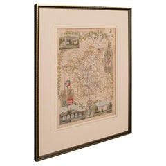
Antique Lithography Map, Worcestershire, English, Framed Engraving, Cartography
Located in Hele, Devon, GB
This is an antique lithography map of Worcestershire. An English, framed atlas engraving of
Category

Antique Early 19th Century British Regency Maps

Materials

Wood

Antique Lithography Map, Western Russia, English, Framed, Cartography, Victorian
Located in Hele, Devon, GB
This is an antique lithography map of Western Russia. An English, framed atlas engraving of
Category

Antique Mid-19th Century British Early Victorian Maps

Materials

Wood

Antique Lithography Map, West Africa, English, Framed, Cartography, Victorian
Located in Hele, Devon, GB
This is an antique lithography map of Western Africa. An English, framed atlas engraving of
Category

Antique Mid-19th Century British Early Victorian Maps

Materials

Wood

Antique County Map, Norfolk, English, Framed Lithography, Cartography, Victorian
Located in Hele, Devon, GB
This is an antique lithography map of Norfolk. An English, framed atlas engraving of cartographic
Category

Antique Mid-19th Century British Victorian Maps

Materials

Glass, Wood

Antique Lithography Map, Black Sea, English, Framed, Cartography, Victorian
Located in Hele, Devon, GB
This is an antique lithography map of the Black Sea region. An English, framed atlas engraving of
Category

Antique Mid-19th Century British Early Victorian Maps

Materials

Wood

Antique County Map, Rutlandshire, English, Framed, Cartography, Victorian, 1860
Located in Hele, Devon, GB
This is an antique lithography map of Rutlandshire. An English, framed atlas engraving of
Category

Antique Mid-19th Century British Victorian Maps

Materials

Wood

Antique Lithography Map, South America, English, Framed, Cartography, Victorian
Located in Hele, Devon, GB
This is an antique lithography map of South America. An English, framed atlas engraving of
Category

Antique Mid-19th Century British Early Victorian Maps

Materials

Wood

Antique Lithography Map, County Durham, English, Framed Cartography, Victorian
Located in Hele, Devon, GB
This is an antique lithography map of County Durham. An English, framed atlas engraving of
Category

Antique Mid-19th Century British Mid-Century Modern Maps

Materials

Wood

Antique Lithography Map, Northamptonshire, English, Framed Cartography, C.1860
Located in Hele, Devon, GB
This is an antique lithography map of Northamptonshire. An English, framed atlas engraving of
Category

Antique Mid-19th Century British Victorian Maps

Materials

Wood

Map Shropshire Joseph Ellis Robert Sayer Carington Bowles Framed
Located in BUNGAY, SUFFOLK
A modern map of Shropshire Drawn from the latest surveys corrected and improved by the best
Category

Antique 18th Century English Georgian Maps

Materials

Paper

Original Antique Map of West Central France in Frame, 1748
Located in Langweer, NL
A nicely framed and hand-coloured decorative map titled "Gouvernemens Generaux De Poitou et De
Category

Antique 1740s Maps

Materials

Paper

Antique Lithography Map, Cornwall, English Framed Engraving, Cartography, C.1850
Located in Hele, Devon, GB
This is an antique lithography map of the Duchy of Cornwall. An English, framed atlas engraving of
Category

Antique Mid-19th Century British Victorian Maps

Materials

Wood

Antique Lithography Map, Isle of Wight, English, Framed, Engraving, Cartography
Located in Hele, Devon, GB
This is an antique lithography map of the Isle of Wight. An English, framed atlas engraving of
Category

Antique Early 19th Century British Regency Maps

Materials

Wood

Antique Map of China and Japan, with Frame Style Border
Located in Langweer, NL
Antique map titled 'Empires Chinois et Japonnais'. Attractive map of China and Japan. This map
Category

Antique Mid-19th Century Maps

Materials

Paper

Antique Map of Spain and Portugal, with Frame Style Border
Located in Langweer, NL
, Majorca, and Minorca. This map originates from Maison Basset's 1852 edition of 'Atlas Illustre Destine a
Category

Antique Mid-19th Century Maps

Materials

Paper

Antique Map of Turkey in Asia, with Frame Style Border
Located in Langweer, NL
, including Cyprus. This map originates from Maison Basset's 1852 edition of 'Atlas Illustre Destine a
Category

Antique Mid-19th Century Maps

Materials

Paper

Antique Map of Russia in Europe, with Frame Style Border
Located in Langweer, NL
Antique map titled 'Russie d'Europe'. Attractive map of Russia in Europe, covers the European
Category

Antique Mid-19th Century Maps

Materials

Paper

Louisiana: A Framed 19th Century Map by O. W. Gray
By Gray and Co
Located in Alamo, CA
This framed 19th century map of the Louisiana territory was published in "Gray's Atlas of the
Category

Antique Mid-19th Century American Other Maps

Materials

Paper

Matthaus Seutter, Framed 1730 Color Engraving Map of "Belgium Fonderatum"
Located in Bridgeport, CT
Label on verso. From Grosser Atlas. The name Belgium comes from the ancient designation "Gallis
Category

Antique 18th Century European Renaissance Maps

Materials

Brass

Antique Map of Greece and Its Colonies, with Frame Style Border
Located in Langweer, NL
. This map originates from Maison Basset's 1852 edition of 'Atlas Illustre Destine a l'enseignement de la
Category

Antique Mid-19th Century Maps

Materials

Paper

Original Antique Hand-colored World Map with or without Frame, '1696'
Located in Langweer, NL
Antique world map titled 'Mappe-Monde dressee sur les Observations de Mrs. de l'Academie Royale des
Category

Antique Late 17th Century Maps

Materials

Paper

Antique Map of Russia in Asia and Siberia, with Frame Style Border
Located in Langweer, NL
map originates from Maison Basset's 1852 edition of 'Atlas Illustre Destine a l'enseignement de la
Category

Antique Mid-19th Century Maps

Materials

Paper

Essex John Cary 1787 Cary's New & Correct English Atlas 40cm 16" long gilt frame
By John Cary
Located in BUNGAY, SUFFOLK
Map of Essex by John Cary Engraver London published as the act directs Sept 1st 1787 by J Cary
Category

Antique 18th Century English Georgian Maps

Materials

Paper

Original Antique Map of Egypt in Frame by C. Weigel, circa 1720
Located in Langweer, NL
- curated the map, which was included in the atlas "Descriptio orbis antiqui in XLIV," around 1720. It
Category

Antique Early 18th Century Maps

Materials

Paper

Road Map John Ogilby No 75 Kings Lyn Harwich, Britannia Framed Wallhanging
By John Ogilby
Located in BUNGAY, SUFFOLK
the three, both in terms of the text, maps and illustrations. In a similar vein, he issued the 'Atlas
Category

Antique 1670s European Baroque Maps

Materials

Paper

Map Road John Ogilby Britannia No 74 Ipswich to Norwich Cromer Framed
By John Ogilby
Located in BUNGAY, SUFFOLK
national road-atlas of any country in Western Europe. It was composed of maps of seventy-three major roads
Category

Antique 1670s English Baroque Maps

Materials

Paper

Road Map John Ogilby London St David's Britannia No 15 Abingdon Monmouth Framed
By John Ogilby
Located in BUNGAY, SUFFOLK
three, both in terms of the text, maps and illustrations. In a similar vein, he issued the 'Atlas
Category

Antique 1670s English Baroque Maps

Materials

Paper

Road Map Britannia No 32 the Road from London to Barnstable John Ogilby Framed
By John Ogilby
Located in BUNGAY, SUFFOLK
collector with no 15 London to St Davids. Framed as a pair. Measures: Black Linear Border around Map
Category

Antique Late 17th Century English Charles II Maps

Materials

Paper

Road Map Britannia No 15 London to St Davids John Ogilby Brown Gilt Frame
By John Ogilby
Located in BUNGAY, SUFFOLK
three, both in terms of the text, maps and illustrations. In a similar vein, he issued the 'Atlas
Category

Antique Late 17th Century British Charles II Maps

Materials

Paper

"Clason's Guide Map of Montana" by The Clason Map Company, Circa 1920s
Located in Colorado Springs, CO
Clason Map Company was the first to publish a modern road atlas of the United States. Their success
Category

Vintage 1920s American Art Deco Maps

Materials

Paper

Road Map Britannia No 25 London to the Lands End, John Ogilby Brown Gilded Frame
By John Ogilby
Located in BUNGAY, SUFFOLK
three, both in terms of the text, maps and illustrations. In a similar vein, he issued the 'Atlas
Category

Antique Late 17th Century British Charles II Maps

Materials

Paper

Road Map Britannia 1675/6 No 5 Road London to Barwick, London Stilton Grey Frame
By John Ogilby
Located in BUNGAY, SUFFOLK
the three, both in terms of the text, maps and illustrations. In a similar vein, he issued the 'Atlas
Category

Antique Late 17th Century British Charles II Maps

Materials

Paper

1864 Map of North America, Antique Hand-Colored Map, by Adolphe Hippolyte Dufour
Located in Colorado Springs, CO
also appeared in Andriveau-Goujon's Atlas Choix. This map covers an extensive amount of land in the
Category

Antique 1860s French Maps

Materials

Paper

Antique Map of Scotland With an Inset Map of the Shetland Islands, 1854
Located in Langweer, NL
Stunning Map of Scotland that will look beautiful in any setting framed on the wall. Description
Category

Antique 1850s Maps

Materials

Paper

Map Colonies Francaises Martinique, 1845
Located in BUNGAY, SUFFOLK
chez L'Editeur, Rue de la Parcheminerie, 15 Imp'ie de Tremercier Paris Atlas National Illustre
Category

Antique 19th Century French Maps

Materials

Paper

Map Colonies Francaises Martinique, 1845
H 14.97 in W 19.3 in D 0.4 in
Saxtons Map of Oxtons, Bucks, Berk
Located in Alton, GB
Framed Saxton’s Map of Oxfordshire, Buckinghamshire, and Berkshire, 1574. Originally published as
Category

Antique 16th Century British Maps

Materials

Paper

Saxtons Map of Oxtons, Bucks, Berk
H 100 in W 110 in D 3 in
Curaçao map - C. van Baarsel en zoon
Located in UTRECHT, UT
Amsterdam op Curaçao” from the atlas “Atlas der overzeesche bezittingen van Zijne Majesteit den Koning der
Category

Antique 1810s Dutch Other Maps

Materials

Paper

Curaçao map - C. van Baarsel en zoon
H 21.86 in W 27.56 in D 0.79 in
17th Century Nicolas Visscher Map of Southeastern Europe
Located in Hamilton, Ontario
ever-expanding market for maps and atlases. Despite the intense competition, with maps such as
Category

Antique 17th Century Dutch Maps

Materials

Paper

Antique Map of Overijssel by Visscher, c.1660
Located in Langweer, NL
Antique map titled 'Transisalania provincia vulgo Over-yssel'. Original antique map of the province
Category

Antique 17th Century Maps

Materials

Paper

Antique Map of Southern Zeeland by Von Reilly, 1790
Located in Langweer, NL
' (Wien: Reilly, 1791-1806), a world atlas in 830 maps by Franz Joseph Johann von Reilly. Artists and
Category

Antique 18th Century Maps

Materials

Paper

French Geographical, Statistical and Historical Map of Pensylvania, 1825
Located in Langweer, NL
others. This map measures 26.5" X 19 3/4 and will good excellent once framed and displayed.
Category

Antique 1820s Maps

Materials

Paper

Hand Colored 17th Century Visscher Map "Hollandiae" Southern Holland
By Nicolaes Visscher II
Located in Alamo, CA
her death in 1726. The Visschers were prolific publishers, producing individual maps and also atlases
Category

Antique Early 18th Century Dutch Maps

Materials

Paper

Antique Lithography Map, Isle of Thanet, Kent, English, Cartography, Victorian
Located in Hele, Devon, GB
This is an antique lithography map of The Isle of Thanet in Kent. An English, framed atlas
Category

Antique Mid-19th Century British Victorian Maps

Materials

Wood

Vintage Reproduction 17th Century Map of Europe, American, Cartography, Blaeuw
Located in Hele, Devon, GB
This is a vintage reproduction map of Europe. An American, paper stock cartography print in frame
Category

Late 20th Century Central American Mid-Century Modern Maps

Materials

Glass, Wood, Paper

Antique Map Depicting Burma, Siam, Annam (Vietnam) and Japan, 1882
Located in Langweer, NL
The image shows two maps side by side from the 1882 atlas by Blackie & Son. On the left, the map is
Category

Antique 1880s Maps

Materials

Paper

Antique Map of the City of Grave by Blaeu, 1649
Located in Langweer, NL
Antique map titled 'Grave'. Original antique map of the city of Grave, the Netherlands. Published
Category

Antique 17th Century Maps

Materials

Paper

Road Map, John Ogilby, No 54, London, Yarmouth, Britannia
By John Ogilby
Located in BUNGAY, SUFFOLK
the three, both in terms of the text, maps and illustrations. In a similar vein, he issued the 'Atlas
Category

Antique 1670s English Baroque Maps

Materials

Paper

Antique Map of the City of Paris by Tirion '1763'
Located in Langweer, NL
Paris, France. This map originates from 'Nieuwe en Beknopte Hand-Atlas, bestaande in eene Verzameling
Category

Antique Mid-18th Century Maps

Materials

Paper

Map Devonshire Richard Creighton J&C Walker Sculp Samuel Lewis
Located in BUNGAY, SUFFOLK
volume. In the original black and gold classic map frame.
Category

Antique 19th Century English Victorian Maps

Materials

Paper

Antique Map of Spain & Portugal 'Iberian Peninsula', Decorative Cartouche, c1755
Located in Langweer, NL
maps and atlases, especially of North America. Condition: Very good, structural damages outside
Category

Antique 1750s Maps

Materials

Paper

Antique Map of the Maluku Islands by Blaeu, c.1640
Located in Langweer, NL
Antique map titled 'Moluccae Insulae Celeberrimae'. Decorative map of the Maluku Islands, also
Category

Antique 17th Century Maps

Materials

Paper

Antique 1630 Colored Belgium Map Flandria Gallica Flanders Henricus Hondius
Located in Dayton, OH
"Antique hand colored map of Flanders, Belgium, circa 1630, engraved by Henricus Hondius. “Henricus
Category

Antique Early 17th Century Renaissance Maps

Materials

Paper

America "Amérique Septentrionale": A 19th Century French Map by Delamarche
By Maison Delamarche 1
Located in Alamo, CA
This framed mid 19th century map of North America entitled "Amérique Septentrionale" by Felix
Category

Antique Mid-19th Century American Other Maps

Materials

Paper

  • 1
Get Updated with New Arrivals
Save "Framed Atlas Map", and we’ll notify you when there are new listings in this category.

Framed Atlas Map For Sale on 1stDibs

Find many varieties of an authentic framed atlas map available at 1stDibs. A framed atlas map — often made from paper, wood and glass — can elevate any home. There are many kinds of the framed atlas map you’re looking for, from those produced as long ago as the 18th Century to those made as recently as the 20th Century. A framed atlas map is a generally popular piece of furniture, but those created in Baroque, Georgian and industrial styles are sought with frequency. Many designers have produced at least one well-made framed atlas map over the years, but those crafted by Frederick de Wit, Nicolaes Visscher II and Antonio Zatta are often thought to be among the most beautiful.

Finding the Right collectibles-curiosities for You

Antique and vintage collectibles and curiosities can bring whimsy and wonder to any interior. 

Decorating with old scientific instruments, historical memorabilia and vintage musical instruments, as well as other authentic collectibles and curiosities that can be found on 1stDibs, presents an opportunity to create a unique, natural history museum-like atmosphere in your home that can provoke conversation as often as it pays tribute to how far we’ve come in understanding our world. 

And bringing collectibles and curiosities into your space is actually on trend — Wunderkammern, or curiosity cabinets, were all the rage in Europe during the 1500s and continued to have adherents there and in the U.S. in the following centuries. Today, however, they’re experiencing a real surge in popularity and influencing how many interior designers are furnishing and decorating homes — combining contemporary with antique, scientific with tribal, earthly with extraterrestrial, Les Lalanne tables with Flemish tapestries.

The original Wunderkammern were entire rooms filled with objects demonstrating their owners’ worldly knowledge: A proper one included artificiala or preciosa (objets d’art); naturalia (such as skeletons, shells, minerals); exotica (taxidermy or dried plants); and scientifica (scientific instruments), frequently alongside religious relics and ancient artifacts.

Pay tribute to a history of rich and diverse musical traditions that have taken shape all over the world by decorating your home with a collection of antique and vintage musical instruments — with a little help from strong hanging wire or some wall hooks, vintage brass instruments such as a gong, French horn or trumpet can help elevate a home office or complement the efforts you’ve made to ensure a welcoming vibe in your home’s entryway. Bells or antique wind instruments can add provocative metallic contrasts to dark woods as tabletop decorative objects.  

Create an intriguing focal point with Georgian scientific instruments, such as stick barometers with mahogany cases or lacquered brass telescopes. These items stem from an era named for the monarchies of the four King Georges, who ruled England in succession starting in 1714 (plus King William’s reign, which lasted until 1837). Just as there was beautiful jewelry produced during the period that today is coveted by collectors, there is much to be found in the collectibles and curiosities realm too.

Wanderlust, nostalgia and a shared love of good design are contributing factors to certain trends in decorating — just as vintage trunks and luggage have reappeared as furniture or home accents in a bedroom or foyer, decorating with globes, maps or nautical objects is similarly rooted in the allure of travel and a penchant for the stylish finishing touch that collectibles bring to our homes.

Find a wide range of antique and vintage collectibles and curiosities on 1stDibs.

Read More

Pamela Shamshiri Shares the Secrets behind Her First-Ever Book and Its Effortlessly Cool Interiors

The sought-after designer worked with the team at Hoffman Creative to produce a monograph that beautifully showcases some of Studio Shamshiri's most inspiring projects.

Moroccan Artworks and Objects Take Center Stage in an Extraordinary Villa in Tangier

Italian writer and collector Umberto Pasti opens the doors to his remarkable cave of wonders in North Africa.

Montecito Has Drawn Royalty and Celebrities, and These Homes Are Proof of Its Allure

Hollywood A-listers, ex-pat aristocrats and art collectors and style setters of all stripes appreciate the allure of the coastal California hamlet — much on our minds after recent winter floods.

Whaam! Blam! Pow! — a New Book on Pop Art Packs a Punch

Publishing house Assouline and writer Julie Belcove have teamed up to trace the history of the genre, from Roy Lichtenstein, Andy Warhol and Yayoi Kusama to Mickalene Thomas and Jeff Koons.

The Sparkling Legacy of Tiffany & Co. Explained, One Jewel at a Time

A gorgeous new book celebrates — and memorializes — the iconic jeweler’s rich heritage.

What Makes a Gem-Encrusted Chess Set Worth $4 Million?

The world’s most opulent chess set, weighing in at 513 carats, is literally fit for a king and queen.

Tauba Auerbach’s Geometric Pop-Up Book Is Mighty Rare, Thanks to a Hurricane

This sculptural art book has an epic backstory of its own.

Step inside the Storied Mansions of Palm Beach’s Most Effervescent Architect

From Spanish-style courtyards to fanciful fountains, these acclaimed structures abound in surprising and elegant details.