Items Similar to Original Antique Map of West Central France in Frame, 1748


Want more images or videos?
Request additional images or videos from the seller
1 of 6
Original Antique Map of West Central France in Frame, 1748
About the Item
A nicely framed and hand-coloured decorative map titled "Gouvernemens Generaux De Poitou et De Saintonge" and engraved by M. Robert. This historical international map includes several specific locations, such as the Isle Dieu, Bretagne, Anjou, Touraine, Angoumois, Perigold, Saintonge, Mer de Gascogne (Bay of Biscay), Poitou, Aunis, Guienne, la Garonne Riviere (Garonne River), and Loudunois, as well as the Tour de Cordouan (Cordouan Lighthouse).
Featured towns on this map include Tonnay, Talmont, Loudun, Mortemer, Poitiers, Chalais, Riberac, Angoule, Marton, Blaye, and Monbrun.
This antique map represents the west-central region of France.
The theme of the atlas from which this map originates is the "Atlas Portatif Universel Et Militaire" by M. Robert. The source description indicates that this atlas is a portable, universal, and military collection composed of the best maps available for the King. It is both engraved and handwritten by the most famous geographers and engineers of the time. Authored by M. Robert, who is described as the Ordinary Geographer to the King, this work was published in Paris, France, in 1748.
- Dimensions:Height: 11.82 in (30 cm)Width: 13 in (33 cm)Depth: 0.56 in (1.4 cm)
- Materials and Techniques:Paper,Engraved
- Period:1740-1749
- Date of Manufacture:1748
- Condition:Good. The framing has been done professionally and the matting is acid free carton.
- Seller Location:Langweer, NL
- Reference Number:
About the Seller
5.0
Platinum Seller
These expertly vetted sellers are 1stDibs' most experienced sellers and are rated highest by our customers.
Established in 2009
1stDibs seller since 2017
1,922 sales on 1stDibs
Typical response time: <1 hour
- ShippingRetrieving quote...Ships From: Langweer, Netherlands
- Return PolicyA return for this item may be initiated within 14 days of delivery.
More From This SellerView All
- Antique Map of Central America and the West Indies, 1882Located in Langweer, NLAntique map titled 'West India Islands and Central America'. Old map of Central America and the West Indies. This map originates from 'The Royal Atlas of Modern Geography, Exhibiting...Category
Antique 19th Century Maps
MaterialsPaper
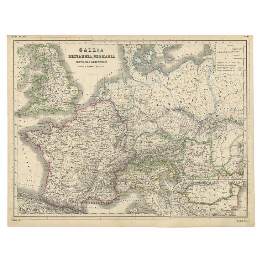
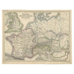
- Original Antique Map of West Europe, circa 1870Located in Langweer, NLAntique map titled 'Gallia, Britannia, Germania'. Old map of West Europe including France, Germany and the United Kingdom. This map originates from 'Atlas Antiquus, twaalf kaarten be...Category
Antique 19th Century Maps
MaterialsPaper
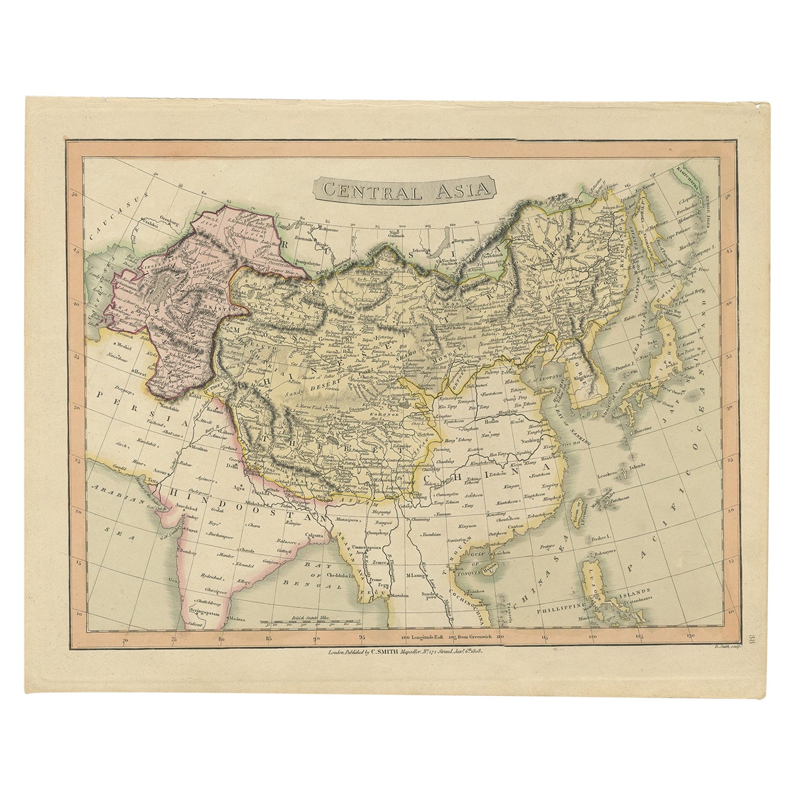
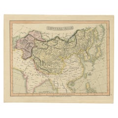
- Original Antique Map of Central Asia by Smith, 1808Located in Langweer, NLAntique map titled 'Central Asia'. Old map of central Asia originating from 'Smith's New General Atlas Containing Distinct Maps Of all the Principal Empires, Kingdoms, & States Throu...Category
Antique 19th Century Maps
MaterialsPaper
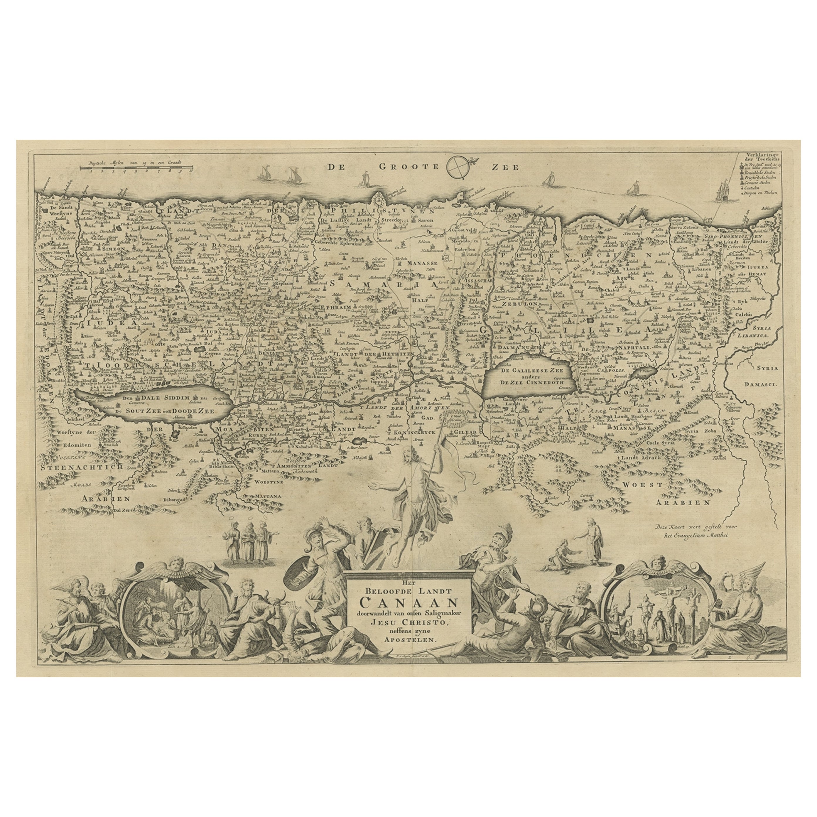
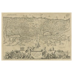
- Antique Map of Israel Filled with Biblical Scenes, Published in 1748Located in Langweer, NLAntique map Holy Land titled 'Het beloofde landt Canaan doorwandelt van onsen Saligmaker Jesu Christo neffens zyne Apostelen'. Antique map of Israel ...Category
Antique 1740s Maps
MaterialsPaper
- Antique Map of the West Indies and Central America by W. G. Blackie, 1859Located in Langweer, NLAntique map titled 'The West India Island & Central America'. Original antique map of the West Indies and Central America, with inset map of Jamaica. Th...Category
Antique Mid-19th Century Maps
MaterialsPaper
- Antique Map of Mexico, Central America and West Indies by A & C. Black, 1870Located in Langweer, NLAntique map titled 'Mexico, Central America and West Indies'. Original antique map of Mexico, Central America and West Indies with inset map of Panama railway. This map originates fr...Category
Antique Late 19th Century Maps
MaterialsPaper


You May Also Like
- Original Antique Map of Central America / Florida, Arrowsmith, 1820Located in St Annes, LancashireGreat map of Central America. Drawn under the direction of Arrowsmith. Copper-plate engraving. Published by Longman, Hurst, Rees, Orme and Brown, 1820 Unframed.Category
Antique 1820s English Maps
MaterialsPaper
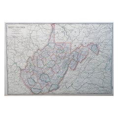
- Large Original Antique Map of West Virginia, USA, C.1900Located in St Annes, LancashireFabulous map of West Virginia Original color Engraved and printed by the George F. Cram Company, Indianapolis. Published, C.1900 Unframed Free shipping.Category
Antique 1890s American Maps
MaterialsPaper
- Antique Lithography Map, West Africa, English, Framed, Cartography, VictorianLocated in Hele, Devon, GBThis is an antique lithography map of Western Africa. An English, framed atlas engraving of cartographic interest by John Rapkin, dating to the early Victorian period and later, circ...Category
Antique Mid-19th Century British Early Victorian Maps
MaterialsWood
- Original Antique Map of France, Arrowsmith, 1820Located in St Annes, LancashireGreat map of France Drawn under the direction of Arrowsmith. Copper-plate engraving. Published by Longman, Hurst, Rees, Orme and Brown, 1820 Unframed.Category
Antique 1820s English Maps
MaterialsPaper
- Original Antique Decorative Map of South America-West Coast, Fullarton, C.1870Located in St Annes, LancashireGreat map of Chili, Peru and part of Bolivia Wonderful figural border From the celebrated Royal Illustrated Atlas Lithograph. Original color. Published by Fullarton, Edi...Category
Antique 1870s Scottish Maps
MaterialsPaper
- Original Antique English County Map - West Yorkshire. J & C Walker. 1851Located in St Annes, LancashireGreat map of The West Riding of Yorkshire Original colour By J & C Walker Published by Longman, Rees, Orme, Brown & Co. 1851 Unframed.Category
Antique 1850s English Other Maps
MaterialsPaper