Items Similar to Map Devonshire Richard Creighton J&C Walker Sculp Samuel Lewis
Want more images or videos?
Request additional images or videos from the seller
1 of 6
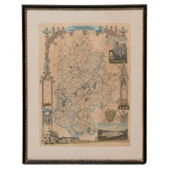
Map Devonshire Richard Creighton J&C Walker Sculp Samuel Lewis
About the Item
Devonshire drawn by Richard Creighton with reference to the Unions
Artist Richard Creighton
Engraved by J&C Walker Sculp
Published in Samuel Lewis Topographical Dictionary 1831, and there were a number or re-issues up to 1849. The county maps, which were drawn by Richard Creighton and engraved by J.& C. Walker, were sometimes published with the text and sometimes in a separate, accompanying atlas volume.
In the original black and gold classic map frame.
- Dimensions:Height: 12.6 in (32 cm)Width: 15.36 in (39 cm)Depth: 0.79 in (2 cm)
- Style:Victorian (Of the Period)
- Materials and Techniques:
- Place of Origin:
- Period:
- Date of Manufacture:circa 1836
- Condition:Wear consistent with age and use.
- Seller Location:BUNGAY, GB
- Reference Number:1stDibs: LU3867332645332
About the Seller
5.0
Vetted Seller
These experienced sellers undergo a comprehensive evaluation by our team of in-house experts.
Established in 1985
1stDibs seller since 2018
84 sales on 1stDibs
Typical response time: 13 hours
- ShippingRetrieving quote...Ships From: BUNGAY, United Kingdom
- Return PolicyA return for this item may be initiated within 7 days of delivery.
More From This SellerView All
- Map Holy Promise Land Canaan Richard Palmer Richard Blome 1687 Joseph MoxonLocated in BUNGAY, SUFFOLKCanaan comonly called the Holy Land or the Land of Promise, being the Possesion of the Israelites & travelled through by Our Lord & Saviour Iesus Christ and his Apostles. Engraven by Richard Palmer for Richard Blome. 1687 Blome, Richard, 1641-1705. London. 283 x 452 mm. Copperplate. Probably from an English Bible...Category
Antique 17th Century British Baroque Maps
MaterialsPaper
- Map SussexLocated in BUNGAY, SUFFOLKMap of Sussex with explanation Maker unknown.Category
Antique 19th Century English Victorian Maps
MaterialsPaper
- Map Huntingdonshire R Scott Archibald Fullarton & Co GlasgowLocated in BUNGAY, SUFFOLKFolding Map of Huntingdonshire by R Scott with distances from London and reference to the hundreds. Published by Archibald Fullarton & Co Glasgow. Measure: 40...Category
Antique 19th Century English Victorian Maps
MaterialsPaper
- Map Bedfordshire General FramedLocated in BUNGAY, SUFFOLKA general map of Bedfordshire with its hundreds A scale of 5 miles in the original green mount and traditional black and gold frame. Measures: 36cm 14" high.Category
Antique 18th Century English Georgian Maps
MaterialsPaper
- Map Bedfordshire WilliamSchmollinger Dunstable Priory Woburn Abbey Moules GothicLocated in BUNGAY, SUFFOLKARTIST William Schmollinger (1811-1869) London : George Virtue, 1832. A highly attractive map in gothick style, with an ornamental architectural border, inset views of Dunstable Priory and Woburn Abbey...Category
Antique 19th Century English Victorian Maps
MaterialsPaper
- Map Bedfordshire WilliamSchmollinger Dunstable Priory Woburn Abbey Moules GothicLocated in BUNGAY, SUFFOLKArtist William Schmollinger (1811-1869) London : George Virtue, 1832. A highly attractive map in gothick style, with an ornamental architectural border, inset views of Dunstable Priory and Woburn Abbey...Category
Antique 19th Century English Victorian Maps
MaterialsPaper


You May Also Like
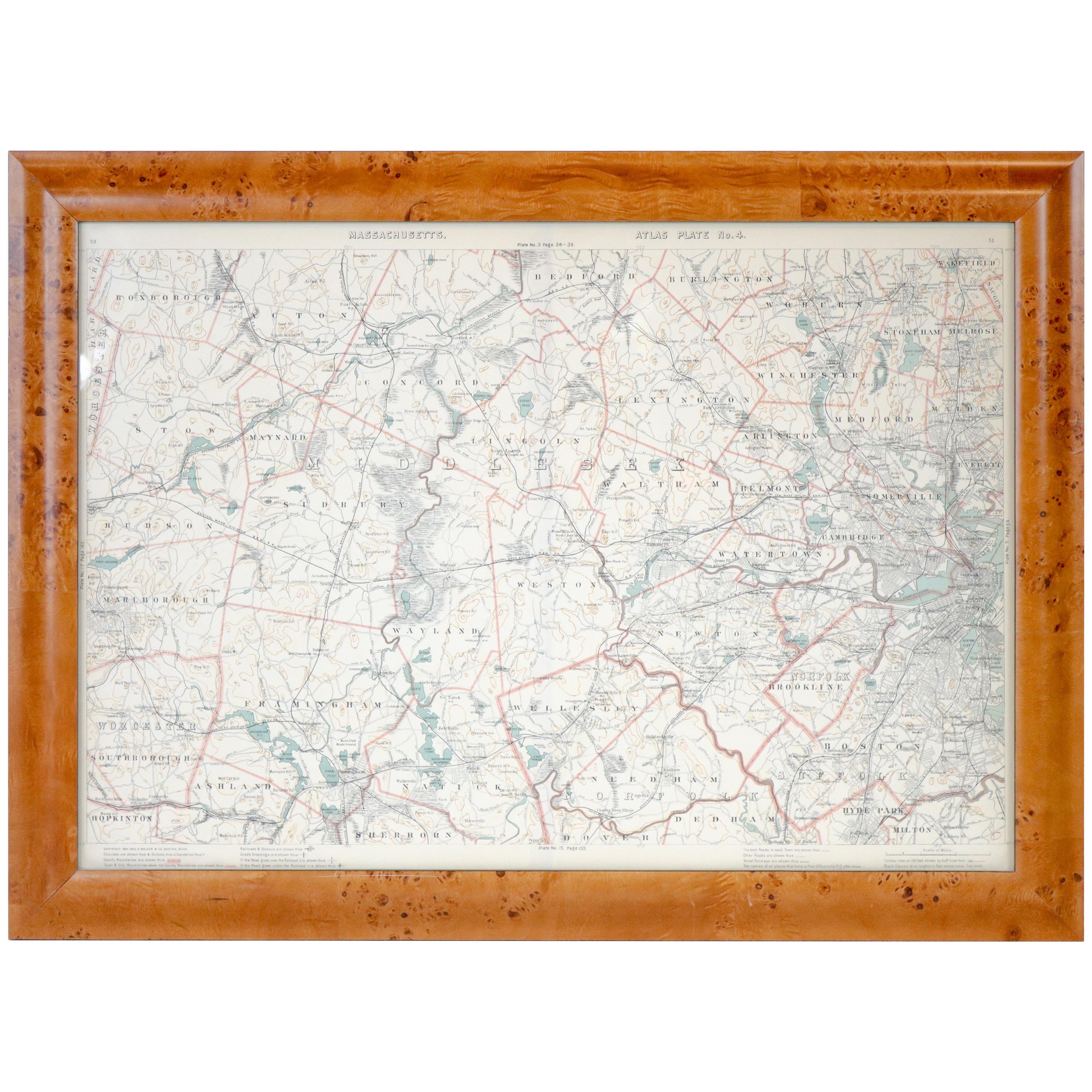
- Original 1891 Walker MapLocated in Norwell, MAOriginal 1891 map of Massachusetts by Walker. Towns include Cambridge, Boston, Dedham, Ashland, Brookline, Newton etc... burl wood frame. Measures...Category
Antique 19th Century Maps
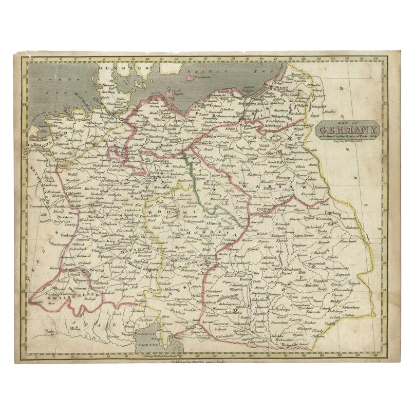
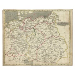
- Antique Map of Germany by Walker, 1820By R. WalkerLocated in Langweer, NLAntique map Germany titled 'Map of Germany as defined by the Peace of Paris'. Detailed antique map of Germany. Artists and Engravers: Engrav...Category
Antique 19th Century Maps
MaterialsPaper
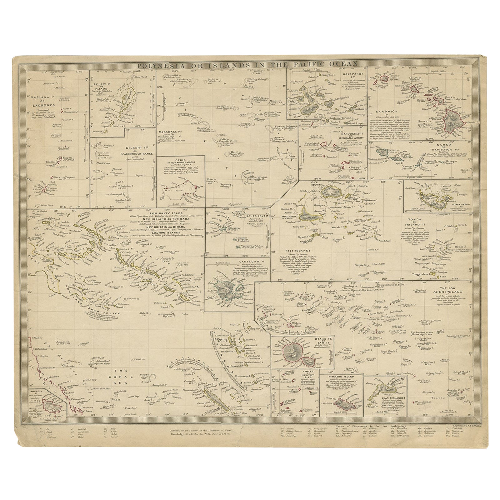
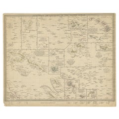
- Antique Map of Polynesia by Walker, 1840Located in Langweer, NLAntique map titled 'Polynesia or Islands in the Pacific Ocean'. This map depicts various islands including the Lousiade Archipelago, Tahiti, Pitcairn Island, Juan Fernandez, The low ...Category
Antique 19th Century Maps
MaterialsPaper
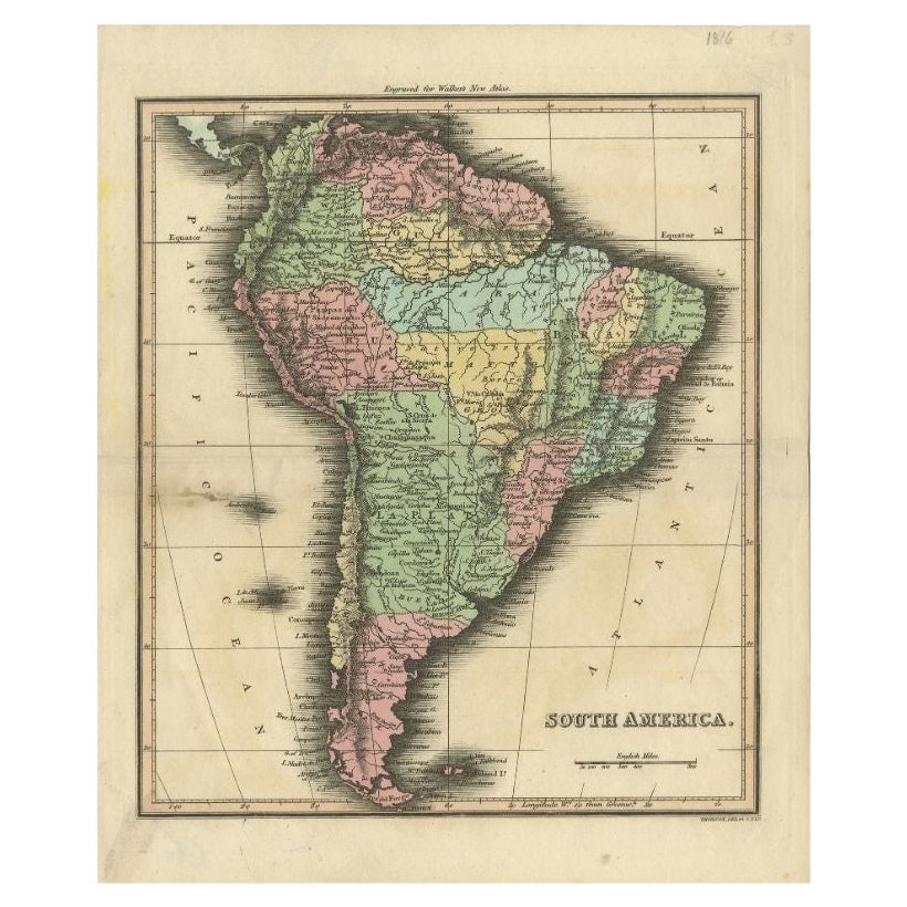
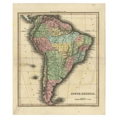
- Antique Map of South America by Walker, 1816By Thomas KitchinLocated in Langweer, NLAntique map titled 'South America'. Old map of South America. This map originates from 'Walker's Universal Atlas'. Artists and Engravers: Printed by Barnard and Farley. Artist: Pr...Category
Antique 19th Century Maps
MaterialsPaper
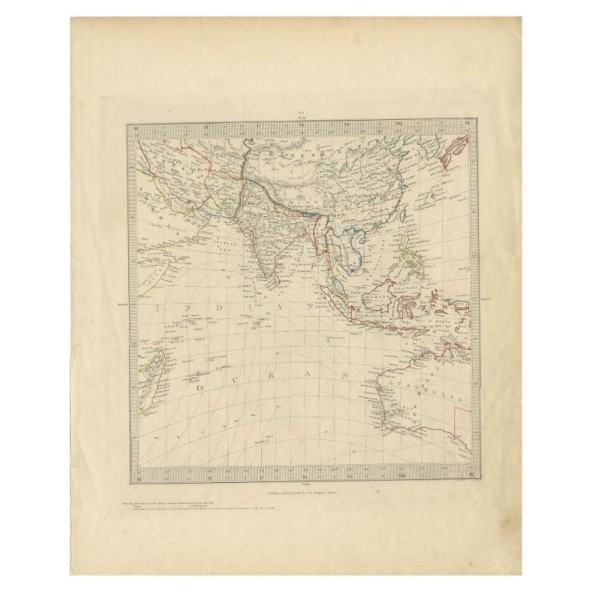
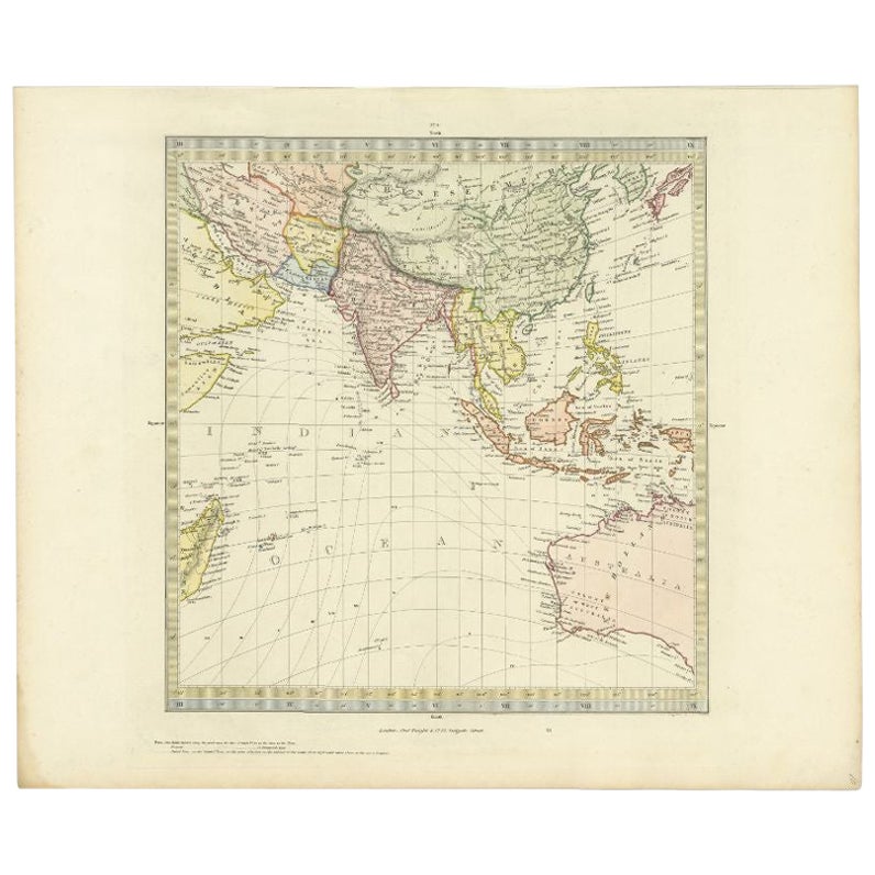
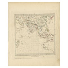
- Antique Map of Southeast Asia by Walker, c.1845Located in Langweer, NL"Untitled map of southeast Asia. This map depicts India, Indonesia, Australia and surrounding regions. Also depicts a large part of the Indian Ocean. Artists and Engravers: Engraved ...Category
Antique 19th Century Maps
MaterialsPaper
- Antique Map of Southern Asia by Walker, c.1840Located in Langweer, NL"Original antique map of Southern Asia, the East Indies and the Indian Ocean. Also shows part of Australia. Published circa 1840. Artists and Engravers: ...Category
Antique 19th Century Maps
MaterialsPaper


Recently Viewed
View AllMore Ways To Browse
Antique Walker
Antique Walkers
Richard Lewis
Framed Atlas Map
J C Walker Map
Large Map Of London
18th Century Antique Mexican
Victorian Compass
Caribbean Antiques
Antique Collectors Australia
Framed Atlas Map
Antique Furniture Central Coast
Willem Blaeu
Antique Furniture North East England
Virginia Maps
Virginia Map
German Compass
Pocket Map