Virginia Map
5
to
14
136
30
70
49
33
31
26
23
18
18
16
13
13
10
8
7
7
6
5
5
5
4
4
4
3
3
3
2
2
2
2
2
2
1
1
1
1
1
1
1
1
1
1
1
1
1
10
4
3
3
2
Sort By
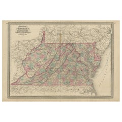
Antique Map of Virginia, Delaware, Maryland & West Virginia by Johnson, 1872
Located in Langweer, NL
Antique map titled 'Johnson's Viriginia (..). Original map of Virginia, Delaware, Maryland and West
Category
Antique Late 19th Century Maps
Materials
Paper
H 18.12 in W 26.38 in D 0.02 in
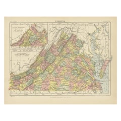
Antique Map of Virginia, with Inset Map of the South Western Continuation
Located in Langweer, NL
Antique map titled 'Virginia'. Original antique map of Virginia, United States. With inset map of
Category
Antique Late 19th Century Maps
Materials
Paper
H 8.27 in W 10.63 in D 0.02 in
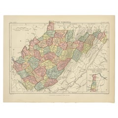
Antique Map of Virginia, with Inset Map of the Northern Part of West Viriginia
Located in Langweer, NL
Antique map titled 'West Virginia'. Original antique map of Virginia, United States. With inset map
Category
Antique Late 19th Century Maps
Materials
Paper
H 8.27 in W 10.63 in D 0.02 in
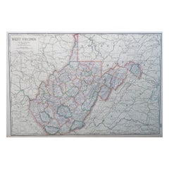
Large Original Antique Map of West Virginia, USA, C.1900
Located in St Annes, Lancashire
Fabulous map of West Virginia
Original color
Engraved and printed by the George F. Cram Company
Category
Antique 1890s American Maps
Materials
Paper
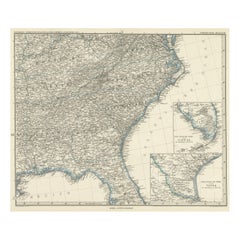
Antique Map of Tennessee, Kentucky, Virginia, Alabama, Georgia and Surroundings
Located in Langweer, NL
, Tennessee, Kentucky, Virginia and part of Florida. With inset maps of the southern part of Florida and the
Category
Antique Mid-19th Century Maps
Materials
Paper
Free Shipping
H 15.16 in W 18.71 in D 0.02 in
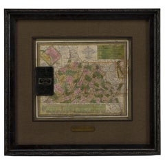
1837 Mitchell's "Tourist's Pocket Map of the State of Virginia" by J.H. Young
Located in Colorado Springs, CO
This is J. H. Young's pocket map of the Virginia, which shows county development current to 1835
Category
Antique 1830s American Maps
Materials
Paper
H 24.25 in W 25.75 in D 1.75 in
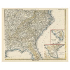
Antique Map of the Region of Georgia with Inset Maps of Florida and Texas
Located in Langweer, NL
, Tennessee, Kentucky, Virginia and part of Florida. With inset maps of the southern part of Florida and the
Category
Antique Late 19th Century Maps
Materials
Paper
H 15.04 in W 18.63 in D 0.02 in
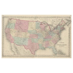
Antique Map Colton's United States of America
Located in Langweer, NL
Antique map titled 'Colton's United States of America'. Show railroads, canals, state capitals
Category
Antique Mid-19th Century Maps
Materials
Paper
Engraving of Idols of Secotam Village in Virginia 'or now North Carolina', 1721
Located in Langweer, NL
image 'Le Dieu des Vents, autre Idole des Virginiens'. The God of Wind. Both idols are key to Virginian
Category
Antique 1720s Maps
Materials
Paper
H 13.98 in W 9.45 in D 0 in
1865 "Johnson's California, Utah, Nevada, Colorado, New Mexico, Arizona" Map
Located in Colorado Springs, CO
Virginia” and the “New Military Map of the United States.”
Condition: Fine condition overall. Hand Colored
Category
Antique Mid-19th Century Maps
Materials
Paper
H 22.5 in W 30.5 in D 0.75 in
1865 "Johnson's Nebraska, Dakota, Colorado, Idaho & Kansas" Map, Johnson & Ward
Located in Colorado Springs, CO
Virginia” and the “New Military Map of the United States.”
Category
Antique Mid-19th Century Maps
Materials
Paper
H 18.5 in W 21.38 in D 0.75 in
1865 "Johnson's Missouri and Kansas" Map by Johnson and Ward
Located in Colorado Springs, CO
War-era maps, one of the “Vicinity of Richmond and Peninsular Campaign in Virginia” and the “New
Category
Antique Mid-19th Century Maps
Materials
Paper
New Map of North America from the Latest Discoveries, 1763
Located in Philadelphia, PA
A fine antique 18th century map of the North American seaboard.
Entitled "A New Map of North
Category
Antique Mid-18th Century English Georgian Maps
Materials
Paper
1856 U.S. Coast Survey Map of Chesapeake Bay and Delaware Bay
Located in Colorado Springs, CO
Carolina. It also shows from Richmond and Petersburg, Virginia to the Atlantic Ocean. The map is highly
Category
Antique 1850s American Maps
Materials
Paper
1889 "The Pacific States and Territories"
Located in Colorado Springs, CO
Presented is an uncommon 1889 map of the western United States, titled “The Pacific States and
Category
Antique 1880s American Maps
Materials
Paper
Civil War Panorama of the Seat of War by John Bachmann, Antique Print circa 1864
Located in Colorado Springs, CO
theaters of War" (Stephenson & McKee Virginia in Maps p.239). This view, taken from the apparent vantage
Category
Antique 1860s American Maps
Materials
Paper
H 33.5 in W 41.5 in D 2 in
Plan for the City of Washington by Andrew Ellicott, Antique Print, 19th Century
Located in Colorado Springs, CO
Territory of Columbia, ceded by the States of Virginia and Maryland to the United States of America and by
Category
Antique Late 19th Century American Maps
Materials
Paper
H 36 in W 43.75 in D 3 in
Virginia. USA. Century Atlas state antique vintage map
Located in Melbourne, Victoria
'The Century Atlas. Virginia'
Original antique map, 1903.
Central fold as issued. Map name and
Category
Early 20th Century Victorian More Prints
Materials
Lithograph
West Virginia. USA. Century Atlas state antique vintage map
Located in Melbourne, Victoria
'The Century Atlas. West Virginia'
Original antique map, 1903.
Central fold as issued. Map name
Category
Early 20th Century Victorian More Prints
Materials
Lithograph
"West Virginia" Cream with Red Florals Area Map Scalloped Cotton Handkerchief
Located in New York, NY
Cream with red multi-florals and red scallop-edged "West Virginia" area map handkerchief
Category
1970s American Handkerchiefs
American Hepplewhite Virginian Secretary Chest with Civil War Provenance
By George Hepplewhite
Located in Dallas, TX
PRESENTING a FANTASTIC and HISTORIC Early 19C American Hepplewhite Virginian Secretary Chest with
Category
Antique Early 19th Century American American Classical Historical Memora...
Materials
Brass
H 44.25 in W 42.75 in D 20.25 in
Important Confederate Field Map of Richmond VA 1864 with Provenance
Located in Dallas, TX
) It is the personal Map of Capt. William Alexander Obenchain who was the Head of the Virginia Corps of
Category
Antique Mid-19th Century American American Classical Historical Memorabilia
Materials
Canvas, Paper
Bermuda: An Early 17th Century Hand-colored Map by Henricus Hondius
By Henricus Hondius
Located in Alamo, CA
cast of The Tempest. The Bermudas were granted to the Virginia Company, which is referenced on the map
Category
Early 17th Century Old Masters Landscape Prints
Materials
Engraving
Lee's Lieutenants by Douglas Southhall Freeman, Three Vols., First Edition, 1942
Located in Colorado Springs, CO
, and 1944 and discuss the various leaders of the Army of Northern Virginia serving under Robert E. Lee
Category
Vintage 1940s American Books
Materials
Leather, Paper
H 9.69 in W 7.13 in D 7.19 in
Warm Beach (#108)
By Joyce Kozloff
Located in Austin, TX
examined bodies of water and the inaccuracies of early maps from the so-called “Age of Discovery.” In 1999
Category
1970s Post-War Abstract Paintings
Materials
Canvas, Acrylic, Graphite
"Downtown San Francisco" Cityscape Acrylic Abstract by Charles Hamilton
By Charles Hamilton
Located in Pasadena, CA
psychedelic map of urban vitality, capturing the essence of San Francisco's bustling downtown district in an
Category
Mid-20th Century Abstract Geometric Landscape Paintings
Materials
Canvas, Oil
H 25.25 in W 49.25 in D 0.75 in
Personal Memoirs of P. H. Sheridan, First Edition, Two-Volume Set, 1888
Located in Colorado Springs, CO
is highly illustrated, with 27 maps and 17 plates. The book is presented beautifully rebound in
Category
Antique 1880s American Books
Materials
Leather, Paper
McClellan's Own Story by George B. McClellan, First Edition, 1887
Located in Colorado Springs, CO
. Illustrated with steel plate engravings and maps. Rebound in quarter navy leather and cloth boards, with
Category
Antique 1880s American Books
Materials
Leather, Paper
Mountain Devil Lizard
Located in Miami, FL
minimalistic and characterized by the fine dotting technique she uses to represent mental maps of her country
Category
20th Century Contemporary Paintings
Materials
Acrylic, Linen
Bush Seeds
Located in Miami, FL
minimalistic and characterized by the fine dotting technique she uses to represent mental maps of her country
Category
20th Century Contemporary Paintings
Materials
Acrylic, Linen
Aboriginal Painting by Kathleen Petyarre
Located in Miami, FL
minimalistic and characterised by the fine dotting technique she uses to represent mental maps of her country
Category
20th Century Abstract Paintings
Materials
Linen, Acrylic
Aboriginal Painting by Kathleen Petyarre
Located in Miami, FL
minimalistic and characterised by the fine dotting technique she uses to represent mental maps of her country
Category
20th Century Paintings
Materials
Linen, Acrylic
Mountain Devil Lizard
Located in Miami, FL
minimalistic and characterized by the fine dotting technique she uses to represent mental maps of her country
Category
20th Century Contemporary Paintings
Materials
Acrylic, Linen
Movie Treatment for Spiral Jetty, Dwan Gallery Poster
Located in New York, NY
philanthropist Virginia Dwan, a contemporary art gallery closely identified with the American movements of
Category
1970s Conceptual Figurative Prints
Materials
Offset, Lithograph
English Pocket Globe, London, Circa 1775-1798
By Herman Moll
Located in Milano, IT
region in his 1727 map. (Encyclopaedia Britannica, ed. 1902, under "States of Central Africa"); Tartary
Category
Antique Late 18th Century English George III Globes
Materials
Shagreen, Paper
Bibliomania or Book Madness by Thomas Frognall Dibdin, 1842
Located in Dallas, TX
Bowling Green, KY and originally, Virginia.
He served as a Colonel/Major on General Lee’s Staff during
Category
Antique Mid-19th Century English Early Victorian Books
Materials
Paper
Hex-2, Original Signed Contemporary Colorful Geometric Abstract Grid Painting
Located in Boston, MA
would be addressing in the grid I had mapped on the canvas, as well as a random hex-code generator to
Category
21st Century and Contemporary Contemporary Abstract Paintings
Materials
Canvas, Acrylic
H 36 in W 36 in D 1.5 in
China 100 BC Han Dynasty Ancient Rare Stickman Sculpture in Earthenware Pottery
Located in Miami, FL
royal family and forbidden to ordinary people.
The Chinese Han Dynasty Geography & Map
The Han
Category
Antique 15th Century and Earlier Chinese Han Antiquities
Materials
Iron
H 18.5 in W 5.5 in D 5.1 in
Demosthenis Selectae Orationes by Richard Mounteney 1791 7th Edition
Located in Dallas, TX
418 pages with illustrated pull out map of ancient Greece.
In Latin.
Previous owners label: ‘WM
Category
Antique 18th Century English Classical Greek Books
Materials
Leather, Paper
A truly delightful miniature terrestrial pocket globe
By Nathaniel Mills
Located in ZWIJNDRECHT, NL
turning overhead. In line with its counterpart, the terrestrial globe, celestial globes are mapped by a
Category
Antique Mid-18th Century British Dutch Colonial Globes
Materials
Other
General William Tecumseh Sherman Autograph
Located in Dallas, TX
attached to the Virginia Corps of Engineers and served on General Robert E. Lee’s Staff. Captain Obenchain
Category
Antique Late 19th Century American American Classical Historical Memorab...
Materials
Paper
"Portrait of an Italian Fencer, " John Frederick Kensett, Hudson River School
By John Frederick Kensett
Located in New York, NY
engraver of labels, banknotes and maps and was employed part of that time by the American Bank Note Company
Category
1840s Hudson River School Figurative Paintings
Materials
Watercolor, Paper
Sir Francis Bacon: 18th C. Portrait of Philosopher, Scientist, Author, Statesman
By Jacobus Houbraken
Located in Alamo, CA
rolled manuscript and a compass for measuring distances on a map on the left.
Francis Bacon (1561-1626
Category
1730s Portrait Prints
Materials
Engraving
Ecce Homo Plate X
By Werner Drewes
Located in Fairlawn, OH
painting at Columbia and held two other positions: director of the WPA/FAP Graphic Arts Project and map
Category
1920s Bauhaus Nude Prints
Materials
Woodcut
Ecce Homo VII
By Werner Drewes
Located in Fairlawn, OH
painting at Columbia and held two other positions: director of the WPA/FAP Graphic Arts Project and map
Category
1920s Expressionist Abstract Prints
Materials
Woodcut
One Hundred and Eight Inflated Dollars, from Sonnabend and Castelli Collection
By Oyvind Fahlstrom
Located in New York, NY
is a synthesis of psychodrama, truth of history, game theory, maps, puzzles, performance, and
Category
1970s Contemporary Figurative Prints
Materials
Rag Paper, Lithograph
Eddie (Sylvie's Brother) in the Desert (celebrated 1960s silkscreen)
By Oyvind Fahlstrom
Located in New York, NY
is a synthesis of psychodrama, truth of history, game theory, maps, puzzles, performance, and
Category
1960s Conceptual Abstract Prints
Materials
Screen
Raleigh Tavern, Williamsburg, VA
Located in San Francisco, CA
was assigned to working on top-secret maps for the invasion of Japan, Leonard Mersky did not return
Category
Late 20th Century Realist Landscape Prints
Materials
Etching
Duke of Gloucester Street, Willamsburg
Located in San Francisco, CA
II where he was assigned to working on top-secret maps for the invasion of Japan, Leonard Mersky did
Category
Late 20th Century Realist Landscape Prints
Materials
Etching
Epic of America by Jt Adams First Edition Re-Print
Located in Dallas, TX
American with roots in Virginia and his paternal grandmother Carmen Michelena de Salias was a Venezuelan of
Category
Early 20th Century American American Classical Books
Materials
Paper
Flute by Varvara Shavrova Abstract Russian Expressionist Serigraph Painting
Located in Dayton, OH
exhibition at York Art Gallery (2018) and at Virginia Commonwealth University Arts Qatar Gallery in Doha
Category
1990s Expressionist Prints
Materials
Paint, Paper
Mid Century Abstracted Landscape -- South from Puertecitos
By Edgar Dorsey Taylor
Located in Soquel, CA
, Edgar Dorsey Taylor was the son of painter Adelaide Virginia Dorsey and Edgar Mayo Taylor, and the
Category
1960s Abstract Impressionist Landscape Prints
Materials
Archival Paper, Woodcut
H 25 in W 21 in D 1 in
Dawn of the Tigris, Mid Century Modern Abstract Oil Painting, Blue Red White
Located in Denver, CO
Trucksess and Virginia True in The Prospectors, a Regionalist art collaborative stressing a strong sense of
Category
Mid-20th Century Abstract Abstract Paintings
Materials
Canvas, Oil
H 49.5 in W 37.5 in D 2 in
Large Format Polaroid Photograph Still Life Color Photo Dye Print Betty Hahn Art
By Betty Hahn
Located in Surfside, FL
museum, Pasadena, California
2006 – The Social Lens, University of Virginia Art Museum, Charlottesville
Category
1980s Contemporary Color Photography
Materials
Color, Polaroid
Original Drawing Painting Abstract Biomorphic Art Phoenix Bird Michele Oka Doner
By Michele Oka Doner
Located in Surfside, FL
Manupelli experimental film, a "Map Read" performance with art drawing instructor Al Loving and Judsonite
Category
Early 2000s Abstract Abstract Drawings and Watercolors
Materials
Gold Leaf
Original Drawing Painting Abstract Biomorphic Art Gold Leaf Michele Oka Doner
By Michele Oka Doner
Located in Surfside, FL
today. Oka Doner participated in a Manupelli experimental film, a "Map Read" performance with art
Category
Early 2000s Abstract Abstract Drawings and Watercolors
Materials
Gold Leaf
Small Clocks, Timepieces, Mixed Media Acrylic Abstract Bright Vibrant Painting
By Chris Anderson
Located in Surfside, FL
: Yaddo, Austrian Chancellery of Art, Edward F. Albee Foundation, Virginia Center for the Creative Arts
Category
20th Century Abstract Paintings
Materials
Paper, Pastel, Acrylic
Washington D.C. Map, 1795
By John Russell
Located in Houston, TX
This map is based on the 1792 plan published by Andrew Ellicott. This is one of nine maps published
Category
Antique 1790s Great Britain (UK) Maps
Rare Civil War Map of Part of South Eastern Virginia
Located in New York, NY
Rare Civil War Map published in 1862 by H. Lindenkohl & Chs. G. Krebs, shows fortifications used
Category
19th Century Realist Landscape Prints
Materials
Lithograph
DeGroot's Map of Nevada Territory
By Henry DeGroot
Located in La Jolla, CA
The first printed map devoted to Nevada Territory, with the first printed guide book on Nevada
Category
Antique 1860s American American Empire Prints
Materials
Paper
- 1
Get Updated with New Arrivals
Save "Virginia Map", and we’ll notify you when there are new listings in this category.
Virginia Map For Sale on 1stDibs
Find many varieties of an authentic virginia map available at 1stDibs. Each virginia map for sale was constructed with extraordinary care, often using paper. You’ve searched high and low for the perfect virginia map — we have versions that date back to the 18th Century alongside those produced as recently as the 20th Century are available. A virginia map, designed in the Rococo style, is generally a popular piece of furniture. You’ll likely find more than one virginia map that is appealing in its simplicity, but J. Jansson and Jan Johansson produced versions that are worth a look.
How Much is a Virginia Map?
A virginia map can differ in price owing to various characteristics — the average selling price 1stDibs is $1,563, while the lowest priced sells for $67 and the highest can go for as much as $7,500.
More Ways To Browse
Men In Suits Painting
14k Square Watch
Spring Morning Paris
J C Roy
Self Playing Piano
Art Book Judaica
Colorado Mining
Ann Walker
Richard Taylor Fine Art
Grace Bay
Man With Violin
Two Minds Meeting
Ships In Storm Oil Painting
Paints By Max
Color Shift Panel Medium
Paris Discovering Period Interiors
M Lowe
Italian Landscape Watercolor 1940s
