Items Similar to 1837 Mitchell's "Tourist's Pocket Map of the State of Virginia" by J.H. Young
Want more images or videos?
Request additional images or videos from the seller
1 of 7
1837 Mitchell's "Tourist's Pocket Map of the State of Virginia" by J.H. Young
About the Item
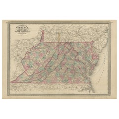
This is J. H. Young's pocket map of the Virginia, which shows county development current to 1835. The map was engraved by E. Yeager and F. Dankworth and published by S. A. Mitchell. Issued as a folding map and marketed towards travelers and tourists of the region, the map folds into a green cloth and gilt-tooled booklet for easy storage.
The map offers good detail of topography, rivers, towns and settlements of pre-Civil War Virginia. Only four railroads are shown at this time: Winchester to Harper's Ferry, Fredericksburg to Richmond, Petersburg to North Carolina, and Portsmouth to North Carolina.
The map includes an inset of the District of Columbia and Alexandria at upper left. The DC map is oriented and colored in its diamond configuration, prior to the 1846 retrocession of land back to Virginia. Eight significant landmarks, including the President's House and the Capitol, are identified and listed on the inset map. Tables showing steam boat routes and stage routes through Virginia are presented along the bottom and top right margins.
CONDITION:
The map was originally issued folding, so original fold lines are present. Several fold separations have been stabilized on verso with archival tape. Light scattered foxing throughout. Two small areas of loss (Campbell County and Delaware) have been repaired on both recto and verso with archival tape. Map measures 12 3/8" H x 15"W.
Map has been archivally presented attached to its original booklet. Booklet has green cloth boards and gilt tooling of title, " Mitchell's Map of Virginia," on front cover. Map is framed with acid-free mats, UV glass, and a custom-built wooden frame.
Framed Dimensions: 24 1/4" H x 25 3/4" W x 1 3/4" D
- Dimensions:Height: 24.25 in (61.6 cm)Width: 25.75 in (65.41 cm)Depth: 1.75 in (4.45 cm)
- Materials and Techniques:
- Place of Origin:
- Period:
- Date of Manufacture:1837
- Condition:Additions or alterations made to the original: Framed by Art Source International Framing in Boulder, Colorado in 2018. Wear consistent with age and use. Minor losses. Minor fading.
- Seller Location:Colorado Springs, CO
- Reference Number:
About the Seller
4.9
Platinum Seller
These expertly vetted sellers are 1stDibs' most experienced sellers and are rated highest by our customers.
Established in 2010
1stDibs seller since 2011
400 sales on 1stDibs
Typical response time: <1 hour
- ShippingRetrieving quote...Ships From: Colorado Springs, CO
- Return PolicyA return for this item may be initiated within 10 days of delivery.
More From This SellerView All
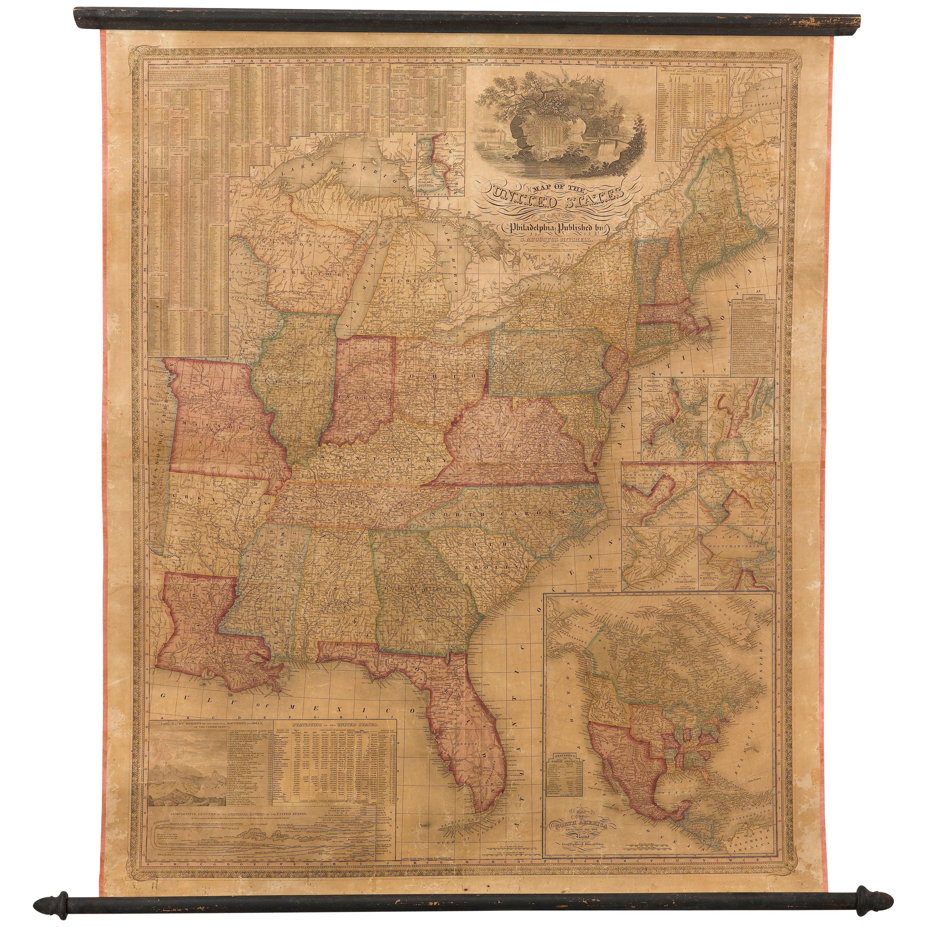
- 1842 Wall Map of the United States by J. H. Young, Published by S. A. MitchellLocated in Colorado Springs, COPresented is an 1842 hanging “Map of the United States,” engraved by J. H. Young and published by Samuel Augustus Mitchell, Philadelphia. This is a beautiful example of the rare 1842...Category
Antique 1840s American Maps
MaterialsPaper
- 1859 "Colton's New Map of the State of Texas..." by Johnson & BrowningLocated in Colorado Springs, COPresented is "Colton's New Map of the State of Texas Compiled from De Cordova's Large Map", published in Alivin J. Johnson’s “New Illustrated Family Atlas.” The map was published in ...Category
Antique 1850s American Maps
MaterialsPaper
- 1847 Antique Map of Mexico, Texas and California by Samuel Augustus MitchellBy Samuel Augustus Mitchell 1Located in Colorado Springs, COPresented is the second edition of Samuel Augustus Mitchell's Map of Mexico, Including Yucatan & Upper California, an important map showing the progress of the Mexican-American War. ...Category
Antique 1840s American Maps
MaterialsPaper
- 1861 Topographical Map of the District of Columbia, by Boschke, Antique MapLocated in Colorado Springs, COPresented is an original map of Albert Boschke's extremely sought-after "Topographical Map of the District of Columbia Surveyed in the Years 1856 ...Category
Antique 1860s American Historical Memorabilia
MaterialsPaper
- "Clason's Guide Map of Montana" by The Clason Map Company, Circa 1920sLocated in Colorado Springs, COPresented is “Clason's Guide Map of Montana,” published in the early 1920s by the Clason Map Company. Issued as a folding map, this map identifies county boundaries, county seats, Na...Category
Vintage 1920s American Art Deco Maps
MaterialsPaper
- 1908 "Map of Texas" by The Kenyon CompanyLocated in Colorado Springs, COPresented is an antique map of the state of Texas, printed as a pocket map in 1908 by The Kenyon Company. The state map is brightly colored by county, with principal cities and towns listed. The congressional districts are numbered and boldly outlined in red. Rivers, roads, and railroads all appear prominently on this fantastic map...Category
Antique Early 1900s American Maps
MaterialsPaper


You May Also Like
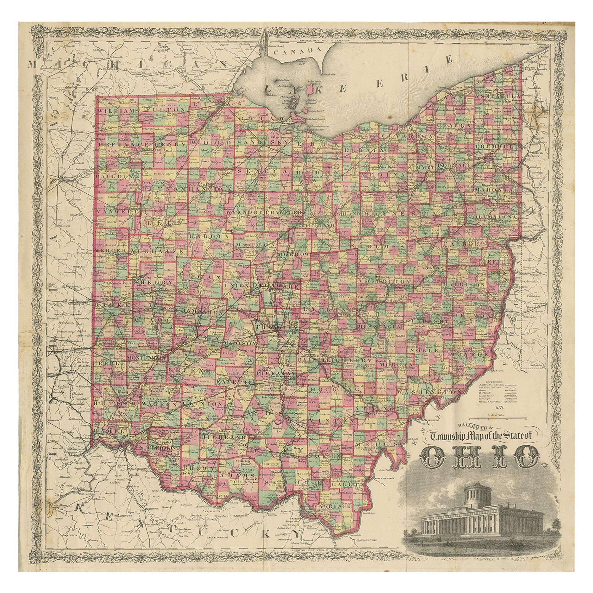
- Antique Map of the State of Ohio by Titus '1871'Located in Langweer, NLAntique map titled 'Railroad & Township Map of the State of Ohio'. Original antique map of the State of Ohio. This map originates from 'Atlas of Preble County Ohio' by C.O. Titus. Pu...Category
Antique Late 19th Century Maps
MaterialsPaper
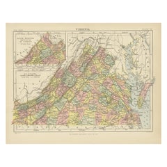
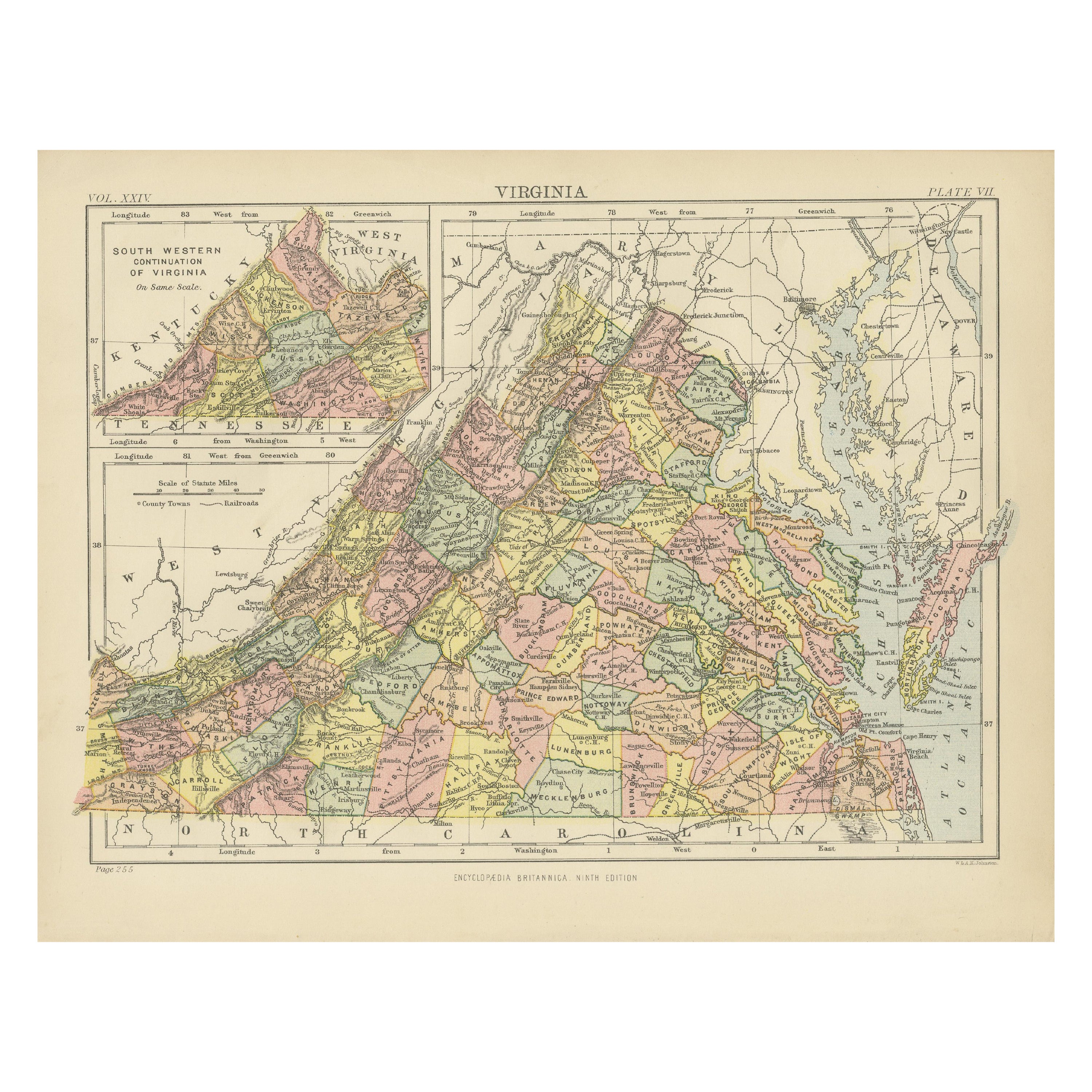
- Antique Map of Virginia, with Inset Map of the South Western ContinuationLocated in Langweer, NLAntique map titled 'Virginia'. Original antique map of Virginia, United States. With inset map of the south western continuation of Virginia. T...Category
Antique Late 19th Century Maps
MaterialsPaper
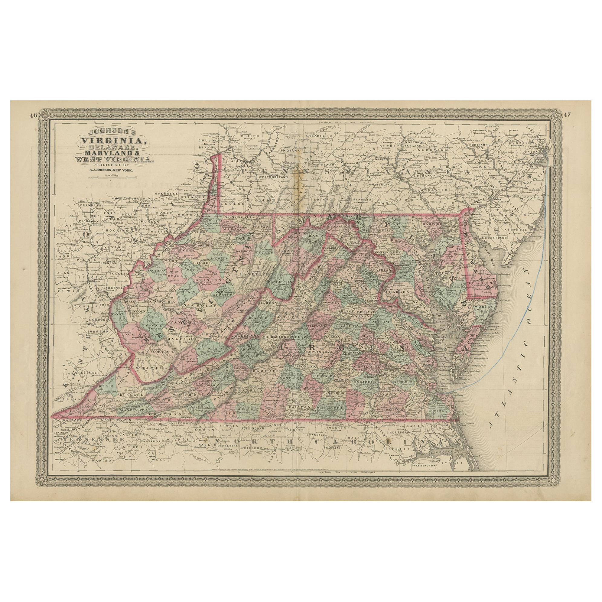
- Antique Map of Virginia, Delaware, Maryland & West Virginia by Johnson, 1872Located in Langweer, NLAntique map titled 'Johnson's Viriginia (..). Original map of Virginia, Delaware, Maryland and West Virginia. This map originates from 'Johnson's New I...Category
Antique Late 19th Century Maps
MaterialsPaper
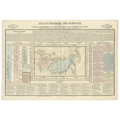
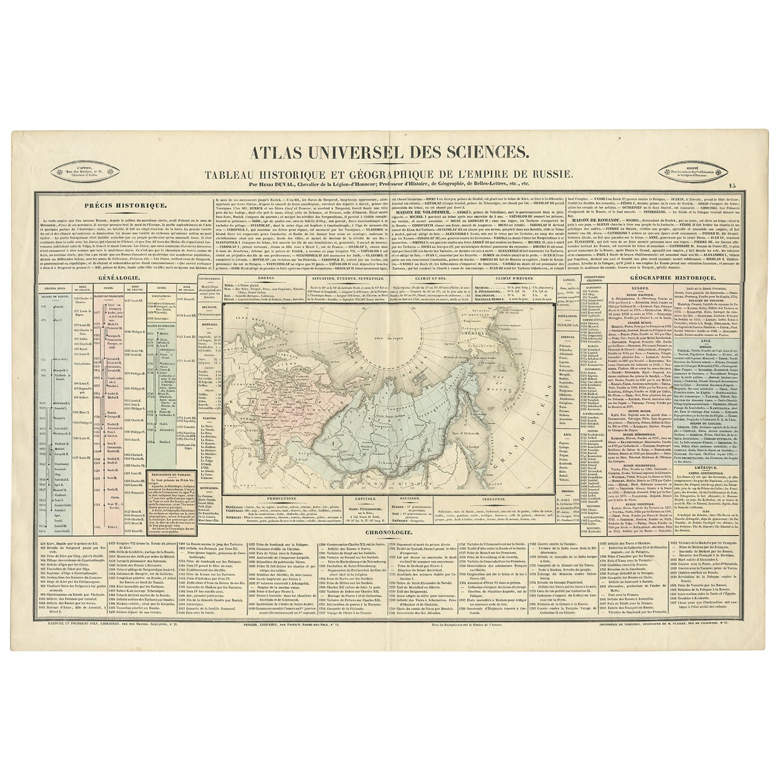
- Original French Antique Map of the Russian Empire, 1837Located in Langweer, NLAntique map titled 'Tableau Historique et Géographique de L'Empire de Russie'. Original antique map of the Russian Empire will detailed written information about the chronology, ...Category
Antique 1830s Maps
MaterialsPaper
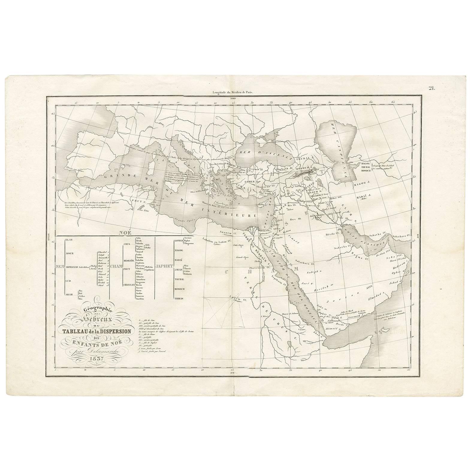
- Antique Map of Southern Europe by F. Delamarche, 1837Located in Langweer, NLTitle: Géographie des Hébreux ou Tableau de la Dispersion des enfants de Noé - **Origin**: From 'Atlas De La Géographie Ancienne' by F. Delamarche - **Date of Publication**: 1837 D...Category
Antique Mid-19th Century Maps
MaterialsPaper
- Antique Map of Virginia, with Inset Map of the Northern Part of West ViriginiaLocated in Langweer, NLAntique map titled 'West Virginia'. Original antique map of Virginia, United States. With inset map of the 'Panhandle' or northern part of West...Category
Antique Late 19th Century Maps
MaterialsPaper