Items Similar to Original French Antique Map of the Russian Empire, 1837


Want more images or videos?
Request additional images or videos from the seller
1 of 5
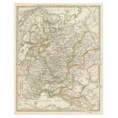
Original French Antique Map of the Russian Empire, 1837
About the Item
Antique map titled 'Tableau Historique et Géographique de L'Empire de Russie'.
Original antique map of the Russian Empire will detailed written information about the chronology, genealogy and geography. This map originates from 'Atlas Universel des Sciences' by H. Duval.
Artists and Engravers: Author: Henri Duval.
- Dimensions:Height: 16.15 in (41 cm)Width: 23.63 in (60 cm)Depth: 0 in (0.02 mm)
- Materials and Techniques:
- Period:
- Date of Manufacture:1837
- Condition:Condition: Very good, general age-related toning. Blind stamp top left, minor wear. Please study image carefully.
- Seller Location:Langweer, NL
- Reference Number:
About the Seller
5.0
Platinum Seller
These expertly vetted sellers are 1stDibs' most experienced sellers and are rated highest by our customers.
Established in 2009
1stDibs seller since 2017
1,922 sales on 1stDibs
Typical response time: <1 hour
- ShippingRetrieving quote...Ships From: Langweer, Netherlands
- Return PolicyA return for this item may be initiated within 14 days of delivery.
More From This SellerView All
- Original Antique Engraved Map of the Russian Empire, 1778Located in Langweer, NLDescription: Antique map titled 'A New and Correct Map of the Russian Empire'. Original antique map of the Russian Empire. This map originates from Moore's 'New and Complete Coll...Category
Antique 1770s Maps
MaterialsPaper
- Detailed Original Antique Map of the Russian Empire in Asia, 1750Located in Langweer, NLAntique map titled 'Partie Orientale de l'Empire de Russie en Asie (..)'. Detailed map of the Russian Empire in Asia. Artists and Engravers: Gilles Robert de Vaugondy (1688-1766) was the head of a leading family of geographers in eighteenth century France. Gilles got his start when he jointly inherited the shop of Pierre-Moullart Sanson, grandson of the famous geographer Nicholas Sanson. The inheritance included the business, its stock of plates, and a roller press...Category
Antique 1750s Maps
MaterialsPaper
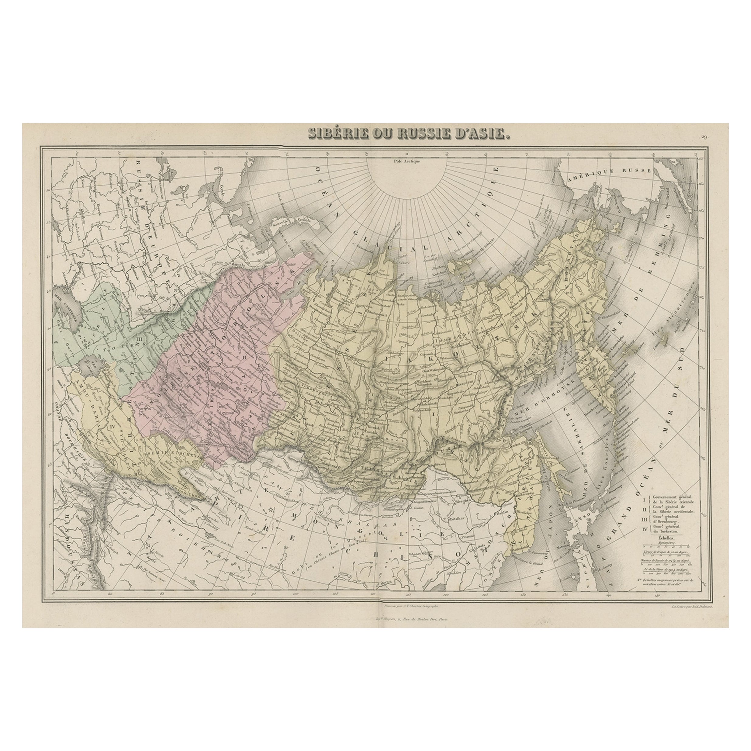
- Original Antique Map Covering the Russian Empire in Asia, 1880Located in Langweer, NLAntique map titled 'Sibérie ou Russie d'Asie'. Migeon's map covers the Russian empire in Asia from european Russia and the Ural Mountains to the Bering Strait and from the Arctic...Category
Antique 1880s Maps
MaterialsPaper
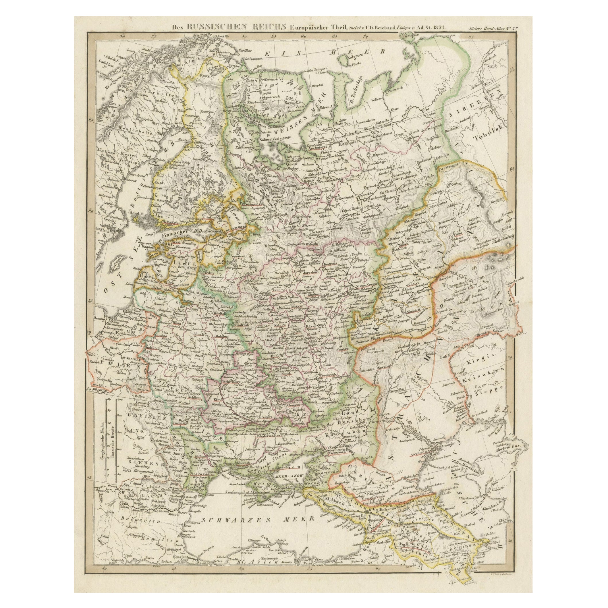
- Original Antique German Map of the Russian Empire in Europe, ca.1825Located in Langweer, NLAntique map titled 'Des Russischen Reichs - Europäische Theil'. Original antique map of the Russian Empire in Europe. This map originates from 'Stielers Handatlas'. Published circa...Category
Antique 1820s Maps
MaterialsPaper
- Antique Map of the Russian Empire by R. Bonne, 1780Located in Langweer, NLAntique map titled 'Carte de l'Empire de Russie.' Drawn by R. Bonne for G. Raynal’s Atlas de Toutes les Parties Connues du Globe Terrestre, Dressé pour l'Histoire Philosophique et Po...Category
Antique Late 18th Century Maps
MaterialsPaper
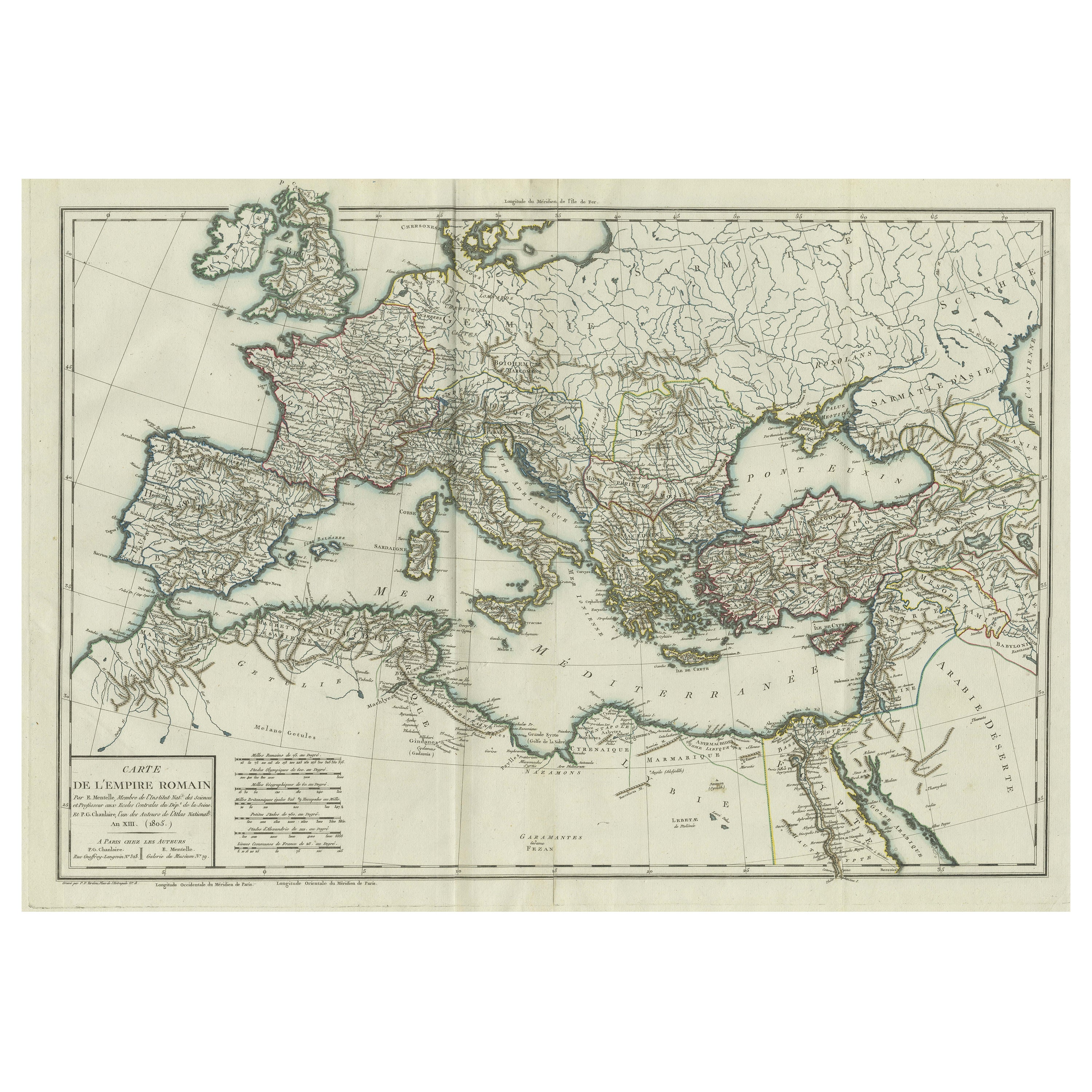
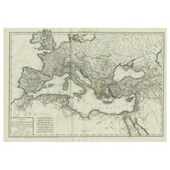
- Original Antique Map of the Roman EmpireLocated in Langweer, NLAntique map titled 'Carte de l'Empire Romain'. Original antique map of the Roman Empire, two sheets joined. Engraved by Pierre Francois Tardieu and published by Edme Mentelle, circa ...Category
Antique Late 18th Century Maps
MaterialsPaper


You May Also Like
- Original Antique Map of Russia By Arrowsmith. 1820Located in St Annes, LancashireGreat map of Russia Drawn under the direction of Arrowsmith Copper-plate engraving Published by Longman, Hurst, Rees, Orme and Brown, 1820 Unframed.Category
Antique 1820s English Maps
MaterialsPaper
- 1814 Map of "Russian Empire" Ric.r032Located in Norton, MA1814 Map of "Russian Empire" Ric.r032 Russian Empire. Description: This is an 1814 John Thomson map of the Russian Empire. The map depicts the region from the Baltic Sea, Prussia, and Sweden to the Aleutian Islands and from the Arctic Ocean to the Yellow River. Highly detailed, myriad cities, towns, and villages are labeled throughout, including St. Petersburg, Moscow, Minsk, Kiev, and Kharkov. Rivers and mountain ranges are also identified, as are islands and numerous locations along the coastlines. It is important to note that the long-disputed sea between Korea and Japan is identified as the 'Sea of Japan. Historical Context: In 1815, Tsarist Russia emerged from the Napoleonic Wars economically insolvent and politically fearful of the Revolutionary fervor that had just swept through Europe. In order to shore up Russia's economic position, the Tsars began an aggressive series of expansions into the Caucuses and Central Asia that would vastly increase the landmass of the Russian Empire. Publication History Thomson maps are known for their stunning color, awe inspiring size, and magnificent detail. Thomson's work, including this map, represents some of the finest cartographic art...Category
Antique 19th Century Unknown Maps
MaterialsPaper
- Super Rare Antique French Map of Chine and the Chinese Empire, 1780Located in Amsterdam, Noord HollandSuper Rare Antique French Map of Chine and the Chinese Empire, 1780 Very nice map of Asia. 1780 Made by Bonne. Additional information: Type: Map ...Category
Antique 18th Century European Maps
MaterialsPaper
- Large1852 Map "Russian Empire" Ric.r0011Located in Norton, MALarge 1852 map "Russian Empire" George Phillips & Son 1852 Ric.r0011 Dimension: Paper: 67 cm W x 52 cm H ; Sight: 60cm W x 50 cm H Condition: Good Condition with aged tonin...Category
Antique 19th Century Unknown Maps
MaterialsPaper
- Large Original Antique Map of The World, Fullarton, C.1870Located in St Annes, LancashireGreat map of the World. Showing both hemispheres From the celebrated Royal Illustrated Atlas Lithograph. Original color. Published by Fullarton, Edinburgh, C.1870 Unframed. Rep...Category
Antique 1870s Scottish Maps
MaterialsPaper
- Original Antique Map of the American State of Pennsylvania, 1889Located in St Annes, LancashireGreat map of Pennsylvania Drawn and Engraved by W. & A.K. Johnston Published By A & C Black, Edinburgh. Original colour Unframed. Repair to a minor tear on bottom edge.Category
Antique 1880s Scottish Victorian Maps
MaterialsPaper


Recently Viewed
View AllMore Ways To Browse
Empire Russian
Russia Empire
Antique Empire De
Russian Empire Furniture
Antique Science
Antique Russian Empire
Antique Russian Map
Tableau Antique
Antique Map Russia
Antique Map Of Russia
Antique Maps Of Russia
Antique Genealogy
H Duval
Antique Maps Of Russian Empire
Wood And Sons Plate
Antique Caribbean
Holland Utrecht
Antique Paper Globe