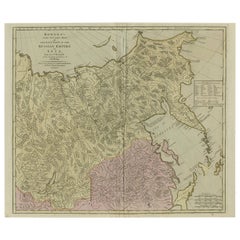
Antique Maps Of Russian Empire

6
to
8
45
12
32
16
15
10
10
10
7
6
6
5
5
4
3
2
2
2
2
1
1
1
1
1
1
1
1
1
1
1
1
1
1
2
1
1
1
1
Sort By
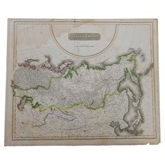
1814 Map of "Russian Empire" Ric.r032
Located in Norton, MA
1814 Map of "Russian Empire" Ric.r032 Russian Empire. Description: This is an 1814 John
Category

19th Century Unknown Antique Maps Of Russian Empire

Materials

Paper

Antique 1814 Map of "Russian Empire" Ric.r032
1814 Map of "Russian Empire" Ric.r032
H 20.87 in W 24.81 in D 0.4 in
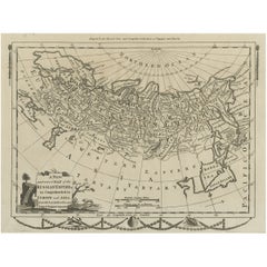
Original Antique Engraved Map of the Russian Empire, 1778
Located in Langweer, NL
Description: Antique map titled 'A New and Correct Map of the Russian Empire'. Original antique
Category

1770s Antique Maps Of Russian Empire

Materials

Paper

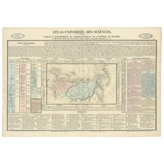
Original French Antique Map of the Russian Empire, 1837
Located in Langweer, NL
map of the Russian Empire will detailed written information about the chronology, genealogy and
Category

1830s Antique Maps Of Russian Empire

Materials

Paper

Antique Map of the Russian Empire in Europe, ca.1780
Located in Langweer, NL
Description: Antique map titled 'Bowles's New Pocket Map of the Russian Empire in Europe
Category

1780s Antique Maps Of Russian Empire

Materials

Paper

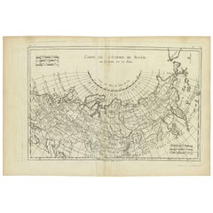
Antique Map of the Russian Empire by R. Bonne, 1780
Located in Langweer, NL
Antique map titled 'Carte de l'Empire de Russie.' Drawn by R. Bonne for G. Raynal’s Atlas de Toutes
Category

Late 18th Century Antique Maps Of Russian Empire

Materials

Paper

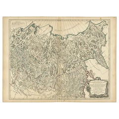
Detailed Original Antique Map of the Russian Empire in Asia, 1750
Located in Langweer, NL
Antique map titled 'Partie Orientale de l'Empire de Russie en Asie (..)'. Detailed map of the
Category

1750s Antique Maps Of Russian Empire

Materials

Paper

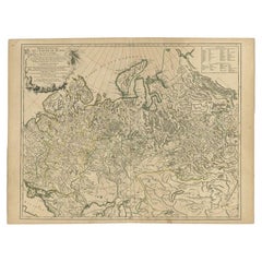
Antique Map of the Russian Empire in Europe by Vaugondy, 1750
Located in Langweer, NL
Antique map titled 'Partie Occidentale de l'Empire de Russie (..)'. Detailed map of the western
Category

18th Century Antique Maps Of Russian Empire

Materials

Paper

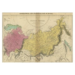
Old Map of the Russian Empire, with English Language Text, Ca.1820
Located in Langweer, NL
Antique map titled 'Geographical, Statistical and Historical Map of Russia'. Old map of the
Category

1820s Antique Maps Of Russian Empire

Materials

Paper

Large and Detailed Map of the Russian Empire in Asia, ca.1780
Located in Langweer, NL
Description: Antique map titled 'Bowles's New Pocket Map of the East Part of the Russian Empire in
Category

1780s Antique Maps Of Russian Empire

Materials

Paper

Original Antique German Map of the Russian Empire in Europe, ca.1825
Located in Langweer, NL
Russian Empire in Europe. This map originates from 'Stielers Handatlas'. Published circa 1825. Artists
Category

1820s Antique Maps Of Russian Empire

Materials

Paper

Original Antique Map Covering the Russian Empire in Asia, 1880
Located in Langweer, NL
Antique map titled 'Sibérie ou Russie d'Asie'. Migeon's map covers the Russian empire in Asia
Category

1880s Antique Maps Of Russian Empire

Materials

Paper

Antique Map of the Extension of the Russian Empire in the XIXth Century, 1806
Located in Langweer, NL
Russian Empire at the beginning of the XIXth century. Several letterpress notations are present on the map
Category

Early 1800s Antique Maps Of Russian Empire

Materials

Paper

Antique Map of Western Tartary and the Gobi Desert of the Russian Empire, c.1750
Located in Langweer, NL
. Kyrillow's Map of the Russian Empire'. Map of the Gobi Desert and the eastern portion of the Silk Route
Category

18th Century Antique Maps Of Russian Empire

Materials

Paper

Antique Map of Old European Russia, 1846
Located in Langweer, NL
Antique map titled 'Russia in Europe'. Old map of European Russia. This map originates from 'A New
Category

19th Century Antique Maps Of Russian Empire

Materials

Paper

Antique Map of Old European Russia, 1846
H 17.13 in W 13.78 in D 0 in
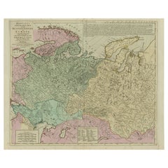
Antique Map of West Russia, with Title a New Map of Moskovy, 1741
Located in Langweer, NL
Russian Empire (1721–1917). Antique map of West Russia, originates from 'Geography Anatomiz'd or the
Category

1740s Antique Maps Of Russian Empire

Materials

Paper

Antique Map of Siberia and Russia, c.1885
Located in Langweer, NL
in Asia. Migeon's map covers the Russian empire in Asia from european Russia and the Ural Mountains
Category

19th Century Antique Maps Of Russian Empire

Materials

Paper

Antique Map of Siberia and Russia, c.1885
H 13.39 in W 18.71 in D 0 in
Antique Map of Southern Russia by Johnston, 1882
Located in Langweer, NL
"Antique map titled 'South-West Russia'. Old map of southern Russia, also showing the extent of the
Category

19th Century Antique Maps Of Russian Empire

Materials

Paper

Antique Map of Russia and Siberia by Migeon, 1880
Located in Langweer, NL
Antique map titled 'Sibérie ou Russie d'Asie'. Migeon's map covers the Russian empire in Asia from
Category

19th Century Antique Maps Of Russian Empire

Materials

Paper

Antique Map of Russia and Central Asia, showing the Northeast Passage
Located in Langweer, NL
Central Asia, showing the Northeast Passage. The map covers the entirety of the Russian Empire at the time
Category

Mid-18th Century Antique Maps Of Russian Empire

Materials

Paper

Old Map of Southern Russia, Incl the Extent of the Kingdom of Poland, 1882
Located in Langweer, NL
Antique map titled 'South-West Russia'. Old map of southern Russia, also showing the extent of
Category

1880s Antique Maps Of Russian Empire

Materials

Paper

Set of 2 Antique Maps of Russia in Europe by W. G. Blackie, 1859
Located in Langweer, NL
Antique map titled 'Russia in Europe'. Original antique map of Russia in Europe with inset maps of
Category

Mid-19th Century Antique Maps Of Russian Empire

Materials

Paper

Imperial Frontiers: A 19th Century Map of Southern Russia and the Caucasus, 1882
Located in Langweer, NL
cultures. Provincial boundaries within the Russian Empire are outlined and shaded with different colors
Category

1880s Antique Maps Of Russian Empire

Materials

Paper

Detailed Antique Cartography of Asian Russia, 1882
Located in Langweer, NL
'. Published by the esteemed Blackie and Son, this map details the vast expanse of Russia within the Asian
Category

1880s Antique Maps Of Russian Empire

Materials

Paper

Map of Independent Tartary with Vignettes of the Region's Culture, 1851
Located in Langweer, NL
The map of Independent Tartary is part of the collection by John Tallis & Company, which were
Category

1850s Antique Maps Of Russian Empire

Materials

Paper

Arctic Exploration: An Original Map of the North Circumpolar Regions, 1882
Located in Langweer, NL
This map, extracted from the 1882 atlas by Blackie & Son, presents the North Circumpolar Regions in
Category

1880s Antique Maps Of Russian Empire

Materials

Paper

Oriental Realms: A Detailed Map of Persia, Afghanistan, and Beloochistan, 1882
Located in Langweer, NL
the period, offering a snapshot of the Great Game era when the British and Russian empires vied for
Category

1880s Antique Maps Of Russian Empire

Materials

Paper

1839 Map of Karte Des "Russischen Reiches in Europa Und Asien" Ric.R0013
Located in Norton, MA
and Asian parts of Russian Empire. Karte der Russischen Reiches in Europa und Asien. 1tes Blatt, 1824
Category

19th Century Unknown Antique Maps Of Russian Empire

Materials

Paper

Hand-Colored 18th Century Homann Map of the Black Sea, Turkey and Asia Minor
By Johann Baptist Homann
Located in Alamo, CA
An attractive original early 18th century hand-colored map of the Black Sea and Turkey entitled
Category

Early 18th Century German Antique Maps Of Russian Empire

Materials

Paper

Black Sea in Antiquity: Pontus Euxinus Map, Published in 1880
Located in Langweer, NL
important ancient empires and peoples. **Features of the map include:** 1. **Regional Focus**: It focuses
Category

1880s Antique Maps Of Russian Empire

Materials

Paper

Black Sea in Antiquity: Pontus Euxinus Map, Published in 1880
Free Shipping
H 15.56 in W 18.51 in D 0 in
Original Antique Engrving of Chinese Tartary in the 18th Century, 1737
Located in Langweer, NL
, which includes a country dependent on Russia to the west of NIPTCHOU. " This map, originating from the
Category

1730s Antique Maps Of Russian Empire

Materials

Paper

Mid-19th Century Persian Tribal Bidjar Rug
Located in Los Angeles, US
mercy of invading cultures for thousands of years. Military invasions from Russia and Europe have
Category

19th Century Tribal Antique Maps Of Russian Empire

Materials

Wool, Cotton

Mid-19th Century Persian Tribal Bidjar Rug
Free Shipping
W 50 in L 78 in
Antique Bidjar Rug with Floral Design 17'8''x11'7''
Located in Los Angeles, US
mercy of invading cultures for thousands of years. Military invasions from Russia and Europe have
Category

Early 1900s Asian Other Antique Maps Of Russian Empire

Materials

Wool, Cotton

Map of the Russian Empire: An Original 18th Century Hand-colored Map by E. Bowen
Located in Alamo, CA
Voyages and Travels". This highly detailed and colorful map depicts the Russian Empire, as it was known in
Category

Mid-18th Century Old Masters Antique Maps Of Russian Empire

Materials

Engraving

Antique rare amusing Russian silver model of a bear, St Petersburg, circa 1890
Located in Tel Aviv - Jaffa, IL
Dramatic plays since as early as the 16th century, and relating alike to the Russian Empire, The Russian
Category

1890s Russian Antique Maps Of Russian Empire

Materials

Onyx, Silver

A huge pair of 21 inches Cruchley Library Globes
By G.F. Cruchley
Located in ZWIJNDRECHT, NL
remained unexplored and undeveloped. In Europe, there was still the ‘Russian Empire’, the ‘Ottoman Empire
Category

1850s British Victorian Antique Maps Of Russian Empire

Materials

Other

First Edition Guthrie's Geographical Grammmar in Miniature, 1807
Located in Langweer, NL
worldmap and maps of Scandinavia, the Russian dominions, Great Britain and Ireland, France, Belgium ("The
Category

Early 19th Century Antique Maps Of Russian Empire

Materials

Paper

Map: Russian Empire
By William Home Lizars
Located in Florham Park, NJ
Russian Empire (with) Chart of the Communication between the Archipelago and Black Sea The
Category

19th Century Antique Maps Of Russian Empire

Map:  Russian Empire
H 33.5 in W 48 in
German Antique Map of the Russian Empire in Europe, c.1825
Located in Langweer, NL
Antique map titled 'Des Russischen Reichs - Europäische Theil'. Original antique map of the Russian
Category

19th Century Antique Maps Of Russian Empire

Materials

Paper

German Antique Map of the Russian Empire in Europe, c.1825
Free Shipping
H 16.34 in W 13.39 in D 0 in
Antique Map of Russia in Europe by Johnston, 1882
Located in Langweer, NL
Antique map titled 'European Russia'. Old map of Russia in Europe. This map originates from 'The
Category

19th Century Antique Maps Of Russian Empire

Materials

Paper

Original Antique Decorative Map of Russia / Kamchatka, Fullarton, C.1870
Located in St Annes, Lancashire
Great map of the Russian Empire including Kamchatka and the Aral Sea Wonderful figural border
Category

1870s Scottish Antique Maps Of Russian Empire

Materials

Paper

Antique Map of Poland and Lithuania, c.1744
Located in Langweer, NL
as parts of Germany, the Russian Empire, Hungary, Transylvania, and Latvia. Artists and Engravers
Category

18th Century Antique Maps Of Russian Empire

Materials

Paper

Antique Map of China and Japan by E. Stanford, 1900
By E. Stanford
Located in Langweer, NL
Russian Empire, India, Burma, &c.'. Large folding map of the Far East.
Category

Early 20th Century English Antique Maps Of Russian Empire

Materials

Linen, Paper

Original Antique WWI Poster Map War Is The National Industry Of Prussia Octopus
Located in London, GB
Original antique World War One map poster portraying Prussia as an octopus stretching its tentacles
Category

1910s French Antique Maps Of Russian Empire

Materials

Paper

Pair of Monumental Louis Revival Ormolu and Porphyry Candelabra 19th Century
Located in London, GB
its purchase from the Russian Empire, an enemy of France.  
Category

1860s Antique Maps Of Russian Empire

Materials

Porphyry, Ormolu

Antique Tribal Bidjar Persian Rug
Located in New York, NY
mercy of invading cultures for thousands of years. Military invasions from Russia and Europe have
Category

Late 19th Century Persian Tribal Antique Maps Of Russian Empire

Materials

Wool

Early 17th Century Dutch Miniature Antique Map of The Russian Empire, 1616
Located in Langweer, NL
This rare miniature map of Russia covers the Russian Empire in Eastern Europe and is embellished
Category

1610s Antique Maps Of Russian Empire

Materials

Paper

Original Antique Map of the Russian Empire in Europe with Nice Cartouche, 1793
Located in Langweer, NL
was part of a larger map of two sheets. The map depicts the Russian Empire in Europe. With decorative
Category

1790s Antique Maps Of Russian Empire

Materials

Paper

Antique Map of Saint Petersburg and Surroundings in Russia '1847'
Located in Langweer, NL
significant change and development in the Russian Empire. During the mid-19th century, Saint Petersburg was
Category

Mid-19th Century Antique Maps Of Russian Empire

Materials

Paper

Antique Map of Saint Petersburg and Surroundings in Russia '1847'
1 bid
No Reserve
H 9.06 in W 11.23 in D 0.02 in
19th Century Map Imperial Court of Austria Habsburgs
Located in London, GB
Germany, Kingdom of Hungary, Empire of Russia, Kingdom of Croatia, Second Mexican Empire, Kingdom of
Category

1820s Spanish Antique Maps Of Russian Empire

Antique Map of the Altai Mountains and Surroundings by Tardieu, 1783
Located in Langweer, NL
Altai Mountains in Central Russia. Detailed map of northern Khazakistan and southern Russia. The map
Category

18th Century Antique Maps Of Russian Empire

Materials

Paper

Napoleon's Expedition to Russia by Count De Segur, 2-Volumes, 1825
Located in Colorado Springs, CO
De Segur, Count Philip. Napoleon's Expedition to Russia. London: Treuttel and Wurtz, 1825. Octavo
Category

1820s Antique Maps Of Russian Empire

Maison Odiot Paris, French Art Nouveau Rock Crystal and Silver Claret Jug
By Maison Odiot Paris
Located in New York, NY
world map. The splendor of the Empire era echoed magnificently in his work. Numerous orders from
Category

Early 1900s French Art Nouveau Antique Maps Of Russian Empire

Materials

Silver

After Henri Matisse - Blue Nude
By (after) Henri Matisse
Located in Collonge Bellerive, Geneve, CH
times. The coming of the railway had put Bohain on the industrial map, but people still traveled
Category

1920s Abstract Impressionist Antique Maps Of Russian Empire

Materials

Lithograph

Vegetables
By (after) Henri Matisse
Located in Collonge Bellerive, Geneve, CH
on the industrial map, but people still traveled everywhere on foot or horseback. Matisse’s father
Category

1920s Modern Antique Maps Of Russian Empire

Materials

Lithograph

Vegetables
Vegetables
H 31.5 in W 23.63 in D 0.04 in
Henri Matisse - The Saint Michel Bridge - Original Etching
By Henri Matisse
Located in Collonge Bellerive, Geneve, CH
on the industrial map, but people still traveled everywhere on foot or horseback. Matisse’s father
Category

1920s Modern Antique Maps Of Russian Empire

Materials

Etching

Original Antique WWI Poster Map War Is The National Industry Of Prussia Octopus
Located in London, GB
Original antique World War One map poster portraying Prussia as an octopus stretching its tentacles
Category

1910s Antique Maps Of Russian Empire

Materials

Paper

Map of the World, 1905, on Retractable Wooden Roller
Located in Madison, WI
empires of England, Russia and China.
Category

Early 20th Century Scottish British Colonial Antique Maps Of Russian Empire

Materials

Paper, Wood

Map of the World, 1905, on Retractable Wooden Rolle, Antique, Archival
Located in Madison, WI
empires of England, Russia and China. As the world goes digital, human perspective becomes limited to a
Category

Early 20th Century Scottish British Colonial Antique Maps Of Russian Empire

Materials

Paper

Get Updated with New Arrivals
Save "Antique Maps Of Russian Empire", and we’ll notify you when there are new listings in this category.

Antique Maps Of Russian Empire For Sale on 1stDibs

Find many varieties of an authentic antique maps of russian empire available at 1stDibs. An antique maps of russian empire — often made from paper — can elevate any home. You’ve searched high and low for the perfect antique maps of russian empire — we have versions that date back to the 18th Century alongside those produced as recently as the 19th Century are available.

How Much is a Antique Maps Of Russian Empire?

Prices for an antique maps of russian empire can differ depending upon size, time period and other attributes — at 1stDibs, they begin at $153 and can go as high as $929, while the average can fetch as much as $383.

Read More

Pamela Shamshiri Shares the Secrets behind Her First-Ever Book and Its Effortlessly Cool Interiors

The sought-after designer worked with the team at Hoffman Creative to produce a monograph that beautifully showcases some of Studio Shamshiri's most inspiring projects.

Moroccan Artworks and Objects Take Center Stage in an Extraordinary Villa in Tangier

Italian writer and collector Umberto Pasti opens the doors to his remarkable cave of wonders in North Africa.

Montecito Has Drawn Royalty and Celebrities, and These Homes Are Proof of Its Allure

Hollywood A-listers, ex-pat aristocrats and art collectors and style setters of all stripes appreciate the allure of the coastal California hamlet — much on our minds after recent winter floods.

Whaam! Blam! Pow! — a New Book on Pop Art Packs a Punch

Publishing house Assouline and writer Julie Belcove have teamed up to trace the history of the genre, from Roy Lichtenstein, Andy Warhol and Yayoi Kusama to Mickalene Thomas and Jeff Koons.

The Sparkling Legacy of Tiffany & Co. Explained, One Jewel at a Time

A gorgeous new book celebrates — and memorializes — the iconic jeweler’s rich heritage.

What Makes a Gem-Encrusted Chess Set Worth $4 Million?

The world’s most opulent chess set, weighing in at 513 carats, is literally fit for a king and queen.

Tauba Auerbach’s Geometric Pop-Up Book Is Mighty Rare, Thanks to a Hurricane

This sculptural art book has an epic backstory of its own.

Step inside the Storied Mansions of Palm Beach’s Most Effervescent Architect

From Spanish-style courtyards to fanciful fountains, these acclaimed structures abound in surprising and elegant details.