Items Similar to Original Antique Engrving of Chinese Tartary in the 18th Century, 1737
Want more images or videos?
Request additional images or videos from the seller
1 of 7
Original Antique Engrving of Chinese Tartary in the 18th Century, 1737
About the Item
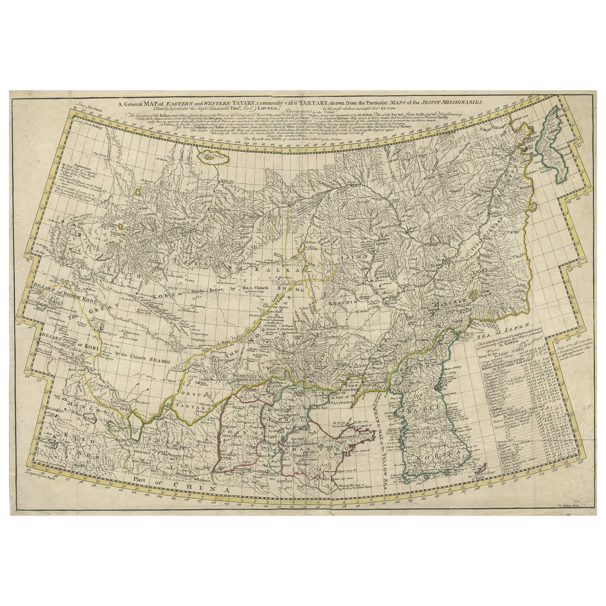
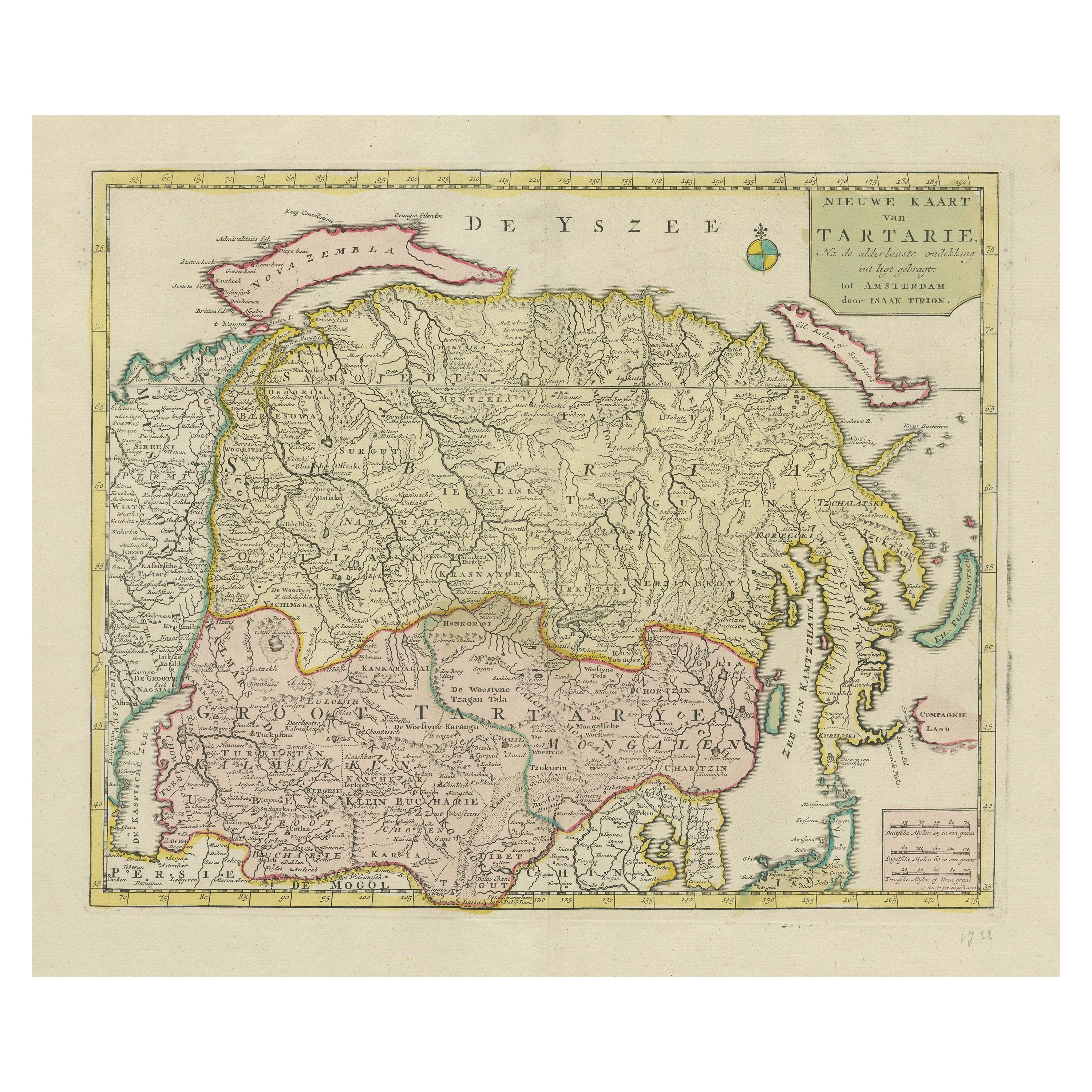
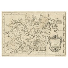
The antique map titled " Ozieme feuille particuls de la Tartarie Chinoise, qui contient un pays dependant de la russie aucouchant de NIPTCHOU " translates to "Sixth sheet of parts of Chinese Tartary, which includes a country dependent on Russia to the west of NIPTCHOU. " This map, originating from the 18th century, is a part of a series delineating sections of the Chinese Tartary region.
It specifically highlights a territory within Chinese Tartary, situated to the west of NIPTCHOU, likely referencing the Nizhny Novgorod region in Russia. These maps aimed to provide geographic insights into regions within Chinese Tartary, detailing boundaries, cities, rivers, and topographical features.
As a historical artifact, this map contributes to the understanding of territorial demarcations and geographic knowledge prevalent during the 18th century. The map's details and cartographic accuracy offer valuable insights into the region's landscape and the geopolitical relationships between China and Russia at that time.
Source; Map of the Chinese Tartary. Relief shown pictorially.
D'Anville's map showcases the northern region adjacent to Mongolia, emphasizing rivers, sparse settlements, and the road linking Niptchou (or Nerzinskoi) to Beijing. The map's eastern portion marks the road's beginning, and a decorative cartouche adds ornamental detail.
An anonymous French source from 1765 describes Nerzinskoi as a fortified city-state under the Grand Duke of Muscovy, positioned in Siberia and serving as the provincial capital of the Nerz dows. Inhabited by pagans, it boasts a robust garrison and enjoys the Czar's protective patronage.
New atlas of China, Chinese Tartary and Tibet. drawn up by Jean Baptiste Bourguignon d’ Anville. The first edition of "the principal cartographic authority on China during the 18th century ". It was the second major atlas of China produced in Europe following the Martini/ Blaeu Novus Atlas Sinensis 1655. Atlas composed of general & special maps of these countries, as well as the map of the Kingdom of Korea. Includes engraved title page, with index “Liste et ordre des cartes comprises dans cet atlas ”,12 pages of descriptive text by a Swedish officer and 42 engraved maps, with decorative cartouches and compass roses. Some maps bound out of sequence, some folded and some outline hand color. Descriptive text on some maps. Includes a general map of Tibet together with 9 regional maps and 12 maps of Chinese Tartary. Maps 3, 11, 12 show Great Wall of China. Map 18 shows Japan. Maps show topography, vegetation, waterways, ports, roads. Some maps include notes. Relief shown pictorially. D'Anville's maps also appeared in du Halde's 1732 "Description geographique historique... de l'Empire de la Chine et de la Tartarie Chinoise." Based on Jesuit sources, D' Anville's maps remained the definitive European rendering of China's provinces until the end of the 19th century. "The Kangxi Emperor employed Jesuit brothers (1708–18) to produce maps of the provinces of China using a combination of Western and Chinese survey methods. The maps were completed by 1721. They were sent back to Europe and became the basis for maps of China produced by Jean Baptiste Bourguignon d’ Anville in 1735. The main changes from traditional Chinese mapping were to use latitude and longitude as primary coordinates, map them using a spherical projection, and use astronomical measurements of latitude and longitude to establish baselines. Changes in latitude and longitude were found using traditional metric survey and relationships between distance north–south and latitude and distance east–west and longitude to convert to degrees.
- Dimensions:Height: 11.42 in (29 cm)Width: 18.9 in (48 cm)Depth: 0 in (0.02 mm)
- Materials and Techniques:Paper,Engraved
- Period:1730-1739
- Date of Manufacture:1737
- Condition:Good conditon. Strong paper. Later hand coloring.
- Seller Location:Langweer, NL
- Reference Number:Seller: BGJC-001701stDibs: LU3054337328192
About the Seller
5.0
Platinum Seller
These expertly vetted sellers are 1stDibs' most experienced sellers and are rated highest by our customers.
Established in 2009
1stDibs seller since 2017
1,922 sales on 1stDibs
Typical response time: <1 hour
- ShippingRetrieving quote...Ships From: Langweer, Netherlands
- Return PolicyA return for this item may be initiated within 14 days of delivery.
Auctions on 1stDibs
Our timed auctions are an opportunity to bid on extraordinary design. We do not charge a Buyer's Premium and shipping is facilitated by 1stDibs and/or the seller. Plus, all auction purchases are covered by our comprehensive Buyer Protection. Learn More
More From This SellerView All
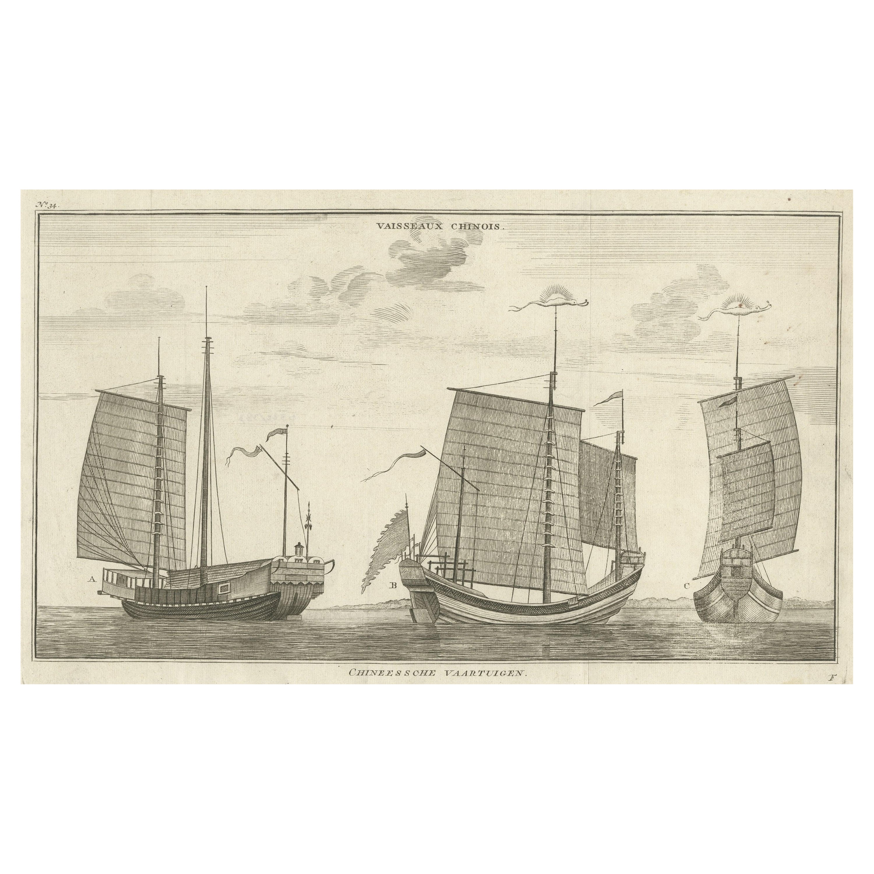
- Antique Original Engraving of Chinese Vessels in the 18th Century, 1765Located in Langweer, NLDescription: Plate no.34: 'Vaisseaux chinois.' (Chinese vessels.) This original auhentic plate originates from: 'Reize rondom de werreld, Gedaan in de jaaren 1740 tot 1744, door den ...Category
Antique 1760s Prints
MaterialsPaper
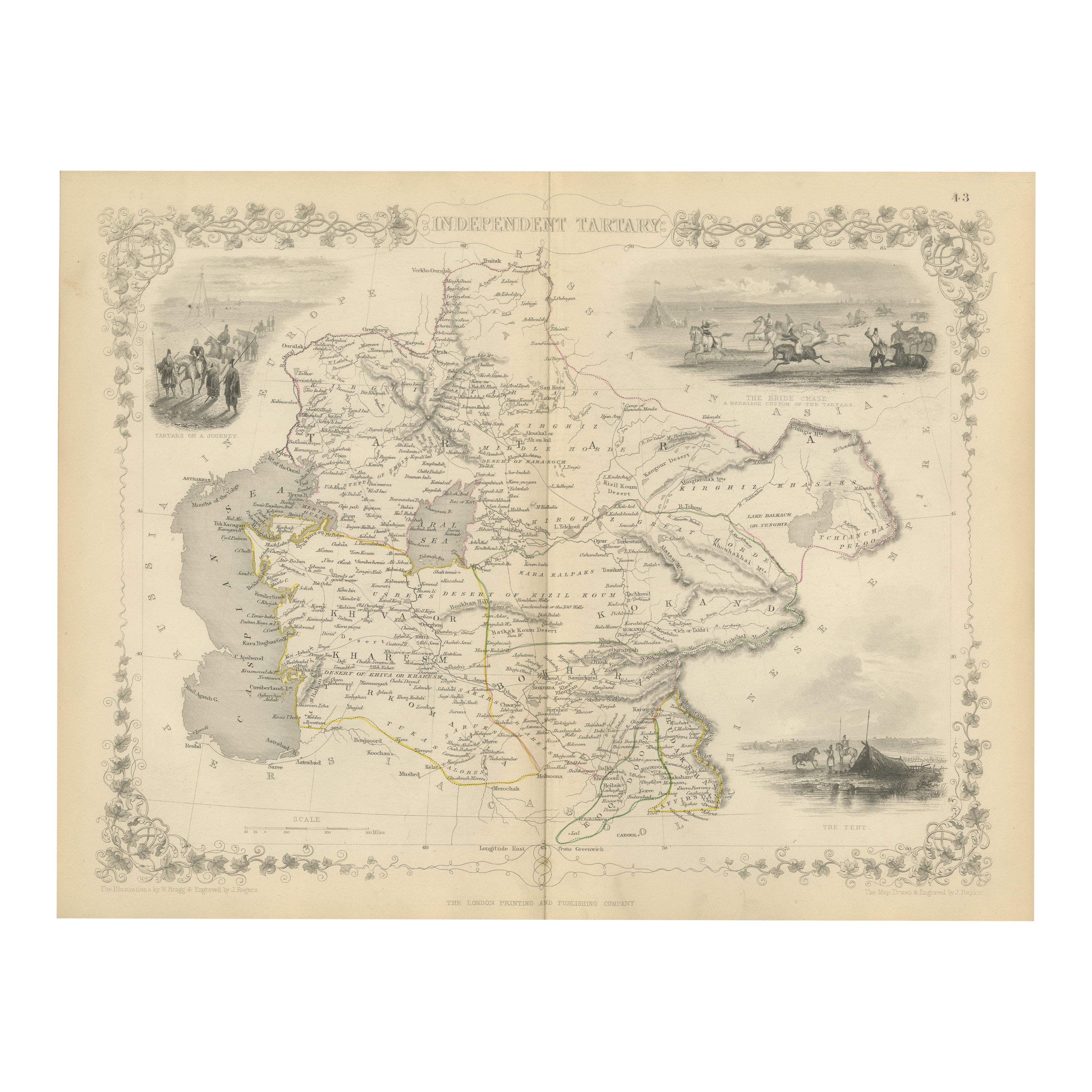
- Antique Map of Tartary, Also Showing the Great Wall of ChinaLocated in Langweer, NLAntique map titled 'Carte de Tartarie'. Detailed map of Tartary, consisting of the Eastern part of Russia, Central Asia, China and Korea, first published by Guillaume De L'Isle in 1706. The map extends from the Peninsula of Korea in the east to the Caspian and Black Seas. The Great Wall of China...Category
Antique Early 18th Century Maps
MaterialsPaper
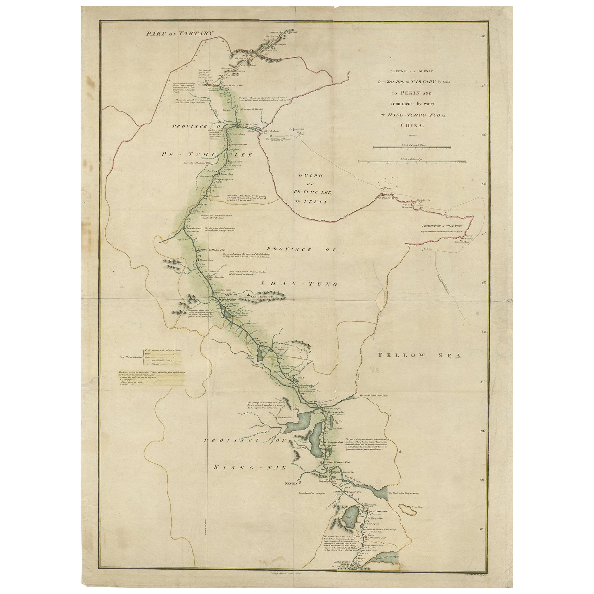
- Original Antique Map of Tartary 'Northern China & Far Eastern Russia', 1757Located in Langweer, NLAntique map titled 'Carte de la Tartarie Orientale (..)'. Original antique map of what is present day northern China and far eastern Russia. Centere...Category
Antique 1750s Maps
MaterialsPaper
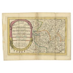
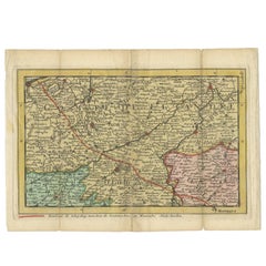
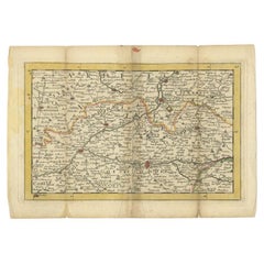
- Antique Map of the Region of Beauvais in France, 1737Located in Langweer, NLUntitled map of the region of Beauvais, France. This map originates from 'Nieuw en beknopt Kaart-Boekje vertoonende de XVII. Nederlandse Provintien (..)'. Artists and Engravers: Au...Category
Antique 18th Century Maps
MaterialsPaper
- Antique Map of the Region of Flanders in Belgium, 1737Located in Langweer, NLUntitled map of the region of Flanders, Belgium. This map originates from 'Nieuw en beknopt Kaart-Boekje vertoonende de XVII. Nederlandse Provintien (..)'. Artists and Engravers: A...Category
Antique 18th Century Maps
MaterialsPaper
- Antique Map of the Region of Soissons in France, 1737Located in Langweer, NLUntitled map of the region of Soissons, France. This map originates from 'Nieuw en beknopt Kaart-Boekje vertoonende de XVII. Nederlandse Provintien (..)'. Artists and Engravers: A...Category
Antique 18th Century Maps
MaterialsPaper
You May Also Like
- French Furniture of the 18th CenturyBy Pierre VerletLocated in valatie, NYFrench Furniture of the 18th century by Pierre Verlet and Penelope Hunter-Stiebel (Translator). University Press of Virginia, Charlottesville, VA, 1991. First edition thus hardcover ...Category
1990s American Books
MaterialsPaper
- Antique 18th Century Map of the Province of Pensilvania 'Pennsylvania State'Located in Philadelphia, PAA fine antique of the colony of Pennsylvania. Noted at the top of the sheet as a 'Map of the province of Pensilvania'. This undated and anonymous map is thought to be from the Gentleman's Magazine, London, circa 1775, although the general appearance could date it to the 1760's. The southern boundary reflects the Mason-Dixon survey (1768), the western boundary is placed just west of Pittsburgh, and the northern boundary is not marked. The map has a number of reference points that likely refer to companion text and appear to be connected to boundaries. The western and southern boundaries are marked Q, R, S, for example. A diagonal line runs from the Susquehanna R to the Lake Erie P. A broken line marked by many letters A, B, N, O, etc., appears in the east. There are no latitude or longitude markings, blank verso. Framed in a shaped contemporary gilt wooden frame and matted under a cream colored matte. Bearing an old Graham Arader Gallery...Category
Antique 18th Century British American Colonial Maps
MaterialsPaper
- 18th Century the Immaculate Conception, UnsignedLocated in Virum, DKPainter unknown, 18th century: The immaculate conception. Unsigned. Oil on canvas laid on canvas. Ca. 67 × 52 cm. Unframed.Category
Antique Mid-18th Century Italian Paintings
MaterialsCanvas

- 18th Century Italian Rustic Antique Kneeler in Larch WoodLocated in Casale Monferrato, ITRare antique Italian kneeler, very rustic in larch wood. Completely original and in its old condition, it has not been restored. Place this elegant antique Arma Christi...Category
Antique 1780s Italian Religious Items
MaterialsWood
- Original 18th Century Tyrolean Spinning Wheel in Walnut, Still WorkingLocated in Vigonza, PaduaA museum tool, made entirely by hand that recalls the peasant culture of the past.Category
Antique 18th Century Austrian Antiquities
MaterialsWalnut
- Pair of 18th Century Italian Puttini in GiltwoodLocated in Atlanta, GAA delightful pair of 18th century Italian puttini or cherubs in giltwood. Wonderfully carved with delicate features - lending this pair elegance and charm.Category
Antique 18th Century Italian Figurative Sculptures
MaterialsWood

Recently Viewed
View AllMore Ways To Browse
Antique Map Of North And East Asia 1751
Map Of Mississippi
Bedfordshire Antique Map
Auge En Pierre
Covens & Mortier On Sale
Larousse Universel
Staffordshire Antique Map
Staffordshire Map
Tam Austria
Antique Furniture Manitoba
Nova Hollandia
William Wyld
Matthew Seutter On Sale
Menorca Map
Pierre Fran�ois Tardieu On Sale
Rand Mcnally Map Of Kansas
Sumba Map
1681 Moses Pitt