Items Similar to Antique Map of the Journey from Zhe-Hol in Tartary to Beijing and Hang-Tchoo Foo

Want more images or videos?
Request additional images or videos from the seller
1 of 6
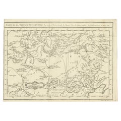
Antique Map of the Journey from Zhe-Hol in Tartary to Beijing and Hang-Tchoo Foo
About the Item
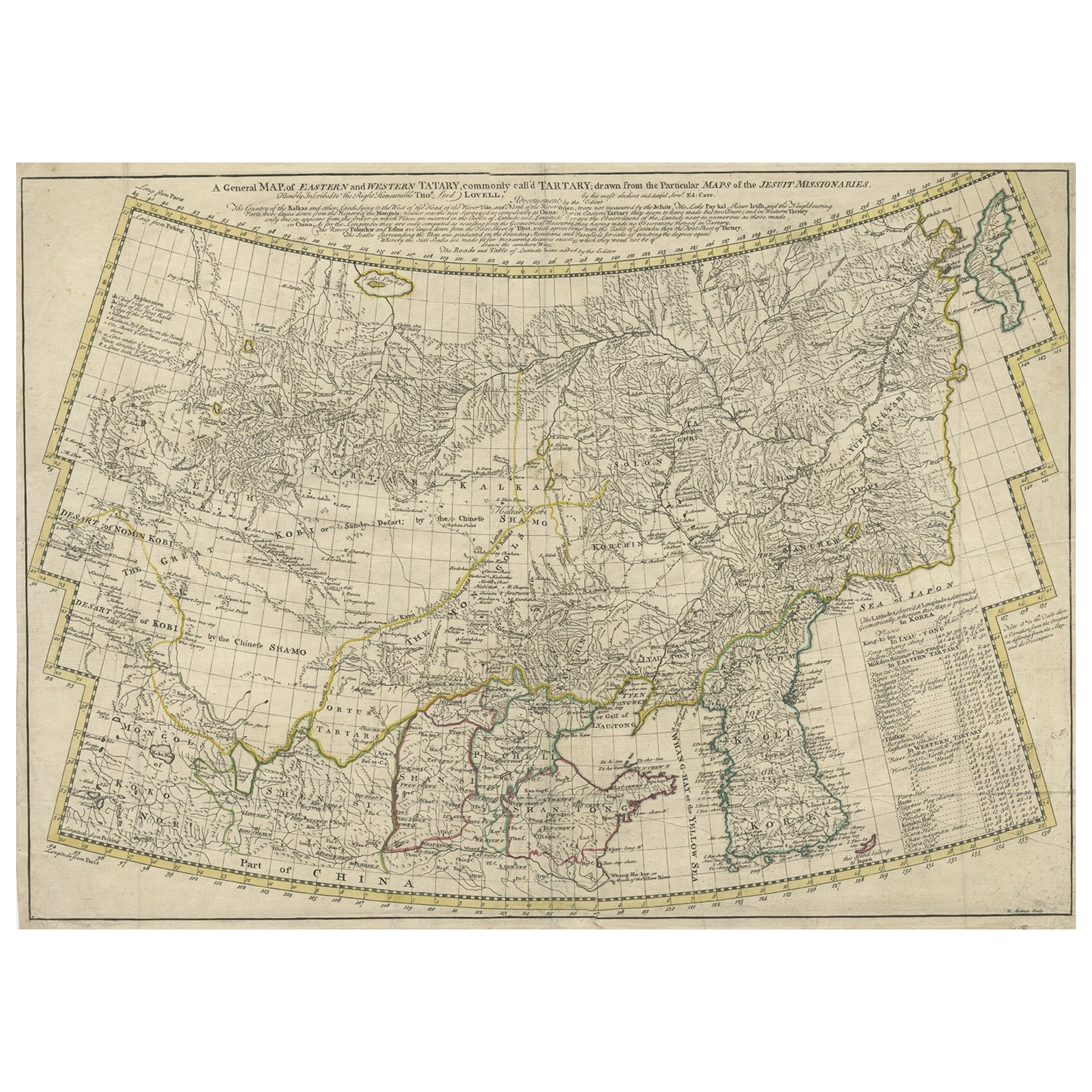
Antique map of China titled 'A Sketch of a Journey from Zhe-Hol in Tartary by land to Pekin and from thence by water to Hang-Tchoo-Foo in China'. Detailed map showing the route taken from Zhe-Hol in Tartary to Beijing and then on to Hang-Tchoo Foo. The map details George Macartney's Embassy to China, the first British embassy to that country, undertaken between 1792 and 1794. During the second half of the 18th century the British were eager to open up further trade with the Chinese Empire. Since 1757, international trade had been restricted to the port of Canton in southern China. In 1792, Prime Minister William Pitt the Younger, dispatched George Macartney, an Anglo-Irish diplomat, on a Mission to the court of the Emperor Qianlong in Beijing in an effort to gain trade concessions.
The map shows how Macartney had gone to the summer palace at Chengde (Zhe-Hol on the map), north of Beijing, to meet the Emperor. He returned to Beijing overland, before travelling south to Hangzhou (Hang-Tchoo Foo) on the Yangtze River delta via the 1000-mile Great Canal of China. Diplomatically, the Mission was a complete failure, as the Emperor proved entirely unwilling to consider trade concessions, however, the trip yielded Europeans valuable new information on China's geography and social customs.
This map originates from 'An Authentic Account of an Embassy from the King of Great Britain to the Emperor of China' by George L. Staunton.
- Dimensions:Height: 26.78 in (68 cm)Width: 20.08 in (51 cm)Depth: 0.02 in (0.5 mm)
- Materials and Techniques:
- Period:
- Date of Manufacture:1796
- Condition:Minor losses. Minor structural damages. Minor fading. General age-related toning. Some defects professionally restored. Please study image carefully.
- Seller Location:Langweer, NL
- Reference Number:Seller: BG-120961stDibs: LU3054316522882
About the Seller
5.0
Platinum Seller
These expertly vetted sellers are 1stDibs' most experienced sellers and are rated highest by our customers.
Established in 2009
1stDibs seller since 2017
1,928 sales on 1stDibs
Typical response time: <1 hour
- ShippingRetrieving quote...Ships From: Langweer, Netherlands
- Return PolicyA return for this item may be initiated within 14 days of delivery.
Auctions on 1stDibs
Our timed auctions are an opportunity to bid on extraordinary design. We do not charge a Buyer's Premium and shipping is facilitated by 1stDibs and/or the seller. Plus, all auction purchases are covered by our comprehensive Buyer Protection. Learn More
More From This SellerView All
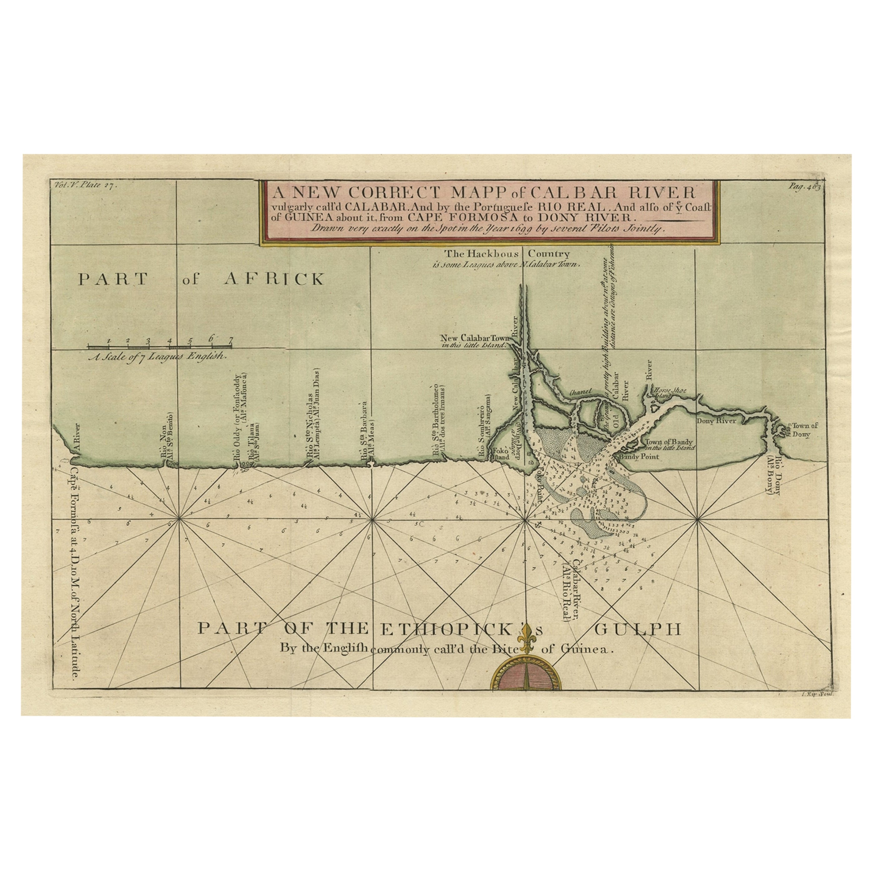
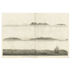
- Antique Print of the City of Ten-Tchoo-Foo, China, 1796Located in Langweer, NLAntique print titled 'View of the City of Ten-Tchoo-Foo from the Anchorage of the Hindostan in the Strait of Mi-a-Tau Bearing South-West'. Together on a sheet with 'Cape Maccartney and Cape Gower'. The top two views depict coastal profile views of local islands named after important people in the Embassy, including Macartney, Staunton, and Gower. Below, a view of the city of Ten-Tchoo-Foo taken from aboard the Hindostan, one of the ships on the mission. These land approach views appeared in the account of George Macartney's travels to China, published by George Nicol. Macartney was Britain's first envoy to China, and was tasked with convincing Emperor Qianlong to ease restrictions on trade between Great Britain and China by allowing the British to have a permanent embassy in the country. Sir George Staunton prepared the official report, 'An Authentic Account of an Embassy from the King of Great Britain to the Emperor of China', which included charts and views based on manuscript sketches and drawings by Sir John Barrow...Category
Antique 1790s Maps
MaterialsPaper
- Antique Map of Manchuria and the Northeast Portion of TartaryLocated in Langweer, NLAntique map titled 'Carte de la Tartarie Orientale (..)'. Detailed map of Manchuria and the Northeast portion of Tartary, including Sagallan Anga Hata--Isle de la Bouche...Category
Antique Mid-18th Century Maps
MaterialsPaper
- Antique Map of Tartary and Northeast Asia, c.1750Located in Langweer, NLAntique map titled 'Carte de la tartarie occidentale'. An interesting map of Tartary and northeast Asia, from Lake Baykal, Partie du Siberia in the north, Pays des Kalkas at the cent...Category
Antique 18th Century Maps
MaterialsPaper
- Old Genuine Antique Map of Tartary in the Russian Far EastLocated in Langweer, NLOriginal antique map titled 'Tartaria sive Magni Chami Imperium'. This great map of Tartary covers all of eastern Asia between the Caspian Sea and northern China and Manchuria. Being...Category
Antique Mid-17th Century Maps
MaterialsPaper
- Antique Map of Western Tartary, with Information from Kyrkov's SurveysLocated in Langweer, NLAntique map titled 'Carte de la Tartarie Occidentale'. This map covers western Tartary with a focus on the region of present-day Mongolia. This map includes information from Kyrkov's...Category
Antique Mid-18th Century Maps
MaterialsPaper
- Antique Map of Persia and Tartary by Lowry, '1852'Located in Langweer, NLAntique map titled 'Persia and Tartary'. Original map of Persia and Tartary. This map originates from 'Lowry's Table Atlas constructed and engraved from the most recent Authorities' ...Category
Antique Mid-19th Century Maps
MaterialsPaper

You May Also Like
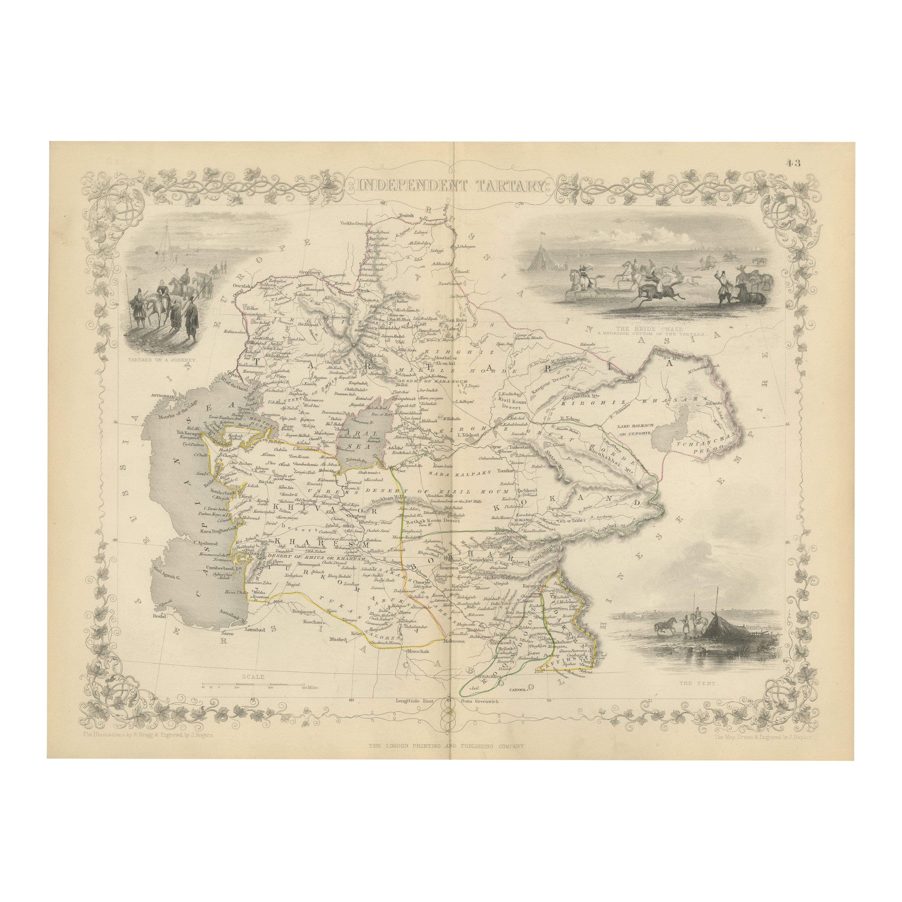
- 1851 Map of "Independent Tartary", Ric. R018Located in Norton, MA1851 Map of Independent Tartary "Russia" Ric.r018 A highly decorative 1851 map of Independent Tartary by John Tallis and John Rapkin. Covers the regions between the Caspian Sea and Lake Bakquash and between Russia and Afghanistan. These include the ancient Silk Route kingdoms of Khiva, Tartaria, Kokand, and Bokhara. Today this region roughly includes Kazakhstan, Uzbekistan, Turkmenistan, Kyrgyzstan, and Tajikistan. This wonderful map offers a wealth of detail for anyone with an interest in the Central Asian portion of the ancient Silk Road. Identifies various caravan routes, deserts, wells, and stopping points, including the cities of Bokhara and Samarkand. Three vignettes by W. Bragg decorate the map, these including an image of Tartars on a Journey, a horseback Bride Chase, and a tartar camp site. Surrounded by a vine motif border. Engraved by J. Rapkin for John Tallis's 1851 Illustrated Atlas . Tartary Antique Map...Category
Antique 19th Century Unknown Maps
MaterialsPaper
- 1880s Map of The Italian Alps from Milan to Lake GardaLocated in Roma, ITGeographical Map of the Profile and Elevation of the Italian Alps from Milano to Lake Garda. The map features the name of each peak and key cities including Monza, Brescia and Bergam...Category
Antique 1880s Italian Maps
MaterialsParchment Paper
- Samuel Johnson — A Journey to the Western Islands of ScotlandLocated in Middletown, NYLondon: W. Strahan and T. Cadwell, 1775. FIRST EDITION, FIRST STATE 8vo, 8 3/8 x 5 1/4 (212 x 132 mm); Title, 284 pp, 1 leaf (errata with 11 items on 12 lines). Printed on laid pap...Category
Antique Late 18th Century English Books
MaterialsLeather, Paper
- "The United States from the Latest Authorities" Antique Wall Map, 1835Located in Colorado Springs, COThis is a 1835 map of “The United States from the Latest Authorities” by Ezra Strong. A hand-colored engraved wall map of the eastern half of the United States, this map has a large inset of the "Oregon District" and several engraved city views and two portraits. The primary map extends to Mexico Texas and the Missouri Territory, showing the course of the Missouri River to Ft. Mandan and Old Ft. Mandan, and noting many forts along the river. The territories to the east of Missouri Territory are separately delineated as Sioux District and Huron District. The western details of the map are very good for a map of this time period, with many Native American settlements, villages, forts and other details noted. The map is bordered with vignettes of Boston, New York, Philadelphia, Hartford, Cincinnati, and Baltimore. Each vignette notes the date settled, primary settler, and the population as of 1830. Two portraits of LaFayette and George Washington are presented in full length with related biographical information. A large inset map at lower right shows the Oregon District, centered on the Columbia River and extending to the Rocky Mountains. This is one of the earliest commercial appearances of a separate map of Oregon...Category
Antique 1830s American Maps
MaterialsPaper
- 1861 Topographical Map of the District of Columbia, by Boschke, Antique MapLocated in Colorado Springs, COPresented is an original map of Albert Boschke's extremely sought-after "Topographical Map of the District of Columbia Surveyed in the Years 1856 ...Category
Antique 1860s American Historical Memorabilia
MaterialsPaper
- New Map of North America from the Latest Discoveries, 1763Located in Philadelphia, PAA fine antique 18th century map of the North American seaboard. Entitled "A New Map of North America from the Latest Discoveries 1763". By the Cartographer/Engraver - John Spil...Category
Antique Mid-18th Century English Georgian Maps
MaterialsPaper


Recently Viewed
View AllMore Ways To Browse
Chinese Antique British Furniture
Southern New And Used Furniture
Antique Trade Show
George Map
Map Of China
Route Map
Beijing Antique
18th Century Sketch
Beijing Antique Furniture
King Of Ireland
Mission China
Great Britain Maps
Antique Irish China
Antique Britain Map
Antique Map Britain
Antique Map Of China
Antique Maps Of China
Foo Chinese Antique