Items Similar to 1880s Map of The Italian Alps from Milan to Lake Garda
Want more images or videos?
Request additional images or videos from the seller
1 of 10
1880s Map of The Italian Alps from Milan to Lake Garda
About the Item
Geographical Map of the Profile and Elevation of the Italian Alps from Milano to Lake Garda. The map features the name of each peak and key cities including Monza, Brescia and Bergamo. Published by Francesco Vallardi, a member of the distinguished family of Milanese Publishers in 1880. This geographical map is incredibly beautiful, the colours showing the elevation and snow level of the mountains are divine and led me to purchase this piece. It is an exceptional map in an excellent state of conservation. We have mounted this piece to conserve it but it can be shipped with or without the mount depending on destination.
Dimensions: W69cm x H50cm plus mount
- Dimensions:Height: 19.69 in (50 cm)Width: 27.17 in (69 cm)Depth: 0.04 in (1 mm)
- Materials and Techniques:Parchment Paper,Etched
- Place of Origin:
- Period:
- Date of Manufacture:circa 1880
- Condition:
- Seller Location:Roma, IT
- Reference Number:1stDibs: LU8425238078832
About the Seller
5.0
Gold Seller
These expertly vetted sellers are highly rated and consistently exceed customer expectations.
1stDibs seller since 2023
22 sales on 1stDibs
Typical response time: 4 hours
- ShippingRetrieving quote...Ships From: Amelia, Italy
- Return PolicyA return for this item may be initiated within 3 days of delivery.
More From This SellerView All
- Italian Parchment Map of the City of Pisa Dated, 1640By Matthäus Merian the ElderLocated in Roma, ITAn antique map of the Tuscan city of Pisa engraved for The 'Itinerarium Italiæ Nov-antiquæ' by Matthäus Merian the Elder and printed in 1640....Category
Antique 1640s Italian Maps
MaterialsPaper
- Italian Parchment Map of the City of Lucca Dated 1640By Matthäus Merian the ElderLocated in Roma, ITAn antique map of the Tuscan city of Lucca engraved for The 'Itinerarium Italiæ Nov-antiquæ' by Matthäus Merian the Elder and printed in 1640...Category
Antique 1640s Italian Maps
MaterialsParchment Paper, Paper
- Antique Italian Map of Viaggio da Roma a Napoli 1775Located in Roma, ITAn original print from 1775 showing an early route map of the journey from Rome to Naples. This route map was part of a collection of travellers routes published in a book translated...Category
Antique 1770s Italian Maps
MaterialsParchment Paper
- Pair of Italian Hand-Painted Ceramic Pots / Albarelli made in the late 1800sLocated in Roma, ITA beautiful and rare pair of maiolica patterned Italian albarelli, late 1800s early 1900s. Found in Palazzo Torlogna in Rome. Alberelli were ancient storage containers often used in...Category
Antique Early 19th Century Italian Urns
MaterialsCeramic
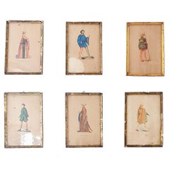
- A Set of Six French Prints of French and Italian Noble CostumesLocated in Roma, ITA beautiful set of Six prints each dipicting French and Italian noblemen in their formal 18th and 19h century costumes. The prints are in good condition considering their age but al...Category
20th Century French Prints
MaterialsPaint, Paper
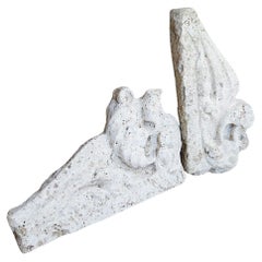
- Pair of 17th Century Italian Travertine MantlesLocated in Roma, ITA pair of 300 year old travertine mantles salvaged from a 17th century church in Le Marche. The stone is absolutely beautiful and the pieces have aged allowing for us still to see th...Category
Antique 17th Century Italian Abstract Sculptures
MaterialsTravertine


You May Also Like
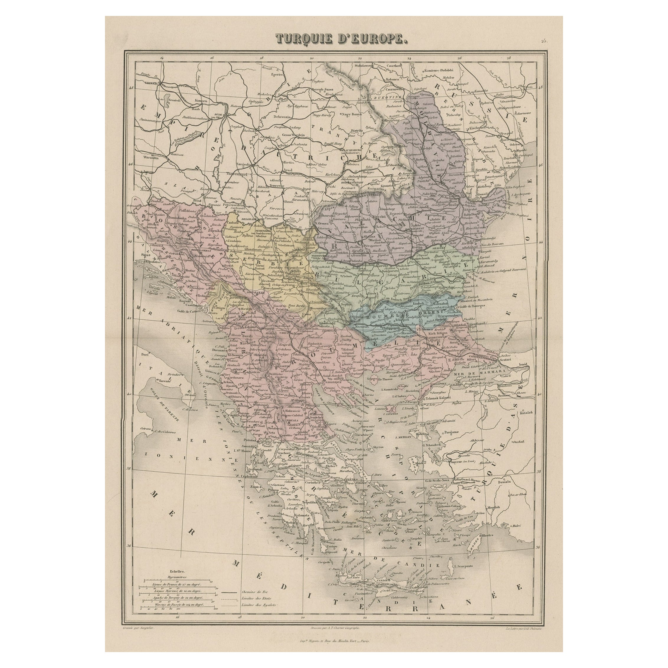
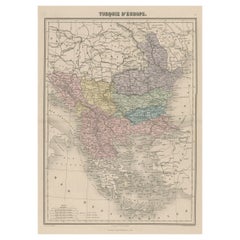
- Antique Map of Moldova to Thessaly and from the Adriatic to the Black Sea, 1880Located in Langweer, NLAntique map titled 'Turquie d'Europe'. Map of the european parts of Turkey. The map covers from Moldova to Thessaly and from the Adriatic to the Black Sea. Greece and the island ...Category
Antique 1880s Maps
MaterialsPaper
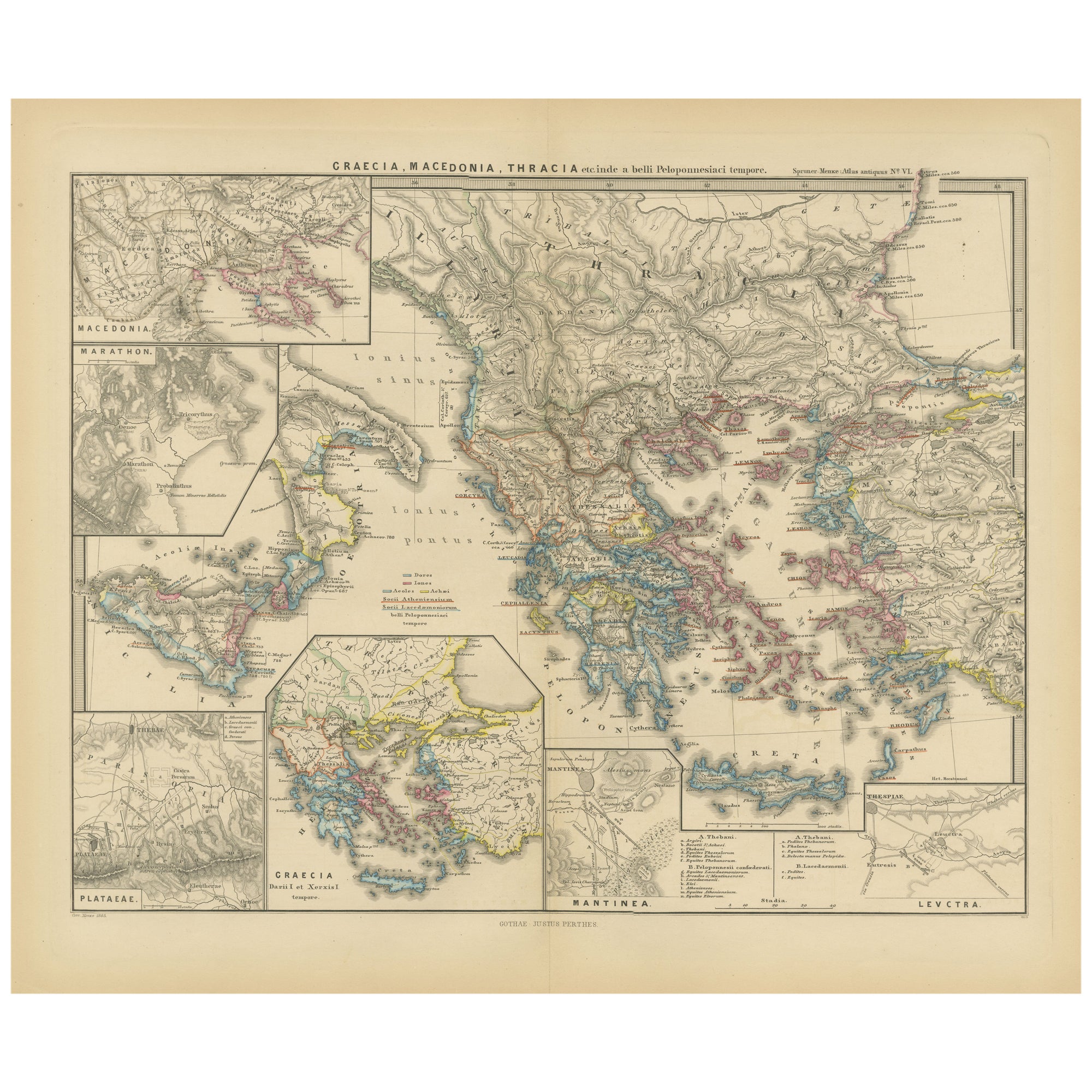
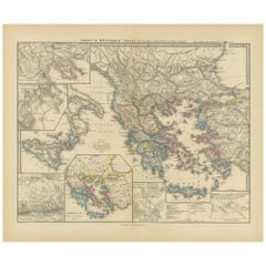
- Map of Greece, Macedonia, Thrace from the time of the Peloponnesian War, 1880Located in Langweer, NLThe map titled "GRAECIA, MACEDONIA, THRACIA et inde a bello Peloponnesiaco tempore," translates to "Greece, Macedonia, Thrace from the time of the Peloponnesian War." This period cor...Category
Antique 1880s Maps
MaterialsPaper
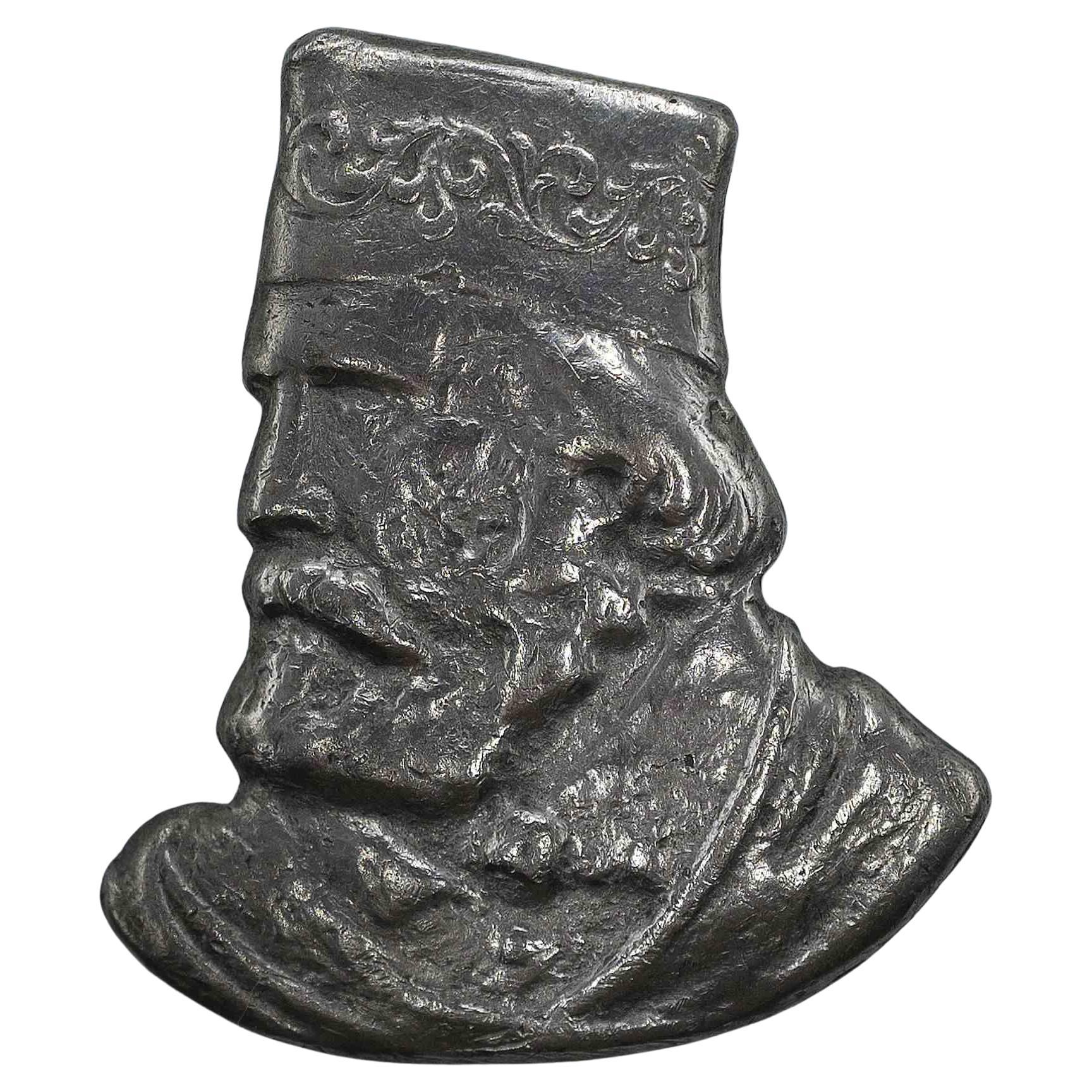
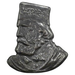
- Portrait of Garibaldi, 1880sLocated in Roma, ITPortrait of Garibaldi is an original handmade object realized in 1880 ca. Metal, 3,5 x 2,3 cm. Good conditionsCategory
Antique 1880s Italian Historical Memorabilia
MaterialsMetal
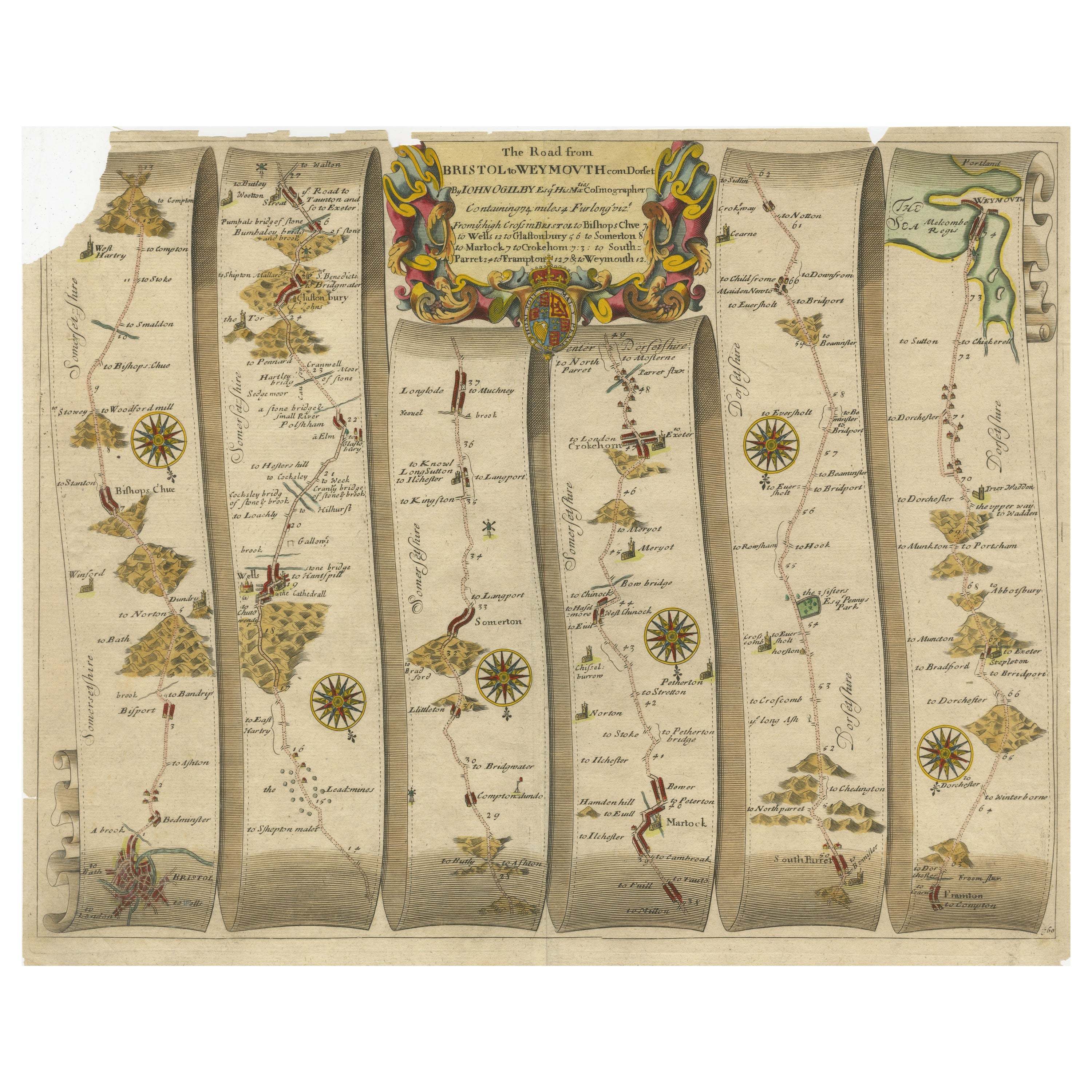
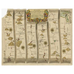
- Original Antique Map of the Road from Bristol to WeymouthLocated in Langweer, NLAntique map titled 'The Road from Bristol to Weymouth (..)'. Original antique map of the road from Bristol to Weymouth. Plate 60 from Ogilby's 'Britannia', the first road atlas of En...Category
Antique Late 17th Century Maps
MaterialsPaper
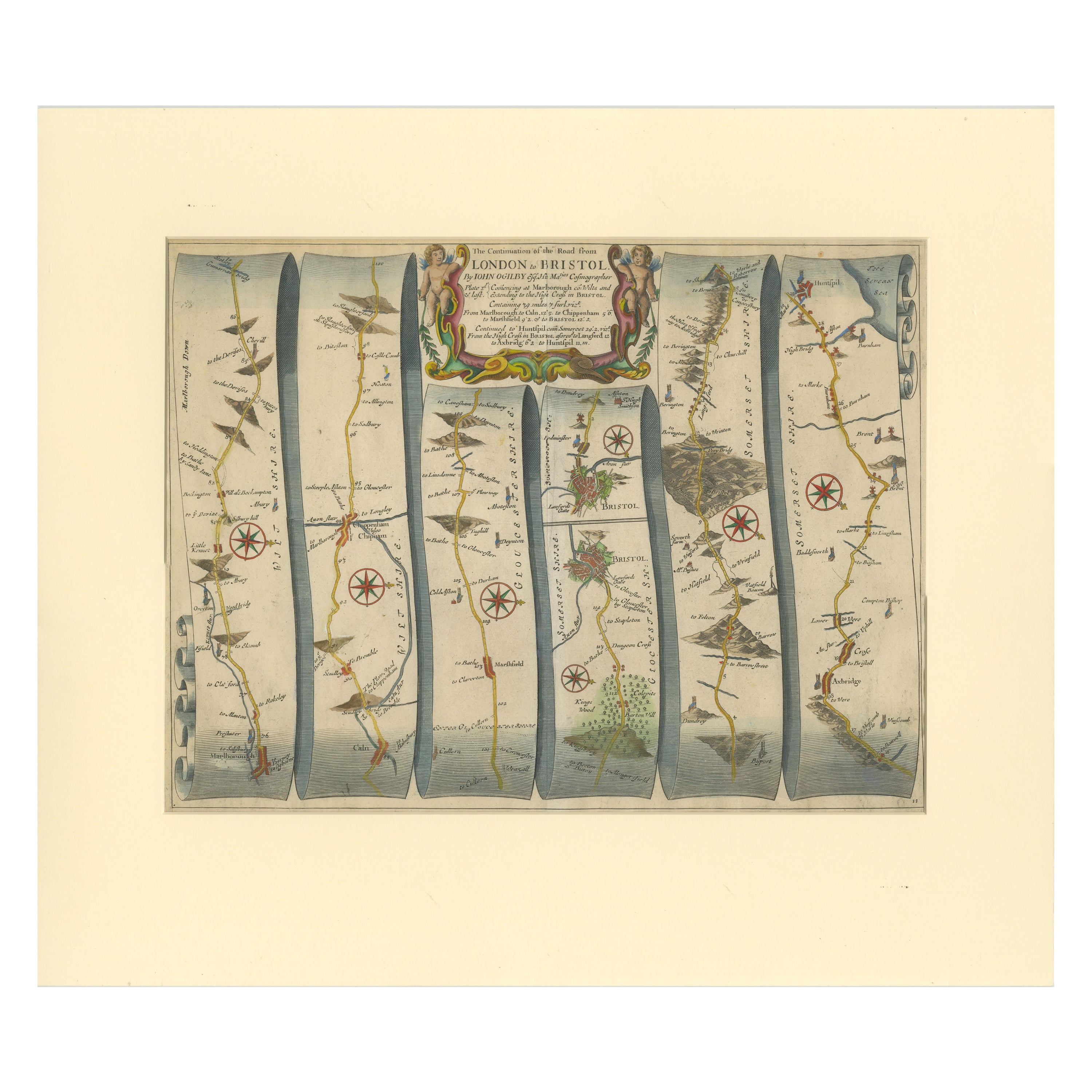
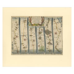
- Original Antique Map of the Road from Marlborough to HuntspilLocated in Langweer, NLAntique map titled 'The Continuation of the Road from London to Bristol (..)'. A strip map of the continuation of the road from London to Bristol, this particular sheet showing the r...Category
Antique Late 17th Century Maps
MaterialsPaper
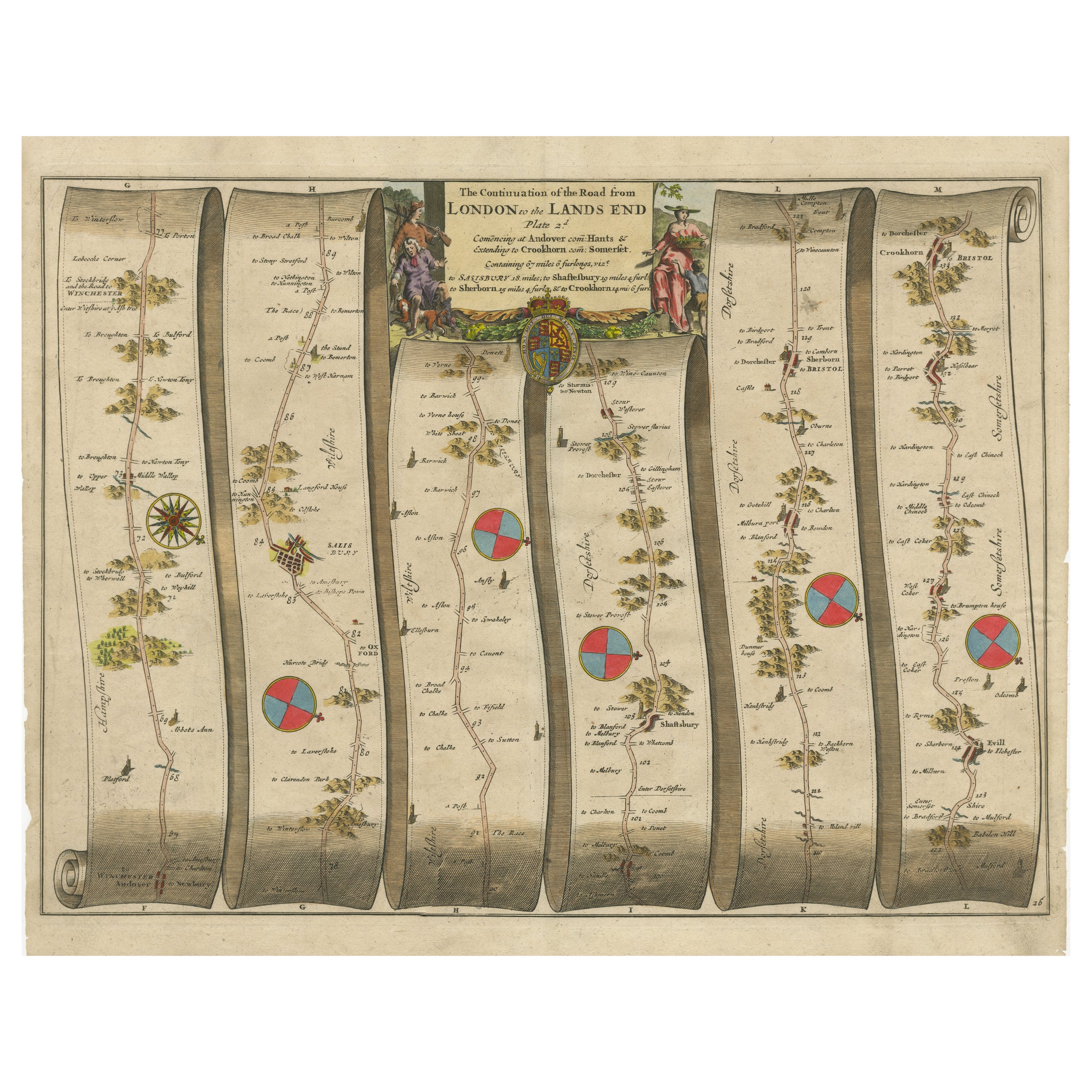
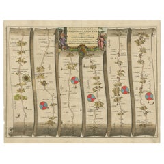
- Original Antique Map of the Road from Andover to CrewkerneLocated in Langweer, NLAntique map titled 'The Continuations of the Road from London to the Lands End'. Original antique map of the road from Andover to Crewkerne. Plate 26 from Ogilby's 'Britannia', the f...Category
Antique Late 17th Century Maps
MaterialsPaper
Recently Viewed
View AllMore Ways To Browse
Italian Maps
1859 Asia Map
Antique Map Antilles
Antique Alabama Map
Antique Furniture Oklahoma City
J Beringer
Old Sicily Map
Antique Map Of Tuscany
Map Of Washington Dc
Washington Dc Map
Aigue Marine
Furniture Sellers In Israel
Inland Empire
Map Of Native American Tribes
Montana Maps
Op Ocean Pacific
1847 Rio
A Plan City And Castle Of Batavia