Antique Maps Of China
14
to
65
330
34
229
157
117
58
38
27
26
26
23
20
19
18
14
13
9
8
7
7
6
6
6
5
4
4
4
3
3
3
3
2
2
2
2
2
2
2
1
1
1
1
1
1
1
15
13
6
4
3
Sort By
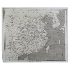
Original Antique Map of China, Arrowsmith, 1820
Located in St Annes, Lancashire
Great map of China
Drawn under the direction of Arrowsmith
Copper-plate engraving
Category
1820s English Antique Maps Of China
Materials
Paper
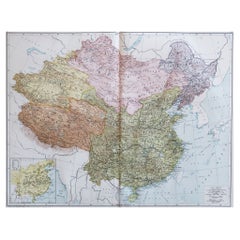
Large Original Vintage Map of China, circa 1920
Located in St Annes, Lancashire
Great map of China.
Original color. Good condition.
Published by Alexander Gross
Unframed.
Category
1920s English Edwardian Antique Maps Of China
Materials
Paper
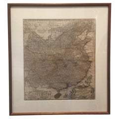
Framed Map of China
Located in Greenwich, CT
Map of China, 19th century. European print map of China
Conservation frame with walnut frame
Category
19th Century European Qing Antique Maps Of China
Materials
Paper
Original Antique Map of China by Thomas Clerk, 1817
Located in St Annes, Lancashire
Great map of China
Copper-plate engraving
Drawn and engraved by Thomas Clerk, Edinburgh
Category
1810s English Antique Maps Of China
Materials
Paper
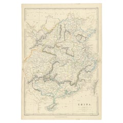
Antique Map of China, 1874
Located in Langweer, NL
Antique map titled 'China'. Detailed map of China originates from Blackie's 'The Comprehensive
Category
19th Century Antique Maps Of China
Materials
Paper
Antique Map of China by A & C, Black, 1870
Located in Langweer, NL
Antique map titled 'China'. Original antique map of China. This map originates from ‘Black's
Category
Late 19th Century Antique Maps Of China
Materials
Paper
Antique Map of China by W. G. Blackie, 1859
Located in Langweer, NL
Antique map titled 'China'. Original antique map of China. This map originates from ‘The Imperial
Category
Mid-19th Century Antique Maps Of China
Materials
Paper
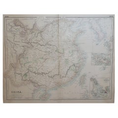
Large Original Antique Map of China, Fullarton, C.1870
Located in St Annes, Lancashire
Great map of China
From the celebrated Royal Illustrated Atlas
Lithograph by Swanston
Category
1870s Scottish Antique Maps Of China
Materials
Paper
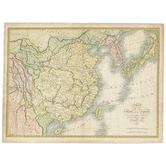
Antique Map of China and Japan by Tardieu, 1821
Located in Langweer, NL
Antique map titled 'Carte de la Chine et du Japon'. Detailed map of China, showing Korea, Japan and
Category
Early 19th Century Antique Maps Of China
Materials
Paper
Antique Map of China and Japan by Johnson, 1872
Located in Langweer, NL
Antique map titled 'Johnson's China and Japan'. Map of China and Japan, with an inset map of the
Category
Late 19th Century Antique Maps Of China
Materials
Paper
Antique Map of China and Japan by Wyld '1845'
Located in Langweer, NL
Antique map titled 'Map of the Empires of China and Japan'. Original antique map of China and Japan
Category
Mid-19th Century Antique Maps Of China
Materials
Paper
Antique Map of China and Japan, with Frame Style Border
Located in Langweer, NL
Antique map titled 'Empires Chinois et Japonnais'. Attractive map of China and Japan. This map
Category
Mid-19th Century Antique Maps Of China
Materials
Paper
Antique Map of China Including Korea and Taiwan by Vaugondy, 1749
Located in Langweer, NL
Antique map titled 'Empire de la Chine'. Beautiful map of China including Korea and Taiwan (Formosa
Category
Mid-18th Century Antique Maps Of China
Materials
Paper
Antique Map of China, Korea, Japan and the Northern Philippines, circa 1780
Located in Langweer, NL
'. Interesting and detailed map of China, Korea, Japan and the Northern Philippines. Published circa 1780.
Category
Late 18th Century Antique Maps Of China
Materials
Paper
H 15.56 in W 9.85 in D 0.02 in
Antique Map of Chinese and Independent Tartary, Korea and Japan, 1806
Located in Langweer, NL
Antique map titled 'A New Map of Chinese & Independent Tartary'. Beautiful map of Chinese Tartary
Category
19th Century Antique Maps Of China
Materials
Paper
Rare 16th Century Original Handcolored Miniature Map of China, Published in 1593
Located in Langweer, NL
.
Very interesting and decorative miniature map of China.
Italian text with 'India' in title on the
Category
16th Century Antique Maps Of China
Materials
Paper
H 4.53 in W 6.3 in D 0 in
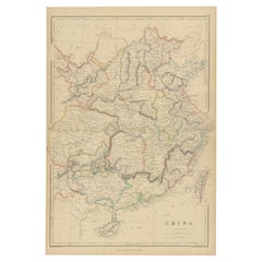
Antique 19th Century Map of China by Blackie & Son, 1882
Located in Langweer, NL
This map is an 1882 Blackie & Son map of China. The title "CHINA." is prominently displayed at the
Category
1880s Antique Maps Of China
Materials
Paper
Antique Map of China and Japan by Meyer, 1895
Located in Langweer, NL
Antique map titled 'China und Japan'. Map of China, Mongolia, Taiwan and Japan. With an inset map
Category
19th Century Antique Maps Of China
Materials
Paper
Antique Map of China with insets the Island of Chusan and Canton River, c.1860
Located in Langweer, NL
Antique map titled 'China'. Large map of China, with insets the Island of Chusan, and the Estuary
Category
19th Century Antique Maps Of China
Materials
Paper
H 18.9 in W 23.63 in D 0 in
Map of China - Etching - 19th Century
Located in Roma, IT
This map of China is an etching realized in 19th century.
The state of preservation of the artwork
Category
19th Century Antique Maps Of China
Materials
Etching
Antique Map of China by Wilkinson '1803'
Located in Langweer, NL
Antique map titled 'China, Contains 15 Subject Provinces Including the 2 Islands of Hainan, Formosa
Category
Early 19th Century Antique Maps Of China
Materials
Paper
Antique Map of China by Larousse, 1897
By Pierre Larousse
Located in Langweer, NL
Sheet: Front: 'Chine.' (China map). Verso: 'China.' (China views, nature, animals, costume). This
Category
19th Century Antique Maps Of China
Materials
Paper
Beautiful Antique Map of China and Korea by Famous Mapmaker Janssonius, c.1660
Located in Langweer, NL
Antique map titled 'Imperii Sinarum Nova Descriptio'. Beautiful map of China and Korea. This map
Category
17th Century Antique Maps Of China
Materials
Paper
H 20.48 in W 24.22 in D 0 in
Antique Map of China, Also Depicting Formosa 'Taiwan' and Part of Korea, c.1840
Located in Langweer, NL
Antique map titled 'China'. Old map of China, also depicting Formosa (Taiwan) and part of Korea
Category
19th Century Antique Maps Of China
Materials
Paper
H 13.59 in W 16.15 in D 0 in
Framed Early 19th Century Drawn and Engraved Map of China
By John Knighton Thomson
Located in San Francisco, CA
Hand drawn and tinted engraved map of China dated 1815
Created for Thomson's New General Atlas
Category
Early 19th Century European Antique Maps Of China
Materials
Paper
Antique Map of China and Korea incl Formosa and Hainan, by Janssonius, ca.1650
Located in Langweer, NL
Antique map titled 'Imperii Sinarum Nova Descriptio'. Beautiful map of China and Korea, much detail
Category
17th Century Antique Maps Of China
Materials
Paper
H 20.48 in W 24.02 in D 0 in
Antique Map of China and the East Indies by Lowry, 1852
Located in Langweer, NL
Antique map titled 'China & Indian Archipelago'. Two individual sheets of China and the East Indies
Category
Mid-19th Century Antique Maps Of China
Materials
Paper
Antique Map of China and Japan by A.K. Johnston, 1865
Located in Langweer, NL
Antique map titled 'China and Japan'. Depicting Eastern China, the Islands of Japan and more. This
Category
Mid-19th Century Antique Maps Of China
Materials
Paper
Antique Map of China, Tartary and Central Asia by Blaeu, c.1645
Located in Langweer, NL
journals of Marco Polo. The map covers from the Caspian Sea and the Volga River east as far as the China
Category
17th Century Antique Maps Of China
Materials
Paper
Schley, Xinjiang Uygur Zizhiqu, Tien Shan, Sinkiang, Map of China
By Jacques-Nicolas Bellin
Located in Norwich, GB
nabuurige landen
Xinjiang Uygur Zizhiqu (China), Tien Shan, Sinkiang. Relief shown pictorially
Category
1740s Dutch Antique Maps Of China
Materials
Paper
Antique Map of the Mouth of the Yangtze River 'China' by J.N. Bellin, 1764
Located in Langweer, NL
This detailed regional map of China is a historical cartographic work from the mid-18th century and
Category
Mid-18th Century Antique Maps Of China
Materials
Paper
H 10.04 in W 15.48 in D 0.02 in
Antique Map of the Journey from Zhe-Hol in Tartary to Beijing and Hang-Tchoo Foo
Located in Langweer, NL
Antique map of China titled 'A Sketch of a Journey from Zhe-Hol in Tartary by land to Pekin and
Category
Late 18th Century Antique Maps Of China
Materials
Paper
No Reserve
H 26.78 in W 20.08 in D 0.02 in
Original Antique Engrving of Chinese Tartary in the 18th Century, 1737
Located in Langweer, NL
time.
Source; Map of the Chinese Tartary. Relief shown pictorially.
D'Anville's map showcases the
Category
1730s Antique Maps Of China
Materials
Paper
No Reserve
H 11.42 in W 18.9 in D 0 in
Old Map of the Chinese Empire and Japan, 1882
Located in Langweer, NL
An original antique map titled "The Chinese Empire and Japan," dating from an 1882 atlas by Blackie
Category
1880s Antique Maps Of China
Materials
Paper
Antique Map of the Coast of China by Bellin, 1752
By Jacques-Nicolas Bellin
Located in Langweer, NL
'. Detailed map of the region from the Cambodia River to Macao, along the coast of China.
Artists and
Category
18th Century Antique Maps Of China
Materials
Paper
Antique Map of Southeast Asia, China, Philippines and India
Located in Langweer, NL
Antique map titled 'Indiae Orientalis et Insularum Adiacentium'. Decorative map of Southeast Asia
Category
Early 18th Century Antique Maps Of China
Materials
Paper
Antique Map of Wuxi and Huzhou in China, 1746
Located in Langweer, NL
Antique map titled 'Vusihyen. Hu Chew Fu'. Plans of Wuxi and Huzhou, China. Originates from
Category
18th Century Antique Maps Of China
Materials
Paper
Antique Map of the Chinese Empire and Japan, '1875'
Located in Langweer, NL
Antique map titled 'Carte générale de l'Empire Chinois et du Japon'. Large map of the Chinese
Category
Late 19th Century Antique Maps Of China
Materials
Paper
Antique Map of Tartary, Also Showing the Great Wall of China
Located in Langweer, NL
Russia, Central Asia, China and Korea, first published by Guillaume De L'Isle in 1706. The map extends
Category
Early 18th Century Antique Maps Of China
Materials
Paper
Antique Map of the Empire of China by Bonne, c.1780
By Rigobert Bonne
Located in Langweer, NL
Antique map titled 'Carte de L'Empire de la Chine.' Decorative map of the Empire of China
Category
18th Century Antique Maps Of China
Materials
Paper
Antique 1803 Italian Map of Asia Including China Indoneseia India
Located in Amsterdam, Noord Holland
Antique 1803 Italian Map of Asia Including China Indoneseia India
Very nice map of Asia. 1803
Category
19th Century European Antique Maps Of China
Materials
Paper
Antique Map of Hangzhou, Capital of the Province of Zheijang, China, 1748
Located in Langweer, NL
Antique map titled 'Plan de la ville de Hang-Tcheou-Fou ou Hang-Chew-Fu Capitale de la Province de
Category
1740s Antique Maps Of China
Materials
Paper
Antique Map of Cities of the Province of Shanxi in China, 1749
By Jacques-Nicolas Bellin
Located in Langweer, NL
an enormous outpt in maps, particular of maritime interest.
Condition: Very good, please study
Category
18th Century Antique Maps Of China
Materials
Paper
Antique Map of Korea and Southern China by Bonne '1771'
Located in Langweer, NL
Antique map titled 'Carte de la Tartarie Chinoise'. Original antique map of Korea and Southern
Category
Mid-18th Century Antique Maps Of China
Materials
Paper
Antique French Map of Asia Including China Indoneseia India, 1783
Located in Amsterdam, Noord Holland
Very nice map of Asia. 1783 Dedie au Roy.
Additional information:
Country of Manufacturing: Europe
Category
18th Century European Antique Maps Of China
Materials
Paper
Antique Map of Central and Southern China by Kuyper, 1880
Located in Langweer, NL
Plate 53 : 'China, Midden en Zuid.' (China, Central and South). This lithographed map originates
Category
19th Century Antique Maps Of China
Materials
Paper
Antique Map of the Shanxi Province of China by Du Halde, 1738
Located in Langweer, NL
Antique map titled 'Province IX Shan-Si'. Old map depicting the Shanxi province of China
Category
18th Century Antique Maps Of China
Materials
Paper
Antique Map of the Huguang Province of China by Du Halde, 1738
Located in Langweer, NL
Antique map titled 'Province VI Hu-Quang'. Old map depicting the Huguang province of China
Category
18th Century Antique Maps Of China
Materials
Paper
Antique Map of the Jiangxi Province of China by Du Halde, 1738
Located in Langweer, NL
Antique map titled 'Province III Kyang-Si'. Old map depicting the Jiangxi province of China
Category
18th Century Antique Maps Of China
Materials
Paper
Antique Map of Cities of the Province of Che-Kyang in China, 1738
Located in Langweer, NL
Antique print China titled 'Cities of the Province of Che-Kyang'. Old map depicting four walled
Category
18th Century Antique Maps Of China
Materials
Paper
Antique Map of Cities of the Province of Che-Kiang in China, 1738
Located in Langweer, NL
Antique map titled 'Cities of the Province of Che-Kyang'. Old map depicting four walled cities of
Category
18th Century Antique Maps Of China
Materials
Paper
Antique Map of Cities in the Region of Hubei in China, 1758
Located in Langweer, NL
Antique map titled 'Plans de Quelques villes de la province de Hou-Quang.' Three plans of cities in
Category
18th Century Antique Maps Of China
Materials
Paper
Antique Map of Cities of the Jiangsu Region in China, c.1760
By Jacques-Nicolas Bellin
Located in Langweer, NL
Antique map titled 'Plan de l' Enceinte de la Ville de Nan-King ou Kyang-Ning-Fou et plan de la
Category
18th Century Antique Maps Of China
Materials
Paper
Antique Map of Hangzhou, Capital of the Province of Zheijang, China, c.1750
Located in Langweer, NL
Antique map titled ‘Plan de la ville de Hang-Tcheou-Fou ou Hang-Chew-Fu Capitale de la Province de
Category
1750s Antique Maps Of China
Materials
Paper
H 10.63 in W 7.88 in D 0 in
Antique Map of Cities in the Province of Shanxi in China, 1749
Located in Langweer, NL
.
Image size: 27 x 20 cm.
We sell original antique maps to collectors, historians, educators and
Category
18th Century Antique Maps Of China
Materials
Paper
Antique Map of the Chinese Empire by W. G. Blackie, 1859
Located in Langweer, NL
Antique map titled 'The Chinese Empire'. Original antique map of the Chinese Empire. This map
Category
Mid-19th Century Antique Maps Of China
Materials
Paper
Original Old Map of Present-Day Mongolia, Northeast China and Korea
Located in Langweer, NL
Antique map titled 'Carte de la Tartarie Chinoise. Projettee et assujettie aux observations
Category
Late 18th Century Antique Maps Of China
Materials
Paper
Antique Map of the Chinese Empire and Japan by Lapie, 1842
Located in Langweer, NL
Antique map titled 'Carte de L'Empire Chinois et du Japon'. Map of the Chinese Empire (China) and
Category
Mid-19th Century Antique Maps Of China
Materials
Paper
Antique Map of Southeast Asia and China by Kiepert, c.1870
By Thomas Kitchin
Located in Langweer, NL
Antique map titled 'Ostindien und China'. Old map of Southeast Asia and China. This map originates
Category
19th Century Antique Maps Of China
Materials
Paper
Superb, Large Map of British India, Chinese Empire, Indochina, Malaysia, 1860
Located in Langweer, NL
. A superb, large-scale map of British India, the Chinese Empire, Indochina, the Malay Peninsula, and
Category
1860s Antique Maps Of China
Materials
Paper
H 22.8 in W 31.07 in D 0 in
- 1
Get Updated with New Arrivals
Save "Antique Maps Of China", and we’ll notify you when there are new listings in this category.
Antique Maps Of China For Sale on 1stDibs
With a vast inventory of beautiful furniture at 1stDibs, we’ve got just the piece of antique maps of china you’re looking for. Was constructed with extraordinary care, often using paper, fabric and linen. You’ve searched high and low for the perfect item from our selection of antique maps of china — we have versions that date back to the 18th Century alongside those produced as recently as the 20th Century are available. When you’re browsing for the right choice in our collection of antique maps of china, those designed in styles are of considerable interest. Jacques-Nicolas Bellin, Pierre Larousse and John Knighton Thomson each produced at least one beautiful object in our assortment of antique maps of china that is worth considering.
How Much is a Antique Maps Of China?
The average selling price for a piece of antique maps of china at 1stDibs is $347, while they’re typically $58 on the low end and $3,251 for the highest priced.
Questions About Antique Maps Of China
- 1stDibs ExpertApril 5, 2022For an item to be considered antique, it needs to be 100 years or older. It can be tricky to determine the age of a cabinet on your own. The best way to determine the value and age of your china cabinet is to work with a certified appraiser. You’ll find expertly vetted antique china cabinets and other furniture on 1stDibs.
- 1stDibs ExpertOctober 12, 2021How much an antique china cabinet is worth depends on the style of the cabinet, age and condition. Any additional features/decorative touches might increase the worth of the cabinet. That is, a cabinet with hand painting or carving will cost more in general. Also, the older the cabinet, the more its value. An antique china cabinet can be purchased for $1500 onwards. Find a collection of antique china cabinets today on 1stDibs.
- 1stDibs ExpertApril 5, 2022Antique blue and white china are known as Flow Blue. Flow Blue was popular during the Victorian era and is still highly coveted by collectors for its eye-catching design and hazy patterns. Browse a wide selection of authentic Flow Blue dishware and serve ware on 1stDibs.
More Ways To Browse
Antique Sri Lanka Map
Malaysia Map
Framed Map Asia
Antique Maps Of San Francisco
Great Lakes Maps
G A Cox
Stanford Antiques
Fujian Cabinet
Antique Maps Hawaii
Antique Maps Of Hawaii
Antique Map Hawaii
Antique Hawaii Maps
Maps Of Ireland 18th Century
Antique Hawaii Map
Antique Map Of Hawaii
Set Of Maps Paris
Antique South East Asia Map
Date Kan

