Antique South East Asia Map
7
to
14
49
11
38
21
15
14
13
11
8
8
8
7
5
5
5
3
3
3
3
2
2
2
1
1
1
1
1
1
1
7
5
2
1
1
Sort By
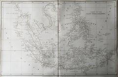
Original Antique Map of South East Asia, Arrowsmith, 1820
Located in St Annes, Lancashire
Great map of South East Asia
Drawn under the direction of Arrowsmith
Copper-plate engraving
Category
1820s English Antique South East Asia Map
Materials
Paper
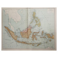
Large Original Vintage Map of South East Asia, circa 1920
Located in St Annes, Lancashire
Great map of South East Asia
Original color.
Good condition
Published by Alexander Gross
Category
1920s English Edwardian Antique South East Asia Map
Materials
Paper
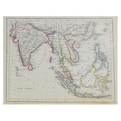
Original Antique Map of South East Asia by Becker, circa 1840
Located in St Annes, Lancashire
Great map of South East Asia
Steel engraving with original color outline
Engraved by Becker
Category
1840s English Other Antique South East Asia Map
Materials
Paper
No Reserve
H 8.5 in W 10.75 in D 0.07 in
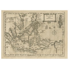
Original Antique Map of South East Asia by Thomas Clerk, 1817
Located in St Annes, Lancashire
Great map of South East Asia
Copper-plate engraving
Drawn and engraved by Thomas Clerk
Category
1810s English Antique South East Asia Map
Materials
Paper
No Reserve
H 8.25 in W 10.25 in D 0.07 in
Antique Map of South East Asia, Australia and the Indian Ocean, 1726
By F. Valentijn
Located in Langweer, NL
Asia and the Indian Ocean. The map features a fine depiction of the outlines of the western two-thirds
Category
Mid-18th Century Dutch Antique South East Asia Map
Materials
Paper
Free Shipping
H 20.67 in W 27.17 in D 0.02 in
Early Original Antique Map of South East Asia with Large Parts Still Unknown
Located in Langweer, NL
Antique map titled 'Insulae Indiae Orientalis'. Original antique map of Southeast Asia. Shows towns
Category
Late 17th Century Antique South East Asia Map
Materials
Paper
H 8.47 in W 11.42 in D 0.02 in
Rare and Very Old Antique Map of South East Asia, Published circa 1574
Located in Langweer, NL
A very fine impression of this map of the Malay Peninsula, Sumatra, Java, with Singapore denoted as
Category
16th Century Antique South East Asia Map
Materials
Paper
Free Shipping
H 8.47 in W 12.21 in D 0 in
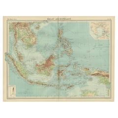
Old Map of South East Asia Showing the Malay Archipelago, incl Borneo etc, 1922
Located in Langweer, NL
Antique map of South East Asia titled 'Malay Archipelago'.
Old map of South East Asia depicting
Category
1920s Antique South East Asia Map
Materials
Paper
H 17.92 in W 23.23 in D 0 in
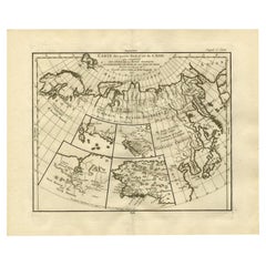
Antique Map of North and East Asia, 1751
Located in Langweer, NL
Map 2: 'Carte des parties nord et est de L'Asie'. (Map of the Northern parts and East Asia.) Five
Category
18th Century Antique South East Asia Map
Materials
Paper
Antique Map of North Europe and East Asia by Vaugondy, circa 1750
Located in Langweer, NL
Asia. Five maps on one sheet, showing California, Alaska and Syberia, Korea and Japan. South to Korea
Category
Mid-18th Century Antique South East Asia Map
Detailed Original Antique Map of India, Southeast Asia and the Far East, 1719
Located in Langweer, NL
of India, Southeast Asia and the Far East, extending from Gujerat to the supposed "Terre De Yeco
Category
1710s Antique South East Asia Map
Materials
Paper
H 26.38 in W 22.25 in D 0 in
Original Antique Hand-Colored Map of The East Indies and Southeast Asia, c.1644
Located in Langweer, NL
decorative maps of Indonesia or South East Asia in general. This map is dedicated to D. Christophorus Thisius
Category
1640s Antique South East Asia Map
Materials
Paper
H 19.69 in W 23.23 in D 0 in
Old Sea Chart of the Tenasserim area, Myanmar 'Burma' in South East Asia, c.1790
Located in Langweer, NL
Antique map titled 'Coast of Tenasserim.'
Sea chart of the Tenasserim area, Myanmar in South
Category
1790s Antique South East Asia Map
Materials
Paper
H 18.51 in W 24.02 in D 0 in
Antique Map of Asia by Dussy, 1778
Located in Langweer, NL
'. Depicting South-East Asia including Hindustan, India and China. This map originates from "Nouvel Atlas
Category
Late 18th Century French Antique South East Asia Map
Materials
Paper
Antique Map of Southeast Asia by Ortelius '1587'
By Abraham Ortelius
Located in Langweer, NL
to the north and south. The map also shows parts of the American northwest, including the cities of
Category
16th Century Antique South East Asia Map
Materials
Paper
Antique Map of Asia by A. Blondeau, circa 1800
Located in Langweer, NL
Africa and the Mediterranean east to the Bering Sea and south as far as Java and New Guinea. This map is
Category
Early 19th Century Antique South East Asia Map
Materials
Paper
Antique Map of the East Indies by Mariette, circa 1650
Located in Langweer, NL
map of Southeast Asia from the Maldives to the South of Japan with parts of the northern Australian
Category
Mid-17th Century Antique South East Asia Map
Materials
Paper
Old Map of the East Indonesian Islands Borneo, Celebes, New Guinea, Bali, 1792
Located in Langweer, NL
Elwe's map of South East Asia, based on Jaillot's work, ca. 100 years ealier. Published in Amsterdam
Category
1790s Antique South East Asia Map
Materials
Paper
H 21.66 in W 25.4 in D 0 in
Large Original Vintage Map of S.E Asia, with a Vignette of Singapore
Located in St Annes, Lancashire
Great map of South East Asia
Original color. Good condition
Published by Alexander Gross
Category
1920s English Antique South East Asia Map
Materials
Paper
No Reserve
H 25 in W 19.5 in D 0.07 in
Antique Map of Borneo (Largely Kalimantan), the Largest Island of Asia, 1726
Located in Langweer, NL
Antique map Indonesia titled 'Kaart van het Eyland Borneo'. Early map of the Island of Borneo. This
Category
18th Century Antique South East Asia Map
Materials
Paper
H 18.51 in W 22.64 in D 0 in
Antique Map of China, Tartary and Central Asia by Blaeu, c.1645
Located in Langweer, NL
journals of Marco Polo. The map covers from the Caspian Sea and the Volga River east as far as the China
Category
17th Century Antique South East Asia Map
Materials
Paper
1812 United States Map, by Pierre Tardieu, Antique French Map Depicting the U.S.
By Pierre François Tardieu
Located in Colorado Springs, CO
format maps from the period. It features a view of the East Coast of the U.S. from Maryland to just below
Category
1810s French Antique South East Asia Map
Materials
Paper
H 43.5 in W 48 in D 2.25 in
Antique Map of the Eastern Part of the World
Located in Langweer, NL
East Asia includes an extended landmass beyond the Kamchatka Peninsula, as well as the outdated ideas
Category
Mid-18th Century Antique South East Asia Map
Materials
Paper
Old Map of Indonesian Islands Borneo, Celebes, New Guinea & New Britain, 1792
Located in Langweer, NL
South East Asia, based on Jaillot's work, ca. 100 years ealier. Published in Amsterdam.
Artists and
Category
1790s Antique South East Asia Map
Materials
Paper
No Reserve
H 21.78 in W 25.99 in D 0 in
Antique Map of the Malay Archipelago with Images of Indigenous People, 1851
Located in Langweer, NL
, but at the time of the map's creation, the region was known as the Dutch East Indies, a collection of
Category
1850s Antique South East Asia Map
Materials
Paper
H 10.71 in W 14.26 in D 0 in
Ancient Cartography of the Indian Subcontinent, Published in 1880
Located in Langweer, NL
the Silk Road and maritime paths used by traders to reach Southeast Asia, the Middle East, and East
Category
1880s Antique South East Asia Map
Materials
Paper
Free Shipping
H 15.56 in W 18.51 in D 0 in
Antique Print Illustrating Trading Activities in South-East Asia by I. Tirion
Located in Langweer, NL
An allegorical scene depicting trading activities in South-East Asia. A female figure representing
Category
Mid-18th Century Antique South East Asia Map
Materials
Paper
H 7.68 in W 4.73 in D 0.02 in
Asia Declineatio: A 17th Century Hand-colored Map of Asia by Justus Danckerts
Located in Alamo, CA
'. This very rare and attractive late 17th century map depicts Asia, India, Indonesia, the Maldives, East
Category
Late 17th Century Old Masters Antique South East Asia Map
Materials
Engraving
Map of the East Indies: An Original 18th Century Hand-colored Map by E. Bowen
Located in Alamo, CA
This is an original 18th century hand-colored map entitled "An Accurate Map of the East Indies
Category
Mid-18th Century Old Masters Antique South East Asia Map
Materials
Engraving
Map of the World: An Original 18th Century Hand-colored Map by E. Bowen
Located in Alamo, CA
Hebrides Islands. This map precedes the accurate exploration of the South Pacific and east coast of
Category
Mid-18th Century Old Masters Antique South East Asia Map
Materials
Engraving
Map of the Russian Empire: An Original 18th Century Hand-colored Map by E. Bowen
Located in Alamo, CA
Ocean (Pacific Ocean) in the east. The Arctic Circle is present in the upper map
The map is embellished
Category
Mid-18th Century Old Masters Antique South East Asia Map
Materials
Engraving
Europe: An Original 18th Century Hand-colored Map by E. Bowen
Located in Alamo, CA
and Asia are seen in the south.
The map is embellished with a Compass Rose in the lower left and a
Category
Mid-18th Century Old Masters Antique South East Asia Map
Materials
Engraving
Colored Antique Print of various Water Plants including Coral in Southeast Asia
By F. Valentijn
Located in Langweer, NL
various water plants including coral native to South East Asia/Indonesia. On the left five whale teeth. In
Category
Mid-18th Century Antique South East Asia Map
Materials
Paper
H 13.19 in W 15.36 in D 0.02 in
Colored Antique Print of Plants, Trees and Indonesian Natives with VOC Men
By F. Valentijn
Located in Langweer, NL
This original antique print depicts various plants and trees from South East Asia, incuding ginger
Category
Mid-18th Century Antique South East Asia Map
Materials
Paper
H 13.19 in W 8.08 in D 0.02 in
Colored Antique Print of a Swallow, Kingfisher and other Birds of Indonesia
By F. Valentijn
Located in Langweer, NL
This print depicts various birds, native to South East Asia/Indonesia; OO: Waterpaeuw / Bintapoe
Category
Mid-18th Century Antique South East Asia Map
Materials
Paper
H 13.19 in W 8.08 in D 0.02 in
Colored Print of Birds of Paradise and the Eurasian Woodcock
By F. Valentijn
Located in Langweer, NL
paradise and the Eurasian woodcock (Scolopax rusticola), native to South East Asia/Indonesia. This print
Category
Mid-18th Century Antique South East Asia Map
Materials
Paper
A huge pair of 21 inches Cruchley Library Globes
By G.F. Cruchley
Located in ZWIJNDRECHT, NL
, published by G.F. Cruchley, map-seller & globe maker, 81 Fleet street.
Signed: CRUCHLEY in London England
Category
1850s British Victorian Antique South East Asia Map
Materials
Other
Ecce Homo Plate X
By Werner Drewes
Located in Fairlawn, OH
professors.
Held in East Germany until the opening of the wall
Category
1920s Bauhaus Antique South East Asia Map
Materials
Woodcut
Ecce Homo VII
By Werner Drewes
Located in Fairlawn, OH
through Europe, North America and Asia. After returning to Germany in 1927, he went back to the Bauhaus
Category
1920s Expressionist Antique South East Asia Map
Materials
Woodcut
Oost Indien Wassende-Graade Paskaart
By Johannes van Keulen
Located in La Jolla, CA
A hugely desirable map for Western Australia, Southeast Asia and the Indian Ocean generally. This
Category
1690s Dutch Baroque Antique South East Asia Map
Materials
Paper
Virginis Lusitane in India […].
By Jan Huygen van Linschoten
Located in Zeeland, Noord-Brabant
to show the region of south Asia in detail.
Artists and Engravers: Made by The Van Doetecum Brothers
Category
1630s Antique South East Asia Map
Materials
Engraving
Cochin Rex elephante vextus [...].
By Jan Huygen van Linschoten
Located in Zeeland, Noord-Brabant
the earliest maps to show the region of south Asia in detail.
Artists and Engravers: Made by The Van
Category
1630s Antique South East Asia Map
Materials
Engraving
Indorum casae, villae, et vici circa Goam [...].
By Jan Huygen van Linschoten
Located in Zeeland, Noord-Brabant
. Linschoten's maps are among the earliest maps to show the region of south Asia in detail.
Artists and
Category
1630s Antique South East Asia Map
Materials
Engraving
H 11.93 in W 13.98 in
Naves celoces seu biremes […].
By Jan Huygen van Linschoten
Located in Zeeland, Noord-Brabant
others. Linschoten's maps are among the earliest maps to show the region of south Asia in detail
Category
1630s Antique South East Asia Map
Materials
Engraving
Left: Naute Arabes [...] - Arabischer scheepluyden [...].
By Jan Huygen van Linschoten
Located in Zeeland, Noord-Brabant
to show the region of south Asia in detail.
Artists and Engravers: Made by The Van Doetecum Brothers
Category
1630s Antique South East Asia Map
Materials
Engraving
Horrendae Idolorum effigies [...].
By Jan Huygen van Linschoten
Located in Zeeland, Noord-Brabant
the earliest maps to show the region of south Asia in detail.
Artists and Engravers: Made by The Van
Category
1630s Antique South East Asia Map
Materials
Engraving
Scaphe piscatorie Goensium et Cochinensium [...].
By Jan Huygen van Linschoten
Located in Zeeland, Noord-Brabant
the earliest maps to show the region of south Asia in detail.
Artists and Engravers: Made by The Van
Category
1630s Antique South East Asia Map
Materials
Engraving
H 11.93 in W 13.98 in
Antique Map of South East Asia by J.H. Young, 1832
Located in Langweer, NL
Antique copper etching from the Malte-Brun atlas, 1832. This map shows South East Asia to
Category
Mid-19th Century Antique South East Asia Map
Materials
Paper
Antique Map of South East Asia by J.N. Bellin, 1757
Located in Langweer, NL
This is an attractive circa 1757 map of the East Indies by Bellin. The map covers from Siam or
Category
Mid-18th Century Antique South East Asia Map
Materials
Paper
Collection of 2 Antique Maps of South East Asia
Located in Langweer, NL
1.Antique Map of South East Asia by J.H. Young, 1832
2.Antique Map of South East Asia by J.N
Category
Mid-19th Century Antique South East Asia Map
Materials
Paper
Large Original Vintage Map of South East Asia, circa 1920
Located in St Annes, Lancashire
Great map of South East Asia
Original color.
Good condition
Published by Alexander Gross
Category
1920s English Edwardian Antique South East Asia Map
Materials
Paper
Antique Map of the East Indies and Southeast Asia by Bradford, 1835
Located in Langweer, NL
Antique map titled 'Farther India or Chin India (..)'. Old map of the East Indies and Southeast
Category
19th Century Antique South East Asia Map
Materials
Paper
Original Antique Map of Turkey in Asia, 1880
Located in Langweer, NL
Crimea south to Egypt, west as far as the Aegean, and east to the Caspian Sea and the Persian Gulf. The
Category
1880s Antique South East Asia Map
Materials
Paper
Large Original Vintage Map of S.E Asia, with a Vignette of Singapore
Located in St Annes, Lancashire
Great map of South East Asia
Original color. Good condition
Published by Alexander Gross
Category
1920s English Antique South East Asia Map
Materials
Paper
No Reserve
H 25 in W 19.5 in D 0.07 in
Large Original Vintage Map of S.E Asia, with a Vignette of Singapore
Located in St Annes, Lancashire
Great map of South East Asia
Original color. Good condition
Published by Alexander Gross
Category
1920s English Victorian Antique South East Asia Map
Materials
Paper
Free Shipping
H 25 in W 19.5 in D 0.07 in
Antique Map of China, Tartary and Central Asia by Blaeu, circa 1645
Located in Langweer, NL
journals of Marco Polo. The map covers from the Caspian Sea and the Volga River east as far as the China
Category
Mid-17th Century Antique South East Asia Map
Materials
Paper
Antique Map by Mapmaker Blaeu of Northern India and Central Asia, c.1650
Located in Langweer, NL
Description: Antique map titled 'Magni Mogolis Imperium.'
A handsome map of northern India and
Category
Mid-17th Century Antique South East Asia Map
Materials
Paper
H 17.72 in W 21.66 in D 0 in
Empires of the East: The Indo-Scythian and Parthian Kingdoms, Published in 1880
Located in Langweer, NL
area of what is now part of Iran, Iraq, Central Asia, and possibly parts of South Asia, representing
Category
1880s Antique South East Asia Map
Materials
Paper
Free Shipping
H 15.56 in W 18.51 in D 0 in
Late 18th to Early 19th Century Pennsylvania Etched Powder Horn
Located in Chapel Hill, NC
Europe, Asia, and the Middle East and ranging in date and style from Baroque to Mid Century Modern. In
Category
Late 18th Century Antique South East Asia Map
Materials
Horn
Very Fine and Small English Sampler Needlework, dated 1808
Located in Philadelphia, PA
, south, east and west, and continents, Europe, Asia, Africa and America, all centered very nicely. We
Category
Early 1800s English Folk Art Antique South East Asia Map
Materials
Textile
Get Updated with New Arrivals
Save "Antique South East Asia Map", and we’ll notify you when there are new listings in this category.
Antique South East Asia Map For Sale on 1stDibs
With a vast inventory of beautiful furniture at 1stDibs, we’ve got just the antique south east asia map you’re looking for. An antique south east asia map — often made from paper — can elevate any home. You’ve searched high and low for the perfect antique south east asia map — we have versions that date back to the 18th Century alongside those produced as recently as the 20th Century are available. A well-made antique south east asia map has long been a part of the offerings for many furniture designers and manufacturers, but those produced by F. Valentijn, Abraham Ortelius and Pierre François Tardieu are consistently popular.
How Much is a Antique South East Asia Map?
An antique south east asia map can differ in price owing to various characteristics — the average selling price 1stDibs is $646, while the lowest priced sells for $50 and the highest can go for as much as $5,760.
More Ways To Browse
Antique Map Of Massachusetts
Taiwan Antique Map
Cambodia Antique Map
Antique Map Vietnam
Pakistan Antique Map
Ottoman Empire Map
Ottoman Map
Map South China Sea
Antique Maps Of Ukraine
Ukraine Antique Map
Map Ukraine
Greek Smyrna
Antique Map Louisiana
Laos Antique Map
Chin Burma
Ruscelli Map
Jordan Antique Map
Kuwait Antique
