Items Similar to Old Sea Chart of the Tenasserim area, Myanmar 'Burma' in South East Asia, c.1790

Want more images or videos?
Request additional images or videos from the seller
1 of 5
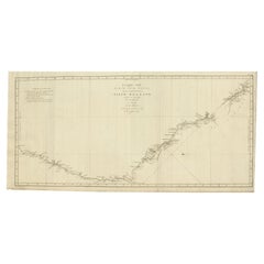
Old Sea Chart of the Tenasserim area, Myanmar 'Burma' in South East Asia, c.1790
About the Item
Antique map titled 'Coast of Tenasserim.'
Sea chart of the Tenasserim area, Myanmar in South East Asia. Source unknown, to be determined.
Artists and Engravers: Anonymous.
- Dimensions:Height: 18.51 in (47 cm)Width: 24.02 in (61 cm)Depth: 0 in (0.02 mm)
- Materials and Techniques:
- Period:1790-1799
- Date of Manufacture:circa 1790
- Condition:Condition: Good, given age. Slight paper loss bottom margin; backed. Repaired tear upper right. Damp stain in the left margin, 1 cm into image. A few minor spots. Original middle fold as issued. General age-related toning and/or minor defects.
- Seller Location:Langweer, NL
- Reference Number:
About the Seller
5.0
Platinum Seller
These expertly vetted sellers are 1stDibs' most experienced sellers and are rated highest by our customers.
Established in 2009
1stDibs seller since 2017
1,922 sales on 1stDibs
Typical response time: <1 hour
- ShippingRetrieving quote...Ships From: Langweer, Netherlands
- Return PolicyA return for this item may be initiated within 14 days of delivery.
More From This SellerView All
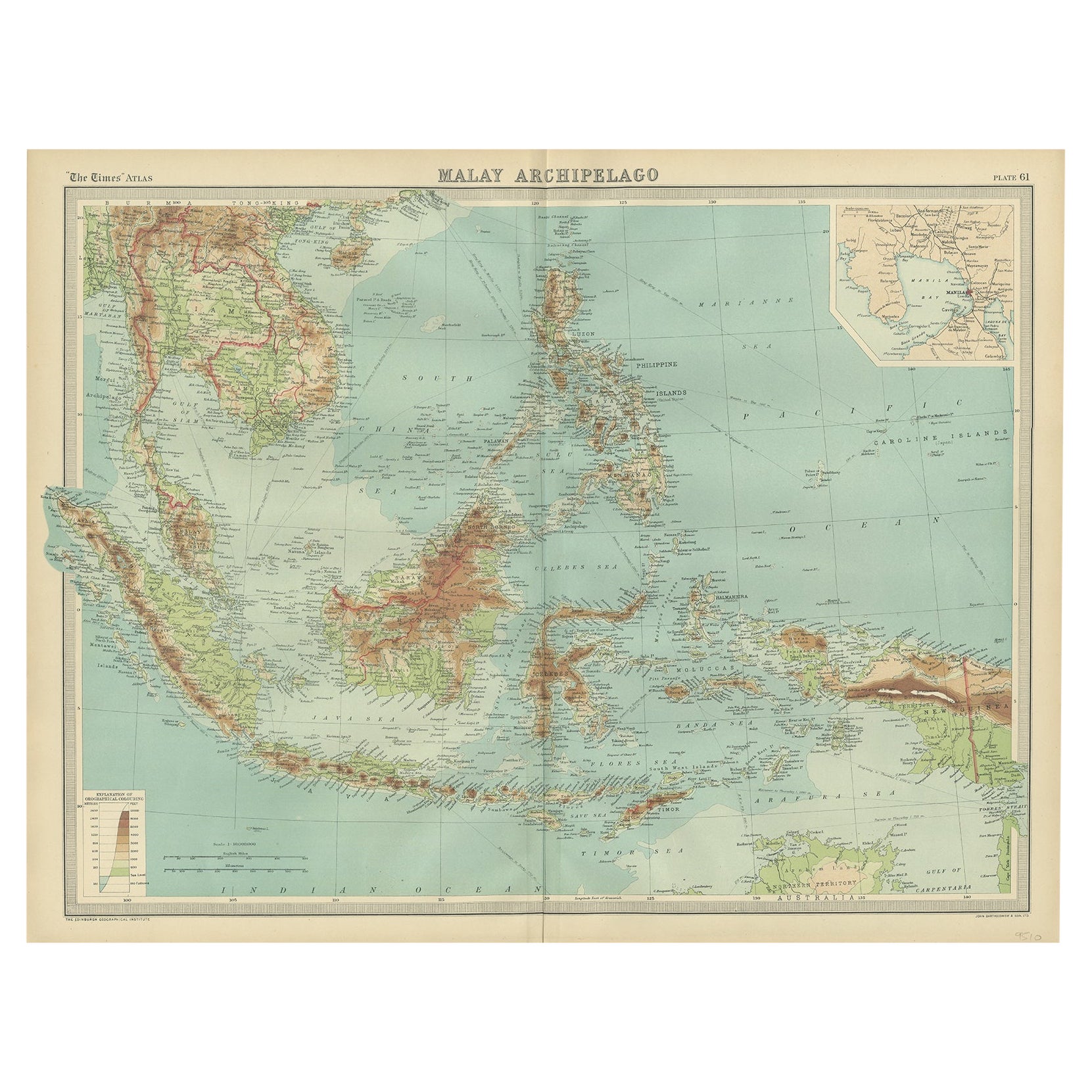
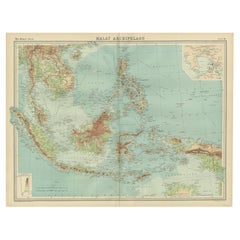
- Old Map of South East Asia Showing the Malay Archipelago, incl Borneo etc, 1922Located in Langweer, NLAntique map of South East Asia titled 'Malay Archipelago'. Old map of South East Asia depicting the Malay Archipelago including Sumatra, Java...Category
Vintage 1920s Maps
MaterialsPaper
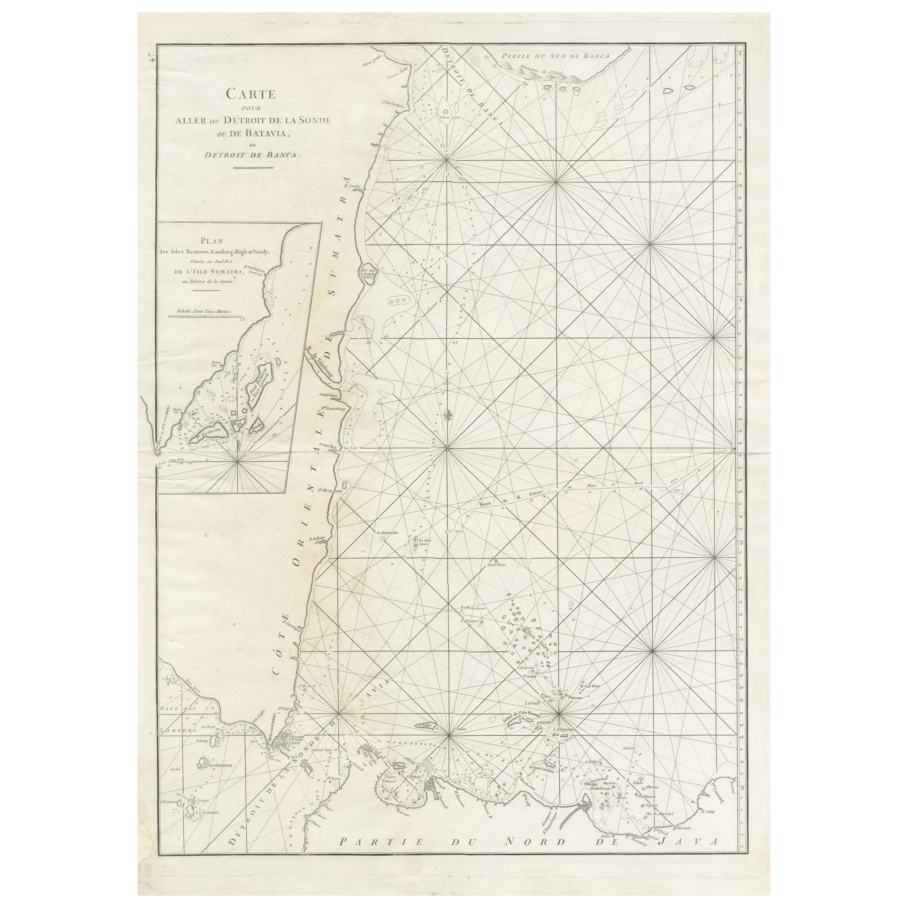
- Large Antique Sea Chart of the South-Eastern Coast of Sumatra, IndonesiaLocated in Langweer, NLAntique map titled 'Carte pour aller du Détroit de la Sonde ou de Batavia, au Détroit de Banca'. This uncommon sea chart shows northern Java and eastern Sumatra along with an inset of the small islands in the Detroit Sound. The handsome chart provides detailed navigational information, including the route of Julien Crozet in April 1772, who led a French expedition to the South Pacific after the voyage's commander, Marion De Fresne, and 26 crew members were killed (and allegedly eaten) by a Maori tribe in the Bay of Islands off the coast of New Zealand. With title upper left corner and small inset map of the small isles nearby the south-eastern coast of Sumatra. J. B. d'Apres de Mannevillette, from his atlas "Neptune orientale". French sailor...Category
Antique Late 18th Century Maps
MaterialsPaper
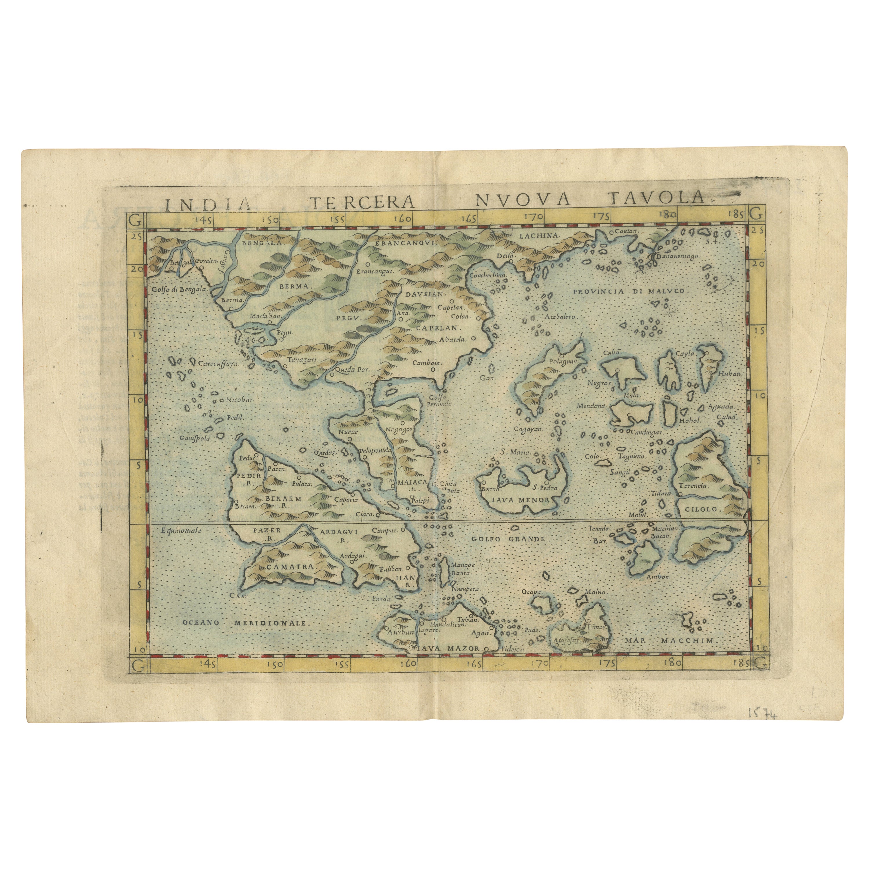
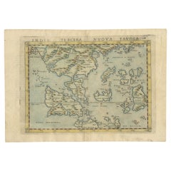
- Rare and Very Old Antique Map of South East Asia, Published circa 1574Located in Langweer, NLA very fine impression of this map of the Malay Peninsula, Sumatra, Java, with Singapore denoted as 'Cinca Pula'. Highly distorted and inaccurate map by Girolamo Ruscelli after J...Category
Antique 16th Century Maps
MaterialsPaper
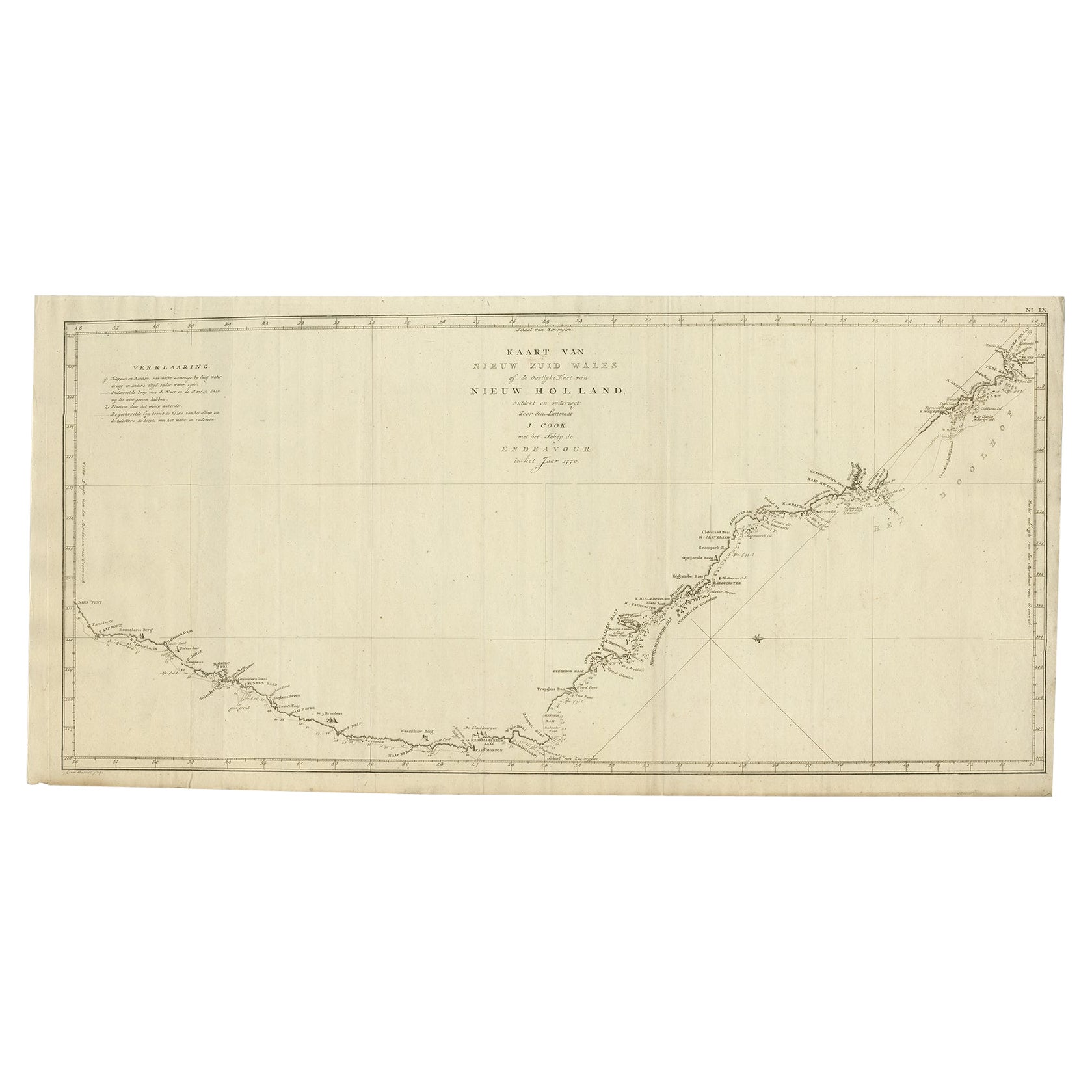
- Old Map of Cook's Discovery and Charting of the East Coast of Australia, 1803Located in Langweer, NLAntique map titled 'Kaart van Nieuw Zuid Wales of de Oostlyke Kust van Nieuw Holland ontdekt en onderzogt door den Luitenant J. Cook met het Schip de Endeavour in het Jaar 1770'. ...Category
Antique Early 1800s Maps
MaterialsPaper
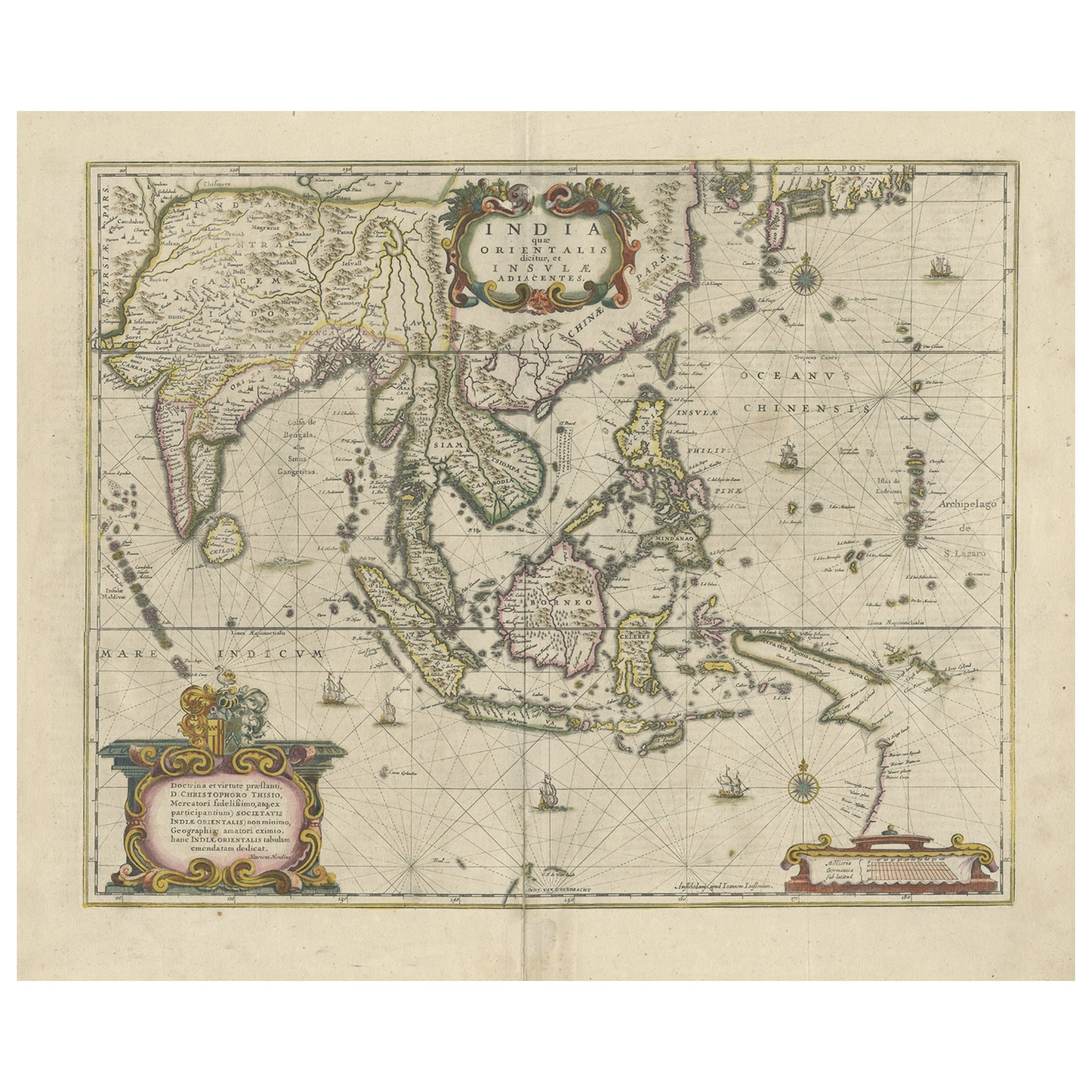
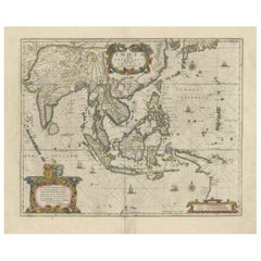
- Old Antique Map of the East Indies and Southeast Asia, ca.1644Located in Langweer, NLAntique map titled 'India quae Orientalis dicitur, et Insulae adiacentes'. Old map of the East Indies and Southeast Asia showing the area between India in the West and parts of Japan, the Marianas and New Guinea/Australia in the East. This map is dedicated to D. Christophorus Thisius by Henricus...Category
Antique 1640s Maps
MaterialsPaper
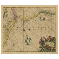
- Sea Chart of Central America and the Northwest Coast of South America, ca.1745Located in Langweer, NLAntique map titled 'Novae Hispaniae, Chili, Peruviae et Guatamala Littorae.' Sea chart of Central America and the northwest coast of South America, oriented to the east, by Reini...Category
Antique 1740s Maps
MaterialsPaper
You May Also Like
- Original Antique Map of South East Asia, Arrowsmith, 1820Located in St Annes, LancashireGreat map of South East Asia Drawn under the direction of Arrowsmith Copper-plate engraving Published by Longman, Hurst, Rees, Orme and Brown, 1820 Unframed.Category
Antique 1820s English Maps
MaterialsPaper
- Original Antique Map of South East Asia by Becker, circa 1840Located in St Annes, LancashireGreat map of South East Asia Steel engraving with original color outline Engraved by Becker Published by Virtue, circa 1840. Unframed.Category
Antique 1840s English Other Maps
MaterialsPaper
- Original Antique Map of South East Asia by Thomas Clerk, 1817Located in St Annes, LancashireGreat map of South East Asia Copper-plate engraving Drawn and engraved by Thomas Clerk, Edinburgh. Published by Mackenzie And Dent, 1817 Unframed.Category
Antique 1810s English Maps
MaterialsPaper
- Hand-Colored 18th Century Homann Map of the Black Sea, Turkey and Asia MinorBy Johann Baptist HomannLocated in Alamo, CAAn attractive original early 18th century hand-colored map of the Black Sea and Turkey entitled "Carte de L'Asie Minevre ou de la Natolie et du Pont Evxin Tiree des Voyages et des Ob...Category
Antique Early 18th Century German Maps
MaterialsPaper
- Antique Anatomical Wall Chart Depicting the Human SkeletonLocated in Berghuelen, DEA rare 19th century anatomical wall chart depicting the human skeleton. On the sides On the sides are detailed description in German language. The wall...Category
Early 20th Century German Victorian Prints
MaterialsPaper
- Hand-Colored 18th Century Homann Map of Denmark and Islands in the Baltic SeaBy Johann Baptist HomannLocated in Alamo, CAAn 18th century copper plate hand-colored map entitled "Insulae Danicae in Mari Balthico Sitae utpote Zeelandia, Fionia, Langelandia, Lalandia, Falstria, Fembria Mona" created by Joh...Category
Antique Early 18th Century German Maps
MaterialsPaper


Recently Viewed
View AllMore Ways To Browse
Used Furniture In The Area
East Asia
Burmese Burma
East Coast Antiques
Antique Sea Charts
Antique Sea Chart
Old Asia Map
Sea Chart
Sea Chart Map
Maps South East Asia
Antique South East Asia Map
Burma Antique Map
Wood Carvings Of Ships
Classroom Furniture Used
Fine Antique Maps
17th Century World Map
Book Of Antique Maps
18th Century Southern Antiques