Antique Sea Chart
11
to
33
151
55
154
86
66
39
34
30
22
22
21
20
12
10
9
9
9
9
6
6
5
5
5
4
4
3
3
3
3
3
3
2
2
2
2
2
1
1
1
1
1
1
1
1
11
11
10
3
3
Sort By
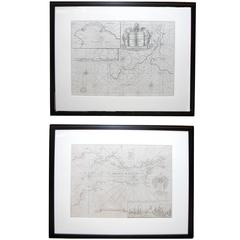
Handsome Pair of Framed Sea Charts by Captain Greenvile Collins
By Captain Greenvile Collins
Located in San Francisco, CA
A handsome pair of framed sea charts of the coasts of Great Britain by Captain Greenvile Collins
Category
Late 18th Century English Antique Sea Chart
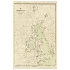
Large Sea Chart of the British Islands, 1918
Located in Langweer, NL
Antique map titled 'The British Islands'.
Large sea chart of the British Islands. It shows
Category
1910s Antique Sea Chart
Materials
Paper
Dartmouth, England: A Hand-Colored 17th Century Sea Chart by Captain Collins
By Captain Greenvile Collins
Located in Alamo, CA
This hand-colored sea chart of the area around Dartmouth, England is from "Great Britain's Coasting
Category
Late 17th Century English Antique Sea Chart
Materials
Paper
H 23 in W 27.75 in D 0.5 in
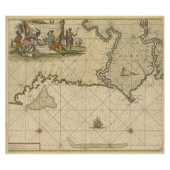
Antique Sea Chart of the Western Coast of Africa
Located in Langweer, NL
Antique map titled 'Nieuwe Paskaert van de Kust van Genehoa (..)'. This attractive sea chart covers
Category
Late 17th Century Antique Sea Chart
Materials
Paper
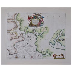
Plymouth, England: A Hand-Colored 17th Century Sea Chart by Captain Collins
By Captain Greenvile Collins
Located in Alamo, CA
This hand-colored sea chart of the area around Plymouth, England from "Great Britain's Coasting
Category
Late 17th Century English Antique Sea Chart
Materials
Paper
H 23 in W 27.75 in D 0.5 in
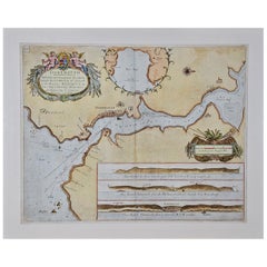
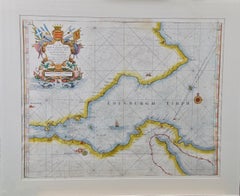
Edinburgh, Scotland: An Original 17th C. Hand-Colored Engraved Sea Chart
By Captain Greenvile Collins
Located in Alamo, CA
This hand-colored sea chart is entitled "Edinburgh Firth" from "Great Britain's Coasting Pilot
Category
Late 17th Century Antique Sea Chart
Materials
Engraving
H 23 in W 27.75 in D 0.5 in
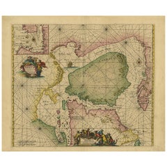
Antique Sea Chart of North America by Ottens, circa 1745
Located in Langweer, NL
Antique map titled 'Septemtrionaliora Americae a Groenlandia (..)'. Sea chart of the northern
Category
Mid-18th Century Antique Sea Chart
Materials
Paper
Free Shipping
H 21.46 in W 25.99 in D 0.02 in
Flanders, Holland & Norfolk: Hand-Colored 17th Century Sea Chart by Collins
By Captain Greenvile Collins
Located in Alamo, CA
This hand-colored chart of the seas about Flanders, Holland, Frisia, and Norfolk is from "Great
Category
Late 17th Century English Antique Sea Chart
Materials
Paper
H 23 in W 27.75 in D 0.5 in
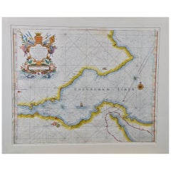
Edinburgh, Scotland Coast: A 17th Century Hand-Colored Sea Chart by Collins
By Captain Greenvile Collins
Located in Alamo, CA
This hand-colored sea chart is entitled "Edinburgh Firth" from "Great Britain's Coasting Pilot
Category
Late 17th Century English Antique Sea Chart
Materials
Paper
H 23 in W 27.75 in D 0.5 in
Old Sea Chart of the Tenasserim area, Myanmar 'Burma' in South East Asia, c.1790
Located in Langweer, NL
Antique map titled 'Coast of Tenasserim.'
Sea chart of the Tenasserim area, Myanmar in South
Category
1790s Antique Sea Chart
Materials
Paper
H 18.51 in W 24.02 in D 0 in
Sea Chart Titled 'Baya de Saldanha' with Robben Island in South Africa, 1726
Located in Langweer, NL
Antique map titled 'Baya de Saldanha'.
Sea chart covering the South African coast from the Cape
Category
1720s Antique Sea Chart
Materials
Paper
H 13.39 in W 15.95 in D 0 in
Old Sea Charts of Tourane Bay & the Con Dao Islands 'Pulo Condor', Vietnam, 1780
Located in Langweer, NL
de l'Isle Condor'.
Sea charts of the coast of Vietnam around the Tourane Bay and the Con Dao
Category
1780s Antique Sea Chart
Materials
Paper
H 21.66 in W 14.57 in D 0 in
Original Antique Sea Chart of the Maas 'or Meuse' River with Neptunes, 1684
Located in Langweer, NL
Antique map titled 'Paskaerte van het inkoomen van de Maes (..)'.
Original antique sea chart of
Category
1680s Antique Sea Chart
Materials
Paper
H 20.48 in W 22.45 in D 0 in
Antique Sea Chart of the coasts of Denmark and Sweden by C.A. Berey, 1720
Located in Langweer, NL
This beautiful large sea chart depicts the Oresund, which forms the border between Skane, Sweden
Category
Early 18th Century Antique Sea Chart
Materials
Paper
Free Shipping
H 25.79 in W 37.01 in D 0.02 in
Sea Chart of Part of the Southwestern Coast of Sumatra & Nias, Indonesia, C1775
Located in Langweer, NL
Antique map titled 'Carte de la Côte Occidentale de l'Isle Sumatra'. Sea chart of the part of the
Category
1770s Antique Sea Chart
Materials
Paper
H 30.71 in W 21.66 in D 0 in
Old Sea Chart of Northern Norway, also depicting Part of Lapland & Russia, 1702
Located in Langweer, NL
Antique map titled 'The Coast of Norway and Lapland, from North kyn to the River Kola'.
Sea
Category
Early 1700s Antique Sea Chart
Materials
Paper
H 17.33 in W 21.66 in D 0 in
Antique Sea Chart of Hudson Bay and Arctic Canada by Van Keulen, circa 1681
Located in Langweer, NL
Antique map titled 'Pascaarte vande Noorderzee Custen van America (..)'. Sea chart of Hudson Bay
Category
Late 17th Century Antique Sea Chart
Materials
Paper
No Reserve
H 20.87 in W 23.82 in D 0.02 in
Large Antique Sea Chart of the South-Eastern Coast of Sumatra, Indonesia
Located in Langweer, NL
'. This uncommon sea chart shows northern Java and eastern Sumatra along with an inset of the small
Category
Late 18th Century Antique Sea Chart
Materials
Paper
H 30.2 in W 20.87 in D 0.02 in
Sea Chart of Central America and the Northwest Coast of South America, ca.1745
Located in Langweer, NL
Antique map titled 'Novae Hispaniae, Chili, Peruviae et Guatamala Littorae.'
Sea chart of
Category
1740s Antique Sea Chart
Materials
Paper
Free Shipping
H 21.66 in W 25.99 in D 0 in
Old Decorative & Highly Detailed Sea Chart of the North Dutch-German Coast, 1681
Located in Langweer, NL
onderhoorige Eylanden; Strekkende van't Eylant der Schelling'.
Decorative and highly detailed sea chart of
Category
1680s Antique Sea Chart
Materials
Paper
H 21.38 in W 23.82 in D 0 in
Antique Sea Chart of the Coast of Sumatra, Indonesia, circa 1775
Located in Langweer, NL
Antique map titled 'Carte de la Côte Occidentale de l'Isle Sumatra'. Sea chart of the part of the
Category
18th Century Antique Sea Chart
Materials
Paper
Decorative Antique Sea Chart of Zeeland, a Province of the Netherlands, ca.1730
Located in Langweer, NL
Antique map titled 'Comitatus Zelandiae Tabula emendata a Frederico De Wit'.
Decorative sea chart
Category
1730s Antique Sea Chart
Materials
Paper
H 21.26 in W 25.2 in D 0 in
Original Antique Sea Chart of the Northern Part of Hispaniola, Western Cuba
Located in Langweer, NL
Antique map titled 'Pas kaart van de Noord Kust van Espaniola (..)'. Beautiful sea chart of the
Category
Late 17th Century Antique Sea Chart
Materials
Paper
H 21.26 in W 24.02 in D 0.02 in
Rare Old English Sea Chart of Part of Indonesia with Java, Madura and Bali, 1711
Located in Langweer, NL
Bally.'
Rare early example of this working English Sea Chart of part of Indonesia with Java, Madura
Category
1710s Antique Sea Chart
Materials
Paper
H 17.72 in W 21.78 in D 0 in
Original Antique Engraving of a Sea Chart of the Western Mediterranean, ca.1650
Located in Langweer, NL
Antique map titled 'Pascaerte van 't westlyckste deel vande Middelandsche-Zee (..)'.
Sea chart of
Category
1650s Antique Sea Chart
Materials
Paper
No Reserve
H 18.71 in W 22.64 in D 0 in
Set of 5 Large Original Vintage Sea Charts, circa 1920
Located in St Annes, Lancashire
5 great maps or charts of the oceans
I particularly like the color of these maps
Unframed
Category
1920s British Antique Sea Chart
Materials
Paper
Antique Sea Chart of the Shetland Islands, Scotland, ca.1745
Located in Langweer, NL
Antique map of Scotland titled 'Nieuwe Paskaard van Hitland met de daar omleggende eylanden na de nieuwe aftekening gemaakt by den Lofwaarden en onvermoeyden Hit en Zeeman Ian Bruyst...
Category
1740s Antique Sea Chart
Materials
Paper
Original Antique Sea Chart of the Coastline from England to Gibraltar, ca.1700
Located in Langweer, NL
Antique map titled 'A Chart of the Sea-Coast from England to the Streights.'
Original antique map
Category
Early 1700s Antique Sea Chart
Materials
Paper
No Reserve
H 18.47 in W 23.55 in D 0 in
Two Antique Sea Charts of the Thousand Islands between Batavia and Bantam, c1734
Located in Langweer, NL
Antique maps titled 'A large draught of the Coast of Iava from Bantam Point to Batavia'. Two seperate sheets, joined together they depict the island of Java, Indonesia.
Condition...
Category
1730s Antique Sea Chart
Materials
Paper
H 20.08 in W 49.61 in D 0 in
Large Sea Chart of the Zuyder Zee & The Northsea with the Wadden Islands, 1773
By H. van Loon
Located in Langweer, NL
' is esteemed as the finest and most sophisticated sea atlas to be published in Amsterdam during that
Category
Late 18th Century Antique Sea Chart
Materials
Paper
H 25.2 in W 36.62 in D 0.02 in
Rare Sea Chart of the East Frisian Islands or Watten and the North Sea, c.1700
Located in Langweer, NL
Hamburgh.'
Rare and interesting chart of the East Frisian Islands (or Watten) and the North Sea. Above
Category
Early 1700s Antique Sea Chart
Materials
Paper
H 20.95 in W 24.73 in D 0 in
Original Antique Engraved Map of Part of the Red Sea, Arabia, 1775
Located in Langweer, NL
Antique map titled 'Carte de l'Entrée du Golfe de la Mer Rouge'. Uncommon sea chart of the entrance
Category
Late 18th Century Antique Sea Chart
Materials
Paper
Antique Map of Malabar Coast by Valentijn, 1726
By F. Valentijn
Located in Langweer, NL
Untitled sea chart of the coast of Malabar, India. This print originates from 'Oud en Nieuw Oost
Category
Early 18th Century Dutch Antique Sea Chart
Materials
Paper
Antique Map of the Island of Borneo by Janssonius, circa 1650
Located in Langweer, NL
Antique map titled 'Insula Borneo et Occidentalis pars Celebis cum adjacentibus Insulis'. Rare sea
Category
Mid-17th Century Antique Sea Chart
Materials
Paper
Mariners Chart of Gloucester and Rockport by George Eldridge 1910
Located in Norwell, MA
- 1900) George Eldridge and his son George Washington Eldridge (1845-1912) were leading sea chart and
Category
1910s North American Antique Sea Chart
Materials
Paper
Mariners Chart of Marion Massachussets by George Eldridge 1901
Located in Norwell, MA
) were leading sea chart and sailing guide publishers from the mid 19th to the early twentieth century
Category
Early 1900s North American Antique Sea Chart
Materials
Paper
Mariners Chart of Fishers Island Sound by George Eldridge 1901
Located in Norwell, MA
son George Washington Eldridge (1845-1912) were leading sea chart and sailing guide publishers from
Category
Early 1900s North American Antique Sea Chart
Materials
Paper
Mariners charts of Massachusett Long Island by George Eldridge 1901
Located in Norwell, MA
Eldridge and his son George Washington Eldridge (1845-1912) were leading sea chart and sailing guide
Category
Early 1900s North American Antique Sea Chart
Materials
Paper
Mariners Chart of Quicks Hole and Tarpaulin Cove by George Eldridge 1901
Located in Norwell, MA
Washington Eldridge (1845-1912) were leading sea chart and sailing guide publishers from the mid 19th to the
Category
Early 1900s North American Antique Sea Chart
Materials
Paper
Mariners Chart of Westport Mass and Narraganset Pier by George Eldridge 1901
Located in Norwell, MA
Eldridge (1845-1912) were leading sea chart and sailing guide publishers from the mid 19th to the early
Category
Early 1900s North American Antique Sea Chart
Materials
Paper
Antique Coastal Map of Sumatra by De La Haye, circa 1780
Located in Langweer, NL
Antique map titled 'Carte de la Côte Occidentale de l'Isle Sumatra'. Sea chart of the part of the
Category
Late 18th Century French Antique Sea Chart
Materials
Paper
Jacques Nicolas Bellin, St Lucia, West Indies, Hand Colored Map
By Jacques-Nicolas Bellin
Located in Norwich, GB
the single most active center for the production of sea charts and maps, including a large folio
Category
1770s Dutch Georgian Antique Sea Chart
Materials
Paper
Antique Map of the Gaspar Strait by Huddart, '1788'
Located in Langweer, NL
Antique map titled 'Sketch of the Straits of Gaspar'. Detailed sea chart of the Gaspar Strait
Category
Late 18th Century Antique Sea Chart
Materials
Paper
Antique Chart of Dundee, Aberdeen and Montrose in Scotland, C.1774
By Captain Greenvile Collins
Located in Langweer, NL
Antique map titled 'To the Honble the Magistrates of the Citty of Aberdeene'. Sea chart of Tay
Category
18th Century Antique Sea Chart
Materials
Paper
Antique Map of Java by Janssonius, circa 1650
Located in Langweer, NL
.
This map was intended to be a sea chart, therefore the interior detail is minimal. The Dutch capital in
Category
Mid-17th Century Antique Sea Chart
Materials
Paper
Indiarum Occidentalium Tractus Littorales cum Insulis Caribicis / Pascaert van W
By Louis Renard
Located in New York, NY
19 x 22 " (48.3 x 55.9 cm) plus margins.
A beautifully engraved Dutch sea chart. Shown is the
Category
18th Century Other Art Style Antique Sea Chart
Materials
Engraving
Antique Map of Macedonia by the Famous Mapmaker Blaeu, c.1650
Located in Langweer, NL
started producing map and sea charts, including his first world map in 1605. His most famous work was the
Category
17th Century Antique Sea Chart
Materials
Paper
Antique Print of the Malabar Coast of India showing the VOC establishments, 1726
Located in Langweer, NL
(publisher)
MALABAR COAST
Sea chart of the Malabar Coast, also known as the Pepper Coast, in southwestern
Category
1720s Antique Sea Chart
Materials
Paper
H 13.39 in W 16.74 in D 0 in
Detailed Antique Map of Southeast England, incl Warwickshire and Hampshire, 1690
Located in Langweer, NL
prodigious amount of cartographic material including separate terrestrial maps and sea charts, sea and
Category
1690s Antique Sea Chart
Materials
Paper
No Reserve
H 25.6 in W 20.08 in D 0 in
Antique Map of Guinea in West Africa by Blaeu, c.1638
Located in Langweer, NL
founded a business as globe maker. Later he started producing map and sea charts, including his first
Category
17th Century Antique Sea Chart
Materials
Paper
Large Antique Chart of The White Sea, Russa 1854
Located in Langweer, NL
Antique map titled 'The White Sea Index Chart'. Large uncommon map of the White Sea with a smaller
Category
19th Century Antique Sea Chart
Materials
Paper
Beautiful Map of Arnhem and the Veluwe Region, Gelderland, The Netherlands, 1690
Located in Langweer, NL
separate terrestrial maps and sea charts, sea and terrestrial atlases, wall maps, and town views. Many of
Category
1690s Antique Sea Chart
Materials
Paper
H 20.67 in W 24.41 in D 0 in
Map of the Duchy Clivia & Ravestein, Brabant in The Netherlands & Germany, 1635
Located in Langweer, NL
founded a business as globe maker. Later he started producing map and sea charts, including his first
Category
1630s Antique Sea Chart
Materials
Paper
H 16.86 in W 22.05 in D 0 in
Large Chart of the island and sea of Java, Indonesia
Located in Langweer, NL
Antique map titled 'Carte Esférica de la Isla Y Mar de Java'. Large chart of the island and sea of
Category
Mid-19th Century Antique Sea Chart
Materials
Paper
Antique Tidal Chart of the British Seas by Johnston, '1850'
Located in Langweer, NL
Antique map titled 'Tidal Chart of the British Seas showing the progress of the wave of high water
Category
Mid-19th Century Antique Sea Chart
Materials
Paper
Cortesi's Masterpiece: A Comprehensive and Authoritative Map of Uruguay, 1903
Located in Langweer, NL
being a meticulous sea chart of the Rio de la Plata and the adjacent waters of the Atlantic. The
Category
Early 20th Century Antique Sea Chart
Materials
Paper
Free Shipping
H 72.84 in W 50.79 in D 0.02 in
Large Antique Map of New Guinea and New Britain Showing Capt. Cooks Tract, 1773
Located in Langweer, NL
New Guinea and New Britain'.
This sea chart of Papua New Guinea shows the new discoveries of
Category
18th Century Antique Sea Chart
Materials
Paper
H 27.96 in W 11.42 in D 0 in
Carte Particular Des Costes De Bretagne Depuis le Cap de Frehel, Jusques a Perros
By Pierre Mortier
Located in Paonia, CO
. This large sea scale chart shows part of the northwestern coast of France, in the region of Brittany
Category
1690s Antique Sea Chart
Materials
Engraving
Carte Particuliere Des Coste De Bretagne qui Comprend Morlaix
By Pierre Mortier
Located in Paonia, CO
considered some of the most beautiful sea charts ever made.
Category
1690s Antique Sea Chart
Materials
Engraving
Map of Friesland with Terschelling, Vlieland, Ameland En Schiermonnikoog, C.1670
Located in Langweer, NL
cartographic material including separate terrestrial maps and sea charts, sea and terrestrial atlases, wall
Category
1670s Antique Sea Chart
Materials
Paper
H 21.7 in W 25.04 in D 0 in
- 1
Get Updated with New Arrivals
Save "Antique Sea Chart", and we’ll notify you when there are new listings in this category.
Antique Sea Chart For Sale on 1stDibs
At 1stDibs, there are many versions of the ideal piece of antique sea chart for your home. Was constructed with extraordinary care, often using paper, fabric and canvas. You’ve searched high and low for the perfect item from our selection of antique sea chart — we have versions that date back to the 18th Century alongside those produced as recently as the 20th Century are available. A well-made choice in our collection of antique sea chart has long been a part of the offerings for many furniture designers and manufacturers, but those produced by Captain Greenvile Collins, Dr. Paul Pfurtscheller and Frederick de Wit are consistently popular.
How Much is a Antique Sea Chart?
Prices for a piece of antique sea chart start at $223 and top out at $6,600 with the average selling for $1,392.
