Items Similar to Mariners Chart of Marion Massachussets by George Eldridge 1901

Want more images or videos?
Request additional images or videos from the seller
1 of 12
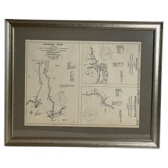
Mariners Chart of Marion Massachussets by George Eldridge 1901
About the Item
Nautical chart showing the harbor and local waters of Marion Harbor., The chart displays depth, buoys, lighthouses, etc., Shown are Planting Island, Ram Island, Sippican Neck, Little Neck, Charles Neck, Rock Island, etc. (1821 - 1900) George Eldridge and his son George Washington Eldridge (1845-1912) were leading sea chart and sailing guide publishers from the mid 19th to the early twentieth century. George Eldridge was a fisherman who suffered an injury so he flourished as a cartographer. His bold easy to read charts were favored by mariners. He also issued an annual tide book. Dated 1901. Matted and framed.
Weight: 7 lbs.
Overall Dimensions: 27"H x 21"W
Made: America
Material: Paper
Date: 1901
- Dimensions:Height: 27 in (68.58 cm)Width: 21 in (53.34 cm)Depth: 1 in (2.54 cm)
- Materials and Techniques:
- Place of Origin:
- Period:1900-1909
- Date of Manufacture:1901
- Condition:
- Seller Location:Norwell, MA
- Reference Number:
About the Seller
5.0
Vetted Seller
These experienced sellers undergo a comprehensive evaluation by our team of in-house experts.
Established in 1967
1stDibs seller since 2015
346 sales on 1stDibs
Typical response time: 2 hours
- ShippingRetrieving quote...Ships From: Norwell, MA
- Return PolicyThis item cannot be returned.
More From This SellerView All
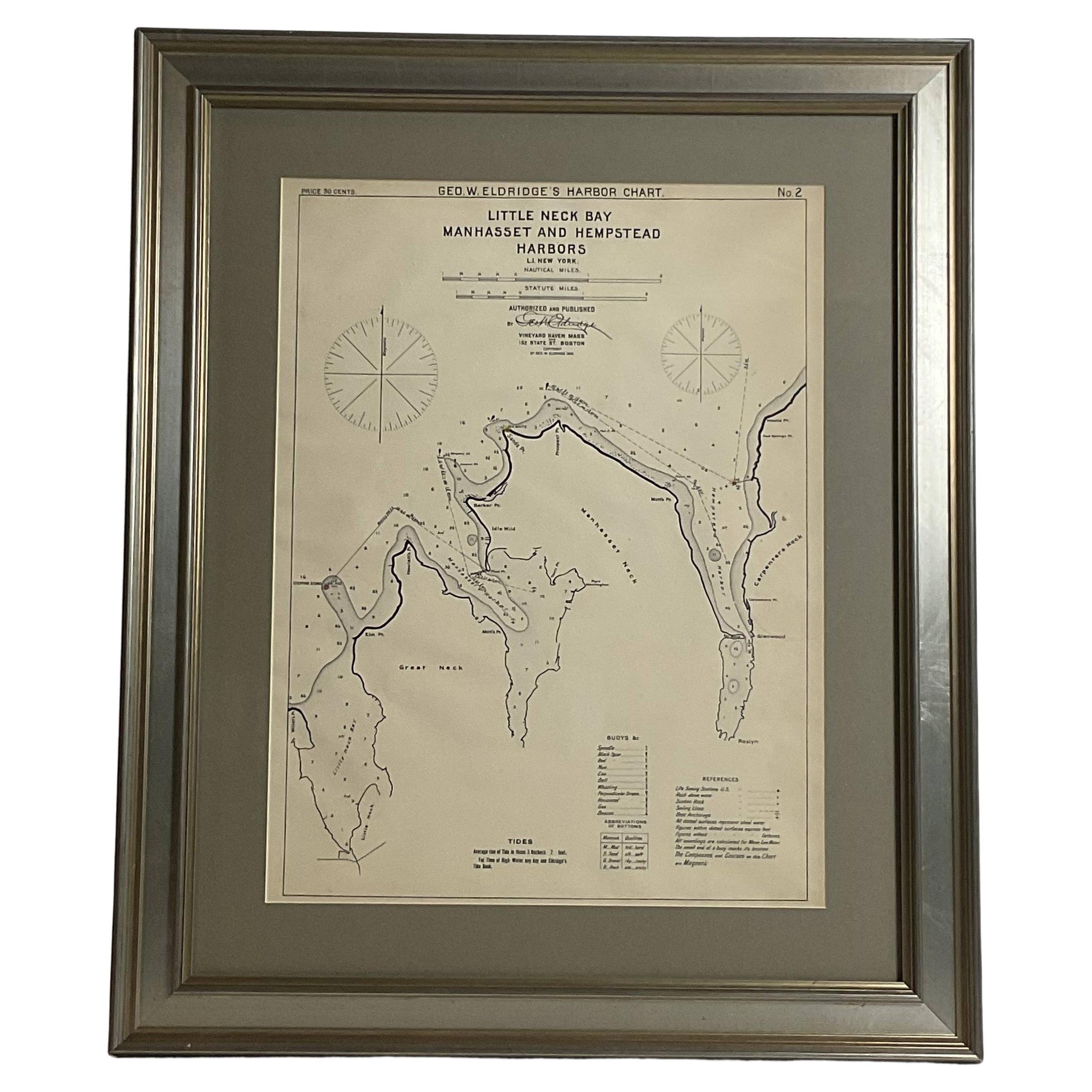
- Mariners charts of Massachusett Long Island by George Eldridge 1901Located in Norwell, MANautical Chart showing the harbor and local waters of the Little Neck Bay, Manhasset and Hempstead Harbors. The chart displays depths, buoys, lighthouses, etc., Shown is Manhasset Ne...Category
Antique Early 1900s North American Prints
MaterialsPaper
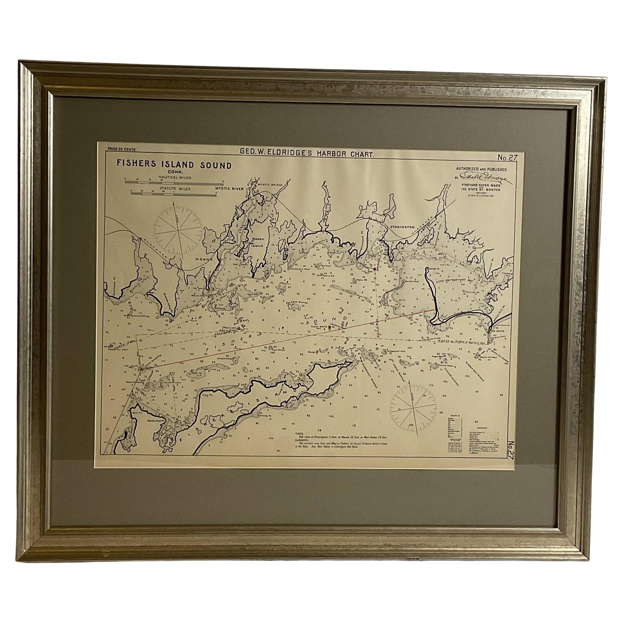
- Mariners Chart of Fishers Island Sound by George Eldridge 1901Located in Norwell, MANautical Chart showing the harbor and local waters of fishers island sound. The chart displays depths, buoys, lighthouses, etc., Shown is Watch Hill Point, Stonington, Mason Island, ...Category
Antique Early 1900s North American Prints
MaterialsPaper
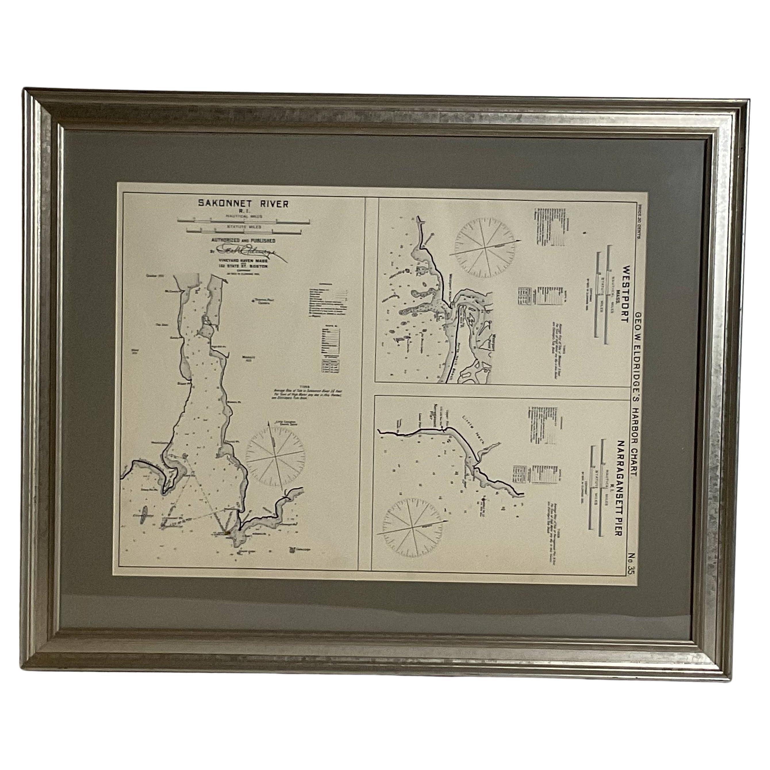
- Mariners Chart of Westport Mass and Narraganset Pier by George Eldridge 1901Located in Norwell, MAOriginal Nautical chart showing the harbor and local waters of Westport Mass, Narraganset Pier R.I. The chart displays depths, the Narraganset Pier, Little Neck Westport Harbor, Hors...Category
Antique Early 1900s North American Prints
MaterialsPaper
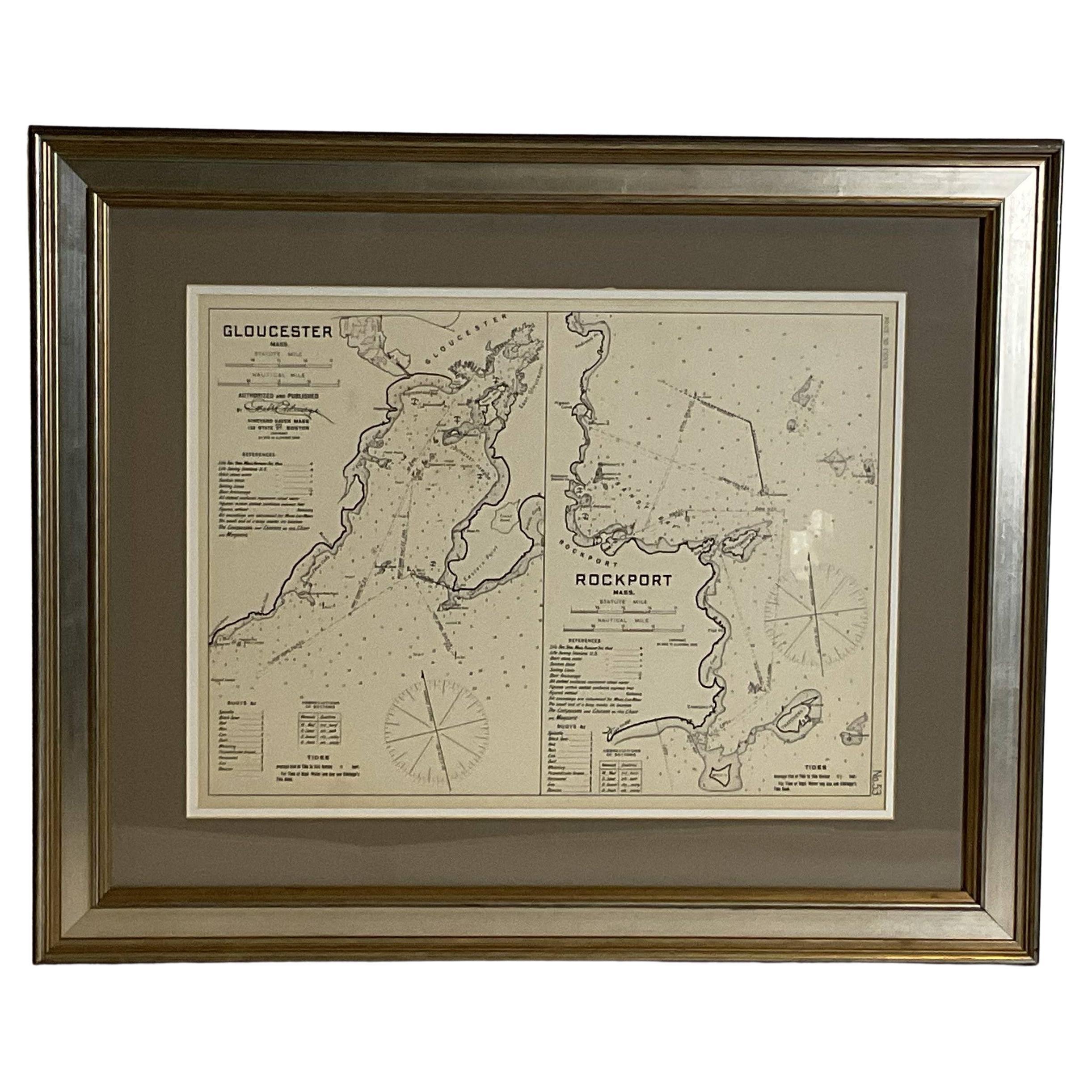
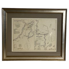
- Mariners Chart of Gloucester and Rockport by George Eldridge 1910Located in Norwell, MANautical chart showing the harbor and local water. The chart display depths buoys, lighthouses, etc., This chart shows Eastern Point, Rocky Neck, Stage head, Thatcher Island, Sandy B...Category
Vintage 1910s North American Prints
MaterialsPaper
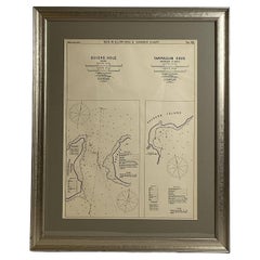
- Mariners Chart of Quicks Hole and Tarpaulin Cove by George Eldridge 1901Located in Norwell, MANautical chart showing the harbor and local waters of Naushon Island Quick Holes. The chart display depths buoys, lightness, etc., The chart shows the cove in Naushon with ships stor...Category
Antique Early 1900s North American Maps
MaterialsPaper
- Copy of 1901 Chart of Boston HarborLocated in Norwell, MALater copy after an original Boston Harbor chart by George Eldridge of Vineyard Haven and Boston. Detailed chart of Boston Harbor from the Neponset River in Quincy south down to Kimb...Category
Vintage 1910s North American Prints
MaterialsPaper


You May Also Like
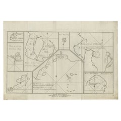
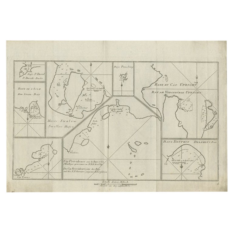
- Antique Chart of CAP Providence and Other Charts by Hawkesworth, 1774Located in Langweer, NLAntique print titled 'Baye du Cap Upright (..)'. Eight charts on one sheet of Cap Providence, St. David's Cove, the Bay of the Island, Swallow's Haven, Puzzling Bay, Baye du Cape Upr...Category
Antique 18th Century Prints
MaterialsPaper
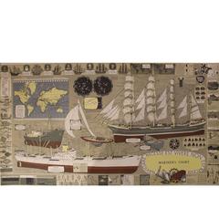
- Mariner's Chart PosterLocated in Hamilton, OntarioMariner's chart poster (nautical).Category
20th Century Posters
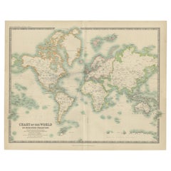
- Antique Chart of the World by Johnston '1909'Located in Langweer, NLAntique map titled 'Chart of the World on Mercator's Projection Showing the directions of the Oceans Currents with the Routes and Distances Between Principal Ports'. Detailed map of ...Category
Early 20th Century Maps
MaterialsPaper
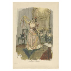
- Antique Print of 'Die Salonzauberin', 1901Located in Langweer, NLAntique print titled 'Emil Heilemann. Die Salonzauberin'. Made after Emil Heilemann. It shows a lady celebrating and dancing in a lounge.Category
Early 20th Century Prints
MaterialsPaper
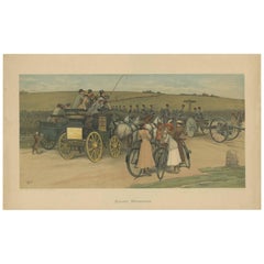
- Antique Military Print of a Troop Manoeuvre by C.E. Clifford, 1901Located in Langweer, NLAntique print titled 'Autumn Manoeuvres'. Published in London by C.E. Clifford & Co, 1901. Entered according to Act of Congress, in the year 1901. Several horses and carriages, the l...Category
Early 20th Century Prints
MaterialsPaper
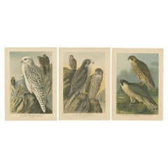
- Three Original Vintage Chromolithographs of Falcons by J.F. Naumann, 1901Located in Langweer, NLThe birds featured in the collage are all falcons, specifically: 1. The first print depicts the Gyrfalcon (Falco rusticolus), showcasing various life stages or morphs of the species...Category
Antique Early 1900s Prints
MaterialsPaper