Items Similar to Antique Chart of CAP Providence and Other Charts by Hawkesworth, 1774
Want more images or videos?
Request additional images or videos from the seller
1 of 6
Antique Chart of CAP Providence and Other Charts by Hawkesworth, 1774
About the Item
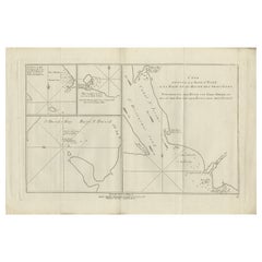
Antique print titled 'Baye du Cap Upright (..)'. Eight charts on one sheet of Cap Providence, St. David's Cove, the Bay of the Island, Swallow's Haven, Puzzling Bay, Baye du Cape Upright 's Bay, Dauphina's Bay. Originates from 'Geschichte der See-Reisen und Entdeckungen im Süd-Meer welche auf Befehl Sr. Großbrittanischen Majestät unternommen, und von Commodore Byron, Capitain Wallis, Capitain Carteret und Capitain Coockim Dolphin, der Swallow, und dem Endeavour nach einander ausgeführt worden sind (..)'.
Artists and Engravers: Published by Haude & Spener, Berlin.
Condition: Very good, general age-related toning. Please study image carefully.
Date: 1774
Overall size: 38.5 x 26 cm.
Image size: 35.5 x 20.5 cm.
Antique prints have long been appreciated for both their aesthetic and investment value. They were the product of engraved, etched or lithographed plates. These plates were handmade out of wood or metal, which required an incredible level of skill, patience and craftsmanship. Whether you have a house with Victorian furniture or more contemporary decor an old engraving can enhance your living space. We offer a wide range of authentic antique prints for any budget.
- Dimensions:Height: 10.24 in (26 cm)Width: 15.16 in (38.5 cm)Depth: 0 in (0.01 mm)
- Materials and Techniques:
- Period:
- Date of Manufacture:1774
- Condition:Condition: Very good, general age-related toning. Please study image carefully.
- Seller Location:Langweer, NL
- Reference Number:
About the Seller
5.0
Platinum Seller
These expertly vetted sellers are 1stDibs' most experienced sellers and are rated highest by our customers.
Established in 2009
1stDibs seller since 2017
1,922 sales on 1stDibs
Typical response time: <1 hour
- ShippingRetrieving quote...Ships From: Langweer, Netherlands
- Return PolicyA return for this item may be initiated within 14 days of delivery.
More From This SellerView All
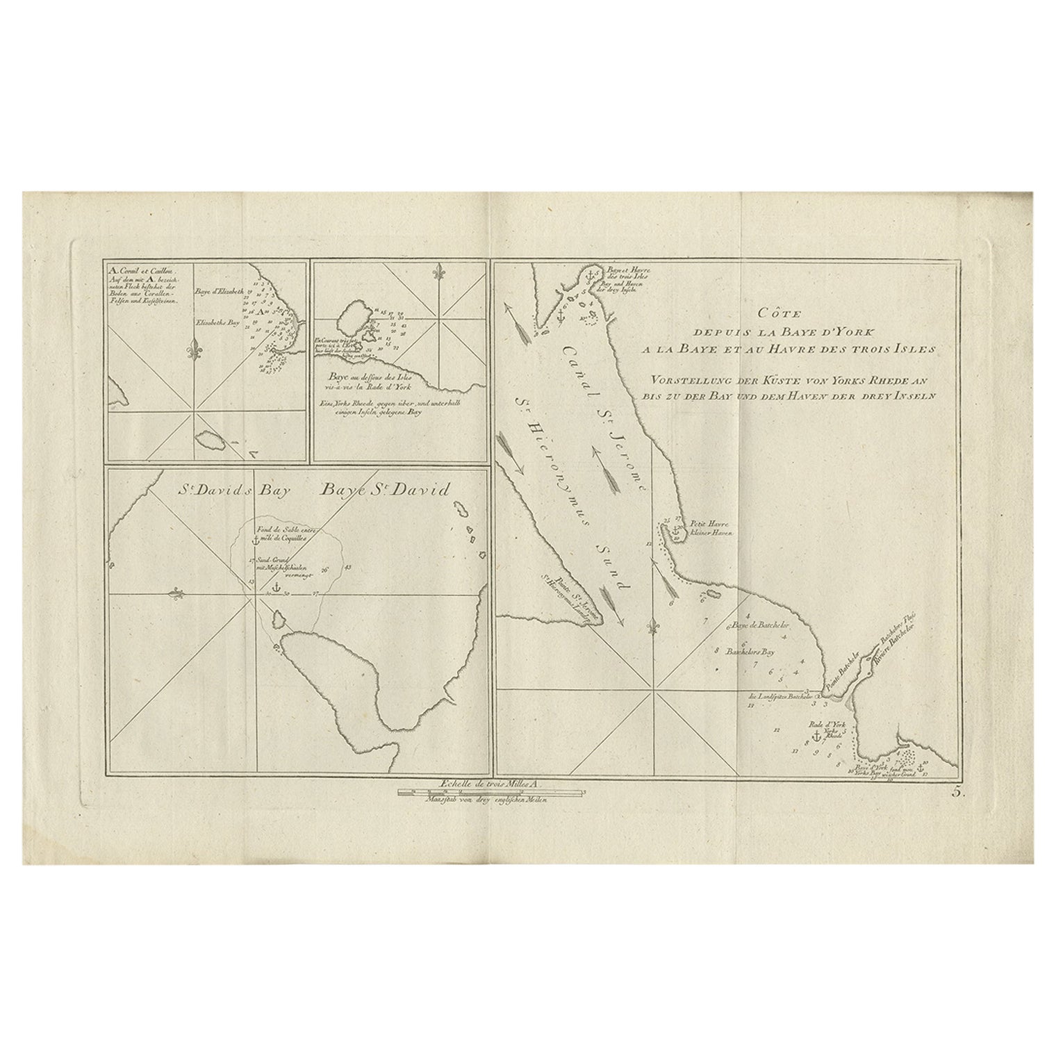
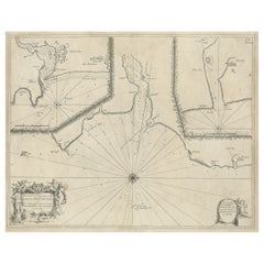
- Antique Chart of York's Bay and Surroundings by Hawkesworth, 1774Located in Langweer, NLAntique print titled 'Baye St. David (..)'. Charts of York's Bay, Haven of the Three Islands, St. David's Bay, and Elizabeth's Bay. Originates from 'Geschichte der See-Reisen und Ent...Category
Antique 18th Century Prints
MaterialsPaper
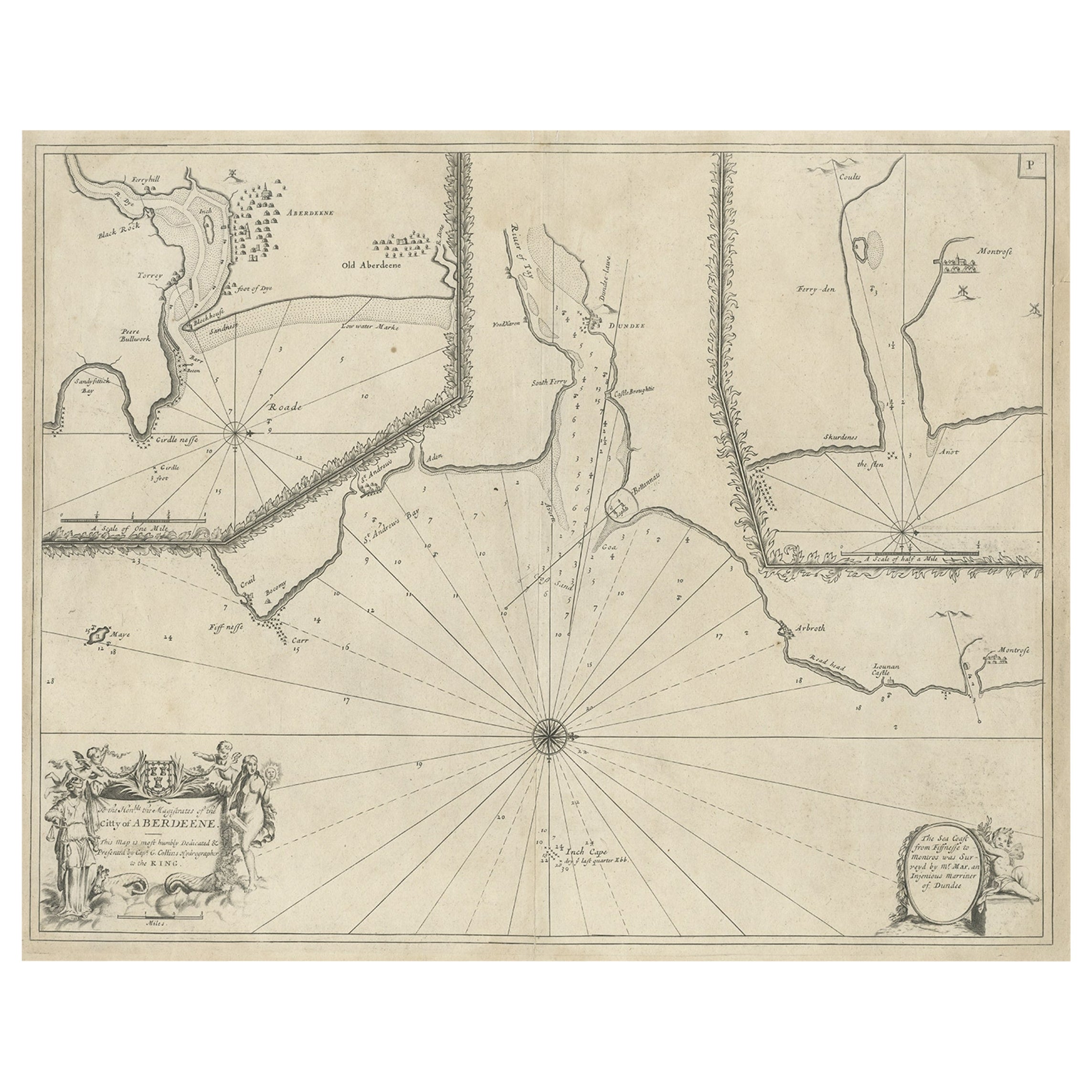
- Antique Chart of Dundee, Aberdeen and Montrose in Scotland, C.1774By Captain Greenvile CollinsLocated in Langweer, NLAntique map titled 'To the Honble the Magistrates of the Citty of Aberdeene'. Sea chart of Tay Estuary depictinging Dundee, with two further inset charts of Aberdeen and Montrose, wi...Category
Antique 18th Century Maps
MaterialsPaper
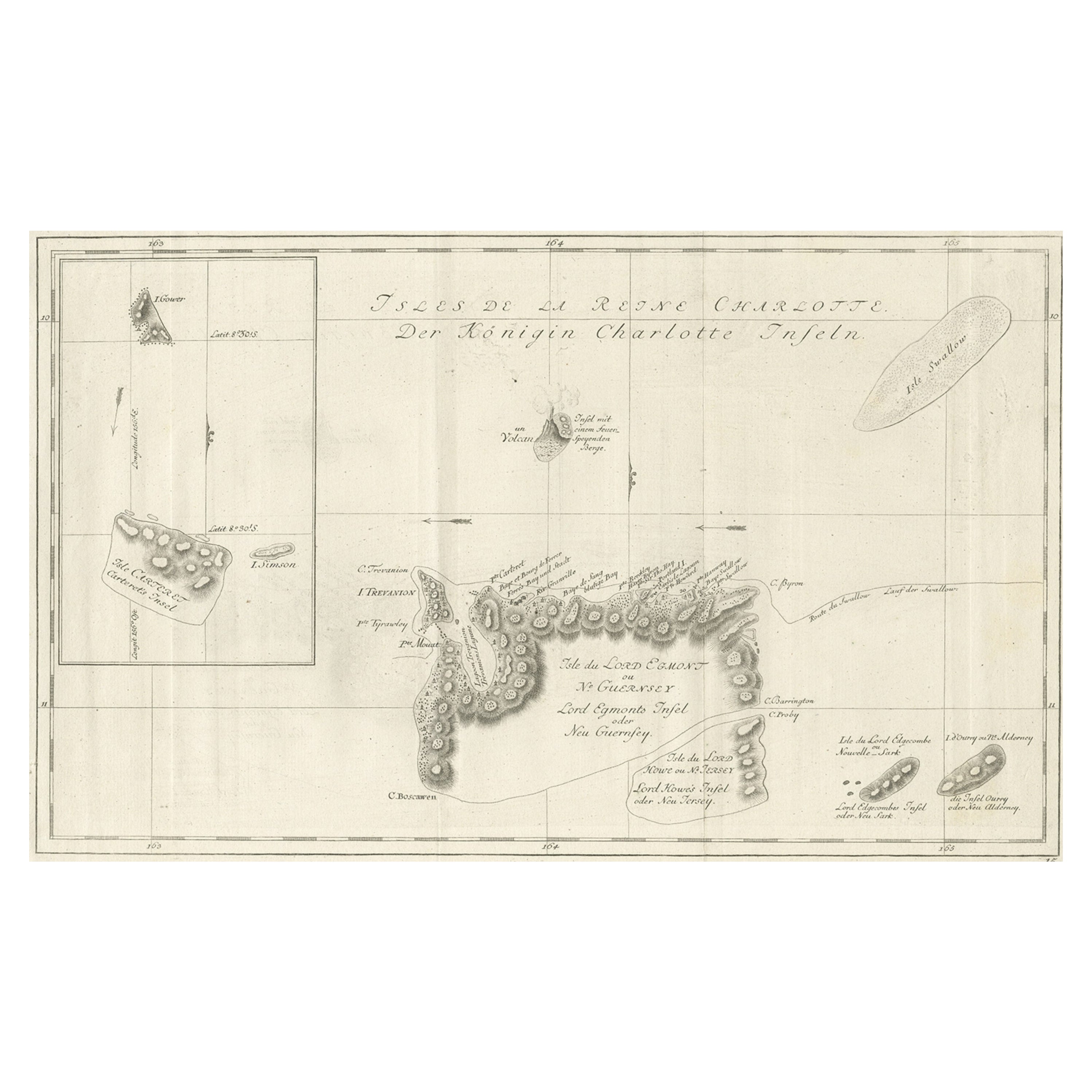
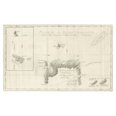
- Original Antique Chart of the Santa Cruz Islands, 1774Located in Langweer, NLAntique print titled 'Isles de la Reine Charlotte (..)'. A detailed chart of the Santa Cruz islands, to the north of the New Hebrides, with Carte...Category
Antique 1770s Maps
MaterialsPaper
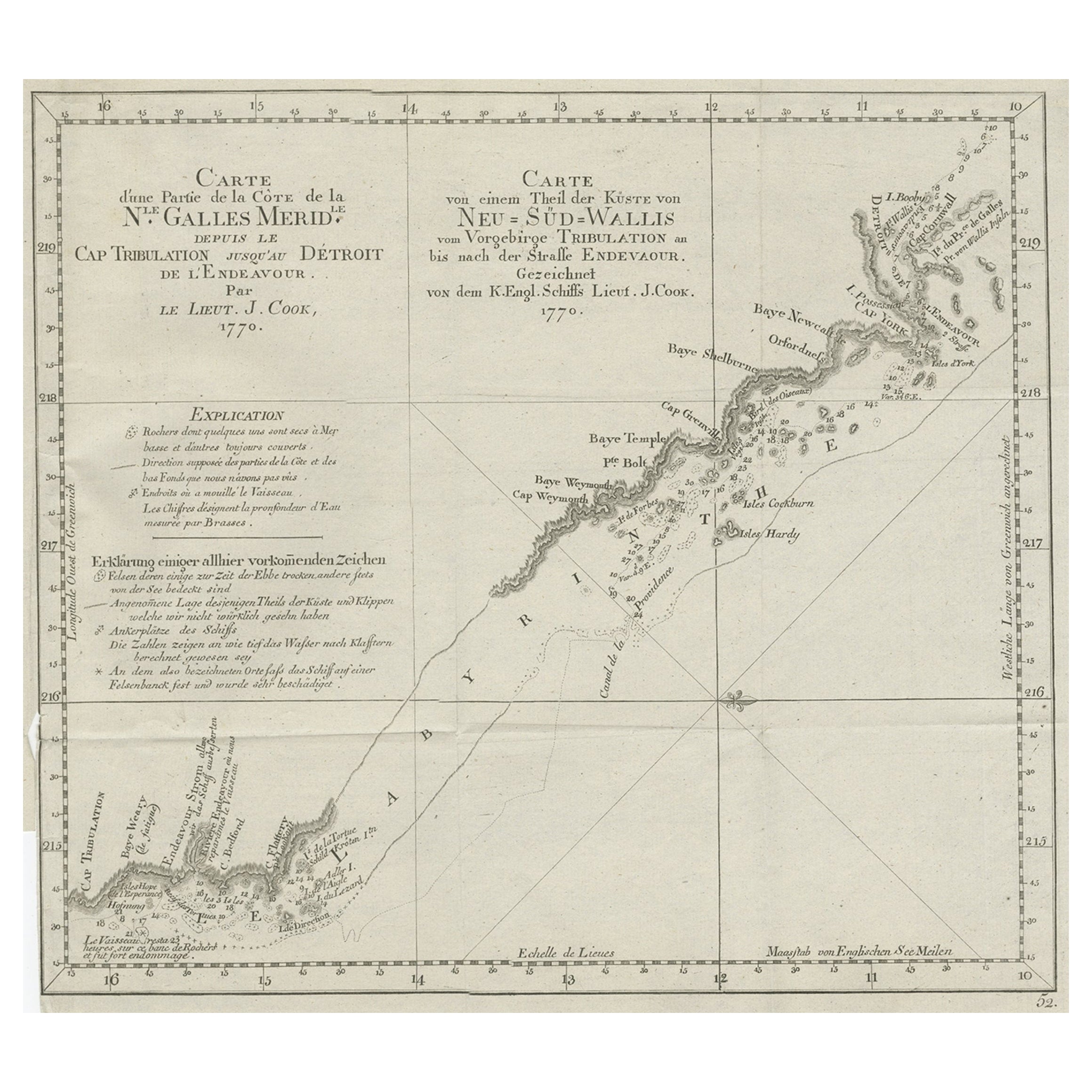
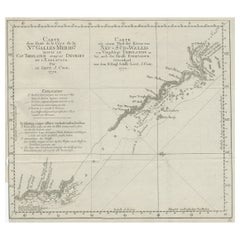
- Old Chart of the North-Eastern Coast of Australia Discovered by Cook, 1774Located in Langweer, NLAntique print titled Carte d'une Partie de la Cote de la N.le Galles Merid etc. An interesting chart of the north-eastern coast of Australia discovered by Cook in 1770, showing th...Category
Antique 1770s Maps
MaterialsPaper
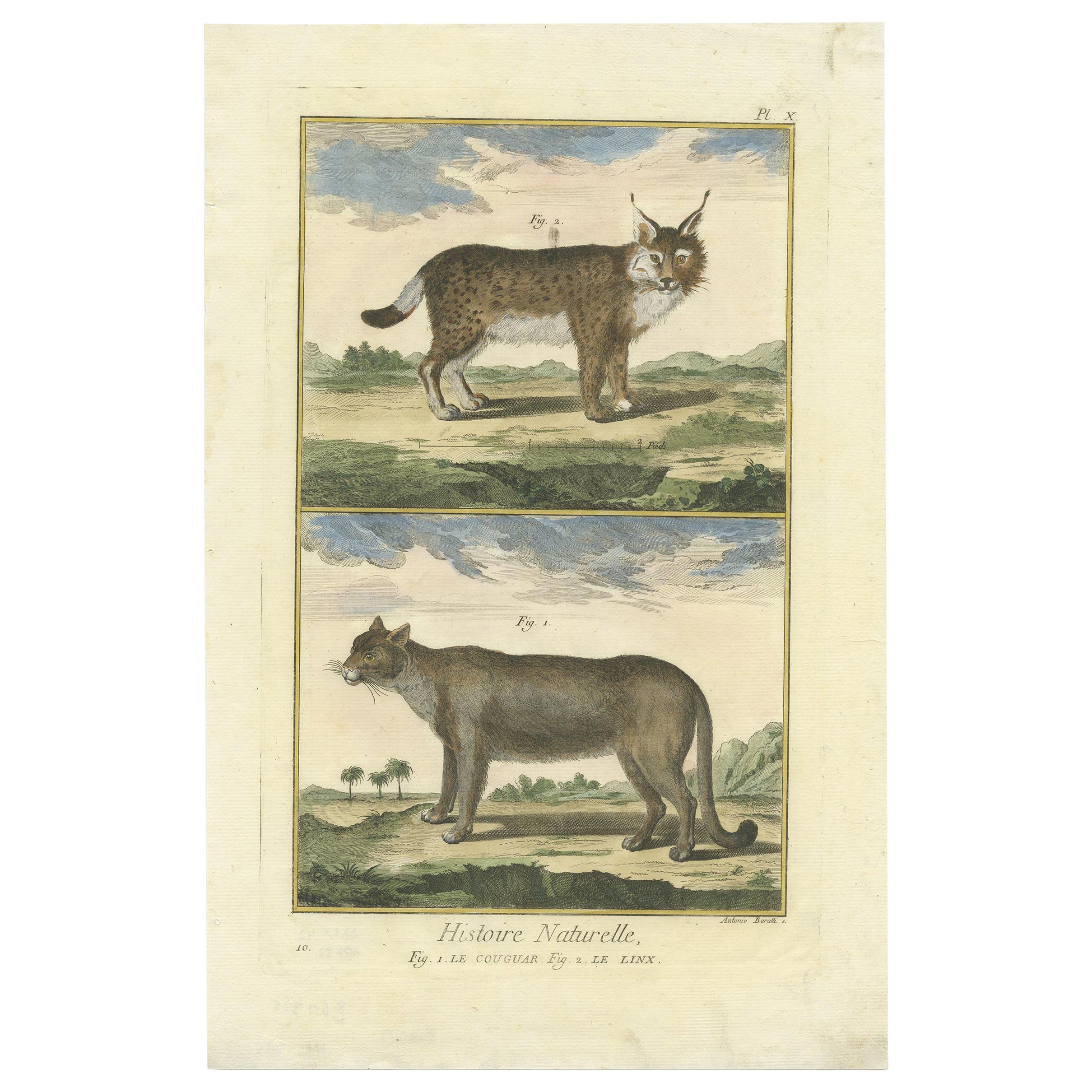
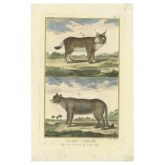
- Antique Print of a Puma and Lynx by Diderot '1774'Located in Langweer, NLAntique print titled '1. Le Couguar, 2. Le Linx'. Handcolored engraving of a puma and lynx. This print originates from 'Encyclopédie, Ou Dictionnaire Raisonné Des Sciences, Des Arts ...Category
Antique Mid-18th Century Prints
MaterialsPaper
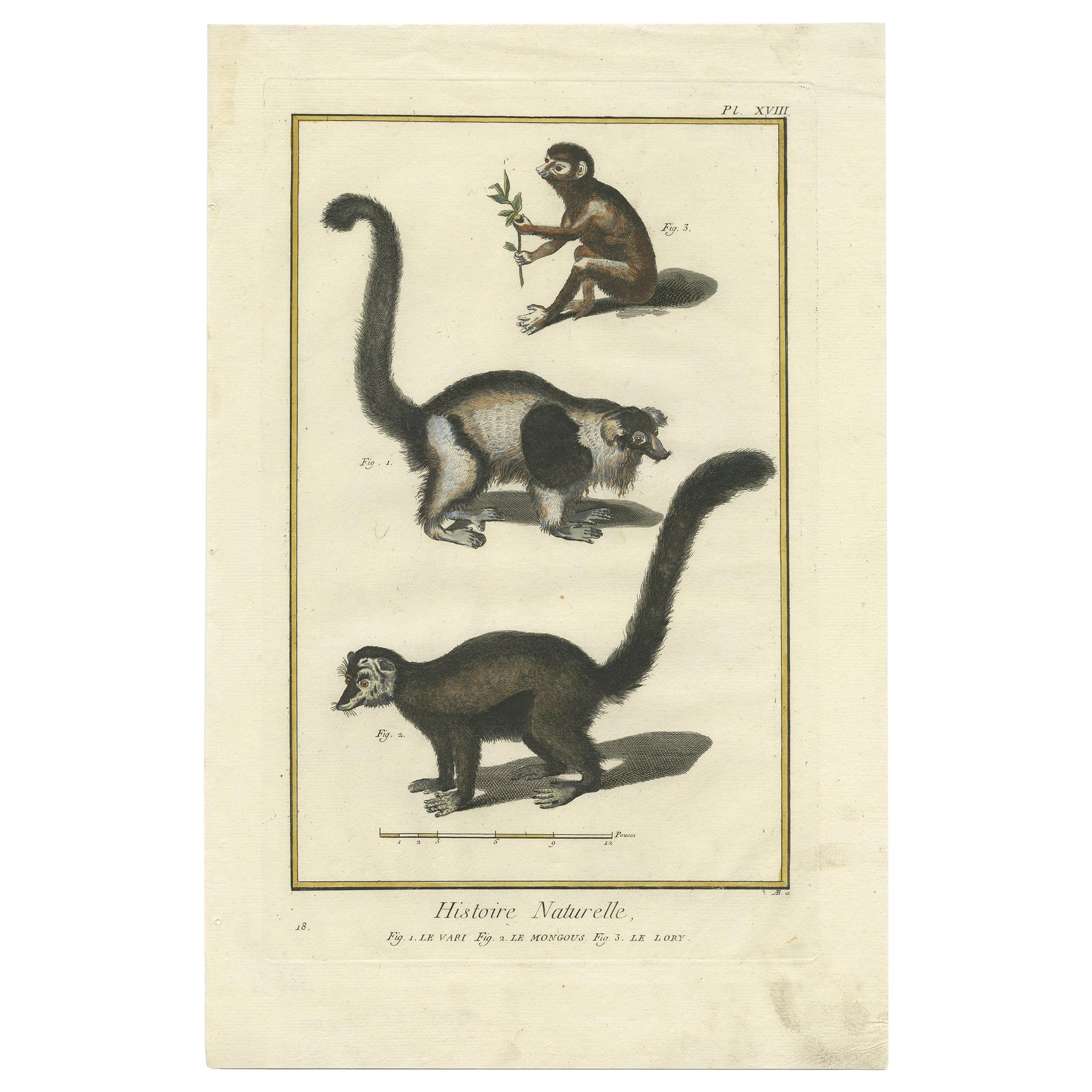
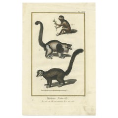
- Antique Print of a Vari, Mongoose and Lori by Diderot '1774'Located in Langweer, NLAntique print titled '1. Le Vari 2. Le Mongous 3. Le Lory'. Handcolored engraving of a Vari monkey, mongoose and lori. This print originates from 'Encyclopédie, Ou Dictionnaire Raiso...Category
Antique Mid-18th Century Prints
MaterialsPaper
You May Also Like
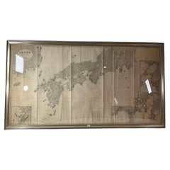
- Chart of Japan by James Imray and SonLocated in Norwell, MAChart of southern Japan compiled by James F. Imray and published in 1870. The chart captures the coast and islands. Includes Nagasaki, Kii Channel, Gulf of Yed...Category
Antique 1870s English Nautical Objects
MaterialsPaper
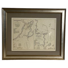
- Mariners Chart of Gloucester and Rockport by George Eldridge 1910Located in Norwell, MANautical chart showing the harbor and local water. The chart display depths buoys, lighthouses, etc., This chart shows Eastern Point, Rocky Neck, Stage head, Thatcher Island, Sandy B...Category
Vintage 1910s North American Prints
MaterialsPaper
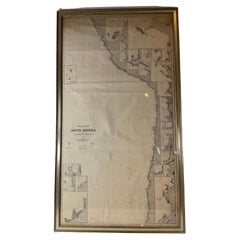
- Chart of West Coast of South America by James Imray and SonLocated in Norwell, MAChart of West Coast of South America compiled by James F. Imray and published in 1880. The chart captures the west coast from Valparaiso to Truxillo. Includes ...Category
Antique 1880s English Nautical Objects
MaterialsPaper
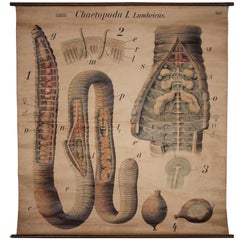
- Antique Earthworm Scientific Educational Chart by Pfurtscheller Denoyer-GeppertLocated in Oakville, CTAntique earthworm Scientific educational chart by Pfurtscheller Denoyer-Geppert "Chaetopoda I. Lumbricus" 51" x 55", Wooden rod measures 53".Category
Mid-20th Century Prints
MaterialsCanvas
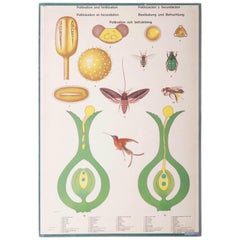
- Antique Swedish School, Teaching Chart, Poster "Polination and Fertilization"Located in Vienna, ATPrinted in Sweden, signed M. Richter. Description in five languages. Dimensions: 70 x 100 cm. Age-related patina.Category
Vintage 1950s Swedish Prints
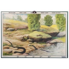
- Antique Swedish School, Teaching Chart, Poster "Snakes and Lizards"Located in Vienna, ATPrinted in Sweden, signed M. Richter. Description in five languages. Dimensions: 70 x 100 cm. Age-related patina.Category
Vintage 1950s Swedish Prints