Items Similar to Copy of 1901 Chart of Boston Harbor
Want more images or videos?
Request additional images or videos from the seller
1 of 10
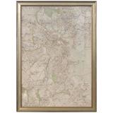
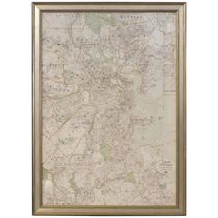
Copy of 1901 Chart of Boston Harbor
About the Item
Later copy after an original Boston Harbor chart by George Eldridge of Vineyard Haven and Boston. Detailed chart of Boston Harbor from the Neponset River in Quincy south down to Kimballs Island in Cohasset. Up to the north to Winthrop. The chart shows the Boston Harbor Islands including Paddocks, Outer Brewster, Middle Brewster, Boston Light, Long Island, Thompsons, etc.. South Shore town and cities include Squantum, Wollaston, Houghs Neck, Quincy, Weymouth, Hingham, Crows Point, World's end, Nantasket, Hull, Etc. Modern copy of a 1901 Original.
Weight: 8 lbs.
Overall Dimensions: 23"H x 28"W
Made: American
Material: Paper
Date: 1913
- Dimensions:Height: 23 in (58.42 cm)Width: 28 in (71.12 cm)Depth: 2 in (5.08 cm)
- Materials and Techniques:
- Place of Origin:
- Period:1910-1919
- Date of Manufacture:1913
- Condition:
- Seller Location:Norwell, MA
- Reference Number:
About the Seller
5.0
Vetted Seller
These experienced sellers undergo a comprehensive evaluation by our team of in-house experts.
Established in 1967
1stDibs seller since 2015
346 sales on 1stDibs
Typical response time: 2 hours
- ShippingRetrieving quote...Ships From: Norwell, MA
- Return PolicyThis item cannot be returned.
More From This SellerView All
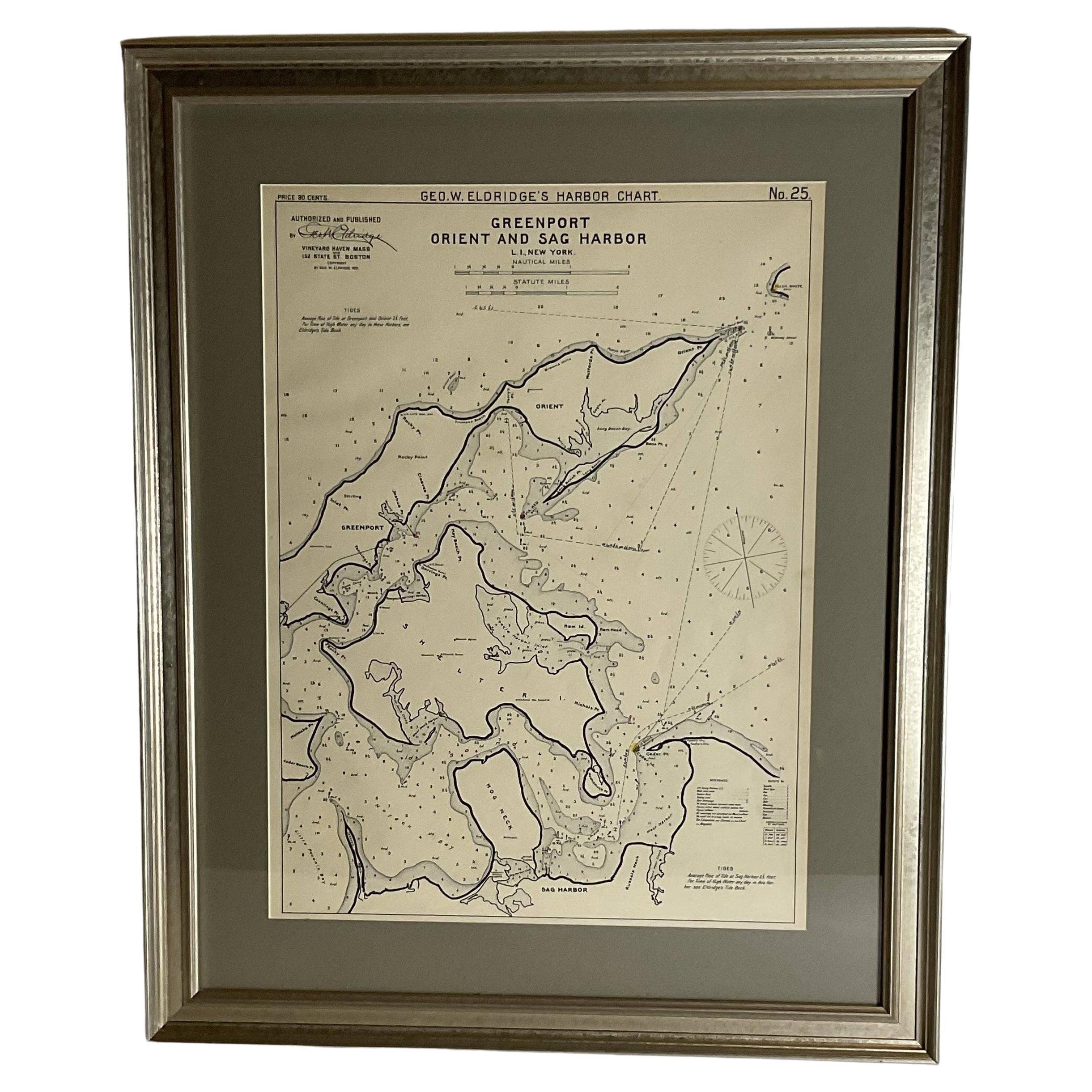
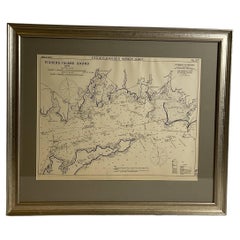
- Sag Harbor Nautical ChartLocated in Norwell, MAMarine chart of Greenport, Orient, and Sag Harbor New York published by George Eldridge in 1901. Details include the areas of Greenport, Orient, Shelter Island, Hog Neck, Sag Harbor,...Category
Antique Early 1900s Prints
MaterialsPaper
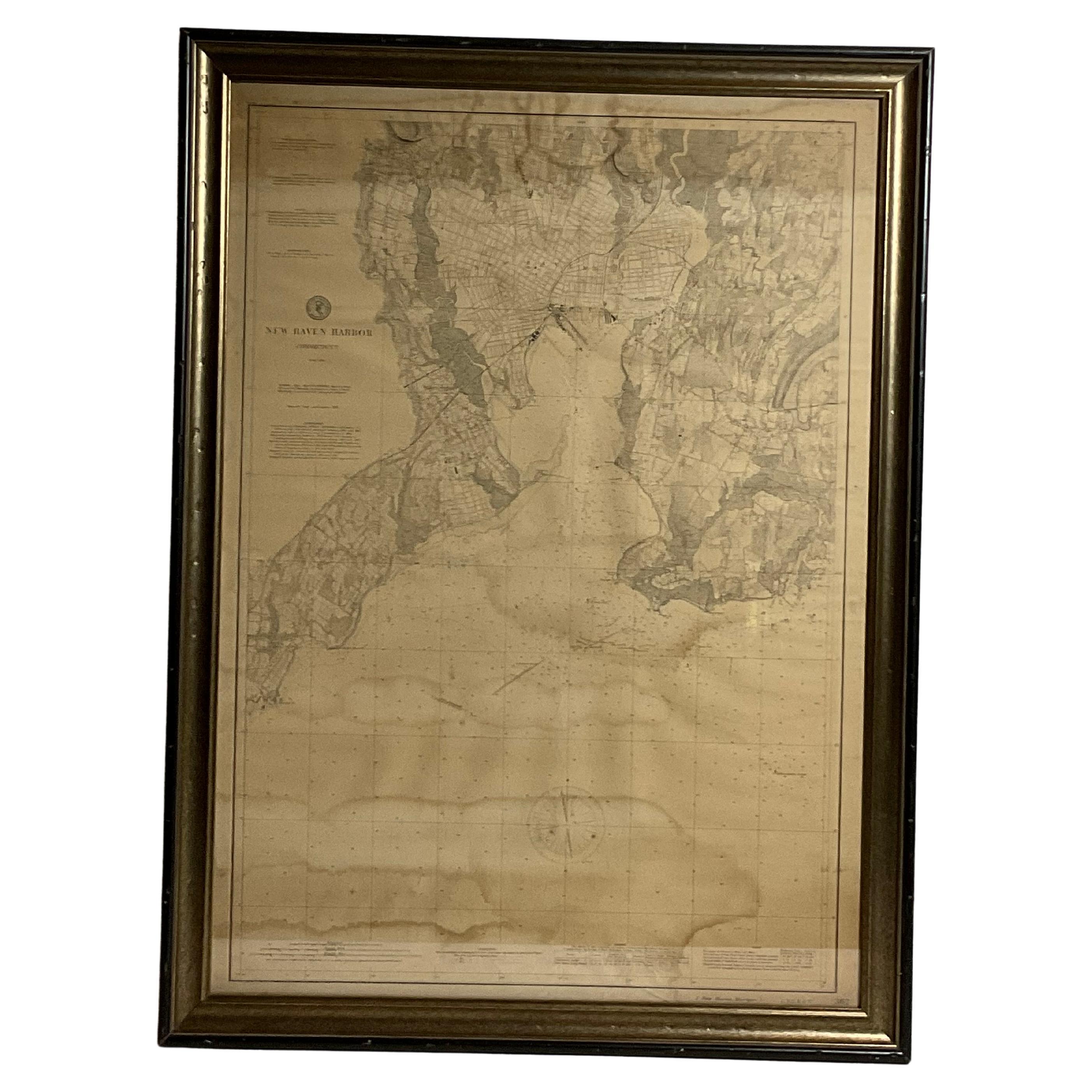
- 1896 Chart of the New Haven HarborLocated in Norwell, MANew Haven Harbor Chart published May 1896 by the United States Coast and geodetic survey. This chart is also a map of the land around the harbor and etc., loaded with detail. Nicely ...Category
Antique 1890s North American Prints
MaterialsPaper
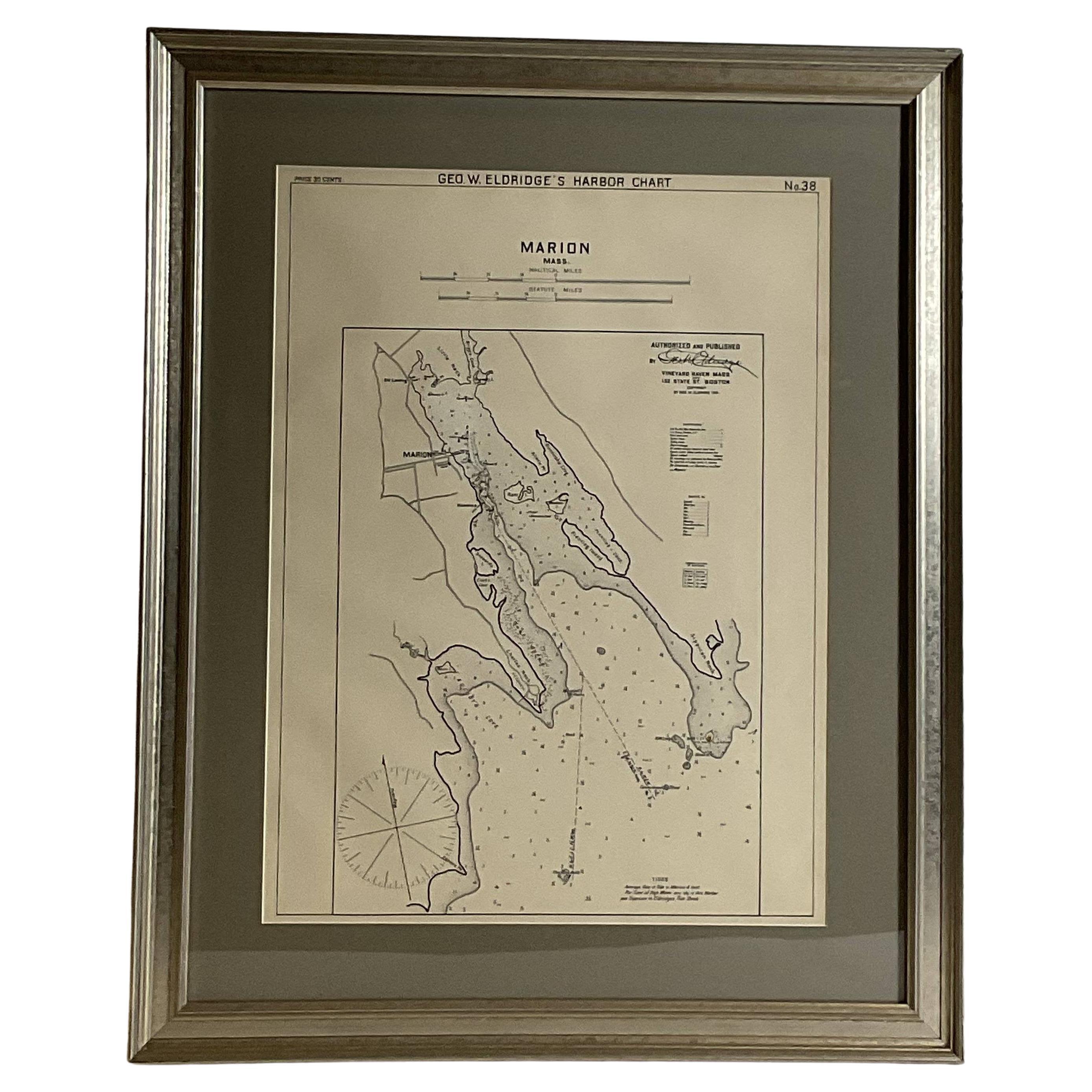
- Mariners Chart of Marion Massachussets by George Eldridge 1901Located in Norwell, MANautical chart showing the harbor and local waters of Marion Harbor., The chart displays depth, buoys, lighthouses, etc., Shown are Planting Island, Ram Island, Sippican Neck, Little...Category
Antique Early 1900s North American Prints
MaterialsPaper
- Copy of Walker Map Titled Boston & SurroundingsLocated in Norwell, MACopy of a Walker map titled Boston & Surroundings. Shows Winchester to Dedham, with greater Boston in detail. Framed. Dimensions: 45" H x 31" L.Category
20th Century Prints
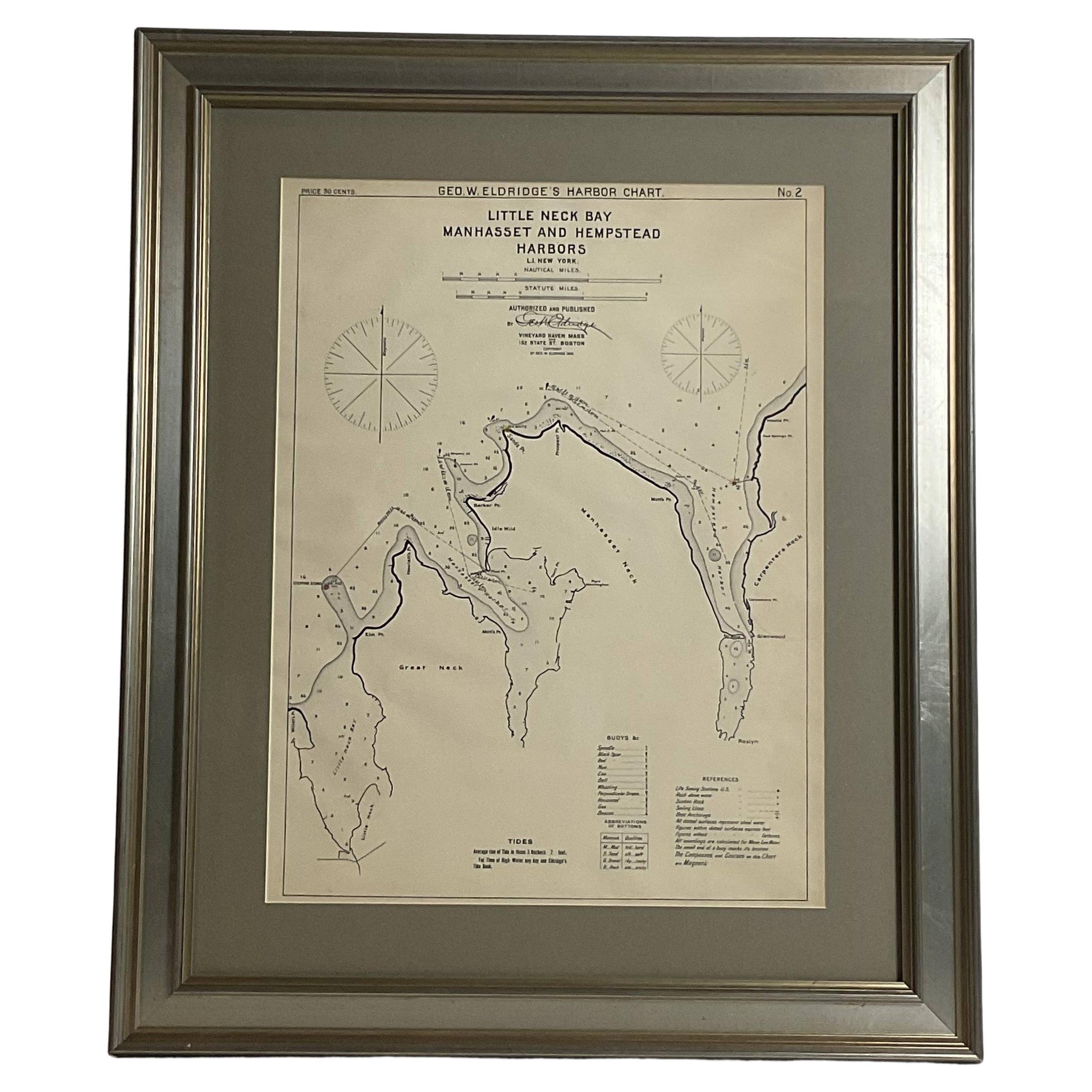
- Mariners charts of Massachusett Long Island by George Eldridge 1901Located in Norwell, MANautical Chart showing the harbor and local waters of the Little Neck Bay, Manhasset and Hempstead Harbors. The chart displays depths, buoys, lighthouses, etc., Shown is Manhasset Ne...Category
Antique Early 1900s North American Prints
MaterialsPaper
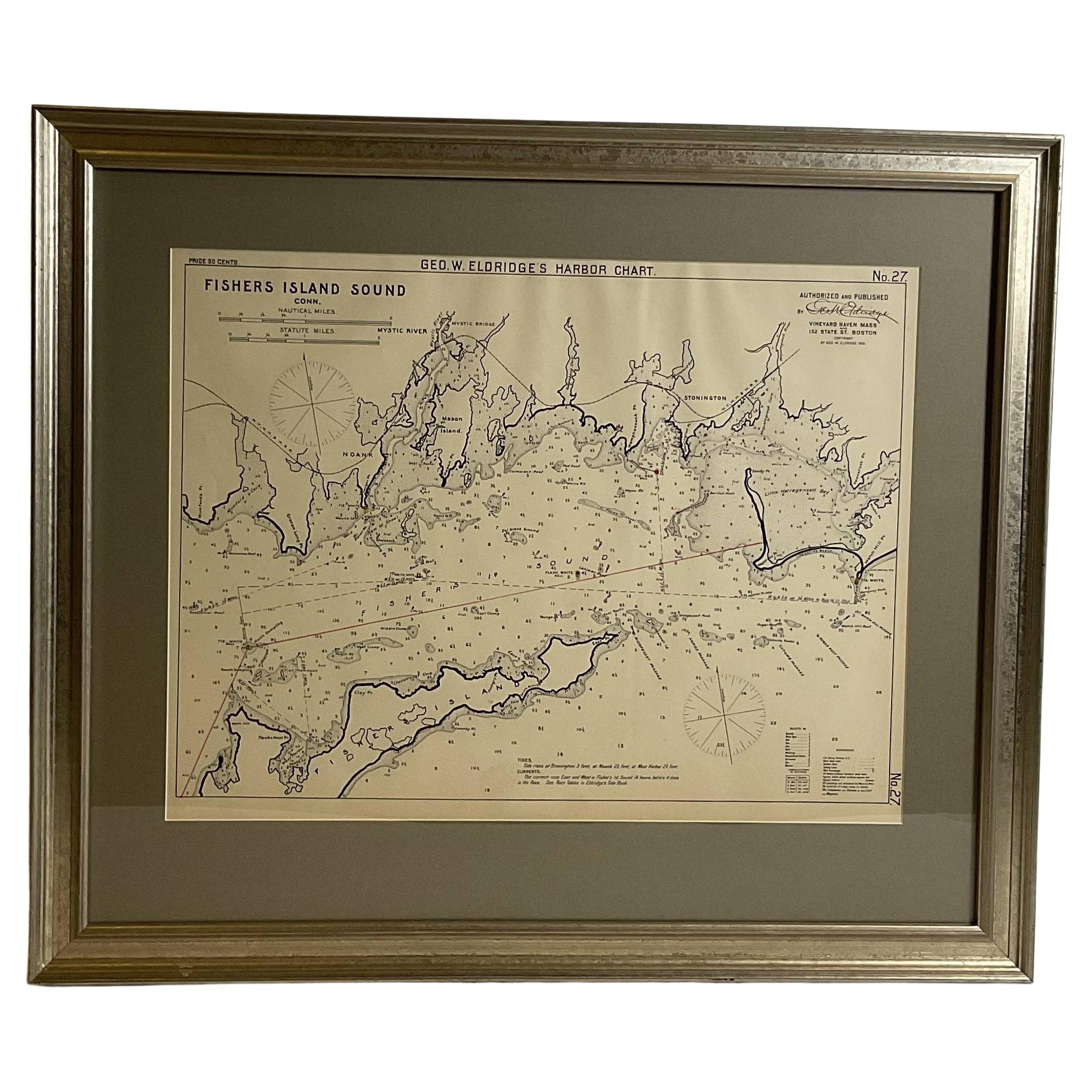
- Mariners Chart of Fishers Island Sound by George Eldridge 1901Located in Norwell, MANautical Chart showing the harbor and local waters of fishers island sound. The chart displays depths, buoys, lighthouses, etc., Shown is Watch Hill Point, Stonington, Mason Island, ...Category
Antique Early 1900s North American Prints
MaterialsPaper


You May Also Like
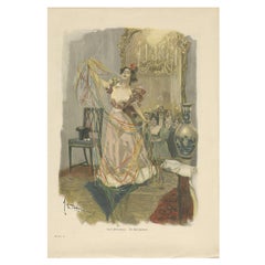
- Antique Print of 'Die Salonzauberin', 1901Located in Langweer, NLAntique print titled 'Emil Heilemann. Die Salonzauberin'. Made after Emil Heilemann. It shows a lady celebrating and dancing in a lounge.Category
Early 20th Century Prints
MaterialsPaper
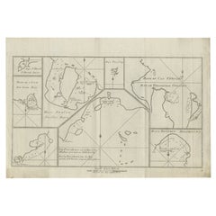
- Antique Chart of CAP Providence and Other Charts by Hawkesworth, 1774Located in Langweer, NLAntique print titled 'Baye du Cap Upright (..)'. Eight charts on one sheet of Cap Providence, St. David's Cove, the Bay of the Island, Swallow's Haven, Puzzling Bay, Baye du Cape Upr...Category
Antique 18th Century Prints
MaterialsPaper
- Vintage Wall Chart of Balikpapan 'Indonesia'Located in Langweer, NLVintage wall chart titled 'Balikpapan'. View of Balikpapan, a seaport city in East Kalimantan, Indonesia. Published circa 1920. The vintage wall ch...Category
Early 20th Century Prints
MaterialsPaper
- Vintage Wall Chart of Australia, 1949Located in Langweer, NLVintage wall chart of Australia and surroundings. Published by R. Bos and K. Zeeman, 1949.Category
Mid-20th Century Prints
MaterialsPaper
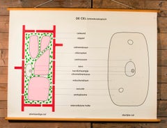
- Pair of Vintage Belgian School Charts of CellsLocated in Houston, TXThe chart also includes its original wooden dowels from which it can be hung. Pair of vintage Belgian school charts printed on cloth likely dating from the 1960s. Very graphic and in...Category
Vintage 1960s Belgian Other Prints
MaterialsPaper
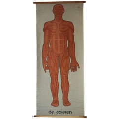
- Vintage Anatomical Chart Muscular Structure of ManLocated in Antwerp, BEVintage anatomical chart muscular structure of man. Holland, circa 1930.Category
Mid-20th Century Dutch Sporting Art Paintings
MaterialsLinen, Wood, Paper