Items Similar to 1896 Chart of the New Haven Harbor

Want more images or videos?
Request additional images or videos from the seller
1 of 20
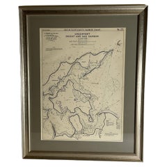
1896 Chart of the New Haven Harbor
About the Item
New Haven Harbor Chart published May 1896 by the United States Coast and geodetic survey. This chart is also a map of the land around the harbor and etc., loaded with detail. Nicely framed.
Weight: 16 lbs.
Overall Dimensions: 43"H x 32"D
Made: Papua
Material: Paper
Date: 1896
- Dimensions:Height: 43 in (109.22 cm)Width: 32 in (81.28 cm)Depth: 3 in (7.62 cm)
- Materials and Techniques:
- Place of Origin:
- Period:
- Date of Manufacture:1896
- Condition:
- Seller Location:Norwell, MA
- Reference Number:
About the Seller
5.0
Vetted Seller
These experienced sellers undergo a comprehensive evaluation by our team of in-house experts.
Established in 1967
1stDibs seller since 2015
346 sales on 1stDibs
Typical response time: 2 hours
- ShippingRetrieving quote...Ships From: Norwell, MA
- Return PolicyThis item cannot be returned.
More From This SellerView All
- Copy of 1901 Chart of Boston HarborLocated in Norwell, MALater copy after an original Boston Harbor chart by George Eldridge of Vineyard Haven and Boston. Detailed chart of Boston Harbor from the Neponset River in Quincy south down to Kimb...Category
Vintage 1910s North American Prints
MaterialsPaper
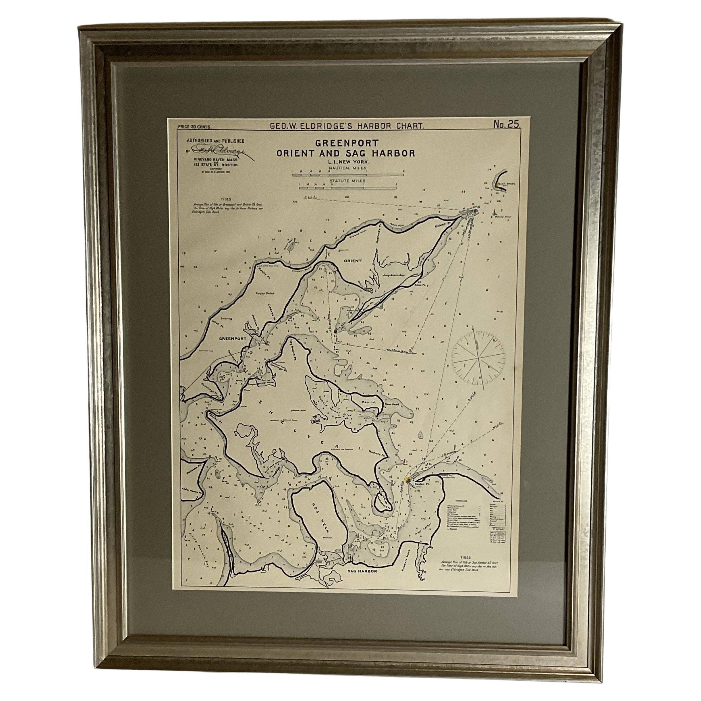
- Sag Harbor Nautical ChartLocated in Norwell, MAMarine chart of Greenport, Orient, and Sag Harbor New York published by George Eldridge in 1901. Details include the areas of Greenport, Orient, Shelter Island, Hog Neck, Sag Harbor,...Category
Antique Early 1900s Prints
MaterialsPaper
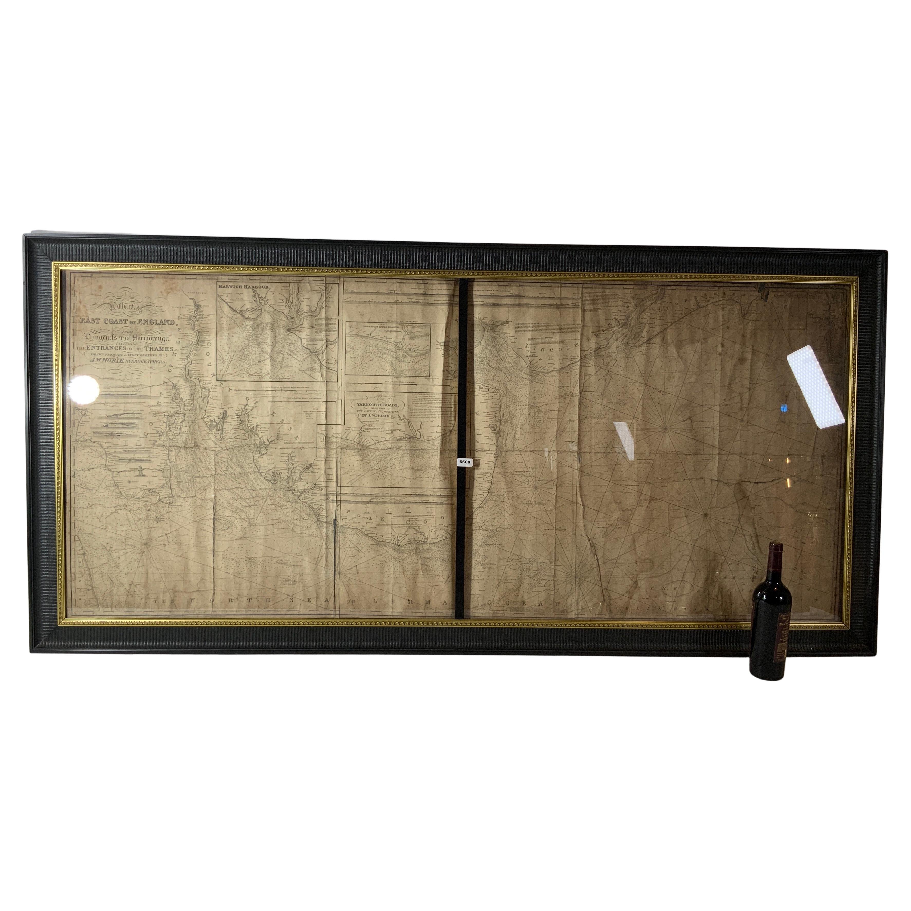
- Chart of the East Coast of EnglandLocated in Norwell, MAChart of the East Coast of England, from Dungeness to Flamborough, including the entrances to the Thames River. Drawn by hydrographer J.W. Norie in 1841. Includes Kent, Essex and Suf...Category
Antique 1840s English Nautical Objects
MaterialsPaper
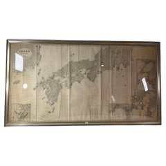
- Chart of Japan by James Imray and SonLocated in Norwell, MAChart of southern Japan compiled by James F. Imray and published in 1870. The chart captures the coast and islands. Includes Nagasaki, Kii Channel, Gulf of Yed...Category
Antique 1870s English Nautical Objects
MaterialsPaper
- Mariners Chart of Marion Massachussets by George Eldridge 1901Located in Norwell, MANautical chart showing the harbor and local waters of Marion Harbor., The chart displays depth, buoys, lighthouses, etc., Shown are Planting Island, Ram Island, Sippican Neck, Little...Category
Antique Early 1900s North American Prints
MaterialsPaper
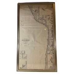
- Chart of West Coast of South America by James Imray and SonLocated in Norwell, MAChart of West Coast of South America compiled by James F. Imray and published in 1880. The chart captures the west coast from Valparaiso to Truxillo. Includes ...Category
Antique 1880s English Nautical Objects
MaterialsPaper


You May Also Like
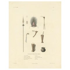
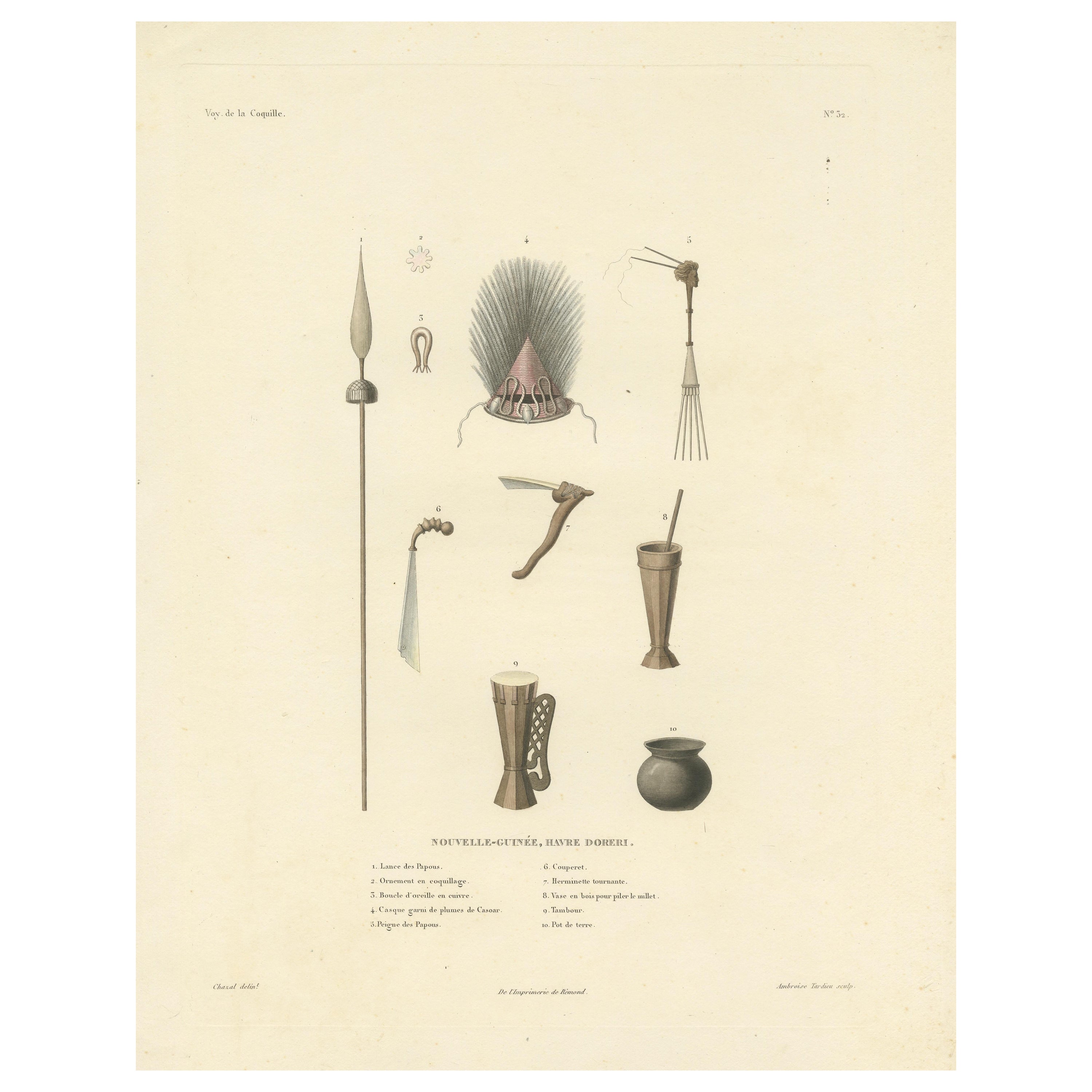
- Antique Print of Artifacts from the Haven of Doreri, New GuineaLocated in Langweer, NLAntique print titled 'Nouvelle-Guinée, Havre Doreri'. Original old print with artifacts from the haven of Doreri, New Guinea (Papua). This print originates from 'Voyage autour du mon...Category
Antique Mid-19th Century Prints
MaterialsPaper
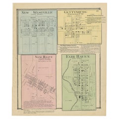
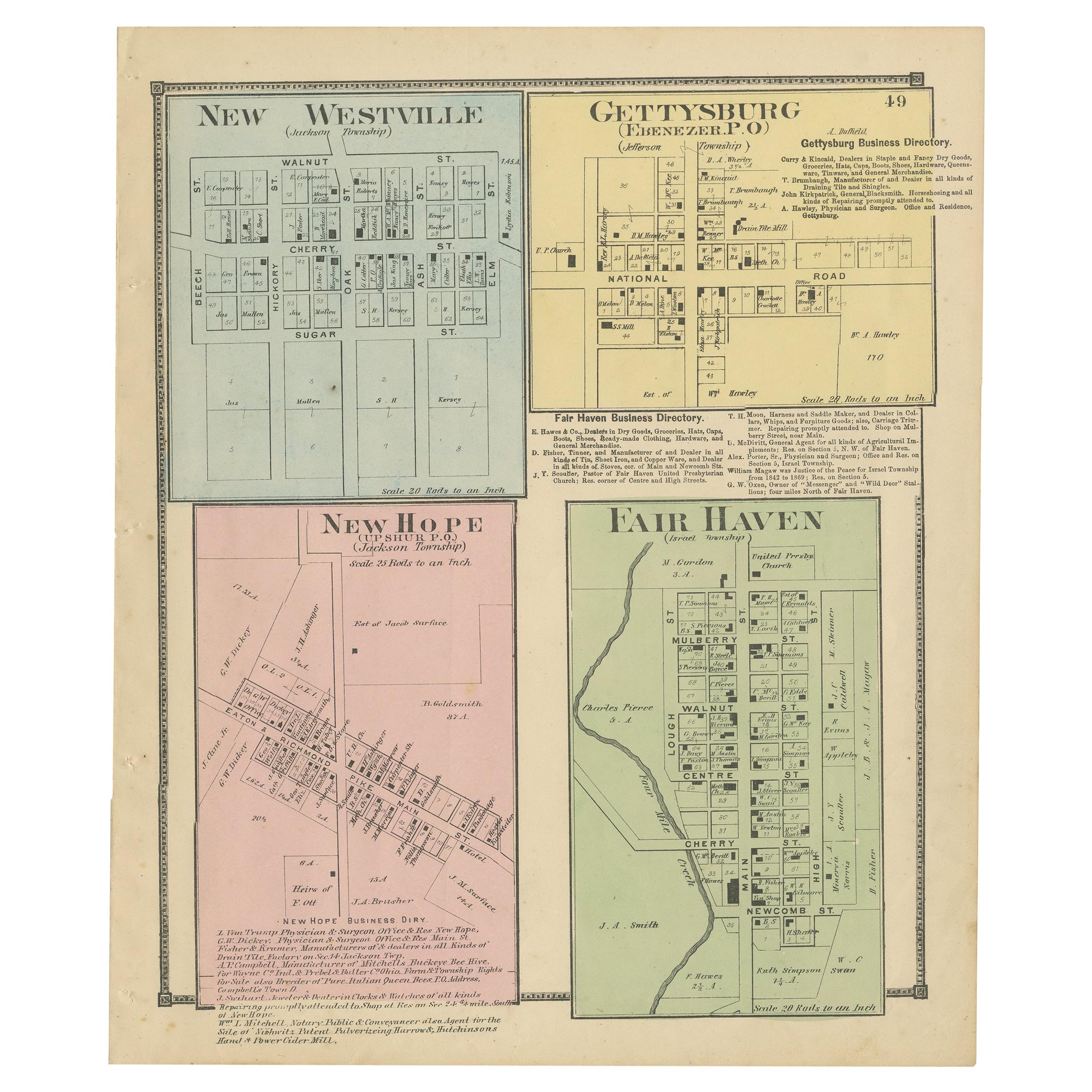
- Antique Map of New Westville, Gettysburg, New Hope & Fair Haven, 1871Located in Langweer, NLAntique map titled 'New Westville, Gettysburg, New Hope, Fair Haven'. Original antique map of villages and communities of Ohio. This map originates from 'Atlas of Preble County Ohio'...Category
Antique Late 19th Century Maps
MaterialsPaper
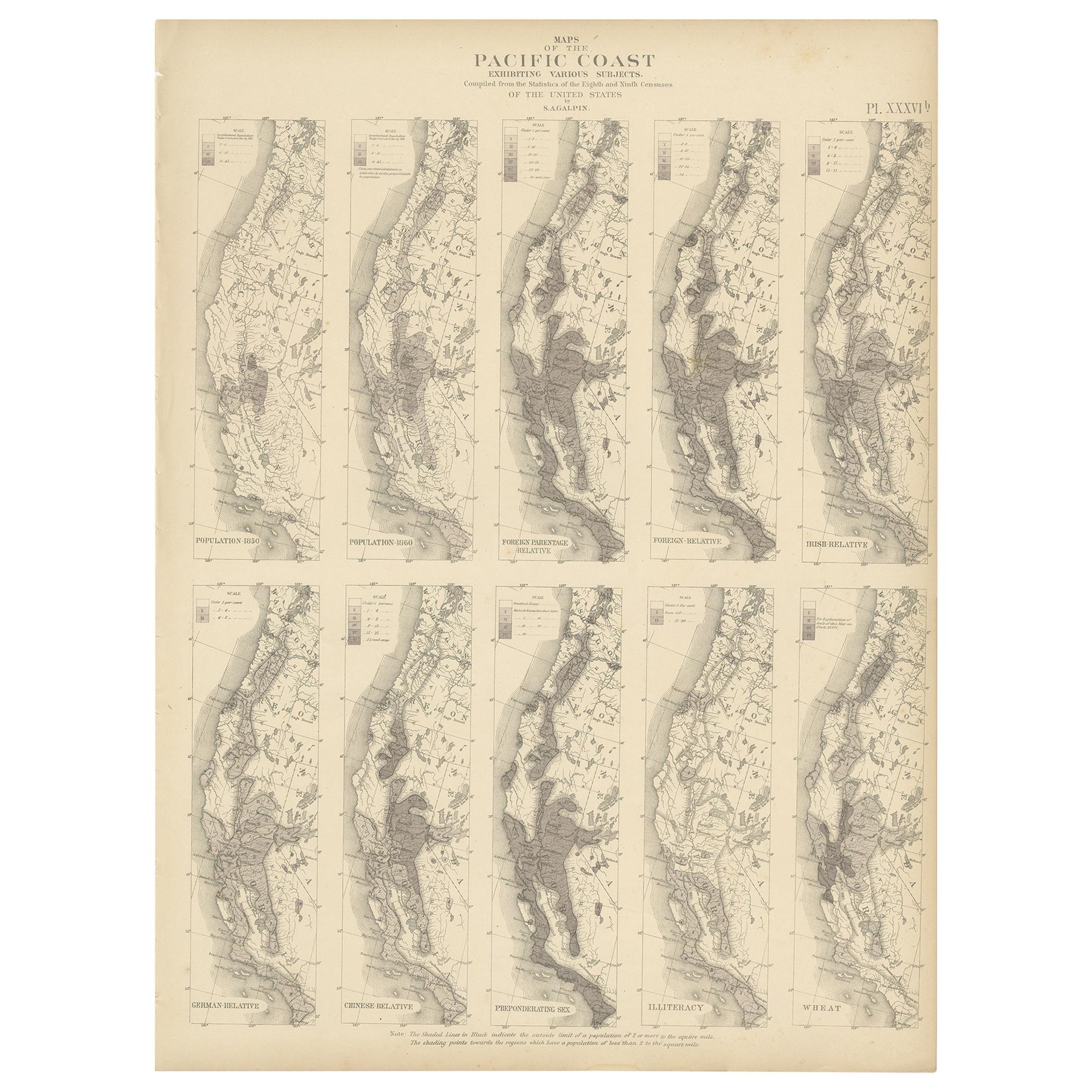
- Antique Chart of the Pacific Coast '1874'Located in Langweer, NLAntique chart titled 'Maps of the Pacific Coast exhibiting various subjects. Compiled from the statistics of the eight and ninth census of the United Sta...Category
Antique Late 19th Century Maps
MaterialsPaper
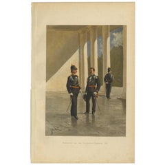
- Adjutants of the Governor-General of the Dutch East Indies '1896', 1900Located in Langweer, NLAntique print, titled: 'Adjudanten van den Gouveneur-Generaal 1896.' - This plate shows adjutants of the Governor-General of the Dutch East Indies in 1896. Artists and Engravers: ...Category
20th Century Prints
MaterialsPaper
- Antique Chart of the Storm Centres of the United States, 1874Located in Langweer, NLAntique chart titled 'U.S. Signal Service chart showing the frequency of storm centres. Number of storm centres passing over each point deduced from the average of the two years Marc...Category
Antique Late 19th Century Maps
MaterialsPaper
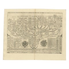
- Antique Genealogy Chart of the House of Holstein, 1732Located in Langweer, NLAntique print titled 'Carte Genealogique d'Holstein (..)'. Genealogical chart of the house Holstein. Shows both the ducal and the royal arms of the House (the ducal arms with keyed l...Category
Antique 18th Century Prints
MaterialsPaper