Items Similar to Antique Chart of the Storm Centres of the United States, 1874
Want more images or videos?
Request additional images or videos from the seller
1 of 5
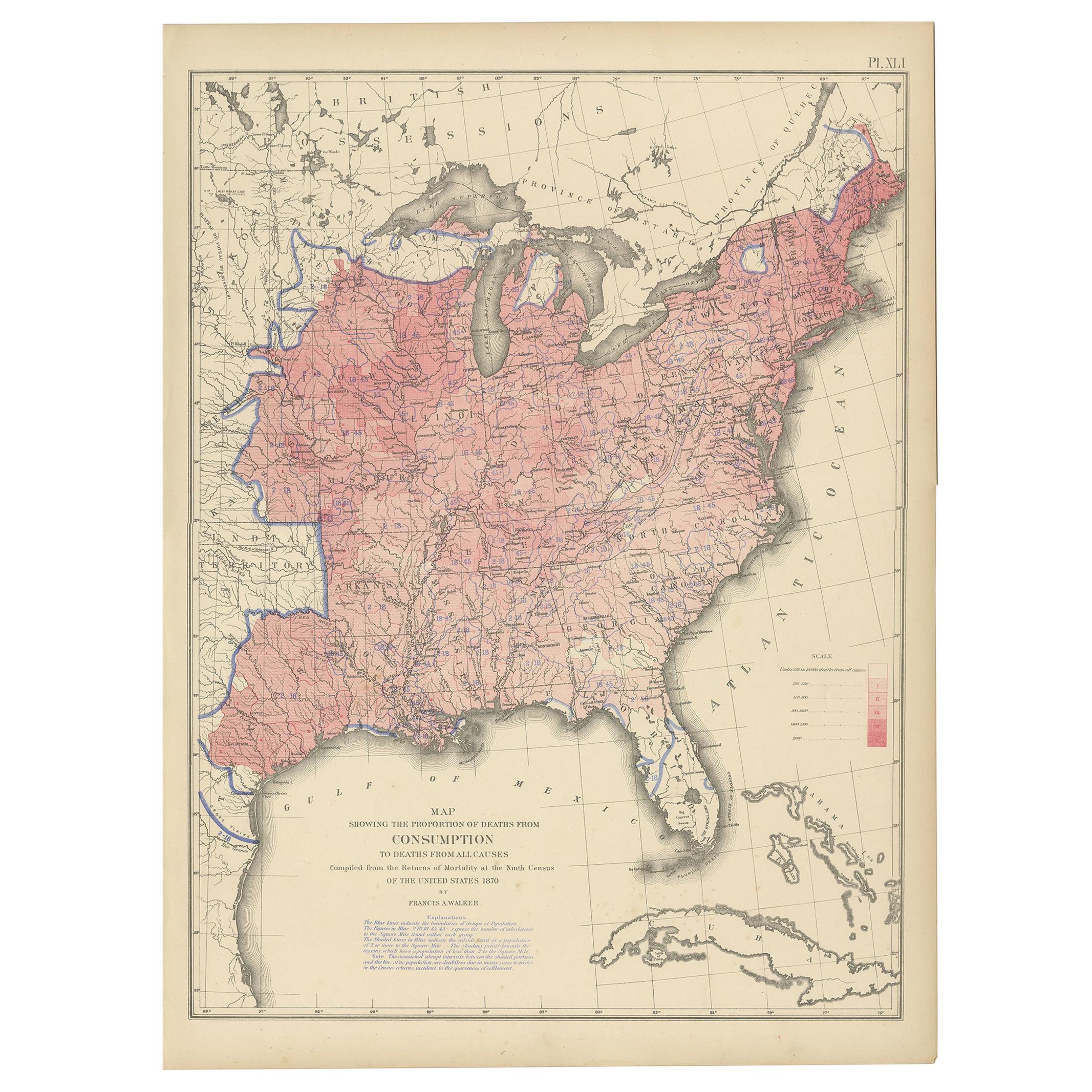
Antique Chart of the Storm Centres of the United States, 1874
About the Item
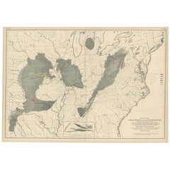
Antique chart titled 'U.S. Signal Service chart showing the frequency of storm centres. Number of storm centres passing over each point deduced from the average of the two years March 1871 to February 1873 inclusive. Compiled from data collected at the Office of the Chief Signal Officer of the Army. '. Chart of the frequency of the storm centres of the United States. Originates from 'Statistical Atlas of the United States based on the results of the ninth census 1870 (..)' by Francis A. Walker.
- Dimensions:Height: 16.15 in (41 cm)Width: 21.66 in (55 cm)Depth: 0.02 in (0.5 mm)
- Materials and Techniques:
- Period:
- Date of Manufacture:1874
- Condition:General age-related toning, minor wear. Blank verso, please study image carefully.
- Seller Location:Langweer, NL
- Reference Number:
About the Seller
5.0
Platinum Seller
These expertly vetted sellers are 1stDibs' most experienced sellers and are rated highest by our customers.
Established in 2009
1stDibs seller since 2017
1,916 sales on 1stDibs
Typical response time: <1 hour
- ShippingRetrieving quote...Ships From: Langweer, Netherlands
- Return PolicyA return for this item may be initiated within 14 days of delivery.
More From This SellerView All
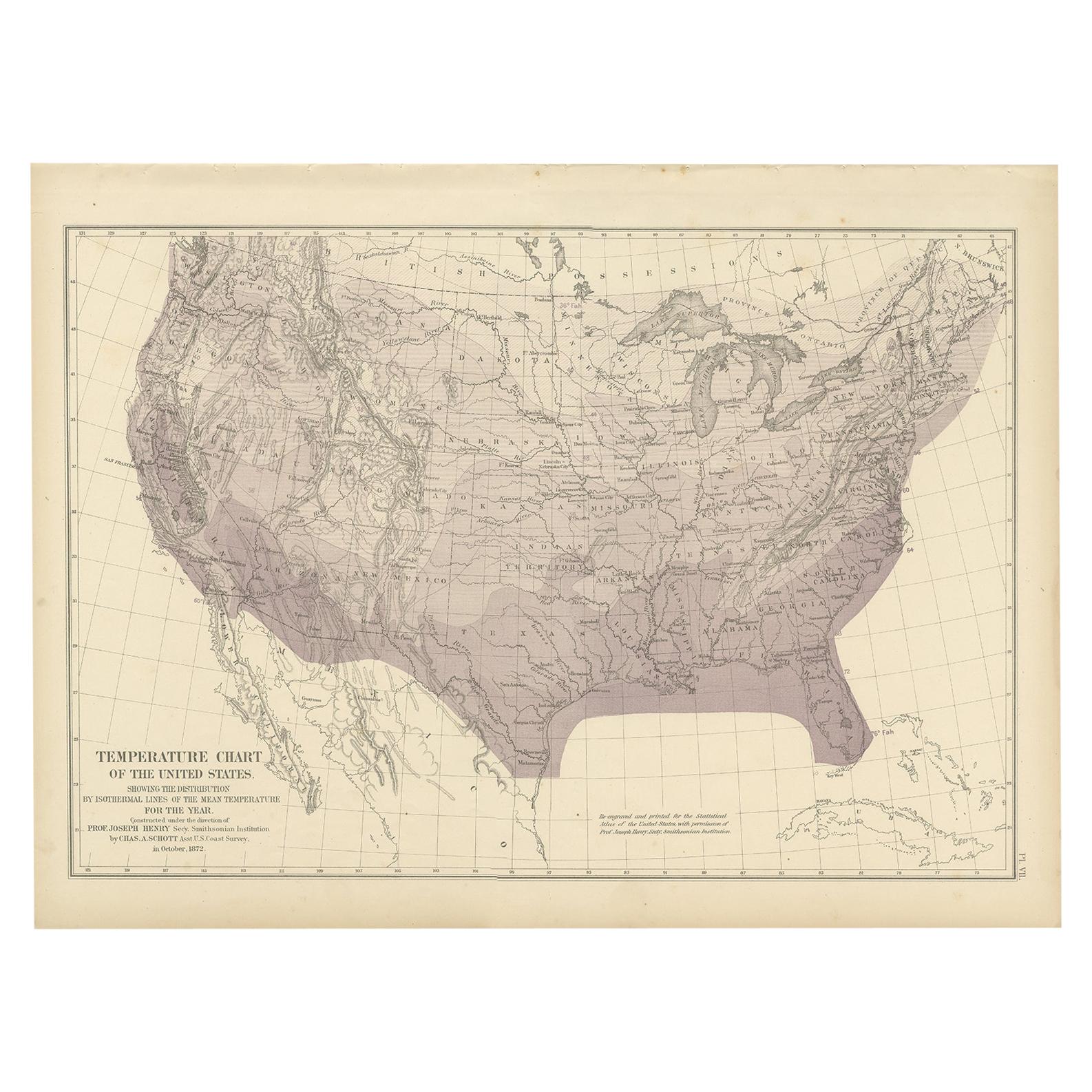
- Pl. 7 Antique Temperature Chart of the United States by Walker, 1874Located in Langweer, NLAntique chart titled 'Temperature chart of the United States. Showing the distribution by isothermal lines of the mean temperature for the year. Constructed under the direction of Pr...Category
Antique Late 19th Century Maps
MaterialsPaper
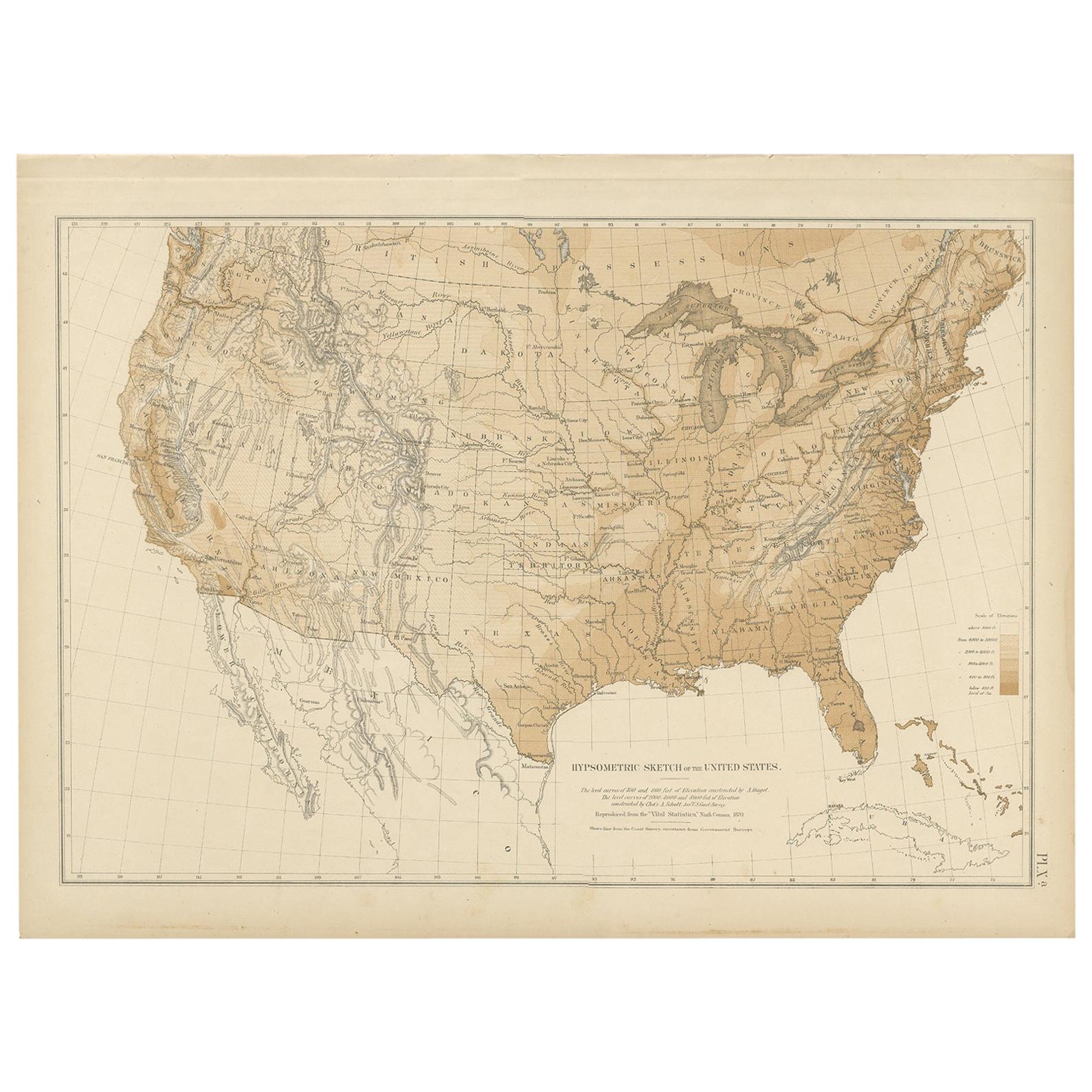
- Pl. 9 Antique Hypsometric Sketch of the United States by Walker, 1874Located in Langweer, NLAntique chart titled 'Hypsometric sketch of the United States. The level curves of 400 and 800 feet of elevation constructed by A. Guyot. The level curves of 2000, 4000 and 8000 feet...Category
Antique Late 19th Century Maps
MaterialsPaper
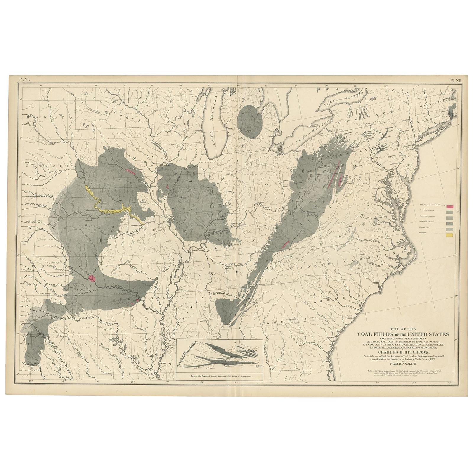
- Antique Map of the Coal Fields of the United States by Walker '1874'Located in Langweer, NLAntique map titled 'Map of the coal fields of the United States, compiled from state reports and data specially furnished by Prof. W.B. Rogers, E.T. Cox, A.H. Worthen, S.S. Lyon, Ric...Category
Antique Late 19th Century Maps
MaterialsPaper
- Antique Fiscal Chart of the United States by Walker, 1874Located in Langweer, NLAntique chart titled 'Fiscal chart of the United States showing the course of the public debt by years 1789-1870 together with the proportion of the total receipts from each principa...Category
Antique Late 19th Century Prints
MaterialsPaper
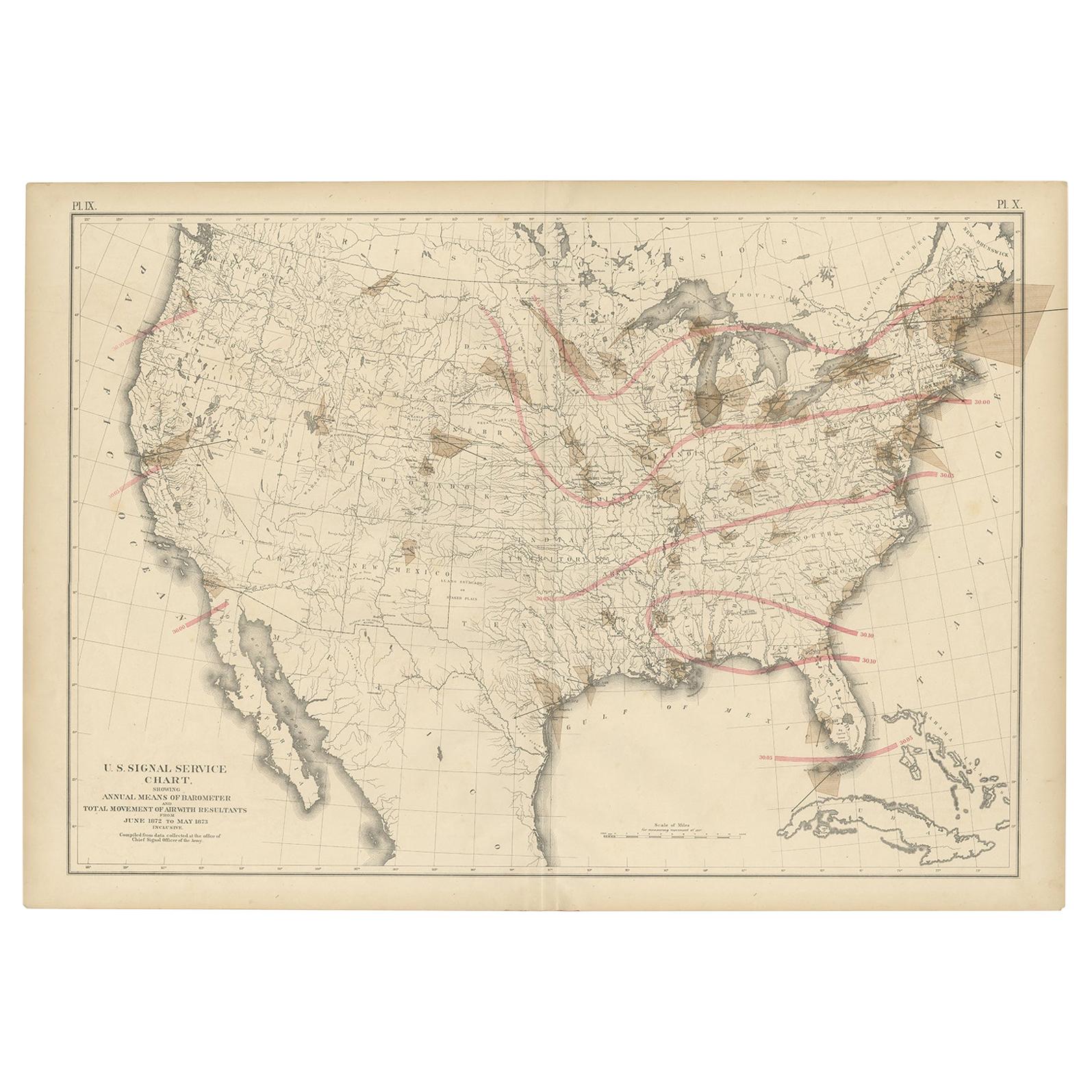
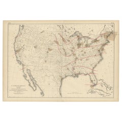
- Pl. 9 Antique Map of the Air Movement of the United States by Walker '1874'Located in Langweer, NLAntique map titled 'U.S. Signal Service chart, showing annual means of barometer and total movement of air with resultants from June 1872 to May 1873 inclusive. Compiled from data co...Category
Antique Late 19th Century Maps
MaterialsPaper
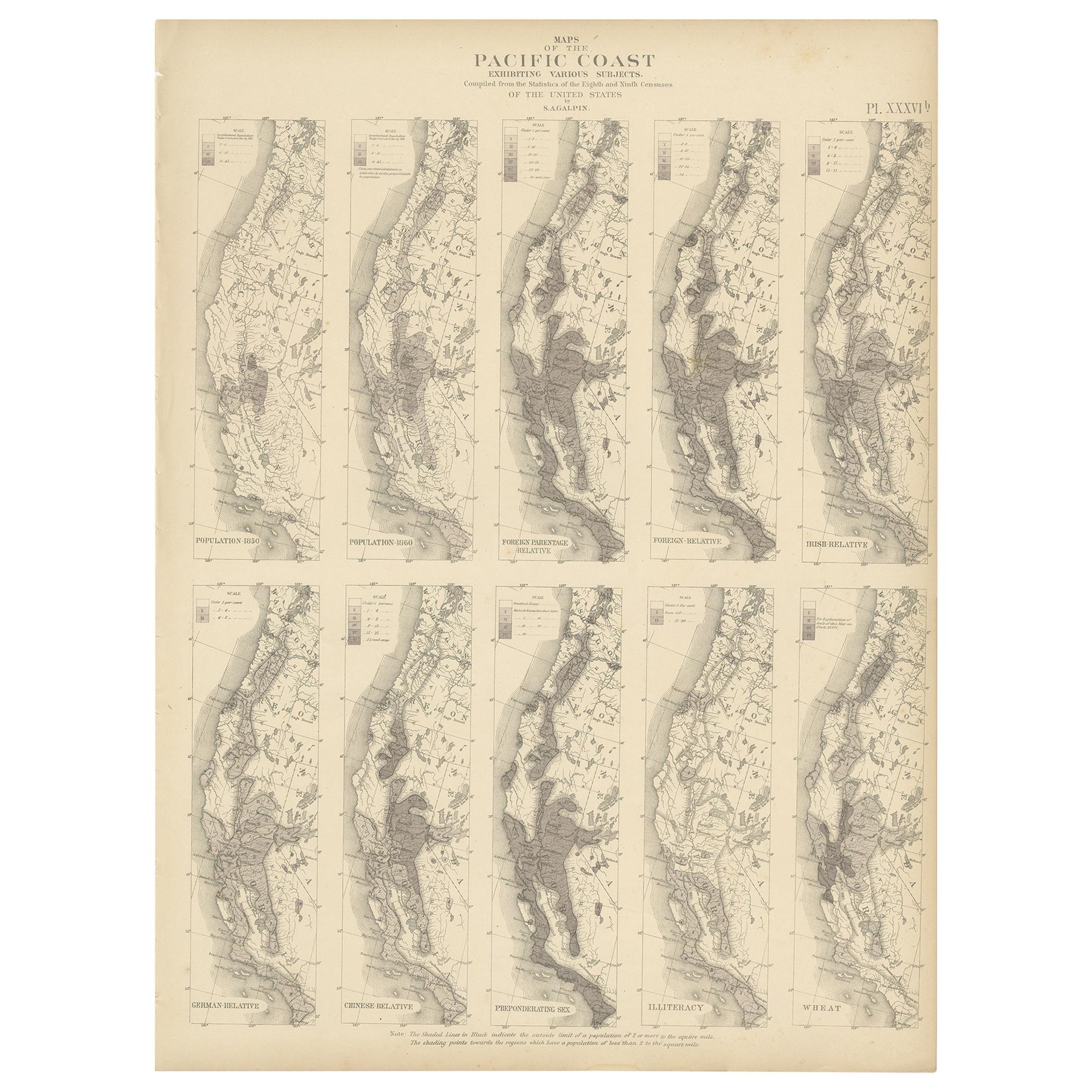
- Antique Chart of the Population of the United States by Walker '1874'Located in Langweer, NLAntique chart titled 'Chart showing the principal constitutional elements of the population of each state, as foreign, native, colored, and native white, and as born within or withou...Category
Antique Late 19th Century Prints
MaterialsPaper
You May Also Like
- N.E. View of the United States Capitol, Washington, DC Antique Proof Print 1858Located in Colorado Springs, COThis engraved print shows a view of the United States Capitol Building, in Washington, D.C. The print depicts the neoclassical building from the northeast orientation, with a bustling street scene in front. The steel engraving is a proof printing, drawn and engraved by Henry Sartain and published in 1858. Plans began in May 1854 to build a new cast-iron dome for the United States Capitol. The then-architect of the Capitol Thomas Walter and his team were sold on the aesthetics of a new dome, as well as the utility of a fire-proof one. A year later, on March 3, 1855, President Franklin Pierce...Category
Antique 1850s American Prints
MaterialsPaper
- Original Antique Map of United States, Grattan and Gilbert, 1843Located in St Annes, LancashireGreat map of United States Drawn and engraved by Archer Published by Grattan and Gilbert. 1843 Original colour Unframed.Category
Antique 1840s English Maps
MaterialsPaper
- Antique Anatomical Wall Chart Depicting the Human SkeletonLocated in Berghuelen, DEA rare 19th century anatomical wall chart depicting the human skeleton. On the sides On the sides are detailed description in German language. The wall...Category
Early 20th Century German Victorian Prints
MaterialsPaper
- Antique Foldable Anatomical Wall Chart Depicting Human MusculatureLocated in Berghuelen, DEAntique Foldable Anatomical Wall Chart Depicting Human Musculature The rare 19th century anatomical wall chart depicts the human musculature and inter...Category
Early 20th Century German Victorian Prints
MaterialsWood, Paper
- Original Antique Map of The United States of America, circa 1890Located in St Annes, LancashireGreat map of the USA By The Stanford's Geographical Establishment Original colour Unframed.Category
Antique 1890s English Victorian Maps
MaterialsPaper
- Large Original Antique Map of the United States of America. 1891By Rand McNally & Co.Located in St Annes, LancashireFabulous map of The United States Original color By Rand, McNally & Co. Dated 1891 Unframed Free shipping.Category
Antique 1890s American Maps
MaterialsPaper


Recently Viewed
View AllMore Ways To Browse
S S United States
Antique Furniture United States
Antique United States
Map Of United States
The United States Map
Map Of The United States
Antique Chart
Antique Charts
Map Chart
Antique United States Maps
Antique Map United States
United States Map Antique
Antique United States Map
Antique Maps Of United States
Antique Maps Of States
Antique Map Of The United States
Antique Maps Of The United States
Chart Antique