Items Similar to Antique Chart of the Population of the United States by Walker '1874'

Want more images or videos?
Request additional images or videos from the seller
1 of 5
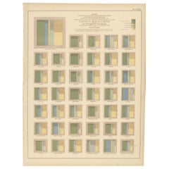
Antique Chart of the Population of the United States by Walker '1874'
About the Item
Antique chart titled 'Chart showing the principal constitutional elements of the population of each state, as foreign, native, colored, and native white, and as born within or without the state of residence'. This chart shows the population of each state of America. Originates from 'Statistical Atlas of the United States based on the results of the ninth census 1870 (..)' by Francis A. Walker.
- Dimensions:Height: 16.15 in (41 cm)Width: 21.66 in (55 cm)Depth: 0.02 in (0.5 mm)
- Materials and Techniques:
- Period:
- Date of Manufacture:1874
- Condition:General age-related toning, minor wear. Blank verso, please study image carefully.
- Seller Location:Langweer, NL
- Reference Number:
About the Seller
5.0
Platinum Seller
These expertly vetted sellers are 1stDibs' most experienced sellers and are rated highest by our customers.
Established in 2009
1stDibs seller since 2017
1,948 sales on 1stDibs
Typical response time: <1 hour
- ShippingRetrieving quote...Ships From: Langweer, Netherlands
- Return PolicyA return for this item may be initiated within 14 days of delivery.
More From This SellerView All
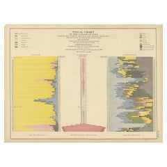
- Antique Fiscal Chart of the United States by Walker, 1874Located in Langweer, NLAntique chart titled 'Fiscal chart of the United States showing the course of the public debt by years 1789-1870 together with the proportion of the total receipts from each principa...Category
Antique Late 19th Century Prints
MaterialsPaper
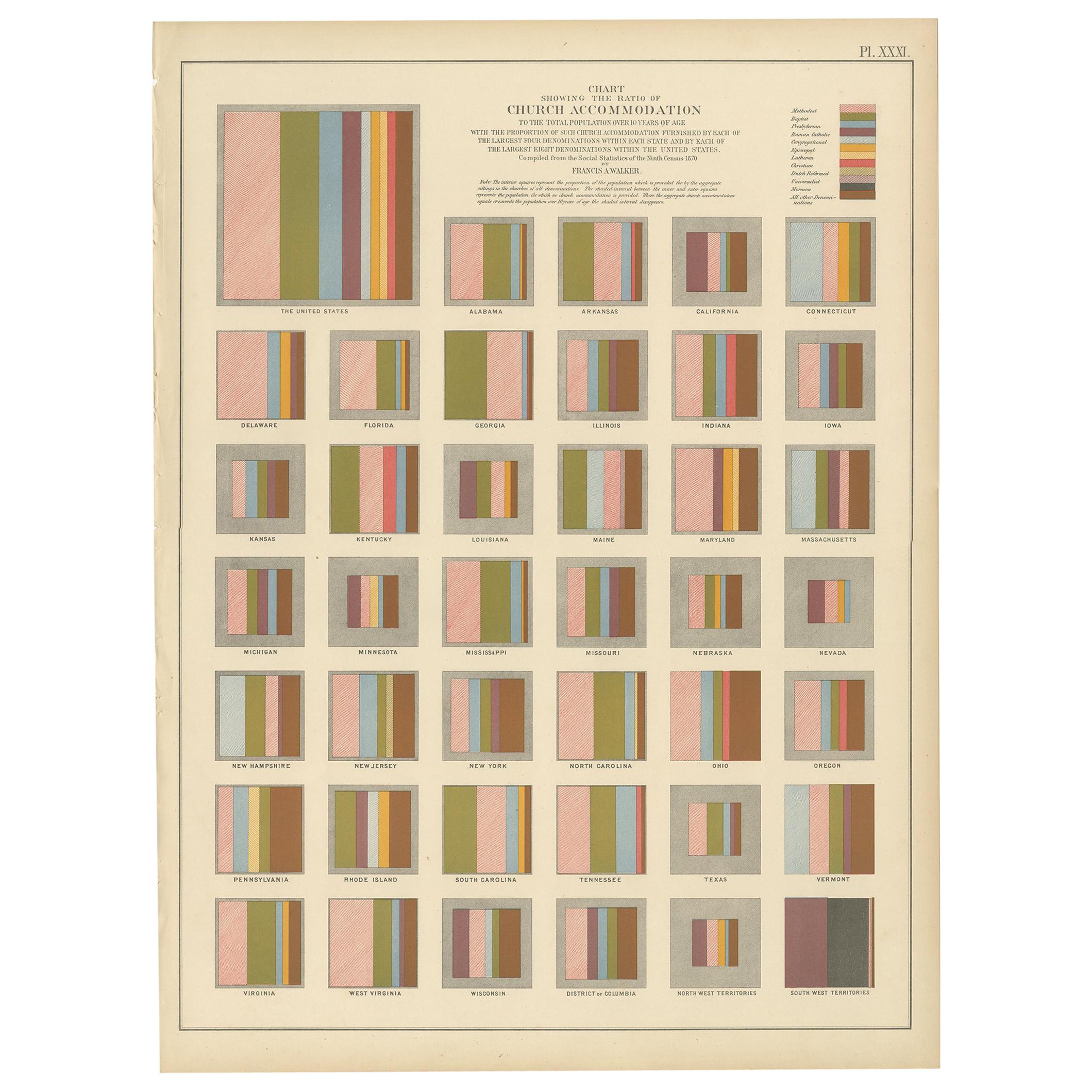
- Antique Chart of the Church Accommodation of the United States by Walker, 1874Located in Langweer, NLAntique chart titled 'Chart showing the ratio of church accommodation to the total population over 10 years of age with the proportion of such church accommodation furnished by each ...Category
Antique Late 19th Century Prints
MaterialsPaper
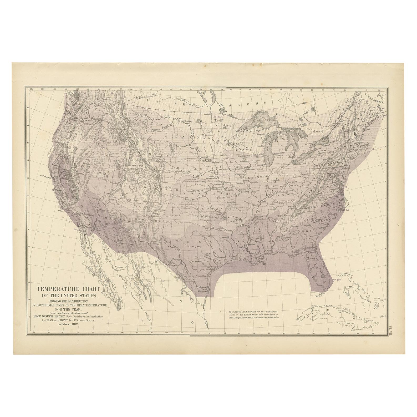
- Pl. 7 Antique Temperature Chart of the United States by Walker, 1874Located in Langweer, NLAntique chart titled 'Temperature chart of the United States. Showing the distribution by isothermal lines of the mean temperature for the year. Constructed under the direction of Pr...Category
Antique Late 19th Century Maps
MaterialsPaper
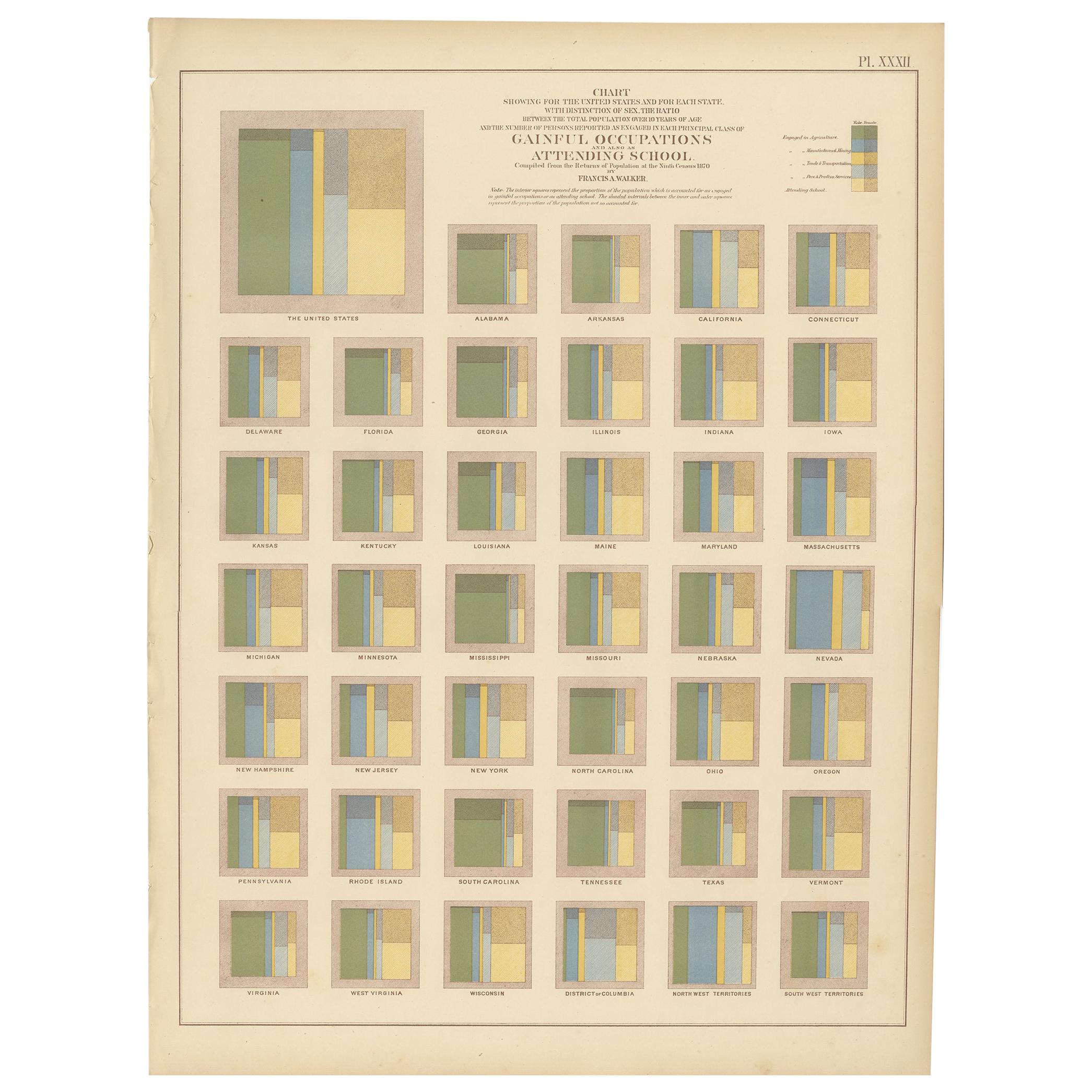
- Antique Chart of Occupations and School Attendance of the United States, 1874Located in Langweer, NLAntique chart titled 'Chart showing for the United States and for each state with distinction of sex, the ratio between the total population over 10 years of age and the number of pe...Category
Antique Late 19th Century Prints
MaterialsPaper
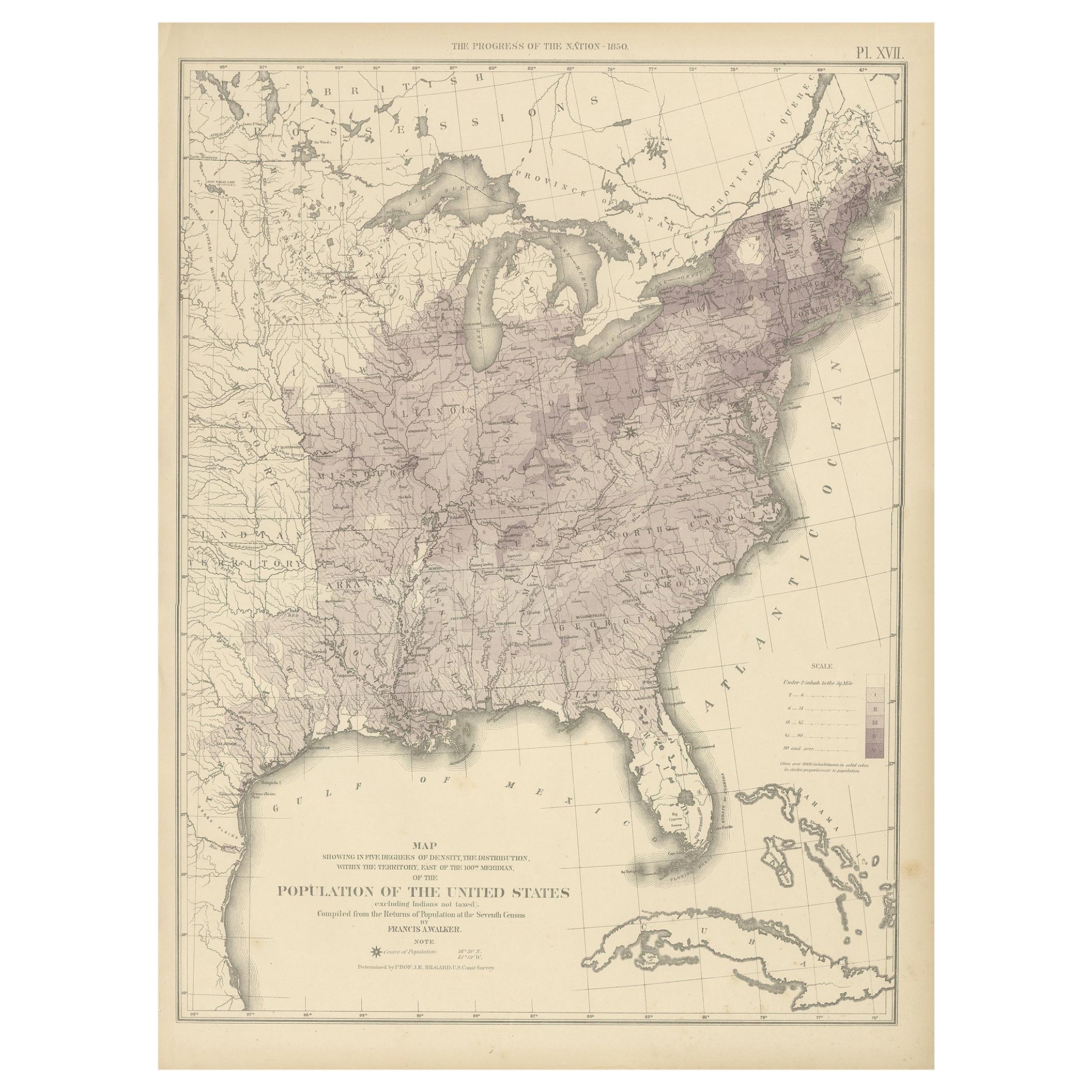
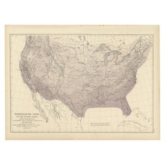
- Pl. 17 Antique Chart of the US Population 1850 by Walker, 1874Located in Langweer, NLAntique chart titled 'Map showing in five degrees of density, the distribution, within the territory east of the 100th Meridian, of the population of the United States, excluding Ind...Category
Antique Late 19th Century Maps
MaterialsPaper
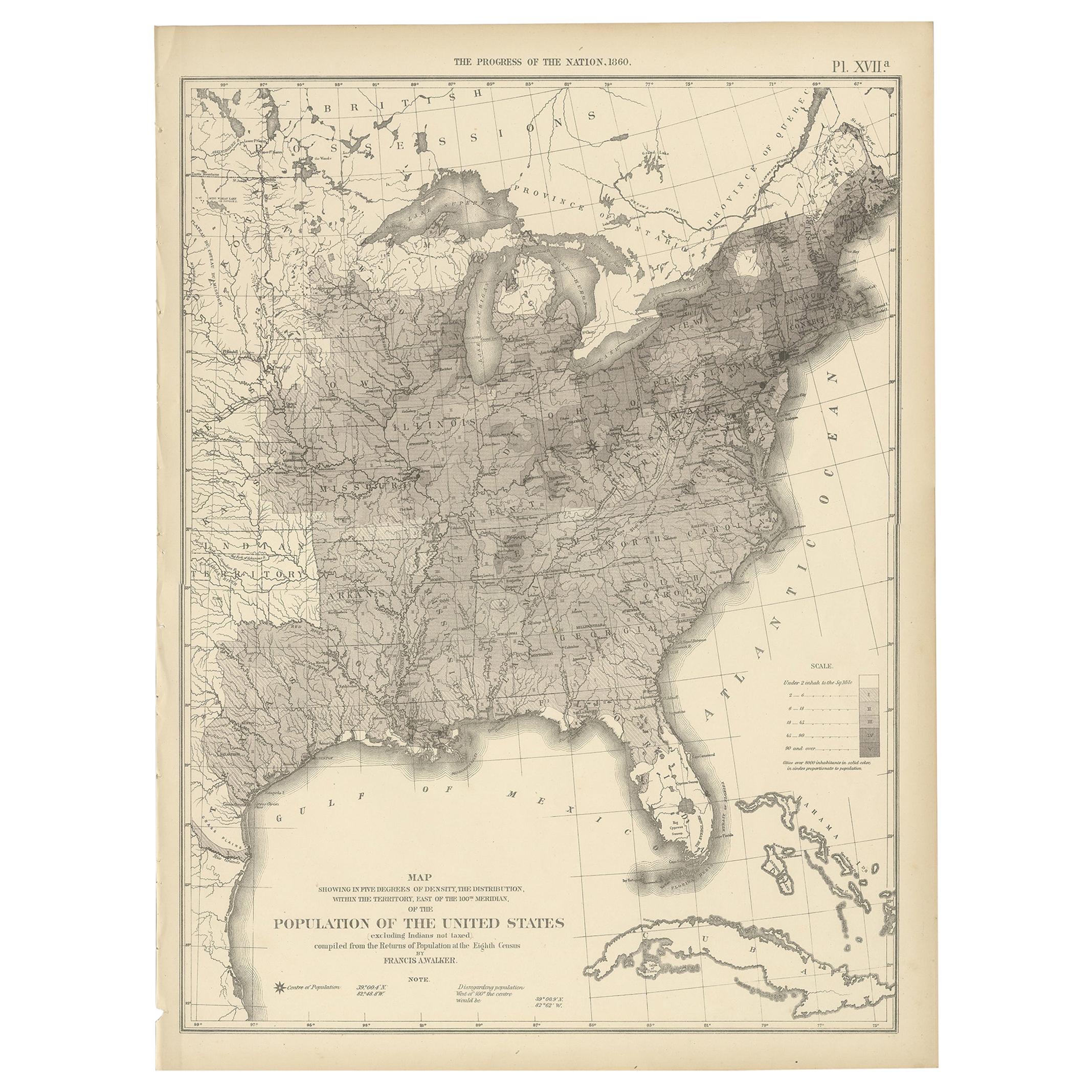
- Pl. 17A Antique Chart of the US Population 1860 by Walker, '1874'Located in Langweer, NLAntique chart titled 'Map showing in five degrees of density, the distribution, within the territory east of the 100th Meridian, of the population of the United States, excluding Ind...Category
Antique Late 19th Century Maps
MaterialsPaper
You May Also Like
- J S Prout, the Upper Goulburn, Victoria', Hand Colored Engraving, U K, 1874By John Skinner Prout, N.W.S. 1Located in Chatham, ONJohn Skinner Prout (1805-1876) - 'the upper Goulburn, Victoria' - antique steel plate engraving after a painting by J. S. Prout - from 'Australia' by Edwin Carton Booth - hand colore...Category
Antique Late 19th Century British Victorian Prints
MaterialsPaint, Paper
- Large Original Antique Map of the United States of America. 1891By Rand McNally & Co.Located in St Annes, LancashireFabulous map of The United States Original color By Rand, McNally & Co. Dated 1891 Unframed Free shipping.Category
Antique 1890s American Maps
MaterialsPaper
- Original Antique Map of The United States of America, circa 1890Located in St Annes, LancashireGreat map of the USA By The Stanford's Geographical Establishment Original colour Unframed.Category
Antique 1890s English Victorian Maps
MaterialsPaper
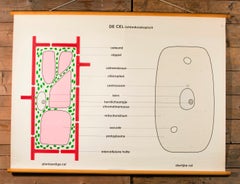
- Pair of Vintage Belgian School Charts of CellsLocated in Houston, TXThe chart also includes its original wooden dowels from which it can be hung. Pair of vintage Belgian school charts printed on cloth likely dating from the 1960s. Very graphic and in...Category
Vintage 1960s Belgian Other Prints
MaterialsPaper
- J.S. Prout, 'Diggers on the Road .', Hand Colored Engraving, U.K., C.1874By John Skinner Prout, N.W.S. 1Located in Chatham, ONJOHN SKINNER PROUT (1805-1876) - 'Diggers on the Road to a Rush' - Antique steel plate engraving after a painting by J. S. Prout - from 'Australia' by Edwin Carton Booth - hand color...Category
Antique Late 19th Century English Victorian Prints
MaterialsPaint, Paper
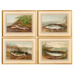
- S. A. Kilbourne "Game Fishes of the United States" 4 Framed ChromolithographsLocated in Morristown, NJAfter Samuel A. Kilbourne (American, 1836-1881), "Game Fishes of the United States", uniformly matted and framed under glass. Clockwise from upper left, The Kingfish and The Whitin...Category
Vintage 1970s American American Classical Prints
MaterialsGlass, Wood, Paper


Recently Viewed
View AllMore Ways To Browse
Antique Native American Prints
Wall Plagues
Antique French Paper Horses
Antiques Lebanon
Antique Engravings Libraries
Antique Corvette
Martinet Birds
Wood Duck Print
Botanical Chart
K J Wood
South Tyrol
Used Furniture Lansing
Dutch Ceylon
Salvador Dali Circa 1970
Equestrian Engraving
Antique Chinese Posters
Goose Girl
Drexel Italian