Items Similar to Original Antique Engraved Map of Part of the Red Sea, Arabia, 1775


Want more images or videos?
Request additional images or videos from the seller
1 of 6
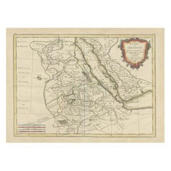
Original Antique Engraved Map of Part of the Red Sea, Arabia, 1775
About the Item
Antique map titled 'Carte de l'Entrée du Golfe de la Mer Rouge'. Uncommon sea chart of the entrance to the Red Seas as far as Mocha, with rhumb lines and soundings. Two insets of the vicinity of Mocha.
- Dimensions:Height: 15.36 in (39 cm)Width: 21.66 in (55 cm)Depth: 0.02 in (0.5 mm)
- Materials and Techniques:
- Period:
- Date of Manufacture:1775
- Condition:Please study images carefully.
- Seller Location:Langweer, NL
- Reference Number:
About the Seller
5.0
Platinum Seller
These expertly vetted sellers are 1stDibs' most experienced sellers and are rated highest by our customers.
Established in 2009
1stDibs seller since 2017
1,922 sales on 1stDibs
Typical response time: <1 hour
- ShippingRetrieving quote...Ships From: Langweer, Netherlands
- Return PolicyA return for this item may be initiated within 14 days of delivery.
More From This SellerView All
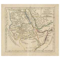
- Original Antique Map of Arabia and the Red SeaLocated in Langweer, NLAntique map titled 'Carte de la Coste d'Arabie (..) - Kaart van de Kust van Arabië (..)'. This is a Dutch version, engraved by J. van Schley, of Bellin's map of Arabia and the Red Se...Category
Antique Mid-18th Century Maps
MaterialsPaper
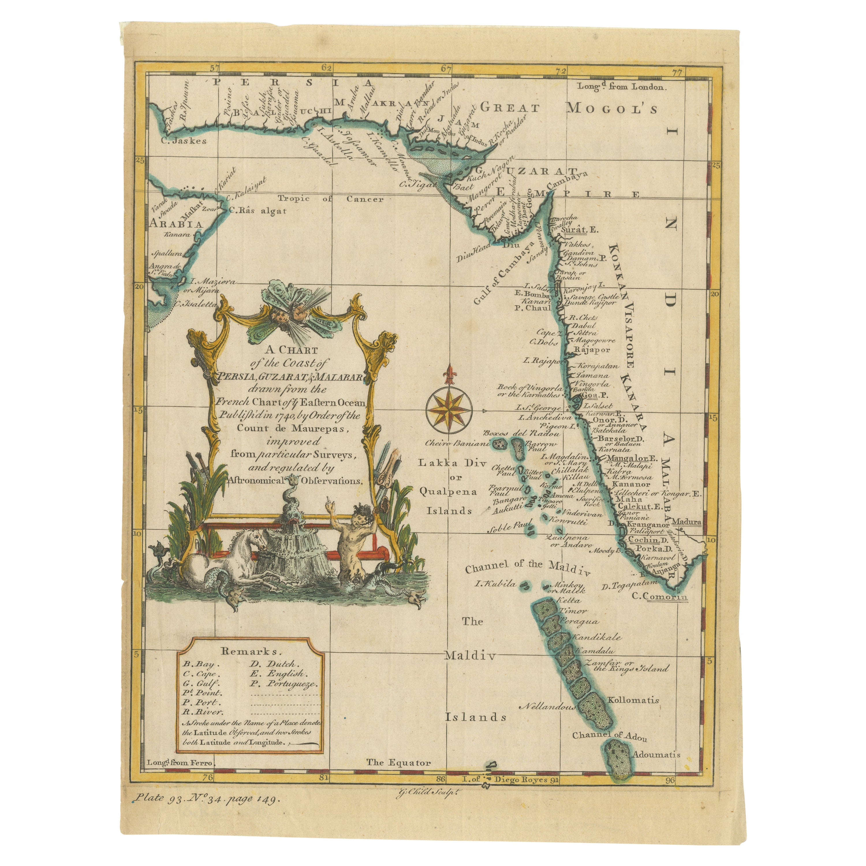
- Antique Map of the Region of the Arabian SeaLocated in Langweer, NLAntique map titled 'A Chart of the Coast of Persia, Guzarat & Malabar'. Old map centered on the Arabian Sea that shows some of the Persian Gulf and the Gulf of Oman, extending past P...Category
Antique Mid-18th Century Maps
MaterialsPaper
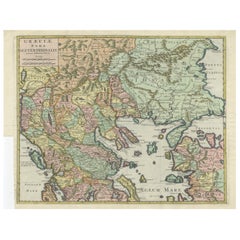
- Antique Engraved Map of the Northern Part of Greece and the Aegean Sea, Ca.1730Located in Langweer, NLTitle: "GRÆCIÆ PARS Septentrionalis". Hand Coloured Engraved map by G. Delisle of the northern part of the Aegean. In the top left corner a distance scale included. Condition...Category
Antique 1730s Maps
MaterialsPaper
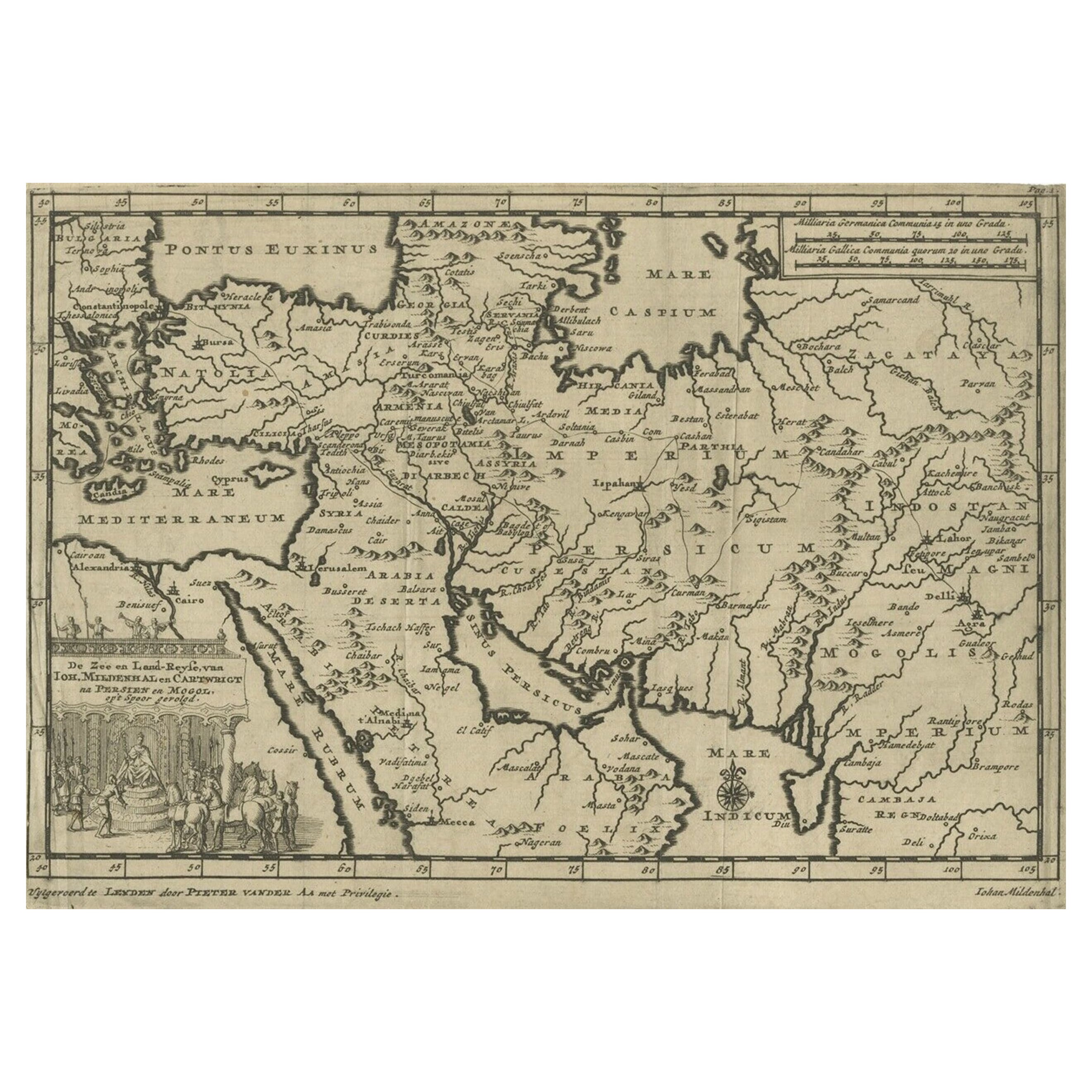
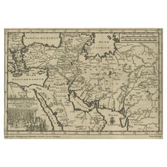
- Old Engraved Map of the Middle East, Arabia and Part of Greece 'Cyprus', 1706Located in Langweer, NLTitle: Antique map titled 'De Zee en Land-Reyse, van Ioh. Mildenhal en Cartwrigt na Persien en Mogol, opt spoor gevolgd'. Old map of the Middle East, also depicting part of Greece ...Category
Antique Early 1700s Maps
MaterialsPaper
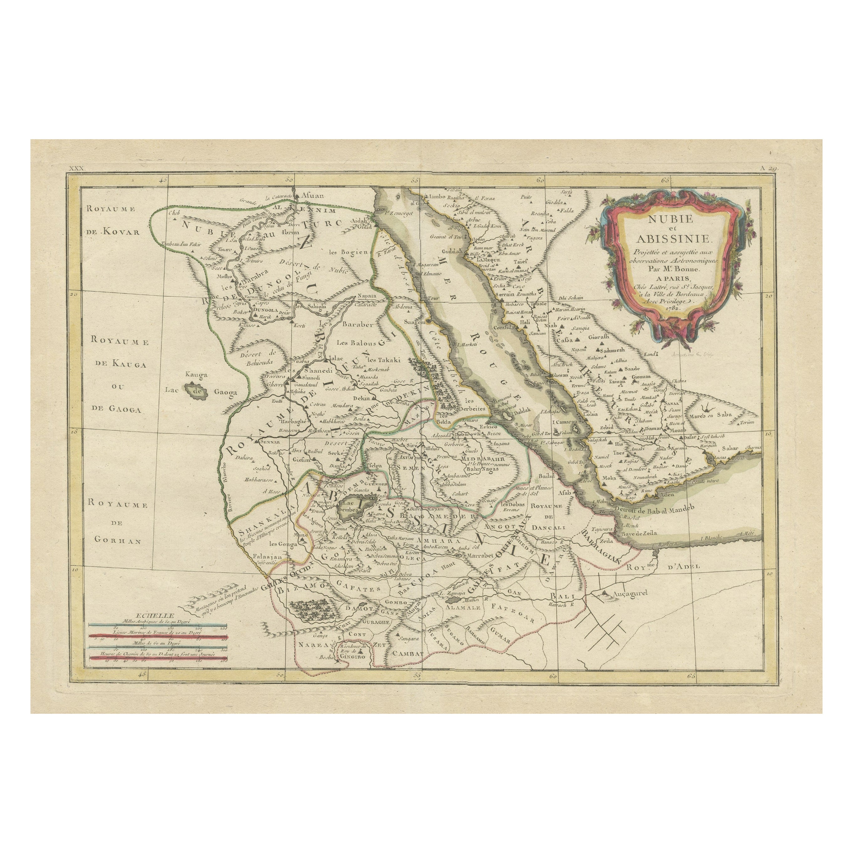
- Antique Map of Arabia including Nubia and Abyssinia, also shows the Red SeaLocated in Langweer, NLAntique map titled 'Nubie et Abissinie'. Original antique map of Nubia, a region along the Nile river, and Abyssinia or the Ethiopian Empire. This map o...Category
Antique Late 18th Century Maps
MaterialsPaper
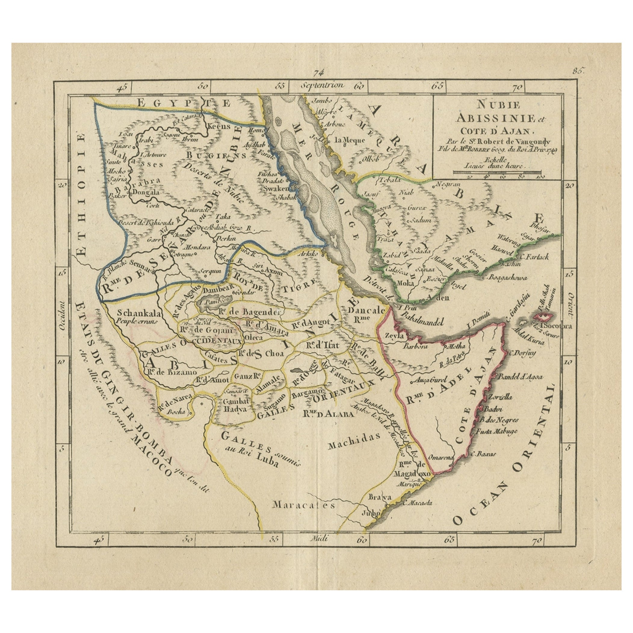
- Original Antique Map of Abyssinia, Sudan and the Red Sea, 1749Located in Langweer, NLAntique map titled 'Nubie, Abissinie et Cote d'Ajan'. Map of Abyssinia, Sudan and the Red Sea by Robert Vaugondy. Covers from Arabia and Egypt south to Mogadishu and includes parts...Category
Antique 1740s Maps
MaterialsPaper


You May Also Like
- Original Antique Map of The Netherlands, Engraved by Barlow, Dated 1807Located in St Annes, LancashireGreat map of Netherlands Copper-plate engraving by Barlow Published by Brightly & Kinnersly, Bungay, Suffolk. Dated 1807 Unframed.Category
Antique Early 1800s English Maps
MaterialsPaper
- Original Antique Map of Sweden, Engraved by Barlow, 1806Located in St Annes, LancashireGreat map of Sweden Copper-plate engraving by Barlow Published by Brightly & Kinnersly, Bungay, Suffolk. 1806 Unframed.Category
Antique Early 1800s English Maps
MaterialsPaper
- Original Antique Map of Switzerland, Engraved By Barlow, Dated 1807Located in St Annes, LancashireGreat map of Switzerland Copper-plate engraving by Barlow Published by Brightly & Kinnersly, Bungay, Suffolk. Dated 1807 Unframed.Category
Antique Early 1800s English Maps
MaterialsPaper
- Original Antique Map of Spain and Portugal, Engraved By Barlow, 1806Located in St Annes, LancashireGreat map of Spain And Portugal Copper-plate engraving by Barlow Published by Brightly & Kinnersly, Bungay, Suffolk. 1806 Unframed.Category
Antique Early 1800s English Maps
MaterialsPaper
- Original Antique Map of Italy. C.1780Located in St Annes, LancashireGreat map of Italy Copper-plate engraving Published C.1780 Unframed.Category
Antique Early 1800s English Georgian Maps
MaterialsPaper

- Original Antique Map of Asia. C.1780Located in St Annes, LancashireGreat map of Asia Copper-plate engraving Published C.1780 Two small worm holes to right side of map Unframed.Category
Antique Early 1800s English Georgian Maps
MaterialsPaper


