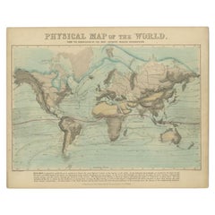
Antique Map Of World
56
to
363
3,003
301
1,681
1,510
966
542
234
215
149
132
132
71
61
58
54
52
49
41
39
29
26
25
24
24
21
18
17
16
14
14
11
11
11
10
9
8
8
7
7
6
6
5
5
5
5
4
4
4
4
2
2
1
94
40
30
26
19
Sort By
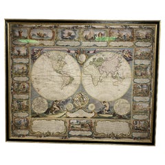
Colored wall map of the WORLD
By Chambon
Located in ZWIJNDRECHT, NL
huge wall map of the world in two hemispheres printed on two sheets, depicting the Eastern and Western
Category
Mid-18th Century French French Provincial Antique Map Of World
Materials
Wood, Paper
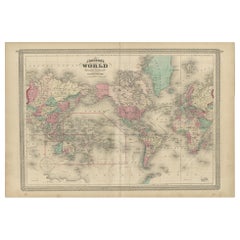
Antique Map of the World by Johnson, '1872'
Located in Langweer, NL
Antique map titled 'Johnson's World. Original world map. This map originates from 'Johnson's New
Category
Late 19th Century Antique Map Of World
Materials
Paper
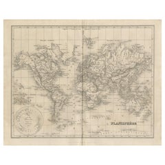
Antique Map of the World by Balbi '1847'
Located in Langweer, NL
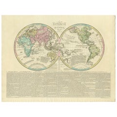
Antique map titled 'Planisphère'. Original antique map of the world. This map originates from
Category
Mid-19th Century Antique Map Of World
Materials
Paper
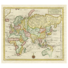
Antique Map of the Eastern Part of the World
Located in Langweer, NL
Antique map titled 'Nieuwe Kaart van het Oostelykste Deel der Weereld, diendende tot aanwyzing van
Category
Mid-18th Century Antique Map Of World
Materials
Paper
Antique World Map by Johnston, 1882
Located in Langweer, NL
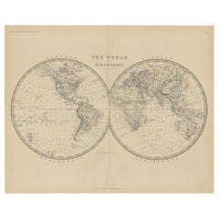
Antique map titled 'The World in Hemispheres'. Old double-hemisphere world map. This map originates
Category
19th Century Antique Map Of World
Materials
Paper
Antique World Map by Lesage, 1823
Located in Langweer, NL
Antique world map titled 'Mappe Monde Historique'. The map depicts both the Eastern and Western
Category
Early 19th Century Antique Map Of World
Materials
Paper
Antique Map of the World by Stoopendaal, c.1714
Located in Langweer, NL
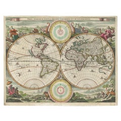
Antique world map titled 'Orbis Terrarum Tabula Recens Emendata et in Lucem Edita'. Decorative
Category
18th Century Antique Map Of World
Materials
Paper
1847 “World at One View” Antique Hand-Colored Wall Map of the World
Located in Colorado Springs, CO
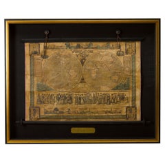
This is a highly desirable hanging wall map of the "World at One View", published in 1847 by Ensign
Category
19th Century American Antique Map Of World
Materials
Paper
Antique Physical Map of the World by Reynolds, 1849
Located in Langweer, NL
Antique physical map of the world, showing the discoveries of the most eminent modern geographers
Category
19th Century Antique Map Of World
Materials
Paper
Antique Rain Map of the World by Johnston '1850'
Located in Langweer, NL
Antique map titled 'Hyetographic or Rain Map of the World'. Original antique rain map of the world
Category
Mid-19th Century Antique Map Of World
Materials
Paper
Antique Ethnographic Map of the World by Johnston '1850'
Located in Langweer, NL
Antique map titled 'Ethnographic map of the world showing the present distribution of the leading
Category
Mid-19th Century Antique Map Of World
Materials
Paper
Antique Geological Map of the World by Johnston '1850'
Located in Langweer, NL
world. This map originates from 'The Physical Atlas of Natural Phenomena' by A.K. Johnston, published
Category
Mid-19th Century Antique Map Of World
Materials
Paper
Large Original Vintage Map of The World, circa 1920
Located in St Annes, Lancashire
Great map of The World
Original color.
Good condition / minor foxing
Published by
Category
1920s English Antique Map Of World
Materials
Paper
Antique Map of the World by D'Urville '1853'
Located in Langweer, NL
Antique map titled 'Voyage Autour du Monde'. Original map of the world. This map originates from
Category
Mid-19th Century Antique Map Of World
Materials
Paper
Antique Map of the World on Mercator's Projection, 1788
Located in Langweer, NL
Antique map titled 'Kaart van de Geheele Wereld (..)'. Uncommon small world map on Mercator's
Category
Late 18th Century Antique Map Of World
Materials
Paper
Antique Map of the World in two sheets, 1852
Located in Langweer, NL
Antique map titled 'The World on Mercator's Projection'. Two individual sheets of the world. This
Category
Mid-19th Century Antique Map Of World
Materials
Paper
Antique Map of the World by A. Vuillemin, 1854
By Victor Levasseur
Located in Langweer, NL
This map originates from ‘Atlas National de la France Illustré’. Published by A. Combette, Paris
Category
Mid-19th Century Antique Map Of World
Materials
Paper
Decorative Ancient World Map with Large Parts of the World Still Unknown, c 1731
Located in Langweer, NL
Interesting ancient map of the world, based upon Strabo. The Southern tip of Africa is undiscovered
Category
1730s Antique Map Of World
Materials
Paper
H 9.45 in W 14.57 in D 0 in
Antique Map of the Distribution of Vegetation throughout the World '1851'
Located in Langweer, NL
of vegetation throughout the world. Five drawings above the map show the vegetation in numerous areas
Category
Mid-19th Century Antique Map Of World
Materials
Paper
H 19.69 in W 21.86 in D 0.79 in
Antique World Map before the Voyages of Christopher Columbus, 1880
Located in Langweer, NL
Antique world map titled 'Monde Connu des Anciens'. Antique map of the World and continents before
Category
19th Century Antique Map Of World
Materials
Paper
Antique World Map by P. Schenk '1706'
By Peter Schenk
Located in Langweer, NL
Aert-klooten (..)'. One of the earliest Dutch World Maps to focus on a more modern cartographic style
Category
Early 18th Century Antique Map Of World
Materials
Paper
Antique Map of the World, Mercator Projection, by Wyld, '1845'
Located in Langweer, NL
Antique map titled 'The World'. Original antique world map, on Mercator's projection. This map
Category
Mid-19th Century Antique Map Of World
Materials
Paper
Large Original Antique Map of The World, Fullarton, C.1870
Located in St Annes, Lancashire
Great map of the World. Showing both hemispheres
From the celebrated Royal Illustrated Atlas
Category
1870s Scottish Antique Map Of World
Materials
Paper
Four Physical Maps of the World on One Sheet , 1872
Located in Langweer, NL
Four physical maps of the world on one sheet. The upper map shows lowlands, highlands and highest
Category
Late 19th Century Antique Map Of World
Materials
Paper
Large Original Antique Map of the World, Fullarton, circa 1870
Located in St Annes, Lancashire
Great map of the World.
From the celebrated Royal Illustrated Atlas
Lithograph. Original color
Category
1870s Scottish Antique Map Of World
Materials
Paper
No Reserve
H 18.5 in W 22.5 in D 0.07 in
Antique Map of the World in Hemispheres by Johnson, '1872'
Located in Langweer, NL
Antique map titled 'Johnson's Globular World. Original world map depicting the Eastern Hemisphere
Category
Late 19th Century Antique Map Of World
Materials
Paper
Antique Map of the World by R. de Vaugondy, 1795
Located in Langweer, NL
Attractive world map by Vaugondy but corrected and issued by Lamarche in year 3 of the French
Category
Late 18th Century Antique Map Of World
Materials
Paper
Original Antique Map of The World by Thomas Clerk, 1817
Located in St Annes, Lancashire
Great map of The Eastern and Western Hemispheres
On 2 sheets
Copper-plate engraving
Drawn
Category
1810s English Antique Map Of World
Materials
Paper
The World After the Battle of Corupedium: Hellenistic Kingdoms Map, 1880
Located in Langweer, NL
The map is titled "ORBIS TERRARUM post proelium Corupedinse," which translates to "The World after
Category
1880s Antique Map Of World
Materials
Paper
Free Shipping
H 15.56 in W 18.51 in D 0 in
Colorful Detailed Antique Map of The World on Mercators Projection, 1882
Located in Langweer, NL
The 'World of Mercator's Projection' is a map with a stunning portrayal of global geography and
Category
1880s Antique Map Of World
Materials
Paper
H 14.97 in W 22.45 in D 0 in
Antique Map of the World on Mercator Projection by Anson, 1749
Located in Langweer, NL
'. Original antique map of the world on Mercator's Projection from a Dutch edition of Anson's voyages. The map
Category
18th Century Antique Map Of World
Materials
Paper
Antique Map of The World in Hemispheres on Various Projections, 1882
Located in Langweer, NL
This stunning 1882 'Antique Map of The World in Hemispheres' showcases an exquisite blend of
Category
1880s Antique Map Of World
Materials
Paper
1864 Johnson's Map of the World on Mercator's Projection, Ric.B009
Located in Norton, MA
An 1864 Johnson's map of
the World on Mercator's Projection
Ric.b009
About this Item
Category
19th Century Dutch Antique Map Of World
Materials
Paper
Antique Map of the World with California as an Island, 1788
Located in Langweer, NL
Wareld verbeeld in de gedaante van een hard'. This interesting composition contains three world maps on
Category
1780s Antique Map Of World
Materials
Paper
Antique Map of the Eastern Part of the World by Tirion, 1755
By Isaak Tirion
Located in Langweer, NL
Antique map titled 'Nieuwe Kaart van het Oostelykste Deel der Weereld, dienende tot Aanwyzing van
Category
Mid-18th Century Dutch Antique Map Of World
Materials
Paper
Free Shipping
H 15.56 in W 15.56 in D 0.02 in
Antique Map of the World Showing the Distribution of Plants and Minerals, 1872
Located in Langweer, NL
Antique map titled 'Johnson's World showing the distribution of the Characteristic Forest Trees
Category
Late 19th Century Antique Map Of World
Materials
Paper
H 13.39 in W 16.93 in D 0.02 in
Antique Map of The World in Hemispheres by W. G. Blackie, 1859
Located in Langweer, NL
Antique map titled 'The World in Hemispheres with other projections'. Original antique map of The
Category
Mid-19th Century Antique Map Of World
Materials
Paper
Very Attractive Antique Map of the World as Planisphere, Shows Cook's Voyages
Located in Langweer, NL
Antique map titled 'Chart of the World, according to Mercators Projection'. This world map shows
Category
Late 18th Century Antique Map Of World
Materials
Paper
No Reserve
H 16.15 in W 20.08 in D 0.02 in
Original Engraved Antique Map of the World, Colorful and Decorative, C.1780
By Pierre François Tardieu
Located in Langweer, NL
' - This handsome double hemisphere map presents a view of the physical world with particularly nice detail
Category
18th Century Antique Map Of World
Materials
Paper
H 15.6 in W 20.32 in D 0 in
Ancient World Map of Europe, Asia & Northern Africa with Ancient Names, 1725
Located in Langweer, NL
ancient world depicting Europe, Asia, and northern Africa with ancient place names. This map originates
Category
1720s Antique Map Of World
Materials
Paper
H 15.75 in W 18.51 in D 0 in
Antique Mercator Projection World Map by Petri, c.1873
Located in Langweer, NL
Antique world map titled 'Wereldkaart naar Mercator's Projectie'. Old map of the world. This map
Category
19th Century Antique Map Of World
Materials
Paper
Antique Detailed World Map Drawn on Mercator's Projection, 1700
Located in Langweer, NL
Antique world map titled 'Carte generale du monde, ou description du monde terrestre & Aquatique
Category
17th Century Antique Map Of World
Materials
Paper
Antique Map of the World in Hemispheres by Keizer & de Lat, 1788
Located in Langweer, NL
double hemisphere world map on polar projections. In North America, there is a large Island of California
Category
Late 18th Century Antique Map Of World
Materials
Paper
Original Old Composite of Several Maps of the Ancient World on One Sheet, 1880
Located in Langweer, NL
Theodorus Menke. The map is a detailed depiction of the ancient world. The atlas it comes from is known for
Category
1880s Antique Map Of World
Materials
Paper
Free Shipping
H 15.56 in W 18.51 in D 0 in
Victorian Visions of the New World: A Detailed Tallis Map of North America, 1851
Located in Langweer, NL
The map presented here is an intricate example from the series of maps produced by John Tallis
Category
1850s Antique Map Of World
Materials
Paper
H 14.26 in W 10.71 in D 0 in
Antique Bible World Map by R. & J. Wetstein, 1743
Located in Langweer, NL
Antique world map titled 'De Werelt Caart'.
A scarce and richly detailed double hemisphere world
Category
Mid-18th Century Antique Map Of World
Materials
Paper
Antique Map of the Old World Projection, Entitled Orbis Terrarum Ad Mentem, 1825
Located in Langweer, NL
Antique map titled 'Orbis Terrarum ad Mentem (..)'. Old map of the world originating from 'Atlas
Category
19th Century Antique Map Of World
Materials
Paper
H 8.51 in W 9.77 in D 0 in
Antique Miniature Map of the Old World and France by Mallet, circa 1683
Located in Langweer, NL
shows a hemisphere of the Old World. The lower map shows France. This map originates from 'Description
Category
Late 17th Century Antique Map Of World
Materials
Paper
H 11.03 in W 8.86 in D 0.6 in
Antique Hemisphere Map of the World 'Two on One Sheet' by Levasseur, '1875'
Located in Langweer, NL
la projection polaire'. Large map with two hemisphere world maps on one sheet. This map originates
Category
Late 19th Century Antique Map Of World
Materials
Paper
H 24.02 in W 18.71 in D 0.02 in
Antique Map of the World with Polar Projections by Keizer & de Lat, 1788
Located in Langweer, NL
Antique map titled 'Schuine Ronde Aard-Klooten (..)'. Interesting double hemisphere world map with
Category
Late 18th Century Antique Map Of World
Materials
Paper
H 8.08 in W 11.03 in D 0.02 in
Antique Map of the World in 12 Globe Gores by Scherer, 'circa 1702'
Located in Langweer, NL
Superinducendus'. Beautiful example of Scherer's map of the World, configured in 12 globe gores. California is
Category
Early 18th Century Antique Map Of World
Materials
Paper
Antique Map of the World in two Hemispheres by Keizer & de Lat, 1788
Located in Langweer, NL
Antique map titled 'Kaart van de Twee platte Warelds Bollen (..)'. Interesting world map in two
Category
Late 18th Century Antique Map Of World
Materials
Paper
Rare Original Double Hemisphere World Map with Allegorical Figures, 1785
Located in Langweer, NL
hemisphere world map. Four allegorical figures in the corners represent Europe, Asia, Africa and America
Category
1780s Antique Map Of World
Materials
Paper
H 17.05 in W 23.23 in D 0 in
Very Decorative Original Antique Map of the World, Published in France in c.1780
By Rigobert Bonne
Located in Langweer, NL
Antique map titled 'L'Ancien Monde Et Le Nouveau en Deux Hemispheres' - Double hemisphere map of
Category
18th Century Antique Map Of World
Materials
Paper
H 10.24 in W 17.6 in D 0 in
Small Antique World Map in Decorative Old Hand-Colouring, circa 1840
Located in Langweer, NL
Antique map titled 'Wereld Kaart'. Small and very decorative double hemisphere world map. Source
Category
19th Century Antique Map Of World
Materials
Paper
Antique Map showing Isotherm Lines throughout the World by Johnston '1850'
Located in Langweer, NL
lines throughout the world. This map originates from 'The Physical Atlas of Natural Phenomena' by A.K
Category
Mid-19th Century Antique Map Of World
Materials
Paper
H 11.03 in W 14.18 in D 0.02 in
Antique Map Showing the Religions Around the World by Johnston '1854'
Located in Langweer, NL
Antique map titled 'Moral & Statistical Chart showing the Geographical Distribution of Man
Category
Mid-19th Century Antique Map Of World
Materials
Paper
No Reserve
H 21.66 in W 26.38 in D 0.02 in
Antique Double Hemisphere World Map with California as an Island, 1710
Located in Langweer, NL
hemisphere world map from a Dutch bible by Cornelis Dankerts (Danckerts), engraved by Albert Schut, printed
Category
1710s Antique Map Of World
Materials
Paper
Map Silk Embroidered Western Eastern Hemisphere New Old World Asia America Afri
Located in BUNGAY, SUFFOLK
A rare, late-18th century, silk, embroidered, double hemisphere, world map, blackwork, sampler
Category
18th Century British Georgian Antique Map Of World
Materials
Silk
H 0.4 in W 0.4 in D 0.4 in
Gorgeous Antique World Map by the Dutch Mapmaker Visscher, published circa 1679
Located in Langweer, NL
example of Nicholas Visscher's World map, which appeared in his Atlas Minor after 1679.
The map is
Category
Late 17th Century Antique Map Of World
Materials
Paper
Free Shipping
H 20.79 in W 25.2 in D 0.02 in
- 1
- ...
Get Updated with New Arrivals
Save "Antique Map Of World", and we’ll notify you when there are new listings in this category.
Antique Map Of World For Sale on 1stDibs
With a vast inventory of beautiful furniture at 1stDibs, we’ve got just the antique map of world you’re looking for. An antique map of world — often made from paper, wood and bronze — can elevate any home. There are many kinds of the antique map of world you’re looking for, from those produced as long ago as the 18th Century to those made as recently as the 20th Century. When you’re browsing for the right antique map of world, those designed in Baroque, Industrial and Louis XVI styles are of considerable interest. You’ll likely find more than one antique map of world that is appealing in its simplicity, but George F. Cram, Victor Levasseur and Heinrich Kiepert produced versions that are worth a look.
How Much is a Antique Map Of World?
The average selling price for an antique map of world at 1stDibs is $571, while they’re typically $76 on the low end and $65,000 for the highest priced.
More Ways To Browse
Winkle Co
Greece Map Print
Tent Camping
Miniature Safe
Egyptian Print Pictures
East Lake Antique
Used Office Furniture South Florida
Copenhagen Map
Ch 23
East Lake Antique Furniture
New York Rangers
Vancouver Antique Furniture
Antique Furniture New South Wales
California As An Island Map
Basilica Table
Antique Armillary Sphere Antiques
Antique Armillary Sphere
Ch 28
