
California Map

8
to
58
468
85
300
168
105
86
76
57
44
41
33
26
24
21
20
19
19
16
15
15
11
9
9
9
8
7
7
7
6
6
5
5
4
4
4
4
3
3
3
2
2
2
2
2
2
1
1
1
1
1
1
1
1
1
1
1
42
21
19
19
14
Sort By
Antique Map of Baja California and parts of Alta California, Arizona and Sonora
Located in Langweer, NL
Antique map titled 'Kaart van het Westelyk Gedeelte van Nieuw Mexico en van California'. Beautiful
Category

Antique Mid-18th Century Maps

Materials

Paper

Large Original Antique Map of California, USA, circa 1900
Located in St Annes, Lancashire
Fabulous map of California Original color Engraved and printed by the George F. Cram Company
Category

Antique 1890s American Maps

Materials

Paper

1865 "Johnson's California, Utah, Nevada, Colorado, New Mexico, Arizona" Map
Located in Colorado Springs, CO
Presented is an original 1865 "Johnson's California, with Territories of Utah, Nevada, Colorado
Category

Antique Mid-19th Century Maps

Materials

Paper

Original Antique Map of the Western Part of NEW MEXICO & CALIFORNIA
Located in Langweer, NL
Title: "Map of the Western Part of NEW MEXICO and CALIFORNIA According to the Latest Discoveries by
Category

Antique 1760s Maps

Materials

Paper

Antique Map of California, Utah, Nevada, Colorado, New Mexico & Arizona '1872'
Located in Langweer, NL
Antique map titled 'Johnson's California (..)'. Original map of California, Utah, Nevada, Colorado
Category

Antique Late 19th Century Maps

Materials

Paper

Antique Map of the World with California as an Island, 1788
Located in Langweer, NL
cordiform projections show California as an island. However, as this map was published at the very end of
Category

Antique 1780s Maps

Materials

Paper

Antique Double Hemisphere World Map with California as an Island, 1710
Located in Langweer, NL
Description: Antique map titled 'De Werelt Caart'. First state (out of three) antique double
Category

Antique 1710s Maps

Materials

Paper

Antique Miniature Map of the Western Hemisphere, with California as an Island
Located in Langweer, NL
the Western Hemisphere, published by Alain Manesson Mallet. The map shows California as an Island, no
Category

Antique Late 17th Century Maps

Materials

Paper

California, Alaska and Mexico: 18th Century Hand-Colored Map by de Vaugondy
By Didier Robert de Vaugondy
Located in Alamo, CA
cartes publiees au commencement de 17e Siecle" (Map of California and the Northwestern Countries
Category

Antique 1770s French Maps

Materials

Paper

Antique Map of America with California as an Island by Homann '1710'
Located in Langweer, NL
as an Island**: One of the most distinctive features of this map is the depiction of California as an
Category

Antique Early 18th Century Maps

Materials

Paper

Beautiful Antique Map of the Northern Hemisphere with California as an Island
By Isaak Tirion
Located in Langweer, NL
Antique map titled 'Nieuwe Kaart van de Noord Pool na de alderlaatste ontdekking int licht gebracht
Category

Antique Mid-18th Century Maps

Materials

Paper

Antique Map of Part of the United States Including Lower California & Arizona
Located in Langweer, NL
Antique map of part of the United States of America including Lower California, Arizona and part of
Category

Antique Late 19th Century Maps

Materials

Paper

1847 Antique Map of Mexico, Texas and California by Samuel Augustus Mitchell
By Samuel Augustus Mitchell 1
Located in Colorado Springs, CO
& Upper California, an important map showing the progress of the Mexican-American War. Published in 1847
Category

Antique 1840s American Maps

Materials

Paper

1873 "Map of the States of California and Nevada" by Chas. Drayton Gibbes
Located in Colorado Springs, CO
Presented is Warren Holt and Charles Drayton Gibbes' 1873 “Map of California and Nevada.” This map
Category

Antique 1870s American Maps

Materials

Paper

1830 Mexico and United States Framed Map
Located in Stamford, CT
Map of North America published circa 1830. Map shows United States into Canada. Mexico extending
Category

Antique 1830s American American Classical Maps

Materials

Glass, Wood, Paper

Antique Map of North and East Asia, 1751
Located in Langweer, NL
maps on one sheet, showing California, Alaska and Siberia, Korea and Japan. South to Korea the island
Category

Antique 18th Century Maps

Materials

Paper

Antique Map of North and East Asia, 1751
H 18.35 in W 14.97 in D 0 in
Antique Map of the Pacific Ocean by Anson, 1765
Located in Langweer, NL
Antique map titled 'Carte de la Mer du Sud ou Mer Pacifique - Kaart van de Zuyd-Zee of stille
Category

Antique 18th Century Maps

Materials

Paper

Antique Detailed World Map Drawn on Mercator's Projection, 1700
Located in Langweer, NL
Antique world map titled 'Carte generale du monde, ou description du monde terrestre & Aquatique
Category

Antique 17th Century Maps

Materials

Paper

Antique Bible World Map by R. & J. Wetstein, 1743
Located in Langweer, NL
Antique world map titled 'De Werelt Caart'. A scarce and richly detailed double hemisphere world
Category

Antique Mid-18th Century Maps

Materials

Paper

Antique Bible World Map by R. & J. Wetstein, 1743
Free Shipping
H 15.52 in W 21.26 in D 0.02 in
Vintage Reproduction 17th Century Map of Europe, American, Cartography, Blaeuw
Located in Hele, Devon, GB
This is a vintage reproduction map of Europe. An American, paper stock cartography print in frame
Category

Late 20th Century Central American Mid-Century Modern Maps

Materials

Glass, Wood, Paper

Antique Map of Central America Showing the Communication Lines, 1850
Located in Langweer, NL
Antique map titled 'Map of Central America Shewing the Different Lines of Atlantic & Pacific
Category

Antique 19th Century Maps

Materials

Paper

America "Amérique Septentrionale": A 19th Century French Map by Delamarche
By Maison Delamarche 1
Located in Alamo, CA
. California and the southwestern states are still part of Mexico at the time this map was published. The map
Category

Antique Mid-19th Century American Other Maps

Materials

Paper

Antique Map of the World on Mercator Projection by Anson, 1749
Located in Langweer, NL
Antique map titled 'Nieuwe Wereld Kaart waar in de Reizen van den Hr. Anson rondsom de Wereld
Category

Antique 18th Century Maps

Materials

Paper

Original Hand-Colored Antique Map of America by Danckerts, circa 1680
Located in Langweer, NL
'. Striking map of America. California is shown as an island, Based Upon Sanson's model. The Great Lakes are
Category

Antique Late 17th Century Maps

Materials

Paper

1847 Ornamental Map of the United States & Mexico by H. Phelps
Located in Colorado Springs, CO
map proclaims the Manifest Destiny, with the recent acquisition of Upper California and Texas at the
Category

Antique 1840s American Maps

Materials

Paper

Antique Map of the Bay of Terney by La Pérouse, 1797
Located in Langweer, NL
Californias in 1786. He stopped at the Presidio of San Francisco long enough to create an outline map of the
Category

Antique 18th Century Maps

Materials

Paper

Nice Sheet of the Sangihe Archipelago in Indonesia & California Island, 1788
Located in Langweer, NL
Antique map titled 'De Noord Pool waar in aangetoont werd alle de Nieuwe Landen (..) De
Category

Antique 1780s Maps

Materials

Paper

Antique Map of The United States of North America, Pacific States, 1882
Located in Langweer, NL
The map is from the same 1882 Blackie Atlas and focuses on the Pacific States of the United States
Category

Antique 1880s Maps

Materials

Paper

Antique Map of the World in Hemispheres by Keizer & de Lat, 1788
Located in Langweer, NL
double hemisphere world map on polar projections. In North America, there is a large Island of California
Category

Antique Late 18th Century Maps

Materials

Paper

Map Silk Embroidered Western Eastern Hemisphere New Old World Asia America Afri
Located in BUNGAY, SUFFOLK
A rare, late-18th century, silk, embroidered, double hemisphere, world map, blackwork, sampler
Category

Antique 18th Century British Georgian Maps

Materials

Silk

Gorgeous Antique World Map by the Dutch Mapmaker Visscher, published circa 1679
Located in Langweer, NL
Antique map titled 'Novissima Totius Terrarum Orbis Tabula, Auctore Nicolao Visscher'. Gorgeous
Category

Antique Late 17th Century Maps

Materials

Paper

Antique Map of North Europe and East Asia by Vaugondy, circa 1750
Located in Langweer, NL
Asia. Five maps on one sheet, showing California, Alaska and Syberia, Korea and Japan. South to Korea
Category

Antique Mid-18th Century Maps

Crossroads of Empires: A John Tallis Map of the Isthmus of Panama, 1851
Located in Langweer, NL
The Tallis map of the Isthmus of Panama is a beautifully detailed work, characteristic of the maps
Category

Antique 1850s Maps

Materials

Paper

1863 "Lloyd's New Map of the United States, the Canadas, and New Brunswick"
Located in Colorado Springs, CO
Presented is “Lloyd's New Map of the United States, the Canadas and New Brunswick, From the latest
Category

Antique 1860s American Maps

Materials

Linen, Wood, Paper

Antique Map of the World with Polar Projections by Keizer & de Lat, 1788
Located in Langweer, NL
Antique map titled 'Schuine Ronde Aard-Klooten (..)'. Interesting double hemisphere world map with
Category

Antique Late 18th Century Maps

Materials

Paper

Antique Map of the North Pole & Sangihe Archipelago by Keizer & de Lat, 1788
Located in Langweer, NL
Antique map titled 'De Noord Pool waar in aangetoont werd alle de Nieuwe Landen (..) - De Eilanden
Category

Antique Late 18th Century Maps

Materials

Paper

Antique Map of the World in two Hemispheres by Keizer & de Lat, 1788
Located in Langweer, NL
Antique map titled 'Kaart van de Twee platte Warelds Bollen (..)'. Interesting world map in two
Category

Antique Late 18th Century Maps

Materials

Paper

Map of Australia, New Zealand, Part of China, Japan and Southeast Asia, 1857
Located in Langweer, NL
German Antique map titled 'Australien'. Map of Australia, New Zealand, part of China, Japan and
Category

Antique 19th Century Maps

Materials

Paper

Antique Map of Australia, New Zealand and Oceania by F. von Stülpnagel, 1850
Located in Langweer, NL
Antique map titled 'Australien und Polynesien in Mercators Projection'. A map of Australia, New
Category

Antique Mid-19th Century Maps

Materials

Paper

Antique Map of the World in 12 Globe Gores by Scherer, 'circa 1702'
Located in Langweer, NL
Superinducendus'. Beautiful example of Scherer's map of the World, configured in 12 globe gores. California is
Category

Antique Early 18th Century Maps

Materials

Paper

Antique Map of the Northern Hemisphere and North Pole by Tirion, circa 1754
Located in Langweer, NL
Antique map titled 'Nieuwe Kaart van de Noord Pool na de alderlaatste ondekking int licht gebracht
Category

Antique Mid-18th Century Maps

Materials

Paper

Excellent Antique Map of America with Unusual Northwest Coast of America, c.1754
Located in Langweer, NL
Description: Antique map titled 'Nieuwe Kaart Van het Westelykste Deel Der Weereld, dienende tot
Category

Antique 1750s Maps

Materials

Paper

Interesting Antique Map of the Development of the Mapping of the America's, 1841
Located in Langweer, NL
". Collection of hand-colored engraved maps by D. VEELWAARD on 1 sheet, "Dertiende aflevering, linker blad" from
Category

Antique 1840s Maps

Materials

Paper

Unique Antique Projection of the World with Twice California as an Island, c1703
Located in Langweer, NL
Description: Antique map of the world. Printed for Scherer's 'Atlas Novus' (1702-1710). On this
Category

Antique Early 1700s Maps

Materials

Paper

1889 "The Pacific States and Territories"
Located in Colorado Springs, CO
Territories.” The vertical map depicts the Western states at the time: Washington, Oregon, California, Montana
Category

Antique 1880s American Maps

Materials

Paper

1889 "The Pacific States and Territories"
H 16.25 in W 14.25 in D 1 in
1879 "United States of America, Western Part" by O. J. Stuart
Located in Colorado Springs, CO
This colorful original map, titled “United States of America, Western Part,” was issued in Volume
Category

Antique 1870s American Maps

Materials

Paper

Interesting Antique Engraving of the World in Hemispheres with 6 Diagrams, 1788
Located in Langweer, NL
Antique map titled 'De Nieuwe en Ouden oppervlakke en doorzigtkundige Aardrykes Bollen (..)'. Twin
Category

Antique Late 18th Century Maps

Materials

Paper

Antique Chart of the Mid-Pacific Ocean by Anson, 'c.1784'
Located in Langweer, NL
Antique map titled 'Carte de la Mer du Sud ou Mer Pacifique'. Original chart of the mid-Pacific
Category

Antique Late 18th Century Maps

Materials

Paper

1877 "Geological and Geographical Atlas of Colorado" by F. V. Hayden
Located in Colorado Springs, CO
Triangulations, Drainage, an Economic Map, and a General Geological map. The second series consists of twelve
Category

Antique 1870s American Maps

Materials

Paper

New Map of the Terraqueous Globe - WORLD MAP - CALIFORNIA AS AN ISLAND
By Edward Wells
Located in Santa Monica, CA
EDWARD WELLS (British 1667- 1727) A NEW MAP of the TERRAQUEOUS GLOBE - according to the latest
Category

Early 1700s Old Masters Landscape Prints

Materials

Engraving

Original 'Map of the United States as Californians See It' vintage map poster
Located in Spokane, WA
Original vintage poster: "Map of the United States as Californians See It". 1947, artist: Oren
Category

1940s American Modern Landscape Prints

Materials

Offset

Original Southern California Home Federal Fun Map vintage poster
Located in Spokane, WA
Original California Fun Map vintage poster from 1973. Archival linen backed in fine condition
Category

1970s American Modern Landscape Prints

Materials

Offset

California: 18th Century Hand-colored Map by de Vaugondy
By Didier Robert de Vaugondy
Located in Alamo, CA
cartes publiees au commencement de 17e Siecle" (Map of California and the Northwestern Countries
Category

1770s Landscape Prints

Materials

Engraving

Original Los Angeles, California Funny Funny World vintage fun map
Located in Spokane, WA
Original Los Angeles, California vintage fun map, Funny Funny World. Archival linen backed in
Category

1970s American Modern Landscape Prints

Materials

Offset

California, Northern Part. USA Century Atlas state antique vintage map
Located in Melbourne, Victoria
'The Century Atlas. California, Northern Part' Inset maps of 'Yosemite Valley' and 'San Francisco
Category

Early 20th Century Victorian More Prints

Materials

Lithograph

Original San Francisco, California vintage fun map poster Henry Hinton
Located in Spokane, WA
Original San Francisco, California fun map vintage poster 1970. Archival linen backed in very
Category

1970s American Impressionist Landscape Prints

Materials

Offset

"San Francisco, Upper California” 1851 Antique Map of San Francisco
Located in Colorado Springs, CO
prodigious body of early California views. Very early on, Britton and Rey earned a reputation for
Category

Antique 1850s American Prints

Materials

Paper

California
By Nemo Jantzen
Located in New York, NY
on a wooden board as his canvas, and using his photography as a road map, Nemo zigzags thread from
Category

2010s Contemporary Mixed Media

Materials

Textile, Thread, Plexiglass, Mixed Media, Wood Panel

California
H 53.5 in W 47.5 in D 4 in
"Sonoma Fields" napa california inspired
By Chase Langford
Located in Edgartown, MA
environment while embarking into uncharted territory. His impactful depictions recall maps and aerial
Category

2010s Figurative Paintings

Materials

Oil

Tar Paint Map, Orev-Raven
By Ken Goldman
Located in Surfside, FL
- Craft in America Museum - California 2014 - Through the Others Eyes - Wolfson Museum - Jerusalem Israel
Category

21st Century and Contemporary Contemporary Photography

Materials

Digital

  • 1
Get Updated with New Arrivals
Save "California Map", and we’ll notify you when there are new listings in this category.

California Map For Sale on 1stDibs

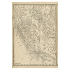
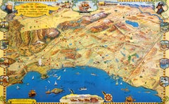
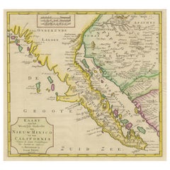
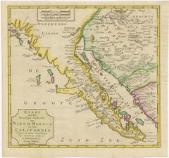
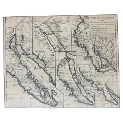
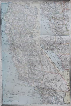
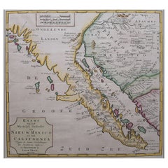
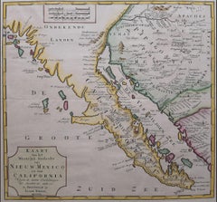
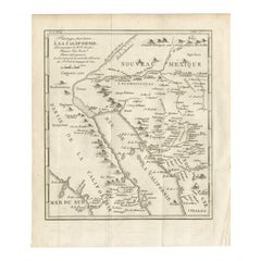
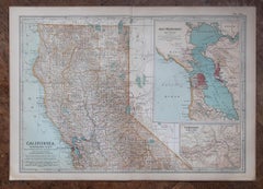
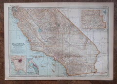
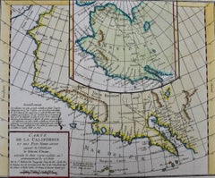
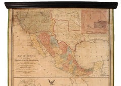
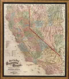
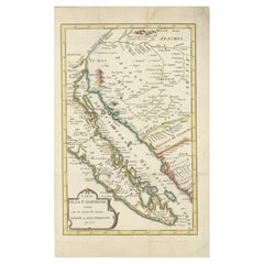
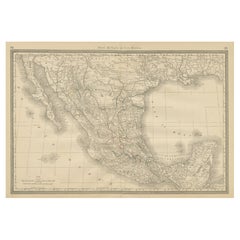
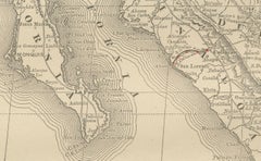
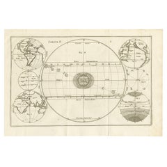
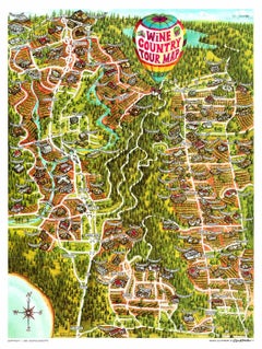
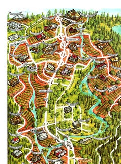
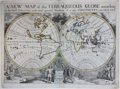
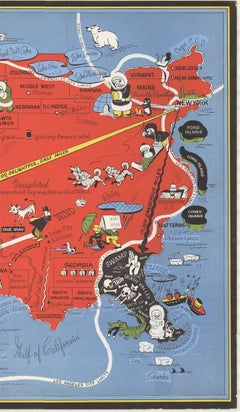
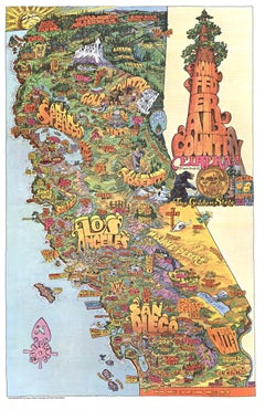
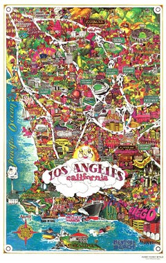
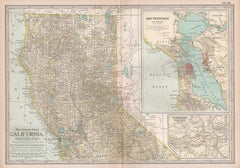
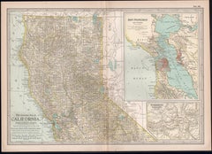
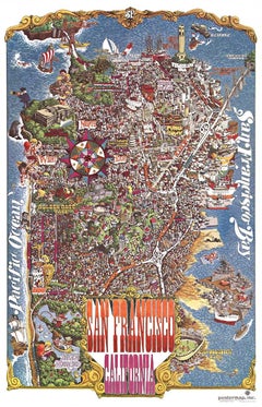
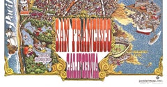
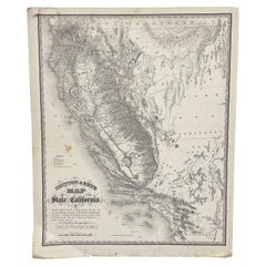
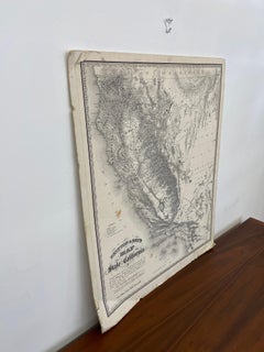
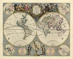
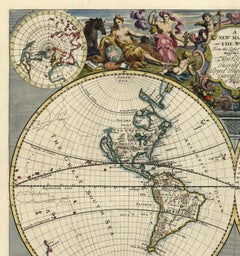
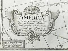
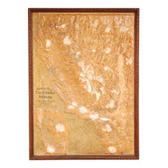
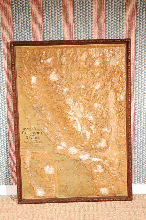
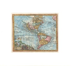
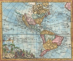
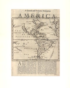
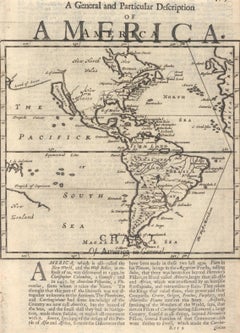
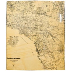
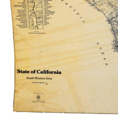
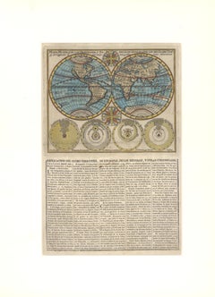
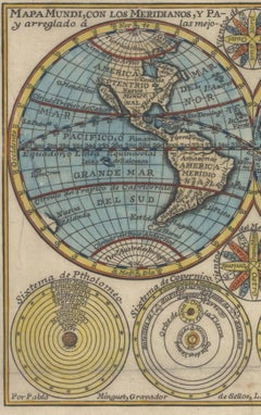
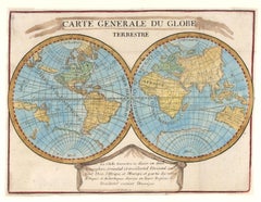
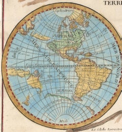
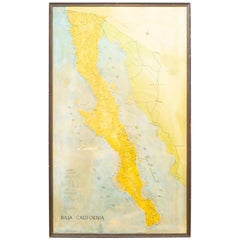
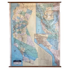
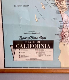
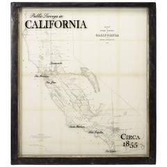
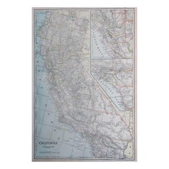
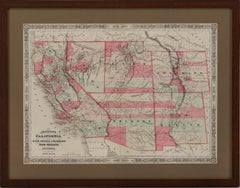
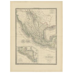
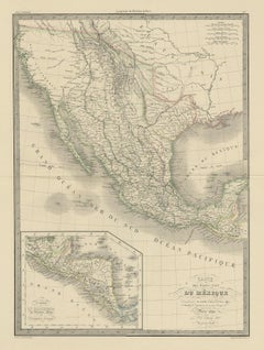
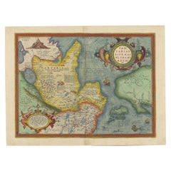
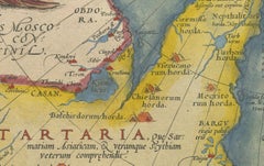
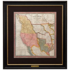
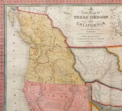
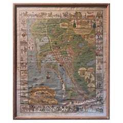
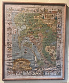
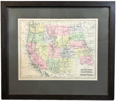
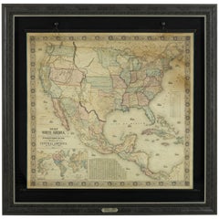
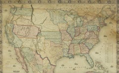
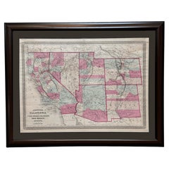
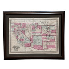
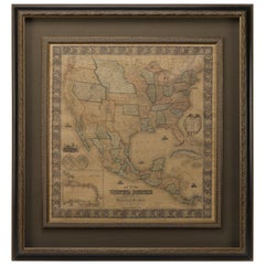
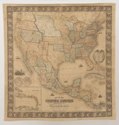
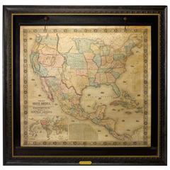
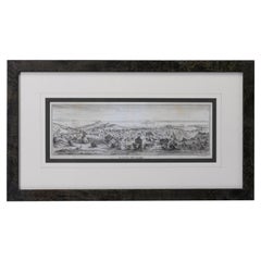
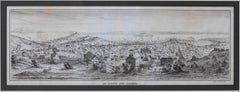
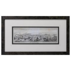
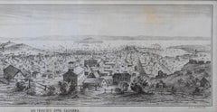
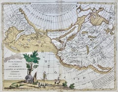
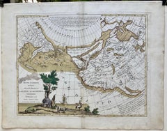
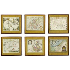
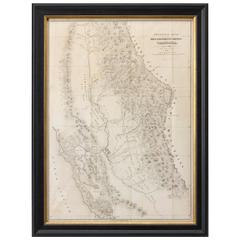
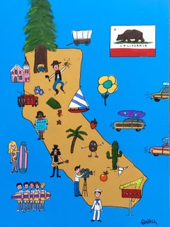
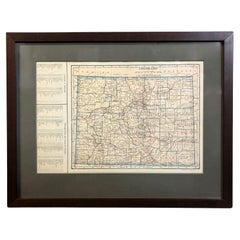
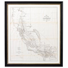
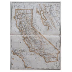
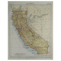
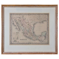
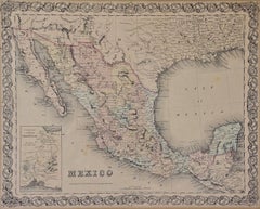
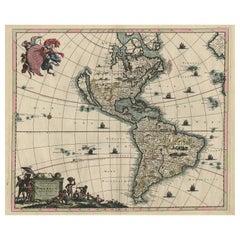
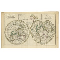
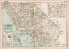
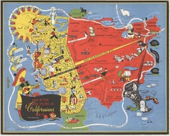
Choose from an assortment of styles, material and more with respect to the california map you’re looking for at 1stDibs. Frequently made of paper and wood, every california map was constructed with great care. Whether you’re looking for an older or newer california map, there are earlier versions available from the 18th Century and newer variations made as recently as the 20th Century. When you’re browsing for the right california map, those designed in Mid-Century Modern styles are of considerable interest. Many designers have produced at least one well-made california map over the years, but those crafted by Samuel Augustus Mitchell and J.H. Colton are often thought to be among the most beautiful.

How Much is a California Map?

The average selling price for a california map at 1stDibs is $975, while they’re typically $95 on the low end and $135,000 for the highest priced.