Items Similar to Antique Map of the Northern Hemisphere and North Pole by Tirion, circa 1754


Want more images or videos?
Request additional images or videos from the seller
1 of 5
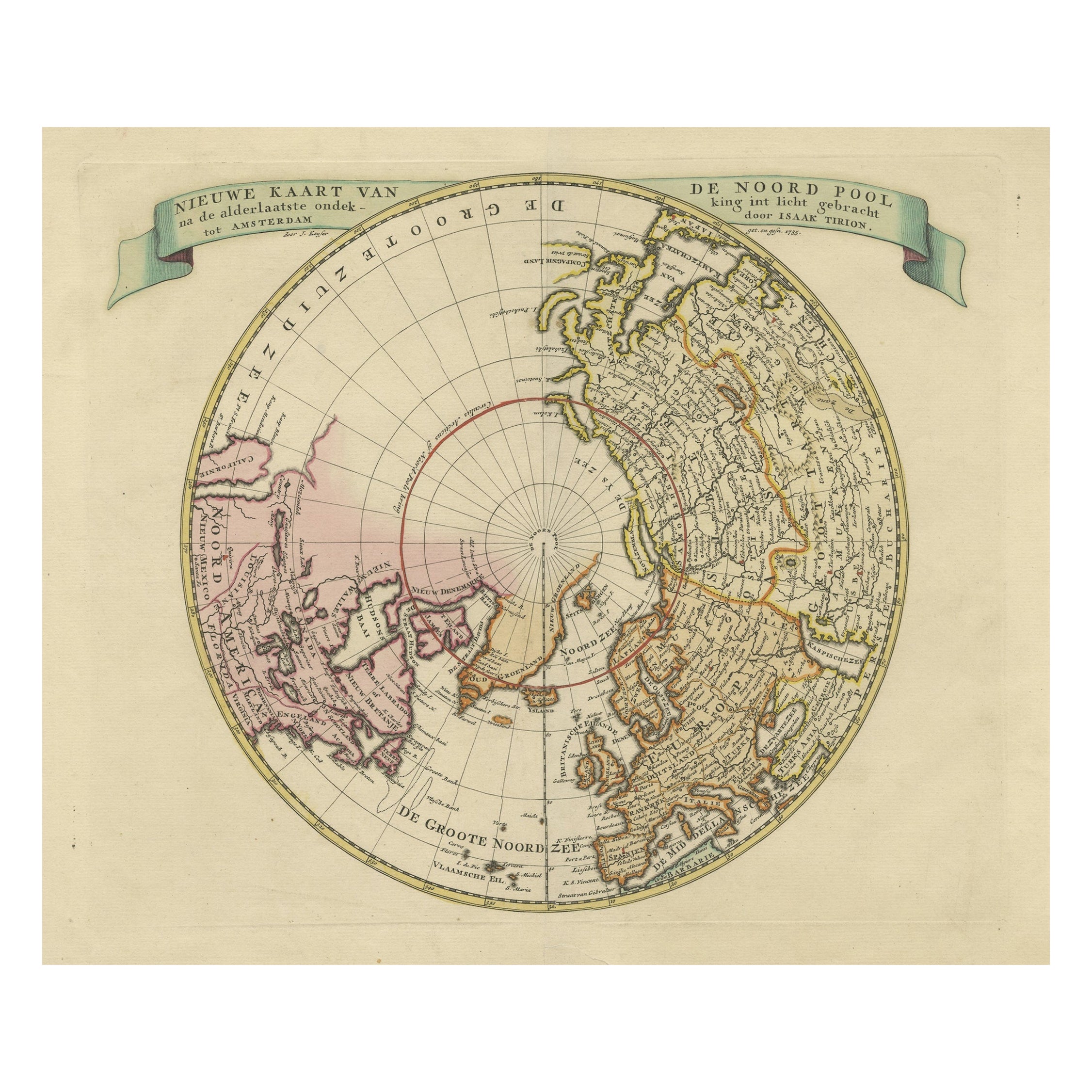
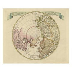
Antique Map of the Northern Hemisphere and North Pole by Tirion, circa 1754
About the Item
Antique map titled 'Nieuwe Kaart van de Noord Pool na de alderlaatste ondekking int licht gebracht'. Map of the Northern Hemisphere and North Pole, which shows the NE Passage, but no definite NW Passage. California is shown as an Island, along with the River systems of North America. Nice detail in the Polar regins, especially New Denmark and Greenland and in Asia and Europe. Published by I. Tirion, circa 1754.
- Dimensions:Height: 12.8 in (32.5 cm)Width: 14.77 in (37.5 cm)Depth: 0.02 in (0.5 mm)
- Materials and Techniques:
- Period:
- Date of Manufacture:circa 1754
- Condition:Good, given age. Small hole bottom left corner, outside image area. Original folds as issued. General age-related toning and/or occasional minor defects from handling. Please study images carefully.
- Seller Location:Langweer, NL
- Reference Number:
About the Seller
5.0
Platinum Seller
These expertly vetted sellers are 1stDibs' most experienced sellers and are rated highest by our customers.
Established in 2009
1stDibs seller since 2017
1,933 sales on 1stDibs
Typical response time: <1 hour
- ShippingRetrieving quote...Ships From: Langweer, Netherlands
- Return PolicyA return for this item may be initiated within 14 days of delivery.
More From This SellerView All
- Antique Map of London by Tirion '1754'Located in Langweer, NLAntique map titled 'Kaart van Londen enz. en van het naby gelegen land ruim een Uur gaans rondsom dezelve Stad; getrokken uit de groote gemeeten Kaart van Hr. John Rocque'. In the se...Category
Antique Mid-18th Century Maps
MaterialsPaper
- Antique Map of the Northern Hemisphere by Lowry, '1852'Located in Langweer, NLAntique map titled 'Perspective Projection of the World on the horizon of London'. Original map of the northern hemisphere. This map originates fro...Category
Antique Mid-19th Century Maps
MaterialsPaper
- Antique Map of the North Pole by V.M. Coronelli, circa 1692By Vincenzo CoronelliLocated in Langweer, NLGlobe gore by Vincenzo Maria Coronelli shows the North Pole with the coasts of Canada, Greenland, Scandinavia and Siberia, and is decorated with pictorial scenes of bear, seal and wh...Category
Antique Late 17th Century Maps
MaterialsPaper
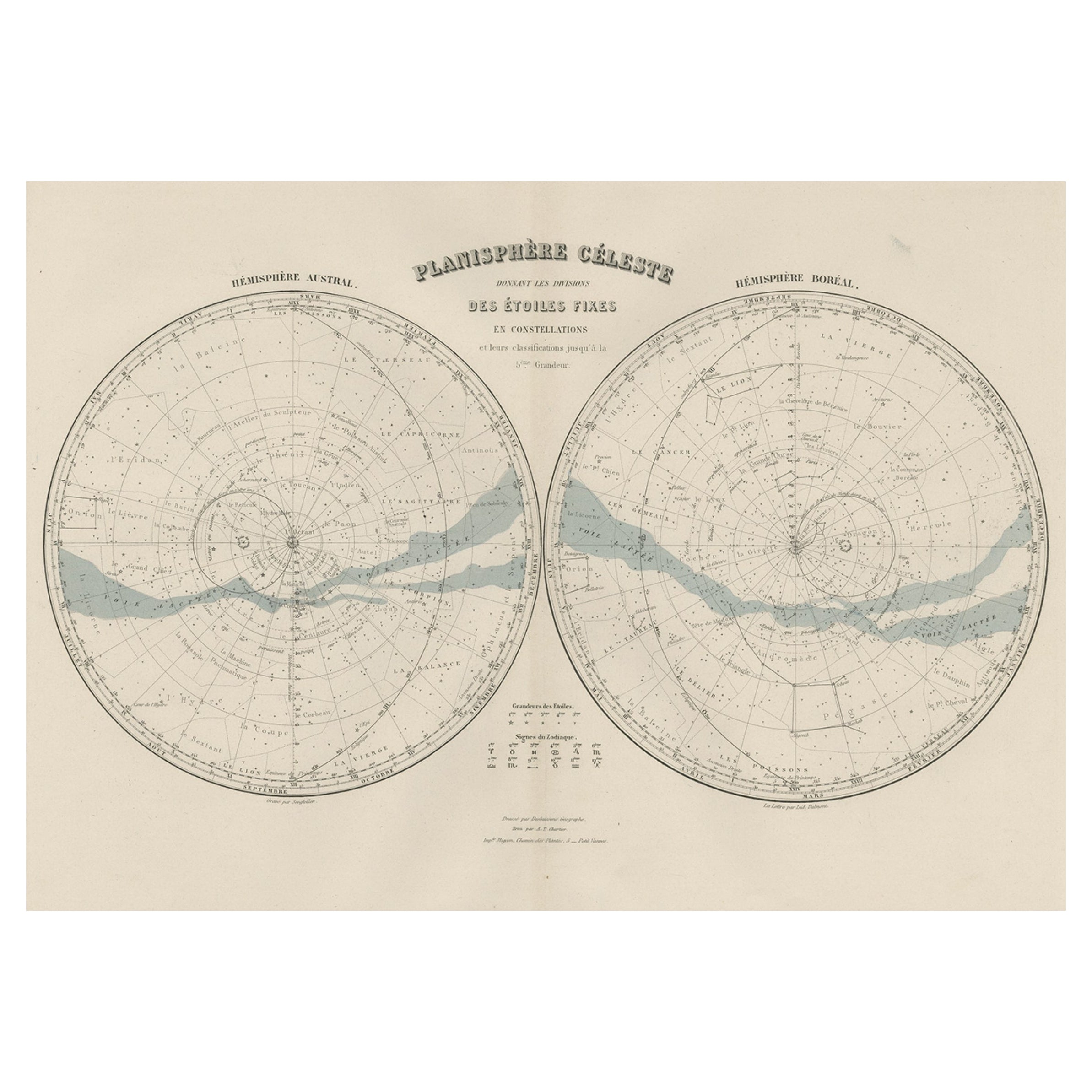
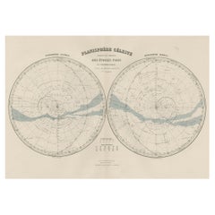
- Antique Map of the Night Skies of the Northern and Southern Hemispheres, 1880Located in Langweer, NLAntique world map titled 'Planisphère en Céleste'. This map depicts the night skies of both the northern and southern hemispheres. This map originates from 'Géographie Universell...Category
Antique 1880s Maps
MaterialsPaper
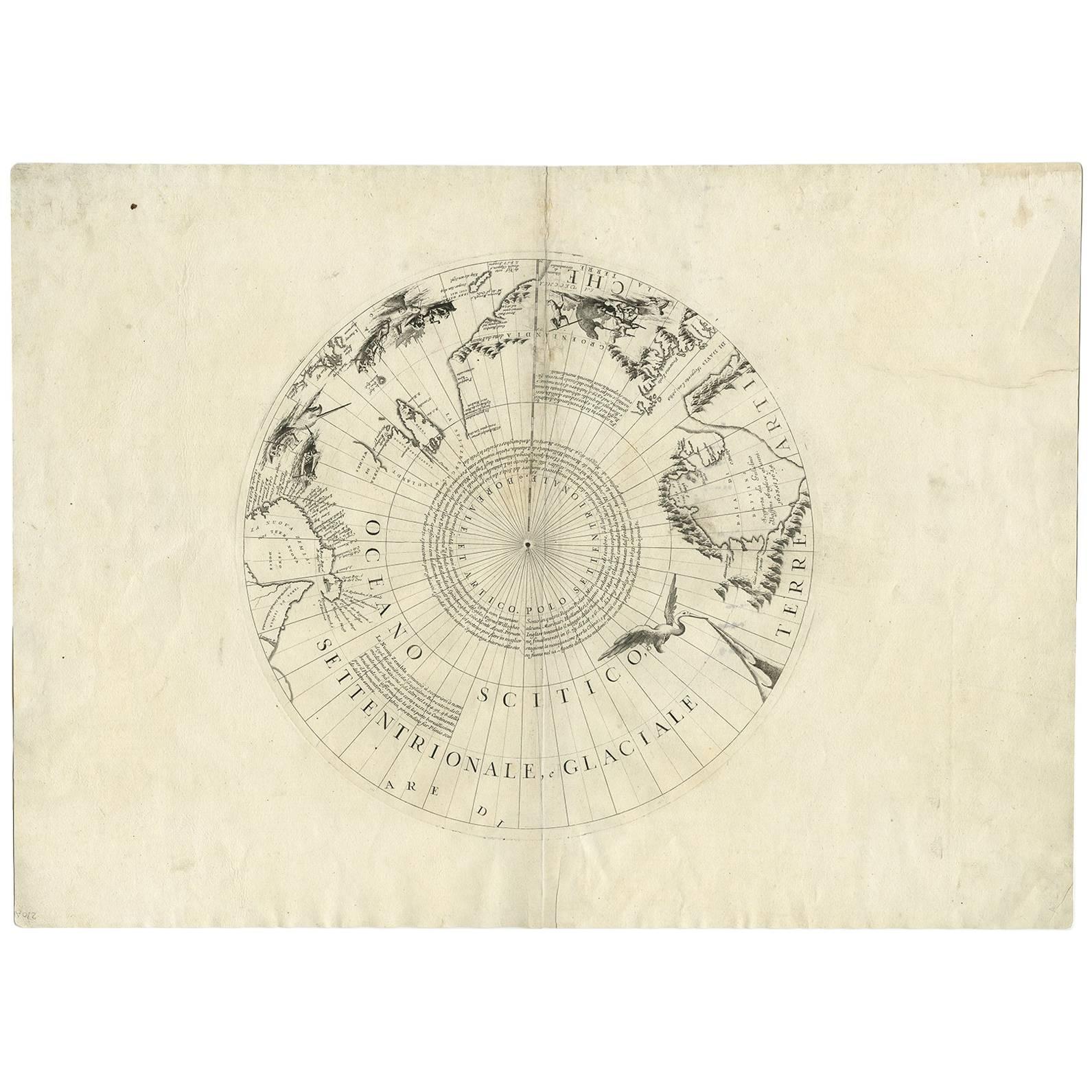
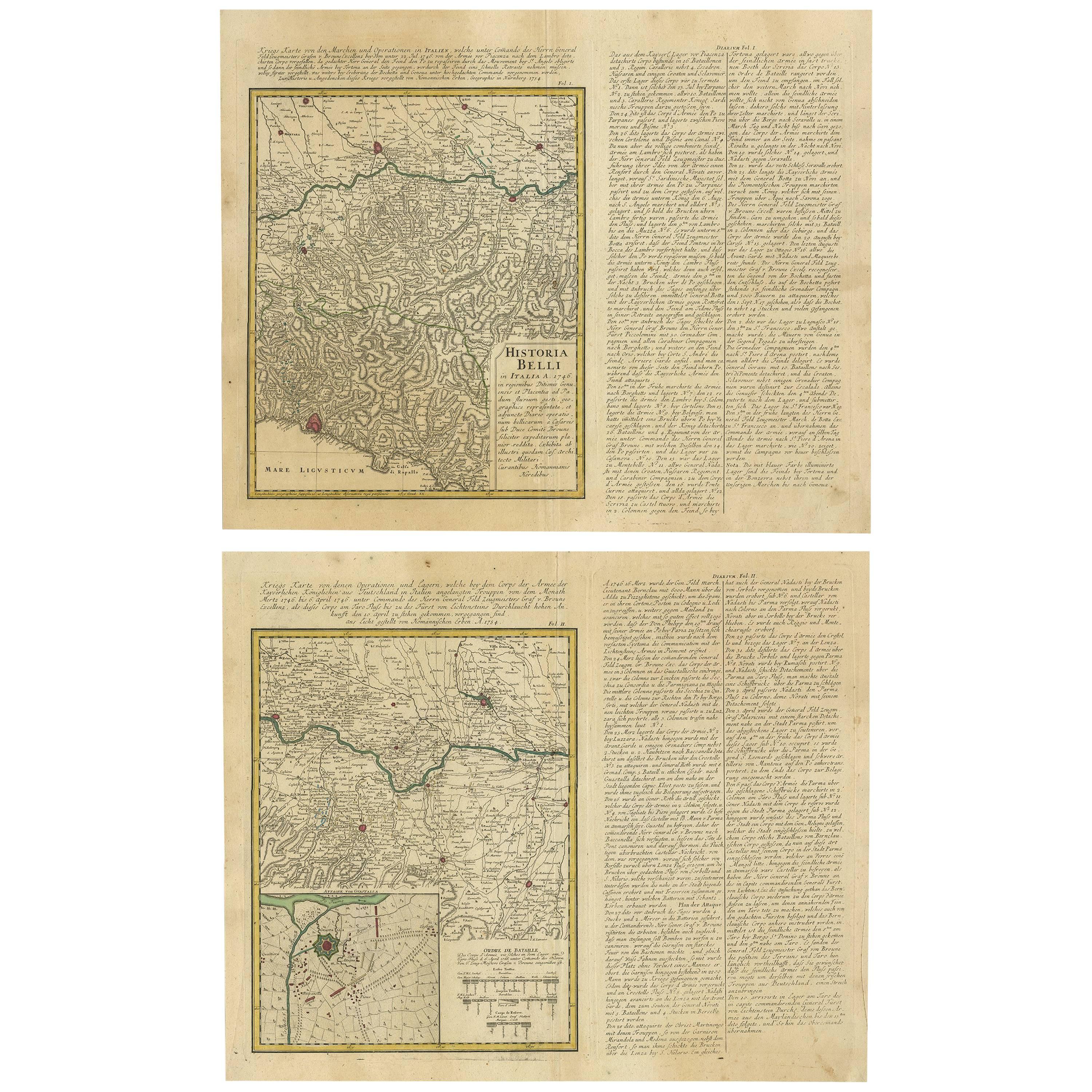
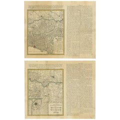
- Set of Two Antique Maps of Northern Italy by Homann Heirs, 1754Located in Langweer, NLSet of two maps of northern Italy showing the position of troups during the war in April and March 1746. The area covered includes the course of the River Po between Valenza (north of Alexandria) and San Benedetto...Category
Antique Mid-18th Century Maps
MaterialsPaper
- Beautiful Antique Map of the Northern Hemisphere with California as an IslandBy Isaak TirionLocated in Langweer, NLAntique map titled 'Nieuwe Kaart van de Noord Pool na de alderlaatste ontdekking int licht gebracht tot Amsterdam door Isaak Tirion'. Beautiful map of the Northern Hemisphere and Nor...Category
Antique Mid-18th Century Maps
MaterialsPaper


You May Also Like
- Large Antique 1859 Map of North AmericaLocated in Sag Harbor, NYThis Map was made by Augustus Mitchell in 1859 It is in amazing condition for being 163 years old. This price is for the rolled up easy to ship version of this piece. I will be Frami...Category
Antique Mid-19th Century American Maps
MaterialsCanvas, Paper

- England, Scotland & Ireland: A Hand Colored Map of Great Britain by TirionBy Isaak TirionLocated in Alamo, CAThis is a hand-colored double page copperplate map of Great Britain entitled "Nieuwe Kaart van de Eilanden van Groot Brittannien Behelzende de Kon...Category
Antique Mid-18th Century Dutch Maps
MaterialsPaper
- New Map of North America from the Latest Discoveries, 1763Located in Philadelphia, PAA fine antique 18th century map of the North American seaboard. Entitled "A New Map of North America from the Latest Discoveries 1763". By the Cartographer/Engraver - John Spil...Category
Antique Mid-18th Century English Georgian Maps
MaterialsPaper
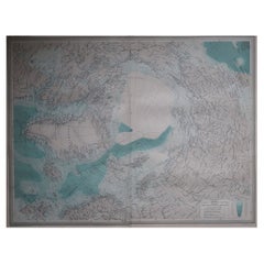
- Large Original Vintage Map of The North Pole, circa 1920Located in St Annes, LancashireGreat maps of The North Pole. Unframed. Original color. By John Bartholomew and Co. Edinburgh Geographical Institute. Published, circa 1920. Free shipp...Category
Vintage 1920s British Maps
MaterialsPaper
- Original Antique Map of Belgium by Tallis, Circa 1850Located in St Annes, LancashireGreat map of Belgium Steel engraving Many lovely vignettes Published by London Printing & Publishing Co. ( Formerly Tallis ), C.1850 Origin...Category
Antique 1850s English Maps
MaterialsPaper
- Original Antique Map of Spain and Portugal, circa 1790Located in St Annes, LancashireSuper map of Spain and Portugal Copper plate engraving by A. Bell Published, circa 1790. Unframed.Category
Antique 1790s English Other Maps
MaterialsPaper


Recently Viewed
View AllMore Ways To Browse
Antique Poles
Map North America
Map Of North America
Antique Pole
Antique Pool
North Pole
California Map
Map Of California
Antique Tires
Tire Antique
Antique Maps North America
Antique Map North America
Antique North America Map
North America Antique Map
Antique Maps Of North America
Antique Map Of North America
Denmark Maps
Denmark Map