Map Of North America
17
to
72
472
318
254
247
174
161
157
146
119
73
52
48
46
45
41
37
29
26
25
24
18
16
15
13
12
12
12
12
10
10
9
9
8
8
7
7
7
7
6
6
6
5
5
5
5
5
4
3
3
3
3
3
2
2
1
1
1
1
103
42
42
22
19
Sort By
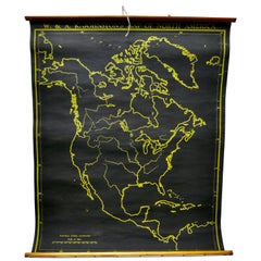
University Chart “Black Map of North America
Located in Chillerton, Isle of Wight
University Chart “Black Map of North America
W&A K Johnston’s Charts of Physical Maps By G W
Category
Early 20th Century Industrial Maps
Materials
Linen
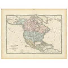
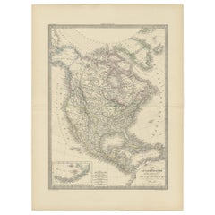
Antique Map of North America by Levasseur '1875'
Located in Langweer, NL
Antique map titled 'Carte générale de l'Amérique Septentrionale'. Large map of North America. This
Category
Antique Late 19th Century Maps
Materials
Paper
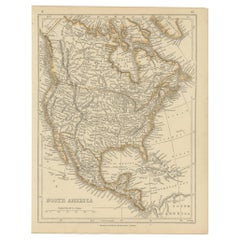
Antique Map of North America by Lowry '1852'
Located in Langweer, NL
Antique map titled 'North America'. Original map of North America. This map originates from
Category
Antique Mid-19th Century Maps
Materials
Paper
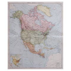
Large Original Vintage Map of North America, circa 1920
Located in St Annes, Lancashire
Great map of North America
Original color. Good condition
Published by Alexander Gross
Category
Vintage 1920s English Edwardian Maps
Materials
Paper
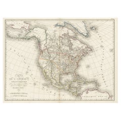
Antique Map of North America, 1821
Located in Langweer, NL
Antique map of America titled 'Carte de l'Amerique septentrionale'. Scarce map of North America
Category
Antique 19th Century Maps
Materials
Paper
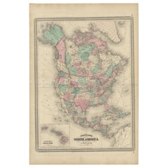
Antique Map of North America by Johnson, '1872'
Located in Langweer, NL
Antique map titled 'Johnson's North America'. Original map of North America, with an inset map of
Category
Antique Late 19th Century Maps
Materials
Paper
Antique Map of North America by Wyld '1845'
Located in Langweer, NL
Antique map titled 'North America'. Original antique map of North America. This map originates from
Category
Antique Mid-19th Century Maps
Materials
Paper
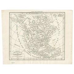
Antique Map of North America by Dufour 'circa 1834'
Located in Langweer, NL
Antique map titled 'Amérique Septentrionale'. Uncommon map of North America. Published by or after
Category
Antique Mid-19th Century Maps
Materials
Paper
Antique Map of North America by Lapie '1842'
Located in Langweer, NL
Antique map titled 'Carte de l'Amérique septentrionale'. Map of North America, with an inset map of
Category
Antique Mid-19th Century Maps
Materials
Paper
Antique Map of North America by A & C. Black, 1870
Located in Langweer, NL
Antique map titled 'North America'. Original antique map of North America. This map originates from
Category
Antique Late 19th Century Maps
Materials
Paper
Antique Map of North America by Laarman, c.1860
Located in Langweer, NL
Antique map titled 'Noord Amerika'. Original antique map of North America. Published circa 1860
Category
Antique 19th Century Maps
Materials
Paper
Old Original Antique German Map of North America, ca.1870
Located in Langweer, NL
Antique map titled 'Nord-America'.
Old map of North America. This map originates from 'H
Category
Antique 1870s Maps
Materials
Paper
Antique Map of North America by Johnston, 1882
By Alexander Keith Johnston
Located in Langweer, NL
Antique map titled 'North America'.
Old map of North America. This map originates from 'The Royal
Category
Antique 19th Century Maps
Materials
Paper
Antique Map of North America Including the West Indies
Located in Langweer, NL
Original antique map titled 'Nord-America'. Old map of North America and the West Indies. Also
Category
Antique Mid-19th Century Maps
Materials
Paper
Antique Map of North America and the West Indies by Stieler, circa 1865
Located in Langweer, NL
Antique map titled 'Nord-America und West-Indien'. Old map of North America and the West Indies
Category
Antique Mid-19th Century Maps
Materials
Paper
H 9.45 in W 12.21 in D 0.02 in
Antique Decorative Coloured Map of North America, 1882
Located in Langweer, NL
This original antique map of North America is from the Blackie & Son Atlas published in 1882. Here
Category
Antique 1880s Maps
Materials
Paper
Antique Map of North America from an Old Dutch School Atlas, 1852
Located in Langweer, NL
Antique map titled 'Noord-Amerika'. Map of North America. This map originates from 'School-Atlas
Category
Antique 19th Century Maps
Materials
Paper
Large University Chart “Political Map of North America” by Bacon
Located in Chillerton, Isle of Wight
Large University chart “Political Map of North America” by Bacon
W&A K Johnston’s Charts of
Category
Early 20th Century American Empire Posters
Materials
Linen
Large University Chart “Political Map of North America” by Bacon
Located in Chillerton, Isle of Wight
Large University Chart “Political Map of North America” by Bacon
W&A K Johnston’s Charts of
Category
Early 20th Century American Empire Posters
Materials
Linen
Antique Map of North America with Vignette of the Statue of Liberty, New York
Located in Langweer, NL
Antique map titled 'Amérique du Nord'. Original antique map of North America. Meticulous
Category
Antique Late 19th Century Maps
Materials
Paper
Free Shipping
H 15.44 in W 20.4 in D 0.02 in
Large Antique 1859 Map of North America
Located in Sag Harbor, NY
population of 1850 North America is included as well as details of all of North and Central America. The size
Category
Antique Mid-19th Century American Maps
Materials
Canvas, Paper
New Map of North America from the Latest Discoveries, 1763
Located in Philadelphia, PA
A fine antique 18th century map of the North American seaboard.
Entitled "A New Map of North
Category
Antique Mid-18th Century English Georgian Maps
Materials
Paper
1864 Map of North America, Antique Hand-Colored Map, by Adolphe Hippolyte Dufour
Located in Colorado Springs, CO
Offered is a map of North America entitled Amerique du Nord from 1864. This rare, separately
Category
Antique 1860s French Maps
Materials
Paper
H 44.5 in W 33 in D 1.5 in
Early 19th Century Hand Coloured Map of North America by Aaron Arrowsmith
By Aaron Arrowsmith
Located in Hamilton, Ontario
Septentionale" (North America).
Map size: 9.5" x 8"
Mat size: 20.5" x 14.25".
Category
Antique Early 19th Century English Maps
Materials
Paper
H 20.5 in W 14.25 in D 0.1 in
one of the earliest large-scale English maps of North America
By John Senex
Located in London, GB
one of the earliest large-scale English maps of North America
SENEX, John.
North America Corrected
Category
1710s Naturalistic More Art
Materials
Watercolor, Engraving
Victorian Visions of the New World: A Detailed Tallis Map of North America, 1851
Located in Langweer, NL
illustrates North America, detailing the political boundaries, cities, and topography with hand-colored
Category
Antique 1850s Maps
Materials
Paper
H 14.26 in W 10.71 in D 0 in
Old German Map of Northern America with Attractive Hand Colouring, 1864
Located in Langweer, NL
Interesting German map of Northern America in a handsome coloring.
Genuine antique hand colored map
Category
Antique 1860s Maps
Materials
Paper
1830 Mexico and United States Framed Map
Located in Stamford, CT
Map of North America published circa 1830. Map shows United States into Canada. Mexico extending
Category
Antique 1830s American American Classical Maps
Materials
Glass, Wood, Paper
Antique Map with Hand Coloring of North America and the West Indies
Located in Langweer, NL
Original antique map titled 'Nord-America'. Old map of North America and the West Indies.
This
Category
Antique Late 19th Century Maps
Materials
Paper
Free Shipping
H 15.08 in W 18.78 in D 0.02 in
1875 "North America" Map by J. Bartholomew
Located in Colorado Springs, CO
Presented is an original 1875 map of “North America.” The map was issued in Volume 1 of the Ninth
Category
Antique 1870s Scottish Maps
Materials
Paper
America "Amérique Septentrionale": A 19th Century French Map by Delamarche
By Maison Delamarche 1
Located in Alamo, CA
This framed mid 19th century map of North America entitled "Amérique Septentrionale" by Felix
Category
Antique Mid-19th Century American Other Maps
Materials
Paper
H 20 in W 22.63 in D 0.88 in
Engraving of Allegorical Celebrations of the British Victories in America, 1880
Located in Langweer, NL
III in classical dress. An allegorical image of America at the top, with a map of North America
Category
Antique 1880s Maps
Materials
Paper
Free Shipping
H 16.74 in W 21.93 in D 0 in
Louisiana: A Framed 19th Century Map by O. W. Gray
By Gray and Co
Located in Alamo, CA
-19th century maps of North America in identical style frames and maps that are listed on 1stdibs. They
Category
Antique Mid-19th Century American Other Maps
Materials
Paper
Antique Map of British North America by Lowry, '1852'
Located in Langweer, NL
Antique map titled 'British North America'. Original map of British North America. This map
Category
Antique Mid-19th Century Maps
Materials
Paper
Antique Map of The United States of North America, 1882
Located in Langweer, NL
This is a historical map titled "The United States of North America, Central Part" from the 1882
Category
Antique 1880s Maps
Materials
Paper
Antique Map of the West Coast of North America & North East Coast of Asia '1772'
Located in Langweer, NL
'. Map of the West Coast of North America and North-East Coast of Asia, based upon Buache's report of the
Category
Antique Late 18th Century Maps
Materials
Paper
H 13.78 in W 18.78 in D 0.02 in
Antique Map of North and Central America by Migeon '1880'
By J. Migeon
Located in Langweer, NL
Antique map titled 'Amérique Septentrionale'. Old map of North and Central America. With a
Category
Antique Late 19th Century French Maps
Materials
Paper
Antique Map of North and South America by Walker, 1828
Located in Langweer, NL
Antique map titled 'Geographical, Historical and Statistical Map of America'. Two maps on one sheet
Category
Antique 19th Century Maps
Materials
Paper
Decorative Dutch Antique Map of North and South America, 1841
Located in Langweer, NL
Description: Antique map titled 'Amerika'. Small map of North and South America.
This map
Category
Antique 1840s Maps
Materials
Paper
Antique Map of the United States of North America, c.1882
Located in Langweer, NL
Antique map titled 'United States of North America'. Old map of the United States of North America
Category
Antique 1880s Maps
Materials
Paper
Antique Map of British North America, The Dominion of of Canada, 1882
Located in Langweer, NL
This map is titled "British North America, Dominion of Canada," from the 1882 Blackie Atlas. It
Category
Antique 1880s Maps
Materials
Paper
No Reserve
H 14.97 in W 22.45 in D 0 in
Antique Map of British North America by W. G. Blackie, 1859
Located in Langweer, NL
Antique map titled 'British North America'. Original antique map of British North America. This map
Category
Antique Mid-19th Century Maps
Materials
Paper
Antique Map of the United States of North America by Johnston '1909'
Located in Langweer, NL
Antique map titled 'United States of North America'. Original antique map of United States of North
Category
Early 20th Century Maps
Materials
Paper
Antique Map of the United States of North America by Wyld '1845'
Located in Langweer, NL
Antique map titled 'Map of The United States of North America'. Original antique map of the United
Category
Antique Mid-19th Century Maps
Materials
Paper
Antique Hand-Coloured Map of North and South America, ca.1765
Located in Langweer, NL
Description: Antique map titled 'Nieuwe Kaart van Amerika.' Attractive map of North and South
Category
Antique 1760s Maps
Materials
Paper
Antique Map of The United States of North America, Pacific States, 1882
Located in Langweer, NL
The map is from the same 1882 Blackie Atlas and focuses on the Pacific States of the United States
Category
Antique 1880s Maps
Materials
Paper
No Reserve
H 14.97 in W 11.03 in D 0 in
Antique Map of South America ‘North’ by A.K. Johnston, 1865
Located in Langweer, NL
Antique map titled 'South America, Northern Sheet'. Depicting Guiana, Ecuador, Brazil, Bolivia the
Category
Antique Mid-19th Century Maps
Materials
Paper
Antique Map of the British Possessions in North America by Wyld '1845'
Located in Langweer, NL
Antique map titled 'Map of The British Possessions in North America'. Original antique map of the
Category
Antique Mid-19th Century Maps
Materials
Paper
H 10.24 in W 14.18 in D 0.02 in
Original Antique Map of North and South America in Attractive Old Coloring
By Isaak Tirion
Located in Langweer, NL
Antique map titled 'Nieuwe Kaart van America'. Beautiful map of America. The fabled Quivira is used
Category
Antique Mid-18th Century Maps
Materials
Paper
H 16.15 in W 19.69 in D 0.02 in
Antique Map of North and South America by Schneider and Weigel, 1818
Located in Langweer, NL
Antique map titled 'America nach Arrowsmiths Weltcharte und dessen Globular Projection (..)'. Map
Category
Antique Early 19th Century Maps
Materials
Paper
Exploring South America's North: Antique Map from the Royal Atlas of 1909
Located in Langweer, NL
The antique map titled 'South America, Northern Sheet' is a historical cartographic representation
Category
Early 20th Century Maps
Materials
Paper
H 19.49 in W 24.41 in D 0.02 in
Very Attractive Map of North and South America and Western Part of Africa, 1744
Located in Langweer, NL
Antique map titled 'Nieuwe Kaart van America.' Very attractive map of North and South America, the
Category
Antique 18th Century Maps
Materials
Paper
H 16.34 in W 21.26 in D 0 in
1842 Wall Map of the United States by J. H. Young, Published by S. A. Mitchell
Located in Colorado Springs, CO
North America, including all the recent geographical discoveries'' at bottom right, as well as seven
Category
Antique 1840s American Maps
Materials
Paper
H 45 in W 38 in D 1 in
Large University Chart “Physical Map of Africa” by Bacon
Located in Chillerton, Isle of Wight
Maps By G W Bacon,
This is colorful Physical map of North America, it is large lithograph set on
Category
Early 20th Century Folk Art Posters
Materials
Linen
Antique Map Dedicated to British Merchants Trading to North America, ca.1746
Located in Langweer, NL
’s appearance. Jefferys dedicated this map to the British merchants trading to North America. Originates from
Category
Antique 1740s Maps
Materials
Paper
H 13.98 in W 19.69 in D 0 in
Old Map Showing the Tracks of Cook Between North America and Asia's Coast, 1803
Located in Langweer, NL
Description: Antique map titled 'Kaart van de Noord-West kust van Amerika en de Noord-Oost kust van
Category
Antique Early 1800s Maps
Materials
Paper
H 20.87 in W 29.14 in D 0 in
North & South America: A 17th Century Hand-colored Map by Jansson & Goos
By Johannes Janssonius
Located in Alamo, CA
A 17th century hand-colored map of North & South America entitled "Americae Descriptio" by the
Category
Antique 1620s Dutch Maps
Materials
Paper
Chart of Boston's North Shore
Located in Norwell, MA
Circa 1980
Weight: 9 lbs
Overall Dimensions: 26"H x 30"W
Made: American
Material: Paper
Date: 1980
Category
Vintage 1980s North American Maps
Materials
Paper
Antique Map of the United States ' North East ' by Johnston '1909'
Located in Langweer, NL
Antique map titled 'United States of North America'. Original antique map of United States of North
Category
Early 20th Century Maps
Materials
Paper
Antique Map of the United States 'North West' by Johnston, '1909'
Located in Langweer, NL
Antique map titled 'United States of North America'. Original antique map of the United States of
Category
Early 20th Century Maps
Materials
Paper
- 1
- ...
Get Updated with New Arrivals
Save "Map Of North America", and we’ll notify you when there are new listings in this category.
Map Of North America For Sale on 1stDibs
With a vast inventory of beautiful furniture at 1stDibs, we’ve got just the map of North america you’re looking for. A map of North america — often made from paper, fabric and linen — can elevate any home. You’ve searched high and low for the perfect map of North america — we have versions that date back to the 18th Century alongside those produced as recently as the 20th Century are available. Each map of North america bearing Mid-Century Modern, Victorian or Folk Art hallmarks is very popular. A well-made map of North america has long been a part of the offerings for many furniture designers and manufacturers, but those produced by Aaron Arrowsmith, Emanuel Bowen and Tony Sarg are consistently popular.
How Much is a Map Of North America?
A map of North america can differ in price owing to various characteristics — the average selling price 1stDibs is $665, while the lowest priced sells for $36 and the highest can go for as much as $24,500.
