Items Similar to Exploring South America's North: Antique Map from the Royal Atlas of 1909

Want more images or videos?
Request additional images or videos from the seller
1 of 5
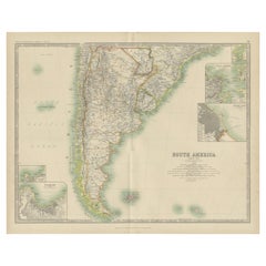
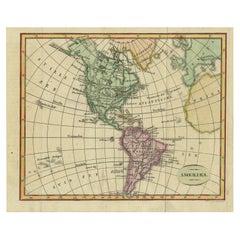
Exploring South America's North: Antique Map from the Royal Atlas of 1909
About the Item
The antique map titled 'South America, Northern Sheet' is a historical cartographic representation of the northern part of South America. This original antique map features inset maps of the Galapagos Isles and Lima Callao. It is sourced from the 'Royal Atlas of Modern Geography,' which was published by W. & A.K. Johnston in the year 1909.
**Key Aspects of the Map:**
1. **Geographical Coverage**: The map focuses on the northern region of South America, encompassing countries such as Colombia, Venezuela, Guyana, and parts of Brazil and Ecuador. It provides a detailed view of the topography, rivers, and coastlines of this area.
2. **Inset Maps**: Inset maps of the Galapagos Isles and Lima Callao are included. These insets offer more detailed views of these specific regions, allowing viewers to explore them in greater depth.
3. **Historical Context**: Published in 1909, this map reflects the geographical knowledge and political boundaries of the early 20th century. It provides insights into the colonial territories and boundaries of South American countries during this era.
4. **Publisher**: The 'Royal Atlas of Modern Geography' was a renowned atlas publication by W. & A.K. Johnston, known for its accuracy and detail. Maps from this atlas are valuable historical references.
5. **Educational Value**: Antique maps like this one serve as valuable educational tools, offering historical insights into the geography, cartography, and geopolitical divisions of the time.
6. **Geographical Features**: The map likely includes details such as mountain ranges, rivers, cities, and coastal features, providing a comprehensive view of the region's natural and human-made landmarks.
7. **Cartographic Style**: The map's cartographic style and design reflect the standards of mapmaking in the early 20th century, with attention to accuracy and detail.
8. **Inset of Galapagos Isles**: The inclusion of the Galapagos Isles as an inset is of particular interest due to their ecological significance, famously studied by Charles Darwin. This inset may highlight important geographical details of the islands.
Overall, the 'South America, Northern Sheet' antique map is a valuable historical document, offering a snapshot of South America's northern region as understood in the early 20th century. It is a valuable resource for historians, geographers, and anyone interested in the region's geography and historical boundaries.
- Dimensions:Height: 19.49 in (49.5 cm)Width: 24.41 in (62 cm)Depth: 0.02 in (0.5 mm)
- Materials and Techniques:
- Period:
- Date of Manufacture:1909
- Condition:General age-related toning. Please study image carefully.
- Seller Location:Langweer, NL
- Reference Number:
About the Seller
5.0
Platinum Seller
These expertly vetted sellers are 1stDibs' most experienced sellers and are rated highest by our customers.
Established in 2009
1stDibs seller since 2017
1,928 sales on 1stDibs
Typical response time: <1 hour
- ShippingRetrieving quote...Ships From: Langweer, Netherlands
- Return PolicyA return for this item may be initiated within 14 days of delivery.
More From This SellerView All
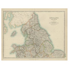
- Original Antique Map of England and Wales from the 1909 Royal AtlasLocated in Langweer, NLThe antique map titled 'England and Wales' is a historical cartographic representation of these two nations. This original antique map of England...Category
Early 20th Century Maps
MaterialsPaper
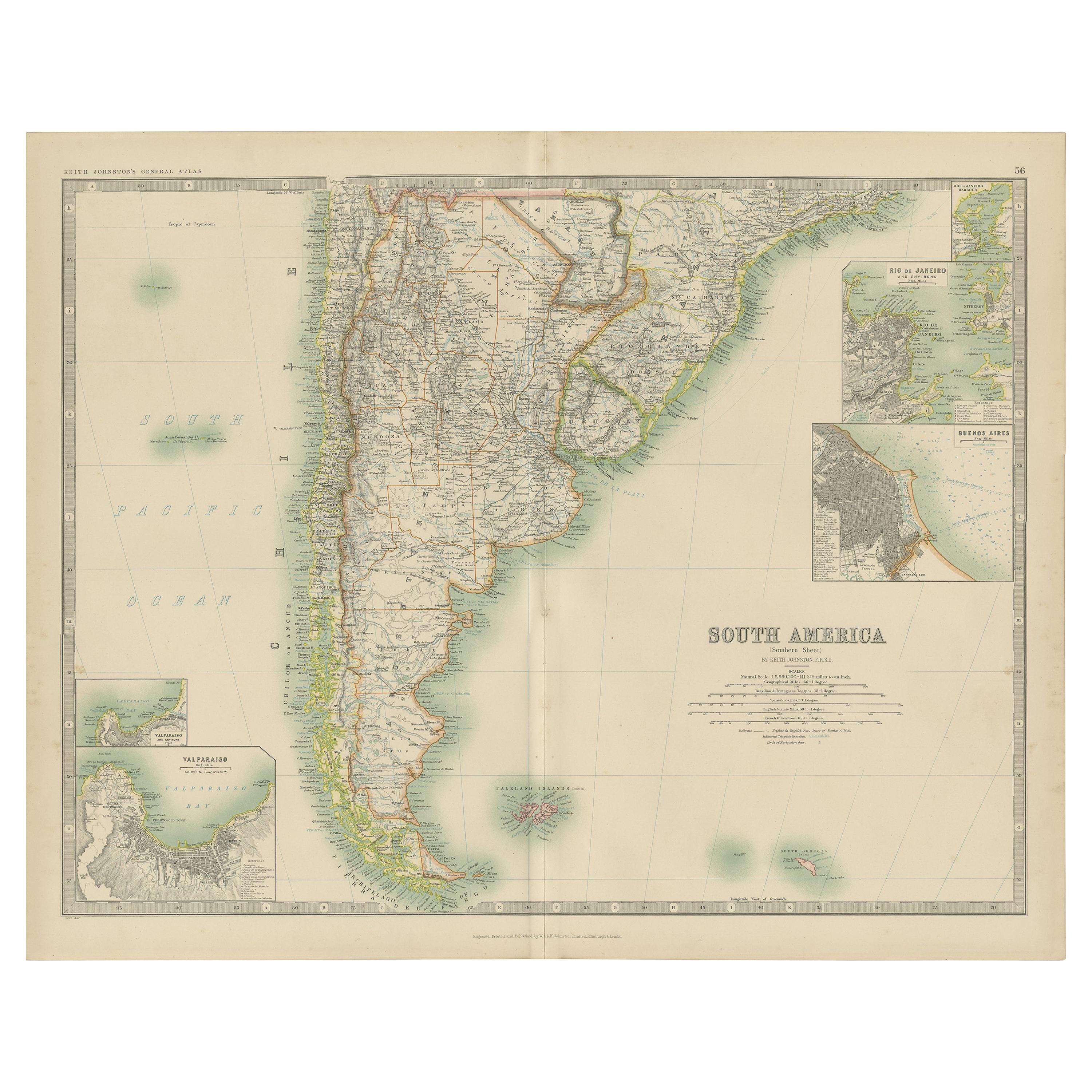
- Antique Map of South America by Johnston '1909'Located in Langweer, NLAntique map titled 'South America, Southern Sheet'. Depicting Chile, Argentina, Brazil, Patagonia, the Falkland Island and more. With inset maps of Valparaiso, Rio de Janeiro and Bue...Category
Early 20th Century Maps
MaterialsPaper
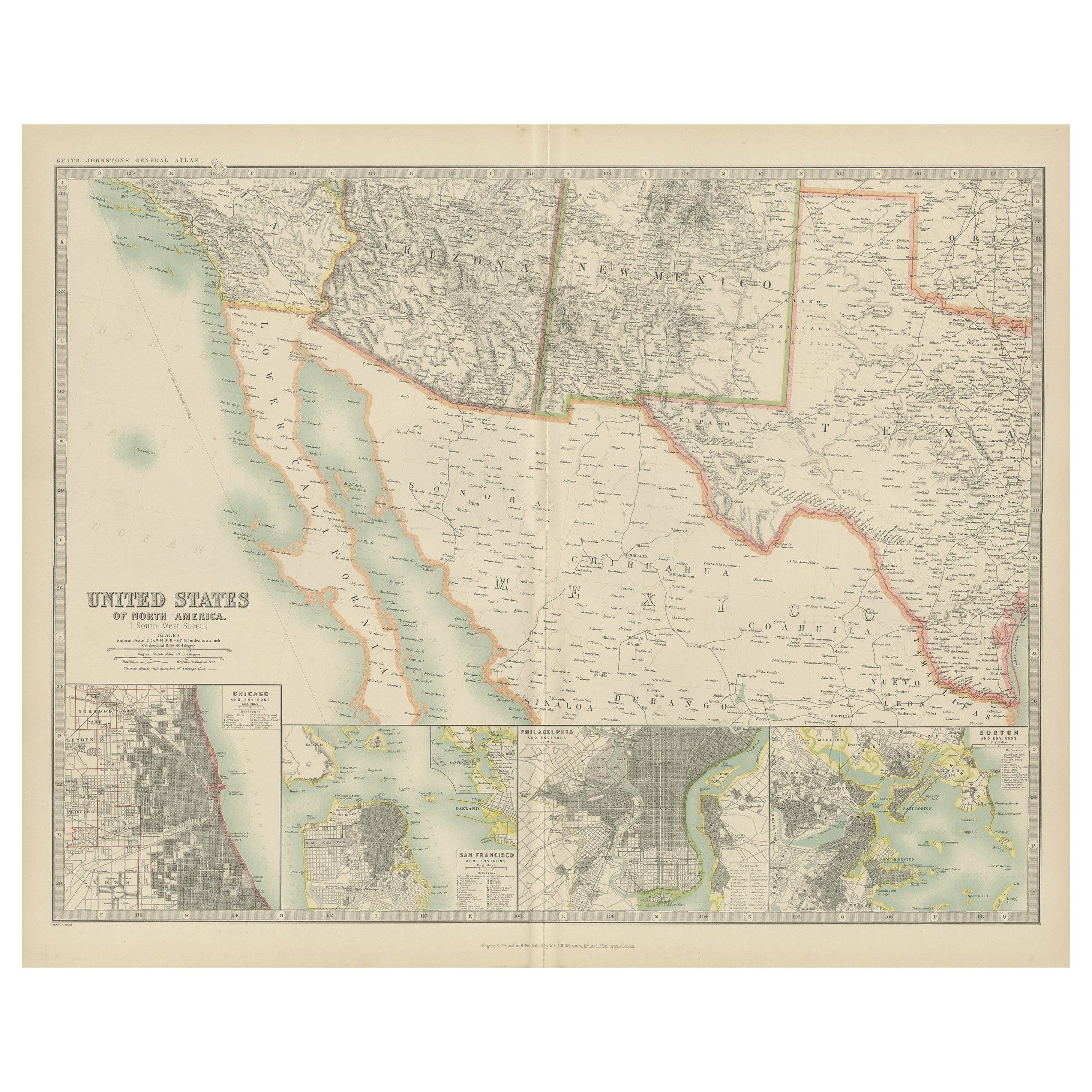
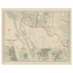
- Antique Map of the United States of North America by Johnston '1909'Located in Langweer, NLAntique map titled 'United States of North America'. Original antique map of United States of North America ( South West Sheet ). With inset maps of Chicago...Category
Early 20th Century Maps
MaterialsPaper
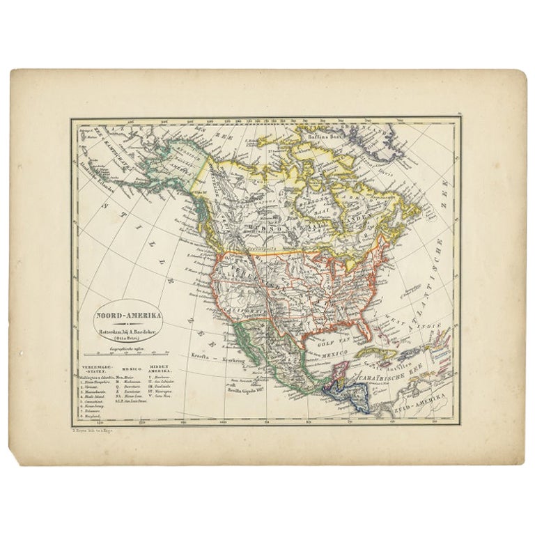
- Antique Map of North America from an Old Dutch School Atlas, 1852Located in Langweer, NLAntique map titled 'Noord-Amerika'. Map of North America. This map originates from 'School-Atlas van alle deelen der Aarde' by Otto Petri. Artists and Engra...Category
Antique 19th Century Maps
MaterialsPaper
- Antique Map of South America ‘North’ by A.K. Johnston, 1865Located in Langweer, NLAntique map titled 'South America, Northern Sheet'. Depicting Guiana, Ecuador, Brazil, Bolivia the Amazones and more. This map originates from the ‘Royal Atlas of Modern Geography’ b...Category
Antique Mid-19th Century Maps
MaterialsPaper
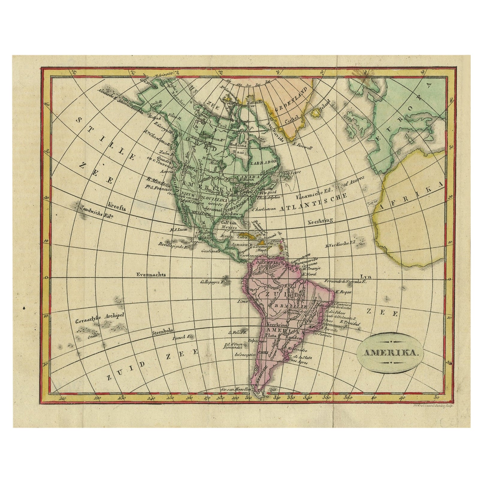
- Decorative Dutch Antique Map of North and South America, 1841Located in Langweer, NLDescription: Antique map titled 'Amerika'. Small map of North and South America. This map originates from the Dutch publication 'De Aarde, beschouwd in haren Natuurlijken Toestan...Category
Antique 1840s Maps
MaterialsPaper


You May Also Like
- New Map of North America from the Latest Discoveries, 1763Located in Philadelphia, PAA fine antique 18th century map of the North American seaboard. Entitled "A New Map of North America from the Latest Discoveries 1763". By the Cartographer/Engraver - John Spil...Category
Antique Mid-18th Century English Georgian Maps
MaterialsPaper
- Large Antique 1859 Map of North AmericaLocated in Sag Harbor, NYThis Map was made by Augustus Mitchell in 1859 It is in amazing condition for being 163 years old. This price is for the rolled up easy to ship version of this piece. I will be Frami...Category
Antique Mid-19th Century American Maps
MaterialsCanvas, Paper

- Original Antique Map of South America. C.1780Located in St Annes, LancashireGreat map of South America Copper-plate engraving Published C.1780 Two small worm holes to left side of map Unframed.Category
Antique Early 1800s English Georgian Maps
MaterialsPaper
- Original Antique Map of South America, circa 1830Located in St Annes, LancashireGreat map of South America Copper plate engraving Published by Butterworth, Livesey & Co., circa 1830 Unframed.Category
Antique Early 1800s English Other Maps
MaterialsPaper
- Original Antique Map of South America by Thomas Clerk, 1817Located in St Annes, LancashireGreat map of South America Copper-plate engraving Drawn and engraved by Thomas Clerk, Edinburgh. Published by Mackenzie And Dent, 1817 Unframed.Category
Antique 1810s English Maps
MaterialsPaper
- North & South America: A 17th Century Hand-colored Map by Jansson & GoosBy Johannes JanssoniusLocated in Alamo, CAA 17th century hand-colored map of North & South America entitled "Americae Descriptio" by the cartographer Johannes Jansson, published in Jansson's Atlas Minor in Amsterdam in 1628....Category
Antique 1620s Dutch Maps
MaterialsPaper


Recently Viewed
View AllMore Ways To Browse
South America
Antique Map America
Antique American Maps
Antique American Map
America Antique Map
Antique Map Of America
Antique Maps Of America
Map South America
Map Of South America
Antique Map South America
Antique Maps South America
South America Antique Map
Antique South America Map
Antique Map Of South America
Antique Maps Of South America
Old Maps Of World
16th Century Dutch
Orient Antique