Items Similar to Interesting Antique Map of the Development of the Mapping of the America's, 1841
Want more images or videos?
Request additional images or videos from the seller
1 of 5
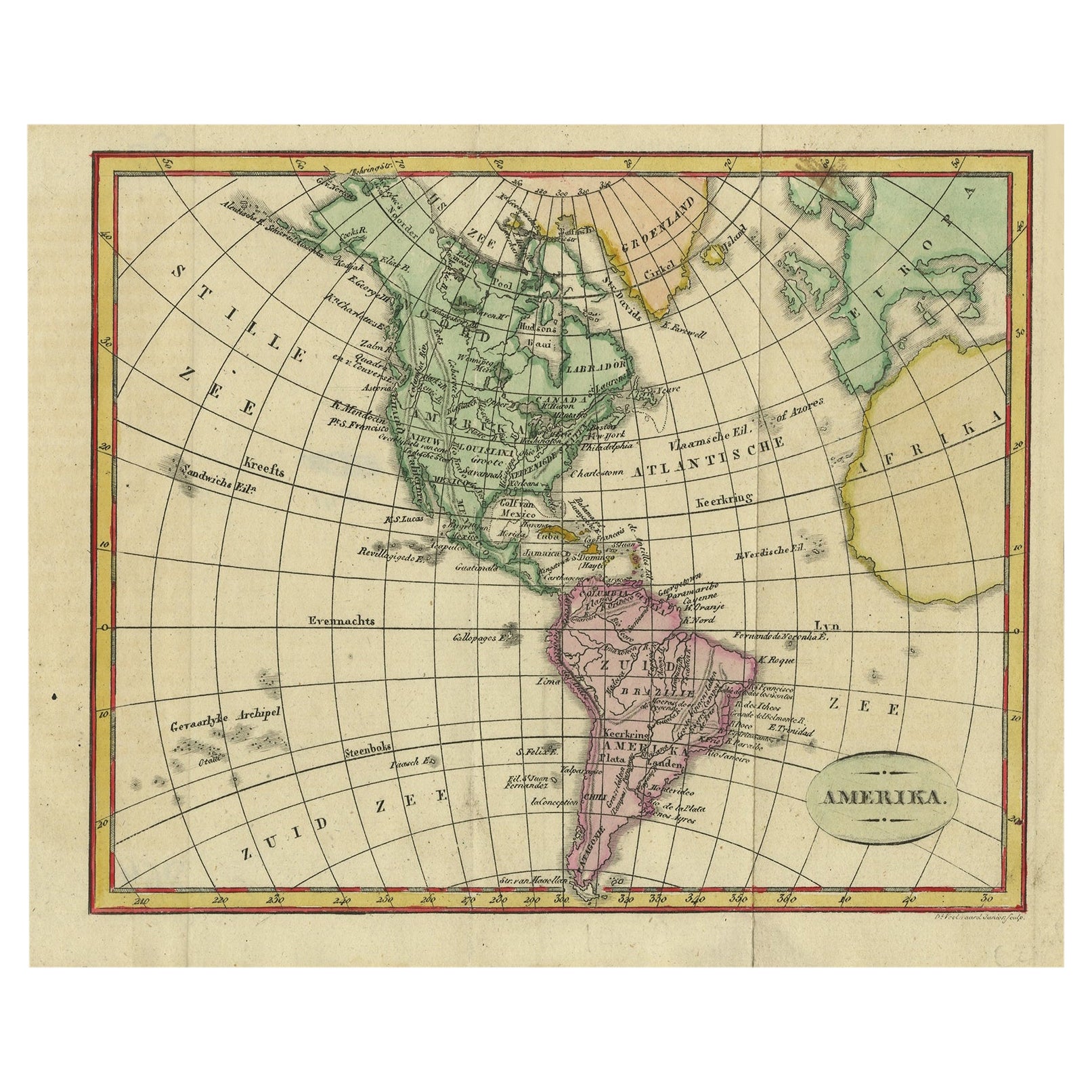
Interesting Antique Map of the Development of the Mapping of the America's, 1841
About the Item
Title: "De ontdekking van Amerika. Voorgesteld in eene reeks geschiedkundige kaarten".
Collection of hand-colored engraved maps by D. VEELWAARD on 1 sheet, "Dertiende aflevering, linker blad" from ESCHAZIER'S Encyklopedische Atlas (Amst., ±1841).
Interesting overview of the development in mapping of the America's from the discovery by Columbus in 1492 to the situation in 1841. In the depiction of the Rounding of the Cape, California is still engraved as an island.
Condition: Good. Original hand-colouring of the borders. Fold Line in middle as issued. Study image carefully.
- Dimensions:Height: 18.9 in (48 cm)Width: 23.23 in (59 cm)Depth: 0 in (0.02 mm)
- Materials and Techniques:
- Period:
- Date of Manufacture:circa 1841
- Condition:
- Seller Location:Langweer, NL
- Reference Number:
About the Seller
5.0
Platinum Seller
These expertly vetted sellers are 1stDibs' most experienced sellers and are rated highest by our customers.
Established in 2009
1stDibs seller since 2017
1,946 sales on 1stDibs
Typical response time: <1 hour
- ShippingRetrieving quote...Ships From: Langweer, Netherlands
- Return PolicyA return for this item may be initiated within 14 days of delivery.
More From This SellerView All
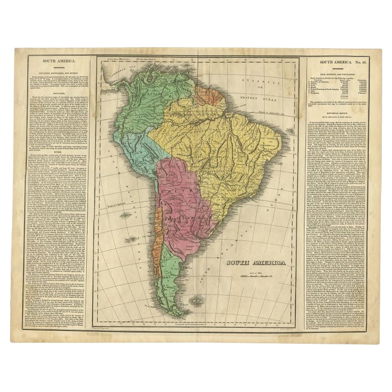
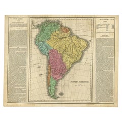
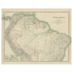
- Interesting Original Antique Map of South America, 1822Located in Langweer, NLAntique map titled 'South America'. Map of South America with attractive topography, surrounded on three sides by text on the history, geography, and economy of the continent. Sh...Category
Antique 19th Century Maps
MaterialsPaper
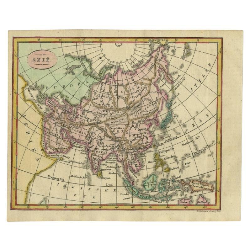
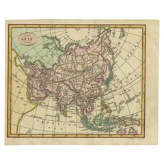
- Small Antique Map of the Asian Continent, 1841Located in Langweer, NLAntique map titled 'Azie.' Small map of the Asian continent. This map originates from 'De Aarde, beschouwd in haren Natuurlijken Toestand en Verdeeling (..)' by N.G. van Kampen. Publ...Category
Antique 19th Century Maps
MaterialsPaper
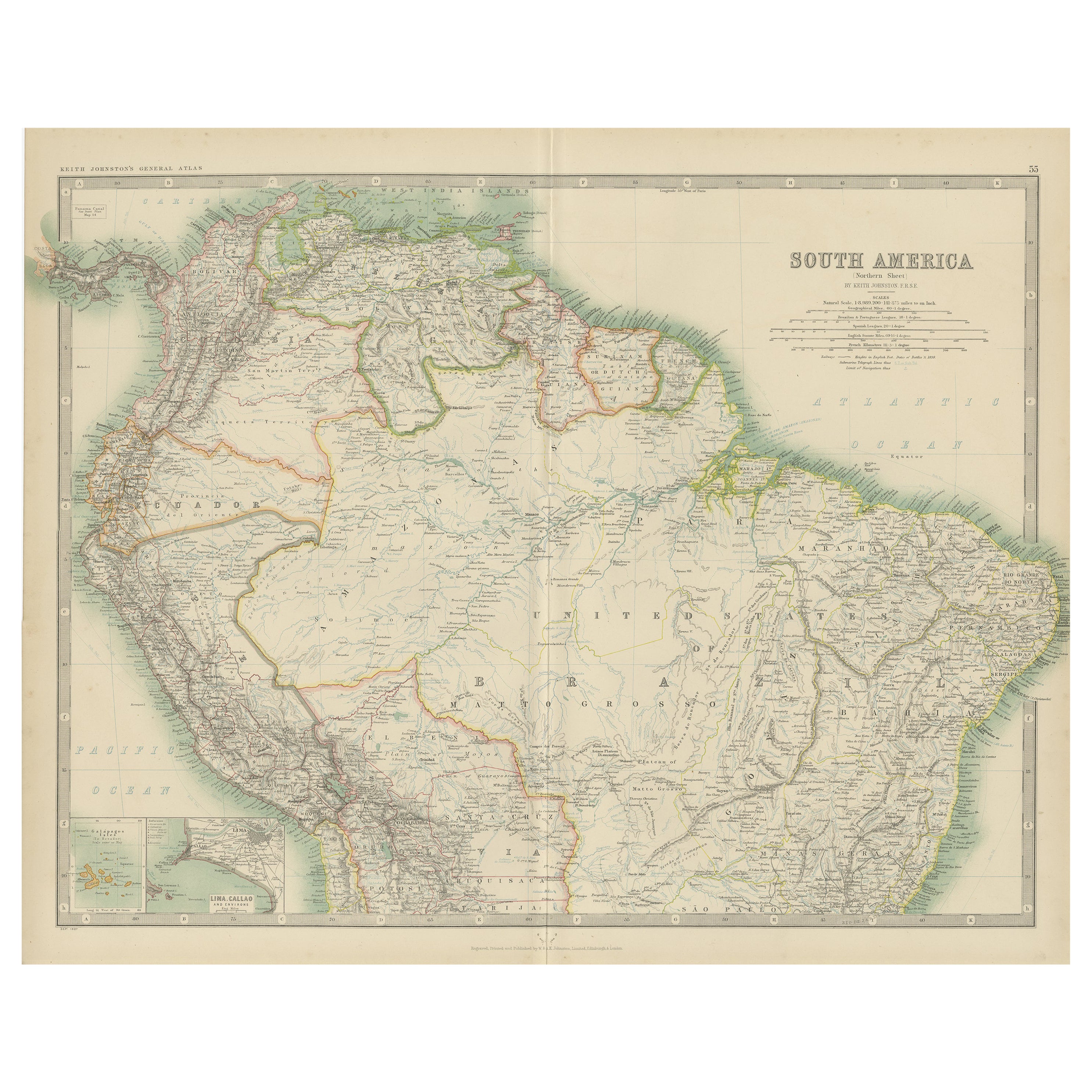
- Exploring South America's North: Antique Map from the Royal Atlas of 1909Located in Langweer, NLThe antique map titled 'South America, Northern Sheet' is a historical cartographic representation of the northern part of South America. This original antique map features inset map...Category
Early 20th Century Maps
MaterialsPaper
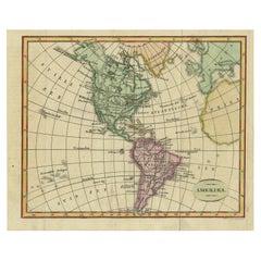
- Decorative Dutch Antique Map of North and South America, 1841Located in Langweer, NLDescription: Antique map titled 'Amerika'. Small map of North and South America. This map originates from the Dutch publication 'De Aarde, beschouwd in haren Natuurlijken Toestan...Category
Antique 1840s Maps
MaterialsPaper
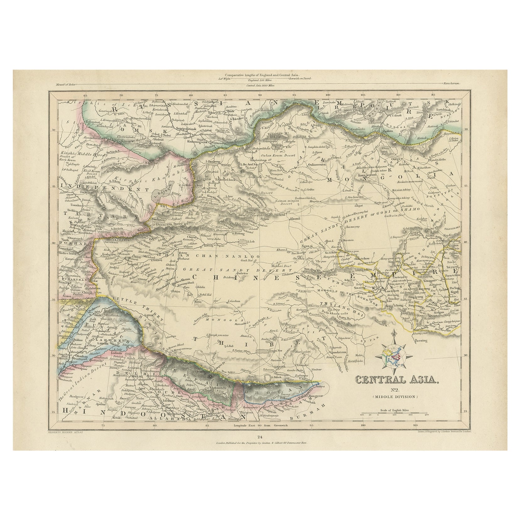
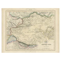
- Antique Map of Central Asia, Finely Engraved, 1841Located in Langweer, NLAntique map titled 'Central Asia, Middle Division'. A finely engraved and attractive mid 19th Century map of Central Asia which was drawn and engraved by Joshua Archer and published ...Category
Antique 19th Century Maps
MaterialsPaper
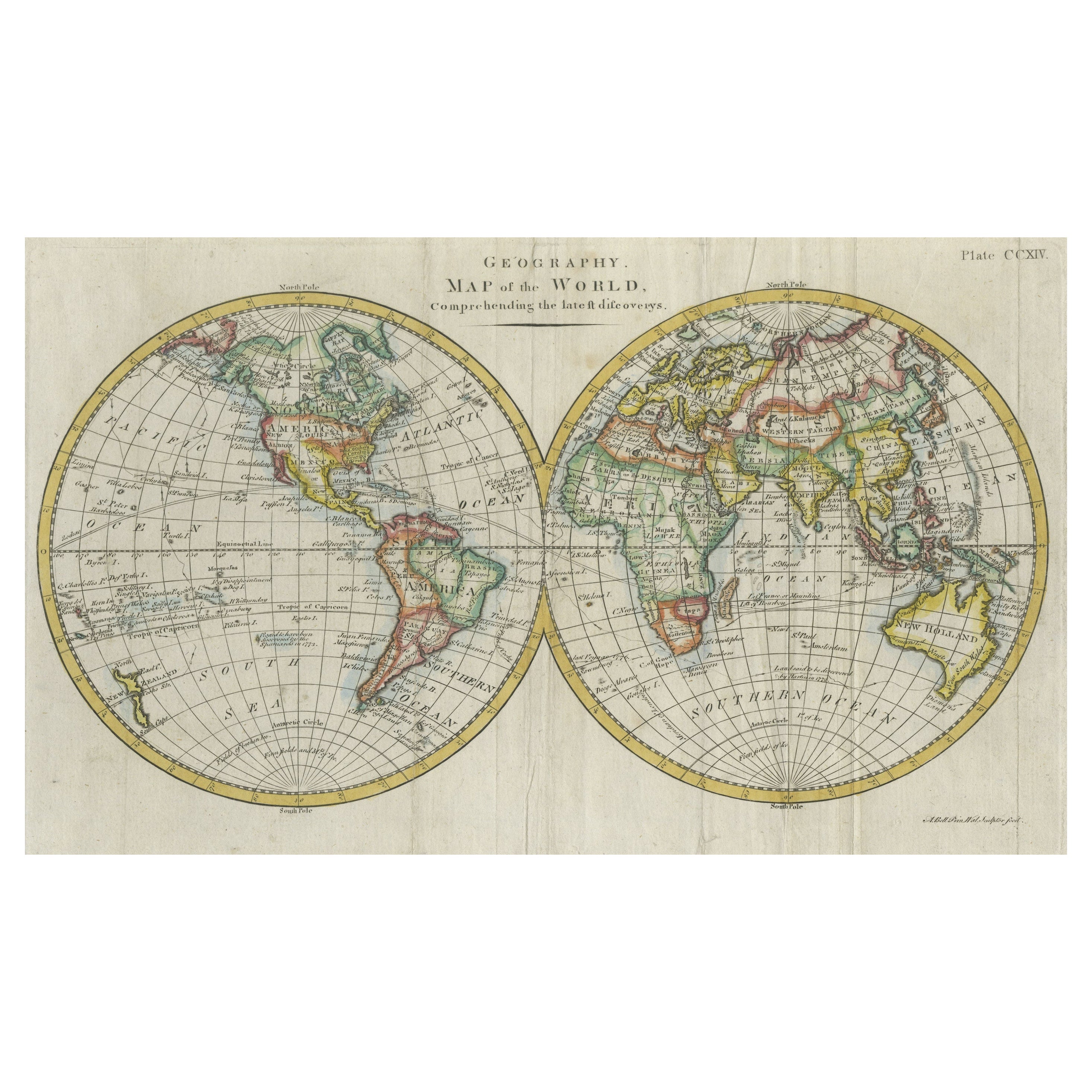
- Interesting Original Antique Hemisphere Map Showing the Latest DiscoveriesLocated in Langweer, NLAntique world map titled 'A Map of the World from the best Authorities'. Detailed map of the World, showing tracks of Captain James Cook in his 3 voyages in great detail. The map is ...Category
Antique Late 18th Century Maps
MaterialsPaper

You May Also Like
- Antique Map of Paris, "Carte Routiere des Environs de Paris" 1841Located in Colorado Springs, COThis beautiful hand-colored road map of Paris was published in 1841. The map shows Paris and the surrounding area in a folding pocket map. Organized and detailed for travelers, this ...Category
Antique 1840s French Maps
MaterialsPaper
- Large Antique 1859 Map of North AmericaLocated in Sag Harbor, NYThis Map was made by Augustus Mitchell in 1859 It is in amazing condition for being 163 years old. This price is for the rolled up easy to ship version of this piece. I will be Frami...Category
Antique Mid-19th Century American Maps
MaterialsCanvas, Paper

- Original Antique Map of South America, circa 1830Located in St Annes, LancashireGreat map of South America Copper plate engraving Published by Butterworth, Livesey & Co., circa 1830 Unframed.Category
Antique Early 1800s English Other Maps
MaterialsPaper
- Original Antique Map of Central America / Florida, Arrowsmith, 1820Located in St Annes, LancashireGreat map of Central America. Drawn under the direction of Arrowsmith. Copper-plate engraving. Published by Longman, Hurst, Rees, Orme and Brown, 1820 Unframed.Category
Antique 1820s English Maps
MaterialsPaper
- New Map of North America from the Latest Discoveries, 1763Located in Philadelphia, PAA fine antique 18th century map of the North American seaboard. Entitled "A New Map of North America from the Latest Discoveries 1763". By the Cartographer/Engraver - John Spil...Category
Antique Mid-18th Century English Georgian Maps
MaterialsPaper
- Original Antique Map of South America by Thomas Clerk, 1817Located in St Annes, LancashireGreat map of South America Copper-plate engraving Drawn and engraved by Thomas Clerk, Edinburgh. Published by Mackenzie And Dent, 1817 Unframed.Category
Antique 1810s English Maps
MaterialsPaper


Recently Viewed
View AllMore Ways To Browse
Interesting Antique
Used Furniture In Columbus
California Map
Map Of California
Antique Columbus
Antique Furniture Columbus
Antique Maps California
Antique Map California
Antique Maps Of California
Antique Map Of California
California Antique Map
California Island Map
California As An Island Map
Map Columbus Used
Space Map
Set Of Maps
Antique World Globes
World Globes Antique