Items Similar to Antique Map of Central Asia, Finely Engraved, 1841
Want more images or videos?
Request additional images or videos from the seller
1 of 5
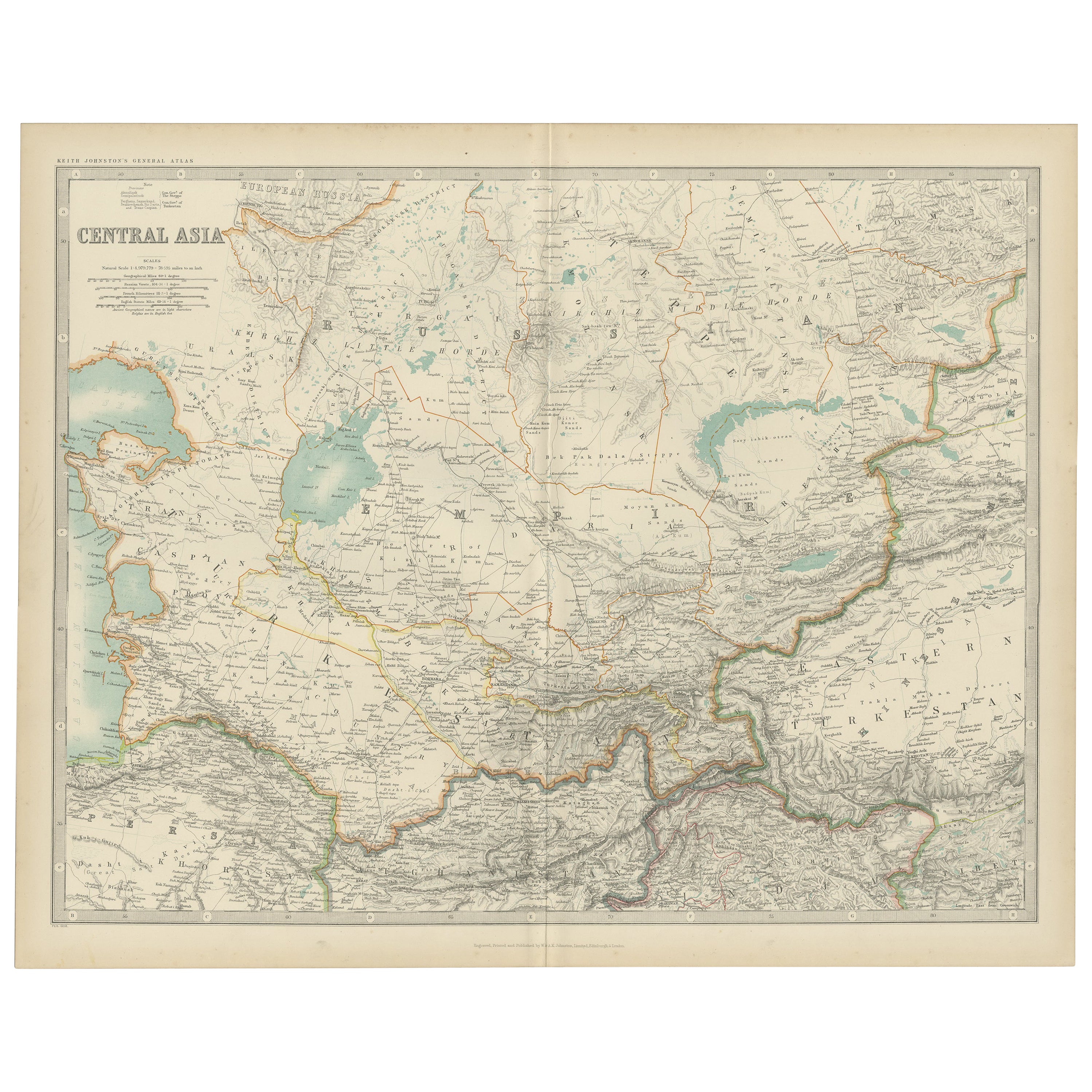
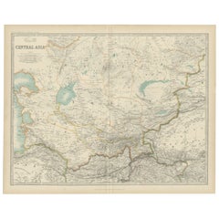
Antique Map of Central Asia, Finely Engraved, 1841
About the Item
Antique map titled 'Central Asia, Middle Division'. A finely engraved and attractive mid 19th Century map of Central Asia which was drawn and engraved by Joshua Archer and published in Gilbert's Modern Atlas.
Artists and Engravers: Joshua Archer (fl. 1841 - 1861) was prolific engraver of maps. He had produced a series of maps for William Pinnock, a part series of Diocese maps for the British Magazine , some maps for Henry Fisher, and engraved a set for Thomas Dugdale's Curiosities of Great Britain. These Dugdale maps were engraved by Archer to replace those by Cole and Roper found in the early copies of Dugdale's historical and topographical gazetter-style work
Condition: Good, general age-related toning. Please study image carefully.
Date: 1841
Overall size: 33 x 26 cm.
Image size: 0.001 x 28 x 23 cm.
We sell original antique maps to collectors, historians, educators and interior decorators all over the world. Our collection includes a wide range of authentic antique maps from the 16th to the 20th centuries. Buying and collecting antique maps is a tradition that goes back hundreds of years. Antique maps have proved a richly rewarding investment over the past decade, thanks to a growing appreciation of their unique historical appeal. Today the decorative qualities of antique maps are widely recognized by interior designers who appreciate their beauty and design flexibility. Depending on the individual map, presentation, and context, a rare or antique map can be modern, traditional, abstract, figurative, serious or whimsical. We offer a wide range of authentic antique maps for any budget.
- Dimensions:Height: 10.24 in (26 cm)Width: 13 in (33 cm)Depth: 0 in (0.01 mm)
- Materials and Techniques:
- Period:
- Date of Manufacture:1841
- Condition:
- Seller Location:Langweer, NL
- Reference Number:
About the Seller
5.0
Platinum Seller
These expertly vetted sellers are 1stDibs' most experienced sellers and are rated highest by our customers.
Established in 2009
1stDibs seller since 2017
1,919 sales on 1stDibs
Typical response time: <1 hour
- ShippingRetrieving quote...Ships From: Langweer, Netherlands
- Return PolicyA return for this item may be initiated within 14 days of delivery.
More From This SellerView All
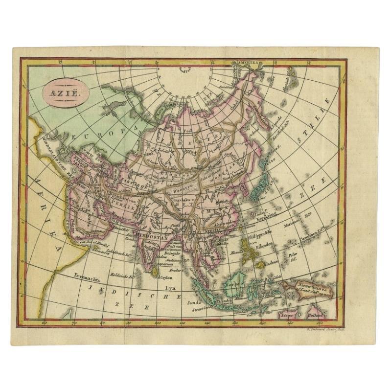
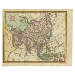
- Small Antique Map of the Asian Continent, 1841Located in Langweer, NLAntique map titled 'Azie.' Small map of the Asian continent. This map originates from 'De Aarde, beschouwd in haren Natuurlijken Toestand en Verdeeling (..)' by N.G. van Kampen. Publ...Category
Antique 19th Century Maps
MaterialsPaper
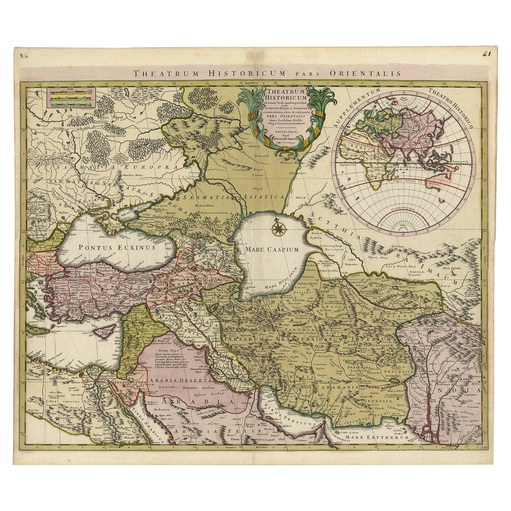
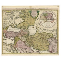
- Finely Engraved Historical Map of Middle East and Asia, c.1745Located in Langweer, NLDescription: Antique map titled'Theatrum Historicum pars Orientalis.' Finely engraved historical map with a profusion of details. It shows the Middle East and Asia. Decorative ti...Category
Antique 1740s Maps
MaterialsPaper
- Antique Map of Central Asia by Johnston '1909'Located in Langweer, NLAntique map titled 'Central Asia'. Original antique map of Central Asia. This map originates from the ‘Royal Atlas of Modern Geography’. Published by W. & A.K. Johnston, 1909.Category
Early 20th Century Maps
MaterialsPaper
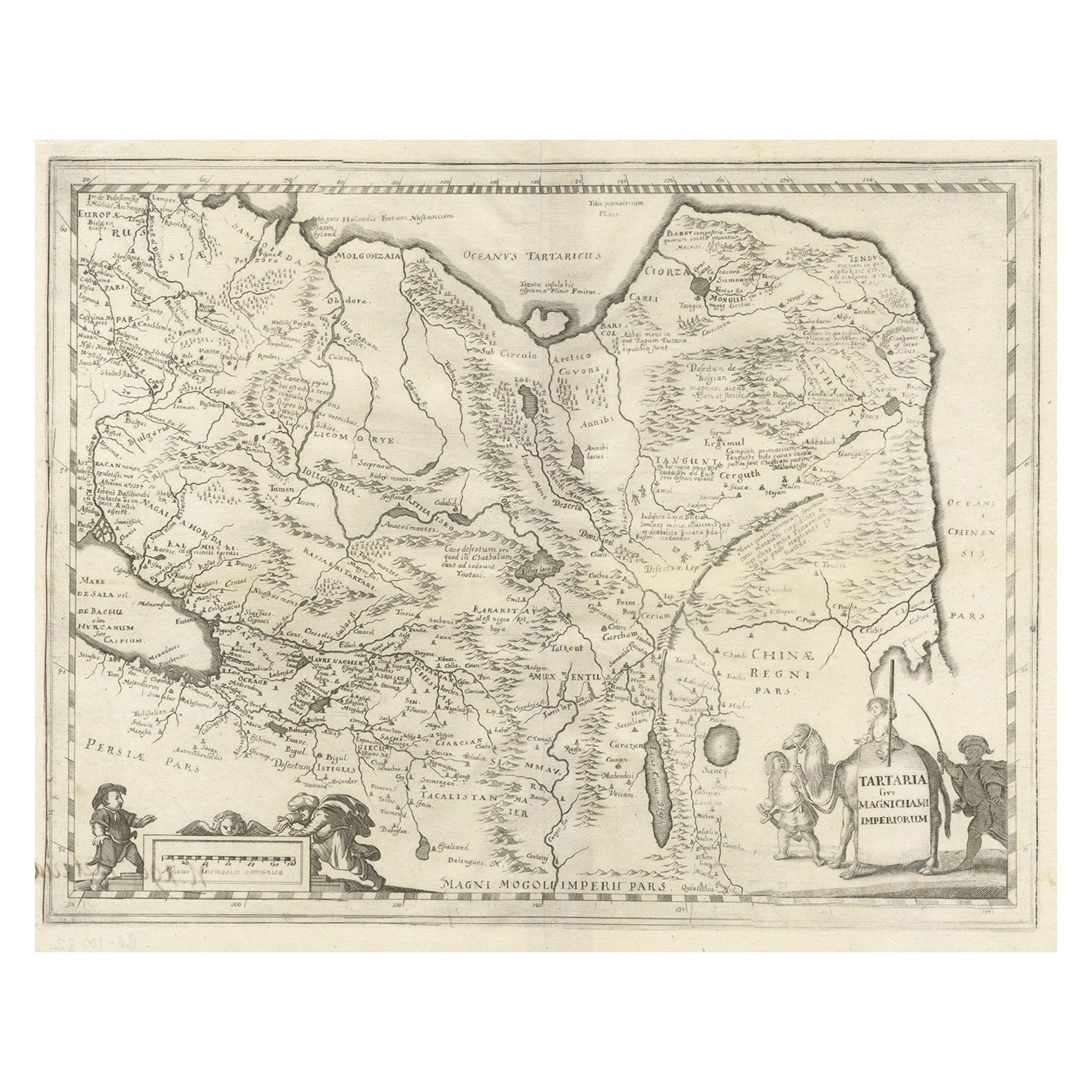
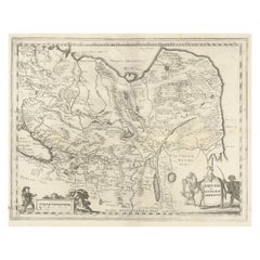
- Antique Map of China, Tartary and Central Asia by Blaeu, c.1645Located in Langweer, NLAntique map titled ‘Tartaria sive Magnichami Imperiorum‘. Early map of Siberia based upon the journals of Marco Polo. The map covers from the Caspian Sea and the Volga River east as far as the China Sea and the city of Xanadu. It extends north to Nova Zembla and south to the Upper Ganges River. When Blaeu drew this map this part of the world was almost entirely unknown. Blaeu relied on the journals of Marco Polo to compile most of the map. Devils and dragons frolic in the Lop Nor and far to the north the summer seat...Category
Antique 17th Century Maps
MaterialsPaper
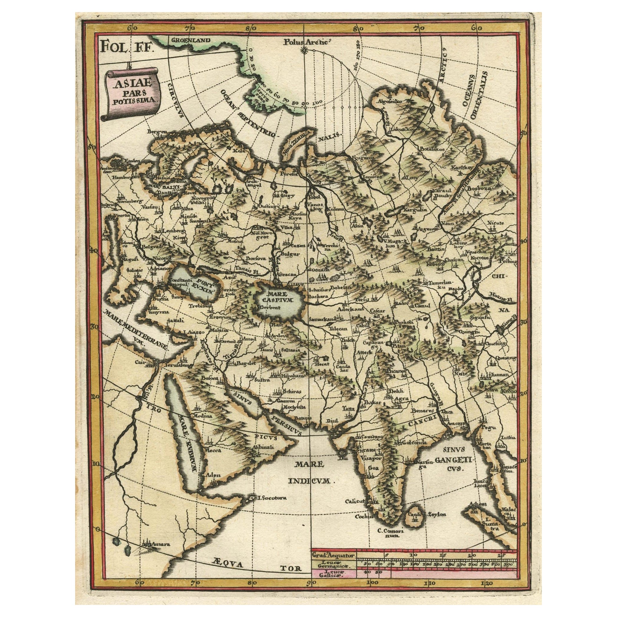
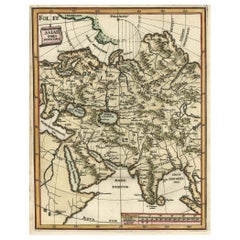
- Antique Map of Central Asia Wiht Nova Zembla as an Island, C.1700Located in Langweer, NLAntique map titled 'Asiae Pars Potissima.' Attractive map focusing on the central part of Asia but extending to include much of Eastern Europe and Northeastern Africa. The Caspian Se...Category
Antique 18th Century Maps
MaterialsPaper
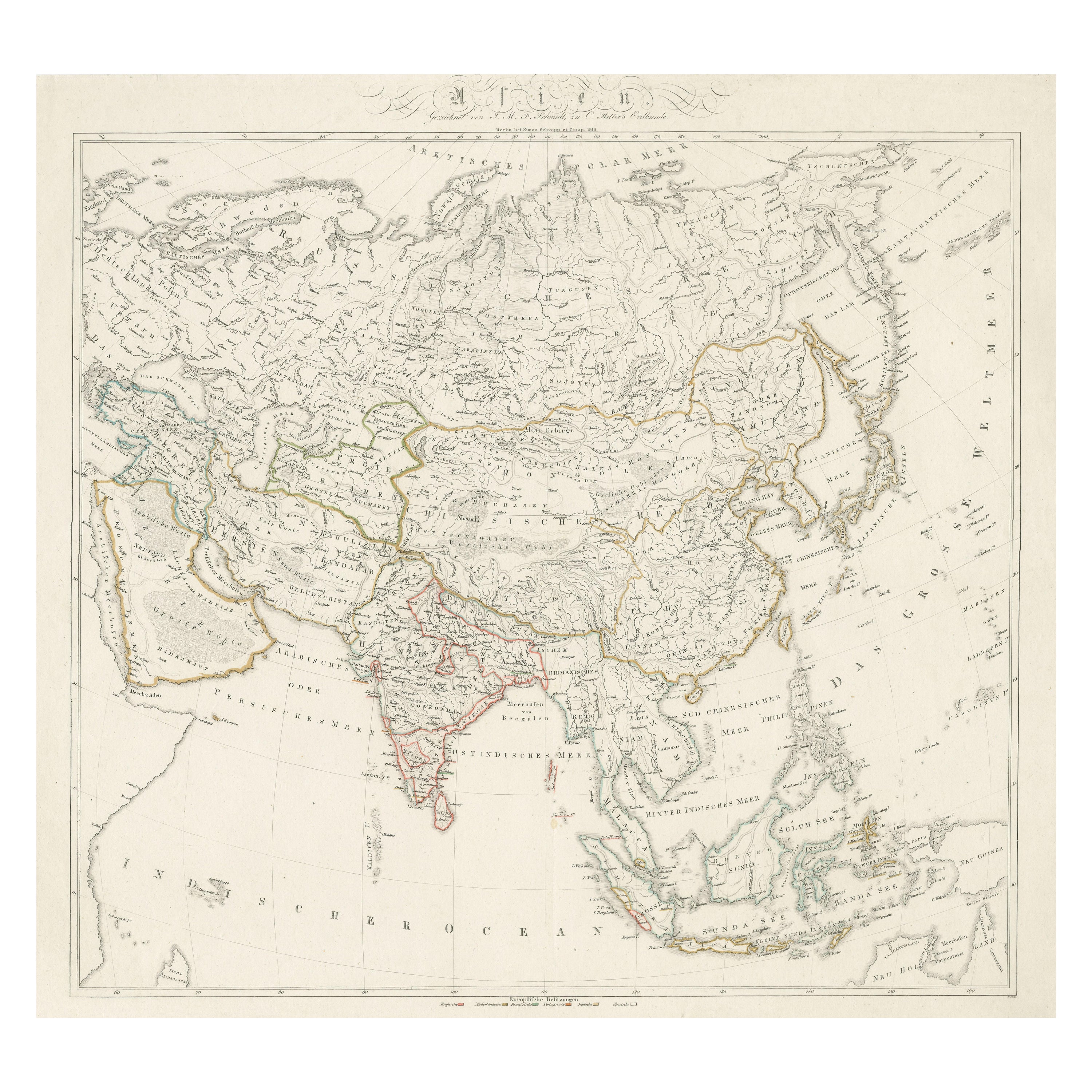
- Original Antique Map of AsiaLocated in Langweer, NLAntique map titled 'Asien'. Original old map of Asia. Published in Berlin by Simon Schropp et Comp, 1819.Category
Antique Early 19th Century Maps
MaterialsPaper

You May Also Like
- Original Antique Map of Asia. C.1780Located in St Annes, LancashireGreat map of Asia Copper-plate engraving Published C.1780 Two small worm holes to right side of map Unframed.Category
Antique Early 1800s English Georgian Maps
MaterialsPaper

- Antique Map of Paris, "Carte Routiere des Environs de Paris" 1841Located in Colorado Springs, COThis beautiful hand-colored road map of Paris was published in 1841. The map shows Paris and the surrounding area in a folding pocket map. Organized and detailed for travelers, this ...Category
Antique 1840s French Maps
MaterialsPaper
- Original Antique Map of Central America / Florida, Arrowsmith, 1820Located in St Annes, LancashireGreat map of Central America. Drawn under the direction of Arrowsmith. Copper-plate engraving. Published by Longman, Hurst, Rees, Orme and Brown, 1820 Unframed.Category
Antique 1820s English Maps
MaterialsPaper
- Original Antique Map of Sweden, Engraved by Barlow, 1806Located in St Annes, LancashireGreat map of Sweden Copper-plate engraving by Barlow Published by Brightly & Kinnersly, Bungay, Suffolk. 1806 Unframed.Category
Antique Early 1800s English Maps
MaterialsPaper
- Original Antique Map of South East Asia, Arrowsmith, 1820Located in St Annes, LancashireGreat map of South East Asia Drawn under the direction of Arrowsmith Copper-plate engraving Published by Longman, Hurst, Rees, Orme and Brown, 1820 Unframed.Category
Antique 1820s English Maps
MaterialsPaper
- Original Antique Map of The Netherlands, Engraved by Barlow, Dated 1807Located in St Annes, LancashireGreat map of Netherlands Copper-plate engraving by Barlow Published by Brightly & Kinnersly, Bungay, Suffolk. Dated 1807 Unframed.Category
Antique Early 1800s English Maps
MaterialsPaper


Recently Viewed
View AllMore Ways To Browse
Date Engraved
Engraved 28
Asia Magazine
Set Of Maps
Topographical Map
Antique British Maps
Antique Maps Of Britain
Antique Style Map
Great Britain Maps
World Map British
Antique Topographic Maps
Antique Map Britain
Antique Britain Map
Antique Map Series
Antique Map Set
Set Of Antique Maps
Map Of Great Britain
Antique Style Atlas