World Map British
9
to
22
309
112
121
121
95
83
71
69
52
34
29
29
23
22
20
17
16
11
10
9
8
8
8
7
5
5
4
4
4
4
3
3
2
2
2
2
2
2
2
1
1
1
1
1
1
1
1
1
1
1
54
19
13
9
7
Sort By
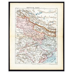
Antique Map of Northern India 'British Indies', C.1880
Located in Langweer, NL
Plate 56 : 'Britsch-Indie, Noord.' (British Indies, North). This lithographed map originates from
Category
Antique 19th Century Maps
Materials
Paper
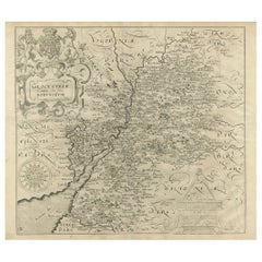
Antique Map of Gloucestershire in Britain by Camden, 1637
Located in Langweer, NL
decorators all over the world. Our collection includes a wide range of authentic antique maps from the 16th
Category
Antique 17th Century Maps
Materials
Paper
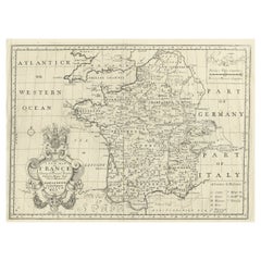
Antique Map of France by British Mapmaker Wells, c.1710
Located in Langweer, NL
Antique map titled 'A New Map of France (..)'.
Original antique map of France. It covers all of
Category
Antique 18th Century Maps
Materials
Paper
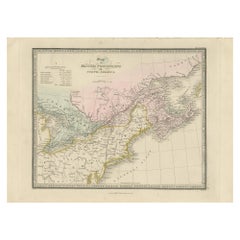
Antique Map of the British Possessions in North America by Wyld '1845'
Located in Langweer, NL
British Possessions in North America. This map originates from 'An Atlas of the World, Comprehending
Category
Antique Mid-19th Century Maps
Materials
Paper
H 10.24 in W 14.18 in D 0.02 in
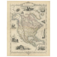
Victorian Visions of the New World: A Detailed Tallis Map of North America, 1851
Located in Langweer, NL
the world under British influence and to appeal to the British public's sense of curiosity and
Category
Antique 1850s Maps
Materials
Paper
H 14.26 in W 10.71 in D 0 in
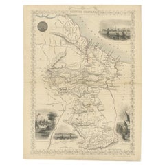
Antique Map of British Guayana with Insets of Georgetown, Devil's Rock Etc, 1851
Located in Langweer, NL
Antique map titled ‘British Guayana’. Includes decorative vignettes titled Georgetown, Christmas
Category
Antique 19th Century Maps
Materials
Paper
Free Shipping
H 14.18 in W 10.83 in D 0 in
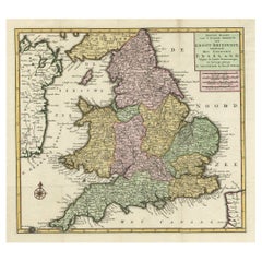
Antique Map of the South Part of Great Britain by Tirion, c.1750
By Isaak Tirion
Located in Langweer, NL
Koningryk Engeland (..).'
Attractive map showing the south part of Great Britain; the Kingdom of England
Category
Antique 18th Century Maps
Materials
Paper
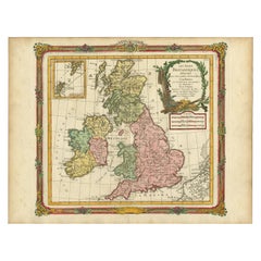
Antique Map of Great Britain and Ireland by Brion de la Tour, 1766
Located in Langweer, NL
Antique map titled 'Les Isles Britanniques (..).'
Attractive map of Great Britain surrounded by
Category
Antique 18th Century Maps
Materials
Paper
Antique Map Made After a Roman Papyrus Travel Map, Known as Peutinger Map, 1773
Located in Langweer, NL
century that contained a copy of the world map originally prepared by Agrippa during the reign of the
Category
Antique 18th Century Maps
Materials
Paper
H 15.56 in W 18.51 in D 0 in
Antique Political Map of Eastern China, 1922
Located in Langweer, NL
all over the world. Our collection includes a wide range of authentic antique maps from the 16th to
Category
20th Century Maps
Materials
Paper
Large Antique County Map of Leicestershire, England, 1805
Located in Langweer, NL
British Atlas' by John Stockdale and published in 1805, this map represents Cary's distinct cartographic
Category
Antique Early 19th Century Maps
Materials
Paper
Antique Political Map of the Japanese Empire, 1922
Located in Langweer, NL
Antique map of Japan titled 'Japanese Empire - Political Map'. Old map of Japan depicting Japan
Category
20th Century Maps
Materials
Paper
Antique Map of Central Asia, Finely Engraved, 1841
Located in Langweer, NL
had produced a series of maps for William Pinnock, a part series of Diocese maps for the British
Category
Antique 19th Century Maps
Materials
Paper
Antique Map of Holland with Colorful Vignettes, 1851
Located in Langweer, NL
. Rapkin. Artists and Engravers:
John Tallis (1817-1876) was a British map publisher. Born in the
Category
Antique 19th Century Maps
Materials
Paper
Antique Map of South Australia by Tallis, 1851
By Thomas Kitchin
Located in Langweer, NL
British map publisher. Born in the Midlands, Tallis came to London in the 1840s. Tallis began his London
Category
Antique 19th Century Maps
Materials
Paper
Antique Map of Denmark by Hall, circa 1820
Located in Langweer, NL
atlases containing maps of the United Kingdom and of the ancient world.
Condition: Very good, given age
Category
Antique 19th Century Maps
Materials
Paper
Antique Map of North America Including the West Indies
Located in Langweer, NL
showing British Overseas Territories and Hudson Bay.
This map originates from Stielers Handatlas
Category
Antique Mid-19th Century Maps
Materials
Paper
Antique Map of the Pacific Ocean by Anson, 1765
Located in Langweer, NL
, British admiral whose four-year voyage around the world is one of the great tales of naval heroism.
We
Category
Antique 18th Century Maps
Materials
Paper
Old Engraved Map of Hungary with Decorative Vignettes, 1851
Located in Langweer, NL
. Artists and Engravers: John Tallis (1817-1876) was a British map publisher. Born in the Midlands, Tallis
Category
Antique 19th Century Maps
Materials
Paper
Antique Map of the Eastern Hemisphere by Wyld, 1842
Located in Langweer, NL
and Australia.
Artists and Engravers: James Wyld (1812–1887) was a British geographer and map-seller
Category
Antique 19th Century Maps
Materials
Paper
Antique Map of Eastern India by Kuyper, C.1880
Located in Langweer, NL
Plate 55 : 'Britsch-Indie, Oost.' (British Indies, East). This lithographed map originates from
Category
Antique 19th Century Maps
Materials
Paper
Antique Map of the Low Countries by Ortelius, 1584
By Abraham Ortelius
Located in Langweer, NL
English Channel and part of Britain. This map originates from Ortelius' 'Theatrum Orbis Terrarum
Category
Antique 16th Century Maps
Materials
Paper
Antique Map of France Showing Post-Napoleonic Departments, 1816
Located in Langweer, NL
decorators all over the world. Our collection includes a wide range of authentic antique maps from the 16th
Category
Antique 19th Century Maps
Materials
Paper
Antique Map of South America Depicting Guayana, c.1780
Located in Langweer, NL
Antique map titled 'La Guyane Francopise avec partie de la Guyane Hollandoise: suivant les
Category
Antique 18th Century Maps
Materials
Paper
Map of Polynesia Highlighting Cultural Landscapes and Maritime Activities, 1851
Located in Langweer, NL
world in transition, showing how the British saw their empire and its global context. These maps remain
Category
Antique 1850s Maps
Materials
Paper
H 10.71 in W 14.26 in D 0 in
Antique Decorative Coloured Map Egypt, Nubia, Abyssinia and more, 1882
Located in Langweer, NL
educate its British audience about the world beyond their borders is of historical interest.
6
Category
Antique 1880s Maps
Materials
Paper
Free Shipping
H 14.97 in W 22.45 in D 0 in
Antique Map of New South Wales 'Australia' by Wyld '1845'
Located in Langweer, NL
Antique map titled 'British Settlements in New South Wales'. Original antique map of New South
Category
Antique Mid-19th Century Maps
Materials
Paper
Road Map, John Ogilby, No 54, London, Yarmouth, Britannia
By John Ogilby
Located in BUNGAY, SUFFOLK
continue the projects. Morgan completed the map of London, but despite attempts to Revive the British Atlas
Category
Antique 1670s English Baroque Maps
Materials
Paper
Antique Map of Russia in Asia by Tallis, c.1851
Located in Langweer, NL
. Rapkin. Artists and Engravers: John Tallis (1817-1876) was a British map publisher. Born in the Midlands
Category
Antique 19th Century Maps
Materials
Paper
Antique Map of Coiba Island, Panama, South America, C.1740
Located in Langweer, NL
original antique maps to collectors, historians, educators and interior decorators all over the world. Our
Category
Antique 18th Century Maps
Materials
Paper
Antique Map of the Netherlands and Belgium by Bowen, 1747
By Emanuel Bowen
Located in Langweer, NL
the world. Our collection includes a wide range of authentic antique maps from the 16th to the 20th
Category
Antique 18th Century Maps
Materials
Paper
Beautiful Decorative Hand-Colored Antique Map of West Canada, 1851
Located in Langweer, NL
: John Tallis (1817-1876) was a British map publisher. Born in the Midlands, Tallis came to London in the
Category
Antique 1850s Maps
Materials
Paper
No Reserve
H 10.63 in W 14.38 in D 0 in
Antique Map of England and Wales with Decorative Vignettes, 1851
Located in Langweer, NL
(1817-1876) was a British map publisher. Born in the Midlands, Tallis came to London in the 1840s
Category
Antique 19th Century Maps
Materials
Paper
Antique Map of Central America Showing the Communication Lines, 1850
Located in Langweer, NL
Antique map titled 'Map of Central America Shewing the Different Lines of Atlantic & Pacific
Category
Antique 19th Century Maps
Materials
Paper
19th Century Illustrated Map of Ceylon (Sri Lanka) with Notable Landmarks
Located in Langweer, NL
fine example of their work. Ceylon was an important British colony at the time, and maps like these
Category
Antique 1850s Maps
Materials
Paper
H 14.26 in W 10.71 in D 0 in
Map of Independent Tartary with Vignettes of the Region's Culture, 1851
Located in Langweer, NL
The map of Independent Tartary is part of the collection by John Tallis & Company, which were
Category
Antique 1850s Maps
Materials
Paper
No Reserve
H 10.71 in W 14.26 in D 0 in
An Illustrated Map of Kabul, Punjab, and Baluchistan by Tallis, 1851
Located in Langweer, NL
British imperialism and the public's curiosity about the empire's territories.
These maps are more than
Category
Antique 1850s Maps
Materials
Paper
Large Sea Chart of the British Islands, 1918
Located in Langweer, NL
Antique map titled 'The British Islands'.
Large sea chart of the British Islands. It shows
Category
Vintage 1910s Maps
Materials
Paper
Original Antique Map of the Channel Islands, Incl. Decorative Vignettes, 1851
Located in Langweer, NL
and Engraved by J. Rapkin.
Artists and engravers: John Tallis (1817-1876) was a British map
Category
Antique 1850s Maps
Materials
Paper
H 14.57 in W 10.24 in D 0 in
Antique Map of Part of the Bombay Presidency in India, 1831
Located in Langweer, NL
antique maps to collectors, historians, educators and interior decorators all over the world. Our
Category
Antique 19th Century Maps
Materials
Paper
A Decorative Map of Nova Scotia and Newfoundland by John Tallis, 1851
Located in Langweer, NL
The map is part of the series created by John Tallis & Company, known for their mid-19th-century
Category
Antique 1850s Maps
Materials
Paper
Mid-19th Century Decorative Map of India with Cultural and Natural Vignettes
Located in Langweer, NL
glimpse into the 19th-century British perspective of the world and its diverse cultures, landscapes, and
Category
Antique 1850s Maps
Materials
Paper
H 14.26 in W 10.71 in D 0 in
Original Antique Map of the West Indies by J. Arrowsmith, 1842
Located in Langweer, NL
Title: "J. Arrowsmith's 19th Century Map of the West Indies"
This original antique map, crafted by
Category
Antique Early 19th Century Maps
Materials
Paper
No Reserve
H 20.87 in W 27.17 in D 0 in
Antique Map of Chinese and Independent Tartary, Korea and Japan, 1806
Located in Langweer, NL
maps to collectors, historians, educators and interior decorators all over the world. Our collection
Category
Antique 19th Century Maps
Materials
Paper
Mid-19th Century Decorative Map of Asia with Cultural and Natural Vignettes
Located in Langweer, NL
-off lands. These maps are especially valued for their portrayal of the world during an era when the
Category
Antique 1850s Maps
Materials
Paper
H 10.71 in W 14.26 in D 0 in
Antique Map of the Coast of Acapulco by Anson, c.1740
Located in Langweer, NL
interior decorators all over the world. Our collection includes a wide range of authentic antique maps from
Category
Antique 18th Century Maps
Materials
Paper
An Ornate and Historical Tallis Map of Jamaica with Decorative Vignettes, 1851
Located in Langweer, NL
Caribbean, was a British colony at the time this map was produced. It is known for its rich history
Category
Antique 1850s Maps
Materials
Paper
H 10.71 in W 14.26 in D 0 in
Original Old Map of Eastern China, Also Depicting Taiwan 'Formosa', 1922
Located in Langweer, NL
over the world. Our collection includes a wide range of authentic antique maps from the 16th to the
Category
20th Century Maps
Materials
Paper
H 23.23 in W 17.92 in D 0 in
Antique Map of the Region of Berar and Rewah in India, 1832
Located in Langweer, NL
Antique map titled 'India VII'. Old steel engraved map of part of India including the Rajah of
Category
Antique 19th Century Maps
Materials
Paper
Antique Map of Germany During the Mid-18th Century, Published in 1747
Located in Langweer, NL
Antique map Germany titled 'A New & Accurate Map of Germany'. It covers Germany during the mid-18th
Category
Antique 18th Century Maps
Materials
Paper
Map of Western Australia & Swan River, insets of Perth, Aboriginals, Sheep, 1851
Located in Langweer, NL
published the Illustrated World Atlas, one of the last series of decorative world maps ever produced. The
Category
Antique 1850s Maps
Materials
Paper
H 14.57 in W 10.63 in D 0 in
Decorative Map of part of South Australia with Illustrations of Adelaide, 1851
Located in Langweer, NL
: John Tallis (1817-1876) was a British map publisher. Born in the Midlands, Tallis came to London in the
Category
Antique 1850s Maps
Materials
Paper
H 13.71 in W 10.83 in D 0 in
Decorative Antique Map of the Malay Archipelago or East Indies Island, 1851
Located in Langweer, NL
and Engraved by J. Rapkin.
Artists and Engravers: John Tallis (1817-1876) was a British map publisher
Category
Antique 1850s Maps
Materials
Paper
No Reserve
H 10.44 in W 14.18 in D 0 in
Antique Map of the Region of Tokyo and Nagasaki in Japan, 1922
Located in Langweer, NL
antique maps to collectors, historians, educators and interior decorators all over the world. Our
Category
20th Century Maps
Materials
Paper
Antique Map of the Region of the Nile River by Bartholomew, 1922
Located in Langweer, NL
Antique map of Africa titled 'Egypt and the Nile'. Old map of Africa depicting Egypt, the Nile
Category
20th Century Maps
Materials
Paper
Antique Map of the Provinces of Gelderland and Overijssel by Kaerius, 1617
Located in Langweer, NL
published individual maps, but also atlases of the Netherlands and of Great Britain. In 1627 his Atlas Minor
Category
Antique 17th Century Maps
Materials
Paper
H 15.75 in W 20.67 in D 0 in
Captain Cook's Exploration of Tahiti 18th C. Hand-Colored Map by Bellin
By Jacques-Nicolas Bellin
Located in Alamo, CA
This beautiful 18th century hand-colored copper plate engraved map is entitled "Carte de l'Isle de
Category
Antique Mid-18th Century French Maps
Materials
Paper
H 11.38 in W 17.5 in D 0.13 in
Map of Russia with Vignettes of the Neoskoi Prospect, St. Petersburg, ca.1851
Located in Langweer, NL
J. Rapkin.
Artists and Engravers: John Tallis (1817-1876) was a British map publisher. Born in
Category
Antique 1850s Maps
Materials
Paper
H 14.38 in W 10.63 in D 0 in
Map Road John Ogilby Britannia No 74 Ipswich to Norwich Cromer Framed
By John Ogilby
Located in BUNGAY, SUFFOLK
his sixty-sixth year, as a publisher of maps and geographical accounts.
Ogilby was born outside
Category
Antique 1670s English Baroque Maps
Materials
Paper
Road Map John Ogilby No 75 Kings Lyn Harwich, Britannia Framed Wallhanging
By John Ogilby
Located in BUNGAY, SUFFOLK
continue the projects. Morgan completed the map of London, but despite attempts to Revive the British Atlas
Category
Antique 1670s European Baroque Maps
Materials
Paper
H 15.75 in W 19.69 in D 0.6 in
- 1
Get Updated with New Arrivals
Save "World Map British", and we’ll notify you when there are new listings in this category.
More Ways To Browse
Maltese Falcon
Georgetown Map
Guyana Antique Map
Panama Antique Map
Herman Mile
Antique Furniture Worcester Ma
King Richard Service For 12
Gilded Stand 1600
Antique Maps Ontario
East Coast Australia Charts
Antique Map Ontario
Prunella Clough
Antique Map Of New Hampshire
Ontario Map
Papua New Guinea Antique Map
Azores Map
Dior Ballet Bag
Pt Reyes
