Items Similar to Mid-19th Century Decorative Map of Asia with Cultural and Natural Vignettes


Want more images or videos?
Request additional images or videos from the seller
1 of 6
Mid-19th Century Decorative Map of Asia with Cultural and Natural Vignettes
About the Item
John Tallis & Company, known for their decorative mid-19th-century maps, created this map of Asia. These maps were distinctive for their elaborate borders and detailed vignettes. They often included scenes that reflected the culture, geography, and political relationships of the time.
Robert Montgomery Martin, known for his works on the British Empire, likely provided the textual descriptions accompanying the map, giving insights into the colonial perspective of the era.
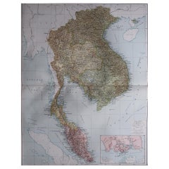
The map itself would have shown the vast continent of Asia with its many countries, emphasizing areas of particular interest to the British, such as India, which was then part of the British Empire. It might have outlined important cities, trade routes, and geographical features.
The illustrations on the map likely depict scenes and people from various parts of Asia, such as:
- Vignettes of locals from different regions, like the Tartars, reflecting the diversity of the continent.
- Scenes of daily life or typical activities, like a caravan in the desert, that add depth to the understanding of different cultures within Asia.
- Illustrations of flora and fauna unique to the region, like the palm trees and camels, which were often used to convey the exotic nature of the lands beyond Europe.
- Perhaps scenes of key cities or landmarks that were important trade centers or points of colonial interest at the time.
Tallis maps are now appreciated not just as navigational tools but as works of art and historical documents. They represent a Victorian vision of the world, characterized by a mix of accurate cartography and romanticized depictions of far-off lands. These maps are especially valued for their portrayal of the world during an era when the global landscape was rapidly changing due to exploration, colonization, and the expansion of empires.
- Dimensions:Height: 10.71 in (27.2 cm)Width: 14.26 in (36.2 cm)Depth: 0 in (0.02 mm)
- Materials and Techniques:
- Period:
- Date of Manufacture:1851
- Condition:Good given age. Original fold in middle as published. General age-related toning, please study scan carefully.
- Seller Location:Langweer, NL
- Reference Number:
About the Seller
5.0
Platinum Seller
These expertly vetted sellers are 1stDibs' most experienced sellers and are rated highest by our customers.
Established in 2009
1stDibs seller since 2017
1,928 sales on 1stDibs
Typical response time: <1 hour
- ShippingRetrieving quote...Ships From: Langweer, Netherlands
- Return PolicyA return for this item may be initiated within 14 days of delivery.
More From This SellerView All
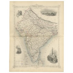
- Mid-19th Century Decorative Map of India with Cultural and Natural VignettesLocated in Langweer, NLThe Tallis maps, including the one of India, are known for their detailed and ornamental style. They were produced during the mid-19th century, a time when cartographic publishing be...Category
Antique 1850s Maps
MaterialsPaper
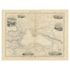
- Mid 19th Century Map of the Black Sea with Decorative Vignettes, 1851Located in Langweer, NLMap of the Black Sea and contingent lands, including Turkey, Russia, Georgia, Azerbaijan, Bulgaria, Crimea and Armenia, with decorative vignettes views of Sebastopol, Varna, Odessa, Sinope, Constantinople and Silistria. Fine antique map...Category
Antique Mid-19th Century Maps
MaterialsPaper
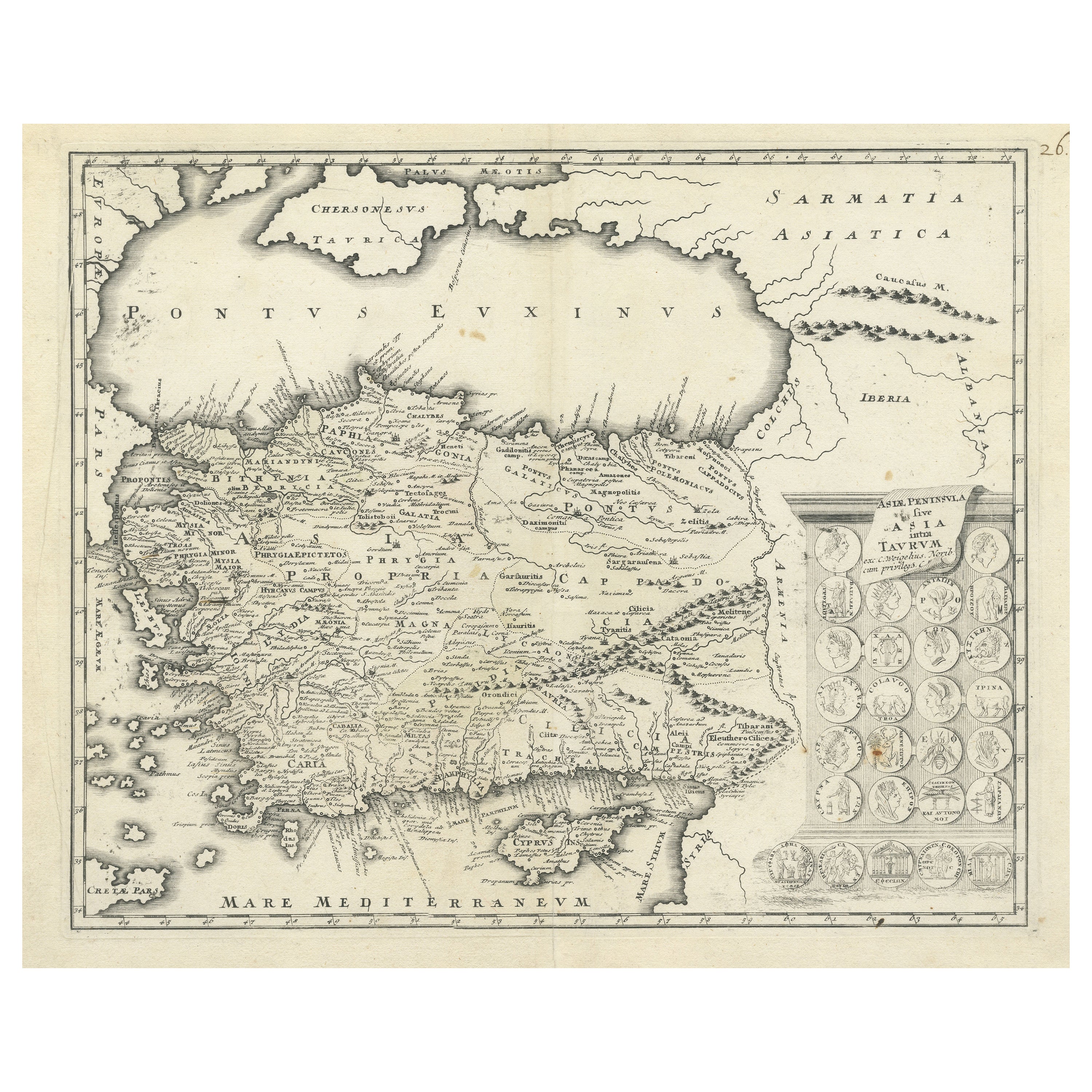
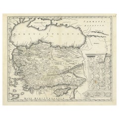
- Antique Map of Cyprus and Asia Minor with Medallions and VignettesLocated in Langweer, NLAntique map titled 'Asiae Peninsula sive Asia intra Taurum'. Decorative map of Cyprus and Asia Minor, featuring the geographical features known to the ancients and decorated with a v...Category
Antique Early 18th Century Maps
MaterialsPaper
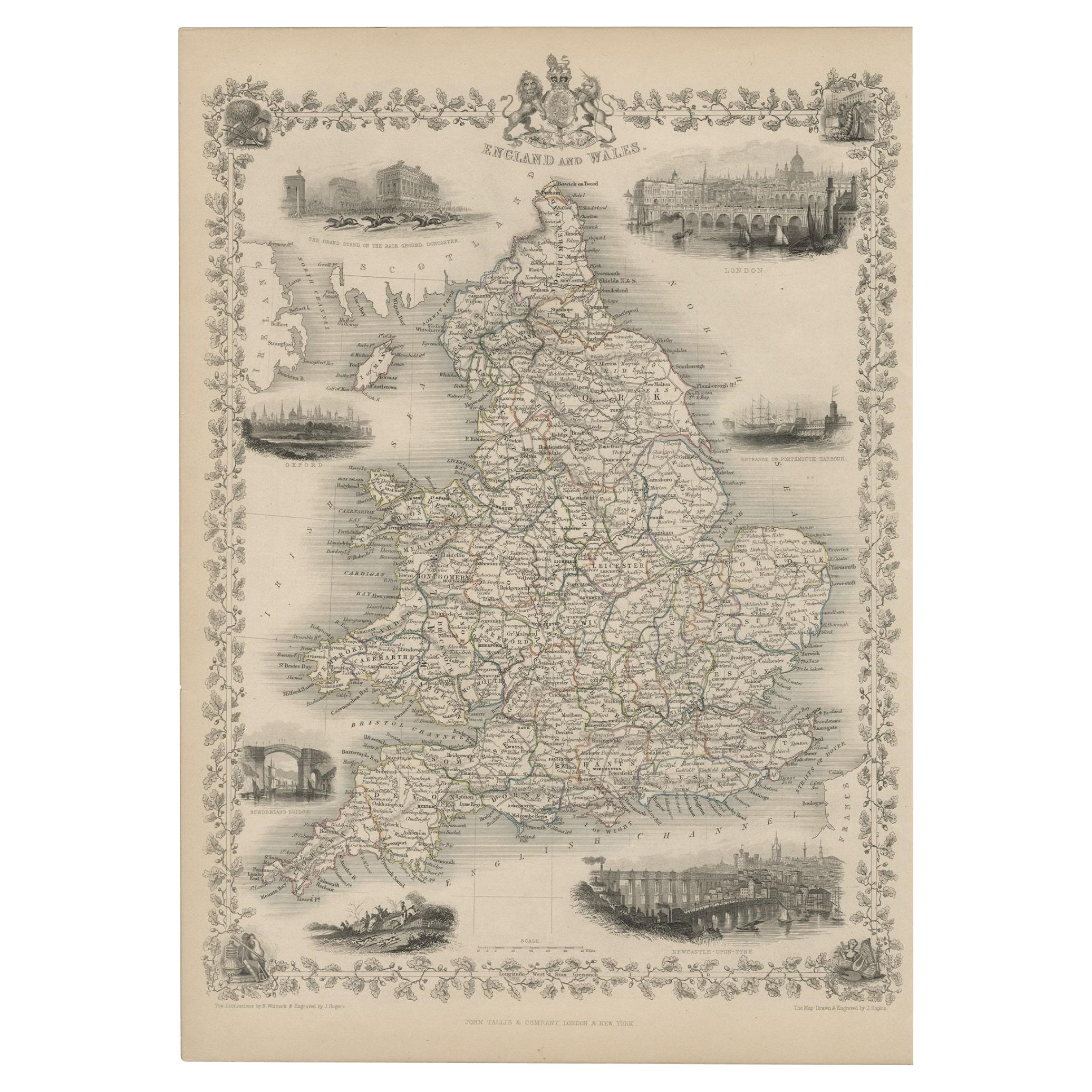
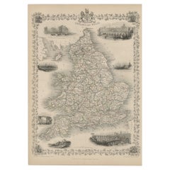
- Antique Map of England and Wales with Decorative Vignettes, 1851Located in Langweer, NLAntique map titled ‘England and Wales’. Includes decorative vignettes titled The grand stand on the race ground Doncaster, London, Oxford, Entrance to Portsmouth Harbour, Sunderland ...Category
Antique 19th Century Maps
MaterialsPaper
- Old Engraved Map of Hungary with Decorative Vignettes, 1851Located in Langweer, NLAntique map titled Hungary. Includes decorative vignettes titled Hungarian Peasants, Pesth and the Fortress of Buda, on the Danube and Hungarian Nobles. Originates from 'The Illustrated Atlas, And Modern History Of The World Geographical, Political, Commercial & Statistical, Edited By R. Montgomery Martin'. Published; John Tallis London, New York, Edinburgh & Dublin. 1851. Drawn and Engraved by J. Rapkin. Artists and Engravers: John Tallis (1817-1876) was a British map publisher. Born in the Midlands, Tallis came to London in the 1840s. Tallis began his London career with a series of remarkable London street views. He began a partnership with a Frederick Tallis, possibly his brother, but their collaboration ended in 1849. For the Great Exhibition of 1851, Tallis published the Illustrated World Atlas, one of the last series of decorative world maps ever produced. The maps were engraved by John Rapkin, a skilled artisan. The maps were later reissued by the London Printing & Publishing Company, who left the Tallis imprint intact, thus ensuring his enduring fame. In 1858, he began publication of the popular Illustrated News of the World...Category
Antique 19th Century Maps
MaterialsPaper
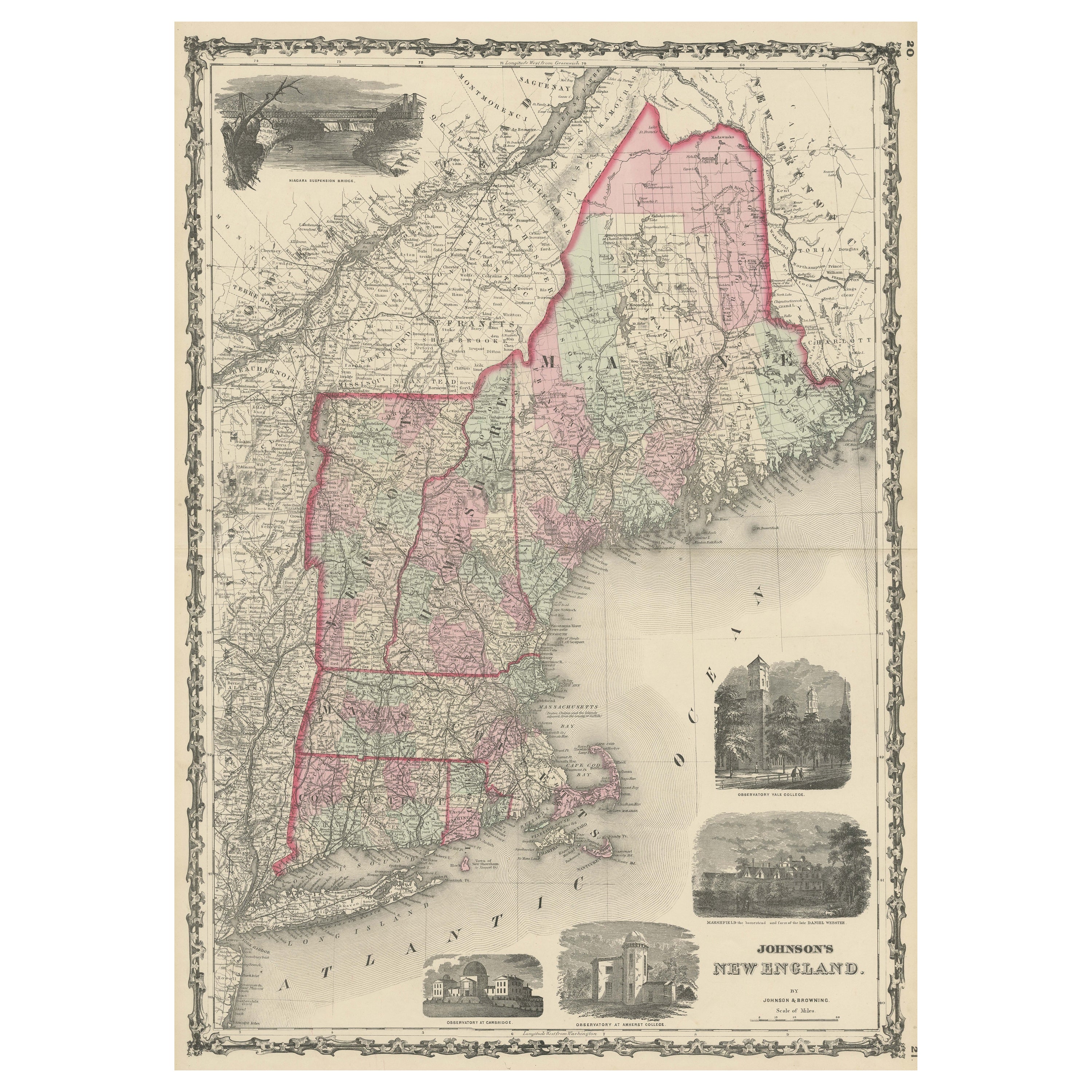
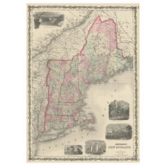
- Large Antique Map of New England with decorative VignettesLocated in Langweer, NLAntique map titled 'Johnson's New England'. Large map of New England, comprising the states Connecticut, Maine, Massachusetts, New Hampshire, Rhode ...Category
Antique Mid-19th Century Maps
MaterialsPaper

You May Also Like
- Large Original Vintage Map of S.E Asia, with a Vignette of SingaporeLocated in St Annes, LancashireGreat map of South East Asia Original color. Good condition Published by Alexander Gross Unframed.Category
Vintage 1920s English Maps
MaterialsPaper
- Framed Mid-19th Century Wall Map of Long Island, the HamptonsLocated in Sag Harbor, NYA Framed museum quality find. This large wall map dates to the mid-1800s. Detailed inset maps of, Sag Harbor, East Hampton, Amagansett, Shelter Island and most villages in Long Islan...Category
Antique Mid-19th Century American Maps
MaterialsLinen, Paper
- Asian 19th Century Ningyo Doll With Head DressLocated in Los Angeles, CABeautiful Asian 19th Century Ningyo doll with head dress. Great textile details. Nice addition to your classical Asian inspired interiors and table tops.Category
Antique 19th Century Japanese Other Toys and Dolls
MaterialsCotton
- Decorative Fancy Victorian Barometer, 19th CenturyLocated in Berlin, DEFancy Victorian barometer, 19th century Mahogany veneer with inlay. Historical condition. The barometer may need to be checked for accuracy. Ple...Category
Antique 19th Century English Victorian Scientific Instruments
- Louisiana: A Framed 19th Century Map by O. W. GrayBy Gray and CoLocated in Alamo, CAThis framed 19th century map of the Louisiana territory was published in "Gray's Atlas of the United States with General Maps of the World, accompanied by Descriptions Geographical, Historical, Scientific and Statistica" published in 1873 in Philadelphia by O.W. Gray and Son and Stedman, Brown and Lyon. It is a highly detailed map of Louisiana...Category
Antique Mid-19th Century American Other Maps
MaterialsPaper
- Pair 19th Century Decorative Desktop Signalling CannonsLocated in Dublin 8, IEPair 19th Century decorative desktop cast iron signalling cannons set on carriages with working wheels.Category
Antique 19th Century English Napoleon III Models and Miniatures
MaterialsIron