Items Similar to Mid-19th Century Decorative Map of India with Cultural and Natural Vignettes


Want more images or videos?
Request additional images or videos from the seller
1 of 6
Mid-19th Century Decorative Map of India with Cultural and Natural Vignettes
About the Item
The Tallis maps, including the one of India, are known for their detailed and ornamental style. They were produced during the mid-19th century, a time when cartographic publishing became as much an art form as a means of geographic representation.
John Tallis & Company, founded by John Tallis, was known for creating maps with elaborate borders and vignettes surrounding the map itself. These maps often included illustrations that depicted scenes representative of the region's culture, significant local wildlife, architectural landmarks, and portraits of indigenous peoples, adding both to the aesthetic appeal and the educational value of the map.
Robert Montgomery Martin, mentioned as the author, was a prolific writer and an authority on the British Colonies. His works often contained detailed descriptions of the colonies' geography, culture, and economy, and were well-regarded during that time.
The map of India would likely have shown not just the geography, but also the political divisions during British rule, with regions marked according to British administrative boundaries. Key cities, transportation routes such as proposed railways, and natural features would also be detailed.
The vignettes on such a map could include depictions of significant landmarks like the Qutub Minar in Delhi, or typical scenes of local life, such as depictions of Indian elephants or the Bengal Tiger, which would be drawn with Western stylistic influences but aimed to provide a sense of the exotic nature of the colony.
As for the Tallis series, it was not just limited to India but spanned the entire globe, offering a glimpse into the 19th-century British perspective of the world and its diverse cultures, landscapes, and peoples. The maps were as much tools for education and reference as they were symbols of the reach of the British Empire at its height.
- Dimensions:Height: 14.26 in (36.2 cm)Width: 10.71 in (27.2 cm)Depth: 0 in (0.02 mm)
- Materials and Techniques:
- Period:
- Date of Manufacture:1851
- Condition:Good given age. Original fold in middle as published. General age-related toning, please study scan carefully.
- Seller Location:Langweer, NL
- Reference Number:
About the Seller
5.0
Platinum Seller
These expertly vetted sellers are 1stDibs' most experienced sellers and are rated highest by our customers.
Established in 2009
1stDibs seller since 2017
1,928 sales on 1stDibs
Typical response time: <1 hour
- ShippingRetrieving quote...Ships From: Langweer, Netherlands
- Return PolicyA return for this item may be initiated within 14 days of delivery.
More From This SellerView All
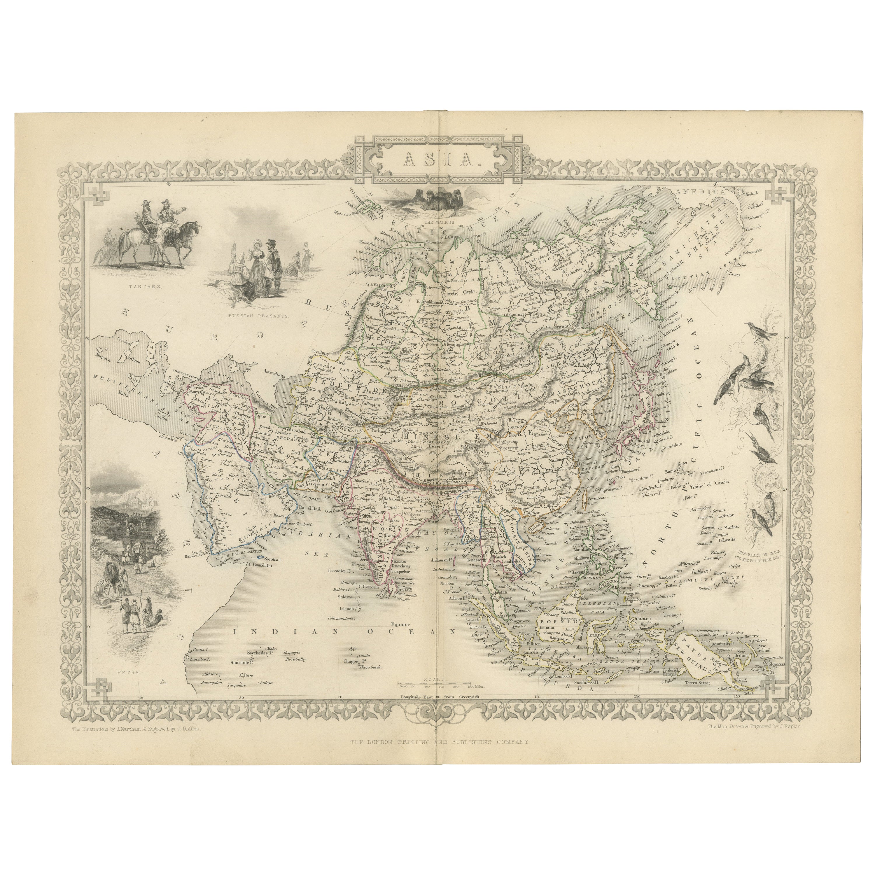
- Mid-19th Century Decorative Map of Asia with Cultural and Natural VignettesLocated in Langweer, NLJohn Tallis & Company, known for their decorative mid-19th-century maps, created this map of Asia. These maps were distinctive for their elaborate borders and detailed vignettes. The...Category
Antique 1850s Maps
MaterialsPaper
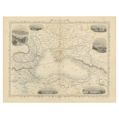
- Mid 19th Century Map of the Black Sea with Decorative Vignettes, 1851Located in Langweer, NLMap of the Black Sea and contingent lands, including Turkey, Russia, Georgia, Azerbaijan, Bulgaria, Crimea and Armenia, with decorative vignettes views of Sebastopol, Varna, Odessa, Sinope, Constantinople and Silistria. Fine antique map...Category
Antique Mid-19th Century Maps
MaterialsPaper
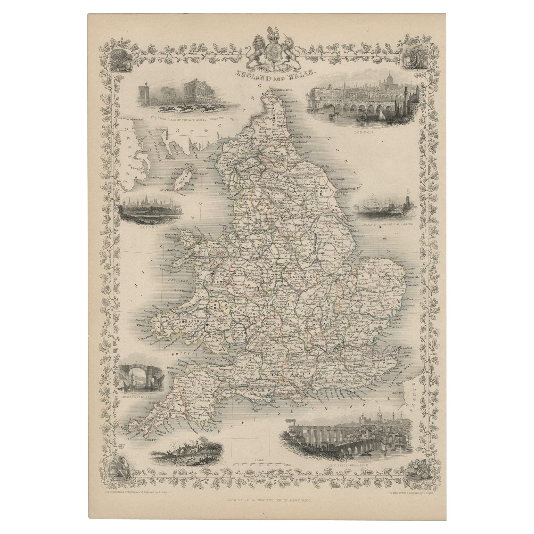
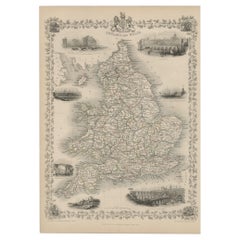
- Antique Map of England and Wales with Decorative Vignettes, 1851Located in Langweer, NLAntique map titled ‘England and Wales’. Includes decorative vignettes titled The grand stand on the race ground Doncaster, London, Oxford, Entrance to Portsmouth Harbour, Sunderland ...Category
Antique 19th Century Maps
MaterialsPaper
- Old Engraved Map of Hungary with Decorative Vignettes, 1851Located in Langweer, NLAntique map titled Hungary. Includes decorative vignettes titled Hungarian Peasants, Pesth and the Fortress of Buda, on the Danube and Hungarian Nobles. Originates from 'The Illustrated Atlas, And Modern History Of The World Geographical, Political, Commercial & Statistical, Edited By R. Montgomery Martin'. Published; John Tallis London, New York, Edinburgh & Dublin. 1851. Drawn and Engraved by J. Rapkin. Artists and Engravers: John Tallis (1817-1876) was a British map publisher. Born in the Midlands, Tallis came to London in the 1840s. Tallis began his London career with a series of remarkable London street views. He began a partnership with a Frederick Tallis, possibly his brother, but their collaboration ended in 1849. For the Great Exhibition of 1851, Tallis published the Illustrated World Atlas, one of the last series of decorative world maps ever produced. The maps were engraved by John Rapkin, a skilled artisan. The maps were later reissued by the London Printing & Publishing Company, who left the Tallis imprint intact, thus ensuring his enduring fame. In 1858, he began publication of the popular Illustrated News of the World...Category
Antique 19th Century Maps
MaterialsPaper
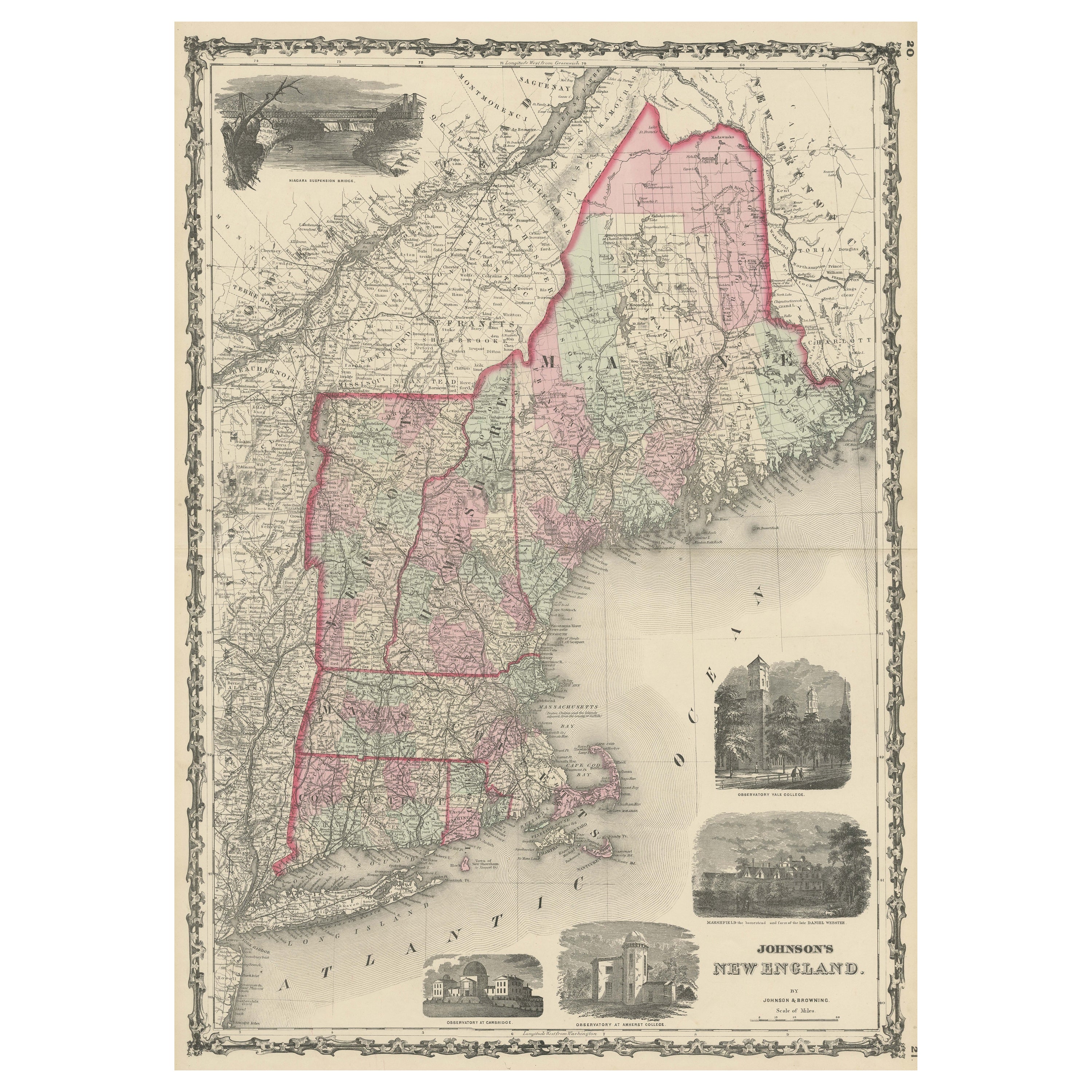
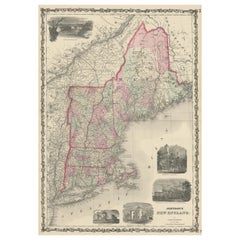
- Large Antique Map of New England with decorative VignettesLocated in Langweer, NLAntique map titled 'Johnson's New England'. Large map of New England, comprising the states Connecticut, Maine, Massachusetts, New Hampshire, Rhode ...Category
Antique Mid-19th Century Maps
MaterialsPaper
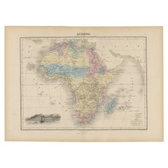
- Antique Map of Africa with Decorative Vignette of Saint Helena, 1880Located in Langweer, NLAntique map titled 'Afrique'. Old map of Africa, covering the African continent. With decorative vignette of Saint Helena. This map originates from 'Géogr...Category
Antique 19th Century Maps
MaterialsPaper

You May Also Like
- Framed Mid-19th Century Wall Map of Long Island, the HamptonsLocated in Sag Harbor, NYA Framed museum quality find. This large wall map dates to the mid-1800s. Detailed inset maps of, Sag Harbor, East Hampton, Amagansett, Shelter Island and most villages in Long Islan...Category
Antique Mid-19th Century American Maps
MaterialsLinen, Paper
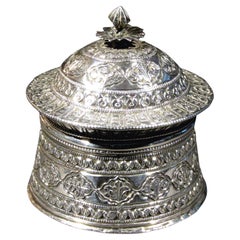
- Mid-19th Century Mughal Style Silver Betel Box, Northern IndiaLocated in Ottawa, OntarioIntended to hold paan or betel, the seamed cylindrical body flaring downward towards the base, the domed lid showing a lotus-bud final over a flattened and canted rim, both decorated...Category
Antique Mid-19th Century Indian Islamic Tobacco Accessories
MaterialsSilver
- Large Original Vintage Map of S.E Asia, with a Vignette of SingaporeLocated in St Annes, LancashireGreat map of South East Asia Original color. Good condition Published by Alexander Gross Unframed.Category
Vintage 1920s English Maps
MaterialsPaper
- Decorative Fancy Victorian Barometer, 19th CenturyLocated in Berlin, DEFancy Victorian barometer, 19th century Mahogany veneer with inlay. Historical condition. The barometer may need to be checked for accuracy. Ple...Category
Antique 19th Century English Victorian Scientific Instruments
- Louisiana: A Framed 19th Century Map by O. W. GrayBy Gray and CoLocated in Alamo, CAThis framed 19th century map of the Louisiana territory was published in "Gray's Atlas of the United States with General Maps of the World, accompanied by Descriptions Geographical, Historical, Scientific and Statistica" published in 1873 in Philadelphia by O.W. Gray and Son and Stedman, Brown and Lyon. It is a highly detailed map of Louisiana...Category
Antique Mid-19th Century American Other Maps
MaterialsPaper
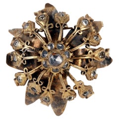
- Golden gilt metal brooch with rose cut diamonds, India end of 19th century.Located in Milan, ITButton-parade brooch in golden metal and diamonds from India for the English market. The base is made up of a continuous laminar body element that opens into petals with twisted tips...Category
Antique Late 19th Century Indian Collectible Jewelry
MaterialsMetal