Items Similar to Antique Map of the Provinces of Gelderland and Overijssel by Kaerius, 1617

Want more images or videos?
Request additional images or videos from the seller
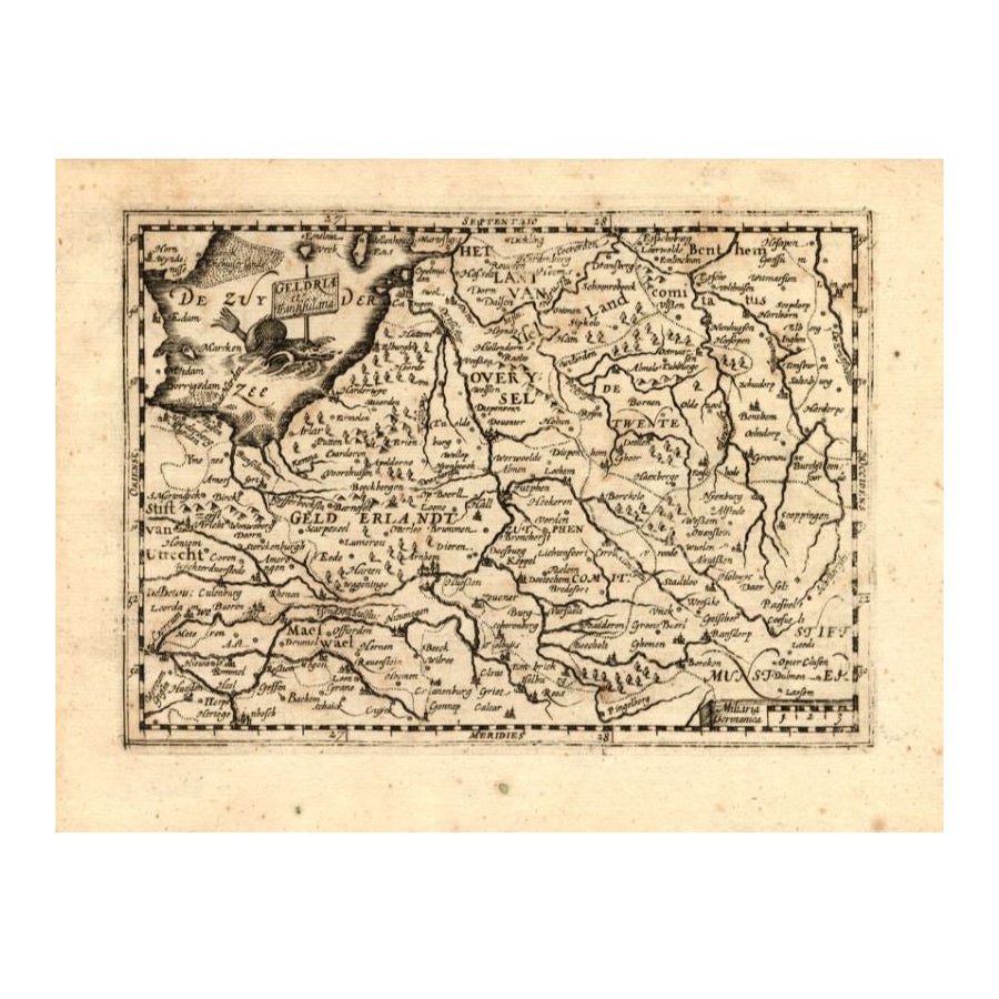
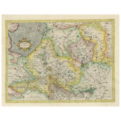
Antique Map of the Provinces of Gelderland and Overijssel by Kaerius, 1617
About the Item
Antique map titled 'Geldria et Transysulana'. Scarse map by Kaerius of the provinces Gelderland and Overijssel in the Netherlands. Large cartouche with coat of arms and sailing ship on the Zuyderzee. This map originates from the most beautiful Atlas of the Low Countries: 'Petri Kaerii Germania Inferior id est, XVII provinciarum ejus novae et exactae Tabulae Geographicae, cum Luculentis Singularum descriptionibus additis.' Published in Amsterdam by Petrus Kaerius in 1617.
Artists and Engravers: Kaerius or actually Pieter van den Keere (1571-1646), is a Dutch engraver and publisher. Persecuted in his country because of his religious orientation he moved to London. As brother-in-law to famous Jodocus Hondius (who had also fled to London) he became his ardent student learning from him the art of engraving and mapmaking. Kaerius published individual maps, but also atlases of the Netherlands and of Great Britain. In 1627 his Atlas Minor was published (known also as miniature Speeds because of the verso text copied from John Speed), containing altogether 63 maps of the entire world.
Condition: Good, general age-related toning; some light staining from handling. Original sheet from atlas, not shortened or cut. Map will look nice when framed, but at closer look you will find that the middle fold area has been separated with some paper loss, which has been backed by paper. Could be restored again. Paper edges with small tears and some paper loss, backed. Please study image carefully.
Date: 1617
Overall size: 52.5 x 40 cm.
Image size: 49 x 37.5 cm.
We sell original antique maps to collectors, historians, educators and interior decorators all over the world. Our collection includes a wide range of authentic antique maps from the 16th to the 20th centuries. Buying and collecting antique maps is a tradition that goes back hundreds of years. Antique maps have proved a richly rewarding investment over the past decade, thanks to a growing appreciation of their unique historical appeal. Today the decorative qualities of antique maps are widely recognized by interior designers who appreciate their beauty and design flexibility. Depending on the individual map, presentation, and context, a rare or antique map can be modern, traditional, abstract, figurative, serious or whimsical. We offer a wide range of authentic antique maps for any budget.
- Dimensions:Height: 15.75 in (40 cm)Width: 20.67 in (52.5 cm)Depth: 0 in (0.01 mm)
- Materials and Techniques:
- Period:
- Date of Manufacture:1617
- Condition:
- Seller Location:Langweer, NL
- Reference Number:
About the Seller
5.0
Platinum Seller
These expertly vetted sellers are 1stDibs' most experienced sellers and are rated highest by our customers.
Established in 2009
1stDibs seller since 2017
1,949 sales on 1stDibs
Typical response time: <1 hour
- ShippingRetrieving quote...Ships From: Langweer, Netherlands
- Return PolicyA return for this item may be initiated within 14 days of delivery.
More From This SellerView All
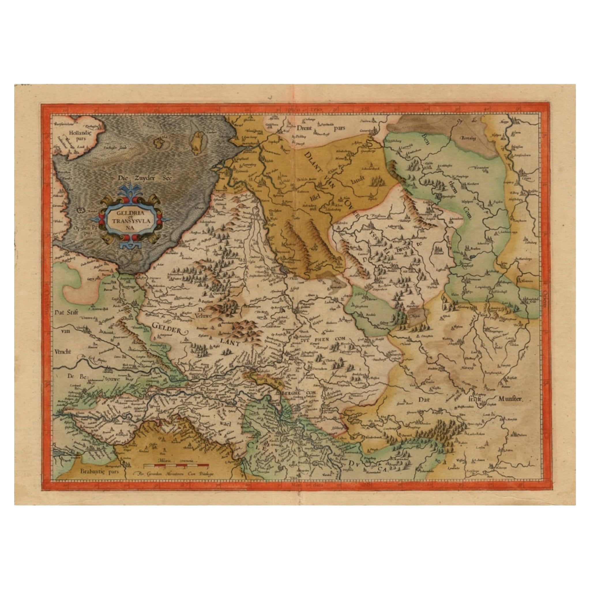
- Antique Map of The Dutch Provinces of Gelderland and Overijssel, 1623Located in Langweer, NLAntique map titled 'Geldria et Transysulana'. One of the earliest maps of Gelderland and Overijssel in the Netherlands, prepared by Gerard Mercator. Artists and Engravers: Gerard Mer...Category
Antique 17th Century Maps
MaterialsPaper
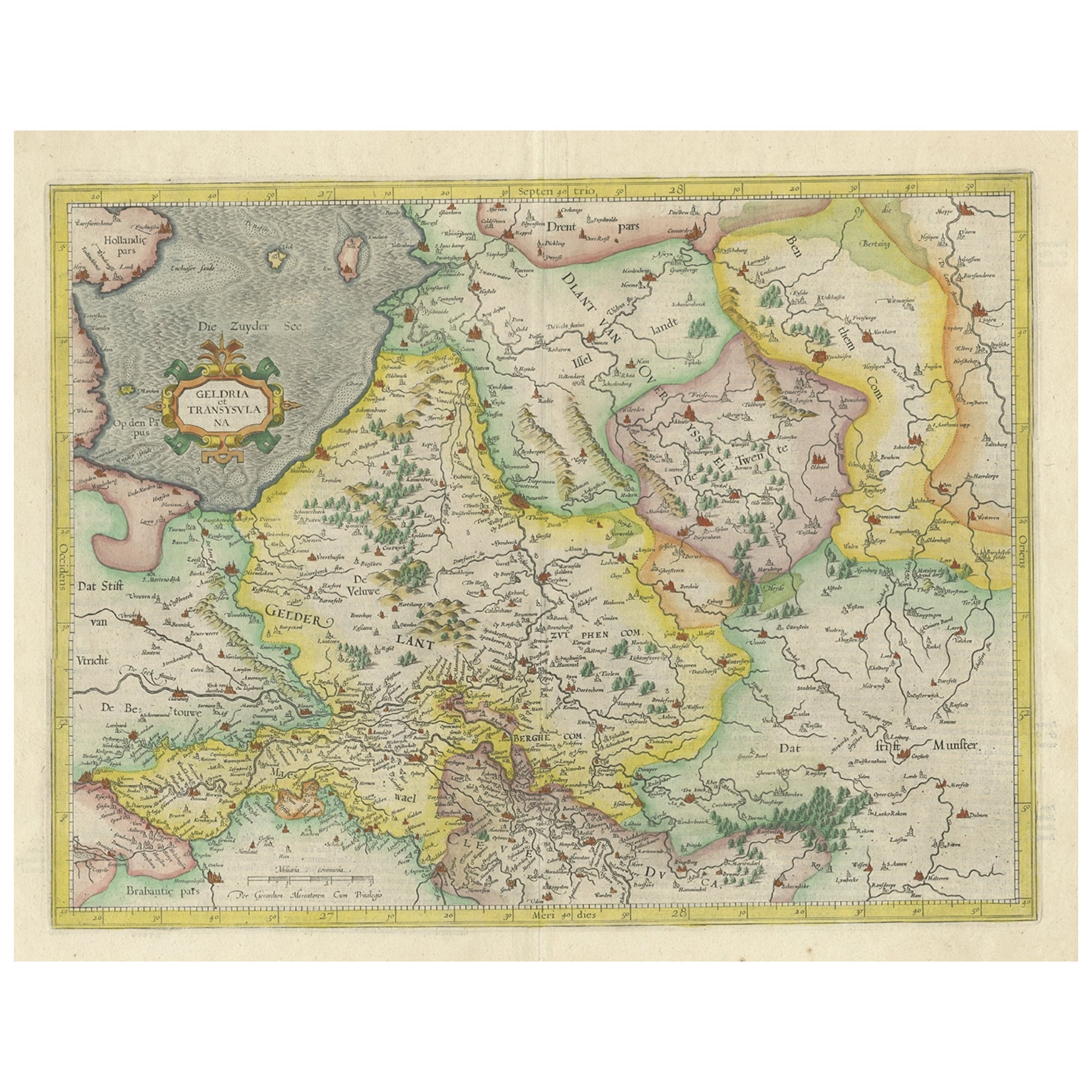
- Antique Map of Gelderland and Overijssel by Guicciardini, 1613Located in Langweer, NLAntique map titled 'Geldria et Transisulania.' (Map of the provinces of Gelderland and Overijssel, the Netherlands.) This original old antique print / plate originates from the scars...Category
Antique 17th Century Maps
MaterialsPaper
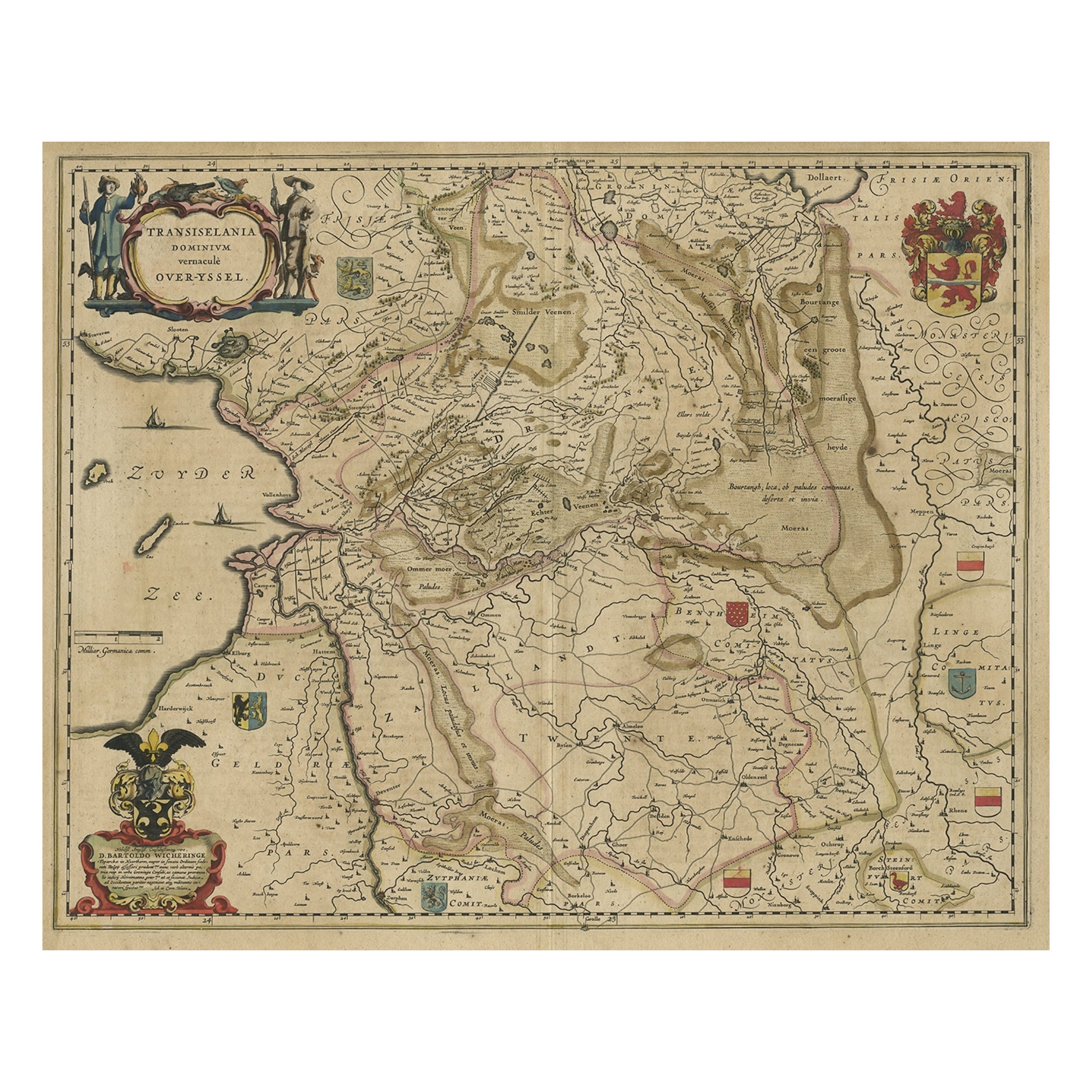
- Original Antique Map of the Dutch Provinces of Overijssel and Drenthe, 1635Located in Langweer, NLAntique map titled 'Transiselania Dominium vernacule Over-Yssel.' - Map of the Dutch Provinces of Overijssel and Drenthe. Dedicated to Mr. Bartold Wich...Category
Antique 1630s Maps
MaterialsPaper
- Early Antique Map of Gelderland and Overijssel in the Netherlands, c.1625Located in Langweer, NLAntique map titled 'Geldria et Transysulana'. One of the earliest maps of Gelderland and Overijssel in the Netherlands, prepared by Gerard Mercator. Artists and Engravers: Gerard...Category
Antique 17th Century Maps
MaterialsPaper
- One of the Earliest Maps of Gelderland and Overijssel in the Netherlands, 1623Located in Langweer, NLAntique map titled 'Geldria et Transysulana'. One of the earliest maps of Gelderland and Overijssel in the Netherlands, prepared by Gerard Mercator. Artists and Engravers: Ger...Category
Antique 1620s Maps
MaterialsPaper
- Antique Map of the Island of Funen by Kaerius, 1628Located in Langweer, NLAntique map titled 'Fionia'. Copper engraved map of the Island of Funen (Denmark) by P. Kaerius. Funen is Denmark's second largest island, between the Jutland peninsula, and the capi...Category
Antique Mid-17th Century Maps
MaterialsPaper


You May Also Like
- 1861 Topographical Map of the District of Columbia, by Boschke, Antique MapLocated in Colorado Springs, COPresented is an original map of Albert Boschke's extremely sought-after "Topographical Map of the District of Columbia Surveyed in the Years 1856 ...Category
Antique 1860s American Historical Memorabilia
MaterialsPaper
- Original Antique Map of The World by Thomas Clerk, 1817Located in St Annes, LancashireGreat map of The Eastern and Western Hemispheres On 2 sheets Copper-plate engraving Drawn and engraved by Thomas Clerk, Edinburgh. Published by Mackenzie And Dent, 1817 ...Category
Antique 1810s English Maps
MaterialsPaper
- 1907 Map of Colorado, Antique Topographical Map, by Louis NellLocated in Colorado Springs, COThis highly detailed pocket map is a topographical map of the state of Colorado by Louis Nell from 1907. The map "has been complied from all availabl...Category
Antique Early 1900s American Maps
MaterialsPaper
- 1854 Map of Massachusetts, Connecticut and Rhode Island, Antique Wall MapLocated in Colorado Springs, COThis striking wall map was published in 1854 by Ensign, Bridgman & Fanning and has both full original hand-coloring and original hardware. This impression is both informative and highly decorative. The states are divided into counties, outlined in red, green, and black, and subdivided into towns. Roads, canals, and railroad lines are prominently depicted, although they are not all labeled. The mapmakers also marked lighthouses, banks, churches, and prominent buildings, with a key at right. The map is an informative and comprehensive overview of the infrastructural development of New England prior to the Civil War. Physical geographies depicted include elevation, conveyed with hachure marks, rivers and lakes. The impression features an inset map of Boston...Category
Antique 19th Century American Maps
MaterialsPaper
- Original Antique Map of the American State of Washington, 1889Located in St Annes, LancashireGreat map of Washington Drawn and Engraved by W. & A.K. Johnston Published By A & C Black, Edinburgh. Original colour Unframed.Category
Antique 1880s Scottish Victorian Maps
MaterialsPaper
- Original Antique Map of the American State of Nevada, 1889Located in St Annes, LancashireGreat map of Nevada Drawn and Engraved by W. & A.K. Johnston Published By A & C Black, Edinburgh. Original colour Unframed.Category
Antique 1880s Scottish Victorian Maps
MaterialsPaper


Recently Viewed
View AllMore Ways To Browse
Antiques Art And Collectables Antique
Antiques Art And Collectables Antique Furniture
Antique Light Art Collectibles
Framed Coat Of Arms
Antique Curiosities Framed Art
17th Century Dutch Frame
Religious Netherlands
John Speed
Coat Of Arms Engraving
Sailing Map
Sailing Maps
Vans Coat Of Arms
Large Framed Maps
Framed World Map
Large Framed Antique Maps
Miniature Maps
Miniature Map
Map Of Great Britain