Items Similar to Early Antique Map of Gelderland and Overijssel in the Netherlands, c.1625


Want more images or videos?
Request additional images or videos from the seller
1 of 5
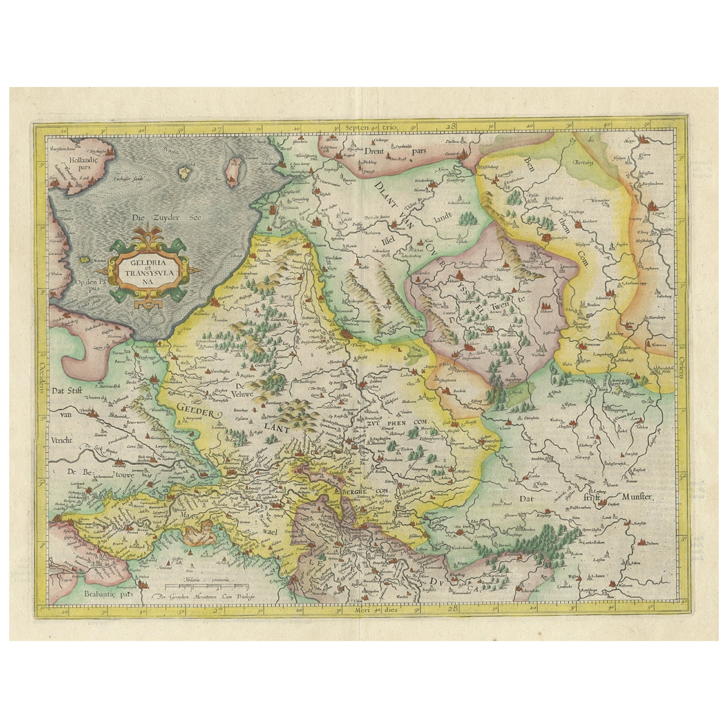
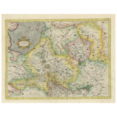
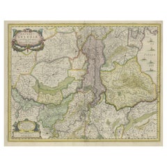
Early Antique Map of Gelderland and Overijssel in the Netherlands, c.1625
About the Item
Antique map titled 'Geldria et Transysulana'.
One of the earliest maps of Gelderland and Overijssel in the Netherlands, prepared by Gerard Mercator.
Artists and Engravers: Gerard Mercator (Kremer) was born in Rupelmonde in Flanders and studied in Louvain. He drawn his first map in 1537 and became a cartographer and globe maker. In 1552 he moved to Duisburg, Germany where he published his famous 18-sheet world map in 1569 with his own new projection, today called Mercator projection. Later he decided to publish a new edition of Ptolemy's Geographia. Followed by his major work, a 3 volume collection of maps to which the word "Atlas" was applied the first time. The first volume was published 1585, followed by the second in 1589 and the third one after his death in 1595 by his son Rumold. A second edition of all three parts was published 1602. 1604 Jodocus Hondius acquired the plates and published several edition together with his sons Jodocus II and Henricus until 1633. More editions followed until 1666 by Janssonius who was in partnership with Henricus. Some of the plated where also used in W.J. Blaeu in 1630.
Artist: Gerard Mercator (Kremer) was born in Rupelmonde in Flanders and studied in Louvain. He drawn his first map in 1537 and became a cartographer and globe maker. In 1552 he moved to Duisburg, Germany where he published his famous 18-sheet world map in 1569 with his own new projection, today called Mercator projection. Later he decided to publish a new edition of Ptolemy's Geographia. Followed by his major work, a 3 volume collection of maps to which the word "Atlas" was applied the first time. The first volume was published 1585, followed by the second in 1589 and the third one after his death in 1595 by his son Rumold. A second edition of all three parts was published 1602. 1604 Jodocus Hondius acquired the plates and published several edition together with his sons Jodocus II and Henricus until 1633. More editions followed until 1666 by Janssonius who was in partnership with Henricus. Some of the plated where also used in W.J. Blaeu in 1630.
Condition: Good, some light staining from handling. Some separation in middle fold backed. Some paper loss in left margin backed. Please study image carefully.
Date: c.1630
Overall size:54.5 x 40 cm.
Image size: 46.5 x 35.5 cm.
We sell original antique maps to collectors, historians, educators and interior decorators all over the world. Our collection includes a wide range of authentic antique maps from the 16th to the 20th centuries. Buying and collecting antique maps is a tradition that goes back hundreds of years. Antique maps have proved a richly rewarding investment over the past decade, thanks to a growing appreciation of their unique historical appeal. Today the decorative qualities of antique maps are widely recognized by interior designers who appreciate their beauty and design flexibility. Depending on the individual map, presentation, and context, a rare or antique map can be modern, traditional, abstract, figurative, serious or whimsical. We offer a wide range of authentic antique maps for any budget.
- Dimensions:Height: 15.75 in (40 cm)Width: 21.46 in (54.5 cm)Depth: 0 in (0.01 mm)
- Materials and Techniques:
- Period:
- Date of Manufacture:circa 1625
- Condition:Condition: Good, some light staining from handling. Some separation in middle fold backed. Some paper loss in left margin backed. Please study image carefully.
- Seller Location:Langweer, NL
- Reference Number:
About the Seller
5.0
Platinum Seller
These expertly vetted sellers are 1stDibs' most experienced sellers and are rated highest by our customers.
Established in 2009
1stDibs seller since 2017
1,916 sales on 1stDibs
Typical response time: <1 hour
- ShippingRetrieving quote...Ships From: Langweer, Netherlands
- Return PolicyA return for this item may be initiated within 14 days of delivery.
More From This SellerView All
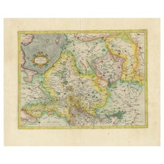
- One of the Earliest Maps of Gelderland and Overijssel in the Netherlands, 1623Located in Langweer, NLAntique map titled 'Geldria et Transysulana'. One of the earliest maps of Gelderland and Overijssel in the Netherlands, prepared by Gerard Mercator. Artists and Engravers: Ger...Category
Antique 1620s Maps
MaterialsPaper
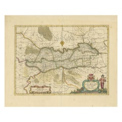
- Antique Map of the Province of Overijssel, the NetherlandsLocated in Langweer, NLOriginal antique map titled 'Ditio Trans-Isulana'. Original old map of the province of Overijssel, the Netherlands. With coat of arms and two decorative cartouches. Published by J. J...Category
Antique Mid-17th Century Maps
MaterialsPaper
- Antique Map of The Dutch Provinces of Gelderland and Overijssel, 1623Located in Langweer, NLAntique map titled 'Geldria et Transysulana'. One of the earliest maps of Gelderland and Overijssel in the Netherlands, prepared by Gerard Mercator. Artists and Engravers: Gerard Mer...Category
Antique 17th Century Maps
MaterialsPaper
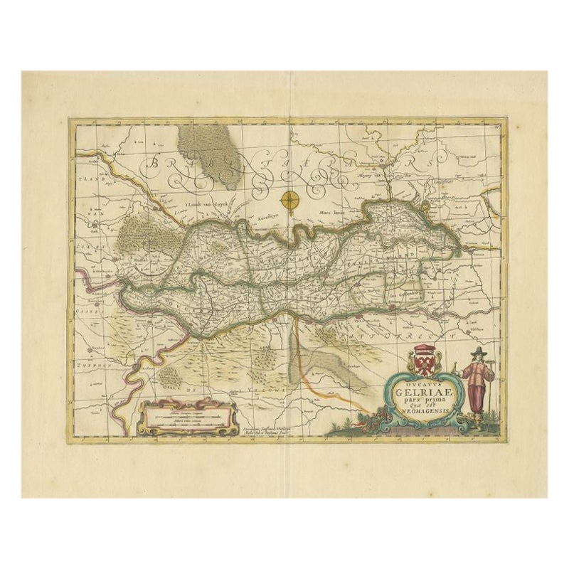
- Antique Map of the Region of Zutphen in Overijssel, The Netherlands, 1683Located in Langweer, NLAntique map titled 'Ducatus Gelriae pars prima Quae est Neomagensis'. Antique map of the region of Zutphen, Gelderland, the Netherlands. This map originates from 'The English Atlas' ...Category
Antique 17th Century Maps
MaterialsPaper
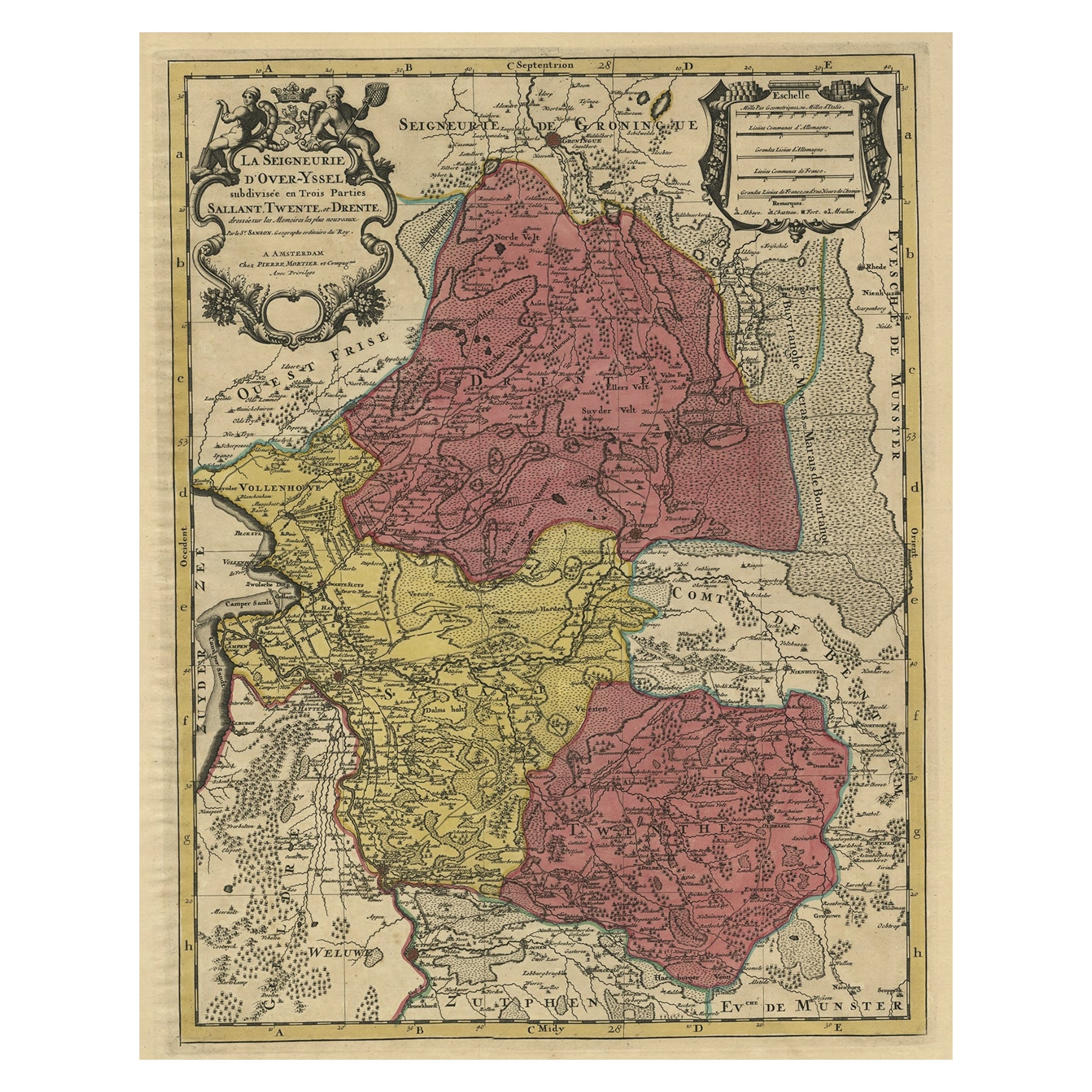
- Detailed Antique Map of the Province of Overijssel in the Netherlands, ca.1700Located in Langweer, NLAntique map titled 'La Seigneurie d'Over-Yssel subdivisee en Trois Parties, Sallant, Twente, et Drente.' Detailed map of the province of Overijssel in the Netherlands. From Jaill...Category
Antique Early 1700s Maps
MaterialsPaper
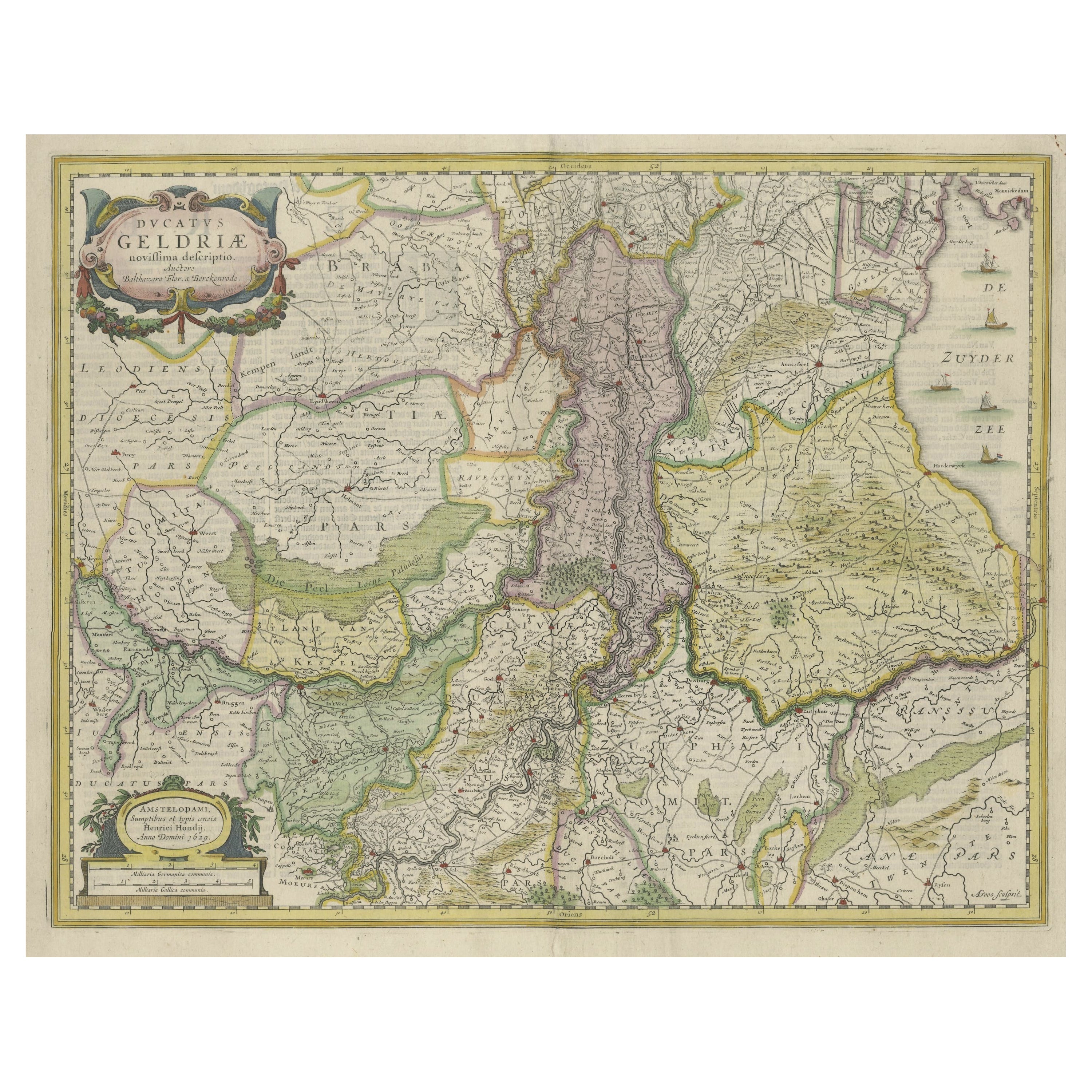
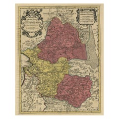
- Original Hand-Colored Antique Map of Gelderland and Utrecht in the NetherlandsLocated in Langweer, NLAntique map titled 'Ducatus Geldriae novissima descriptio'. Detailed map of Gelderland, a province in the Netherlands. Two coats of arms, one with scale. Ships on ‘De Zuyderzee’. Pub...Category
Antique Mid-17th Century Maps
MaterialsPaper

You May Also Like
- Original Antique Map of The Netherlands, Engraved by Barlow, Dated 1807Located in St Annes, LancashireGreat map of Netherlands Copper-plate engraving by Barlow Published by Brightly & Kinnersly, Bungay, Suffolk. Dated 1807 Unframed.Category
Antique Early 1800s English Maps
MaterialsPaper
- Map of the Republic of GenoaLocated in New York, NYFramed antique hand-coloured map of the Republic of Genoa including the duchies of Mantua, Modena, and Parma. Europe, late 18th century. Dimension: 25...Category
Antique Late 18th Century European Maps
- Antique Map of Principality of MonacoBy Antonio Vallardi EditoreLocated in Alessandria, PiemonteST/619 - "Old Geographical Atlas of Italy - Topographic map of ex-Principality of Monaco" - ediz Vallardi - Milano - A somewhat special edition ---Category
Antique Late 19th Century Italian Other Prints
MaterialsPaper
- Original Antique Map of The World by Thomas Clerk, 1817Located in St Annes, LancashireGreat map of The Eastern and Western Hemispheres On 2 sheets Copper-plate engraving Drawn and engraved by Thomas Clerk, Edinburgh. Published by Mackenzie And Dent, 1817 ...Category
Antique 1810s English Maps
MaterialsPaper
- Antique 18th Century Map of the Province of Pensilvania 'Pennsylvania State'Located in Philadelphia, PAA fine antique of the colony of Pennsylvania. Noted at the top of the sheet as a 'Map of the province of Pensilvania'. This undated and anonymous map is thought to be from the Gentleman's Magazine, London, circa 1775, although the general appearance could date it to the 1760's. The southern boundary reflects the Mason-Dixon survey (1768), the western boundary is placed just west of Pittsburgh, and the northern boundary is not marked. The map has a number of reference points that likely refer to companion text and appear to be connected to boundaries. The western and southern boundaries are marked Q, R, S, for example. A diagonal line runs from the Susquehanna R to the Lake Erie P. A broken line marked by many letters A, B, N, O, etc., appears in the east. There are no latitude or longitude markings, blank verso. Framed in a shaped contemporary gilt wooden frame and matted under a cream colored matte. Bearing an old Graham Arader Gallery...Category
Antique 18th Century British American Colonial Maps
MaterialsPaper
- Map "Estuary- Mouth of the Thames"Located in Alessandria, PiemonteST/426 - Antique French Map of the estuary of the Thames, map dated 1769 - "Mape of the entrance of the Thames. Designed by filing of Navy cards fo...Category
Antique Mid-18th Century French Other Prints
MaterialsPaper


Recently Viewed
View AllMore Ways To Browse
Map Light
Antique Globes Of The World
Antique Maps And Globes
Antique Globes And Maps
World Map Globe
Mercator Map
Mercator Antique
Antique Map Globe
Antique Map Blaeu
Antique World Globe Map
Paper Globe Light
Blaeu World Map
Henricus Hondius
Ptolemy Map
United States Map Antique
Antique United States Map
Railroad Antique
Antique Maps Of United States