Antique Maps And Globes

7
to
56
373
110
287
152
152
123
50
50
47
46
37
33
32
31
30
24
22
16
15
13
12
11
10
10
9
8
8
7
7
7
7
5
5
5
4
4
4
4
4
4
4
4
3
3
3
3
3
2
1
1
31
5
5
4
4
Sort By
18th Century Celestial Globe
Located in Mjöhult, SE
and manufacture maps and globes for the service of the public. The foreign maps and globes referred to
Category

Mid-18th Century Swedish Rococo Antique Maps And Globes

Materials

Brass

Antique 18th Century Celestial Globe
18th Century Celestial Globe
H 17.72 in W 16.93 in D 16.93 in
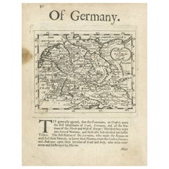
Rare Antique Map of Germany with English Text, c.1690
Located in Langweer, NL
, publisher, and maker of maps and globes. Artist: Robert Morden (c. 1650 ? 1703) was an English bookseller
Category

17th Century Antique Maps And Globes

Materials

Paper

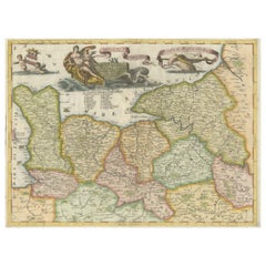
Decorative Original Antique Map of Normandy, France
Located in Langweer, NL
Venetian scholar and Minorite Friar, was one of the most celebrated map and globe makers of his era
Category

Late 17th Century Antique Maps And Globes

Materials

Paper

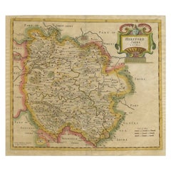
Antique Map of Herefordshire by Morden, c.1700
Located in Langweer, NL
. Robert Morden (c. 1650 ? 1703) was an English bookseller, publisher, and maker of maps and globes. He was
Category

18th Century Antique Maps And Globes

Materials

Paper

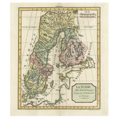
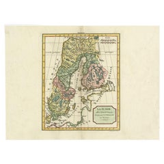
Decorative Antique Map of Sweden and Part of Finland, 1806
Located in Langweer, NL
continued to publish maps and globes until the middle part of the 19th century.
Category

Early 1800s Antique Maps And Globes

Materials

Paper

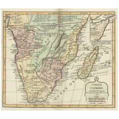
Decorative Antique Map of the Southern Part of Africa, 1806
Located in Langweer, NL
publications in the mid-19th century. The firm continued to publish maps and globes until the middle part of
Category

Early 1800s Antique Maps And Globes

Materials

Paper

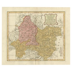
Antique Map of Bavaria in Southern Germany and Austria, 1806
Located in Langweer, NL
Delamarche publications in the mid-19th century. The firm continued to publish maps and globes until the
Category

19th Century Antique Maps And Globes

Materials

Paper

Antique Map of Sweden by Delamarche, 1806
Located in Langweer, NL
continued to publish maps and globes until the middle part of the 19th century. Artist: Made by 'Charles
Category

19th Century Antique Maps And Globes

Materials

Paper

Antique Map of Sweden by Delamarche, 1806
H 11.19 in W 15.08 in D 0 in
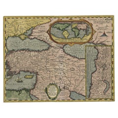
Scarce Antique Map of the Middle East, Surrounded by Latin Text, 1624
Located in Langweer, NL
Antique map titled 'Lumen Historium per Orientem (..).' Scarce map of the Middle East
Category

1620s Antique Maps And Globes

Materials

Paper

Antique Map of the British Isles by Delamarche, 1806
Located in Langweer, NL
continued to publish maps and globes until the middle part of the 19th century. Artist: Made by 'Charles
Category

19th Century Antique Maps And Globes

Materials

Paper

Old Engraved Map of Hungary, European Balkan Countries, Greece and Crete, 1806
Located in Langweer, NL
publications in the mid-19th century. The firm continued to publish maps and globes until the middle part of
Category

19th Century Antique Maps And Globes

Materials

Paper

Antique Map of Asia by Delamarche, 1826
Located in Langweer, NL
publish maps and globes until the middle part of the 19th century. Condition: Very good. General age
Category

19th Century Antique Maps And Globes

Materials

Paper

Antique Map of Asia by Delamarche, 1826
H 12.41 in W 17.72 in D 0 in
Decorative Antique Map of the Southern Part of South America, 1806
Located in Langweer, NL
publish maps and globes until the middle part of the 19th century. Condition: Good, given age. A few
Category

Early 1800s Antique Maps And Globes

Materials

Paper

Antique Map of Africa by Delamarche, 1806
Located in Langweer, NL
firm continued to publish maps and globes until the middle part of the 19th century. Condition: Good
Category

19th Century Antique Maps And Globes

Materials

Paper

Pocket Globe by Nathaniel Hill, London 1754
Located in Milano, IT
geographic survey, the creation of maps and globes and the engraving. Hill was involved in all three
Category

1750s English George II Antique Maps And Globes

Materials

Shagreen, Paper

Antique Map of the Holy Land by Delamarche, 1806
By Charles Francois Delamarche
Located in Langweer, NL
firm continued to publish maps and globes until the middle part of the 19th century. Condition: Good
Category

19th Century Antique Maps And Globes

Materials

Paper

Antique Map of the Northern Part of South America by Delamarche, 1806
Located in Langweer, NL
firm continued to publish maps and globes until the middle part of the 19th century. Condition: Good
Category

19th Century Antique Maps And Globes

Materials

Paper

17th Century Hand-Colored Map of Valencia and Murcia, Spain by Mercator/Hondius
By Gerard Mercator
Located in Alamo, CA
producing important maps and globes, he invented a projection on maps that presented all parallels and
Category

Mid-17th Century Dutch Antique Maps And Globes

Materials

Paper

Antique Map of the Pacific Ocean by Renneville, 1702
Located in Langweer, NL
several Delamarche publications in the mid-19th century. The firm continued to publish maps and globes
Category

18th Century Antique Maps And Globes

Materials

Paper

Southeastern Ireland: A 17th Century Hand Colored Map by Mercator and Hondius
By Gerard Mercator
Located in Alamo, CA
life. In addition to producing important maps and globes, he invented a projection on maps that
Category

Mid-17th Century Dutch Antique Maps And Globes

Materials

Paper

17th Century Hand-Colored Map of West Africa by Mercator/Hondius
Located in Alamo, CA
he lived and worked for the rest of his life. In addition to producing important maps and globes, he
Category

Mid-17th Century Dutch Antique Maps And Globes

Materials

Paper

An exceptional pair of BLAEU table globes
By Willem Blaeu
Located in ZWIJNDRECHT, NL
maps, atlases and instruments. Blaeu’s globes were luxury items for wealthy and intellectual merchants
Category

17th Century European Dutch Colonial Antique Maps And Globes

Materials

Other

        An exceptional pair of BLAEU table globes
        An exceptional pair of BLAEU table globes
Free Shipping
H 15 in Dm 9 in
William IV Terrestrial And Celestial Floor Globes By J. W. Cary
By John & William Cary
Located in New Orleans, LA
during expeditions to the North Pole, while the celestial globe provided a timeless map of the heavens
Category

19th Century English Regency Antique Maps And Globes

Materials

Mahogany

A beautiful Celestial Table Globe produced by Gerard & Leonard Valk
By Gerard and Leonard Valk
Located in ZWIJNDRECHT, NL
A magnificent and very rare early 18th century celestial table globe produced by Gerard and Leonard
Category

Early 18th Century Dutch Dutch Colonial Antique Maps And Globes

Materials

Other

Antique Map of the World in 12 Globe Gores by Scherer, 'circa 1702'
Located in Langweer, NL
Superinducendus'. Beautiful example of Scherer's map of the World, configured in 12 globe gores. California is
Category

Early 18th Century Antique Maps And Globes

Materials

Paper

Miniature Terrestrial Globe Newton & Son London, Post 1833, Ante 1858
By Newton and Son
Located in Milano, IT
Miniature Terrestrial Globe Newton & Son London, post 1833, ante 1858 Paper, papier-mâché
Category

1840s English Early Victorian Antique Maps And Globes

Materials

Bronze

Antique Map of Persia, Georgia and Kazakhstan, ca.1780
Located in Langweer, NL
Antique map titled 'Carte de la Perse, de la Georgie, et de la Tartarie Independante'. Map of
Category

1780s Antique Maps And Globes

Materials

Paper

Antique Map of the Eastern Mediterranean and the Balkans
Located in Langweer, NL
Antique map titled 'La Turquie d'Europe et celle d'Asie'. Attractive double page map of the Eastern
Category

Late 18th Century Antique Maps And Globes

Materials

Paper

Antique Map of Gelderland and Overijssel by Guicciardini, 1613
Located in Langweer, NL
Antique map titled 'Geldria et Transisulania.' (Map of the provinces of Gelderland and Overijssel
Category

17th Century Antique Maps And Globes

Materials

Paper

Antique Map of Spain and Portugal by Cruchley, 1854
Located in Langweer, NL
"Antique map of Spain and Portugal. Also depicts the islands Formentera, Ibiza, Mallorca and
Category

19th Century Antique Maps And Globes

Materials

Paper

Antique Map of Holstein, Germany
Located in Langweer, NL
Antique map titled 'Holsatia Ducatus'. Original old map of Holstein, Germany. By Petrus Kaerius
Category

Mid-17th Century Antique Maps And Globes

Materials

Paper

Antique Map of Holstein, Germany
H 9.85 in W 14.97 in D 0.02 in
19th CENTURY PAIR OF SMALL WORLD GLOBES
Located in Firenze, FI
Unique and fascinating pair of small globes, made with artisanal care by Italian manufacturers in
Category

19th Century Italian Antique Maps And Globes

Materials

Brass

19th CENTURY PAIR OF SMALL WORLD GLOBES
H 5.52 in W 4.73 in D 4.73 in
Terrestrial Globe by W. & A.K. Johnston
By W. & A.K. Johnston
Located in New Orleans, LA
circa 1860; map circa 1890 Measures: Globe: 30" diameter Base: 38" diameter x 47" high.
Category

19th Century English Victorian Antique Maps And Globes

Materials

Brass

Antique Map of Harvey Island and Surroundings by Cook, 1803
Located in Langweer, NL
largely uncharted areas of the globe. He mapped lands from New Zealand to Hawaii in the Pacific Ocean in
Category

19th Century Antique Maps And Globes

Materials

Paper

Antique Map of Harvey Island and Surroundings by Cook, 1803
Free Shipping
H 13.19 in W 16.34 in D 0 in
French Antique Map of Northern Africa and Libya, c.1840
Located in Langweer, NL
. This map originates from 'Le globe Atlas classique Universel de géographie ancienne et moderne, pour
Category

19th Century Antique Maps And Globes

Materials

Paper

Pair of George III Globes by J&W Cary Dated 1815 and 1800
By Cary’s
Located in Lymington, Hampshire
A pair of George III 21 inch globes by J&W Cary, dated 1815 and 1800, set in mahogany stands with
Category

Early 1800s English Antique Maps And Globes

Materials

Mahogany

Antique Map of Scotland With an Inset Map of the Shetland Islands, 1854
Located in Langweer, NL
Stunning Map of Scotland that will look beautiful in any setting framed on the wall. Description
Category

1850s Antique Maps And Globes

Materials

Paper

English Pocket Globe, London, Circa 1775-1798
By Herman Moll
Located in Milano, IT
Pocket globe London, between 1775 and 1798 Re-edition of the globe of Hermann Moll (1678-1732
Category

Late 18th Century English George III Antique Maps And Globes

Materials

Shagreen, Paper

Original and Colourful Map of Northern India with Surrounding Regions, 1783
Located in Langweer, NL
Antique map titled 'Indes'. A map of Northern India with surrounding regions. From Lattre's 'Atlas
Category

1780s Antique Maps And Globes

Materials

Paper

Globe Table Terrestrial Swedish
Located in BUNGAY, SUFFOLK
A Swedish 12 inch terrestrial globe, circa 1900. Measure: height 59cm Just purchased more
Category

1890s Swedish Baroque Revival Antique Maps And Globes

Materials

Paper

Globe Table Terrestrial Swedish
H 23.23 in Dm 15.75 in
A truly delightful miniature terrestrial pocket globe
By Nathaniel Mills
Located in ZWIJNDRECHT, NL
turning overhead. In line with its counterpart, the terrestrial globe, celestial globes are mapped by a
Category

Mid-18th Century British Dutch Colonial Antique Maps And Globes

Materials

Other

Colourful Antique Map of England and Wales Divided in Counties, 1854
Located in Langweer, NL
Antique map titled 'A Map Shewing the Places in England & Wales Sending Members to Parliament with
Category

19th Century Antique Maps And Globes

Materials

Paper

Antique Map of the Philippines, Taiwan and Surroundings by Bonne '1780'
Located in Langweer, NL
of Guam and the Marianas. This map originates from 'Atlas de toutes les parties connues du globe
Category

Late 18th Century Antique Maps And Globes

Materials

Paper

Antique Map of The Dutch Provinces of Gelderland and Overijssel, 1623
Located in Langweer, NL
first map in 1537 and became a cartographer and globe maker. In 1552 he moved to Duisburg, Germany where
Category

17th Century Antique Maps And Globes

Materials

Paper

Antique Map centered on Nuremberg, Germany
Located in Langweer, NL
Amsterdam, where he sold instruments and globes, published maps, and edited the works of intellectuals like
Category

Mid-17th Century Antique Maps And Globes

Materials

Paper

Antique Map centered on Nuremberg, Germany
H 16.42 in W 21.46 in D 0.02 in
Pair of 19th Century Table Globes by Crunchley
Located in Lincolnshire, GB
A pair of 12" table globes by the well known map maker Crunchley, London. In the original and very
Category

19th Century English Antique Maps And Globes

Materials

Mahogany, Paper

Antique Map of the Netherlands and Belgium by Homann, circa 1710
By Johann Baptist Homann
Located in Langweer, NL
Antique map titled 'Tabula Generalis Totius Belgii Provinciae XVII. Infer. Germaniae (..)'. Map of
Category

Early 18th Century German Antique Maps And Globes

Materials

Paper

Antique Map of the Netherlands and Belgium by Homann, circa 1710
Free Shipping
H 20.87 in W 24.02 in D 0.02 in
Antique Map of Persia, Georgia and Kazakhstan by Bonne, c.1780
Located in Langweer, NL
Antique map titled 'Carte de la Perse, de la Georgie, et de la Tartarie Independante'. Map of
Category

18th Century Antique Maps And Globes

Materials

Paper

Mid-19th Century Decorative Map of India with Cultural and Natural Vignettes
Located in Langweer, NL
The Tallis maps, including the one of India, are known for their detailed and ornamental style
Category

1850s Antique Maps And Globes

Materials

Paper

1771 Bonne Map of Poitou, Touraine and Anjou, France, Ric.a015
Located in Norton, MA
1771 Bonne Map of Poitou, Touraine and Anjou, France Ric.a015 1771 Bonne map of Potiou
Category

17th Century Unknown Antique Maps And Globes

Materials

Paper

Antique Map of Delfland, Schieland and Islands of Zuid-Holland, the Netherlands
Located in Langweer, NL
, where he sold instruments and globes, published maps, and edited the works of intellectuals like
Category

Mid-17th Century Antique Maps And Globes

Materials

Paper

Spectacular Large Map of Upper and Lower Austria between Passau and Wien, c.1700
Located in Langweer, NL
, publishers of books, maps, topographical and architectural drawings and globes. Although they produced some
Category

Early 1700s Antique Maps And Globes

Materials

Paper

Antique Map of Macedonia, Northern Greece and part of Turkey in Europe
Located in Langweer, NL
he sold instruments and globes, published maps, and edited the works of intellectuals like Descartes
Category

Mid-17th Century Antique Maps And Globes

Materials

Paper

Antique Map Showing the Division and Distribution of Mammals by Johnston '1850'
Located in Langweer, NL
rodentia and ruminantia over the globe'. Original antique map showing geographical division and
Category

Mid-19th Century Antique Maps And Globes

Materials

Paper

Antique Map of Southern India, the Maldives and Sri Lanka with Currents
Located in Langweer, NL
Desmarest. He also made the maps for the Abbe Raynals’ famous Atlas de Toutes Les Parties Connues du Globe
Category

Late 18th Century Antique Maps And Globes

Materials

Paper

Colored wall map of the WORLD
By Chambon
Located in ZWIJNDRECHT, NL
“Mappe Monde, contenant les Parties Connues du Globe Terrestre” CHAMBON, Gobert-Denis (France, 17
Category

Mid-18th Century French French Provincial Antique Maps And Globes

Materials

Wood, Paper

Colored wall map of the WORLD
Free Shipping
H 45 in W 57 in D 0.8 in
Large Antique Map of Egypt and the Nile Delta by Wyld, 1854
Located in Langweer, NL
Antique map titled 'Lower Egypt and the adjacent desert, with a part of Palestine to which has been
Category

19th Century Antique Maps And Globes

Materials

Paper

Original Antique Map of the Netherlands Incl Amsterdam, Leiden and Haarlem, 1700
Located in Langweer, NL
print sellers, publishers of books, maps, topographical and architectural drawings and globes. Although
Category

Early 1700s Antique Maps And Globes

Materials

Paper

Antique Map of the Northwestern Netherlands, incl Texel and Vlieland, ca.1741
Located in Langweer, NL
) was an engraver, globe-maker and map publisher from Augsburg. He was a pupil of J.B. Homann in
Category

1740s Antique Maps And Globes

Materials

Paper

Early Antique Map of Gelderland and Overijssel in the Netherlands, c.1625
Located in Langweer, NL
first map in 1537 and became a cartographer and globe maker. In 1552 he moved to Duisburg, Germany where
Category

17th Century Antique Maps And Globes

Materials

Paper

  • 1
Get Updated with New Arrivals
Save "Antique Maps And Globes", and we’ll notify you when there are new listings in this category.

Antique Maps And Globes For Sale on 1stDibs

Find a variety of antique maps and globes available on 1stDibs. Frequently made of paper, wood and metal, all antique maps and globes available were constructed with great care. There are all kinds of antique maps and globes available, from those produced as long ago as the 18th Century to those made as recently as the 20th Century. Antique maps and globes bearing Victorian or Georgian hallmarks are very popular at 1stDibs. Antique maps and globes have been a part of the life’s work for many furniture makers, but those produced by Lane's, Newton and Son and Carl Bauer are consistently popular.

How Much are Antique Maps And Globes?

Prices for antique maps and globes start at $150 and top out at $88,500 with the average selling for $3,651.

Read More

Pamela Shamshiri Shares the Secrets behind Her First-Ever Book and Its Effortlessly Cool Interiors

The sought-after designer worked with the team at Hoffman Creative to produce a monograph that beautifully showcases some of Studio Shamshiri's most inspiring projects.

Moroccan Artworks and Objects Take Center Stage in an Extraordinary Villa in Tangier

Italian writer and collector Umberto Pasti opens the doors to his remarkable cave of wonders in North Africa.

Montecito Has Drawn Royalty and Celebrities, and These Homes Are Proof of Its Allure

Hollywood A-listers, ex-pat aristocrats and art collectors and style setters of all stripes appreciate the allure of the coastal California hamlet — much on our minds after recent winter floods.

Whaam! Blam! Pow! — a New Book on Pop Art Packs a Punch

Publishing house Assouline and writer Julie Belcove have teamed up to trace the history of the genre, from Roy Lichtenstein, Andy Warhol and Yayoi Kusama to Mickalene Thomas and Jeff Koons.

The Sparkling Legacy of Tiffany & Co. Explained, One Jewel at a Time

A gorgeous new book celebrates — and memorializes — the iconic jeweler’s rich heritage.

What Makes a Gem-Encrusted Chess Set Worth $4 Million?

The world’s most opulent chess set, weighing in at 513 carats, is literally fit for a king and queen.

Tauba Auerbach’s Geometric Pop-Up Book Is Mighty Rare, Thanks to a Hurricane

This sculptural art book has an epic backstory of its own.

Step inside the Storied Mansions of Palm Beach’s Most Effervescent Architect

From Spanish-style courtyards to fanciful fountains, these acclaimed structures abound in surprising and elegant details.