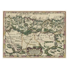
Algeria Antique Map

to
11
40
7
23
20
14
7
6
5
5
4
4
4
4
4
4
2
2
2
1
1
1
1
1
2
2
2
1
1
Sort By
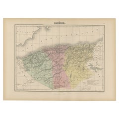
Antique Map of Algeria, 1880
Located in Langweer, NL
Antique map titled 'Algérie. Old map of Algeria. This map originates from 'Géographie Universelle
Category

19th Century Algeria Antique Map

Materials

Paper

Antique Map of Algeria, 1880
H 13.59 in W 18.71 in D 0 in
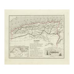
Antique Map of the Region of Algiers, Algeria
Located in Langweer, NL
Antique map titled 'Alger'. This map shows the region of Algiers, Algeria. With a small inset map
Category

Mid-19th Century Algeria Antique Map

Materials

Paper

Antique Map of the Region of Algiers, Algeria
H 10.01 in W 12.05 in D 0.02 in
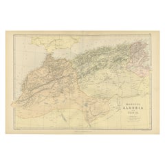
Antique Decorative Coloured Map Marocco, Algeria and Tunis, 1882
Located in Langweer, NL
regions as understood in the late 19th century. **Map of Morocco, Algeria, and Tunis:** This map details
Category

1880s Algeria Antique Map

Materials

Paper

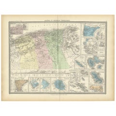
Antique Map of Algeria and the French Colonies, 1875
Located in Langweer, NL
Antique map titled 'Algérie et Colonies Francaises'. Large map of Algeria and the French Colonies
Category

Late 19th Century Algeria Antique Map

Materials

Paper

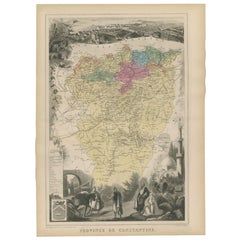
Antique Map of the Province of Constantine, Algeria by Migeon, 1880
Located in Langweer, NL
Antique map titled 'Province de Constantine'. Old map of the province of Constantine, Algeria. The
Category

19th Century Algeria Antique Map

Materials

Paper

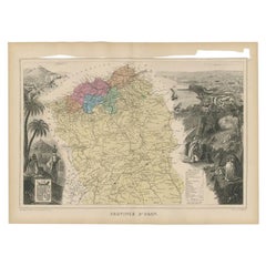
Antique Map of the Province of Oran Algeria by Migeon, 1880
Located in Langweer, NL
Antique map titled 'Province d'Oran'. Old map of the province of Oran, Algeria. The Department of
Category

19th Century Algeria Antique Map

Materials

Paper

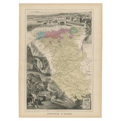
Antique Map of the Province of Alger Algeria by Migeon, 1880
Located in Langweer, NL
Antique map titled 'Province de Constantine'. Old map of the province of Alger, Algeria. This map
Category

19th Century Algeria Antique Map

Materials

Paper

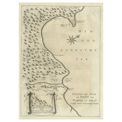
Old Dutch Map of the City of Oran 'Warran', Algeria, 1773
Located in Langweer, NL
Antique print titled 'Ligging der Stad en Haven van Warran of Oran'. Old map of the city of
Category

1770s Algeria Antique Map

Materials

Paper

Copper-Engraved Map Showing the Algerian Coast of North Africa, Published 1683
Located in Langweer, NL
Antique map titled 'Partie de Barbarie, ou est le Royaume d'Alger (..)'. Copper-engraved map
Category

1680s Algeria Antique Map

Materials

Paper

Old Map of North Africa Depicting Libya, Morocco, Algeria, Tunis Etc, 1922
Located in Langweer, NL
, Morocco, Algeria, Tunis and surroundings. This map originates from 'The Times' atlas. Artists and
Category

1920s Algeria Antique Map

Materials

Paper

Antique Map of the French Colony of Algeria by V. Levasseur, 1854
By Victor Levasseur
Located in Langweer, NL
Antique map titled 'Algérie, Colonie Francaise'. Shows the region divided into the administrative
Category

Mid-19th Century Algeria Antique Map

Materials

Paper

Old Map of the Western Region of the Kingdom of Algiers, Algeria, 1773
Located in Langweer, NL
Antique map titled 'Kaart van het Westelyk Gedeelte van het Ryk van Algiers'. Old map of the
Category

1770s Algeria Antique Map

Materials

Paper

Old Map of the Eastern Region of the Kingdom of Algiers, Algeria, 1773
Located in Langweer, NL
Antique map titled 'Kaart van het Oostelyke Deel van het Ryk van Algiers'. Old map of the
Category

1770s Algeria Antique Map

Materials

Paper

Antique Map of Barbary and Biledulgerid by Sanson, 1705
Located in Langweer, NL
Antique map, titled: 'Gedeelte van Barbaryen (…).' - Decorative hand colored map of a part of
Category

18th Century Algeria Antique Map

Materials

Paper

Large Decorative Antique Map of the Mediterranean, ca.1770
Located in Langweer, NL
Antique map titled 'Carte de la Mer Mediterranee en Douze Feuilles'. First map out of twelve
Category

1770s Algeria Antique Map

Materials

Paper

Antique Map of North Africa by Ortelius, c.1580
Located in Langweer, NL
Antique map titled 'Barbariae et Biledulgerid Nova Descriptio'. Original antique map of North
Category

16th Century Algeria Antique Map

Materials

Paper

Antique Map of North and South Africa by Johnston, 1882
Located in Langweer, NL
Two antique maps on one sheet titled 'N.W. Africa, Marocco, Algeria & Tunis' and 'Southern Africa
Category

19th Century Algeria Antique Map

Materials

Paper

Antique Map of North Africa and South Africa by Black, 1854
Located in Langweer, NL
Morocco, Algeria and South Africa. This map orginates from 'General Atlas Of The World: Containing Upwards
Category

19th Century Algeria Antique Map

Materials

Paper

Antique Engraved Map with Original Hand Colour of French Guiana, 1876
Located in Langweer, NL
The 1876 map of French Guiana from the "Grand Atlas Départemental de la France de L'Algérie et des
Category

Late 19th Century Algeria Antique Map

Materials

Paper

Antique Map of Northern Africa "Barbary Coast" by R. Bonne, circa 1780
Located in Langweer, NL
A fine example of Rigobert Bonne and Guilleme Raynal’s 1780 map of northwestern Africa or the
Category

Late 18th Century Algeria Antique Map

Materials

Paper

"Nova Barbariae Descriptio", a 17th Century Hand-Colored Map of North Africa
By Johannes Janssonius
Located in Alamo, CA
This original attractive 17th century hand-colored map of North Africa entitled "Nova Barbariae
Category

Mid-17th Century Dutch Algeria Antique Map

Materials

Paper

West Africa Entitled "Guinea Propria": An 18th Century Hand Colored Homann Map
By Johann Baptist Homann
Located in Alamo, CA
This is a scarce richly hand colored copper plate engraved map of Africa entitled "Guinea Propria
Category

Mid-18th Century German Algeria Antique Map

Materials

Paper

Antique Map of North-Western and South Africa by A.K. Johnston, 1865
Located in Langweer, NL
, Algeria, Tunis, Cape Colony, Natal and more. This map originates from the ‘Royal Atlas of Modern Geography
Category

Mid-19th Century Algeria Antique Map

Materials

Paper

Antique Map of the City of Algiers and Surroundings in Northern Africa, 1773
Located in Langweer, NL
Antique print titled 'Plan van de Stad Algiers'. Old map of Algiers, also depicting surrounding
Category

18th Century Algeria Antique Map

Materials

Paper

Authentique Map by Pilon of The French Colonies in The West Indies, 1876
Located in Langweer, NL
comprehensive collection of maps detailing the territories under French governance, including Algeria and the
Category

Late 19th Century Algeria Antique Map

Materials

Paper

Detailed Original Old Map of the Southern Region of the Kingdom of Algiers 1773
Located in Langweer, NL
Antique map titled 'Kaart van het Zuidelyk Gedeelte van het Ryk Algiers'. Old map of the
Category

18th Century Algeria Antique Map

Materials

Paper

Rare Antique Map of Southwestern Europe and West Africa by V.M. Coronelli, 1692
By Vincenzo Coronelli
Located in Langweer, NL
running from Algeria down to the Bight of Benin, as well as the Canary Islands and Madeira. One of the
Category

Late 17th Century Algeria Antique Map

Materials

Paper

North African Coasts: Marmarica to Mauretania in Roman Times, Published in 1880
Located in Langweer, NL
to parts of modern-day Libya, Tunisia, Algeria, and Morocco. Notable Features of the Map: 1
Category

1880s Algeria Antique Map

Materials

Paper

Original Antique Engraving of Algiers in Algeria, 1773
Located in Langweer, NL
Antique print titled 'Algiers'. Old print with a view of Algiers, Algeria. With Dutch legend
Category

18th Century Algeria Antique Map

Materials

Paper

Antique Print of a Young Moor, Jean Maure, Algeria, 1850
Located in Langweer, NL
27.9 cm. Image size: 13.6 x 21.8 cm. We sell original antique maps to collectors, historians
Category

19th Century Algeria Antique Map

Materials

Paper

West Africa: 18th Century Hand-colored Homann Map Entitled "Guinea Propria"
By Johann Baptist Homann
Located in Alamo, CA
This is a scarce richly hand colored copper plate engraved map of Africa entitled "Guinea Propria
Category

1740s Other Art Style Algeria Antique Map

Materials

Engraving

Mediterranean and Adriatic Seas: Original 18th Century Hand-colored Map by Bowen
Located in Alamo, CA
This is an original 18th century hand-colored map entitled "An Accurate Chart of The Mediterranean
Category

Mid-18th Century Old Masters Algeria Antique Map

Materials

Engraving

Antique Print of Gate of the City of Algiers with Person Hanging on Hook, 1670
Located in Langweer, NL
Antique print Algeria titled 'Tot Argier in Barbarye'. This print depicts a gate of the city of
Category

17th Century Algeria Antique Map

Materials

Paper

In the Bazaar II
By Charles Théodore Frère
Located in New York, NY
enamored with the “Eastern” world following his trip to Algeria and began to exclusively paint its
Category

19th Century Academic Algeria Antique Map

Materials

Oil

Ptolemaic map of NW Africa, Morocco and Algeria by Mercator - Engraving - 17th c
By Gerard Mercator
Located in Zeeland, Noord-Brabant
map covering ancient northwestern Africa, including present day Morocco and Algeria. The interior
Category

1690s Old Masters Algeria Antique Map

Materials

Engraving

The Sea Coast of Barbary from Cape de Tenes to Cape de Rosa.
By James Bennett
Located in Zeeland, Noord-Brabant
Sea and coast chart of Algeria, from ca. Tipaza and Algiers to Annaba and El Kala. In the top right
Category

Early 18th Century Algeria Antique Map

Materials

Engraving

View of Annaba 'Bone' in the Northeastern Corner of Algeria, Near Tunisia, c1630
Located in Langweer, NL
Deceit'). A map of Bone in Tunisia. It shows a merchant with three laden horses in the foreground and
Category

1630s Algeria Antique Map

Materials

Paper

Important giant Map of Africa, for the King of France, 1698
By Nicolas de Fer
Located in Amsterdam, NL
copperplates, later hand colouring, 109.5 x 163 cm (Find our Giant map of Africa by the same artist in our
Category

Late 17th Century Old Masters Algeria Antique Map

Materials

Watercolor, Engraving

Antique Map of Morocco, Algeria and Tunisia by W. G. Blackie, 1859
Located in Langweer, NL
Antique map titled 'Morocco, Algeria and Tunis'. Original antique map of Morocco, Algeria and
Category

Mid-19th Century Algeria Antique Map

Materials

Paper

Antique Map of Africa by V. Levasseur, 1854
By Victor Levasseur
Located in Langweer, NL
Antique map titled 'Afrique'. Shows the entire continent according to perceptions of the time. Much
Category

Mid-19th Century Algeria Antique Map

Materials

Paper

Antique Map of Africa by V. Levasseur, 1854
H 13.98 in W 20.67 in D 0.02 in
Antique Map of North Africa by Ortelius 'circa 1580'
Located in Langweer, NL
Antique map titled 'Africae Propriae Tabula (..)'. Interesting Ortelius map of North Africa and the
Category

16th Century Algeria Antique Map

Materials

Paper

Antique Map of the North Atlantic Ocean by A.K. Johnston, 1865
Located in Langweer, NL
Antilles, South America, England, Ireland, Algeria, Spain, France and more. This map originates from the
Category

Mid-19th Century Algeria Antique Map

Materials

Paper

The Atlantic Ocean, Americas, Africa and Europe: Hand-colored 18th C. Bowen Map
Located in Alamo, CA
This is an original 18th century hand-colored map entitled "A New & Accurate Chart of the The
Category

Mid-18th Century Old Masters Algeria Antique Map

Materials

Engraving

Henri Matisse - The Saint Michel Bridge - Original Etching
By Henri Matisse
Located in Collonge Bellerive, Geneve, CH
on the industrial map, but people still traveled everywhere on foot or horseback. Matisse’s father
Category

1920s Modern Algeria Antique Map

Materials

Etching

After Henri Matisse - Blue Nude
By (after) Henri Matisse
Located in Collonge Bellerive, Geneve, CH
times. The coming of the railway had put Bohain on the industrial map, but people still traveled
Category

1920s Abstract Impressionist Algeria Antique Map

Materials

Lithograph

Vegetables
By (after) Henri Matisse
Located in Collonge Bellerive, Geneve, CH
on the industrial map, but people still traveled everywhere on foot or horseback. Matisse’s father
Category

1920s Modern Algeria Antique Map

Materials

Lithograph

Vegetables
Vegetables
H 31.5 in W 23.63 in D 0.04 in
Antique engraving of "Algeria" by Raimond Bonheur
By Laguillermie and Rainard
Located in Charleston, SC
Raimond Bonheur, and A. M. Perrot The map represents "Algerie, Colonie Francaise' and it is held at
Category

19th Century French Algeria Antique Map

Materials

Glass, Wood

Get Updated with New Arrivals
Save "Algeria Antique Map", and we’ll notify you when there are new listings in this category.

Algeria Antique Map For Sale on 1stDibs

At 1stDibs, there are many versions of the ideal algeria antique map for your home. Frequently made of paper, every algeria antique map was constructed with great care. Your living room may not be complete without a algeria antique map — find older editions for sale from the 18th Century and newer versions made as recently as the 19th Century. You’ll likely find more than one algeria antique map that is appealing in its simplicity, but Victor Levasseur produced versions that are worth a look.

How Much is a Algeria Antique Map?

The average selling price for a algeria antique map at 1stDibs is $264, while they’re typically $113 on the low end and $617 for the highest priced.

Read More

Pamela Shamshiri Shares the Secrets behind Her First-Ever Book and Its Effortlessly Cool Interiors

The sought-after designer worked with the team at Hoffman Creative to produce a monograph that beautifully showcases some of Studio Shamshiri's most inspiring projects.

Moroccan Artworks and Objects Take Center Stage in an Extraordinary Villa in Tangier

Italian writer and collector Umberto Pasti opens the doors to his remarkable cave of wonders in North Africa.

Montecito Has Drawn Royalty and Celebrities, and These Homes Are Proof of Its Allure

Hollywood A-listers, ex-pat aristocrats and art collectors and style setters of all stripes appreciate the allure of the coastal California hamlet — much on our minds after recent winter floods.

Whaam! Blam! Pow! — a New Book on Pop Art Packs a Punch

Publishing house Assouline and writer Julie Belcove have teamed up to trace the history of the genre, from Roy Lichtenstein, Andy Warhol and Yayoi Kusama to Mickalene Thomas and Jeff Koons.

The Sparkling Legacy of Tiffany & Co. Explained, One Jewel at a Time

A gorgeous new book celebrates — and memorializes — the iconic jeweler’s rich heritage.

What Makes a Gem-Encrusted Chess Set Worth $4 Million?

The world’s most opulent chess set, weighing in at 513 carats, is literally fit for a king and queen.

Tauba Auerbach’s Geometric Pop-Up Book Is Mighty Rare, Thanks to a Hurricane

This sculptural art book has an epic backstory of its own.

Step inside the Storied Mansions of Palm Beach’s Most Effervescent Architect

From Spanish-style courtyards to fanciful fountains, these acclaimed structures abound in surprising and elegant details.