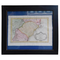
Items Similar to Antique Engraved Map with Original Hand Colour of French Guiana, 1876


Want more images or videos?
Request additional images or videos from the seller
1 of 6
Antique Engraved Map with Original Hand Colour of French Guiana, 1876
About the Item
The 1876 map of French Guiana from the "Grand Atlas Départemental de la France de L'Algérie et des colonies" by H. Fisquet, published by A. Le Vasseur in Paris, is a significant piece in cartography.
**Title:** Map of French Guiana
**Artist/Cartographer/Engraver:** Librairie Abel Pilon & Cie; A. Le Vasseur
**Provenance:** "Grand Atlas Départemental de la France de L'Algérie et des colonies" by H. Fisquet; Published by A. Le Vasseur, Paris [Grand atlas départemental]
**Type:** Antique engraved map with original hand color
The map showcases French Guiana, a region known for its rich biodiversity and unique cultural heritage. It is an engraved piece, highlighting meticulous details and featuring original hand coloring, reflecting the artistry and precision of cartographers during the late 19th century.
Through delicate strokes and intricate lines, the map delineates the geography of French Guiana, encompassing its rivers, coastal boundaries, topographical features, and settlements. The original hand coloring enhances the visual appeal and provides distinction between various geographical elements, possibly differentiating forests, rivers, administrative boundaries, and settlements.
The "Grand Atlas Départemental" context suggests that this map was part of a larger atlas aiming to comprehensively cover the various regions and territories under French governance, including colonies like French Guiana and Algeria. This atlas aimed to provide detailed geographical, administrative, and possibly cultural information about these regions.
French Guiana, being an overseas department of France, holds historical significance due to its colonial past, vibrant cultural amalgamation, and unique ecosystem. Maps like this from the late 19th century serve as valuable historical artifacts, offering insights into the territorial representation, cartographic techniques, and the cultural and geopolitical context of that era.
The intricate details and the use of original hand coloring make this map not only a cartographic representation but also a piece of art, reflecting the craftsmanship and expertise of the engravers and cartographers involved in its creation.
VERSO: There is nothing printed on the reverse side, which is plain
AUTHENTICITY: This is an authentic historic print, published at the date stated above. I do not offer reproductions. It is not a modern copy. The term 'original' when applied to a print means that it was printed at the first or original date of publication; it does not imply that the item is unique. 'Print' means any image created by applying an inked block to paper or card under pressure by any method including wood engraving, steel engraving, copperplate, wood cut and lithography.
- Dimensions:Height: 14.38 in (36.5 cm)Width: 16.34 in (41.5 cm)Depth: 0 in (0.02 mm)
- Materials and Techniques:Paper,Engraved
- Period:
- Date of Manufacture:1876
- Condition:Good; suitable for framing. Some light spotting.This map was coloured by hand at the time of publication. Virtually all antiquarian maps and prints are subject to some normal aging due to use and time which is not obtrusive unless otherwise stated.
- Seller Location:Langweer, NL
- Reference Number:
About the Seller
5.0
Platinum Seller
These expertly vetted sellers are 1stDibs' most experienced sellers and are rated highest by our customers.
Established in 2009
1stDibs seller since 2017
1,922 sales on 1stDibs
Typical response time: <1 hour
- ShippingRetrieving quote...Ships From: Langweer, Netherlands
- Return PolicyA return for this item may be initiated within 14 days of delivery.
More From This SellerView All
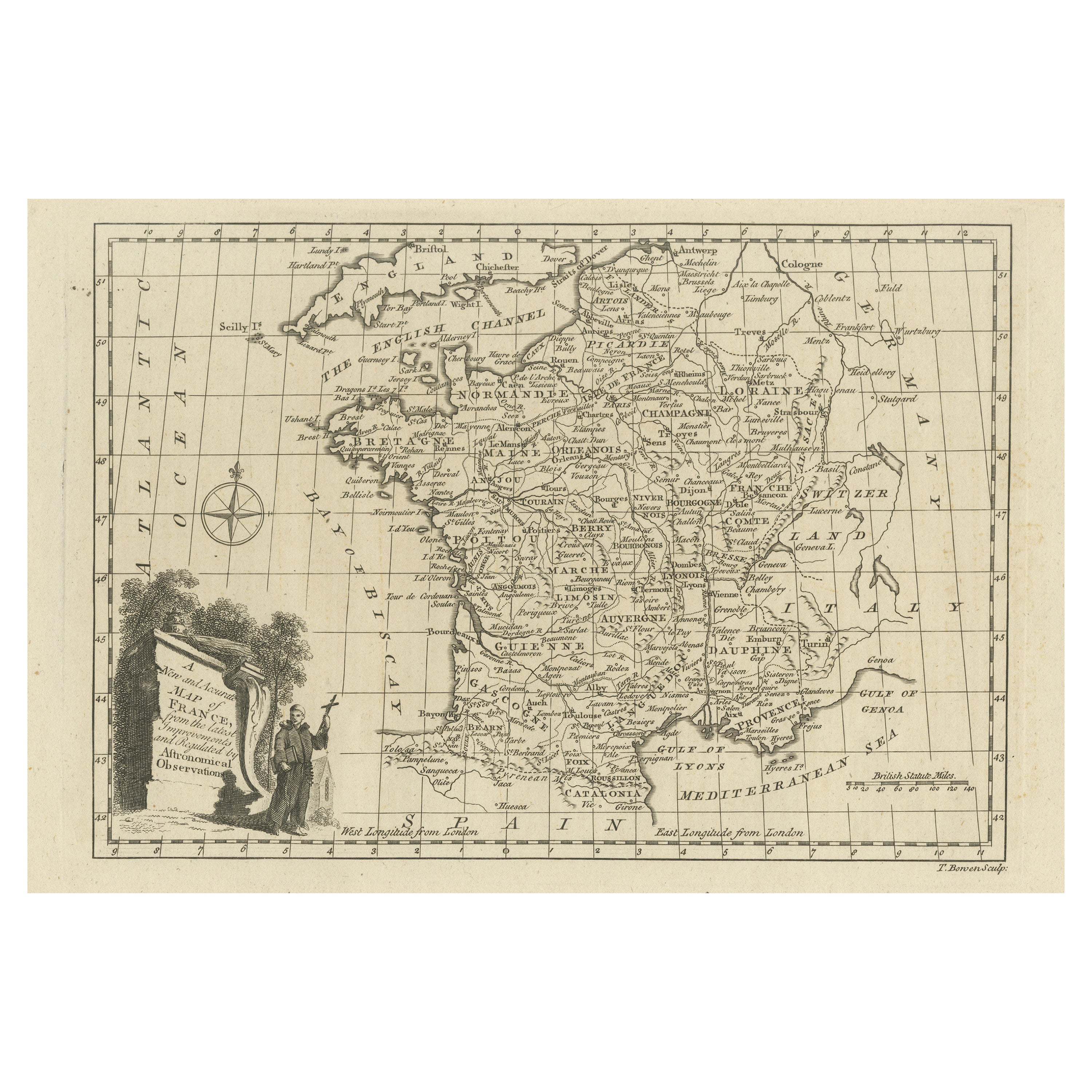
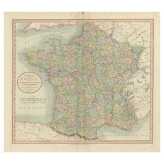
- Original Copper Engraved Map of FranceLocated in Langweer, NLAntique map titled 'New and Accurate Map of France from the latest improvements'. Original copper engraved map of France. Engraved by T. Bowen, published circa 1771.Category
Antique Late 18th Century Maps
MaterialsPaper
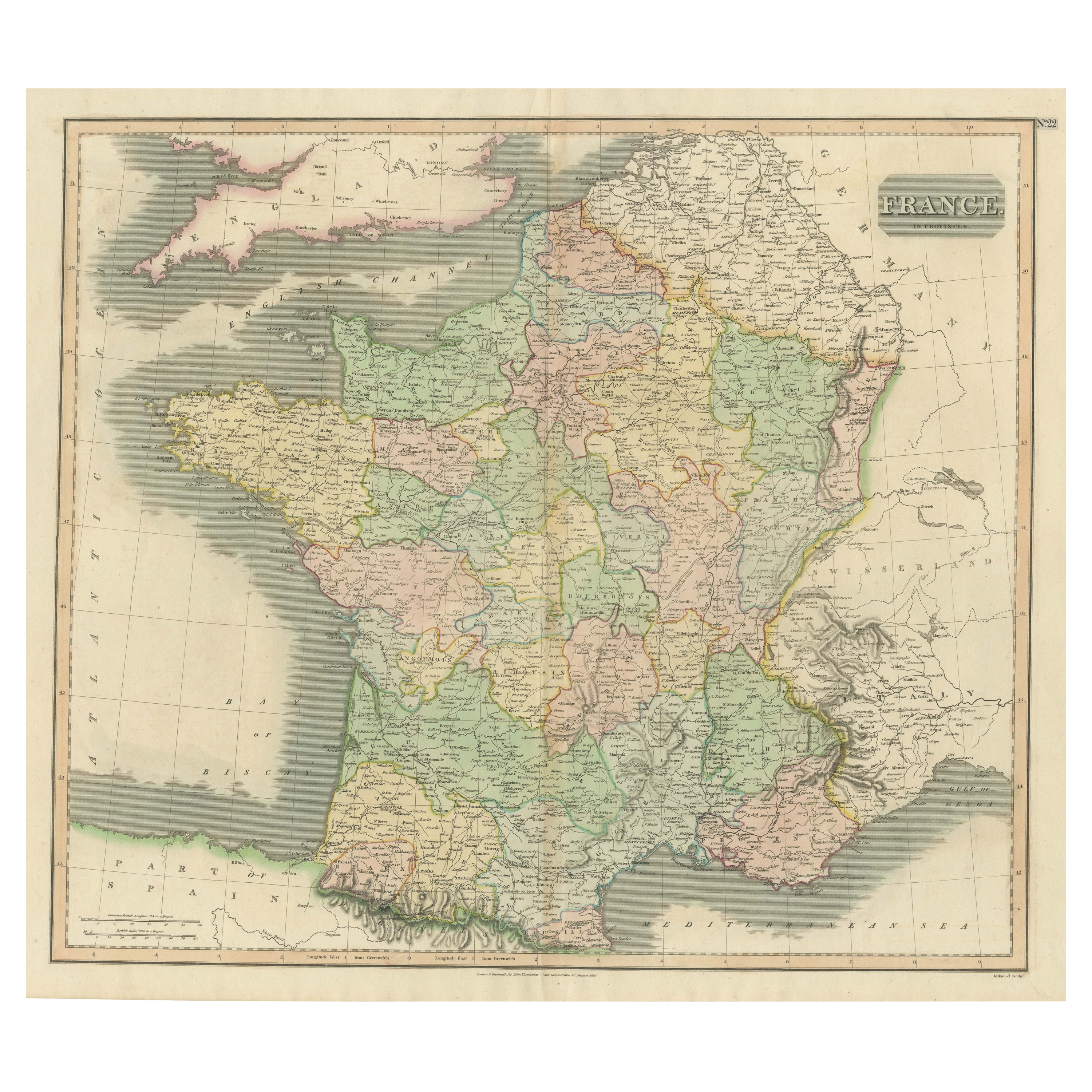
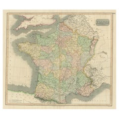
- Large Antique Map of France with Original Hand ColoringLocated in Langweer, NLAntique map titled 'France in Provinces'. Beautiful antique map of France. Drawn and engraved for John Thomson's 'New General Atlas' published circa 1814.Category
Antique Early 19th Century Maps
MaterialsPaper
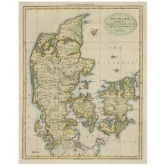
- Antique Hand-Colored Engraved Map of Denmark, 1790Located in Langweer, NLPublished by Russell (J. C.). Denmark. Divided into Dioceses and Prefectures compiled from the best Authorities, 1790, hand-coloured engraved map on handmade paper with watermark. 41...Category
Antique 1790s Maps
MaterialsPaper
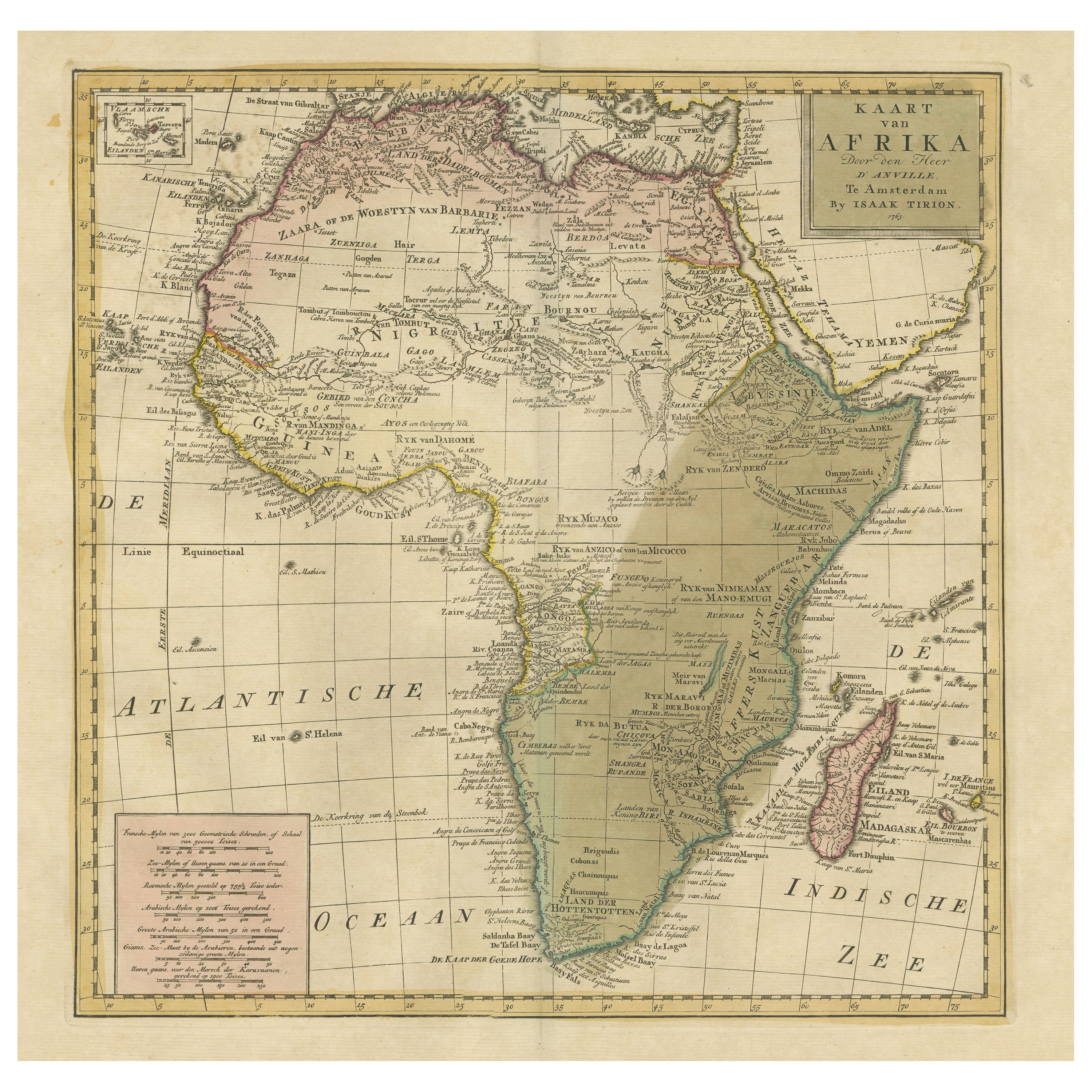
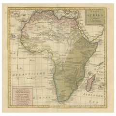
- Antique Map of Africa with Original Hand ColoringLocated in Langweer, NLAntique map titled 'Kaart van Afrika door den Heer d'Anville'. Detailed original old map of Africa, with very small inset map titled 'Vlaamsche Eilanden', which shows the Azores. Pub...Category
Antique Mid-18th Century Maps
MaterialsPaper
- Original Antique Map of England with Hand ColoringLocated in Langweer, NLAntique map titled 'Engand'. Original old map of England. Engraved by W. Milton. Published by John Mc. Gowan, circa 1829.Category
Antique Mid-19th Century Maps
MaterialsPaper
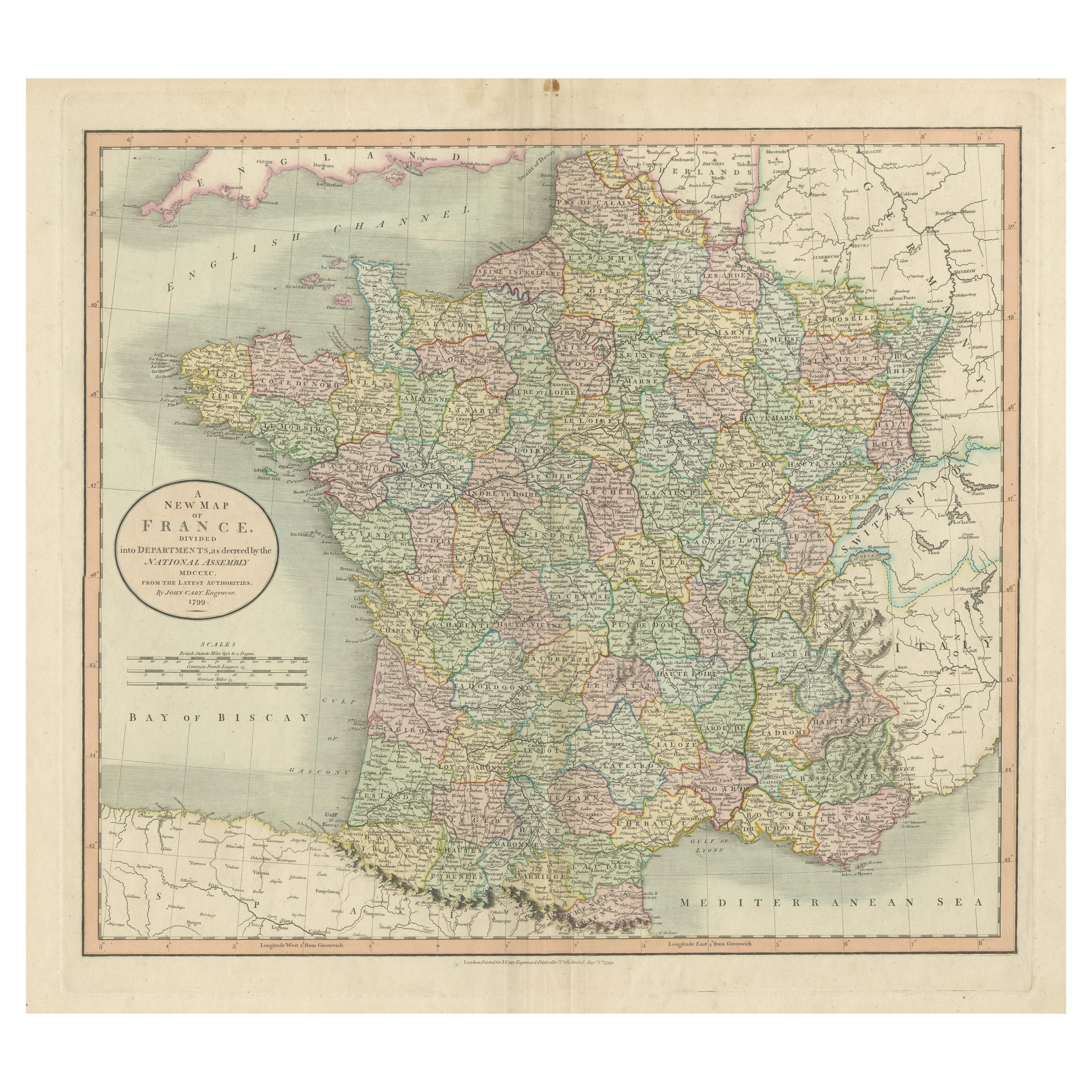
- Antique Map of France Divided into Departments, with Original Hand ColoringLocated in Langweer, NLAntique map titled 'A New Map of France (..)'. Original old map of France, divided into departments. With original/contemporary hand coloring. Published by John Cary, 1799. John Cary was an important and prolific London map seller...Category
Antique Late 18th Century Maps
MaterialsPaper


You May Also Like
- Beautiful Colour French Antique 1856 Hand Watercolour Map of Dept Des La CorseLocated in GBWe are delighted to offer for sale this stunning 1856 hand watercolour map of the Austrian Alps titled Dept Des La Course taken from the Atlas National ...Category
Antique 1850s French Early Victorian Maps
MaterialsPaper
- Original Antique Map of Switzerland, Engraved By Barlow, Dated 1807Located in St Annes, LancashireGreat map of Switzerland Copper-plate engraving by Barlow Published by Brightly & Kinnersly, Bungay, Suffolk. Dated 1807 Unframed.Category
Antique Early 1800s English Maps
MaterialsPaper
- Original Antique Map of France, Arrowsmith, 1820Located in St Annes, LancashireGreat map of France Drawn under the direction of Arrowsmith. Copper-plate engraving. Published by Longman, Hurst, Rees, Orme and Brown, 1820 Unframed.Category
Antique 1820s English Maps
MaterialsPaper
- Original Antique Map of The Netherlands, Engraved by Barlow, Dated 1807Located in St Annes, LancashireGreat map of Netherlands Copper-plate engraving by Barlow Published by Brightly & Kinnersly, Bungay, Suffolk. Dated 1807 Unframed.Category
Antique Early 1800s English Maps
MaterialsPaper
- Original Antique Map of Spain and Portugal, Engraved By Barlow, 1806Located in St Annes, LancashireGreat map of Spain And Portugal Copper-plate engraving by Barlow Published by Brightly & Kinnersly, Bungay, Suffolk. 1806 Unframed.Category
Antique Early 1800s English Maps
MaterialsPaper
- French Framed Copper Engraved Hand Colored Map of Carolina & Georgia, Circa 1757Located in Hollywood, SCFrench copper engraved hand colored map of Carolina & Georgia matted under glass with a painted frame, mid-18th centuryCategory
Antique 1750s French Louis XV Maps
MaterialsGlass, Wood, Paint, Paper