Items Similar to Antique Map of Africa with Original Hand Coloring


Want more images or videos?
Request additional images or videos from the seller
1 of 6
Antique Map of Africa with Original Hand Coloring
About the Item
Antique map titled 'Kaart van Afrika door den Heer d'Anville'. Detailed original old map of Africa, with very small inset map titled 'Vlaamsche Eilanden', which shows the Azores. Published by I. Tirion, circa 1760.
Tirion was born in Utrecht in 1705. He moved to Amsterdam in 1725 and set up shop on Damrak as a book publisher. Tirion quick rose in prominence by publishing pamphlets, historical works, and, most importantly, maps and atlases. He eventually relocated his printing house to the prestigious Kalverstraat. In his long career he produced eight atlases in multiple editions, some of which were published posthumously until about 1784. Most of his cartographic work is based on the earlier maps of Guillaume de L'Isle.
- Dimensions:Height: 16.89 in (42.9 cm)Width: 20.75 in (52.7 cm)Depth: 0.02 in (0.5 mm)
- Materials and Techniques:
- Period:
- Date of Manufacture:c.1760
- Condition:Original/contemporary hand coloring. Original folding line. Age-related toning. Minor wear, blank verso. Please study image carefully.
- Seller Location:Langweer, NL
- Reference Number:
About the Seller
5.0
Platinum Seller
These expertly vetted sellers are 1stDibs' most experienced sellers and are rated highest by our customers.
Established in 2009
1stDibs seller since 2017
1,922 sales on 1stDibs
Typical response time: <1 hour
- ShippingRetrieving quote...Ships From: Langweer, Netherlands
- Return PolicyA return for this item may be initiated within 14 days of delivery.
More From This SellerView All
- Original Antique Map of England with Hand ColoringLocated in Langweer, NLAntique map titled 'Engand'. Original old map of England. Engraved by W. Milton. Published by John Mc. Gowan, circa 1829.Category
Antique Mid-19th Century Maps
MaterialsPaper
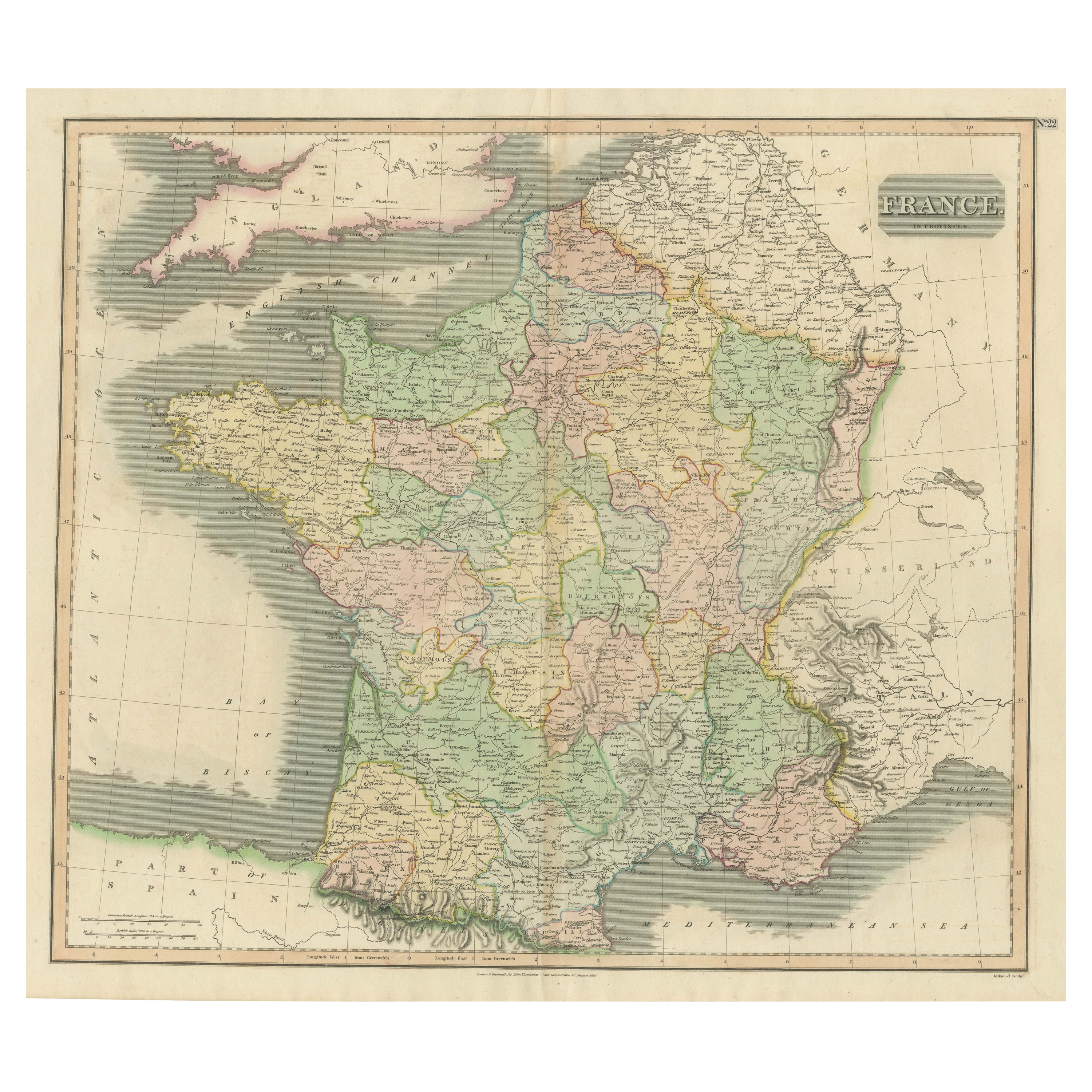
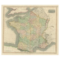
- Large Antique Map of France with Original Hand ColoringLocated in Langweer, NLAntique map titled 'France in Provinces'. Beautiful antique map of France. Drawn and engraved for John Thomson's 'New General Atlas' published circa 1814.Category
Antique Early 19th Century Maps
MaterialsPaper
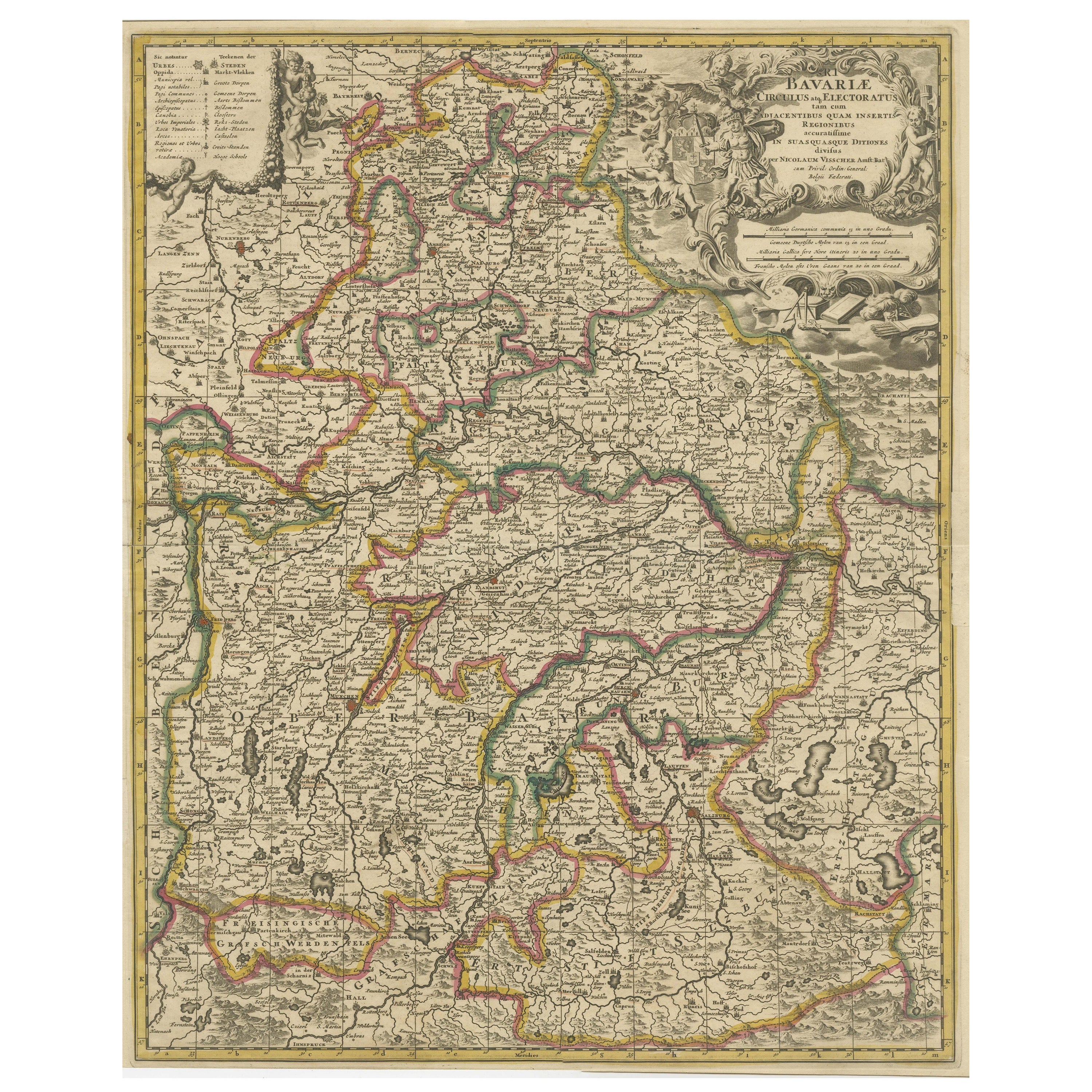
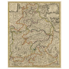
- Antique Map of Bavaria, Bayern, with original Hand ColoringLocated in Langweer, NLAntique map titled 'Bavariae Circulus atq Electoratus tam cum Adiacentibus quam insertis Regionibus'. Original old map of Bavaria, Bayern, Germany. The map stretches south to Innsbru...Category
Antique Late 17th Century Maps
MaterialsPaper
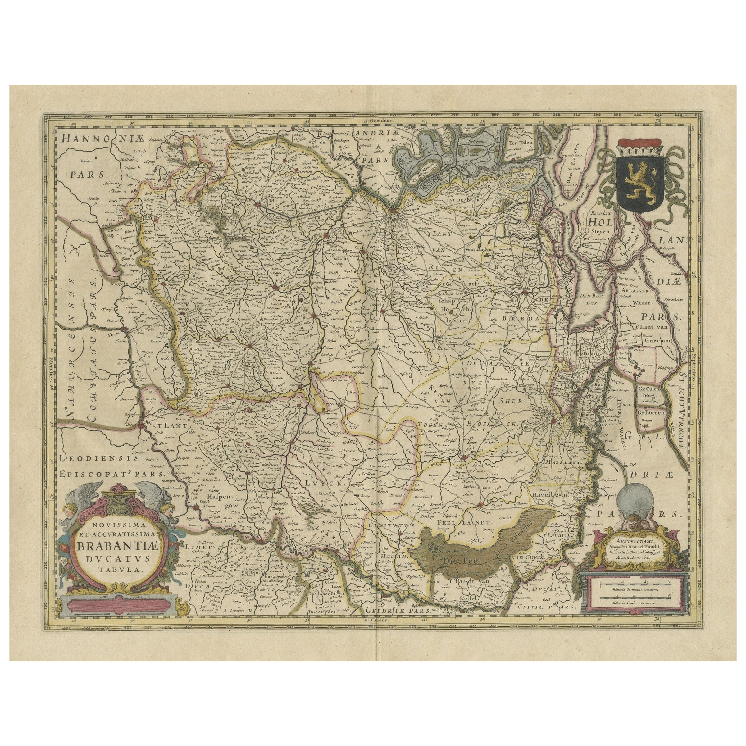
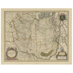
- Antique Map of Brabant, the Netherlands, with Original Hand ColoringLocated in Langweer, NLOriginal antique map titled 'Novissima et Accuratissima Brabantiae Ducatus Tabula'. Old map of Brabant, the Netherlands. North is to the right. Like all other maps of Brabantiae Duca...Category
Antique Mid-17th Century Maps
MaterialsPaper
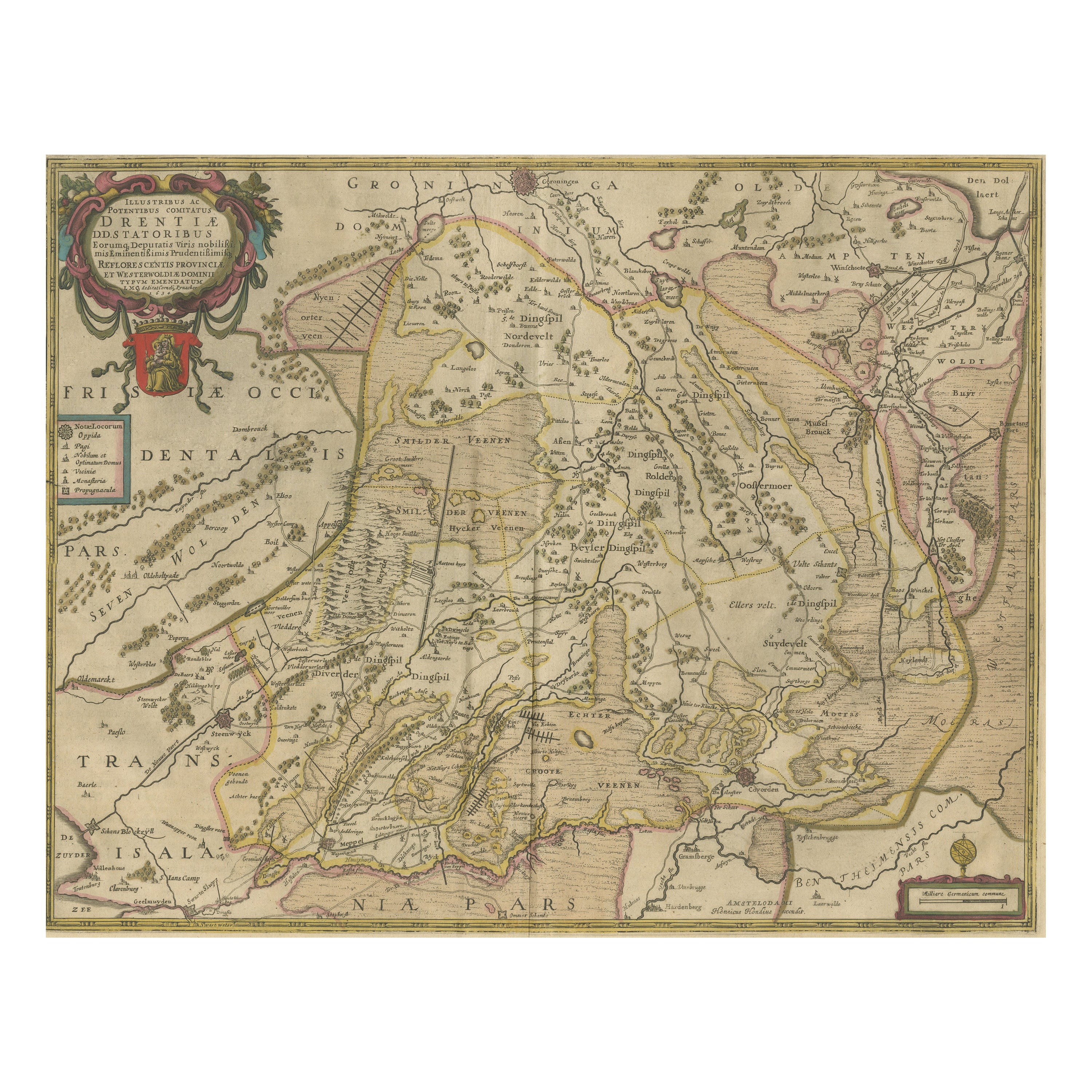
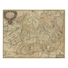
- Antique Map of Drenthe, the Netherlands, with Original Hand ColoringLocated in Langweer, NLOriginal antique map titled 'Illustribus ac Potentibus Comitatus Drentiae (..)'. Old map of the province of Drenthe, the Netherlands. Published by H. Hondius circa 1639. Hendrik ...Category
Antique Mid-17th Century Maps
MaterialsPaper
- Original Antique Map of England with Outline ColoringLocated in Langweer, NLAntique map titled 'Angleterre'. Original old map of England with outline coloring. Source unknown, to be determined. Published circa 1830.Category
Antique Mid-19th Century Maps
MaterialsPaper


You May Also Like
- Original Antique Map of South Africa, Arrowsmith, 1820Located in St Annes, LancashireGreat map of South Africa. Drawn under the direction of Arrowsmith. Copper-plate engraving. Published by Longman, Hurst, Rees, Orme and Br...Category
Antique 1820s English Maps
MaterialsPaper
- Large Original Vintage Map of South Africa, circa 1920Located in St Annes, LancashireGreat map of South Africa Original color. Good condition / repair to a minor edge tear middle bottom Published by Alexander Gross Unframed. ...Category
Vintage 1920s English Edwardian Maps
MaterialsPaper
- Original Antique Map of Italy. C.1780Located in St Annes, LancashireGreat map of Italy Copper-plate engraving Published C.1780 Unframed.Category
Antique Early 1800s English Georgian Maps
MaterialsPaper

- Original Antique Map of Asia. C.1780Located in St Annes, LancashireGreat map of Asia Copper-plate engraving Published C.1780 Two small worm holes to right side of map Unframed.Category
Antique Early 1800s English Georgian Maps
MaterialsPaper

- Original Antique Map of India. C.1780Located in St Annes, LancashireGreat map of India Copper-plate engraving Published C.1780 Three small worm holes to right side of map and one bottom left corner Unframed.Category
Antique Early 1800s English Georgian Maps
MaterialsPaper

- Original Antique Map of Indonesia, 1861Located in St Annes, LancashireGreat map of Indonesia Drawn and engraved by Edward Weller Original color Published in The Weekly Dispatch Atlas, 1861 Repairs to minor e...Category
Antique 1860s English Victorian Maps
MaterialsPaper


Recently Viewed
View AllMore Ways To Browse
Old Chinese Map
Map Of Louisiana
Papua New Guinea Antique Map
Map Of The Bahamas
Antique Map Tuscany
Antique Maps Surrey
Richmond Map
Charlotte Reine
Republic Of Texas Map
Antique Map Bahamas
Antique Maps Of Puerto Rico
Cheshire Antique Map
Map Of Washington Dc
Washington Dc Map
Antique Map Of New Hampshire
Auge En Pierre
Buenos Ayres
Map Lebanon