Antique Map Tuscany
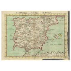
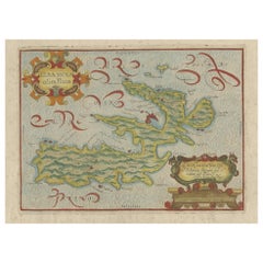
Antique Map of Spain including the Balearic Islands
Located in Langweer, NL
Antique map titled 'Hispania Nova Tabula'. Ruscelli's map of Spain, including the Balearic Islands
Category
16th Century Antique Map Tuscany
Materials
Paper
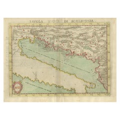
Antique Map of the Balkans with Coat of Arms
Located in Langweer, NL
Antique map titled 'Tavola Nuova di Schiavonia'. Ruscelli's map of the Balkans, with a coat of arms
Category
16th Century Antique Map Tuscany
Materials
Paper
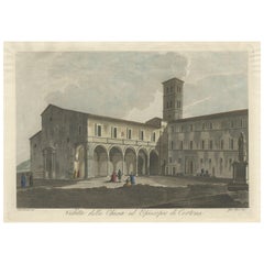
View of the Church of Cortona, a Town and Comune Arezzo, in Tuscany, Italy, 1800
Located in Langweer, NL
Cortona, a town and comune in the province of Arezzo, in Tuscany, Italy. Source unknown, to be determined
Category
Early 1800s Antique Map Tuscany
Materials
Paper
H 12.41 in W 17.33 in D 0 in
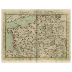
Antique Map of France, based on the work of Ptolemy
Located in Langweer, NL
Antique map titled 'Gallia Nova Tabula'. Ruscelli's map of France. This map originates from
Category
16th Century Antique Map Tuscany
Materials
Paper
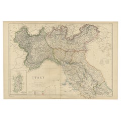
Antique Map of Italy, North Part, by W. G. Blackie, 1859
Located in Langweer, NL
The "Antique Map of Italy, North Part" by W. G. Blackie, dated 1859, is a historically significant
Category
Mid-19th Century Antique Map Tuscany
Materials
Paper
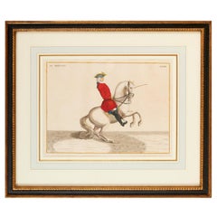
Baron Rais d'Eisenberg, Hand-Colored Equestrian Engraving c. 1747, "Le Brillant"
By Eisenberg
Located in Morristown, NJ
back in Germany before 1753. He probably died in Tuscany where he was Director and Master of the Horse
Category
1740s German Rococo Antique Map Tuscany
Materials
Plexiglass, Wood, Paint, Paper
H 16.5 in W 19.25 in D 0.5 in
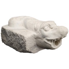
Italian Ancient Marble Sculpture Fountain, Late 16th Century
Located in Milano, IT
element linked to water (on this theme see: Chet Van Duzer, Sea Monsters on Medieval and Renaissance Maps
Category
16th Century Italian Renaissance Antique Map Tuscany
Materials
Carrara Marble
People Also Browsed
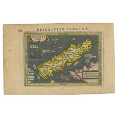
1616 Bertius Map of Sumatra, Singapore and the Straits of Malacca
Located in Langweer, NL
Title: "1616 Bertius Map of Sumatra and the Straits of Malacca"
Description: This is an exquisite 1616 original antique map by Petrus Bertius, titled "Sumatra Insula," showcasing Su...
Category
Early 17th Century Antique Map Tuscany
Materials
Paper
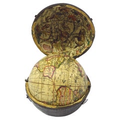
Wonderful and extremely rare Dutch pocketglobe
By Dementz Family DEUR Art Company
Located in ZWIJNDRECHT, NL
Only three copies worldwide.
Miniature terrestrial pocket globe in a celestial case made by Johannes Deur.
Amsterdam, 1720.
Diameter of 2,5 inches / 6 cm. 2 legends are inscribed a...
Category
Early 18th Century Dutch Dutch Colonial Antique Map Tuscany
Materials
Hardwood, Paper
Ancient Cartography of Britannia and Hibernia, Published in 1880
Located in Langweer, NL
This map depicts the geographical area of Great Britain and Ireland, labeled "BRITANNIA et HIBERNIA." It is a historical map, as indicated by the Latin titles and the classical names...
Category
1880s Antique Map Tuscany
Materials
Paper
Free Shipping
H 18.51 in W 15.56 in D 0 in
A Rare ‘Adelie’ Penguin Egg from the Australian 1911-14 Expedition
Located in London, GB
A Rare ‘Adelie’ Penguin Egg from the Australian 1911-14 Expedition
Egg, paper, wood
Adelie Land, Antarctic
Early 20th Century
Size: 7cm high, 5.5cm dia. (max) - 2¾ ins high, 2¼ ...
Category
Early 20th Century Antarctican Antique Map Tuscany
Materials
Eggshell
19th Century Low Pine Chest of Drawers in Early Blue Paint
Located in Nantucket, MA
19th century low chest of (two) drawers with turned wooden knobs. Constructed from pine in original/early bright blue paint, both upper and lower drawers feature original tills. Ci...
Category
Late 19th Century Canadian Antique Map Tuscany
Materials
Pine, Paint
Antique Map of Nova Zembla 'Russia' by J.N. Bellin, 1757
Located in Langweer, NL
Decorative map of Nova Zembla and environs in the Arctic Sea. Includes a large decorative title cartouche. One of the maps produced by Jacques-Nicolas Bellin for Prevost d'Exiles inf...
Category
Mid-18th Century Antique Map Tuscany
Materials
Paper
Harmonious Mischief: A Triptych of Baroque Putti, circa 1620
Located in Langweer, NL
These images are rare but fine examples of original 17th-century European engravings, displaying characteristics that might point to an Italian origin based on stylistic analysis. Th...
Category
1620s Antique Map Tuscany
Materials
Paper
Early 19th Century Flame Birch Chest of Drawers
Located in Nantucket, MA
Early 19th century Flame Birch chest of drawers. With original stain and lovely grain, four graduated drawers with beaded drawer fronts and turned knob pulls, on ogee bracket feet. ...
Category
Early 19th Century Canadian Antique Map Tuscany
Materials
Birch
Whimsical Archers: Duo of Baroque Putti, circa 1620
Located in Langweer, NL
These images are rare but fine examples of original 17th-century European engravings, displaying characteristics that might point to an Italian origin based on stylistic analysis. Th...
Category
1620s Antique Map Tuscany
Materials
Paper
Antique Map of the Strait Between Nova Zembla and the Mainland of Russia
Located in Langweer, NL
Antique map titled 'Carte du Detroit de Waeigats ou de Nassau'. Detailed regional map of the Strait of Waeigats in the Arctic Sea. Includes a decorative title cartouche. One of the m...
Category
Mid-18th Century Antique Map Tuscany
Materials
Paper
H 14.85 in W 18.98 in D 0.2 in
Cherubic Mischief: A Rare Baroque Collection, circa 1620
Located in Langweer, NL
These original antique engravings are characteristic examples of 17th-century European art, possibly Italian, given some of the stylistic choices and the text. The images show putti,...
Category
1620s Antique Map Tuscany
Materials
Paper
Baroque Whimsy: The Putti Engravings of F.L.D. Ciartres, circa 1620
Located in Langweer, NL
These images are rare but fine examples of original 17th-century European engravings, displaying characteristics that might point to an Italian origin based on stylistic analysis. Th...
Category
1620s Antique Map Tuscany
Materials
Paper
Free Shipping
H 7.88 in W 5.79 in D 0 in
A huge pair of 21 inches Cruchley Library Globes
By G.F. Cruchley
Located in ZWIJNDRECHT, NL
G.F. Cruchley (UK, 1796-1880)
London ca 1850
A magnificent pair of terrestrial and celestial globes. Equatorial table engraved with the signs of the zodiac and resting on 3 mahogany...
Category
1850s British Victorian Antique Map Tuscany
Materials
Other
XIX Century Newfoundland Labrador Sculpture (Devezas Ceramics)
Located in Lisboa, PT
The Newfoundland Labrador dog, commonly referred to as the Newfoundland or Newfie, is a large and strong breed known for its gentle and sweet nature. It originated from the Canadian ...
Category
Mid-19th Century Portuguese Antique Map Tuscany
Materials
Porcelain
Original Antique Map of Brasil, Published in the 16th Century, 1561
Located in Langweer, NL
This important Ruscelli map of Brazil, from his work La Geografia di Claudio Tolomeo Alessandrino, is one of the earliest obtainable modern maps of the region. Despite the paucity of...
Category
1660s Antique Map Tuscany
Materials
Paper
No Reserve
H 8.67 in W 11.82 in D 0 in
Antique Print of the Sea Voyage to Nova Zembla, Russia, circa 1730
Located in Langweer, NL
Antique print of the Dutch crew killing a walrus with ships in the background. This print originates from 'Histoire des Provinces-Unies des Pays Bas...', or 'Geschiedenissen der Vere...
Category
Mid-18th Century Antique Map Tuscany
Materials
Paper
Recent Sales
Antique Map of Elba in Tuscany, Italy, Site of Napoleon's First Exile, c.1620
Located in Langweer, NL
Antique map titled 'Elba Isola olim Ilua'. Old map of Elba, a Mediterranean island in Tuscany
Category
17th Century Antique Map Tuscany
Materials
Paper
H 10.83 in W 15.75 in D 0 in
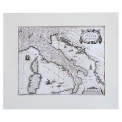
17th Century Geographical Map of Italy
By Matthäus Merian the Elder
Located in Roma, IT
This beautifully detailed geographical map of Italy was printed in 1640. It was made by the expert
Category
Mid-17th Century Italian Antique Map Tuscany
Materials
Parchment Paper
Giorgio Berti (1794-1863) 19th Century Portrait of a Boy with Long Bow
Located in London, GB
of Benvenuti portraits such as ‘Maria Teresa of Austria and Tuscany’, 1817 or ‘Elisa Bonaparte and
Category
19th Century Other Art Style Antique Map Tuscany
Materials
Canvas, Oil
H 35 in W 28.5 in D 2 in
Antique Map of the Duchy of Tuscany by Keizer & de Lat, 1788
Located in Langweer, NL
the Duchy of Tuscany, Italy. This map originates from 'Nieuwe Natuur- Geschied- en Handelkundige Zak
Category
Late 18th Century Antique Map Tuscany
Materials
Paper
Antique Map of the Region of Tuscany Italy by F. de Wit, circa 1700
Located in Langweer, NL
Detailed map of the State of the Church and Tuscany, with a portion of Corsica to the west
Category
Early 18th Century Antique Map Tuscany
Map of Central Italy with a Cartouche Showing the Arms of Rome and Tuscany, 1748
Located in Langweer, NL
Antique map titled 'Stutus Ecclesiastici nec non Magni Ducatus Toscanae (..).'
Map of central
Category
1740s Antique Map Tuscany
Materials
Paper
H 21.07 in W 25.2 in D 0 in
Vintage Map of Northern Italy, 1830
Located in Houston, TX
Charming antique french engraved map of northern Italy, 1830. Shows rivers, mountains, states and
Category
19th Century Other Art Style Antique Map Tuscany
Materials
Ink, Paper, Watercolor
Italian Biedermeier table signed by Magiorelli (Gaetano & Marco)
Located in Long Island City, NY
motifs, book pages, coins, map and a portrait of Peter Leopold von Habsburg, Archduke of Tuscany. Reverse
Category
19th Century Antique Map Tuscany
Materials
Walnut
A Collection Of Classical Plaster Gems Circa 1820
By Bartolomeo and Pietro Paolétti
Located in London, GB
curiosities, where t hey added a temporal dimension to the cabinets’ encyclopedic desire to map out the world
Category
19th Century Antique Map Tuscany
Get Updated with New Arrivals
Save "Antique Map Tuscany", and we’ll notify you when there are new listings in this category.
More Ways To Browse
Map Tuscany
Rooster Bowl
Antique Maps Of Sicily
Vintage Majolica Vase
Sardinia Map
Mediterranean Sea Map
Wedgwood Dragon
Coin Collector Cabinet
Italian Ceramic 1800
Vintage Tin Bowl
Porcelain White Rooster
Antique Italian Polychrome Mirror
Majolica Grape Leaf
Antique Metal Rooster
Napoleon Map
Vintage Delft Blue Pottery
Orange Bowl Clay
Vintage Holland Tin
