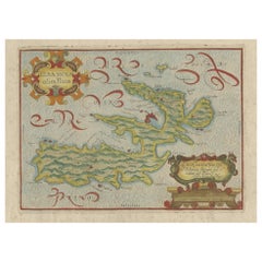
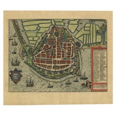
Antique Map of Elba in Tuscany, Italy, Site of Napoleon's First Exile, c.1620
View Similar Items


Want more images or videos?
Request additional images or videos from the seller
1 of 6
Antique Map of Elba in Tuscany, Italy, Site of Napoleon's First Exile, c.1620
About the Item
- Dimensions:Height: 10.83 in (27.5 cm)Width: 15.75 in (40 cm)Depth: 0 in (0.01 mm)
- Materials and Techniques:
- Period:
- Date of Manufacture:circa 1620
- Condition:
- Seller Location:Langweer, NL
- Reference Number:Seller: BG-122351stDibs: LU3054326172692
About the Seller
5.0
Platinum Seller
These expertly vetted sellers are 1stDibs' most experienced sellers and are rated highest by our customers.
Established in 2009
1stDibs seller since 2017
1,933 sales on 1stDibs
More From This SellerView All
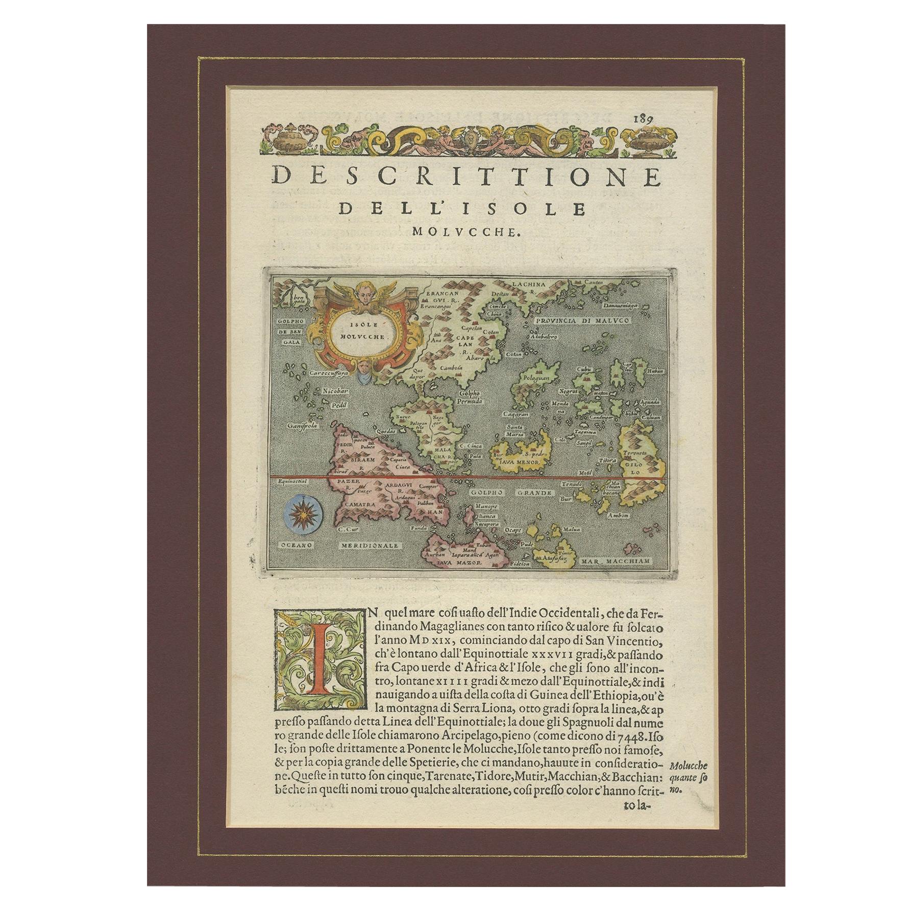
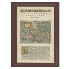
- Antique Map of the Moluccas by Porcacchi, 'circa 1620'Located in Langweer, NLAntique map titled 'Isole Molucche'. The map depicts the East Indies and Indochina, including modern-day Indonesia and the Philippines. The area covered stretches from the Bay of Bengal...Category
Antique Early 17th Century Maps
MaterialsPaper
- Antique Map of Westfalia, Germany by Mercator/Hondius, circa '1620'Located in Langweer, NLAntique map titled 'Westfalia cum dioecelsi Bremensi'. Original antique map of Germany. Published by Mercator/Hondius, circa '1620' 17th Century antique detailled map of Westphali...Category
Antique 16th Century Maps
MaterialsPaper
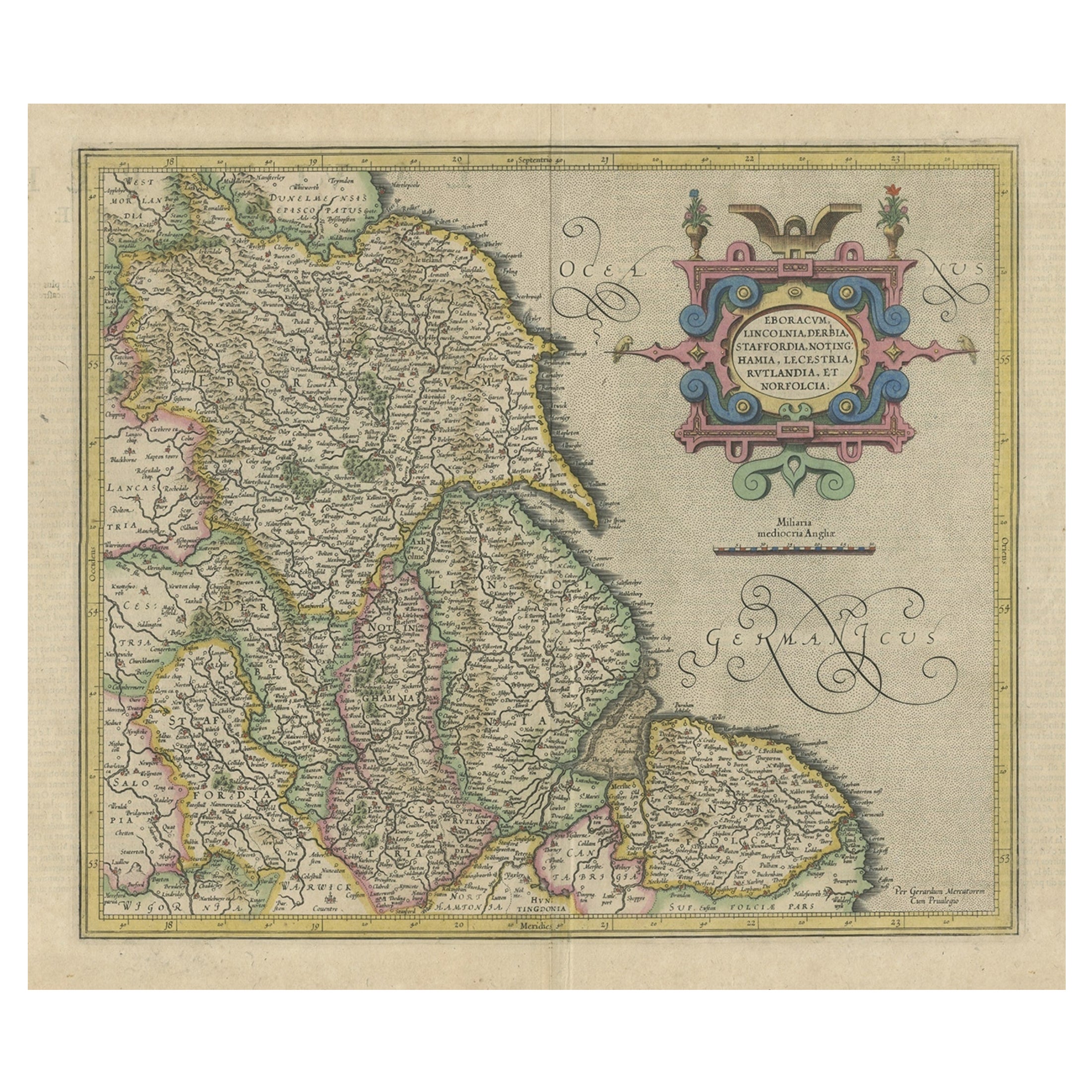
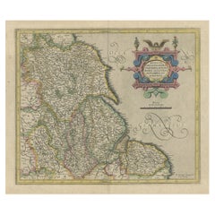
- Antique Map of the Northeast of England by Mercator 'circa 1620'Located in Langweer, NLAntique map titled 'Eboracum Lincolnia, Derbia, Staffordia, Notinghamia, Lecestria, Rutlandia, et Norfolcia'. Decorative early map of the northeast of England, comprising the countie...Category
Antique Early 17th Century Maps
MaterialsPaper
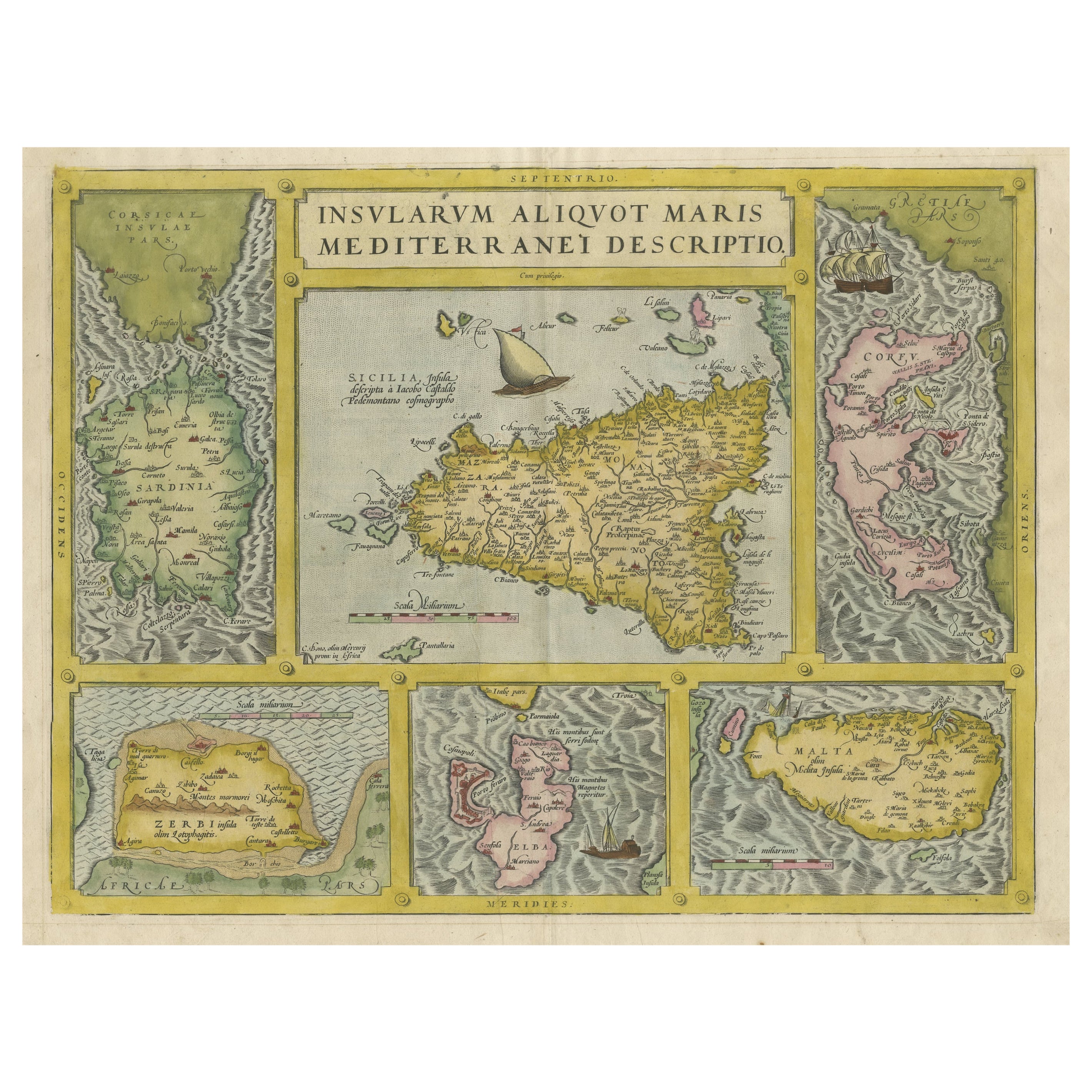
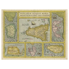
- Coloured Antique Map of Sicily, Sardinia, Corfu, Elba, Malta and Zerbi (Jerba)By Abraham OrteliusLocated in Langweer, NLAntique map titled 'Insularum Aliquot Maris Mediterranei Descriptio'. A very attractive example of Ortelius' map combining, on one page, maps of the islands of Sicily, Sardinia, Corfu, Elba, Malta and Zerbi (Jerba, off the coast of Tunisia.) The maps detail fortifications on the islands and other major features. (Jerba, for instance, is shown connected to the mainland by a causeway.) The waters are attractively engraved and are sailed by ships. A shipwreck, north of Malta, indicates the point at which St. Paul is thought to have shipwrecked. Volcanoes are indicated in the Sicily map...Category
Antique 16th Century Maps
MaterialsPaper
 $1,812 Sale Price25% Off
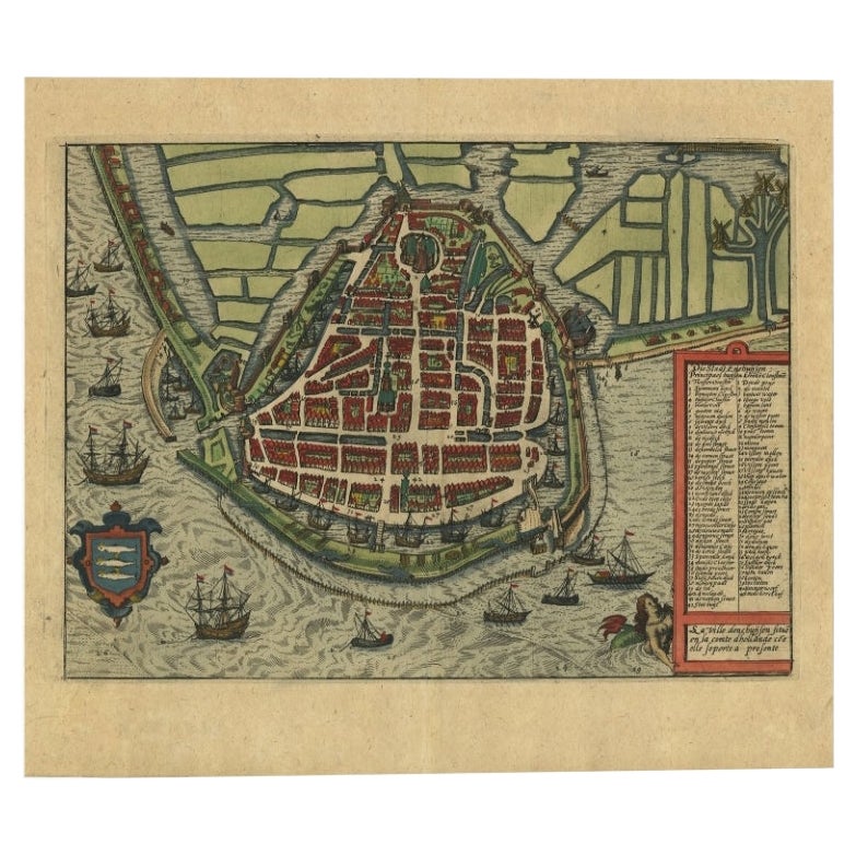
 - Detailed Copper Engraved City Map of Enkuizen, the Netherlands, c.1620By L. GuicciardiniLocated in Langweer, NLAntique map titled 'Die stadt Enchuijsen.' Detailed copper engraved city map of Enkuizen, the Netherlands, by Lodovico Guicciardini and published by Janssonius. Highly decorated with...Category
Antique 17th Century Maps
MaterialsPaper
- Decorative Early Hand-Colored Map of the Northeast of England, ca.1620Located in Langweer, NLAntique map titled 'Eboracum, Lincolnia, Derbia, Staffordia, Notinghamia, Lecestria, Rutlandia et Norfolcia'. Decorative early map of the northeast of England, comprising the cou...Category
Antique 1620s Maps
MaterialsPaper


You May Also Like
- Napoléon's Footbath by George BullockBy George BullockLocated in New Orleans, LAThis amazing footbath was created for Napoleon Bonaparte. It was part of the toilet service to be used during his exile on St. Helena. Just before shipm...Category
Antique Early 19th Century English Empire Historical Memorabilia
MaterialsPorcelain
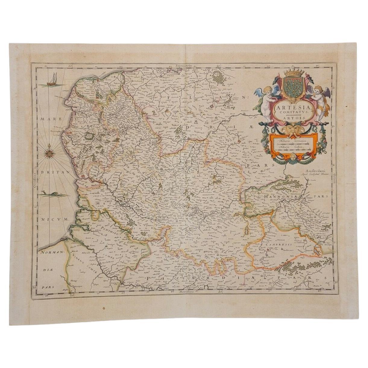
- 1620 Map of Artois Entitled "Artesia Comitatvs Artois, " by Bleau, Ric.a012Located in Norton, MA1640 map of Artois entitled "Artesia Comitatvs Artois," by Bleau Colored A-012. Detailed map of the northern province of Artois, France on the border with Belgium. Feature...Category
Antique 17th Century Dutch Maps
MaterialsPaper
- Original Antique Map of Italy. C.1780Located in St Annes, LancashireGreat map of Italy Copper-plate engraving Published C.1780 Unframed.Category
Antique Early 1800s English Georgian Maps
MaterialsPaper

- Original Antique Map of Italy. Arrowsmith. 1820Located in St Annes, LancashireGreat map of Italy Drawn under the direction of Arrowsmith Copper-plate engraving Published by Longman, Hurst, Rees, Orme and Brown, 1820 Unframed.Category
Antique 1820s English Maps
MaterialsPaper

- Antique Map of Italy by Andriveau-Goujon, 1843By Andriveau-GoujonLocated in New York, NYAntique Map of Italy by Andriveau-Goujon, 1843. Map of Italy in two parts by Andriveau-Goujon for the Library of Prince Carini at Palazzo Carini i...Category
Antique 1840s French Maps
MaterialsLinen, Paper
 $3,350 / set
 - Exiles and Imigrés, The Flight of European Artists from Hitler, First EditionLocated in valatie, NYExiles and Imigrés, the flight of European Artists from Hitler. New York: Harry N. Abrams, Inc., 1997. First Edition softcover. 432pp. A catalogue published in conjunction with a tra...Category
Late 20th Century American Books
MaterialsPaper


Recently Viewed
View AllMore Ways To Browse
Maps Of Mediterranean
Antique Mi
Antique Map Mediterranean
17th Century Italian Map
17th Century Italy Map
Antique Style Map Of The World
World Maps Antique Style
World Map Antique Style
Map Of Sicily
Sicily Map
Map Mediterranean
Antique Mediterranean Map
Map Tuscany
Antique Maps Of Sicily
Mediterranean Sea Map
Sardinia Map
Napoleon Map
Antique Sicily Map